
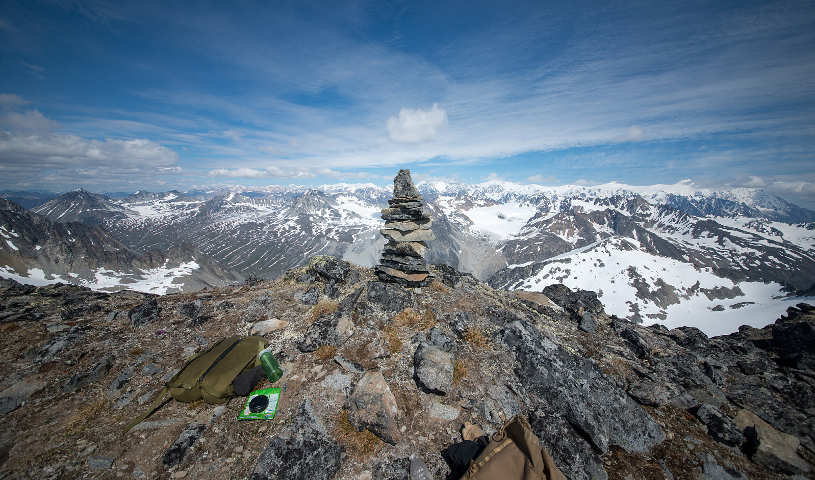
Mount Hugin - 1,925m

|
|

© Christian Nesset |
||||||||||||||||||||||||
| Content | |
|---|---|
| Language | |
| Adviser | none |
| Statistics |
One member has registered 2 ascents of Mount Hugin. |
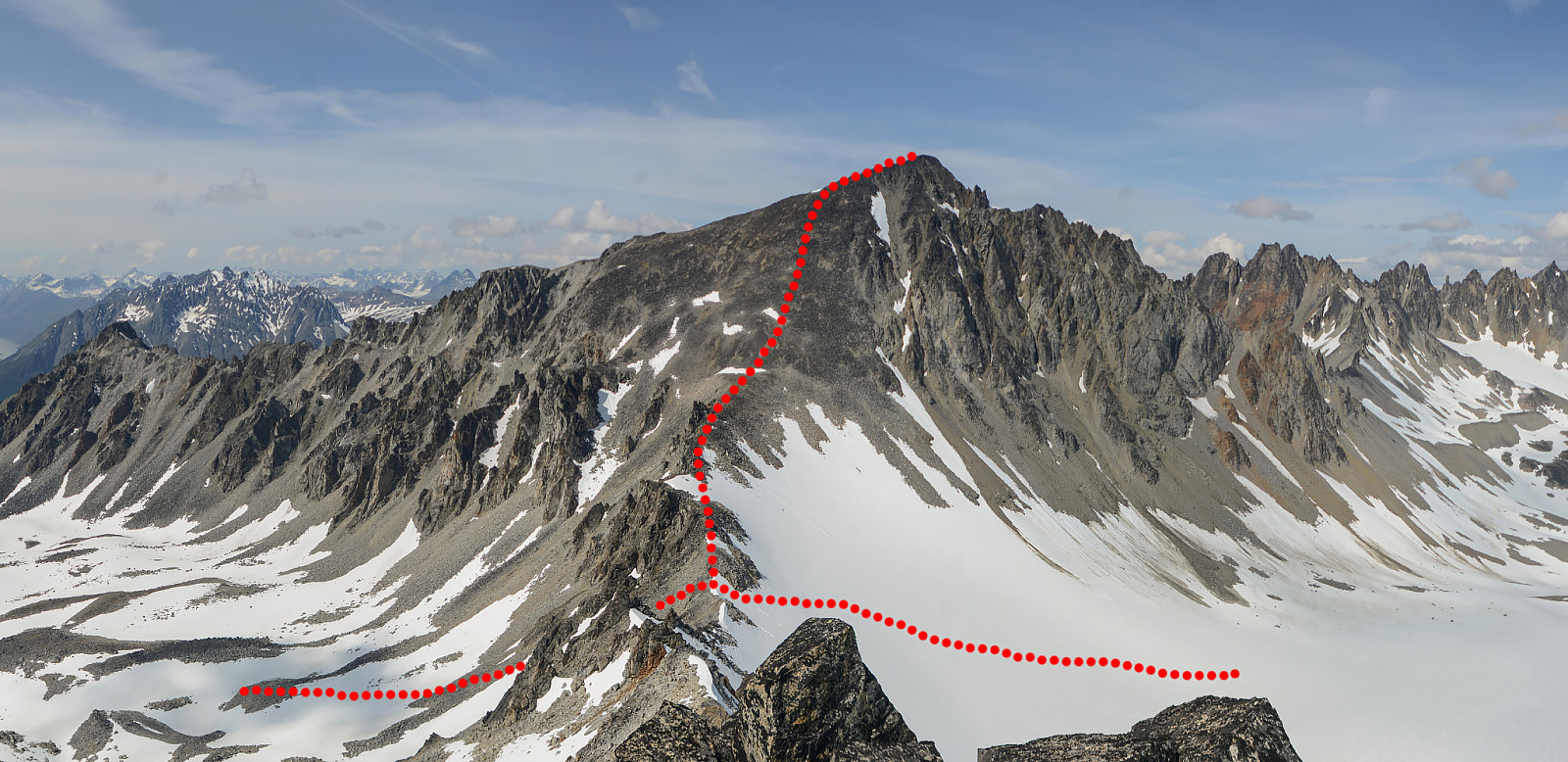
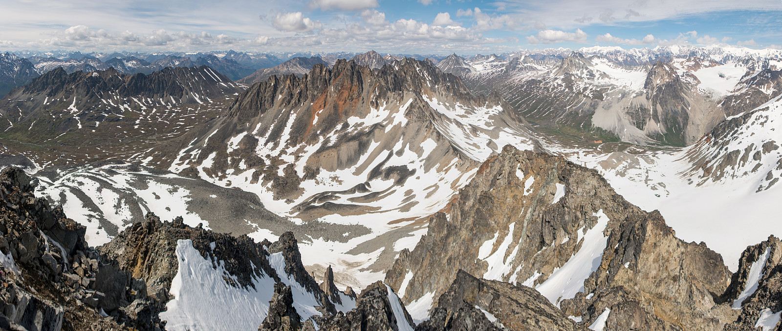
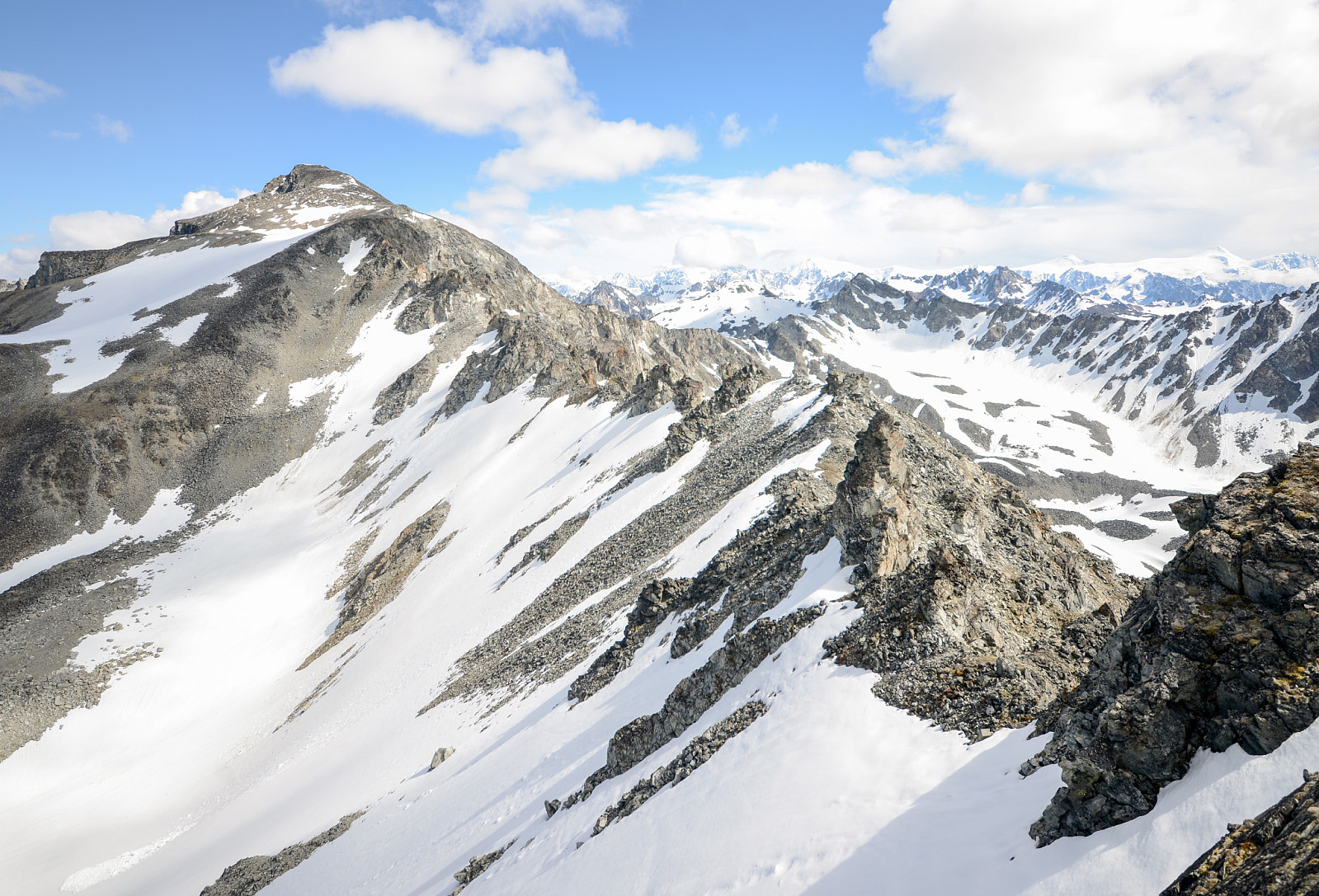
Routes
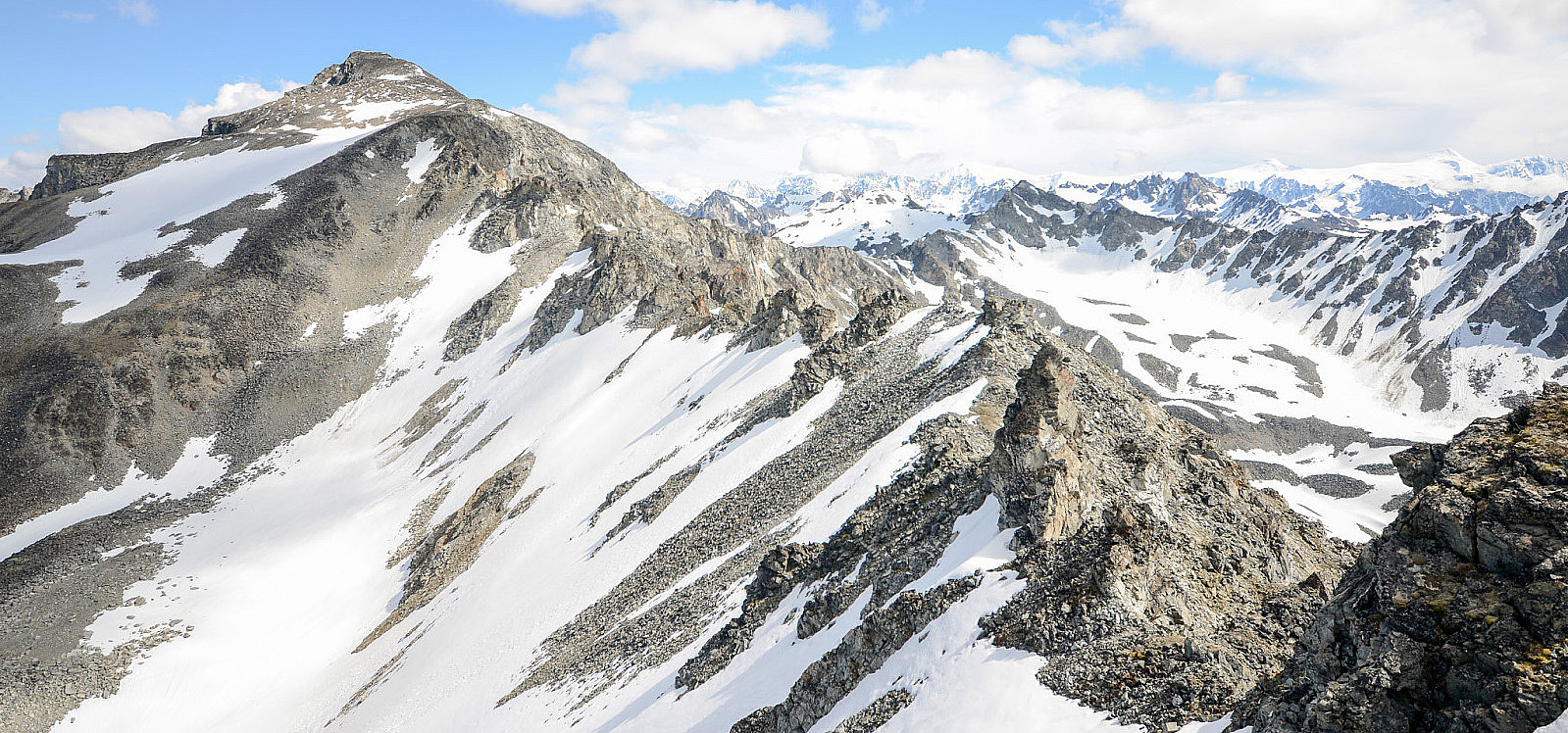
There are several easy routes up Hugin from the south and east and more technical routes from the much steeper north side of the peak. Only the southern traverse to Mount Lindisfarne and the eastern route is known to have been accomplished.
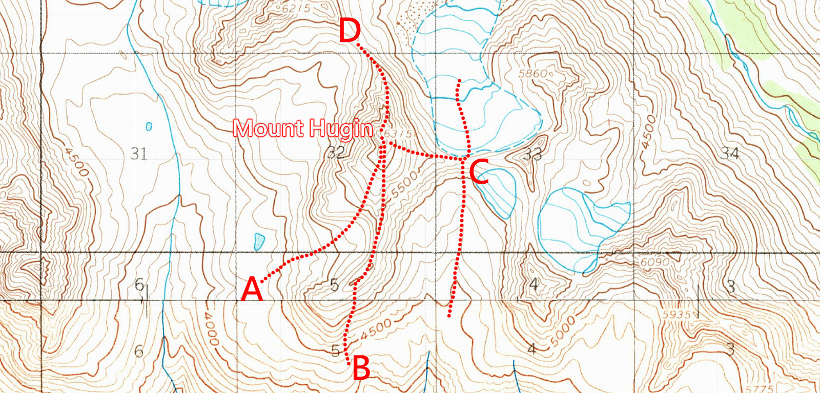
A - Southwestern Route
The southwestern route is the easiest way up Hugin. Its basically a long rocky hike without any scrambling or technical difficulties along the way. There are few dangers along the route as the bowl formation you hike through is large and its easy to hike outside the danger-zone of overhead avalanches or rockfalls from the steep western slopes of Mt. Lindisfarne.
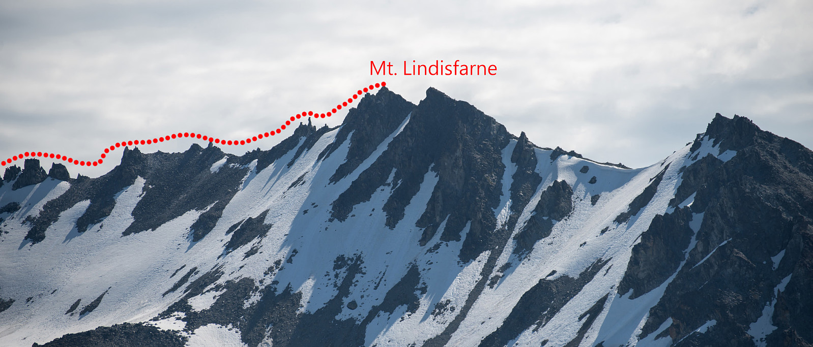
B - Southern Route
The southern route starts on the summit of Mt. Lindisfarne (1686m). Mt. Lindisfarne is a easy scree hike without any technical difficulties. From Lindisfarne follow the long traverse north to the saddle of Hugin. The traverse is full of pinnacles which require technical climbing if you were to summit the pinnacles. However, its easy to avoid the pinnacles on either sides of the traverse. Much of the traverse is on fairly loose scree and rocks and some scrambling is needed especially when you approach the saddle of Hugin.
C - Eastern Route
The eastern route is a easy scree hike, but steeper than the Southwestern Route (A). This route can be approached from either south or north across the glacier.
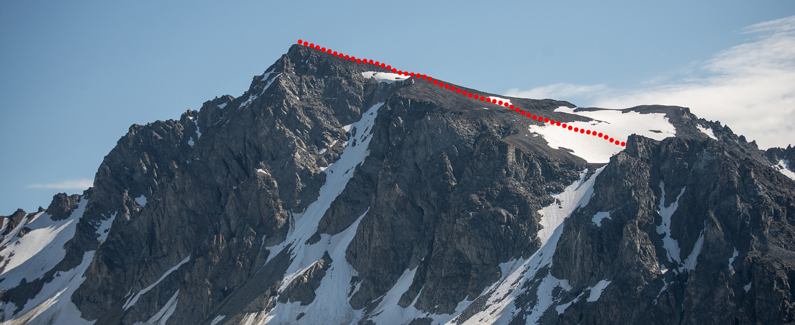
D - Northern Route
A technical climbing route is possible from the north. The route goes across several pinnacles and the rocks look fairly loose. The route has no known attempts.
Other pictures
 |
 |
 |
 |
 |
 |
 |
|
Trip Reports

- 2


- 2


User comments