Archive - Date
Archive - Activity
-
Bike trip (111)
- Bike trip - mixed (25)
- Bike trip - road (86)
-
Drive (9)
- Car drive (9)
-
Other trip (3)
- Kayaking (3)
-
Ski trip (116)
- Backcountry skiing (69)
- Cross-country skiing (47)
- Trip by foot (1897)
Collected lists
-
Utvalgte topper og turmål i Bergen
(349/351)
 99%
99% -
Alle topper i Bergen
(393/400)
98%
-
Voss ≥ 100m pf.
(96/98)
97%
-
Opptur Hordaland
(144/159)
90%
-
Stasjoner på Bergensbanen
(33/40)
82%
-
Ulvik ≥ 100m pf.
(30/38)
78%
-
Hordaland ≥ 100m pf.
(624/863)
72%
-
Mjølfjell PF > 100m
(21/31)
67%
-
Jondal ≥ 100m pf.
(15/23)
65%
-
Dagsturhyttene i Vestland
(36/61)
59%
-
Sunnhordland PF >= 100m
(105/186)
56%
-
Hordaland: Hardanger PF>=100m
(196/359)
54%
-
DNT-hytter i Hordaland
(23/45)
51%
-
Kvinnherad ≥ 100m pf.
(40/79)
50%
-
Eidfjord ≥ 100m pf.
(13/42)
30%
-
Sogndal ≥ 100m pf.
(23/81)
28%
-
Gulen ≥ 100m pf.
(15/54)
27%
-
Vik i Sogn ≥ 100m pf.
(10/46)
21%
-
Sogn - Sør for Sognefjorden PF>=100m
(31/159)
19%
-
DNT-hytter i Sogn og Fjordane
(8/47)
17%

Blåvasshorgi, Kringdalsnipa and Hatlekinni
- Date:
- 26.03.2023
- Characteristic:
- Backcountry skiing
- Duration:
- 6:10h
- Distance:
- 19.6km
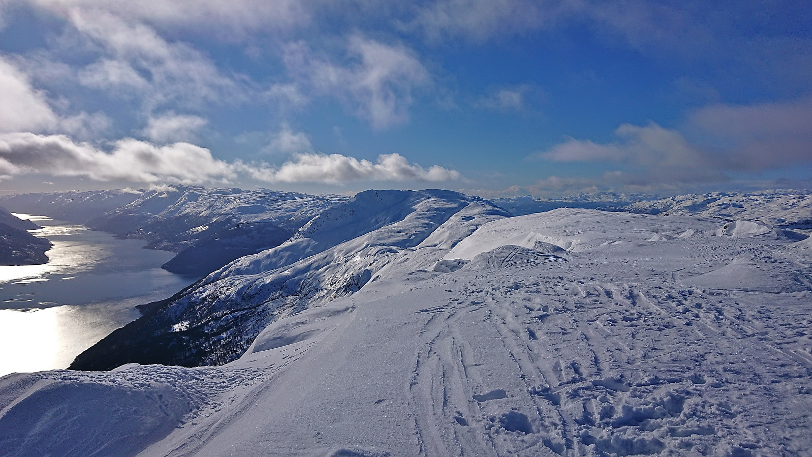
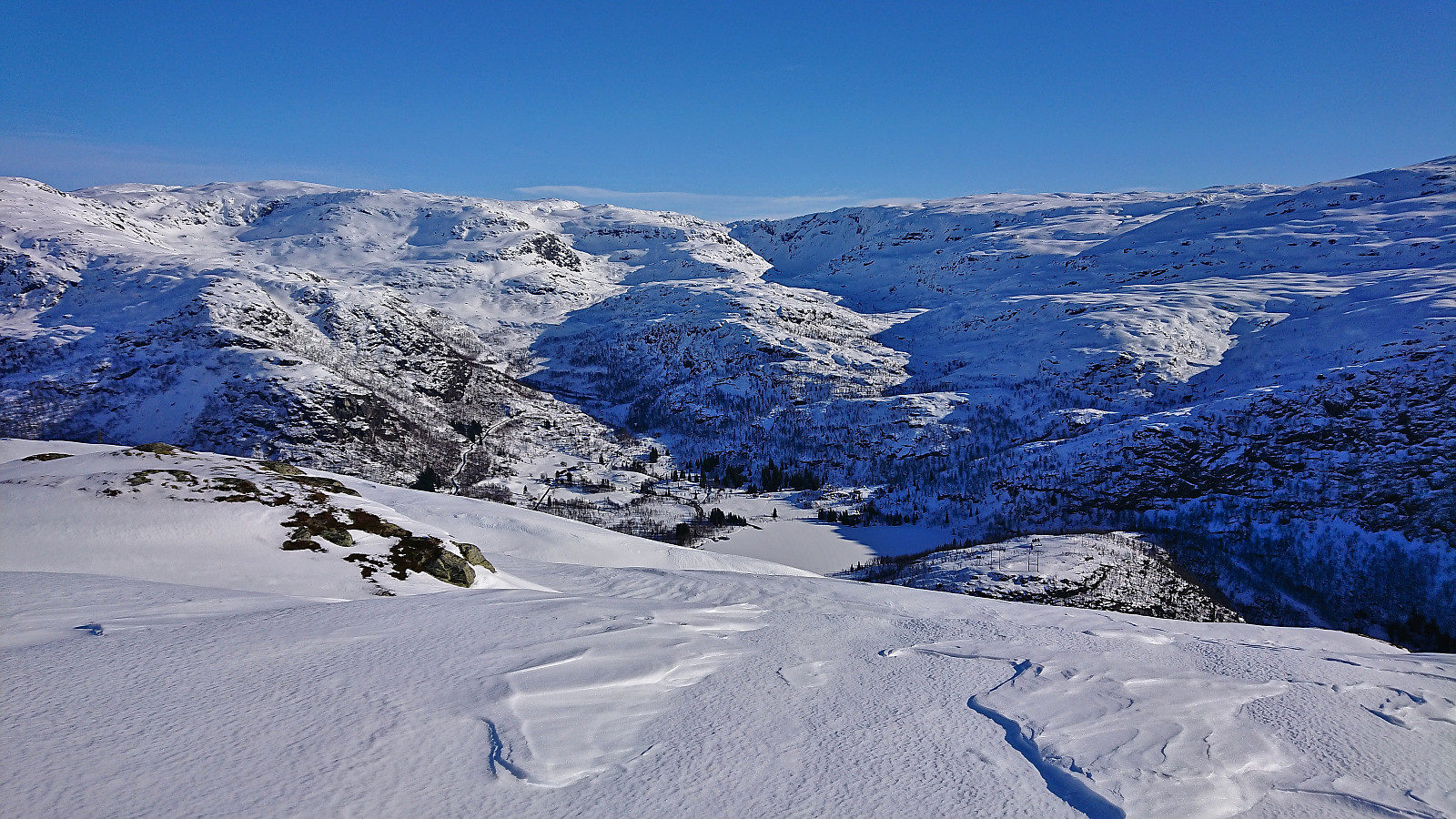
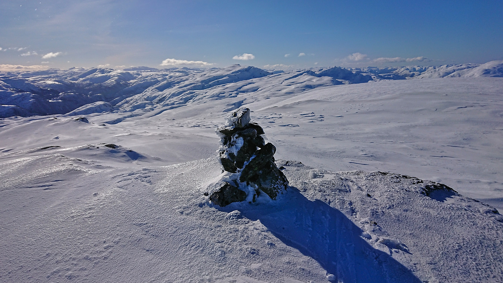
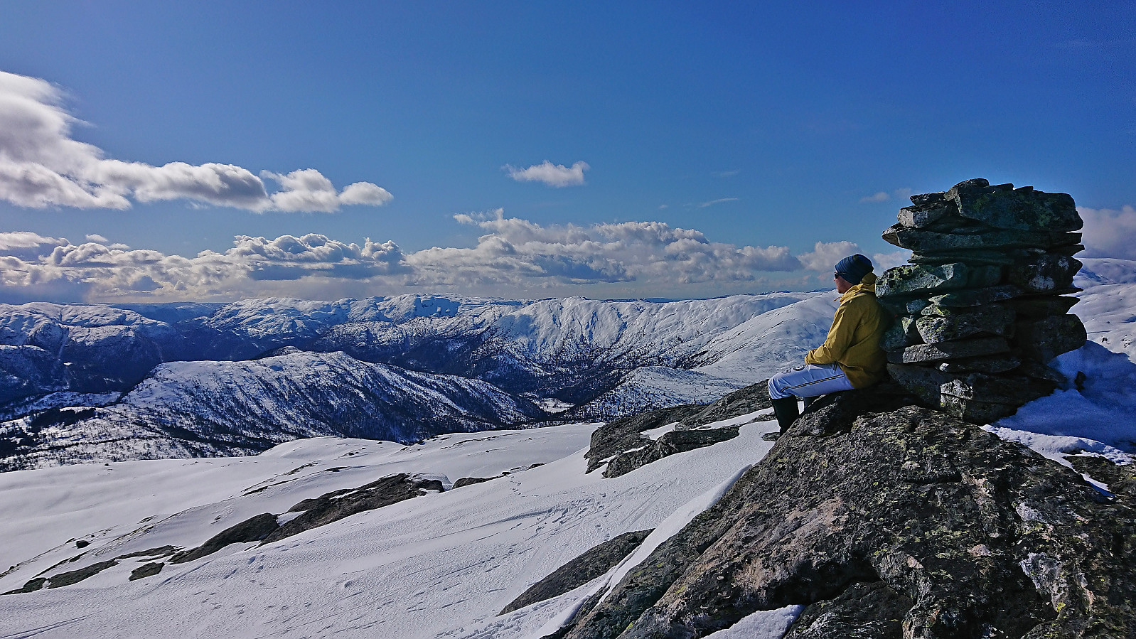 I had initially only planed to go skiing on the Saturday , but when Fjellsamleren (Endre Myrdal Olsen) texted me and asked if I wanted to go skiing on Sunday as well, it only required a quick look at the excellent weather forecast to change my mind. We decided on having a go at the toll road up to Geilane as this should give us easy access to both Blåvasshorgi and Kringdalsnipa , with an added bonus of Hatlekinni for Endre ( which I had already visited once before ).
After paying the 50 kr toll via Vipps at Horvei/Horveid, we followed the steep gravel road to the upper parking lot at Rørgostølen. As expected this parking lot was mainly a private parking lot but there were a couple of guest spots as well.
We quickly put on the climbing skins and could then start skiing directly from the car. The snow was quite hard and icy at the start but as we got higher up this greatly improved and from there on we had near perfect snow conditions for the rest of the >>>
I had initially only planed to go skiing on the Saturday , but when Fjellsamleren (Endre Myrdal Olsen) texted me and asked if I wanted to go skiing on Sunday as well, it only required a quick look at the excellent weather forecast to change my mind. We decided on having a go at the toll road up to Geilane as this should give us easy access to both Blåvasshorgi and Kringdalsnipa , with an added bonus of Hatlekinni for Endre ( which I had already visited once before ).
After paying the 50 kr toll via Vipps at Horvei/Horveid, we followed the steep gravel road to the upper parking lot at Rørgostølen. As expected this parking lot was mainly a private parking lot but there were a couple of guest spots as well.
We quickly put on the climbing skins and could then start skiing directly from the car. The snow was quite hard and icy at the start but as we got higher up this greatly improved and from there on we had near perfect snow conditions for the rest of the >>>
Valafjellet and Åsknappen
- Date:
- 25.03.2023
- Characteristic:
- Backcountry skiing
- Duration:
- 4:42h
- Distance:
- 16.8km
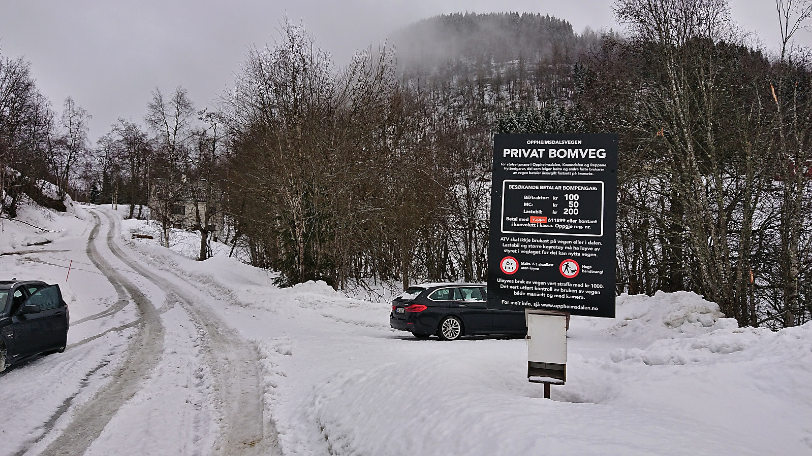 For my first trip with petter (Petter Bjørstad) in over half a year, we settled on two summits north of Oppheimsvatnet: Valafjellet and Åsknappen . We had hoped to gain some elevation by driving up the toll road in Oppheimsdalen , but when all of the parking lots early on were marked as private (also confirmed by a local driving a tractor), we abandoned this plan and returned to the start of the toll road where there was room for a couple of cars outside of the private parking areas.
Here we put on the climbing skins and started skiing directly from the car. We quickly realized that we would not have been able to drive much further anyway, as the road was soon covered by more snow than we would have been able to drive through.
When the road forked right for the third time, we left the road up Oppheimsdalen and turned east, following another road until getting to >>>
For my first trip with petter (Petter Bjørstad) in over half a year, we settled on two summits north of Oppheimsvatnet: Valafjellet and Åsknappen . We had hoped to gain some elevation by driving up the toll road in Oppheimsdalen , but when all of the parking lots early on were marked as private (also confirmed by a local driving a tractor), we abandoned this plan and returned to the start of the toll road where there was room for a couple of cars outside of the private parking areas.
Here we put on the climbing skins and started skiing directly from the car. We quickly realized that we would not have been able to drive much further anyway, as the road was soon covered by more snow than we would have been able to drive through.
When the road forked right for the third time, we left the road up Oppheimsdalen and turned east, following another road until getting to >>>
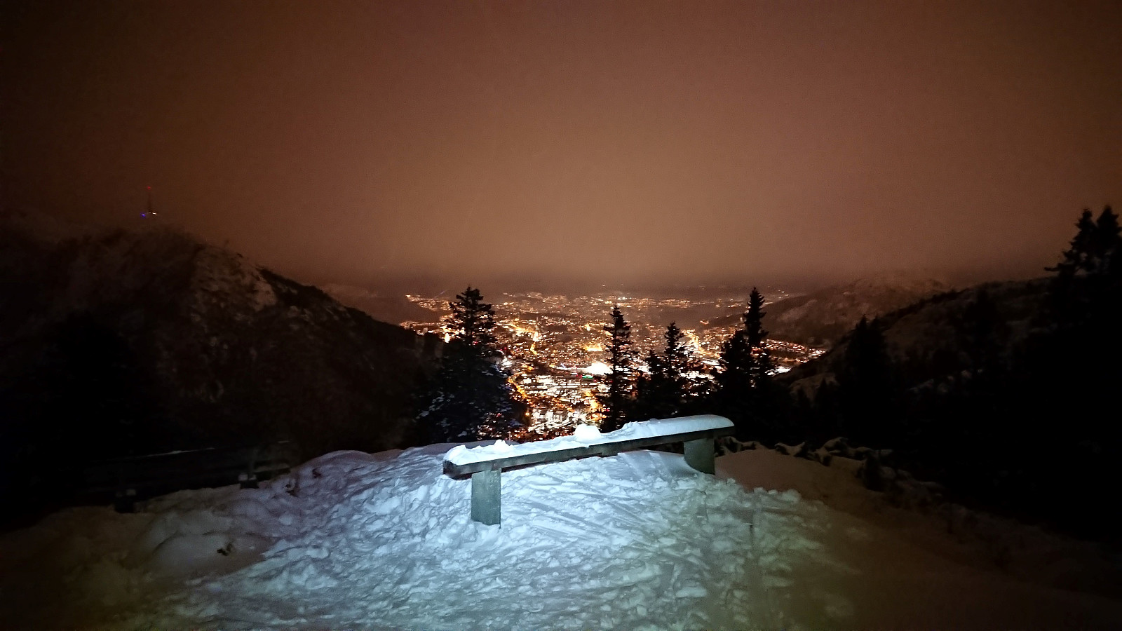
Skiing at Fløyen
- Date:
- 15.03.2023
- Characteristic:
- Cross-country skiing
- Duration:
- 2:19h
- Distance:
- 13.5km
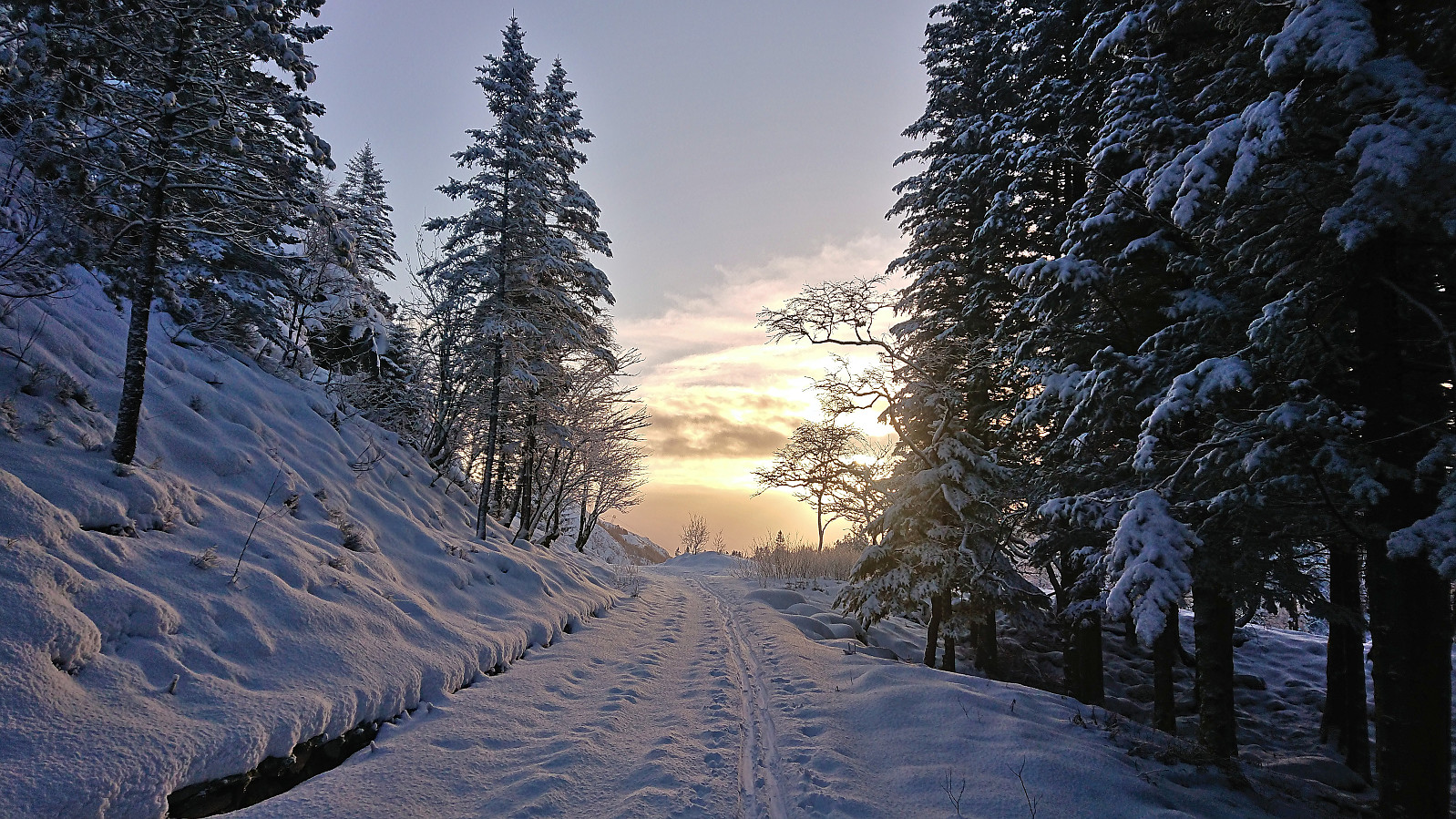
 Left work a bit earlier than usual to take advantage of the tail end of a beautiful sunny day to go skiing at Fløyen. The skis came on shortly after exiting Fløibanen and stayed on all the way to the top of Øyjorden (except for parts of Hellemyrstien where it was simply faster to carry them).
Blåsåta and Kjerringfjellet
- Date:
- 12.03.2023
- Characteristic:
- Backcountry skiing
- Duration:
- 6:17h
- Distance:
- 17.0km
 For the second Sunday in a row I was back at Voss on a skiing trip organized by Voss Utferdslag (part of the Norwegian Trekking Association ). In other words, yet another early morning with the train from Bergen at 07:07. At Voss I met up with the others around 09:00 and we car-pooled to Bergesvatnet. Here we parked at Moseheia p-plass before starting our ascent up Bergsskaret just after 10:00.
The visibility would sadly be quite limited throughout most of the trip with a sun that was visible behind the clouds but refused to properly show itself, but overall the visibility was more than good enough to see where we were heading. To more than make up for this though, the ground was covered with at least 20 centimeters of fresh snow.
After later turning east across Flatafjellet, the terrain levelled off and we soon stopped for a quick lunch break before completing the >>>
For the second Sunday in a row I was back at Voss on a skiing trip organized by Voss Utferdslag (part of the Norwegian Trekking Association ). In other words, yet another early morning with the train from Bergen at 07:07. At Voss I met up with the others around 09:00 and we car-pooled to Bergesvatnet. Here we parked at Moseheia p-plass before starting our ascent up Bergsskaret just after 10:00.
The visibility would sadly be quite limited throughout most of the trip with a sun that was visible behind the clouds but refused to properly show itself, but overall the visibility was more than good enough to see where we were heading. To more than make up for this though, the ground was covered with at least 20 centimeters of fresh snow.
After later turning east across Flatafjellet, the terrain levelled off and we soon stopped for a quick lunch break before completing the >>>
Ingebjørgfjellet from Tveitavegen
- Date:
- 05.03.2023
- Characteristic:
- Backcountry skiing
- Duration:
- 5:46h
- Distance:
- 15.7km
 Sunday skiing trip to Ingebjørgfjellet organized by the Norwegian Trekking Association , or more specifically Voss Utferdslag . The initial plan had also included Oksen , but given difficult conditions in the valley between the two summits, and the overall length of such a combined trip, the plan had in advance been reduced to just Ingebjørgfjellet.
After getting up at 05:30 in the morning, I was on the train from Bergen to Voss at 07:07. At Voss I met up with the others around 09:00 and we all car-pooled to the start of the trip at the crossroads of Tveitavegen and Stokkselvegen above Granvin. In the summer it is possible to pay a toll and drive up to Stokksel, but today this was not really an option as this road was, at least at the start, very icy.
We therefore put on the climbing skins by the cars and proceeded to carry the skis over the first icy stretch before >>>
Sunday skiing trip to Ingebjørgfjellet organized by the Norwegian Trekking Association , or more specifically Voss Utferdslag . The initial plan had also included Oksen , but given difficult conditions in the valley between the two summits, and the overall length of such a combined trip, the plan had in advance been reduced to just Ingebjørgfjellet.
After getting up at 05:30 in the morning, I was on the train from Bergen to Voss at 07:07. At Voss I met up with the others around 09:00 and we all car-pooled to the start of the trip at the crossroads of Tveitavegen and Stokkselvegen above Granvin. In the summer it is possible to pay a toll and drive up to Stokksel, but today this was not really an option as this road was, at least at the start, very icy.
We therefore put on the climbing skins by the cars and proceeded to carry the skis over the first icy stretch before >>>
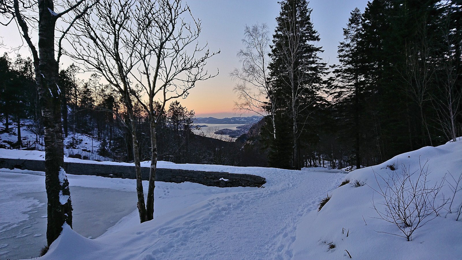
Olav Nygards bu and Nåmdalsfjellet
- Date:
- 02.03.2023
- Characteristic:
- Backcountry skiing
- Duration:
- 3:15h
- Distance:
- 8.6km
 Given the near perfect weather, I took one day of "vinterferie" to go skiing. I convinced my dad to join and together we drove to Modalen and Øvre Helland. Here we left the paved road and continued along a good-quality gravel road up to Steinavatnet p-plass . After a very short climb of only a couple of meters, and less than 150 meters of skiing, we arrived at the ice-covered Steinavatnet, which provided very easy access to Olav Nygards bu .
We then turned west and headed for the ridge to Nåmdalsfjellet . Lots of traces of earlier skiers, however there did not seem to be a fixed summit route. The direction was in any case obvious and there were no steep areas to avoid. It therefore did not take long before we arrived at the summit where we could enjoy the views to the surrounding mountains.
After spending the whole trip in the warm >>>
Given the near perfect weather, I took one day of "vinterferie" to go skiing. I convinced my dad to join and together we drove to Modalen and Øvre Helland. Here we left the paved road and continued along a good-quality gravel road up to Steinavatnet p-plass . After a very short climb of only a couple of meters, and less than 150 meters of skiing, we arrived at the ice-covered Steinavatnet, which provided very easy access to Olav Nygards bu .
We then turned west and headed for the ridge to Nåmdalsfjellet . Lots of traces of earlier skiers, however there did not seem to be a fixed summit route. The direction was in any case obvious and there were no steep areas to avoid. It therefore did not take long before we arrived at the summit where we could enjoy the views to the surrounding mountains.
After spending the whole trip in the warm >>>
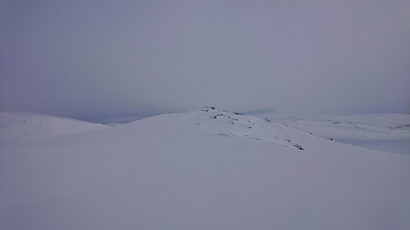
Five summits west of Vinningsleitet
- Date:
- 25.02.2023
- Characteristic:
- Backcountry skiing
- Duration:
- 9:28h
- Distance:
- 24.3km
 When Endre suggested a skiing trip to the five summits east of Vinningsleitet, I of course quickly said yes. (Bonus tip: see this external trip report for a similar skiing trip.) He picked me up early Saturday morning for the drive to Vinningsleitet. We arrived at the small parking lot around 10:00 and were ready to start skiing shortly after. First up was Nonhaugen , which was easily accessed by ascending directly from the parking lot, except for a short descent into the valley between Nonhaugen and Ørnahaugen , and it did not take long before we were standing at the summit.
Throughout the trip there would be a strong and cold wind from north/northeast. It was however mainly coming at us from the side and overall did not present much of an issue. The snow conditions were on the other hand more heavily affected, thus the conditions varied greatly, from packed >>>
When Endre suggested a skiing trip to the five summits east of Vinningsleitet, I of course quickly said yes. (Bonus tip: see this external trip report for a similar skiing trip.) He picked me up early Saturday morning for the drive to Vinningsleitet. We arrived at the small parking lot around 10:00 and were ready to start skiing shortly after. First up was Nonhaugen , which was easily accessed by ascending directly from the parking lot, except for a short descent into the valley between Nonhaugen and Ørnahaugen , and it did not take long before we were standing at the summit.
Throughout the trip there would be a strong and cold wind from north/northeast. It was however mainly coming at us from the side and overall did not present much of an issue. The snow conditions were on the other hand more heavily affected, thus the conditions varied greatly, from packed >>>
Skiing at Fløyen
- Date:
- 17.01.2023
- Characteristic:
- Cross-country skiing
- Duration:
- 2:41h
- Distance:
- 13.7km
 The first skiing trip of 2023! (Although not the first this winter .) Ok, but not great conditions. Even so, the skis came on just above the upper station of Fløibanen and stayed on until Smådiket (the small dam below Storevatnet), where the frequency of small rocks visible in the already rather thin layer of snow simply got too high. However, the skies were put back on between Munkebotsvatnet and the top of Øyjorden.
Skiing: Fløyen and Rundemanen
- Date:
- 18.12.2022
- Characteristic:
- Cross-country skiing
- Duration:
- 3:49h
- Distance:
- 17.1km
 A second skiing trip at Fløyen, but this time taking Fløibanen and also including a visit of Rundemanen . Overall very good conditions for skiing and more new snow than expected. The skis stayed on until the top of Øyjorden, except for most of Hellemyrstien. However there was more ice than snow, and sometimes not a lot of that either, for the final stretch from Vannverkshuset i Skiveien to Munkebotsvatnet and from there to the start of Hellemyrstien.
Skiing at Fløyen in December!
- Date:
- 16.12.2022
- Characteristic:
- Cross-country skiing
- Duration:
- 3:23h
- Distance:
- 14.8km
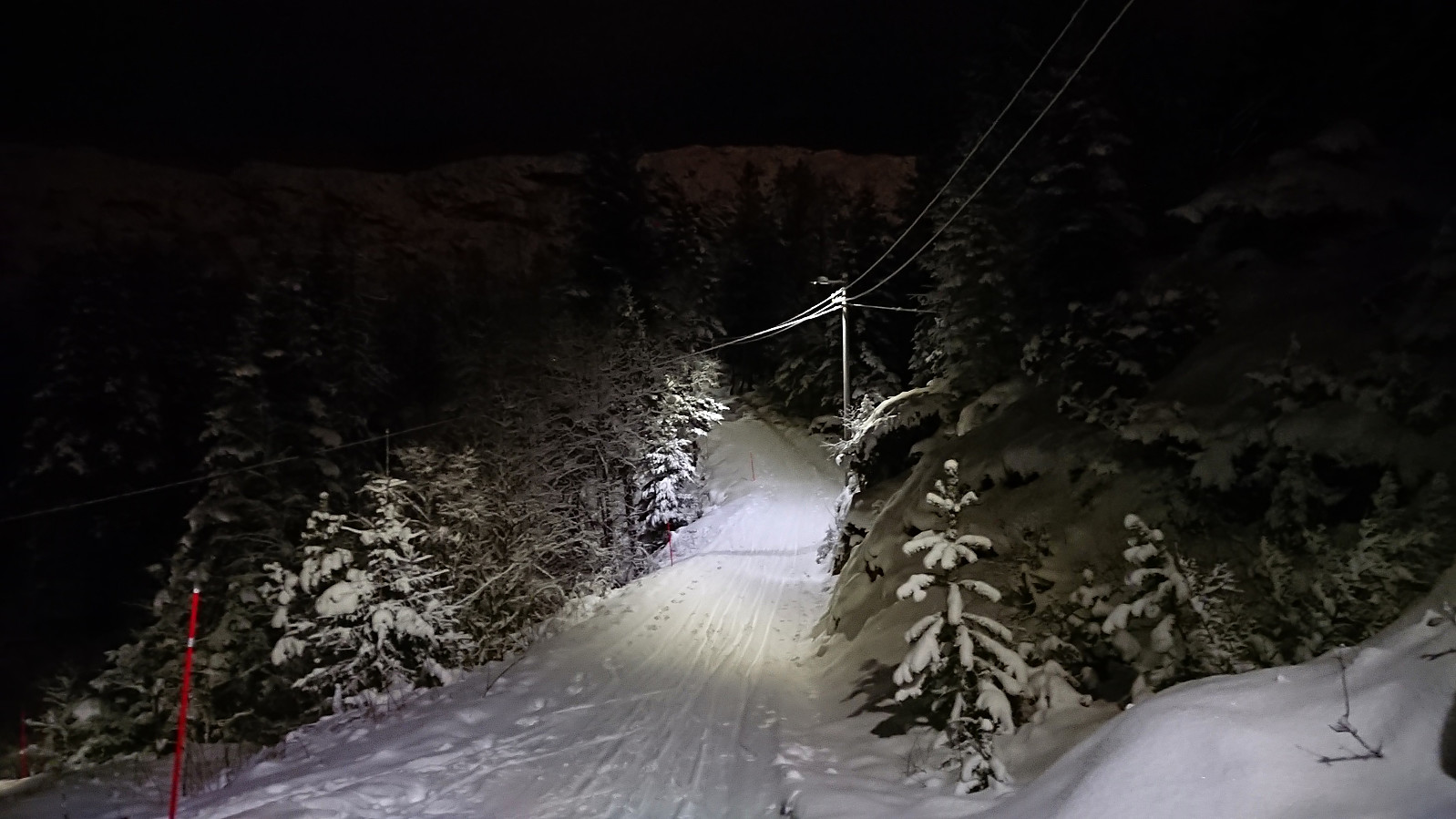 Skiing at Fløyen in December is quite uncommon as there is usually not enough snow in Bergen at this time of the year (I had not recorded any such trips myself for the last six years). Given that the snow would most likely soon disappear, maybe already during the weekend, I decided to have a go after work on a Friday. The plan was to take Fløibanen from the city center, but I missed it by less than one minute and the next one was not until half an hour later. The trip therefore instead started by walking up to Fløyen with the skis coming on just below Skomakerdiket. Pretty good conditions for skiing overall and I more or less had the tracks to myself. Thanks to the recent new snow, some of it during the trip itself, I could even keep the skis on all the way to the top of Øyjorden.
