Archive - Date
Archive - Activity
-
Bike trip (98)
- Bike trip - mixed (23)
- Bike trip - road (75)
-
Drive (6)
- Car drive (6)
-
Other trip (2)
- Kayaking (2)
-
Ski trip (98)
- Backcountry skiing (59)
- Cross-country skiing (39)
- Trip by foot (1483)
Collected lists
-
Utvalgte topper og turmål i Bergen
(301/306)
 98%
98% -
Øytopper Hordaland
(26/27)
96%
-
Alle topper i Bergen
(335/350)
95%
-
Vaksdal ≥ 100m pf.
(59/63)
93%
-
Søyler (fastmerker) i Bergen
(91/100)
91%
-
Nordhordland PF >= 100m
(198/221)
89%
-
Fitjar ≥ 100m pf.
(6/7)
85%
-
Opptur Hordaland
(133/159)
83%
-
Modalen ≥ 100m pf.
(23/30)
76%
-
Hordaland ≥ 500m pf.
(23/30)
76%
-
Masfjorden ≥ 100m pf.
(42/55)
76%
-
Kvam ≥ 100m pf.
(32/44)
72%
-
Stasjoner på Bergensbanen
(26/36)
72%
-
Voss ≥ 100m pf.
(67/97)
69%
-
Hordaland ≥ 100m pf.
(501/862)
58%
-
Dagsturhyttene i Vestland
(31/60)
51%
-
Sunnhordland PF >= 100m
(82/186)
44%
-
DNT-hytter i Hordaland
(18/45)
40%
-
Kvinnherad ≥ 100m pf.
(26/79)
32%
-
Hordaland: Hardanger PF>=100m
(116/357)
32%

"Strafferunde" towards Hardangerjøkulen...
- Date:
- 17.05.2024
- Characteristic:
- Backcountry skiing
- Duration:
- 2:28h
- Distance:
- 10.2km
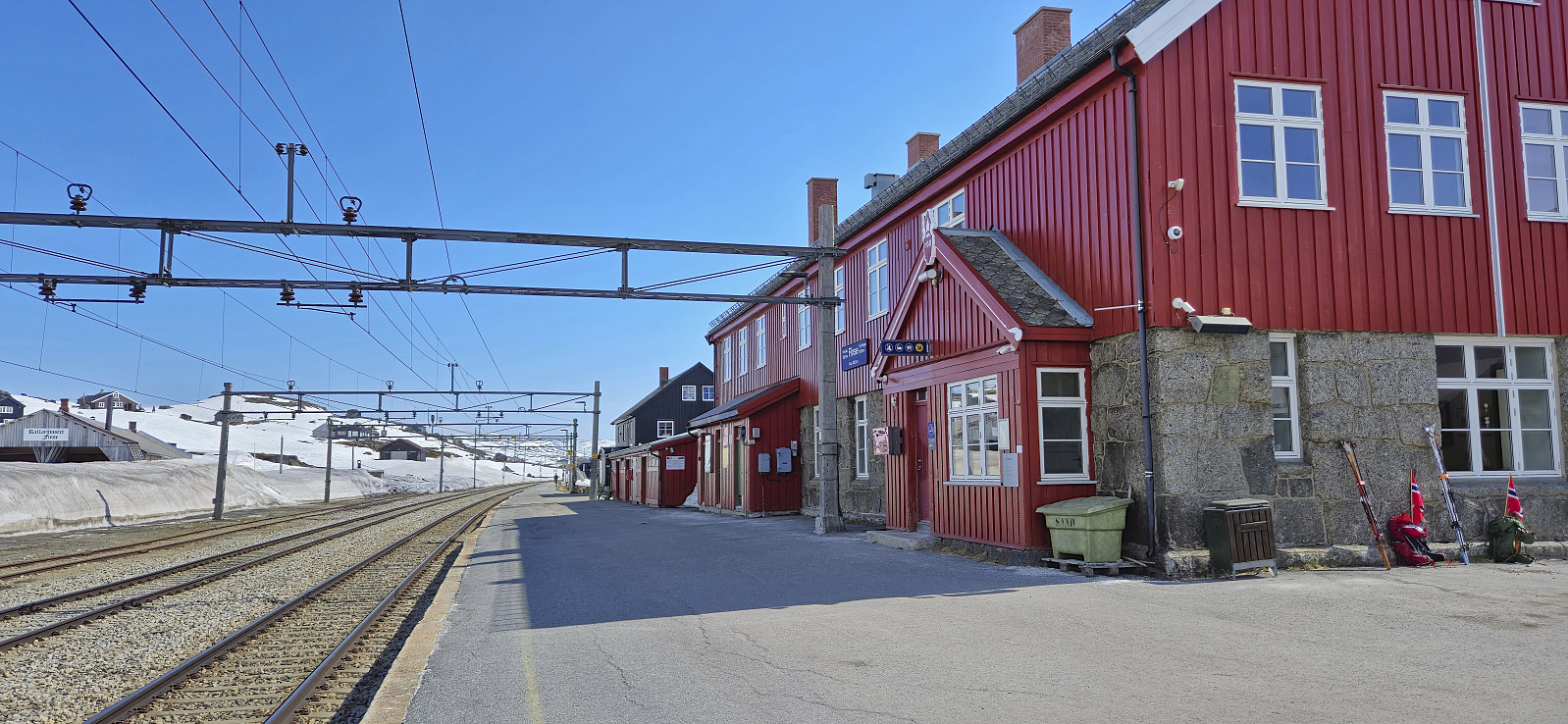 Upon returning to Finse after completing Jøkulrunden I now had two choices: forget about the lost climbing skin and simply take the train back to Bergen or make a second ascent towards Hardangerjøkulen in an attempt to locate the skin and take the next train instead.
After a short break I decided on the latter and started my "strafferunde" across Finsevatnet. During my ascent to Appelsinhytta I asked several of the skiers coming the other way if they had seen a single orange climbing skin during their descent but none had.
Just below Appelsinhytta I spotted something in the distance that looked promising, however it turned out to be a small stuffed animal (more on than later), and my search had to continue. But not long after Appelsinhytta, shortly before the marked route takes a sharp left turn, I again spotted something in the distance >>>
Upon returning to Finse after completing Jøkulrunden I now had two choices: forget about the lost climbing skin and simply take the train back to Bergen or make a second ascent towards Hardangerjøkulen in an attempt to locate the skin and take the next train instead.
After a short break I decided on the latter and started my "strafferunde" across Finsevatnet. During my ascent to Appelsinhytta I asked several of the skiers coming the other way if they had seen a single orange climbing skin during their descent but none had.
Just below Appelsinhytta I spotted something in the distance that looked promising, however it turned out to be a small stuffed animal (more on than later), and my search had to continue. But not long after Appelsinhytta, shortly before the marked route takes a sharp left turn, I again spotted something in the distance >>>
Jøkulrunden on May 17th!
- Date:
- 17.05.2024
- Characteristic:
- Backcountry skiing
- Duration:
- 4:46h
- Distance:
- 22.5km
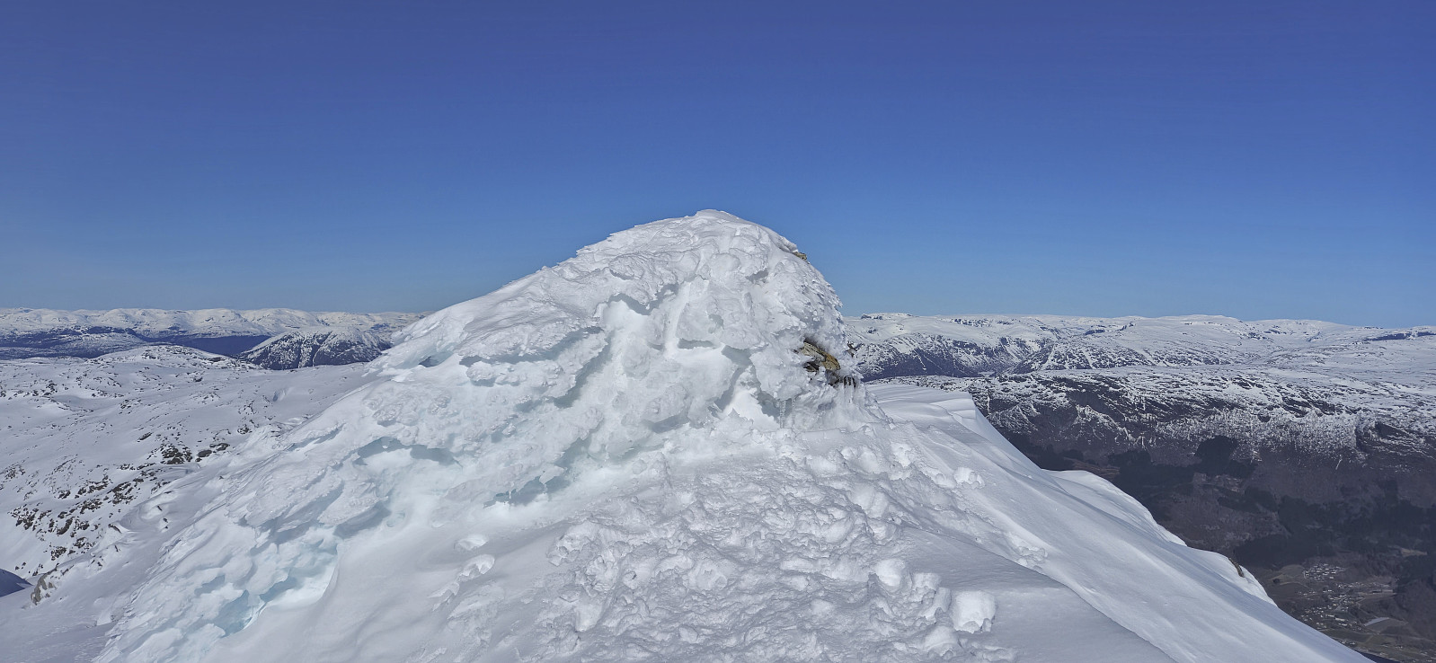
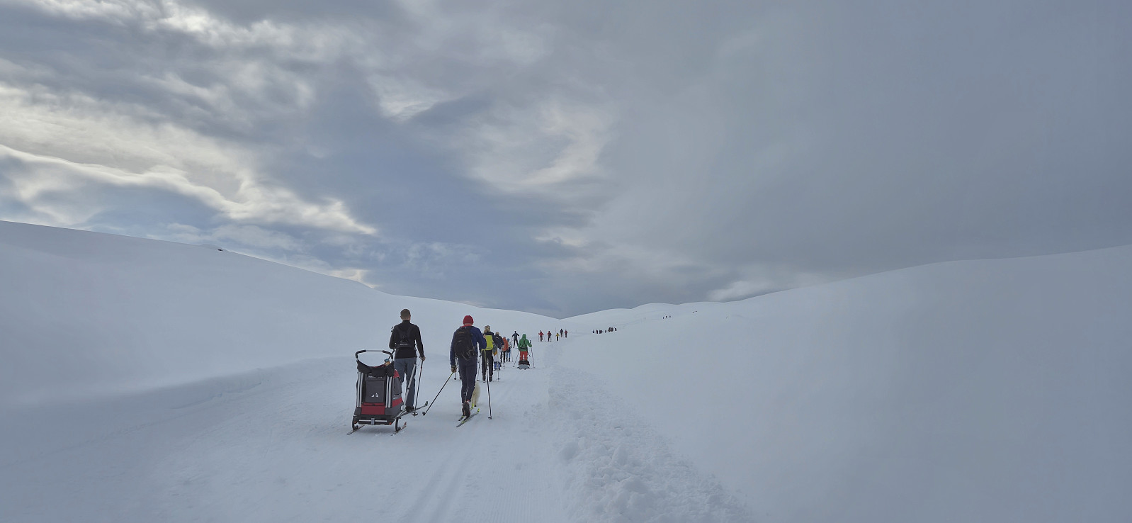
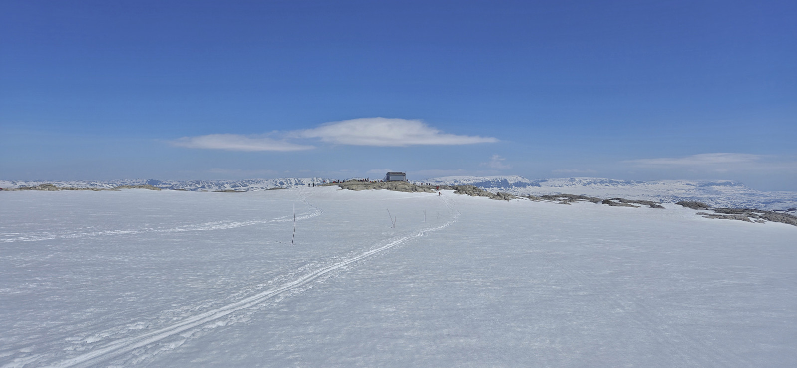 For the first time I decided to have a go at celebrating May 17th (Norway's constitution day) at Finse. I therefore took the morning train from Bergen to Finse where I was ready to start skiing shortly after the train arrived at 10:30. As expected I was far from alone and could simply follow the constant stream of skiers heading towards Hardangerjøkulen . The so-called Jøkulrunden, a roundtrip via the highest point of the glacier, is also marked with wooden sticks during the spring but these were not really needed today.
While I had started from Finse in a T-shirt, and many others were skiing in shorts, a relatively strong and cold wind resulted in a change to warmer clothing soon after passing by Appelsinhytta . For the same reason, the stops at both Jøkulhytta and the summit were cut short. Before continuing on Jøkulrunden I also >>>
For the first time I decided to have a go at celebrating May 17th (Norway's constitution day) at Finse. I therefore took the morning train from Bergen to Finse where I was ready to start skiing shortly after the train arrived at 10:30. As expected I was far from alone and could simply follow the constant stream of skiers heading towards Hardangerjøkulen . The so-called Jøkulrunden, a roundtrip via the highest point of the glacier, is also marked with wooden sticks during the spring but these were not really needed today.
While I had started from Finse in a T-shirt, and many others were skiing in shorts, a relatively strong and cold wind resulted in a change to warmer clothing soon after passing by Appelsinhytta . For the same reason, the stops at both Jøkulhytta and the summit were cut short. Before continuing on Jøkulrunden I also >>>
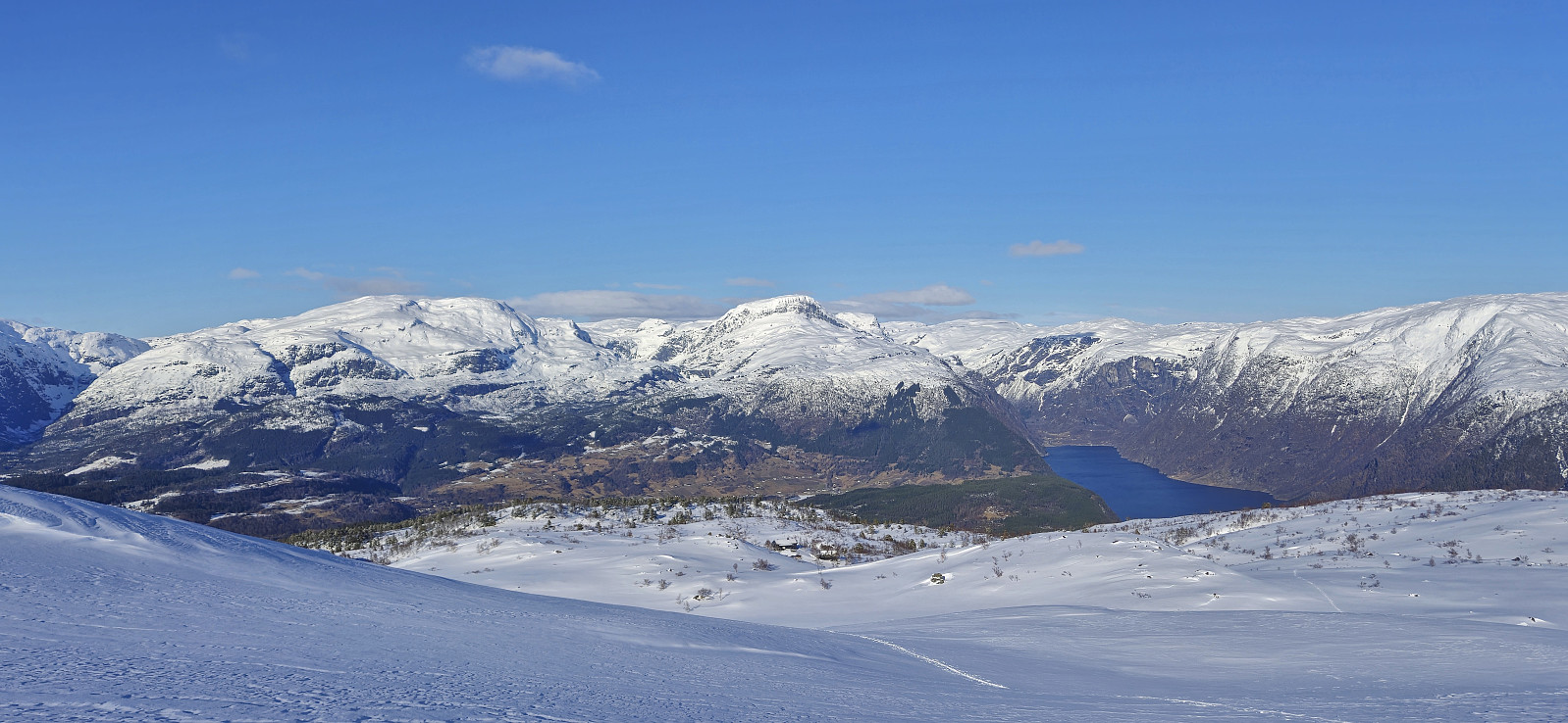
Onen from Austdalen
- Date:
- 12.05.2024
- Characteristic:
- Backcountry skiing
- Duration:
- 7:39h
- Distance:
- 20.7km
 For the second Sunday in a row I caught an early train to Voss to going skiing with Voss Utferdslag . This time our goal was Onen in Ulvik/Eidfjord . At 08:00 we were transported by bus from Voss to Osa and then up to Austdalen p-plass at around 760 meters above the sea level. During the summer it is possible to drive much further but today we could put on the skies only a couple hundred meters after leaving the parking lot.
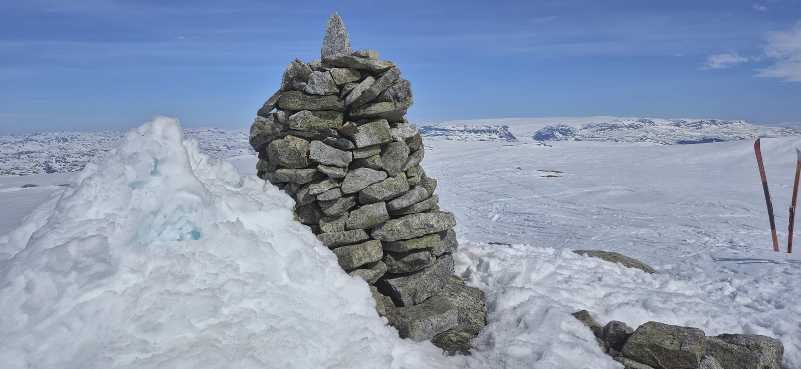
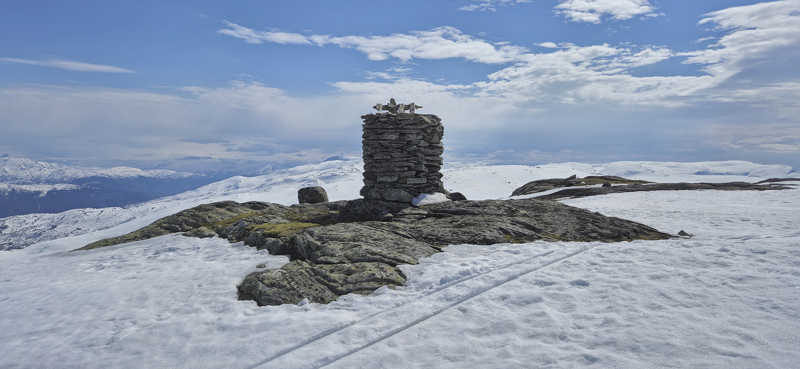
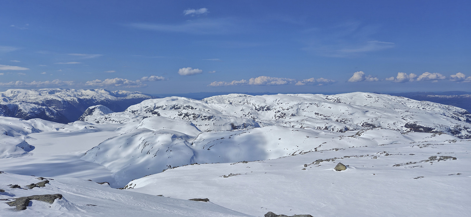
We followed the road to Austdølvatnet before taking a shortcut up to Langvatnet. When walking along the dam we briefly had to take of the skis a couple of times but we after a lunch break next to the lake we could put the skis back on and begin the final ascent to the summit. The summit was reached without any issues and provided an excellent panoramic view. After a short break next to the summit cairn we returned the same way, including another >>>
For the second Sunday in a row I caught an early train to Voss to going skiing with Voss Utferdslag . This time our goal was Onen in Ulvik/Eidfjord . At 08:00 we were transported by bus from Voss to Osa and then up to Austdalen p-plass at around 760 meters above the sea level. During the summer it is possible to drive much further but today we could put on the skies only a couple hundred meters after leaving the parking lot.
We followed the road to Austdølvatnet before taking a shortcut up to Langvatnet. When walking along the dam we briefly had to take of the skis a couple of times but we after a lunch break next to the lake we could put the skis back on and begin the final ascent to the summit. The summit was reached without any issues and provided an excellent panoramic view. After a short break next to the summit cairn we returned the same way, including another >>>
Skiing from Vikafjellet to Bavallen
- Date:
- 05.05.2024
- Characteristic:
- Backcountry skiing
- Duration:
- 10:26h
- Distance:
- 34.3km
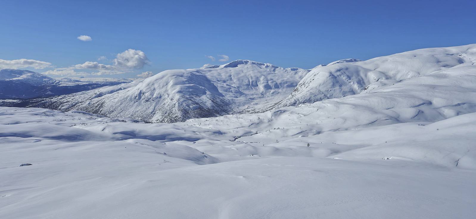
 Sunday skiing trip from Vikafjellet to Bavallen organized by the Norwegian Trekking Association , or more specifically Voss Utferdslag . I started by taking an early train to Voss where I met up with the rest of the group for the bus ride to Vikafjellet. We were dropped off at the parking lot at the start of Sendedalen and were finally ready to start skiing shortly before 09:30.
After an initial easy start along the lakes in Sendedalen we put on the climbing skins and began the ascent to Rjupeskaret followed by the first descent of the day to Murane where we had our first lunch break. From Murane we ascended towards Blåeggi where I made a short detour on my own to the summit before rejoining the rest of the group just north of Mykjedalsvatnet for the ascent to Skreieggi where we all visited the large summit cairn.
We had our second lunch break northwest of Svartenut, where we were joined by a couple >>>
Sunday skiing trip from Vikafjellet to Bavallen organized by the Norwegian Trekking Association , or more specifically Voss Utferdslag . I started by taking an early train to Voss where I met up with the rest of the group for the bus ride to Vikafjellet. We were dropped off at the parking lot at the start of Sendedalen and were finally ready to start skiing shortly before 09:30.
After an initial easy start along the lakes in Sendedalen we put on the climbing skins and began the ascent to Rjupeskaret followed by the first descent of the day to Murane where we had our first lunch break. From Murane we ascended towards Blåeggi where I made a short detour on my own to the summit before rejoining the rest of the group just north of Mykjedalsvatnet for the ascent to Skreieggi where we all visited the large summit cairn.
We had our second lunch break northwest of Svartenut, where we were joined by a couple >>>
Steinafjell and NV av Juklavatnet
- Date:
- 27.04.2024
- Characteristic:
- Backcountry skiing
- Duration:
- 4:59h
- Distance:
- 14.6km
 For the second weekend in a row, Petter and I returned to Jondal to go skiing. This time the plan was to drive up to FONNA Glacier Ski Resort and start our trip from there. However, due to the final part of the road up to ski resort still being covered by snow, we did not take any chances with our summer tires and instead parked at Hestadalen p-plass .
The skis came on immediately after leaving the parking lot and we made good progress up to the unnamed 1084 lake east of Svartaberget. From there we ascended steeply up Svartavassberget before the terrain levelled off as we approached the summit of Steinafjell , which we reached without any issues after roughly 1.5 hours of skiing.
From Steinafjell we wanted to make an attempt at finding a safe route to NV av Juklavatnet . Both of us had in advance arrived at pretty much the same suggested route. The question was whether >>>
For the second weekend in a row, Petter and I returned to Jondal to go skiing. This time the plan was to drive up to FONNA Glacier Ski Resort and start our trip from there. However, due to the final part of the road up to ski resort still being covered by snow, we did not take any chances with our summer tires and instead parked at Hestadalen p-plass .
The skis came on immediately after leaving the parking lot and we made good progress up to the unnamed 1084 lake east of Svartaberget. From there we ascended steeply up Svartavassberget before the terrain levelled off as we approached the summit of Steinafjell , which we reached without any issues after roughly 1.5 hours of skiing.
From Steinafjell we wanted to make an attempt at finding a safe route to NV av Juklavatnet . Both of us had in advance arrived at pretty much the same suggested route. The question was whether >>>
Ruklehaugnuten and Solnuten
- Date:
- 21.04.2024
- Characteristic:
- Backcountry skiing
- Duration:
- 11:54h
- Distance:
- 31.9km
 Petter picked me up at my place at 06:20 for our drive to Tørvikbygd and the first ferry to Jondal. After the short ferry crossing we continued northeast to Herand and Åsleitet where we planned to follow a gravel road up to the parking lot at Vårhaug. We had however not driven many meters on the Grimevegen toll road before we arrived at a locked gate where a local farmer in a tractor told us that the road was closed during the winter. We therefore had no choice but to return to the start of the gravel road and park there.
But just as we were beginning to dread having to carry the skis up the steep extra vertical meters, the farmer returned and asked if we wanted a lift! We of course quickly said yes and hurriedly got ready, placed our gear and ourselves at the back of the tractor and off we went, trying to hold on >>>
Petter picked me up at my place at 06:20 for our drive to Tørvikbygd and the first ferry to Jondal. After the short ferry crossing we continued northeast to Herand and Åsleitet where we planned to follow a gravel road up to the parking lot at Vårhaug. We had however not driven many meters on the Grimevegen toll road before we arrived at a locked gate where a local farmer in a tractor told us that the road was closed during the winter. We therefore had no choice but to return to the start of the gravel road and park there.
But just as we were beginning to dread having to carry the skis up the steep extra vertical meters, the farmer returned and asked if we wanted a lift! We of course quickly said yes and hurriedly got ready, placed our gear and ourselves at the back of the tractor and off we went, trying to hold on >>>
Britabu Easter Barbecue 2024
- Date:
- 28.03.2024
- Characteristic:
- Cross-country skiing
- Duration:
- 3:03h
- Distance:
- 9.5km
 Attending the traditional Easter barbecue at Britabu . The weather was however sadly not the best, with poor visibility during the descent.
Around Fjærlandssetvatnet
- Date:
- 25.03.2024
- Characteristic:
- Cross-country skiing
- Duration:
- 3:38h
- Distance:
- 16.0km
 The standard skiing trip around Fjærlandssetvatnet starting from Rindabotn .
Britastein and Høgehaug
- Date:
- 24.03.2024
- Characteristic:
- Cross-country skiing
- Duration:
- 2:21h
- Distance:
- 10.1km
 My initial plan to visit the highest point of Myrdalsbreen was abandoned at the small hill called Britastein just west of Britabu due to the snow conditions being tougher than expected and the snow starting to build up underneath my climbing skins.
Midtfjell from Sjusete
- Date:
- 16.03.2024
- Characteristic:
- Backcountry skiing
- Duration:
- 5:00h
- Distance:
- 13.3km
 Inspired by an external trip report at tinderangel.no describing what looked like a very nice skiing trip from Sjusete to Midtfjell , Endre and I once more drove from Bergen in the direction of Voss but this time headed for Ulvik and the winter parking lot at Sjusete . As we approached the center of Ulvik we left the main road and instead followed a narrow gravel road southwest up from Vambheim. This included passing through an open gate just north of Gjerdet, but whether this gate is always open remains unknown.
Done with this one potential hurdle we continued up to the parking lot at Sjusete, noticing that the gravel road was rather icy towards the end but hoping that this would improve before the descent later in the day. Plenty of space at the parking lot, in fact we were the only car and, expect for coming across a fresh scooter trail during the descent, we did not see any >>>
Inspired by an external trip report at tinderangel.no describing what looked like a very nice skiing trip from Sjusete to Midtfjell , Endre and I once more drove from Bergen in the direction of Voss but this time headed for Ulvik and the winter parking lot at Sjusete . As we approached the center of Ulvik we left the main road and instead followed a narrow gravel road southwest up from Vambheim. This included passing through an open gate just north of Gjerdet, but whether this gate is always open remains unknown.
Done with this one potential hurdle we continued up to the parking lot at Sjusete, noticing that the gravel road was rather icy towards the end but hoping that this would improve before the descent later in the day. Plenty of space at the parking lot, in fact we were the only car and, expect for coming across a fresh scooter trail during the descent, we did not see any >>>
