Archive - Date
Archive - Activity
-
Bike trip (111)
- Bike trip - mixed (25)
- Bike trip - road (86)
-
Drive (9)
- Car drive (9)
-
Other trip (3)
- Kayaking (3)
-
Ski trip (116)
- Backcountry skiing (69)
- Cross-country skiing (47)
- Trip by foot (1897)
Collected lists
-
Utvalgte topper og turmål i Bergen
(349/351)
 99%
99% -
Alle topper i Bergen
(393/400)
98%
-
Voss ≥ 100m pf.
(96/98)
97%
-
Opptur Hordaland
(144/159)
90%
-
Stasjoner på Bergensbanen
(33/40)
82%
-
Ulvik ≥ 100m pf.
(30/38)
78%
-
Hordaland ≥ 100m pf.
(624/863)
72%
-
Mjølfjell PF > 100m
(21/31)
67%
-
Jondal ≥ 100m pf.
(15/23)
65%
-
Dagsturhyttene i Vestland
(36/61)
59%
-
Sunnhordland PF >= 100m
(105/186)
56%
-
Hordaland: Hardanger PF>=100m
(196/359)
54%
-
DNT-hytter i Hordaland
(23/45)
51%
-
Kvinnherad ≥ 100m pf.
(40/79)
50%
-
Eidfjord ≥ 100m pf.
(13/42)
30%
-
Sogndal ≥ 100m pf.
(23/81)
28%
-
Gulen ≥ 100m pf.
(15/54)
27%
-
Vik i Sogn ≥ 100m pf.
(10/46)
21%
-
Sogn - Sør for Sognefjorden PF>=100m
(31/159)
19%
-
DNT-hytter i Sogn og Fjordane
(8/47)
17%

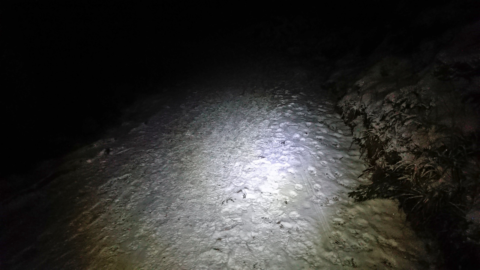
Skiing across Vidden after dark
- Date:
- 19.01.2024
- Characteristic:
- Backcountry skiing
- Duration:
- 4:53h
- Distance:
- 21.1km
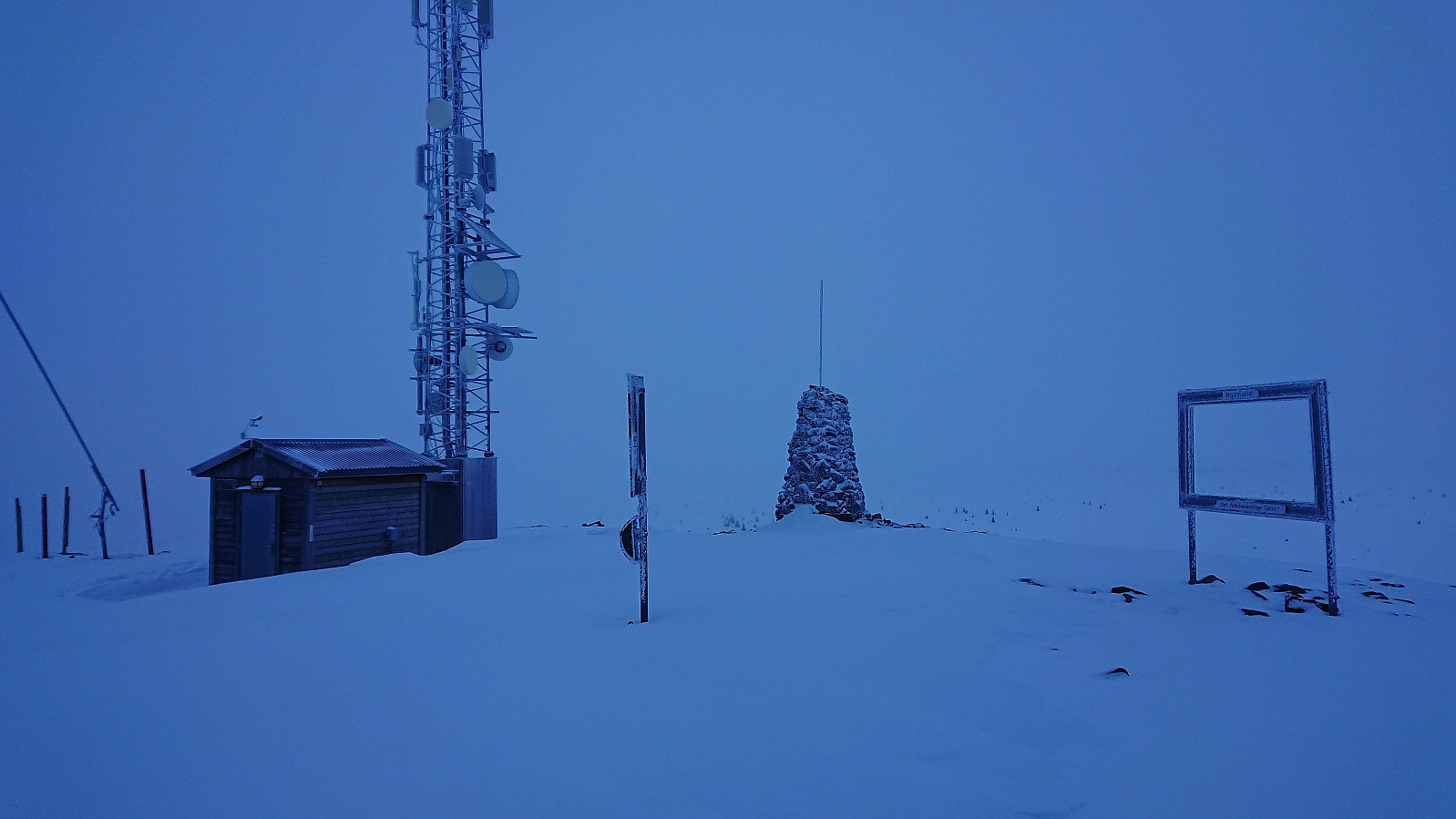
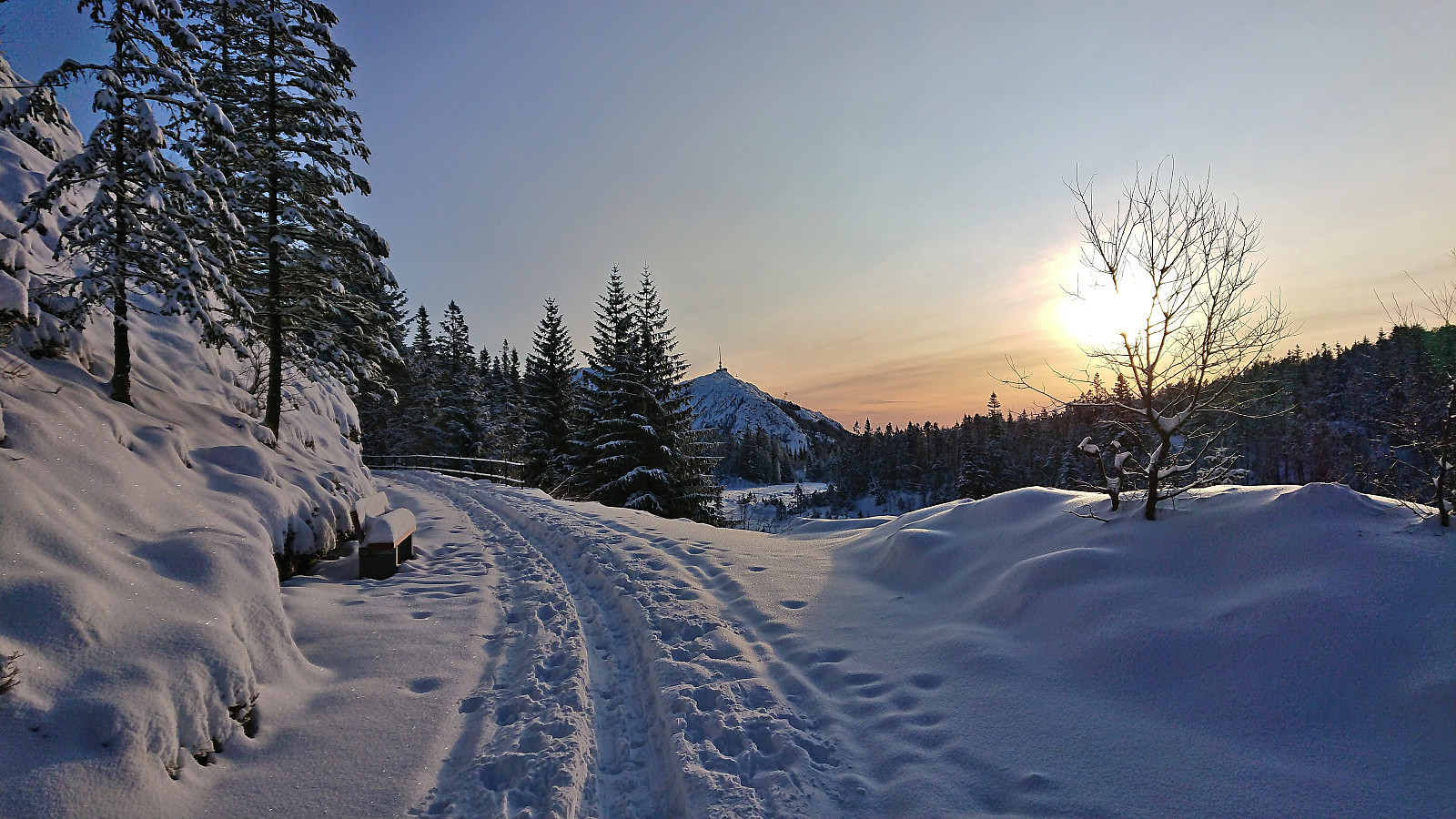
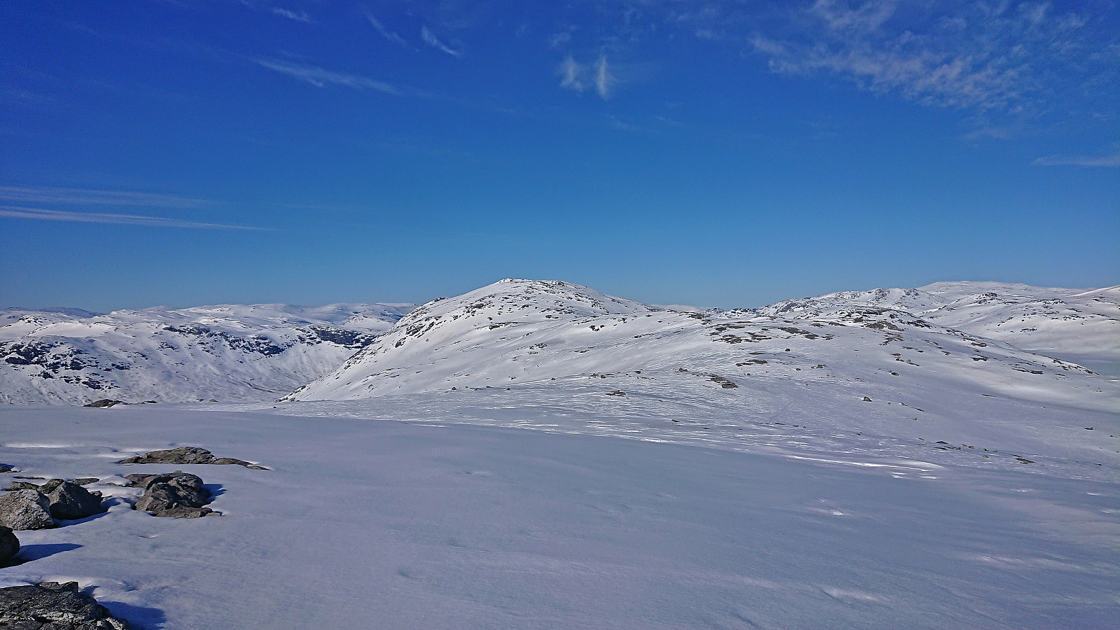
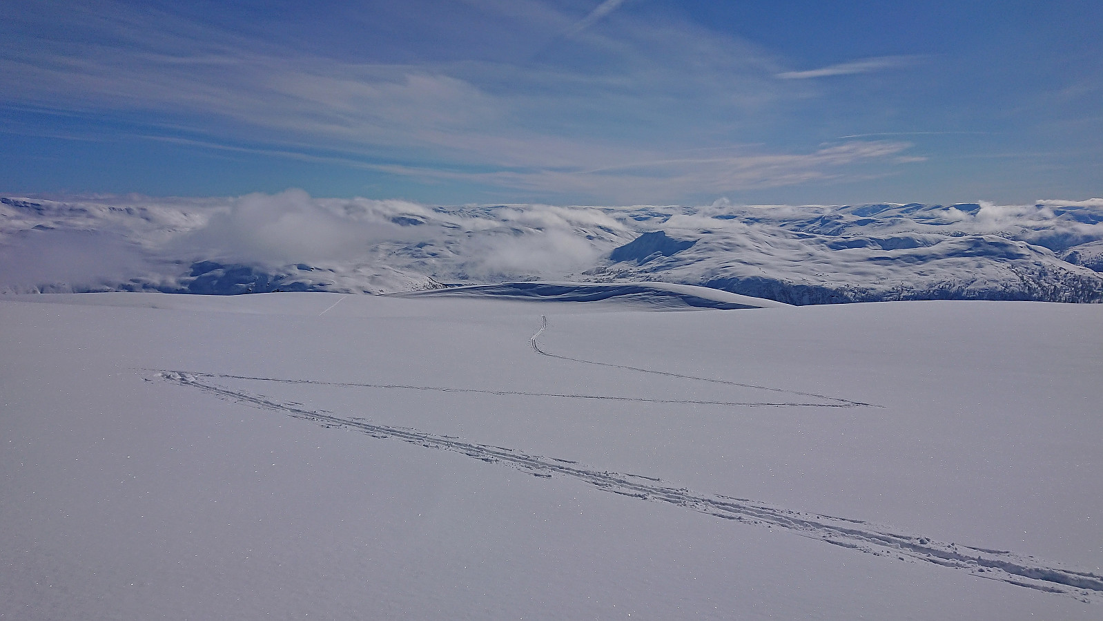
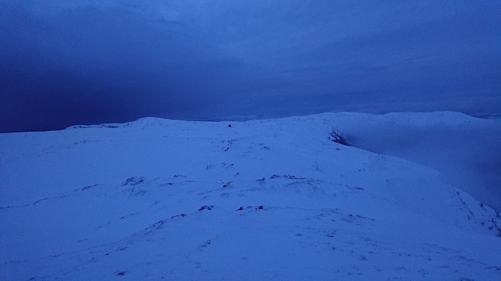 Started the weekend early to take advantage of the recent massive snowfall before it would start raining heavily during the next couple of days. After taking the cable car (230 kr) to the top of Ulriken (or more correctly to Ulriken Vest ), I put on the skis and headed towards Turnerhytten . The visibility was not the best and I constantly had to consider whether my plan to ski across Vidden would be doable after all. At Turnerhytten the visibility gradually improved and I decided to at least continue to Byfjellenes høyeste punkt before deciding. When getting there the visibility had thankfully further improved. Encouraged by also seeing other skiers I decided to continue.
Shortly after passing Skjulet I connected with the trails of the other skiers and could then easily follow these all the way to Borgaskaret. It would probably have been possible >>>
Started the weekend early to take advantage of the recent massive snowfall before it would start raining heavily during the next couple of days. After taking the cable car (230 kr) to the top of Ulriken (or more correctly to Ulriken Vest ), I put on the skis and headed towards Turnerhytten . The visibility was not the best and I constantly had to consider whether my plan to ski across Vidden would be doable after all. At Turnerhytten the visibility gradually improved and I decided to at least continue to Byfjellenes høyeste punkt before deciding. When getting there the visibility had thankfully further improved. Encouraged by also seeing other skiers I decided to continue.
Shortly after passing Skjulet I connected with the trails of the other skiers and could then easily follow these all the way to Borgaskaret. It would probably have been possible >>>
Skiing: Fløyen and Rundemanen
- Date:
- 17.01.2024
- Characteristic:
- Cross-country skiing
- Duration:
- 4:05h
- Distance:
- 17.9km
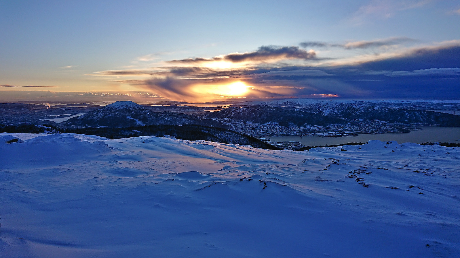 Left work a couple of hours early to enjoy the last part of a day of excellent winter weather. After the massive snowfall from the day before there was plenty of fresh snow. The skis came on just after exiting Fløibanen and stayed on until the top of Øyjorden (except for most of Hellemyrstien where I concluded that it was just as fast to walk).
Storefjell and Veslefjell from Øvre Guriset
- Date:
- 29.12.2023
- Characteristic:
- Cross-country skiing
- Duration:
- 3:11h
- Distance:
- 11.5km
 The weather in the morning looked promising and we once again set out on a joint skiing trip. However, it did not take long before the gray conditions from the day before returned. And also today the grooming of the skiing tracks was suboptimal due to more new snow. At the crossroads northeast of Storefjell we therefore split up and I continued on my own to the summit. Limited views from the top due to the low-hanging clouds and I did not stay long before returning along the same route, with the exception of a minor detour to the highest point at Veslefjell .
Around Auenhaugen from Øvre Guriset
- Date:
- 28.12.2023
- Characteristic:
- Cross-country skiing
- Duration:
- 2:45h
- Distance:
- 10.7km
 Short skiing trip while spending a couple of days at a cabin my sister and her family were renting at Golsfjellet. Due to lots of new snow during the night/early morning the ski tracks were not the best. Combined with gray weather we therefore settled for a roundtrip around Auenhaugen before returning to the cabin.
Skiing at Fløyen
- Date:
- 23.12.2023
- Characteristic:
- Cross-country skiing
- Duration:
- 2:52h
- Distance:
- 13.7km
 The snow returned just in time for Christmas and combined with excellent weather this resulted in a very nice skiing trip starting from the top of Fløibanen. The skis stayed on all the way to Øyjorden with only the occasional rock sticking out of the snow for the last part of the descent down to Munkebotsvatnet.
Skiing at Fløyen
- Date:
- 04.12.2023
- Characteristic:
- Cross-country skiing
- Duration:
- 3:07h
- Distance:
- 15.4km
 Almost a year ago, I wrote that skiing at Fløyen in December is quite uncommon . However, I may have to take that back, as now, less than a year later, I was back skiing at Fløyen, and even earlier than last year. The conditions were reasonably good and except for the final descent down to Storediket (where I hit a couple of rocks sticking out of the snow) and the last part of the descent down to the start of the climb up to Storevatnet (where I most likely could have skied but did not risk it), the skis stayed on until reaching Smådiket (the small dam below Storevatnet). Here the gravel road started showing up underneath the snow and the skis had to be carried the rest of the way home to Lønborg.
Skiing: Mjølfjell to Skiple
- Date:
- 20.05.2023
- Characteristic:
- Backcountry skiing
- Duration:
- 10:12h
- Distance:
- 33.3km
 After last weekend's successful skiing trip to Øykjafonn and Skipanuten I decided to have another go, but this time on my own and starting from Mjølfjell. I again took the early morning train from Bergen and arrived at Mjølfjell train station just before nine. From the station I followed the gravel road north into Rjonaddalen, where I carried the skis for the first 2 km, before putting them on a continuing beside the road where there was just enough snow left.
I soon left the road for a shortcut to reconnect with the road up to Grodjuvet. This road normally continues all the way to the bridge across Grodjyvo , but today the road was soon hidden underneath the snow. By then it was too late to cross the partially open river and I instead continued north until I could safely cross via the mentioned bridge and start the ascent to Grodjuvenuten .
After passing on the northern side of Skyttargluggane, all that remained >>>
After last weekend's successful skiing trip to Øykjafonn and Skipanuten I decided to have another go, but this time on my own and starting from Mjølfjell. I again took the early morning train from Bergen and arrived at Mjølfjell train station just before nine. From the station I followed the gravel road north into Rjonaddalen, where I carried the skis for the first 2 km, before putting them on a continuing beside the road where there was just enough snow left.
I soon left the road for a shortcut to reconnect with the road up to Grodjuvet. This road normally continues all the way to the bridge across Grodjyvo , but today the road was soon hidden underneath the snow. By then it was too late to cross the partially open river and I instead continued north until I could safely cross via the mentioned bridge and start the ascent to Grodjuvenuten .
After passing on the northern side of Skyttargluggane, all that remained >>>
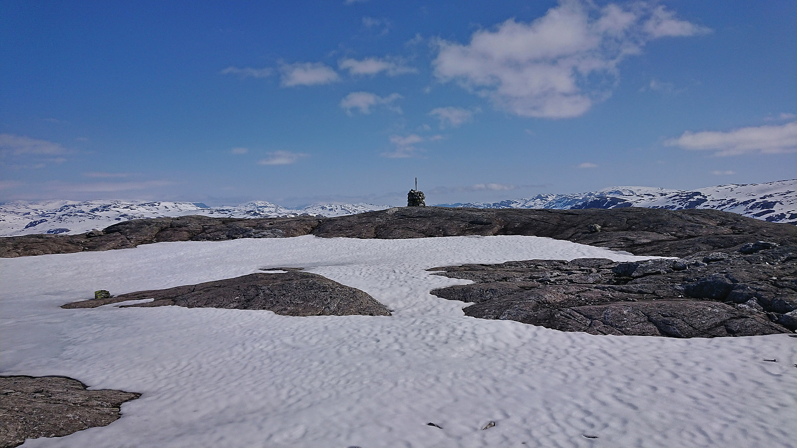
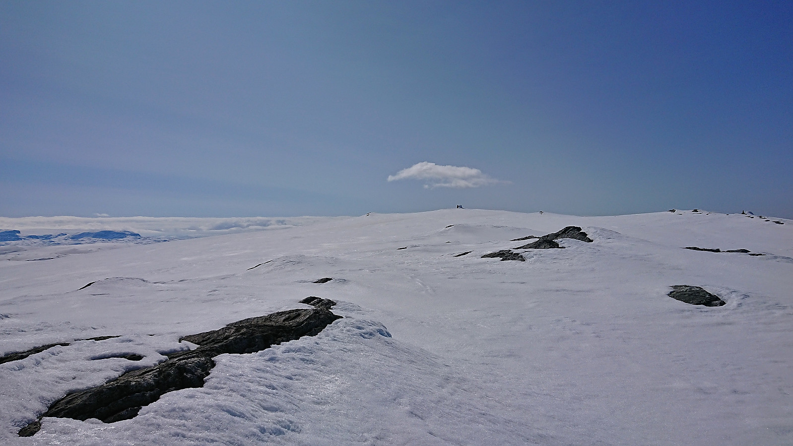
Øykjafonn and Skipanuten from Upsete
- Date:
- 13.05.2023
- Characteristic:
- Backcountry skiing
- Duration:
- 6:07h
- Distance:
- 20.5km
 When petter (Petter Bjørstad) asked if I wanted to go hiking or skiing this weekend I of course said yes, and we settled on a skiing trip to Øykjafonn and Skipanuten . After taking an early train from Bergen we arrived at Upsete stasjon shortly after nine, and after finding a way to safely get to the other side of the train tracks we started the 750 vertical meters ascent to Øykjafonn.
After crossing the river coming down from Gangsdalsvatnet via a snow bridge we pretty much followed the ridge south all the way to the summit. Still plenty of snow, although there were also times when we had to navigate around areas where the snow had already disappeared. Excellent panoramic views from the large summit cairn.
Next, we removed the climbing skins and continued south towards Skipanuten. The descent to the small lake between the two summits was overall straightforward >>>
When petter (Petter Bjørstad) asked if I wanted to go hiking or skiing this weekend I of course said yes, and we settled on a skiing trip to Øykjafonn and Skipanuten . After taking an early train from Bergen we arrived at Upsete stasjon shortly after nine, and after finding a way to safely get to the other side of the train tracks we started the 750 vertical meters ascent to Øykjafonn.
After crossing the river coming down from Gangsdalsvatnet via a snow bridge we pretty much followed the ridge south all the way to the summit. Still plenty of snow, although there were also times when we had to navigate around areas where the snow had already disappeared. Excellent panoramic views from the large summit cairn.
Next, we removed the climbing skins and continued south towards Skipanuten. The descent to the small lake between the two summits was overall straightforward >>>
Klevanuten and Rjoandeggi
- Date:
- 22.04.2023
- Characteristic:
- Backcountry skiing
- Duration:
- 5:24h
- Distance:
- 17.3km
 On a perfect Saturday for skiing, I took the train to Ljosandbotn and followed the marked route up Ljosanddalen to Borgarebuvotni, making a minor detour to visit Appelsintreet . From Borgarebuvotni I continued north before ascending Klevanuten from the northeast. After a short break at the summit I descended into Klevaskaret and ascended to the northern end of Rjoandeggi which I then proceeded to follow south to the highest point . Sunshine and no wind made for an excellent location for my late lunch break.
I continued south along the ridge to Søre Rjoandeggi . Overall straightforward, however there were lots of rocks and even larger areas without any snow that had to be properly navigated. After another extended break, all that remained was the very nice descent to the train station. Even though I had tried to take it slow, and include lots of breaks, I still >>>
On a perfect Saturday for skiing, I took the train to Ljosandbotn and followed the marked route up Ljosanddalen to Borgarebuvotni, making a minor detour to visit Appelsintreet . From Borgarebuvotni I continued north before ascending Klevanuten from the northeast. After a short break at the summit I descended into Klevaskaret and ascended to the northern end of Rjoandeggi which I then proceeded to follow south to the highest point . Sunshine and no wind made for an excellent location for my late lunch break.
I continued south along the ridge to Søre Rjoandeggi . Overall straightforward, however there were lots of rocks and even larger areas without any snow that had to be properly navigated. After another extended break, all that remained was the very nice descent to the train station. Even though I had tried to take it slow, and include lots of breaks, I still >>>
Finnbunuten from Kari Traa-trekket
- Date:
- 29.03.2023
- Characteristic:
- Backcountry skiing
- Duration:
- 1:59h
- Distance:
- 7.6km
 Given the excellent weather, we decided to take the day off and go skiing in Myrkdalen. Several of my colleagues initially wanted to join, but for different reasons, and due to one last minute cancellation, only three of us were on the 08:29 train from Bergen to Voss. We had bought something called a SkiBillett , which included the trains to/from Voss, the ski bus to/from Myrkdalen (which is free anyway) and a one day lift pass, saving around 300 kr per person compared to buying these items separately.
After arriving at Myrkdalen, two of us decided to first make an ascent of Finnbunuten . We started by taking the chair lift "Myrkdalsekspressen" from just outside the hotel and, after a short descent, continued on the T-bar lift "Kari Traa-trekket". Here the GPS was turned on and we headed off-trail >>>
Given the excellent weather, we decided to take the day off and go skiing in Myrkdalen. Several of my colleagues initially wanted to join, but for different reasons, and due to one last minute cancellation, only three of us were on the 08:29 train from Bergen to Voss. We had bought something called a SkiBillett , which included the trains to/from Voss, the ski bus to/from Myrkdalen (which is free anyway) and a one day lift pass, saving around 300 kr per person compared to buying these items separately.
After arriving at Myrkdalen, two of us decided to first make an ascent of Finnbunuten . We started by taking the chair lift "Myrkdalsekspressen" from just outside the hotel and, after a short descent, continued on the T-bar lift "Kari Traa-trekket". Here the GPS was turned on and we headed off-trail >>>
