Archive - Date
Archive - Activity
-
Bike trip (110)
- Bike trip - mixed (25)
- Bike trip - road (85)
-
Drive (9)
- Car drive (9)
-
Other trip (3)
- Kayaking (3)
-
Ski trip (116)
- Backcountry skiing (69)
- Cross-country skiing (47)
- Trip by foot (1884)
Collected lists
-
Utvalgte topper og turmål i Bergen
(348/349)
 99%
99% -
Alle topper i Bergen
(391/398)
98%
-
Voss ≥ 100m pf.
(96/98)
97%
-
Opptur Hordaland
(144/159)
90%
-
Stasjoner på Bergensbanen
(33/40)
82%
-
Ulvik ≥ 100m pf.
(28/38)
73%
-
Hordaland ≥ 100m pf.
(622/863)
72%
-
Mjølfjell PF > 100m
(21/31)
67%
-
Jondal ≥ 100m pf.
(15/23)
65%
-
Dagsturhyttene i Vestland
(36/61)
59%
-
Sunnhordland PF >= 100m
(105/186)
56%
-
Hordaland: Hardanger PF>=100m
(194/359)
54%
-
DNT-hytter i Hordaland
(23/45)
51%
-
Kvinnherad ≥ 100m pf.
(40/79)
50%
-
Eidfjord ≥ 100m pf.
(13/42)
30%
-
Sogndal ≥ 100m pf.
(23/81)
28%
-
Gulen ≥ 100m pf.
(15/54)
27%
-
Vik i Sogn ≥ 100m pf.
(10/46)
21%
-
Sogn - Sør for Sognefjorden PF>=100m
(31/159)
19%
-
DNT-hytter i Sogn og Fjordane
(8/47)
17%

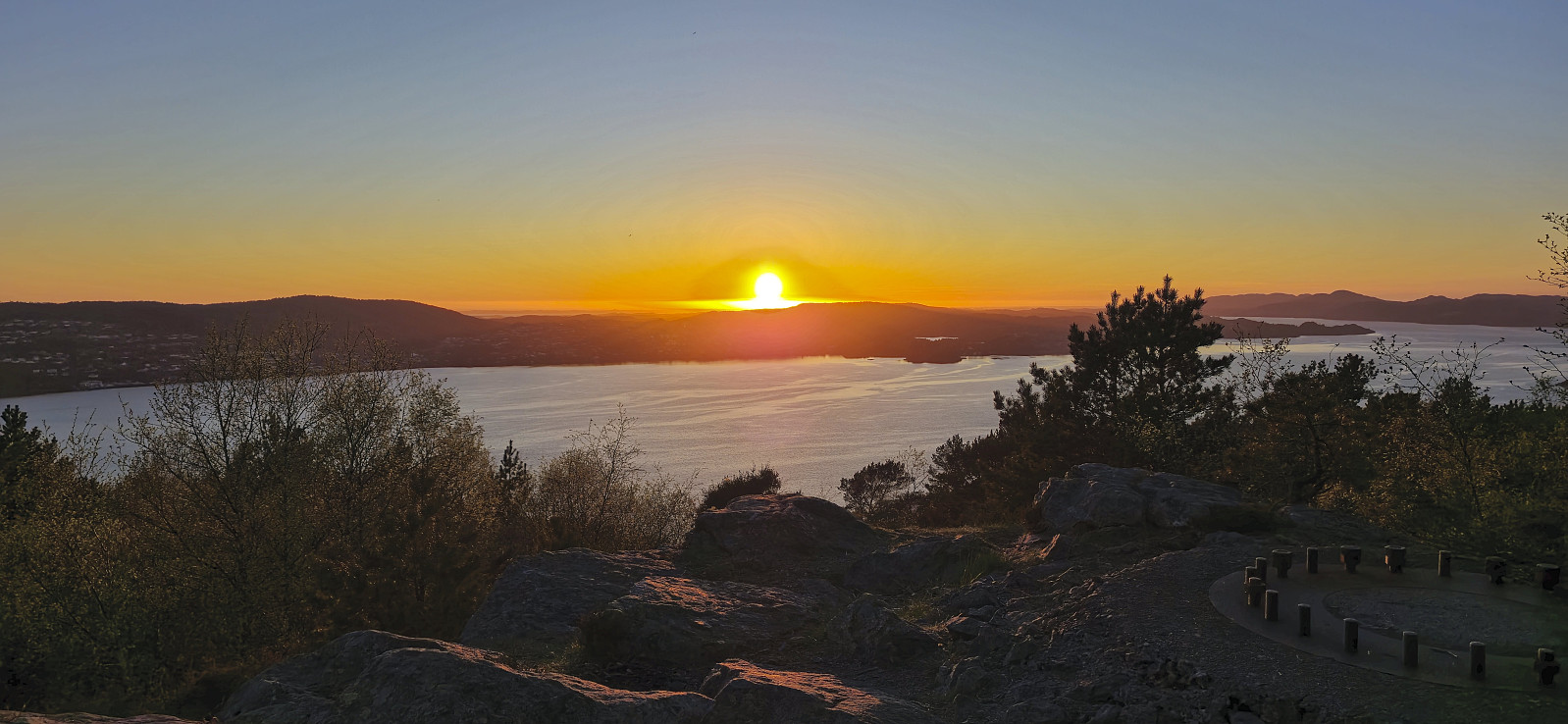
Ørneberget and Furukammen
- Date:
- 12.05.2025
- Characteristic:
- Hillwalk
- Duration:
- 0:52h
- Distance:
- 3.8km
 Short local evening hike.
Samlen from Herand
- Date:
- 04.05.2025
- Characteristic:
- Hillwalk
- Duration:
- 6:36h
- Distance:
- 15.5km
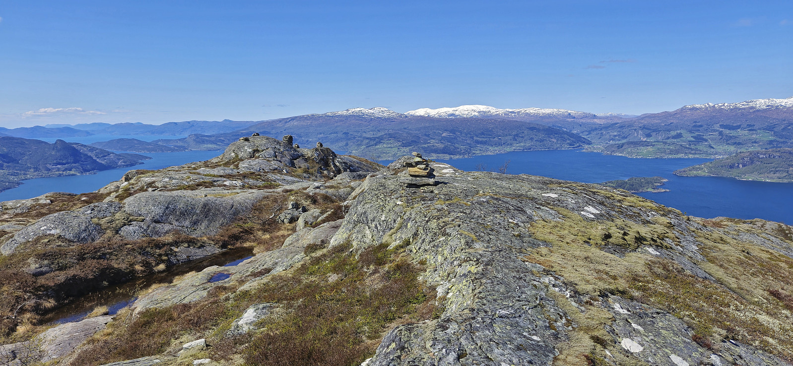 Started by taking an early bus from Bergen to Norheimsund to catch the express boat at 09:00. While the boat continued all the way to Eidfjord, I got off at the first stop and was finally ready to begin my ascent of Samlen from Herand shortly before 09:30.
To get to the trailhead east of the summit, I followed the paved road northeastward for roughly an hour. At the trailhead I was welcomed by a message that the trail to Samlen had gotten a new starting point in relation to Hardangertrappa (a new route including stone steps that is in the process of being completed). Hoping that the sign did not indicate that the older trail was no longer usable, I continued my ascent, and while the trail was a bit steep and rough at times, it was overall straightforward to follow.
In any case, it did not take very long before the two trails connected, >>>
Started by taking an early bus from Bergen to Norheimsund to catch the express boat at 09:00. While the boat continued all the way to Eidfjord, I got off at the first stop and was finally ready to begin my ascent of Samlen from Herand shortly before 09:30.
To get to the trailhead east of the summit, I followed the paved road northeastward for roughly an hour. At the trailhead I was welcomed by a message that the trail to Samlen had gotten a new starting point in relation to Hardangertrappa (a new route including stone steps that is in the process of being completed). Hoping that the sign did not indicate that the older trail was no longer usable, I continued my ascent, and while the trail was a bit steep and rough at times, it was overall straightforward to follow.
In any case, it did not take very long before the two trails connected, >>>
Manen from Pallane
- Date:
- 30.04.2025
- Characteristic:
- Hillwalk
- Duration:
- 3:17h
- Distance:
- 7.4km
 When my plans to spend the first of May skiing at Finse had to be postponed due to bad weather, I instead left work early the day before for a trip to Kvinnherad with Petter . We drove south from Bergen and made the 16:10-ferry from Gjermundshamn with plenty of time to spare.
After crossing the fjord we drove the short distance south to the start of Uskedalen where we parked next to the marked trailhead at Pallane in Eikevegen and were ready to start our hike to Manen shortly after five.
We began by following a tractor road up to the start of the marked trail. The trail was however at first rather weak and we quickly lost it. But after a couple of minutes we found it again and from there on it was straightforward to follow it all the way to the summit. Note however that the trail seems to end at a large cairn that is not at the highest point. The summit >>>
When my plans to spend the first of May skiing at Finse had to be postponed due to bad weather, I instead left work early the day before for a trip to Kvinnherad with Petter . We drove south from Bergen and made the 16:10-ferry from Gjermundshamn with plenty of time to spare.
After crossing the fjord we drove the short distance south to the start of Uskedalen where we parked next to the marked trailhead at Pallane in Eikevegen and were ready to start our hike to Manen shortly after five.
We began by following a tractor road up to the start of the marked trail. The trail was however at first rather weak and we quickly lost it. But after a couple of minutes we found it again and from there on it was straightforward to follow it all the way to the summit. Note however that the trail seems to end at a large cairn that is not at the highest point. The summit >>>
Hillesdalsfjell and Håfjell
- Date:
- 26.04.2025
- Characteristic:
- Hillwalk
- Duration:
- 5:27h
- Distance:
- 14.6km
 Kjell picked me up at 06:50 for the short drive to meet up with Petter and from his place we all continued in Petter's car to Gjermundshamn for the 09:00-ferry to Årsnes. After crossing the fjord, we drove south via Rosendal to Matre and Matersdalen where we found parking next to the road and were finally ready to start hiking shortly after 10:00.
From the car we briefly descended back down the paved road before ascending south along a tractor road up to Vadtjørnane. Here we aimed for Hillesdalsfjell and pretty much followed a straight line towards the summit. We did spot one or two red trail markers on the way, but these were quite faint and of the trail itself we did not really see much evidence. Hence the route has to be described as off-trail but still straightforward and without any real challenges.
After a couple >>>
Kjell picked me up at 06:50 for the short drive to meet up with Petter and from his place we all continued in Petter's car to Gjermundshamn for the 09:00-ferry to Årsnes. After crossing the fjord, we drove south via Rosendal to Matre and Matersdalen where we found parking next to the road and were finally ready to start hiking shortly after 10:00.
From the car we briefly descended back down the paved road before ascending south along a tractor road up to Vadtjørnane. Here we aimed for Hillesdalsfjell and pretty much followed a straight line towards the summit. We did spot one or two red trail markers on the way, but these were quite faint and of the trail itself we did not really see much evidence. Hence the route has to be described as off-trail but still straightforward and without any real challenges.
After a couple >>>
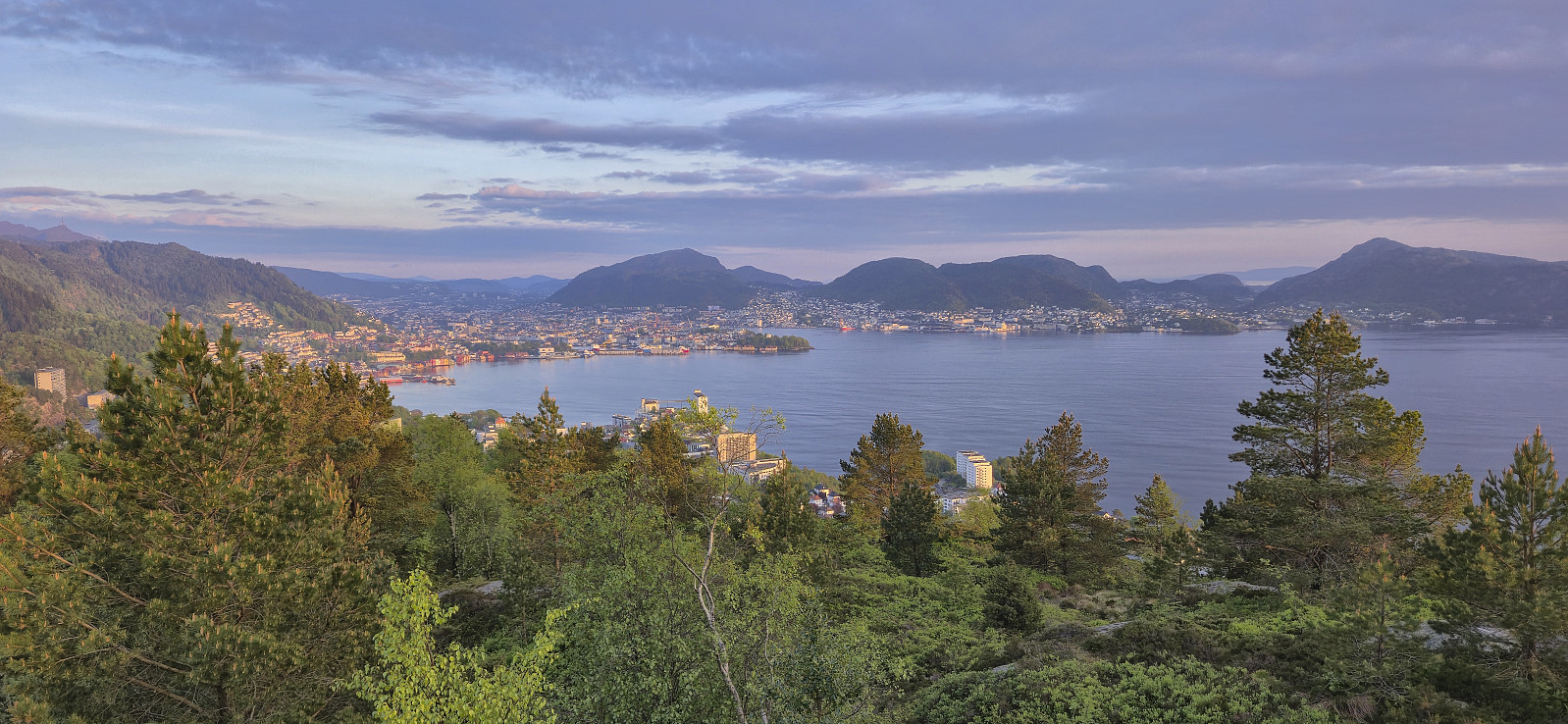
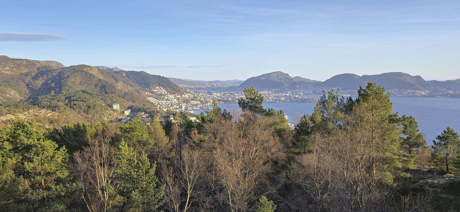
Ørneberget and Furukammen
- Date:
- 23.04.2025
- Characteristic:
- Hillwalk
- Duration:
- 1:04h
- Distance:
- 4.0km
 Short local hike just before sunset.
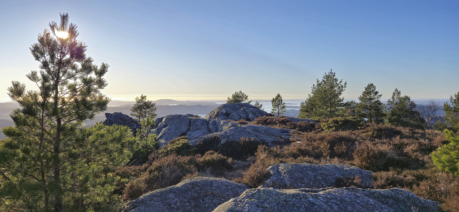
Ørneberget and Furukammen
- Date:
- 09.04.2025
- Characteristic:
- Hillwalk
- Duration:
- 0:49h
- Distance:
- 3.8km
 Short local hike after work.
Lyderhorn from Gravdal to Loddefjord
- Date:
- 02.04.2025
- Characteristic:
- Hillwalk
- Duration:
- 3:13h
- Distance:
- 6.7km
 A hike after work with three of my colleagues in the sunny and unusually warm start of April.
Tjellflotåsen from Skånevik
- Date:
- 30.03.2025
- Characteristic:
- Hillwalk
- Duration:
- 1:26h
- Distance:
- 5.6km
 Initially, I had planned to go skiing this Sunday, but after spending all of the Saturday hiking with Petter in Kvinnherad , I decided to rather take it easy and instead went for a boat trip to Skånevik for a short hike to Tjellflotåsen . Roughly three hours after embarking on the high-speed passenger ferry in Bergen, and after a quick transfer to similar boat in Leirvik, I arrived in sunny Skånevik ready to start my hike.
I started by walking northeast along Skånevikvegen before later leaving the main road and turning southwest on the smaller road to Ytre Nes. After about 300 meters on this road I arrived at the marked trailhead for Tjellflotåsen. From there, the trail was marked all the way to the summit, however there should have been one additional marker early on when the tractor road split. Here the trail continues straight ahead >>>
Initially, I had planned to go skiing this Sunday, but after spending all of the Saturday hiking with Petter in Kvinnherad , I decided to rather take it easy and instead went for a boat trip to Skånevik for a short hike to Tjellflotåsen . Roughly three hours after embarking on the high-speed passenger ferry in Bergen, and after a quick transfer to similar boat in Leirvik, I arrived in sunny Skånevik ready to start my hike.
I started by walking northeast along Skånevikvegen before later leaving the main road and turning southwest on the smaller road to Ytre Nes. After about 300 meters on this road I arrived at the marked trailhead for Tjellflotåsen. From there, the trail was marked all the way to the summit, however there should have been one additional marker early on when the tractor road split. Here the trail continues straight ahead >>>
Bergshovda
- Date:
- 29.03.2025
- Characteristic:
- Hillwalk
- Duration:
- 1:09h
- Distance:
- 2.5km
 After completing the ascent of Åsen , we drove the short distance northeast to the crossroads of Matersvegen, Myklebustvegen and Blådalsvegen for our final ascent of the day, namely Bergshovda . We left the car next to the road and from there tried to follow Pål’s trip report . However, as it did not contain a GPS-track we had to rely on our best attempts at interpreting his written description.
This started out well enough and after first heading northwest without a trail we came across the trail mentioned by Pål and then proceeded to try to follow it. Calling it a trail seemed like an exaggeration though as it looked more like a deer track, but perhaps one of the more frequently used ones. We do not know whether we actually followed the exact same route from there on though, but at least our trail/deer track made sure that we got to the >>>
After completing the ascent of Åsen , we drove the short distance northeast to the crossroads of Matersvegen, Myklebustvegen and Blådalsvegen for our final ascent of the day, namely Bergshovda . We left the car next to the road and from there tried to follow Pål’s trip report . However, as it did not contain a GPS-track we had to rely on our best attempts at interpreting his written description.
This started out well enough and after first heading northwest without a trail we came across the trail mentioned by Pål and then proceeded to try to follow it. Calling it a trail seemed like an exaggeration though as it looked more like a deer track, but perhaps one of the more frequently used ones. We do not know whether we actually followed the exact same route from there on though, but at least our trail/deer track made sure that we got to the >>>
Åsen
- Date:
- 29.03.2025
- Characteristic:
- Hillwalk
- Duration:
- 1:09h
- Distance:
- 2.2km
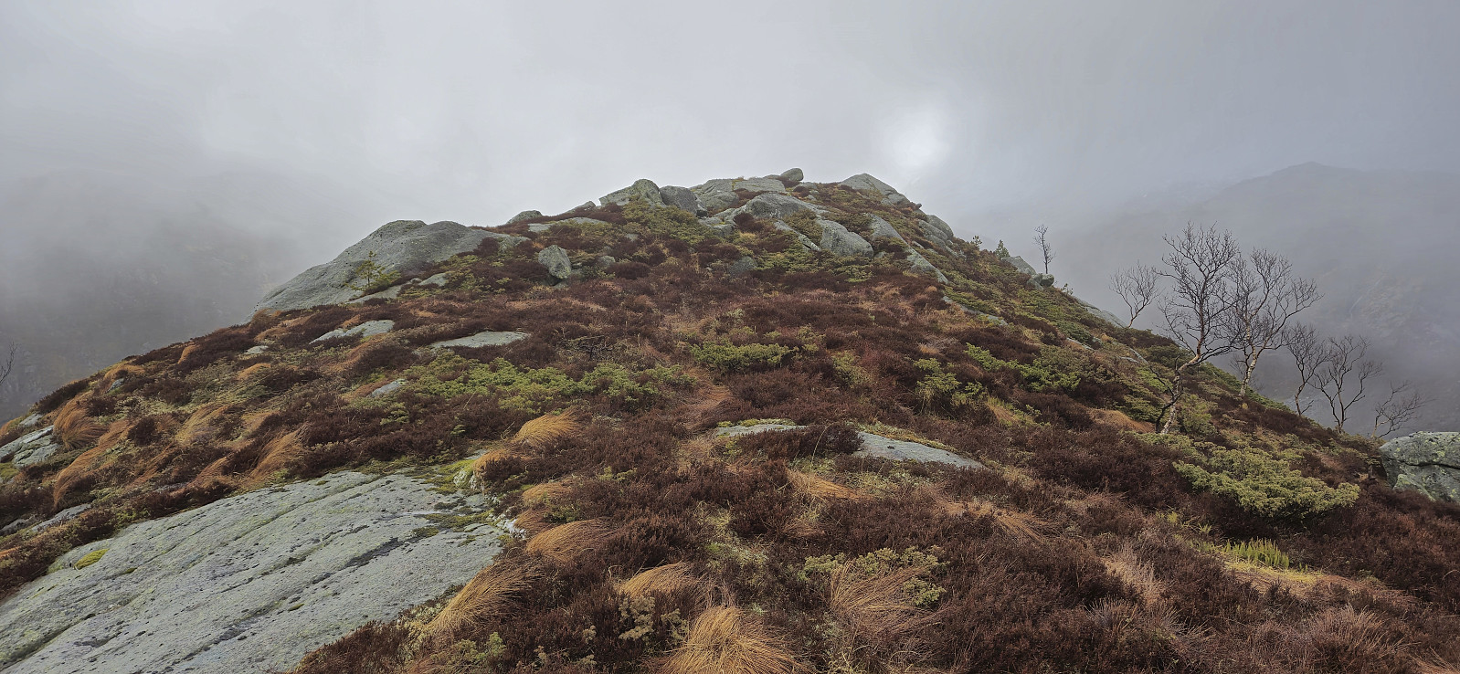
 With Ingahogg and Tindafjellet in the bag, we drove the short distance from the parking lot at Fjellhaugen Skisenter to the top of the pass between Indre Matre and Opstveit. Here there was room for a couple of cars without hindering the traffic or blocking access to the recycling station. In light rain that would thankfully soon stop, we then followed various deer tracks up to the ridge leading to Åsen .
Getting to the ridge involved a short steep section that we managed to avoid when later descending but was otherwise straightforward. It was then just a matter of following various deer tracks on our way to the summit. Despite being the lowest summit of the day, it actually provided the best views, mainly as we were now under the layer of dense fog, however the views were marred by the overhanging powerlines.
We returned more or less the same way and then >>>
With Ingahogg and Tindafjellet in the bag, we drove the short distance from the parking lot at Fjellhaugen Skisenter to the top of the pass between Indre Matre and Opstveit. Here there was room for a couple of cars without hindering the traffic or blocking access to the recycling station. In light rain that would thankfully soon stop, we then followed various deer tracks up to the ridge leading to Åsen .
Getting to the ridge involved a short steep section that we managed to avoid when later descending but was otherwise straightforward. It was then just a matter of following various deer tracks on our way to the summit. Despite being the lowest summit of the day, it actually provided the best views, mainly as we were now under the layer of dense fog, however the views were marred by the overhanging powerlines.
We returned more or less the same way and then >>>
