Archive - Date
Archive - Activity
-
Bike trip (110)
- Bike trip - mixed (25)
- Bike trip - road (85)
-
Drive (9)
- Car drive (9)
-
Other trip (3)
- Kayaking (3)
-
Ski trip (116)
- Backcountry skiing (69)
- Cross-country skiing (47)
- Trip by foot (1884)
Collected lists
-
Utvalgte topper og turmål i Bergen
(348/349)
 99%
99% -
Alle topper i Bergen
(391/398)
98%
-
Voss ≥ 100m pf.
(96/98)
97%
-
Opptur Hordaland
(144/159)
90%
-
Stasjoner på Bergensbanen
(33/40)
82%
-
Ulvik ≥ 100m pf.
(28/38)
73%
-
Hordaland ≥ 100m pf.
(622/863)
72%
-
Mjølfjell PF > 100m
(21/31)
67%
-
Jondal ≥ 100m pf.
(15/23)
65%
-
Dagsturhyttene i Vestland
(36/61)
59%
-
Sunnhordland PF >= 100m
(105/186)
56%
-
Hordaland: Hardanger PF>=100m
(194/359)
54%
-
DNT-hytter i Hordaland
(23/45)
51%
-
Kvinnherad ≥ 100m pf.
(40/79)
50%
-
Eidfjord ≥ 100m pf.
(13/42)
30%
-
Sogndal ≥ 100m pf.
(23/81)
28%
-
Gulen ≥ 100m pf.
(15/54)
27%
-
Vik i Sogn ≥ 100m pf.
(10/46)
21%
-
Sogn - Sør for Sognefjorden PF>=100m
(31/159)
19%
-
DNT-hytter i Sogn og Fjordane
(8/47)
17%

Brattanakken and Midtnova
- Date:
- 16.07.2020
- Characteristic:
- Hillwalk
- Duration:
- 7:45h
- Distance:
- 18.1km
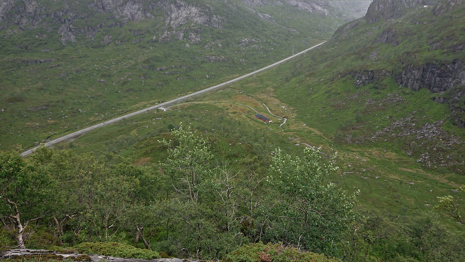
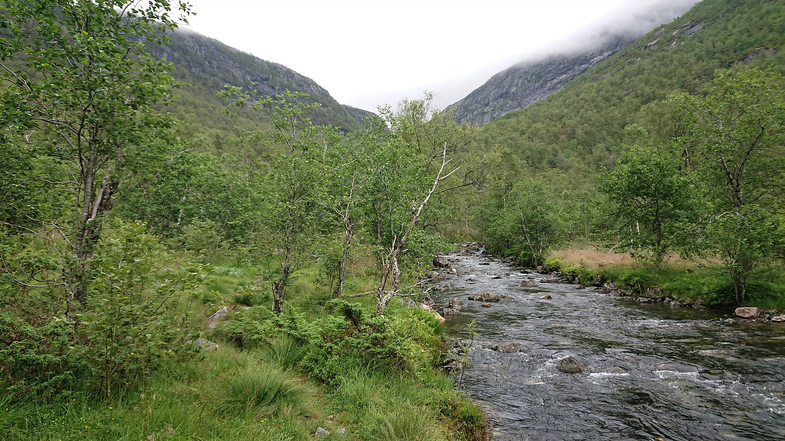 A hike with two colleagues starting from Øyane p-plass and from there following a tractor road up Øyadalen to Dalastølen, and then a marked trail along the river to Gavvatnet. Nice steady ascent with only a short steeper section towards the end.
At Gavvatnet, my two colleagues stayed behind for an extended lunch break while I waded across the river to continue on my own to Brattanakken . First ascending steeply towards Geitahaugen, before turning southeast for the summit of Brattanakken when the terrain turned less steep, and reaching the summit without any difficulties, which provided nice views in all directions, including an unusual view of Storenipa .
I returned to my colleagues along pretty much the same route, and together we continued on the marked trail to Hesjedalsstølen via Øyastølen. We did not go all the way to Hesjedalstølen >>>
A hike with two colleagues starting from Øyane p-plass and from there following a tractor road up Øyadalen to Dalastølen, and then a marked trail along the river to Gavvatnet. Nice steady ascent with only a short steeper section towards the end.
At Gavvatnet, my two colleagues stayed behind for an extended lunch break while I waded across the river to continue on my own to Brattanakken . First ascending steeply towards Geitahaugen, before turning southeast for the summit of Brattanakken when the terrain turned less steep, and reaching the summit without any difficulties, which provided nice views in all directions, including an unusual view of Storenipa .
I returned to my colleagues along pretty much the same route, and together we continued on the marked trail to Hesjedalsstølen via Øyastølen. We did not go all the way to Hesjedalstølen >>>
Såta from Sævellvegen
- Date:
- 15.07.2020
- Characteristic:
- Hillwalk
- Duration:
- 2:18h
- Distance:
- 9.4km
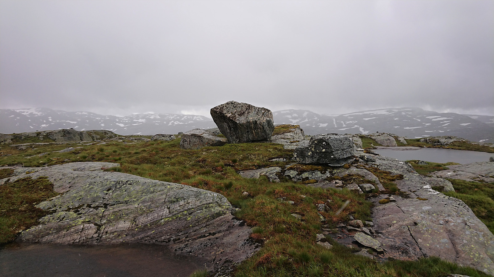
 Started by taking the bus to Sævill/Sævell and from there walking along the (first tarmac, then gravel) road to Kjøpmannavadet Parkering . This took me about half an hour, leaving roughly 1.5 hours for both the real hike and the return to the bus stop. Based on the previous PB-reports to Såta , I decided to follow in the footsteps of Kjell51 (Kjell Øijorden) , and easily located the indicated trailhead just north of the parking lot.
The trail was rather weak though, and soon turned into something looking much more like deer tracks. In any case, following these greatly simplified the ascent and also kept the bush wars to a minimum. And combined with Kjell's GPS track, it made it straightforward to reach the summit. Except perhaps for the very last bit, where a minor fight with the already mentioned bushes was required.
Limited views from the summit, >>>
Started by taking the bus to Sævill/Sævell and from there walking along the (first tarmac, then gravel) road to Kjøpmannavadet Parkering . This took me about half an hour, leaving roughly 1.5 hours for both the real hike and the return to the bus stop. Based on the previous PB-reports to Såta , I decided to follow in the footsteps of Kjell51 (Kjell Øijorden) , and easily located the indicated trailhead just north of the parking lot.
The trail was rather weak though, and soon turned into something looking much more like deer tracks. In any case, following these greatly simplified the ascent and also kept the bush wars to a minimum. And combined with Kjell's GPS track, it made it straightforward to reach the summit. Except perhaps for the very last bit, where a minor fight with the already mentioned bushes was required.
Limited views from the summit, >>>
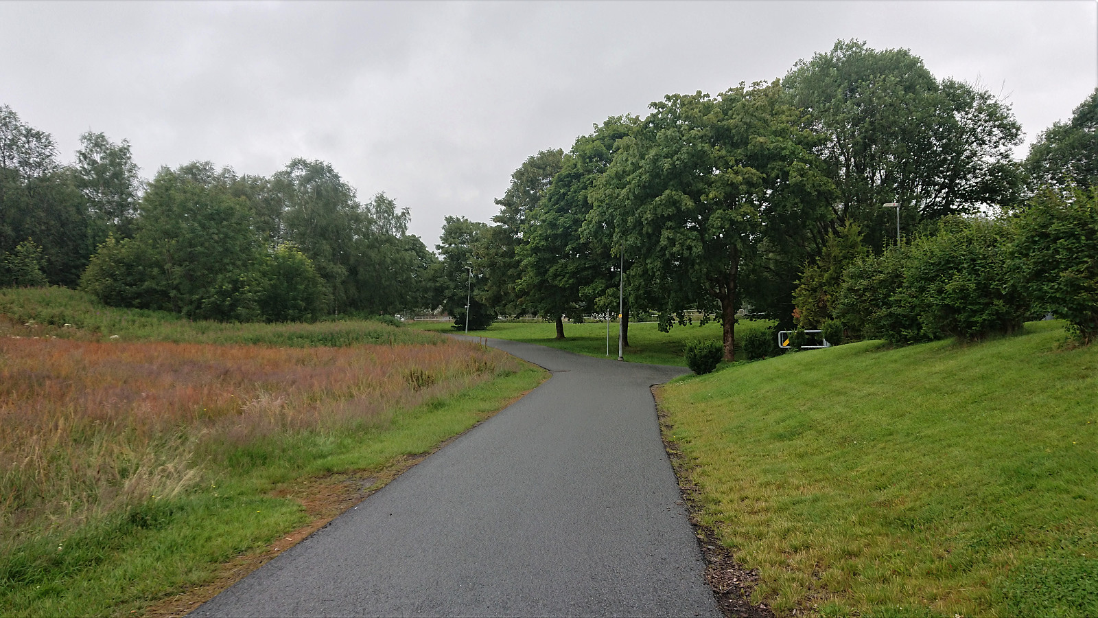
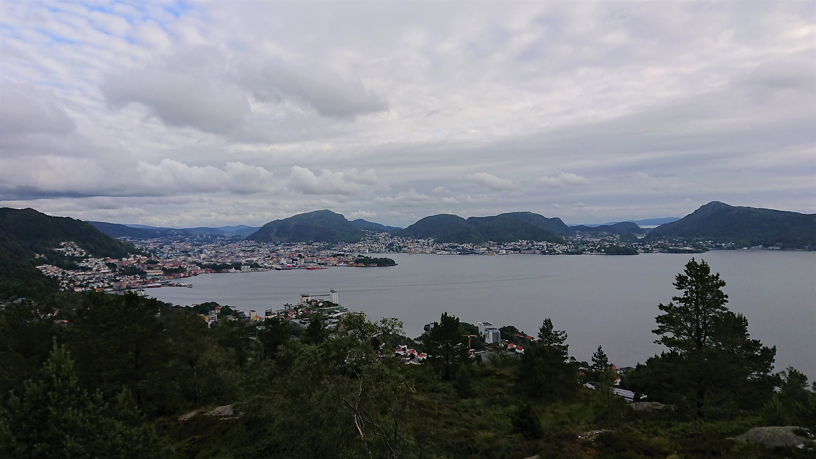
Bergen: Jubileumsstien (Stage 5 and 6)
- Date:
- 13.07.2020
- Characteristic:
- Hillwalk
- Duration:
- 5:33h
- Distance:
- 21.3km
 Jubileumsstien
 is a new trail (or mainly a combination of existing trails) that makes it possible to hike across Bergen, from Krokeide in the south to Tellevik in the north, a total distance of about 55 km. This hike includes Stage 5 and 6: Søylen to Myrdalsvegen.
Stage 5: Søylen to Rolland
After an overall disappointing start to Jubileumsstien (see my earlier reports here and here ), I was back at Søylen, hopeful that the next stage would be better.
From the large information sign marking the start of Stage 5, I easily located the marked trailhead less than 50 meters up the road. The trail itself was less easy to see though, as it was of rather poor quality (even included two potentially dangerous metal wires stretched right across the trail). But after about 200 meters or so the trail thankfully connected >>>
Jubileumsstien
Jubileumsstien is a new trail (or mainly a combination of existing trails) that makes it possible to hike across Bergen, from Krokeide in the south to Tellevik in the north, a total distance of about 55 km. This hike includes Stage 5 and 6: Søylen to Myrdalsvegen.
Stage 5: Søylen to Rolland
After an overall disappointing start to Jubileumsstien (see my earlier reports here and here ), I was back at Søylen, hopeful that the next stage would be better.
From the large information sign marking the start of Stage 5, I easily located the marked trailhead less than 50 meters up the road. The trail itself was less easy to see though, as it was of rather poor quality (even included two potentially dangerous metal wires stretched right across the trail). But after about 200 meters or so the trail thankfully connected >>>
Hellen festning and Ørneberget
- Date:
- 12.07.2020
- Characteristic:
- Hillwalk
- Duration:
- 0:56h
- Distance:
- 4.5km
 Short local evening hike.
Setrelifjellet
- Date:
- 11.07.2020
- Characteristic:
- Hillwalk
- Duration:
- 0:50h
- Distance:
- 1.9km
 After our roundtrip to Gleinefjellet, Sætrefjellet and Gråsida , me and Endre decided to make a quick stop on the way back to Bergen to visit Setrelifjellet . As most other hikers, we started from the small parking lot next to the main road and passed by the red cabin on our way northwest.
The ascent was steep, but with only one spot requiring light climbing (which can easily be avoided, as we discovered on the descent). There were traces of a weak trail, but there was not much difference between following the weak trail or not.
We quickly arrived at the summit, which provided views back towards all of the peaks we had visited earlier in the day. Slightly northwest of the summit, there were also nice views down to Haukeland and towards Kvernhuselva in the distance. From the summit we followed more or less the same route back down. Being careful to avoid the steepest areas.
In summary, a steep short hike with >>>
After our roundtrip to Gleinefjellet, Sætrefjellet and Gråsida , me and Endre decided to make a quick stop on the way back to Bergen to visit Setrelifjellet . As most other hikers, we started from the small parking lot next to the main road and passed by the red cabin on our way northwest.
The ascent was steep, but with only one spot requiring light climbing (which can easily be avoided, as we discovered on the descent). There were traces of a weak trail, but there was not much difference between following the weak trail or not.
We quickly arrived at the summit, which provided views back towards all of the peaks we had visited earlier in the day. Slightly northwest of the summit, there were also nice views down to Haukeland and towards Kvernhuselva in the distance. From the summit we followed more or less the same route back down. Being careful to avoid the steepest areas.
In summary, a steep short hike with >>>
Gleinefjellet, Sætrefjellet and Gråsida
- Date:
- 11.07.2020
- Characteristic:
- Hillwalk
- Duration:
- 4:20h
- Distance:
- 15.6km
 Another trip with Fjellsamleren (Endre Myrdal Olsen) . The first in over half a year. This time starting with three peaks in Masfjorden and more or less following in the footsteps of elbow (Vegard Magnussen) . We began our hike from Sætrefjellet P-plass , which we today had all to ourselves and from there followed the trail to Gleinefjellet . The trailhead is marked from the parking lot, but other than that there were no trail markers.
Not the best views from the summit itself, and not helped by the low-hanging clouds either, with slightly better views towards Matresfjorden/Masfjorden just west of the summit. We did not stay long before returning along the same route to the valley called Snjogilen and from there starting our ascent to Sætrefjellet , making a short detour to a nice viewpoint west of the summit.
The summit was easily reached, although the large rock marking the summit was too slippery >>>
Another trip with Fjellsamleren (Endre Myrdal Olsen) . The first in over half a year. This time starting with three peaks in Masfjorden and more or less following in the footsteps of elbow (Vegard Magnussen) . We began our hike from Sætrefjellet P-plass , which we today had all to ourselves and from there followed the trail to Gleinefjellet . The trailhead is marked from the parking lot, but other than that there were no trail markers.
Not the best views from the summit itself, and not helped by the low-hanging clouds either, with slightly better views towards Matresfjorden/Masfjorden just west of the summit. We did not stay long before returning along the same route to the valley called Snjogilen and from there starting our ascent to Sætrefjellet , making a short detour to a nice viewpoint west of the summit.
The summit was easily reached, although the large rock marking the summit was too slippery >>>
Heihillerhornet, Kjerringafjell and Ottanosi from Holdhus
- Date:
- 09.07.2020
- Characteristic:
- Hillwalk
- Duration:
- 6:54h
- Distance:
- 22.2km
 Started by taking the bus to Holdhus and from there following the roads to Solvang. Here I left the road and instead followed an unmarked trail shortcut up towards Heihiller. After reconnecting with the road it was not long before I came across a marked trailhead for both Heihillerhornet and Kjerringafjell .
The trail started by heading in the wrong direction though, and descending(!), but I assumed it has its reasons and sure within a couple of hundred meters it started ascending in a more reasonable direction. Just south of the summit of Heihillerhornet the trail forked, with signs left (west) for Heihillerhornet and right (east/north) for Kjerringafjell. I of course opted for the former, and soon arrived at the summit, following a nice trail all the way. The summit provided great views and a good overview of the rest >>>
Started by taking the bus to Holdhus and from there following the roads to Solvang. Here I left the road and instead followed an unmarked trail shortcut up towards Heihiller. After reconnecting with the road it was not long before I came across a marked trailhead for both Heihillerhornet and Kjerringafjell .
The trail started by heading in the wrong direction though, and descending(!), but I assumed it has its reasons and sure within a couple of hundred meters it started ascending in a more reasonable direction. Just south of the summit of Heihillerhornet the trail forked, with signs left (west) for Heihillerhornet and right (east/north) for Kjerringafjell. I of course opted for the former, and soon arrived at the summit, following a nice trail all the way. The summit provided great views and a good overview of the rest >>>
Bergen: Jubileumsstien (Stage 3 and 4)
- Date:
- 08.07.2020
- Characteristic:
- Hillwalk
- Duration:
- 2:52h
- Distance:
- 10.1km
 Jubileumsstien
 is a new trail (or mainly a combination of existing trails) that makes it possible to hike across Bergen, from Krokeide in the south to Tellevik in the north, a total distance of about 55 km. This hike includes the third and fourth stages: Valle to Søylen.
Stage 3: Valle to Myrdalsvatnet
After yesterday's overall disappointing start to Jubileumsstien , I was hoping that Stage 3 and 4 would pick up the quality. And the start from the bus stop at Valle was indeed rather interesting, following the very steep Osvegen. I would not want to drive here in the winter!
I did not stay on the steep road for long though, and shortly followed the marked trail northeast, still pretty steep until flattening out when getting closer to the summit of Birkelandsfjellet . Note that the trail does not pass by the summit itself, but it can easily be reached by a >>>
Jubileumsstien
Jubileumsstien is a new trail (or mainly a combination of existing trails) that makes it possible to hike across Bergen, from Krokeide in the south to Tellevik in the north, a total distance of about 55 km. This hike includes the third and fourth stages: Valle to Søylen.
Stage 3: Valle to Myrdalsvatnet
After yesterday's overall disappointing start to Jubileumsstien , I was hoping that Stage 3 and 4 would pick up the quality. And the start from the bus stop at Valle was indeed rather interesting, following the very steep Osvegen. I would not want to drive here in the winter!
I did not stay on the steep road for long though, and shortly followed the marked trail northeast, still pretty steep until flattening out when getting closer to the summit of Birkelandsfjellet . Note that the trail does not pass by the summit itself, but it can easily be reached by a >>>
Bergen: Jubileumsstien (Stage 1 and 2)
- Date:
- 07.07.2020
- Characteristic:
- Hillwalk
- Duration:
- 4:02h
- Distance:
- 13.2km
 Jubileumsstien
With the weather being too unstable for proper mountain hiking, I decided to instead have a go at Jubileumsstien . This is a new trail (or mainly a combination of existing trails) that makes it possible to hike across Bergen, from Krokeide in the south to Tellevik in the north, a total distance of about 55 km. I was only doing the two first stages today though, i.e. from Krokeide to Valle.
Stage 1: Krokeide to Fana Kulturpark
I started by taking the bus to Krokeide and following the smaller roads east. The trailhead was marked by a small sign, but the larger information sign was not found until the real trailhead at Austrefjorden. Not really sure what I was expecting with respect to trail quality, but I was definitely negatively surprised for the first stage. Very wet and with trail markers being >>>
Jubileumsstien
With the weather being too unstable for proper mountain hiking, I decided to instead have a go at Jubileumsstien . This is a new trail (or mainly a combination of existing trails) that makes it possible to hike across Bergen, from Krokeide in the south to Tellevik in the north, a total distance of about 55 km. I was only doing the two first stages today though, i.e. from Krokeide to Valle.
Stage 1: Krokeide to Fana Kulturpark
I started by taking the bus to Krokeide and following the smaller roads east. The trailhead was marked by a small sign, but the larger information sign was not found until the real trailhead at Austrefjorden. Not really sure what I was expecting with respect to trail quality, but I was definitely negatively surprised for the first stage. Very wet and with trail markers being >>>
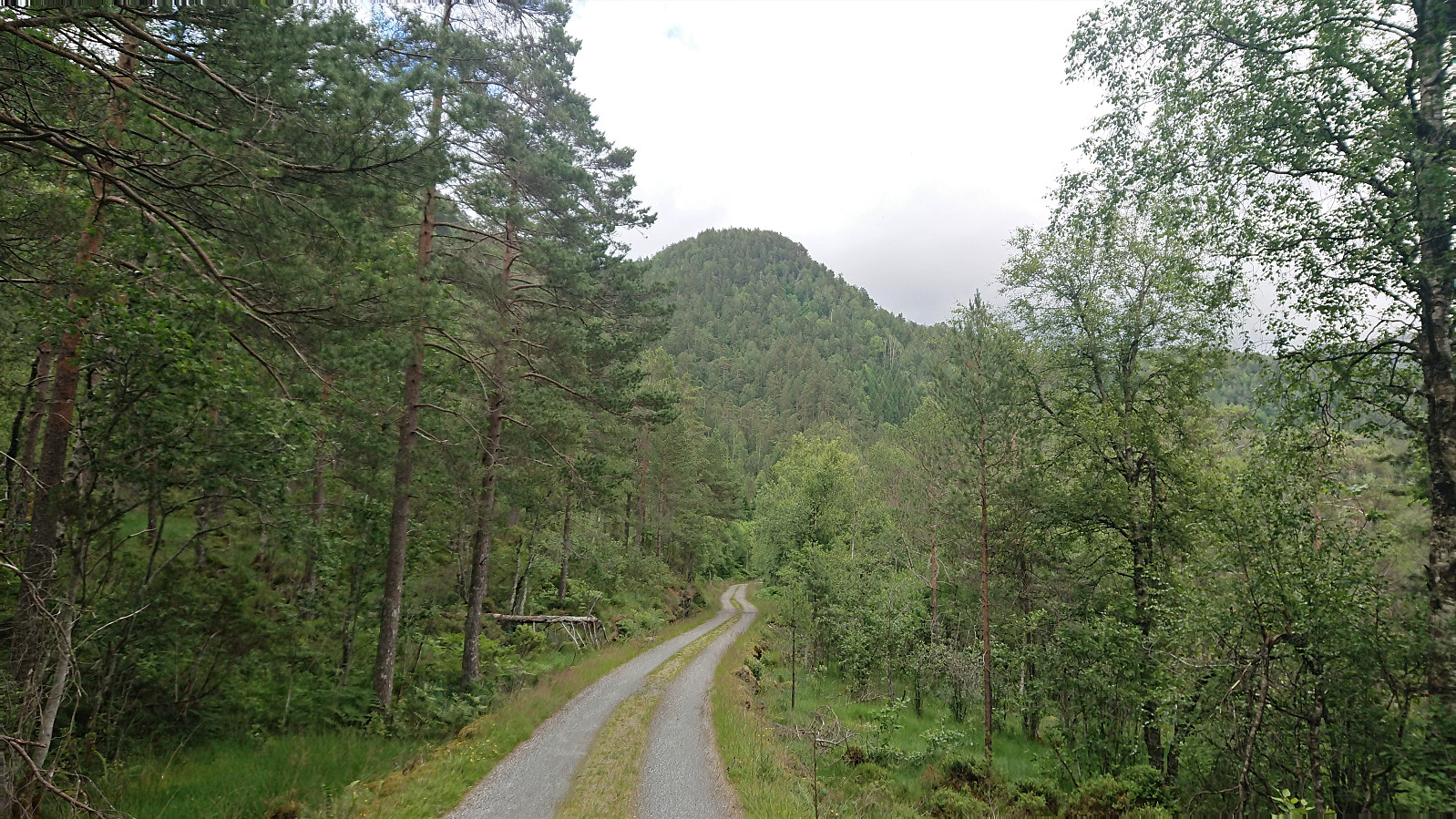
Roundtrip: Frøland to Austre Stemmefjellsnakken (and more)
- Date:
- 04.07.2020
- Characteristic:
- Hillwalk
- Duration:
- 9:11h
- Distance:
- 28.0km
 I started by taking the bus to Frøland and from there walking up the road to Holmane parkering , from where I followed the tractor road (north and then) south. My plan had been to follow the tractor road until it ended, but when coming across a red arrow on the west side of the road just before the road was about to end, I took a chance that perhaps this would provide a trail that could take me to Burlifjellet and left the road behind.
The weakness of the trail should have been a hint though, and the trail soon disappeared completely. And although it seemed to reappear from time to time, I'm guessing these were just animal tracks. I therefore gave up on the trail and instead started to make my own way in the direction of Burlifjellet, deciding to include a visit of Ullandsfjellet on the way. Ullandsfjellet was reached without any real >>>
I started by taking the bus to Frøland and from there walking up the road to Holmane parkering , from where I followed the tractor road (north and then) south. My plan had been to follow the tractor road until it ended, but when coming across a red arrow on the west side of the road just before the road was about to end, I took a chance that perhaps this would provide a trail that could take me to Burlifjellet and left the road behind.
The weakness of the trail should have been a hint though, and the trail soon disappeared completely. And although it seemed to reappear from time to time, I'm guessing these were just animal tracks. I therefore gave up on the trail and instead started to make my own way in the direction of Burlifjellet, deciding to include a visit of Ullandsfjellet on the way. Ullandsfjellet was reached without any real >>>
