Archive - Date
Archive - Activity
-
Bike trip (110)
- Bike trip - mixed (25)
- Bike trip - road (85)
-
Drive (9)
- Car drive (9)
-
Other trip (3)
- Kayaking (3)
-
Ski trip (116)
- Backcountry skiing (69)
- Cross-country skiing (47)
- Trip by foot (1884)
Collected lists
-
Utvalgte topper og turmål i Bergen
(348/349)
 99%
99% -
Alle topper i Bergen
(391/398)
98%
-
Voss ≥ 100m pf.
(96/98)
97%
-
Opptur Hordaland
(144/159)
90%
-
Stasjoner på Bergensbanen
(33/40)
82%
-
Ulvik ≥ 100m pf.
(28/38)
73%
-
Hordaland ≥ 100m pf.
(622/863)
72%
-
Mjølfjell PF > 100m
(21/31)
67%
-
Jondal ≥ 100m pf.
(15/23)
65%
-
Dagsturhyttene i Vestland
(36/61)
59%
-
Sunnhordland PF >= 100m
(105/186)
56%
-
Hordaland: Hardanger PF>=100m
(194/359)
54%
-
DNT-hytter i Hordaland
(23/45)
51%
-
Kvinnherad ≥ 100m pf.
(40/79)
50%
-
Eidfjord ≥ 100m pf.
(13/42)
30%
-
Sogndal ≥ 100m pf.
(23/81)
28%
-
Gulen ≥ 100m pf.
(15/54)
27%
-
Vik i Sogn ≥ 100m pf.
(10/46)
21%
-
Sogn - Sør for Sognefjorden PF>=100m
(31/159)
19%
-
DNT-hytter i Sogn og Fjordane
(8/47)
17%

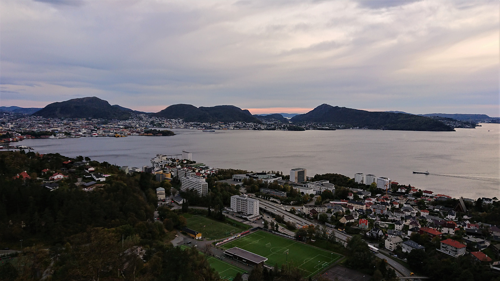
Ulriken
- Date:
- 06.10.2020
- Characteristic:
- Hillwalk
- Duration:
- 1:44h
- Distance:
- 6.7km
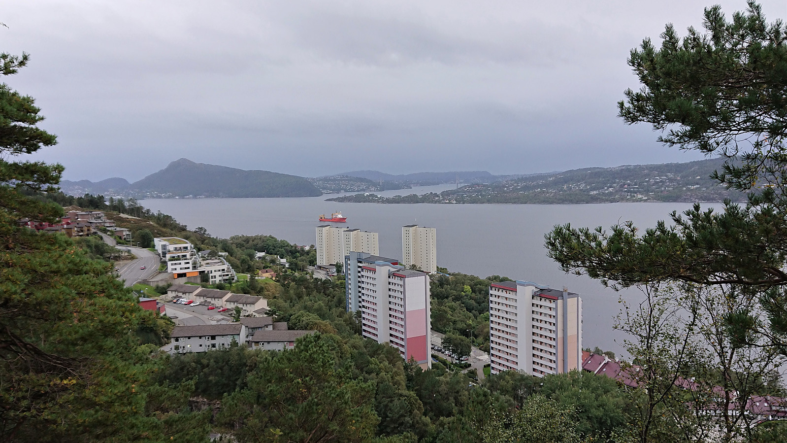
 Short hike to Ulriken after work.
Hoplandsfjellet
- Date:
- 03.10.2020
- Characteristic:
- Hillwalk
- Duration:
- 0:35h
- Distance:
- 1.1km
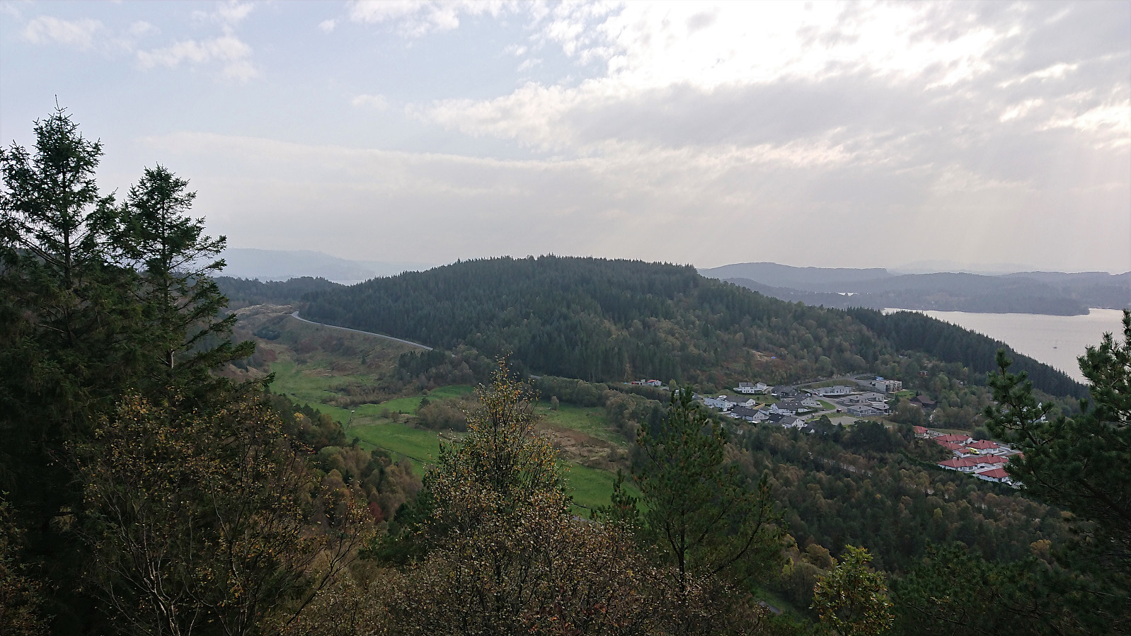 After the trip to Orrsåta , I cycled the short distance from Holsbergstien to the unmarked trailhead for Hoplandsfjellet . Here I again left my bike behind and continued on foot towards the summit.
Note that I had to get pretty close to actually see the trail, even though it starts more or less where the tractor road ended. But the trail soon became much clearer and there were no issues following it all the way to the summit.
The summit provided an almost new bench where I could enjoy both the views and my lunch. By moving slightly away from the bench, I could also get good views towards Hoplandseggena and back towards Orrsåta . I considered continuing east in order to complete the short roundtrip indicated in Kjell 's trip report , but ended up simply returning to my bike to the northwest.
Overall, a nice short hike along a good trail and with excellent views from the summit.
After the trip to Orrsåta , I cycled the short distance from Holsbergstien to the unmarked trailhead for Hoplandsfjellet . Here I again left my bike behind and continued on foot towards the summit.
Note that I had to get pretty close to actually see the trail, even though it starts more or less where the tractor road ended. But the trail soon became much clearer and there were no issues following it all the way to the summit.
The summit provided an almost new bench where I could enjoy both the views and my lunch. By moving slightly away from the bench, I could also get good views towards Hoplandseggena and back towards Orrsåta . I considered continuing east in order to complete the short roundtrip indicated in Kjell 's trip report , but ended up simply returning to my bike to the northwest.
Overall, a nice short hike along a good trail and with excellent views from the summit.
Orrsåta
- Date:
- 03.10.2020
- Characteristic:
- Hillwalk
- Duration:
- 0:48h
- Distance:
- 2.0km
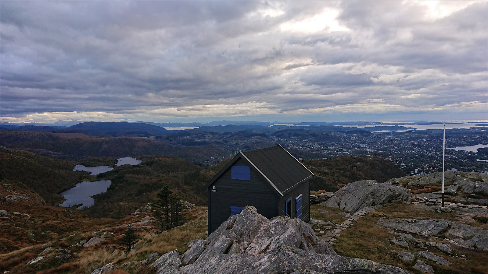
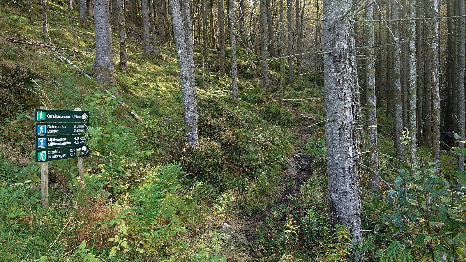 After leaving my bike at the marked northeastern trailhead for Orrsåta , I followed a trail marked with white (and sometimes white and red) plastic ribbons, quickly arriving at the "fake" summit next to the wooden trig marker.
To reach the real summit, a short off-trail hike through the bushes was required. It provided next to no views though and it is highly understandable why most hikes do not feel the need to make this extra detour.
The signs at the "fake" summit however indicated a viewpoint called Holsberget 200 meters to the north. I therefore followed the marked trail in this direction and the views from Holsberget were indeed much better, even if today they were rather limited by a gray haze.
To conclude the hike, I followed the trail to the alternative southwestern trailhead and from there completed >>>
After leaving my bike at the marked northeastern trailhead for Orrsåta , I followed a trail marked with white (and sometimes white and red) plastic ribbons, quickly arriving at the "fake" summit next to the wooden trig marker.
To reach the real summit, a short off-trail hike through the bushes was required. It provided next to no views though and it is highly understandable why most hikes do not feel the need to make this extra detour.
The signs at the "fake" summit however indicated a viewpoint called Holsberget 200 meters to the north. I therefore followed the marked trail in this direction and the views from Holsberget were indeed much better, even if today they were rather limited by a gray haze.
To conclude the hike, I followed the trail to the alternative southwestern trailhead and from there completed >>>
Ørneberget and Rognåsen
- Date:
- 01.10.2020
- Characteristic:
- Hillwalk
- Duration:
- 2:18h
- Distance:
- 5.8km
 Short local evening hike.
Bjørnaknausen and Gråhorga from Kvitingsvatnet
- Date:
- 27.09.2020
- Characteristic:
- Hillwalk
- Duration:
- 5:59h
- Distance:
- 21.1km
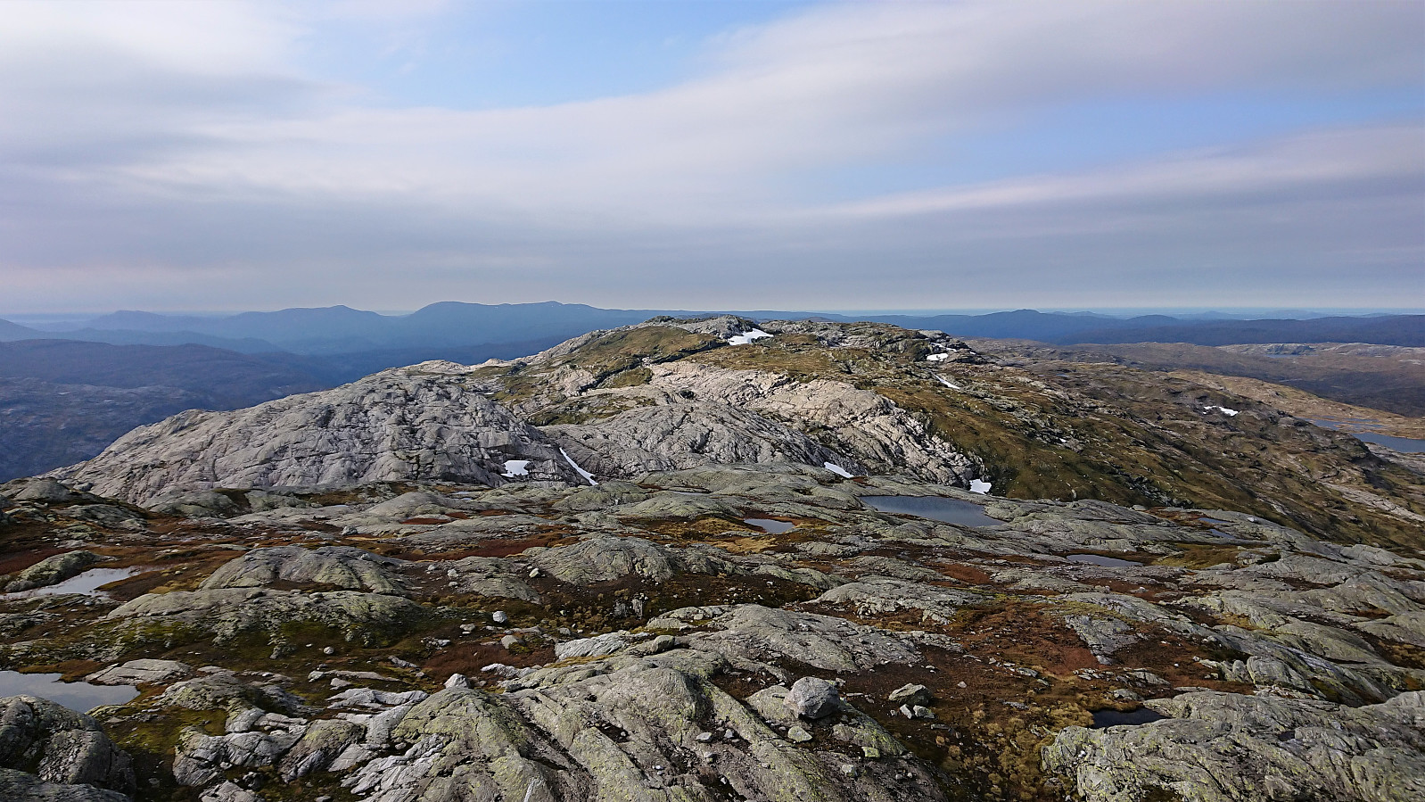 We parked at Kvitingen p-plass and, after paying the 50 kr parking fee, followed the gravel road towards Holmavatnet. When reaching the last bend in the road before the road’s final climb to the large dam at Holmavatnet, we left the road and instead followed the marked trail for Vending , Høgabu and Gullhorgabu . The trail was marked with red T's and overall easy to follow.
Upon reaching Trongasmogtjørna, the trail forked and we continued northeast on the trail to Vending. We did not stay on this trail for very long though, leaving it at the top of Austra Trongasmoget and from there heading off-trail to the summit of Bjørnaknausen . The summit was reached without any difficulties, and after a couple of pictures we returned to the trail along more or less the same route.
After a quick bite, I continued on my own to the summit of the nearby Gråhorga . Given >>>
We parked at Kvitingen p-plass and, after paying the 50 kr parking fee, followed the gravel road towards Holmavatnet. When reaching the last bend in the road before the road’s final climb to the large dam at Holmavatnet, we left the road and instead followed the marked trail for Vending , Høgabu and Gullhorgabu . The trail was marked with red T's and overall easy to follow.
Upon reaching Trongasmogtjørna, the trail forked and we continued northeast on the trail to Vending. We did not stay on this trail for very long though, leaving it at the top of Austra Trongasmoget and from there heading off-trail to the summit of Bjørnaknausen . The summit was reached without any difficulties, and after a couple of pictures we returned to the trail along more or less the same route.
After a quick bite, I continued on my own to the summit of the nearby Gråhorga . Given >>>
Kikenosi, Raudaberget and Gavlen from Frøland
- Date:
- 19.09.2020
- Characteristic:
- Hillwalk
- Duration:
- 9:10h
- Distance:
- 26.4km
 I started by taking the bus to Frøland and from there walking up the gravel road to Holmane parkering II . I then briefly followed a tractor road until locating the unmarked trailhead for Kikenosi . The wet trail was steep but easy to follow and when the trail later got weaker there were small cairns marking the way, which came in very handy in the dense fog.
When reaching the valley east of the summit I somehow lost the cairns and ended up having to both backtrack and head off-trail to relocate them. By now the fog had started to clear, so I cannot blame it on low visibility. With a bit of very light climbing the cairns south of the summit of Kikenosi were located, providing excellent views, even if still limited by the fog. The cairn next to the summit and the summit itself had slightly less impressive views (at least >>>
I started by taking the bus to Frøland and from there walking up the gravel road to Holmane parkering II . I then briefly followed a tractor road until locating the unmarked trailhead for Kikenosi . The wet trail was steep but easy to follow and when the trail later got weaker there were small cairns marking the way, which came in very handy in the dense fog.
When reaching the valley east of the summit I somehow lost the cairns and ended up having to both backtrack and head off-trail to relocate them. By now the fog had started to clear, so I cannot blame it on low visibility. With a bit of very light climbing the cairns south of the summit of Kikenosi were located, providing excellent views, even if still limited by the fog. The cairn next to the summit and the summit itself had slightly less impressive views (at least >>>
Ørneberget
- Date:
- 17.09.2020
- Characteristic:
- Hillwalk
- Duration:
- 1:02h
- Distance:
- 4.1km
 Short local evening hike.
Geitafjellet from Tokagjelet
- Date:
- 16.09.2020
- Characteristic:
- Hillwalk
- Duration:
- 3:12h
- Distance:
- 10.3km
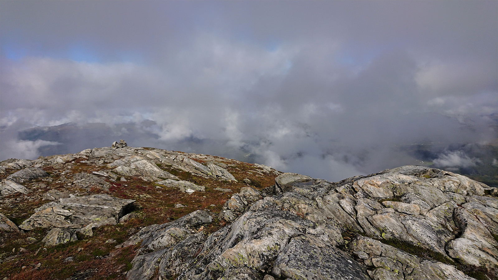
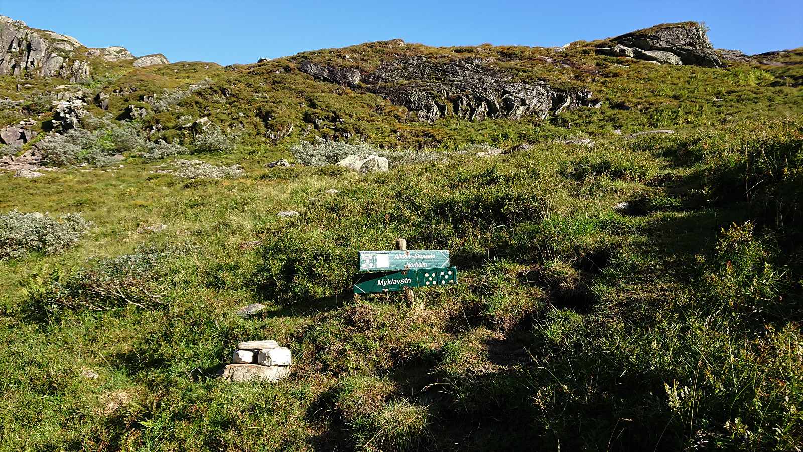 I started by taking the bus to the eastern end of Langvotnevatnet (bus stop called Tokagjelet), and from there followed the gravel road up to Byrkjesete. Here I continued on the trail towards Myklavatnet, but not long after entering Klypet I left the main trail and instead headed east on another trail marked "Alkleiv - Stuasete - Norheim". Did not stay on this weaker trail for long though and soon left it to head off-trail towards the summit of Geitafjellet which was reached without any difficulties.
The views from the summit were even better than expected, with an excellent overview of Norheimsund with Folgefonna in the background. Strong winds made me cut my stay short however and I did not wait long before descending along more or less the same route. The only difference being that I at the beginning >>>
I started by taking the bus to the eastern end of Langvotnevatnet (bus stop called Tokagjelet), and from there followed the gravel road up to Byrkjesete. Here I continued on the trail towards Myklavatnet, but not long after entering Klypet I left the main trail and instead headed east on another trail marked "Alkleiv - Stuasete - Norheim". Did not stay on this weaker trail for long though and soon left it to head off-trail towards the summit of Geitafjellet which was reached without any difficulties.
The views from the summit were even better than expected, with an excellent overview of Norheimsund with Folgefonna in the background. Strong winds made me cut my stay short however and I did not wait long before descending along more or less the same route. The only difference being that I at the beginning >>>
Fagerdalsfjellet
- Date:
- 10.09.2020
- Characteristic:
- Hillwalk
- Duration:
- 1:04h
- Distance:
- 5.5km
 Short local evening hike.
Ulrikseggen
- Date:
- 02.09.2020
- Characteristic:
- Hillwalk
- Duration:
- 2:58h
- Distance:
- 11.1km
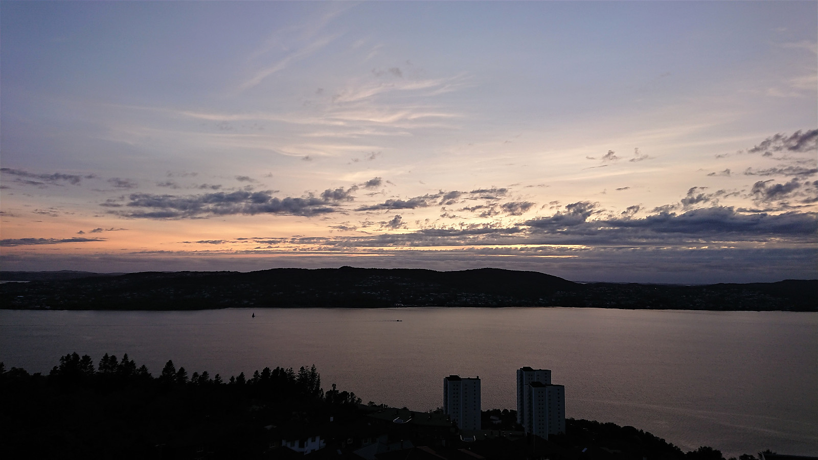
 A hike after work to try the steep trail to Ulriken via Ulrikseggen.
Before starting on Ulrikseggen I made short detours to the ruins of Krutthuset and to Karistølen. I did not find a trail to the former, it was less than 20 meters from the road though, while for the latter, a trail continued where the road ended, but as far as I could tell it did not go far.
The Ulrikseggen trailhead was unmarked but relatively easy to locate. After the first meters being wet and muddy, the trail quality was significantly better than expected. There were a couple of short sections requiring a bit of scrambling, but overall the trail did not present any real challenges, and provided several spots with excellent views. After reaching the summit of Ulriken Vest , I descended via Langrinden.
To conclude, this is in my opinion by far the most >>>
A hike after work to try the steep trail to Ulriken via Ulrikseggen.
Before starting on Ulrikseggen I made short detours to the ruins of Krutthuset and to Karistølen. I did not find a trail to the former, it was less than 20 meters from the road though, while for the latter, a trail continued where the road ended, but as far as I could tell it did not go far.
The Ulrikseggen trailhead was unmarked but relatively easy to locate. After the first meters being wet and muddy, the trail quality was significantly better than expected. There were a couple of short sections requiring a bit of scrambling, but overall the trail did not present any real challenges, and provided several spots with excellent views. After reaching the summit of Ulriken Vest , I descended via Langrinden.
To conclude, this is in my opinion by far the most >>>
