Archive - Date
Archive - Activity
-
Bike trip (110)
- Bike trip - mixed (25)
- Bike trip - road (85)
-
Drive (9)
- Car drive (9)
-
Other trip (3)
- Kayaking (3)
-
Ski trip (116)
- Backcountry skiing (69)
- Cross-country skiing (47)
- Trip by foot (1884)
Collected lists
-
Utvalgte topper og turmål i Bergen
(348/349)
 99%
99% -
Alle topper i Bergen
(391/398)
98%
-
Voss ≥ 100m pf.
(96/98)
97%
-
Opptur Hordaland
(144/159)
90%
-
Stasjoner på Bergensbanen
(33/40)
82%
-
Ulvik ≥ 100m pf.
(28/38)
73%
-
Hordaland ≥ 100m pf.
(622/863)
72%
-
Mjølfjell PF > 100m
(21/31)
67%
-
Jondal ≥ 100m pf.
(15/23)
65%
-
Dagsturhyttene i Vestland
(36/61)
59%
-
Sunnhordland PF >= 100m
(105/186)
56%
-
Hordaland: Hardanger PF>=100m
(194/359)
54%
-
DNT-hytter i Hordaland
(23/45)
51%
-
Kvinnherad ≥ 100m pf.
(40/79)
50%
-
Eidfjord ≥ 100m pf.
(13/42)
30%
-
Sogndal ≥ 100m pf.
(23/81)
28%
-
Gulen ≥ 100m pf.
(15/54)
27%
-
Vik i Sogn ≥ 100m pf.
(10/46)
21%
-
Sogn - Sør for Sognefjorden PF>=100m
(31/159)
19%
-
DNT-hytter i Sogn og Fjordane
(8/47)
17%

Karaldenuten roundtrip from Rong
- Date:
- 30.06.2024
- Characteristic:
- Hillwalk
- Duration:
- 6:07h
- Distance:
- 12.5km
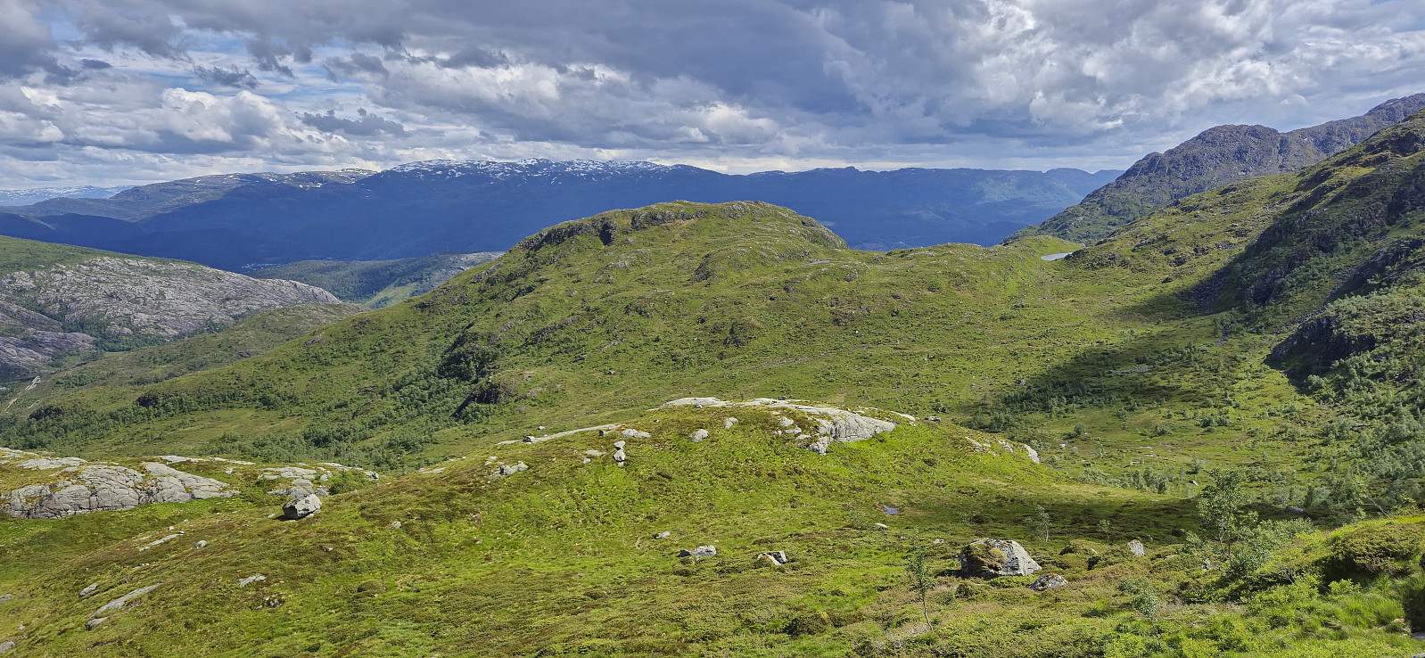
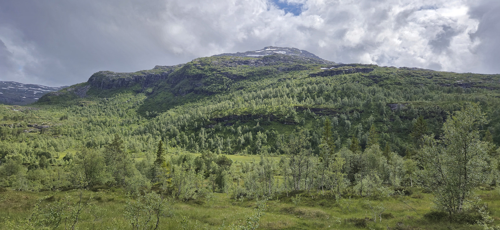 Sunday hike to Karaldenuten organized by Voss Utferdslag . I started by taking the train to Voss where I met up with the others for the short carpool to Rong. Here we parked next to the road south of Rongastovo just after the road forked for Haugamoen. This was also where we met up with the local guide and after a quick overview of the hike we began our ascent along the gravel road towards Grungavatnet.
The gravel road turned into a wet trail before we arrived at the northern end of the lake for the first (and the only real) river crossing of the day. A rope had been put up to simplify the crossing and thus we all made it to the other side almost without getting wet.
A steep but relatively short section followed before the terrain turned less steep. There was a marked trail all the way to the summit, although the markers, a combination >>>
Sunday hike to Karaldenuten organized by Voss Utferdslag . I started by taking the train to Voss where I met up with the others for the short carpool to Rong. Here we parked next to the road south of Rongastovo just after the road forked for Haugamoen. This was also where we met up with the local guide and after a quick overview of the hike we began our ascent along the gravel road towards Grungavatnet.
The gravel road turned into a wet trail before we arrived at the northern end of the lake for the first (and the only real) river crossing of the day. A rope had been put up to simplify the crossing and thus we all made it to the other side almost without getting wet.
A steep but relatively short section followed before the terrain turned less steep. There was a marked trail all the way to the summit, although the markers, a combination >>>
Sveningen from Øvredalen to Midsætret
- Date:
- 26.06.2024
- Characteristic:
- Hillwalk
- Duration:
- 6:43h
- Distance:
- 15.8km
 Ever since a dense fog hid all of the views during our previous visit of Sveningen , I had had plans of repeating the hike under better conditions. Today, seven years later, the day had finally arrived. Once more I managed to convince a couple of colleagues to join but unlike last time we arrived in two cars, allowing us to leave one car at Midsætret p-plass and thus enabling us to skip the rather boring almost 5 km walk back to Øvredalen parkering at the end of the hike.
After parking the second car at Øvredalen parkering, we followed the standard route to the top of Sveningen. Here we had a short lunch break before heading south along the ridge towards Midsætret. Along the way I made short detours on my own to the summits of Drogegjeltoppen and Søtefjellet NV , plus an attempt to locate a trig marker at Sauskolten , of which I only found traces of the supporting metal structure. Upon returning to the car at Midsætret p-plass, we car-pooled >>>
Ever since a dense fog hid all of the views during our previous visit of Sveningen , I had had plans of repeating the hike under better conditions. Today, seven years later, the day had finally arrived. Once more I managed to convince a couple of colleagues to join but unlike last time we arrived in two cars, allowing us to leave one car at Midsætret p-plass and thus enabling us to skip the rather boring almost 5 km walk back to Øvredalen parkering at the end of the hike.
After parking the second car at Øvredalen parkering, we followed the standard route to the top of Sveningen. Here we had a short lunch break before heading south along the ridge towards Midsætret. Along the way I made short detours on my own to the summits of Drogegjeltoppen and Søtefjellet NV , plus an attempt to locate a trig marker at Sauskolten , of which I only found traces of the supporting metal structure. Upon returning to the car at Midsætret p-plass, we car-pooled >>>
Munthemarki Rundt
- Date:
- 23.06.2024
- Characteristic:
- Hillwalk
- Duration:
- 4:10h
- Distance:
- 11.5km
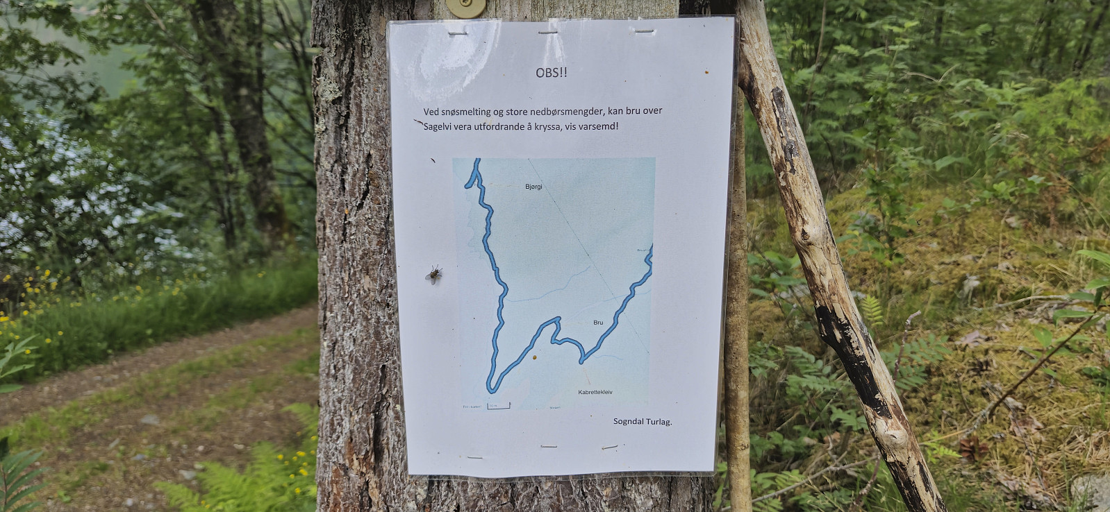 Sunday hike trying out the relatively recently marked route referred to as Munthemarki Rundt . We started from the private parking lot at the end of Barsnesfjorden and at first followed the standard route towards Helgasete . At Kabrettekleiv we however left the main trail and instead followed the signs for "Munthemarki Rundt".
The trail was overall easy to follow. We soon arrived at Årøy where we briefly followed Kongevegen in the direction of Hafslovatnet before heading south on a tractor road that turned into a nice trail taking us to the excellent views at Ormaskori .
After a short break we continued via Galtastegen to more spectacular views at Romnaholten . From there we passed via Dal to connect with the standard trail back to the private parking lot.
To conclude, a great hike with spectacular views that can be highly recommended.
Note that the road >>>
Sunday hike trying out the relatively recently marked route referred to as Munthemarki Rundt . We started from the private parking lot at the end of Barsnesfjorden and at first followed the standard route towards Helgasete . At Kabrettekleiv we however left the main trail and instead followed the signs for "Munthemarki Rundt".
The trail was overall easy to follow. We soon arrived at Årøy where we briefly followed Kongevegen in the direction of Hafslovatnet before heading south on a tractor road that turned into a nice trail taking us to the excellent views at Ormaskori .
After a short break we continued via Galtastegen to more spectacular views at Romnaholten . From there we passed via Dal to connect with the standard trail back to the private parking lot.
To conclude, a great hike with spectacular views that can be highly recommended.
Note that the road >>>
Liabu from Vik Skisenter
- Date:
- 21.06.2024
- Characteristic:
- Hillwalk
- Duration:
- 1:28h
- Distance:
- 5.0km
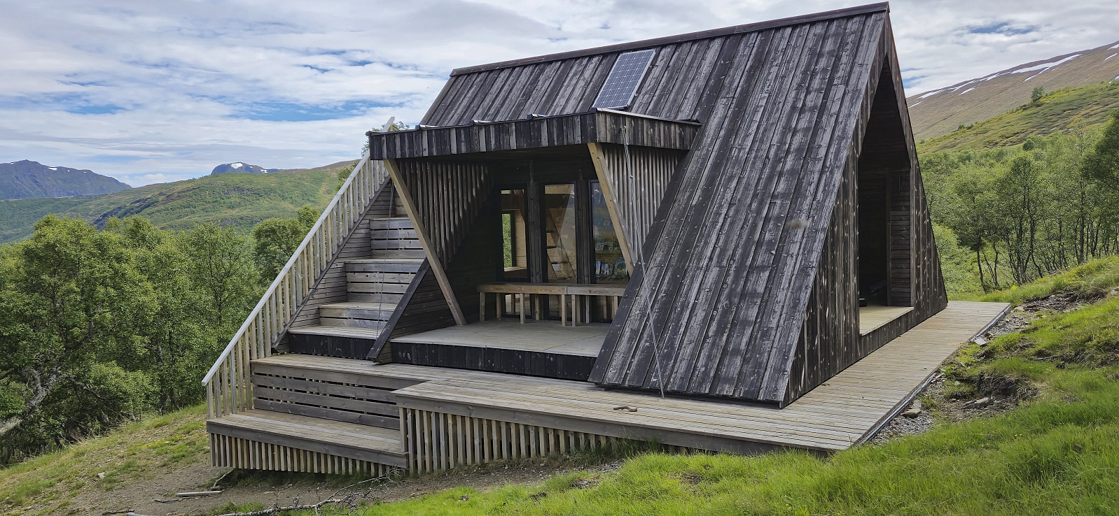 A short stop in Vik to visit Liabu when driving from Bergen to Sogndal to celebrate my parent's 50th wedding anniversary. We parked at the designated parking lot at Vik Skisenter and followed the marked route. First via Vik Fjellandsby and then along a marked trail to the cabin.
Steinfjellet (almost...)
- Date:
- 16.06.2024
- Characteristic:
- Hillwalk
- Duration:
- 2:23h
- Distance:
- 5.5km
 On the way home from a weekend in Myrkdalen we stopped at Gullbotn for a quick ascent of Steinfjellet . This however turned out more complicated than expected and was abandoned less than 250 meters from the summit. The reason being a steep area that we did not want to attempt climbing, especially given the wet conditions. We probably could have found an alternative route, but given that this was only going to be a short hike, we instead returned to the car, leaving the final ascent for another day.
Svolefjellet from Myrkdalen
- Date:
- 15.06.2024
- Characteristic:
- Hillwalk
- Duration:
- 5:05h
- Distance:
- 14.2km
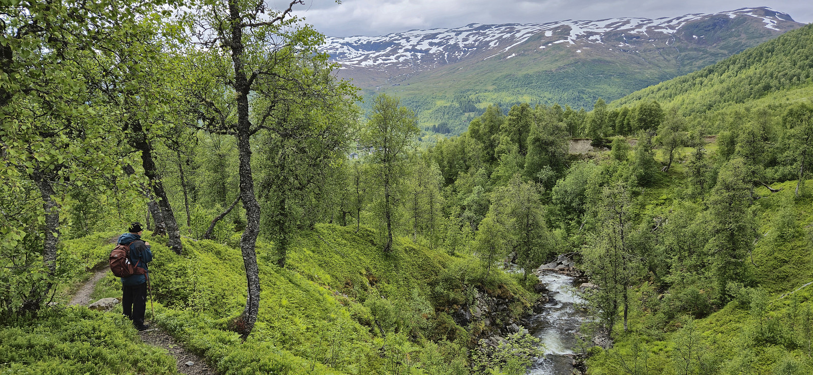 When my sister and her family drove to Voss where my youngest nephew was going to take part in Voss Cup, me and my dad wanted to first go for a hike and decided on Svolefjellet . Based on information from myrkdalen.no I had located a marked trail to Svoleset from the valley north of Svolefjellet and assumed that we would not have any issues reaching the summit from there.
After crossing the main road we followed a gravel road east to Bygdastølen where we crossed the river Kvanndølen via a bridge and continued on a newer and not yet fully set gravel road on the other side of the river. At this point we had come by two trail signs for Svoleset. The first was laying on the ground next to the gate at Bygdastølen, and the second was pointing at a trail stub that quickly came to an end just as the mentioned new gravel road started.
We were therefore >>>
When my sister and her family drove to Voss where my youngest nephew was going to take part in Voss Cup, me and my dad wanted to first go for a hike and decided on Svolefjellet . Based on information from myrkdalen.no I had located a marked trail to Svoleset from the valley north of Svolefjellet and assumed that we would not have any issues reaching the summit from there.
After crossing the main road we followed a gravel road east to Bygdastølen where we crossed the river Kvanndølen via a bridge and continued on a newer and not yet fully set gravel road on the other side of the river. At this point we had come by two trail signs for Svoleset. The first was laying on the ground next to the gate at Bygdastølen, and the second was pointing at a trail stub that quickly came to an end just as the mentioned new gravel road started.
We were therefore >>>
Hatten, Snaufjellet and Dalsfjellet
- Date:
- 08.06.2024
- Characteristic:
- Hillwalk
- Duration:
- 3:31h
- Distance:
- 9.1km
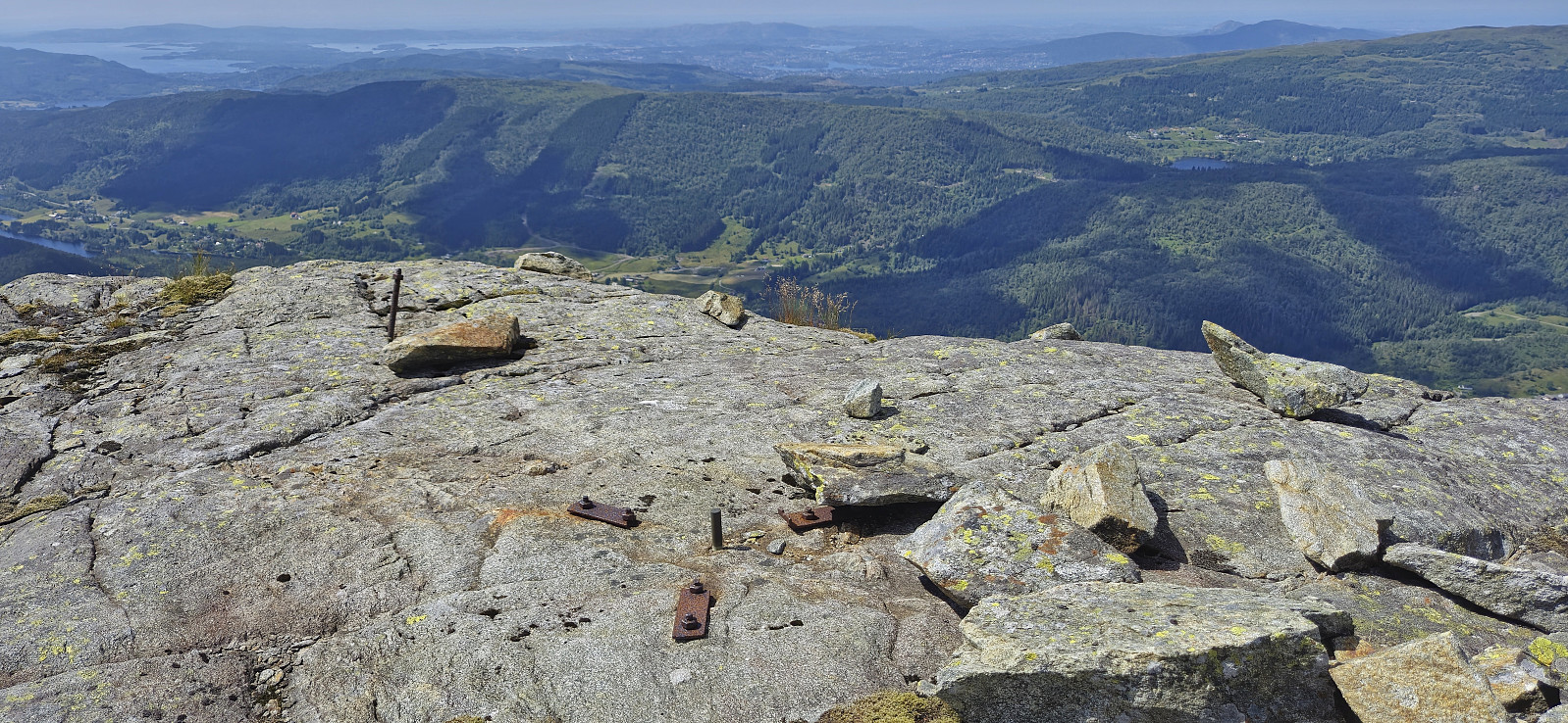
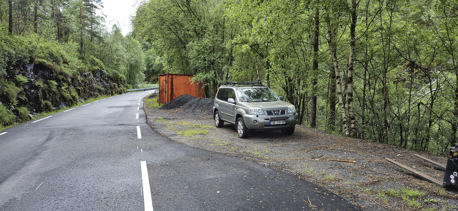
 During the drive south from the ascent of Merkesholten , the rain had picked up in intensity and when we parked next to Nordbygda skule we even waited a couple of minutes in the car with the hope that the conditions would improve. But in the end we could not wait all day and left the car to start the final hike of the day. As it later turned out it would not take long before the rain would stop anyway. After a short walk west along the main road we crossed the road and located the marked trailhead for Hatten . From there it was simply a matter of following the winding marked trail all the way to the summit, or rather to a vantage point just west of the summit. The summit, or maybe more correctly the summit area, as there were at least three potential highest points to choose from, was located around 50 meters to the east.
After >>>
During the drive south from the ascent of Merkesholten , the rain had picked up in intensity and when we parked next to Nordbygda skule we even waited a couple of minutes in the car with the hope that the conditions would improve. But in the end we could not wait all day and left the car to start the final hike of the day. As it later turned out it would not take long before the rain would stop anyway. After a short walk west along the main road we crossed the road and located the marked trailhead for Hatten . From there it was simply a matter of following the winding marked trail all the way to the summit, or rather to a vantage point just west of the summit. The summit, or maybe more correctly the summit area, as there were at least three potential highest points to choose from, was located around 50 meters to the east.
After >>>
Merkesholten
- Date:
- 08.06.2024
- Characteristic:
- Hillwalk
- Duration:
- 0:42h
- Distance:
- 1.4km
 After the overall uninteresting ascent of Beinvedfjellet , we had one more presumably similar summit to ascend, namely Merkesholten . This would however turn out to be a much more enjoyable short hike. We parked next to the road at Byrklelandsvatnet and simply headed off-trail in the direction of the summit.
Thankfully the terrain was much more open and hiking-friendly than at Beinvedfjellet and it did not take long before we arrived at a summit which even provided relatively good views.
With dark clouds in the horizon we still did not stay long before descending along more or less the same route, and shortly after we began the drive south for our final hike of the day to Hatten, Snaufjellet and Dalsfjellet , the rain again started pouring down.
After the overall uninteresting ascent of Beinvedfjellet , we had one more presumably similar summit to ascend, namely Merkesholten . This would however turn out to be a much more enjoyable short hike. We parked next to the road at Byrklelandsvatnet and simply headed off-trail in the direction of the summit.
Thankfully the terrain was much more open and hiking-friendly than at Beinvedfjellet and it did not take long before we arrived at a summit which even provided relatively good views.
With dark clouds in the horizon we still did not stay long before descending along more or less the same route, and shortly after we began the drive south for our final hike of the day to Hatten, Snaufjellet and Dalsfjellet , the rain again started pouring down.
Beinvedfjellet
- Date:
- 08.06.2024
- Characteristic:
- Hillwalk
- Duration:
- 0:40h
- Distance:
- 1.4km
 On the way south from our visit of Melshovden , we did not drive far before finding parking next to the road and starting our ascent of Beinvedfjellet . Thankfully this was a short hike as the terrain was the least inviting of the day with lots of wet areas and an uneven ground with only the occasional deer track.
Next to no views from the summit, the only exception being Mongstad which could be spotted in the distance. After a couple of pictures we therefore quickly returned along more or less the same route.
With three summits in the bag, we drove northeast to Byrkjelandsvatnet for our ascent of Merksholten .
On the way south from our visit of Melshovden , we did not drive far before finding parking next to the road and starting our ascent of Beinvedfjellet . Thankfully this was a short hike as the terrain was the least inviting of the day with lots of wet areas and an uneven ground with only the occasional deer track.
Next to no views from the summit, the only exception being Mongstad which could be spotted in the distance. After a couple of pictures we therefore quickly returned along more or less the same route.
With three summits in the bag, we drove northeast to Byrkjelandsvatnet for our ascent of Merksholten .
Melshovden
- Date:
- 08.06.2024
- Characteristic:
- Hillwalk
- Duration:
- 0:52h
- Distance:
- 2.2km
 After the short drive from Ytre Haugsdal and our ascent of Svelikulten , we found parking next to the road at Rambjørg and from there followed a tractor road north. To our surprise the rain, which according to the forecast was supposed to last all day, had now been replaced by sunshine and we definitely did not complain.
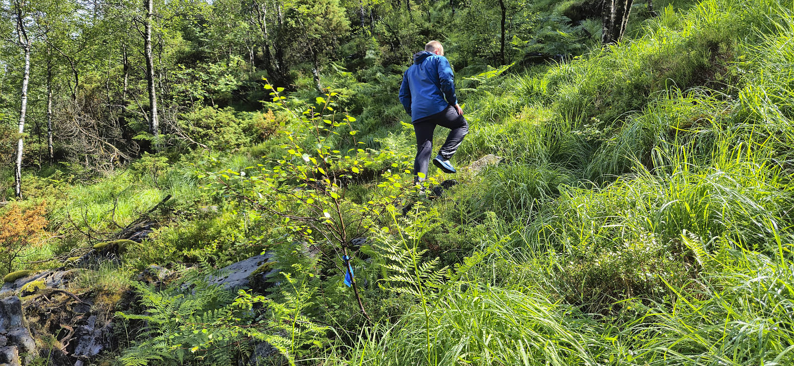
The steep trail up to the summit of Melshovden was marked with blue ribbons but the trailhead could still easily have been missed if it weren't for the GPS tracks from previous trip reports. The trail itself was also partly hidden underneath the tall grasses and ferns but was still relatively easy to follow. Excellent views from the summit and overall a nice short hike that can be recommended.
We returned the same way and then drove a short distance south to ascend Beinvedfjellet .
After the short drive from Ytre Haugsdal and our ascent of Svelikulten , we found parking next to the road at Rambjørg and from there followed a tractor road north. To our surprise the rain, which according to the forecast was supposed to last all day, had now been replaced by sunshine and we definitely did not complain.
The steep trail up to the summit of Melshovden was marked with blue ribbons but the trailhead could still easily have been missed if it weren't for the GPS tracks from previous trip reports. The trail itself was also partly hidden underneath the tall grasses and ferns but was still relatively easy to follow. Excellent views from the summit and overall a nice short hike that can be recommended.
We returned the same way and then drove a short distance south to ascend Beinvedfjellet .
