Archive - Date
Archive - Activity
-
Bike trip (110)
- Bike trip - mixed (25)
- Bike trip - road (85)
-
Drive (9)
- Car drive (9)
-
Other trip (3)
- Kayaking (3)
-
Ski trip (116)
- Backcountry skiing (69)
- Cross-country skiing (47)
- Trip by foot (1884)
Collected lists
-
Utvalgte topper og turmål i Bergen
(348/349)
 99%
99% -
Alle topper i Bergen
(391/398)
98%
-
Voss ≥ 100m pf.
(96/98)
97%
-
Opptur Hordaland
(144/159)
90%
-
Stasjoner på Bergensbanen
(33/40)
82%
-
Ulvik ≥ 100m pf.
(28/38)
73%
-
Hordaland ≥ 100m pf.
(622/863)
72%
-
Mjølfjell PF > 100m
(21/31)
67%
-
Jondal ≥ 100m pf.
(15/23)
65%
-
Dagsturhyttene i Vestland
(36/61)
59%
-
Sunnhordland PF >= 100m
(105/186)
56%
-
Hordaland: Hardanger PF>=100m
(194/359)
54%
-
DNT-hytter i Hordaland
(23/45)
51%
-
Kvinnherad ≥ 100m pf.
(40/79)
50%
-
Eidfjord ≥ 100m pf.
(13/42)
30%
-
Sogndal ≥ 100m pf.
(23/81)
28%
-
Gulen ≥ 100m pf.
(15/54)
27%
-
Vik i Sogn ≥ 100m pf.
(10/46)
21%
-
Sogn - Sør for Sognefjorden PF>=100m
(31/159)
19%
-
DNT-hytter i Sogn og Fjordane
(8/47)
17%

Horn, Volafjellet and Tvarafjellet from Bulken
- Date:
- 27.06.2021
- Characteristic:
- Hillwalk
- Duration:
- 10:32h
- Distance:
- 37.2km
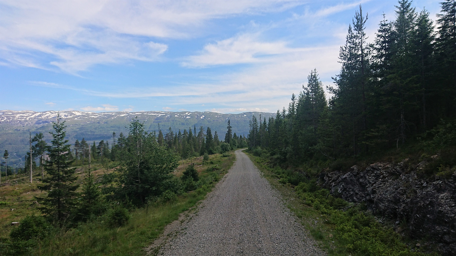 I started by taking the train to Bulken and from there following the paved and later gravel road up to Tverrlii p-plass . Here the road turned into a nice unmarked trail that brought me up to Listred . The map indicated a trail continuing north, but I did not see any traces of it. In any case, I crossed the river and instead headed off-trail towards Horn . Note that while I crossed south of the bridge, as there was very little water in the river, the bridge had been upgraded since Knut Sverre 's visit more than five years ago when it was more of a "build you own bridge" concept. ;)
When getting closer to the summit I came across a weak trail marked with small cairns (maybe coming up from Vestbygdi/Nyestølen?), but it seemed to disappear when approaching the summit. Before heading to the summit, I made a quick visit of the large cairn to the west . Excellent views from both the >>>
I started by taking the train to Bulken and from there following the paved and later gravel road up to Tverrlii p-plass . Here the road turned into a nice unmarked trail that brought me up to Listred . The map indicated a trail continuing north, but I did not see any traces of it. In any case, I crossed the river and instead headed off-trail towards Horn . Note that while I crossed south of the bridge, as there was very little water in the river, the bridge had been upgraded since Knut Sverre 's visit more than five years ago when it was more of a "build you own bridge" concept. ;)
When getting closer to the summit I came across a weak trail marked with small cairns (maybe coming up from Vestbygdi/Nyestølen?), but it seemed to disappear when approaching the summit. Before heading to the summit, I made a quick visit of the large cairn to the west . Excellent views from both the >>>
Ørneberget, Rognåsen and Håmanen
- Date:
- 22.06.2021
- Characteristic:
- Hillwalk
- Duration:
- 1:36h
- Distance:
- 7.4km
 Local hike after work.
Ørneberget and Rognåsen
- Date:
- 18.06.2021
- Characteristic:
- Hillwalk
- Duration:
- 2:31h
- Distance:
- 6.1km
 Local evening hike after work.
Varden, Allestadhaugen and Hesjaholten
- Date:
- 15.06.2021
- Characteristic:
- Hillwalk
- Duration:
- 1:39h
- Distance:
- 5.0km
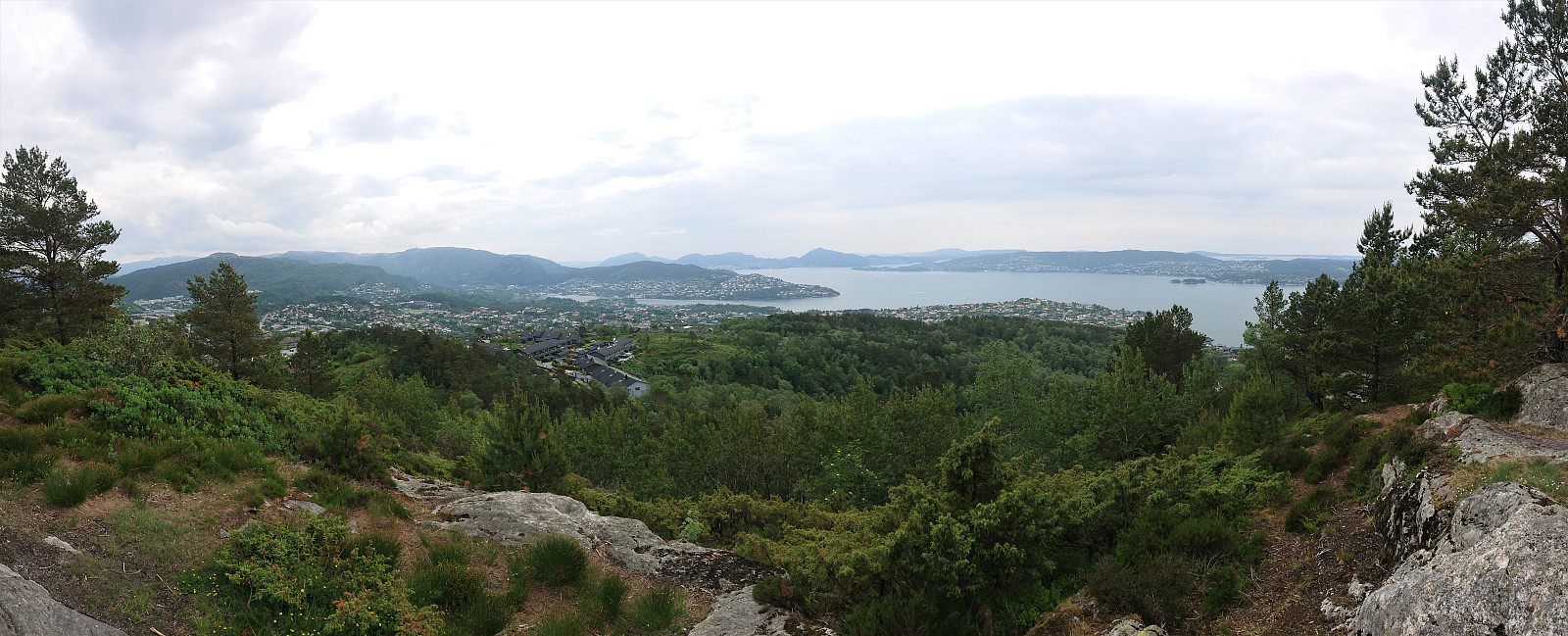
 Short evening hike to visit three minor peaks on the Alle topper i Bergen list. I started by taking the bus to Sandeide terminal, from where I first walked along the roads towards the summit of Varden . Reaching the summit itself only required a minor detour from the road, partly along a weak trail, but as the summit is almost in someone’s backyard, and provides no views at all, a visit cannot really be recommended.
With what I hoped would be the worst part of the hike out of the way, I returned to the road and easily located the unmarked trail taking me down and alongside Gjeddevatnet, the clear highlight of the hike. The trail continued towards Allestadhaugen , but gradually got weaker and pretty much disappeared when I got close to the summit (I even lost the trail when crossing a wet area earlier on as well). Limited views from >>>
Short evening hike to visit three minor peaks on the Alle topper i Bergen list. I started by taking the bus to Sandeide terminal, from where I first walked along the roads towards the summit of Varden . Reaching the summit itself only required a minor detour from the road, partly along a weak trail, but as the summit is almost in someone’s backyard, and provides no views at all, a visit cannot really be recommended.
With what I hoped would be the worst part of the hike out of the way, I returned to the road and easily located the unmarked trail taking me down and alongside Gjeddevatnet, the clear highlight of the hike. The trail continued towards Allestadhaugen , but gradually got weaker and pretty much disappeared when I got close to the summit (I even lost the trail when crossing a wet area earlier on as well). Limited views from >>>
Kråkåsen and Birkelandsvatnet
- Date:
- 13.06.2021
- Characteristic:
- Hillwalk
- Duration:
- 1:25h
- Distance:
- 5.4km
 Short hike on a gray and wet Sunday for a visit of Kråkåsen . The indicated trails to Kråkåsen from the east were blocked by a construction site. I therefore first followed the marked trail for Smøråsfjellet before heading north towards the summit. There are some trails indicated here as well, but either I missed them or they are rather weak and wet.
Kråkåsen is dominated by overhead power lines and is probably not a summit that most hikers will feel the need to visit. From the summit I continued north along a much better trail that took me all the way to the houses north of the small hill. Clearly the recommended route to and from Kråkåsen.
When getting to the main road, I still had plenty of time for the bus, and therefore decided on a detour via Birkelandsvatnet, as the map indicated a trail >>>
Short hike on a gray and wet Sunday for a visit of Kråkåsen . The indicated trails to Kråkåsen from the east were blocked by a construction site. I therefore first followed the marked trail for Smøråsfjellet before heading north towards the summit. There are some trails indicated here as well, but either I missed them or they are rather weak and wet.
Kråkåsen is dominated by overhead power lines and is probably not a summit that most hikers will feel the need to visit. From the summit I continued north along a much better trail that took me all the way to the houses north of the small hill. Clearly the recommended route to and from Kråkåsen.
When getting to the main road, I still had plenty of time for the bus, and therefore decided on a detour via Birkelandsvatnet, as the map indicated a trail >>>
Skjenhaugane, Lauvåsen and Eikhaugen
- Date:
- 12.06.2021
- Characteristic:
- Hillwalk
- Duration:
- 2:09h
- Distance:
- 8.1km
 When the rain showers finally stopped (or so I thought), I went for a hike in Fyllingsdalen to visit three small hills on the Alle topper i Bergen list. I started by walking south from the bus stop outside Løvstakktunnelen to Barliveien, where I located a trail/deer track taking me to the summit of Skjenhaugane . After returning along the same route, I continued to Lauvåsen , which only required a very short detour from the paved shortcut south of the summit, and there was even a path for this final part as well. Much better views than from Skjenhaugane and there was no feeling of trespassing (which can often be the case for these hills in between houses).
I continued north where I located an unmarked trail that seemed to be heading in the direction of Eikhaugen . The trail however soon turned north instead, but I stayed on the trail for a while >>>
When the rain showers finally stopped (or so I thought), I went for a hike in Fyllingsdalen to visit three small hills on the Alle topper i Bergen list. I started by walking south from the bus stop outside Løvstakktunnelen to Barliveien, where I located a trail/deer track taking me to the summit of Skjenhaugane . After returning along the same route, I continued to Lauvåsen , which only required a very short detour from the paved shortcut south of the summit, and there was even a path for this final part as well. Much better views than from Skjenhaugane and there was no feeling of trespassing (which can often be the case for these hills in between houses).
I continued north where I located an unmarked trail that seemed to be heading in the direction of Eikhaugen . The trail however soon turned north instead, but I stayed on the trail for a while >>>
Salsborg from Skjelevika
- Date:
- 06.06.2021
- Characteristic:
- Hillwalk
- Duration:
- 1:36h
- Distance:
- 4.1km
 After having abandoned the more direct trail from Øykjafjellet to Salsborg , and instead descended back to the main road for the short cycling trip to the marked trailhead for Salsborg, I again left the bike behind and started my ascent to Salsborg on foot. Unlike the trail to Øykjafjellet, the trail to Salsborg was marked all the way from the trailhead. It started out relatively steep, but levelled off before reaching the overhead power lines and shortly after turned west towards the summit. Later there was also a sign for the trail to Øykjafjellet, but again the trail seemed rather weak, and I did not regret my choice from earlier.
Note that the large cairn is not at the summit itself, but rather 75 meters southwest of the summit. However, the trail more or less passes by the summit on the way to the cairn. Both locations provided excellent panoramic views and Salsborg is clearly worth >>>
After having abandoned the more direct trail from Øykjafjellet to Salsborg , and instead descended back to the main road for the short cycling trip to the marked trailhead for Salsborg, I again left the bike behind and started my ascent to Salsborg on foot. Unlike the trail to Øykjafjellet, the trail to Salsborg was marked all the way from the trailhead. It started out relatively steep, but levelled off before reaching the overhead power lines and shortly after turned west towards the summit. Later there was also a sign for the trail to Øykjafjellet, but again the trail seemed rather weak, and I did not regret my choice from earlier.
Note that the large cairn is not at the summit itself, but rather 75 meters southwest of the summit. However, the trail more or less passes by the summit on the way to the cairn. Both locations provided excellent panoramic views and Salsborg is clearly worth >>>
Øykjafjellet from Flakkavågen
- Date:
- 06.06.2021
- Characteristic:
- Hillwalk
- Duration:
- 1:14h
- Distance:
- 2.8km
 After arriving at the marked trailhead for Øykjafjellet at Flakkavågen, I left my bike at the start of the trail and continued on foot towards the summit. Note that while the sign at the trailhead was easy to locate, the start of the trail was a bit more hidden due to the uncut grass. It started out as a short tractor road, but quickly turned into an initially unmarked trail that, with the exception of it splitting once or twice early on, could be followed all the way to the summit without any difficulties. When getting to the valley northeast of the summit, a came across the first sign for Øykjafjellet, and from there on there were even some trail markers. The summit itself provided excellent views, however they were a bit limited by the low-hanging clouds not yet having lifted completely.
At the summit there were hiking signs for >>>
After arriving at the marked trailhead for Øykjafjellet at Flakkavågen, I left my bike at the start of the trail and continued on foot towards the summit. Note that while the sign at the trailhead was easy to locate, the start of the trail was a bit more hidden due to the uncut grass. It started out as a short tractor road, but quickly turned into an initially unmarked trail that, with the exception of it splitting once or twice early on, could be followed all the way to the summit without any difficulties. When getting to the valley northeast of the summit, a came across the first sign for Øykjafjellet, and from there on there were even some trail markers. The summit itself provided excellent views, however they were a bit limited by the low-hanging clouds not yet having lifted completely.
At the summit there were hiking signs for >>>
Geitanuken from Saudalen
- Date:
- 05.06.2021
- Characteristic:
- Hillwalk
- Duration:
- 2:09h
- Distance:
- 8.3km
 A revisit of Geitanuken from Saudalen in order to explore three new candidates for the Alle topper i Bergen list. The result was two new peaks: Olderhaug and Novvarden . Morvikavarden was also considered (32V 296251 6709540, vertical separation of about 13 meters), but I was not allowed to add it given its close proximity to Geitanuken, and instead added a new element called Morvikavarden utsiktspunkt .
Olderhaug could be reached via a short detour from the main trail and provided excellent views and even had its own trig marker. Novvarden and Morvikavarden however did not present the cairns indicated by their names. Novvarden provided very nice views into the valley south of Toppenipa and Toppefjellet and the summit could be reached by a minor detour along a weak trail. Finally, the views from Morvikavarden were rather limited and there was no clear highest point, however excellent views >>>
A revisit of Geitanuken from Saudalen in order to explore three new candidates for the Alle topper i Bergen list. The result was two new peaks: Olderhaug and Novvarden . Morvikavarden was also considered (32V 296251 6709540, vertical separation of about 13 meters), but I was not allowed to add it given its close proximity to Geitanuken, and instead added a new element called Morvikavarden utsiktspunkt .
Olderhaug could be reached via a short detour from the main trail and provided excellent views and even had its own trig marker. Novvarden and Morvikavarden however did not present the cairns indicated by their names. Novvarden provided very nice views into the valley south of Toppenipa and Toppefjellet and the summit could be reached by a minor detour along a weak trail. Finally, the views from Morvikavarden were rather limited and there was no clear highest point, however excellent views >>>
Fagerdalsskaret and Ørneberget NV
- Date:
- 04.06.2021
- Characteristic:
- Hillwalk
- Duration:
- 2:08h
- Distance:
- 3.9km
 Short local evening hike
