Archive - Date
Archive - Activity
-
Bike trip (110)
- Bike trip - mixed (25)
- Bike trip - road (85)
-
Drive (9)
- Car drive (9)
-
Other trip (3)
- Kayaking (3)
-
Ski trip (116)
- Backcountry skiing (69)
- Cross-country skiing (47)
- Trip by foot (1884)
Collected lists
-
Utvalgte topper og turmål i Bergen
(348/349)
 99%
99% -
Alle topper i Bergen
(391/398)
98%
-
Voss ≥ 100m pf.
(96/98)
97%
-
Opptur Hordaland
(144/159)
90%
-
Stasjoner på Bergensbanen
(33/40)
82%
-
Ulvik ≥ 100m pf.
(28/38)
73%
-
Hordaland ≥ 100m pf.
(622/863)
72%
-
Mjølfjell PF > 100m
(21/31)
67%
-
Jondal ≥ 100m pf.
(15/23)
65%
-
Dagsturhyttene i Vestland
(36/61)
59%
-
Sunnhordland PF >= 100m
(105/186)
56%
-
Hordaland: Hardanger PF>=100m
(194/359)
54%
-
DNT-hytter i Hordaland
(23/45)
51%
-
Kvinnherad ≥ 100m pf.
(40/79)
50%
-
Eidfjord ≥ 100m pf.
(13/42)
30%
-
Sogndal ≥ 100m pf.
(23/81)
28%
-
Gulen ≥ 100m pf.
(15/54)
27%
-
Vik i Sogn ≥ 100m pf.
(10/46)
21%
-
Sogn - Sør for Sognefjorden PF>=100m
(31/159)
19%
-
DNT-hytter i Sogn og Fjordane
(8/47)
17%

Recovery, day 3: Ørneberget and Hellen festning
- Date:
- 08.04.2023
- Characteristic:
- Hillwalk
- Duration:
- 1:02h
- Distance:
- 4.2km
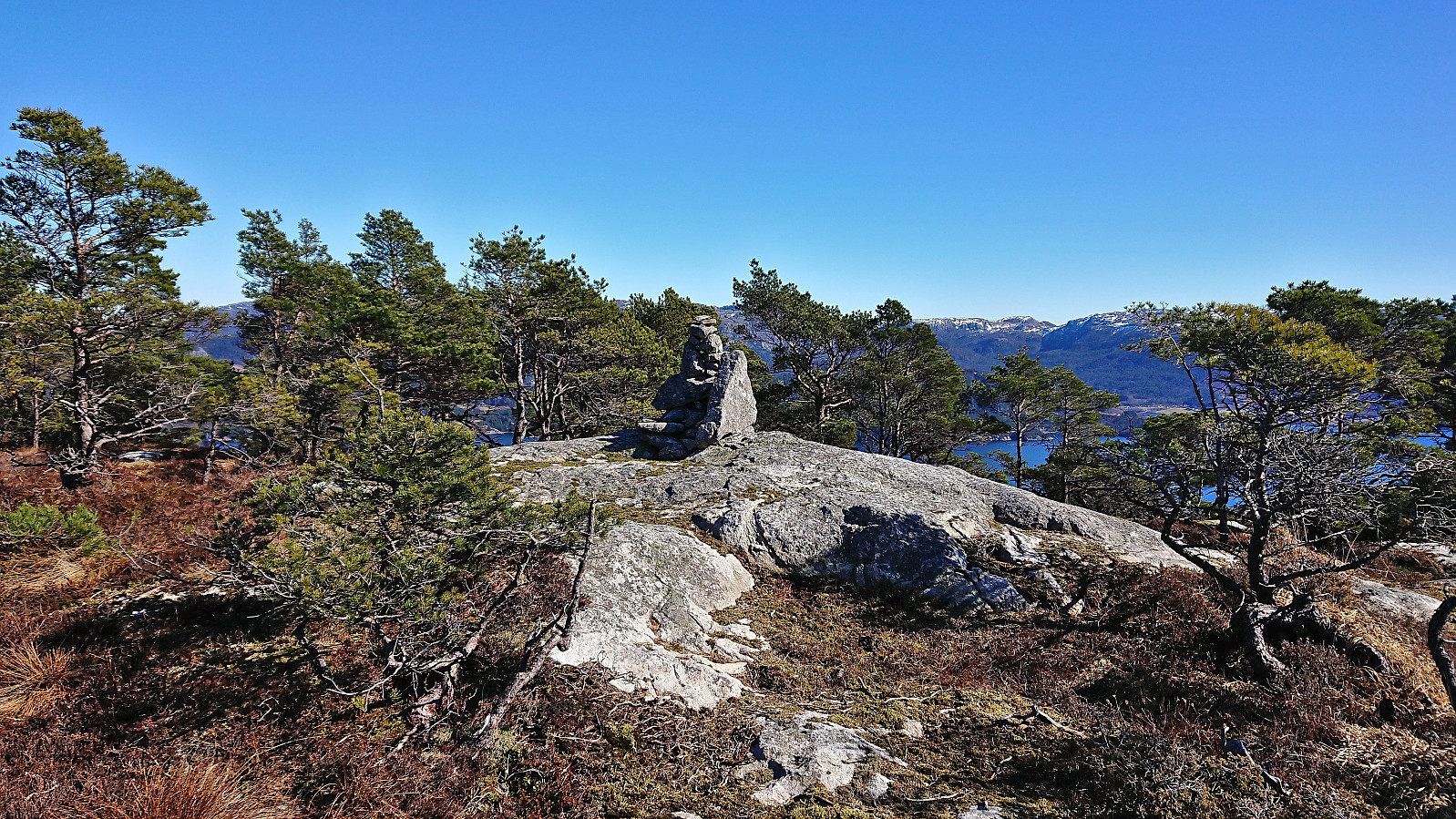
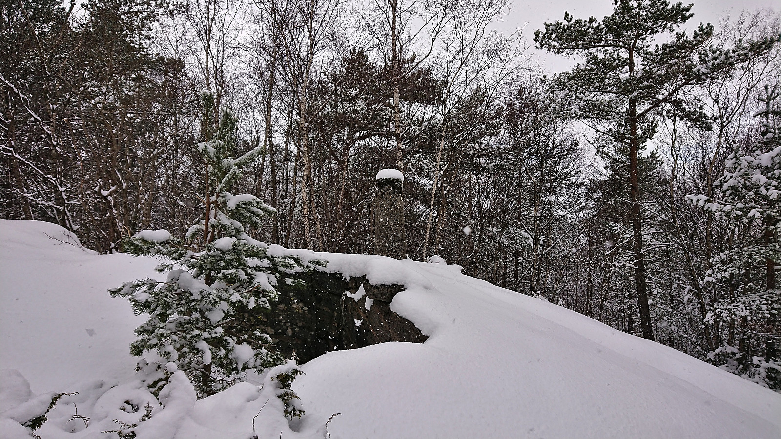
 With the excellent weather, I ventured slightly further today, including a visit of Ørneberget . Still low on energy, but at least I was not getting worse.
Lierfjellet, Vardafjellet, Dreng and Austvikfjellet
- Date:
- 01.04.2023
- Characteristic:
- Hillwalk
- Duration:
- 5:42h
- Distance:
- 13.8km
 I started by taking the express bus from Bergen to Sveio and got off at Hanaleitet. This put me directly north of my first goal, namely Lierfjellet . After a short walk up the gravel road of Hanalio, I arrived at the trailhead for Lierfjellet. The trailhead itself was unmarked, i.e. no sign, but there were plenty of red painted markers to follow. Lots of wet and muddy sections early on, however this soon improved. (By following this marked trail, one also avoids the borderline trespassing via the two houses at the end of Hanalio that some other hikers seem to have used.)
The red markers were not always the easiest to spot, although this was at least partly due to walking towards the low sun. There were also the occasional patches of ice that had to be navigated, but overall the summit was reached without >>>
I started by taking the express bus from Bergen to Sveio and got off at Hanaleitet. This put me directly north of my first goal, namely Lierfjellet . After a short walk up the gravel road of Hanalio, I arrived at the trailhead for Lierfjellet. The trailhead itself was unmarked, i.e. no sign, but there were plenty of red painted markers to follow. Lots of wet and muddy sections early on, however this soon improved. (By following this marked trail, one also avoids the borderline trespassing via the two houses at the end of Hanalio that some other hikers seem to have used.)
The red markers were not always the easiest to spot, although this was at least partly due to walking towards the low sun. There were also the occasional patches of ice that had to be navigated, but overall the summit was reached without >>>
Nesbjørghovda from Stussvikhovdatunnelen
- Date:
- 18.03.2023
- Characteristic:
- Hillwalk
- Duration:
- 3:10h
- Distance:
- 8.3km
 After the hike to Stussvikhovda and Aldalsnuten , we drove the short distance to the crossroads just east of the start of Stussvikhovdatunnelen. Here we found parking at what Skyss refers to as Stussvikhovda snuplass and after a short walk north along the main road we were ready to start the ascent to Nesbjørghovda (which is incorrectly named Nesbjørhovda on PB).
While most hikers seem to start their trip to Nesbjørghovda from Teiga southwest of the summit, and do not speak to highly of the route, I had come across a promising external trip report (scroll down until you find Nesbjørghovda) talking about a marked trail from the main road to the south. This would allow us to follow tractor roads for the first 2.5 km (blocked with a chain across the road early on), leaving only around 1 km on a marked trail to the summit.
The first part was straightforward and we soon arrived >>>
After the hike to Stussvikhovda and Aldalsnuten , we drove the short distance to the crossroads just east of the start of Stussvikhovdatunnelen. Here we found parking at what Skyss refers to as Stussvikhovda snuplass and after a short walk north along the main road we were ready to start the ascent to Nesbjørghovda (which is incorrectly named Nesbjørhovda on PB).
While most hikers seem to start their trip to Nesbjørghovda from Teiga southwest of the summit, and do not speak to highly of the route, I had come across a promising external trip report (scroll down until you find Nesbjørghovda) talking about a marked trail from the main road to the south. This would allow us to follow tractor roads for the first 2.5 km (blocked with a chain across the road early on), leaving only around 1 km on a marked trail to the summit.
The first part was straightforward and we soon arrived >>>
Stussvikhovda and Aldalsnuten
- Date:
- 18.03.2023
- Characteristic:
- Hillwalk
- Duration:
- 2:40h
- Distance:
- 5.5km
 When initial plans to go skiing in Bergsdalen were cancelled due to increased avalanche risk and overall uncertainty about the snow conditions, we decided to instead take the ferry to Tysnes to hike at the Kvinnherad/Bjørnafjorden side of Lukksundet. First up was Stussvikhovda and Aldalsnuten . We left the car at the small parking lot at the marked trailhead at Stussvik and from there followed the marked trail all the way to the excellent viewpoint at Stussvikhovda .
After a short break we continued north along a weaker, but at least partially marked, trail to the slightly higher Aldalsnuten. We first ascended the northern of the two hills with almost the same height, while I took a short detour on my own to the southern hill on the return. The southern hill had several contenders for the highest point, so to be safe I simply visited all of them. Excellent >>>
When initial plans to go skiing in Bergsdalen were cancelled due to increased avalanche risk and overall uncertainty about the snow conditions, we decided to instead take the ferry to Tysnes to hike at the Kvinnherad/Bjørnafjorden side of Lukksundet. First up was Stussvikhovda and Aldalsnuten . We left the car at the small parking lot at the marked trailhead at Stussvik and from there followed the marked trail all the way to the excellent viewpoint at Stussvikhovda .
After a short break we continued north along a weaker, but at least partially marked, trail to the slightly higher Aldalsnuten. We first ascended the northern of the two hills with almost the same height, while I took a short detour on my own to the southern hill on the return. The southern hill had several contenders for the highest point, so to be safe I simply visited all of them. Excellent >>>
Dolvikhaugene and Knappen
- Date:
- 11.03.2023
- Characteristic:
- Hillwalk
- Duration:
- 1:43h
- Distance:
- 5.8km
 A short hike with the main goal of visiting Storåsen på Søreide at Dolvikhaugene, easily reached by passing through a small playground just south of the summit. Given that I was in the area I decided to also revisit Knappen including my first visits of both St. Hanshaugen and Knappen søyle . The hike was then concluded by a quick run to Sandeide terminal in order catch the bus back to the city center.
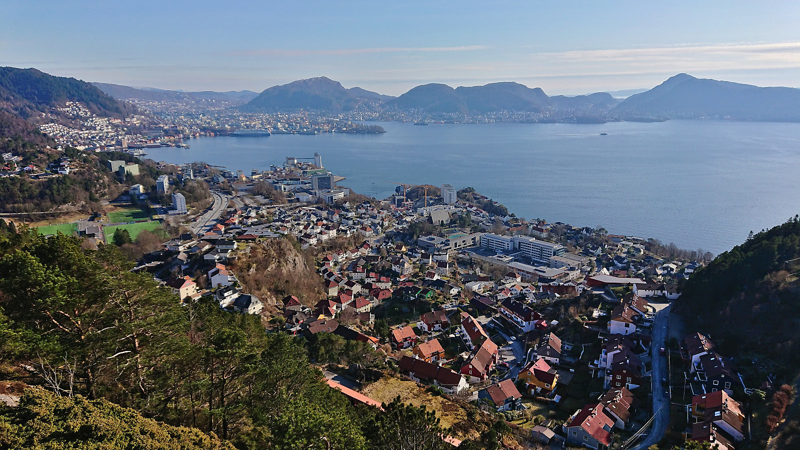
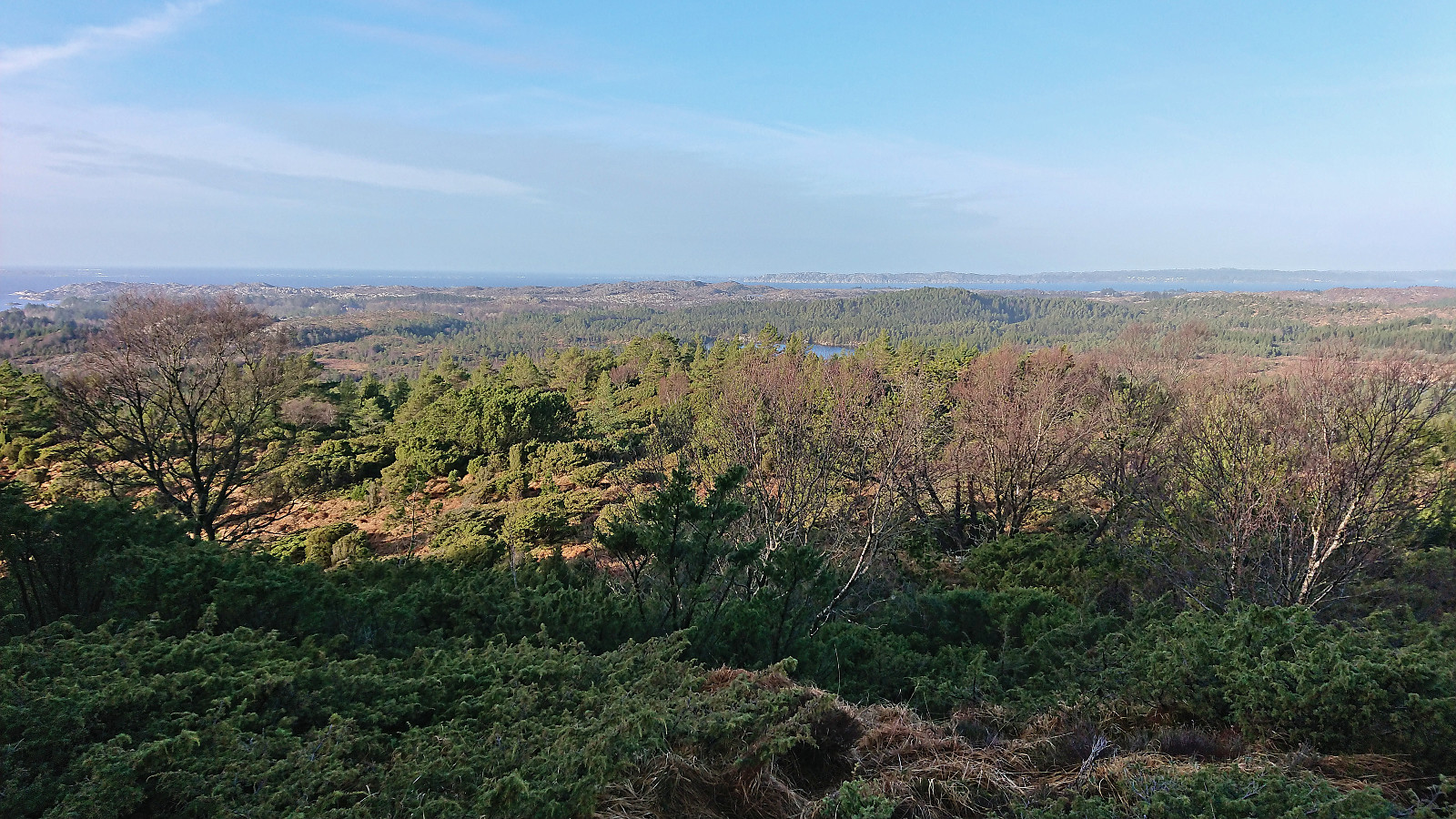
Ørneberget and Hellen festning
- Date:
- 09.03.2023
- Characteristic:
- Hillwalk
- Duration:
- 1:16h
- Distance:
- 4.8km
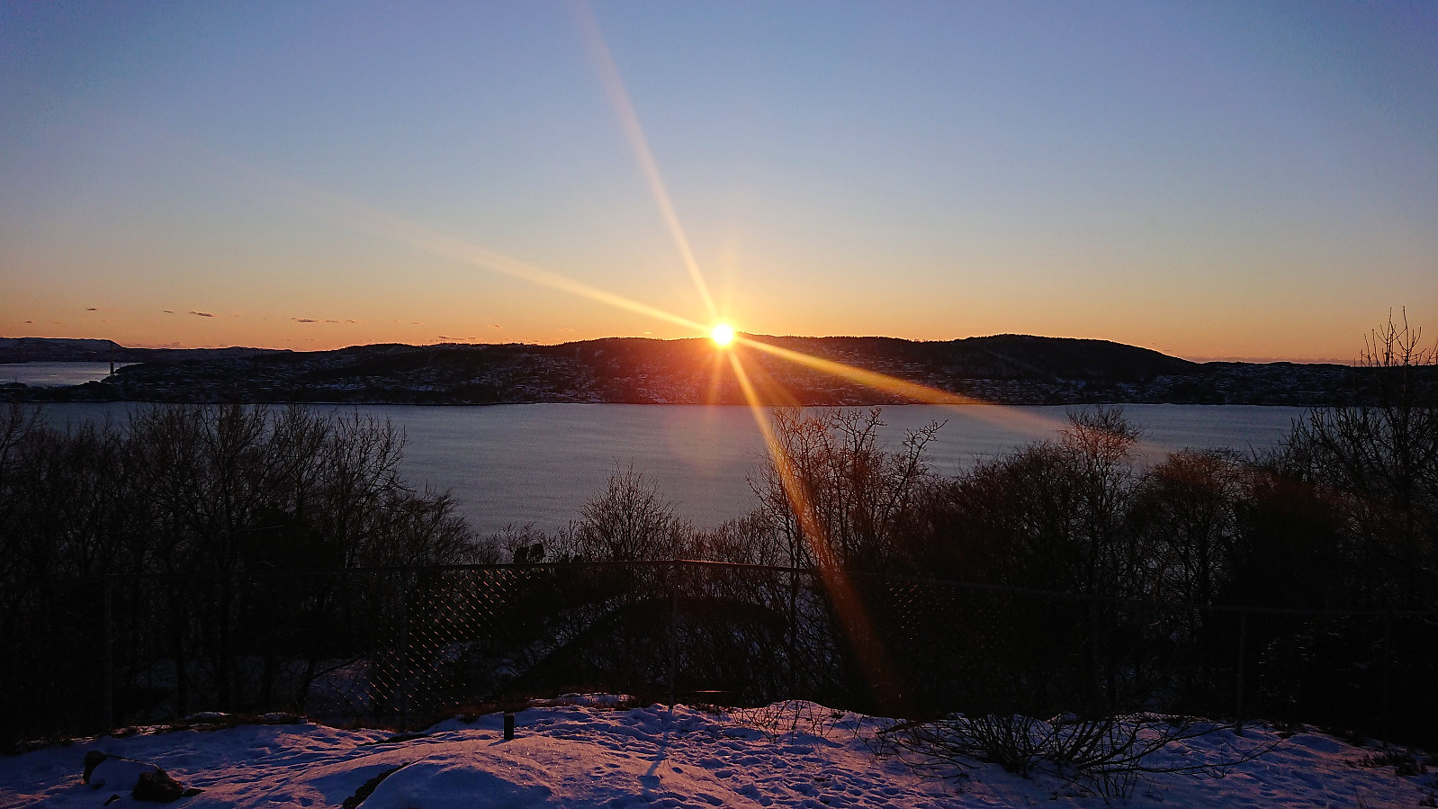 Short local hike just before sunset.
Nordskogfjellet and Golfståvo
- Date:
- 12.02.2023
- Characteristic:
- Hillwalk
- Duration:
- 3:51h
- Distance:
- 16.8km
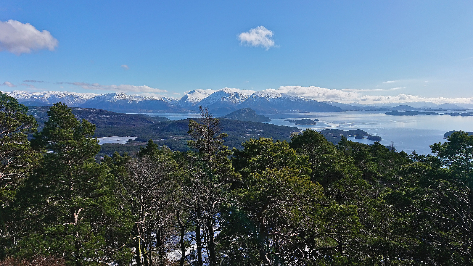
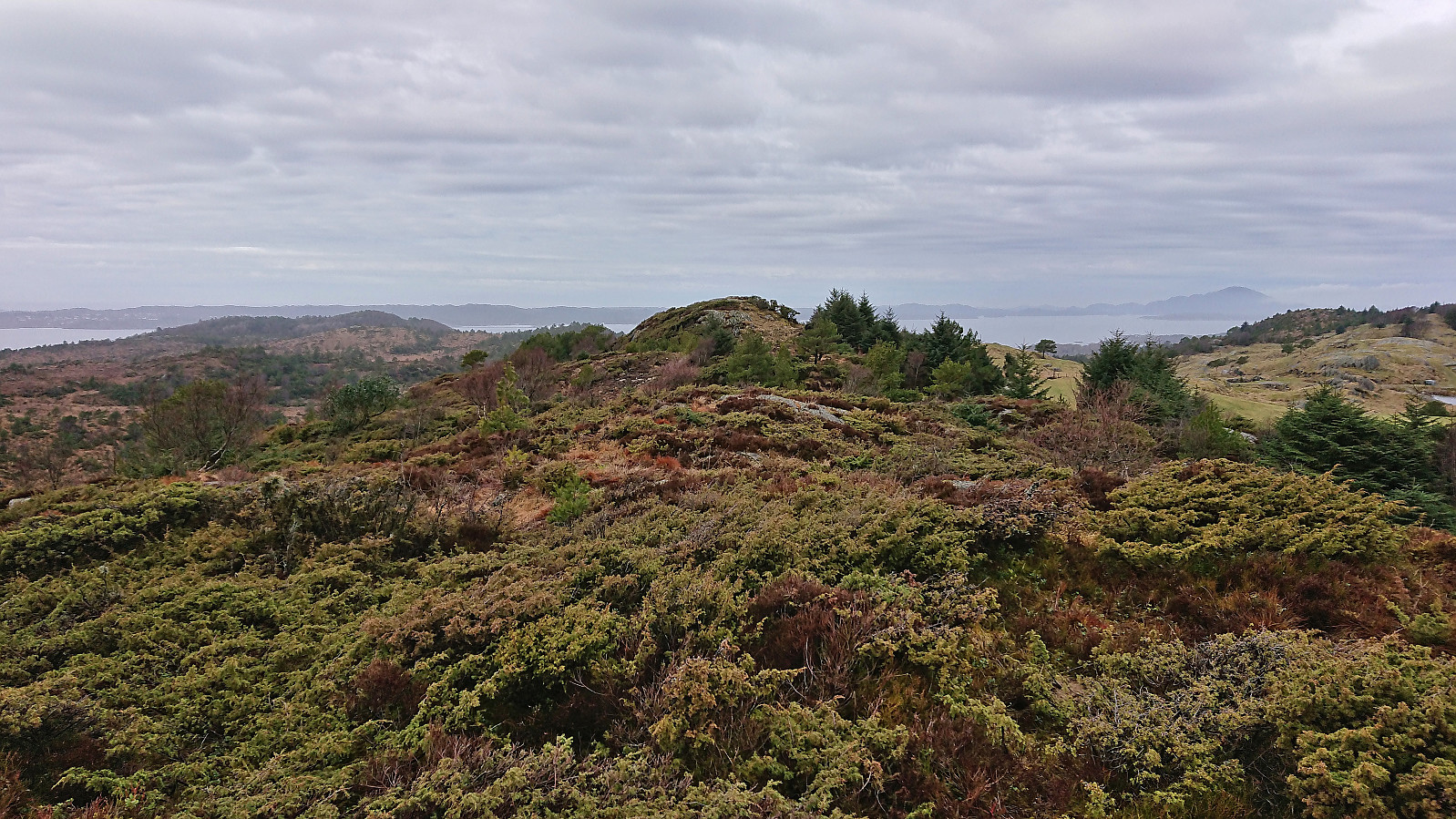 For the second Sunday in a row I returned to Sveio, this time to ascend Nordskogfjellet with an added bonus of also visiting Golfståvo . I started by taking the express bus from Bergen and getting off at the stop "Sveio gravplass". From there I followed the roads north to Nordskog and Skardhaugtjørna where I left the paved road and headed off-trail in the direction of the summit. More traffic than expected for a Sunday morning (or rather mid-day I guess), but even though there were no sidewalks this was generally not an issue.
Less than 100m after leaving the road, I came across a rough tractor road that led me up to the trig marker at the unnamed hill around 650m south of the highest point at Nordskogfjellet. Excellent views from this location (now added as its own PB-element). Next, I turned north and made my own way towards the highest >>>
For the second Sunday in a row I returned to Sveio, this time to ascend Nordskogfjellet with an added bonus of also visiting Golfståvo . I started by taking the express bus from Bergen and getting off at the stop "Sveio gravplass". From there I followed the roads north to Nordskog and Skardhaugtjørna where I left the paved road and headed off-trail in the direction of the summit. More traffic than expected for a Sunday morning (or rather mid-day I guess), but even though there were no sidewalks this was generally not an issue.
Less than 100m after leaving the road, I came across a rough tractor road that led me up to the trig marker at the unnamed hill around 650m south of the highest point at Nordskogfjellet. Excellent views from this location (now added as its own PB-element). Next, I turned north and made my own way towards the highest >>>
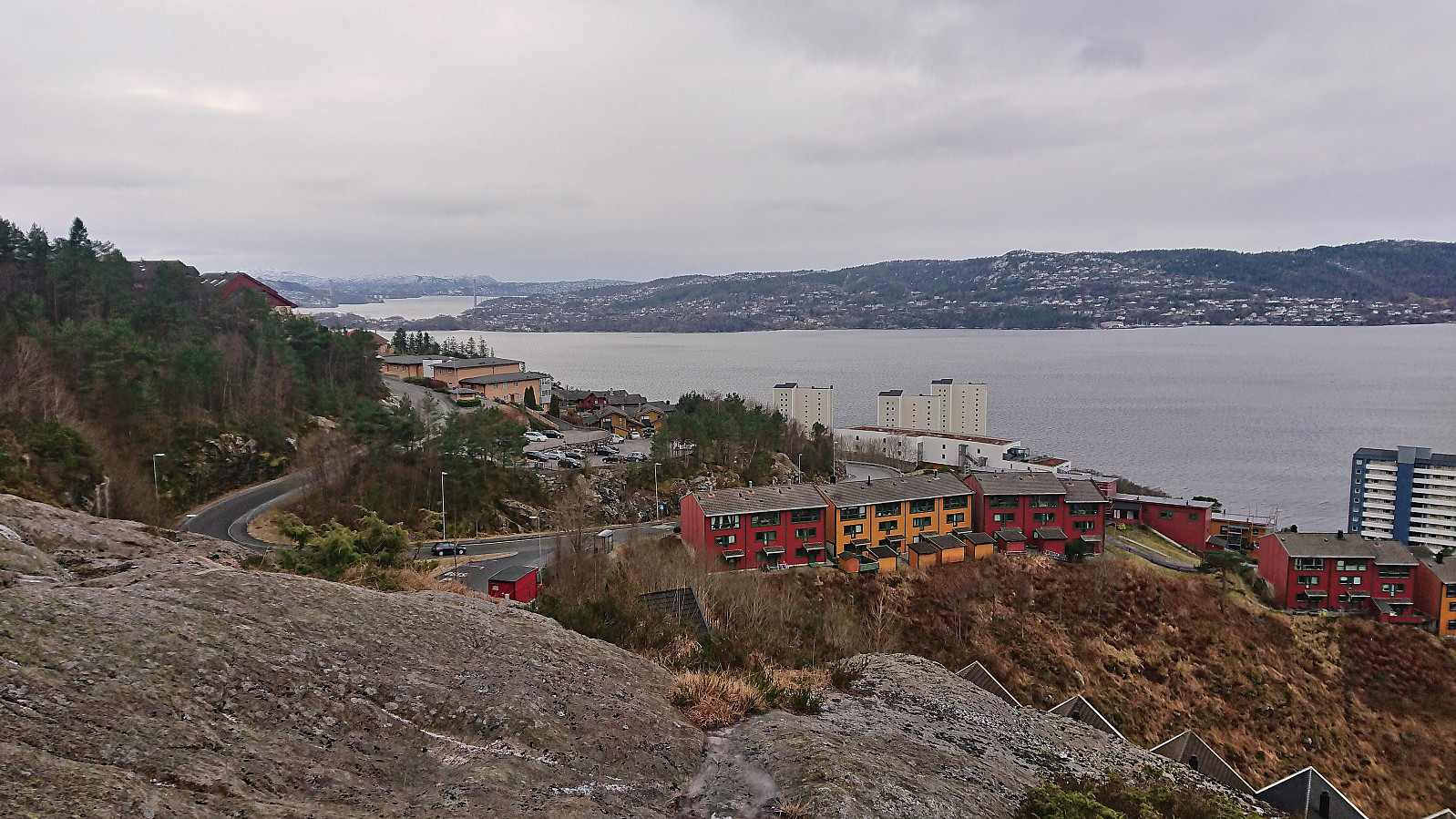
Bergen Travpark and Gjesthaugen
- Date:
- 11.02.2023
- Characteristic:
- Hillwalk
- Duration:
- 0:52h
- Distance:
- 3.9km
 Short hike on a gray Saturday where the main goal was to visit yet another minor summit on the Alle topper i Bergen list, namely Gjesthaugen . While in the area I also took the opportunity to pass by both Bergen Camping Park and Bergen Travpark. The summit of Gjesthaugen was easy to reach via a narrow trail from the southeast, although the trail was a bit weak at times (indicated by my unplanned use of an alternative trail for part of the descent) and one definitely had to pay attention in order to not miss the unmarked trailhead. After descending from Gjesthaugen, I concluded the hike by following the paved hiking path to Breistein, from where I took the bus back home.
Ramsfjellet, Ryvarden, Flokehyttene and Rossafjellet
- Date:
- 05.02.2023
- Characteristic:
- Hillwalk
- Duration:
- 4:45h
- Distance:
- 19.0km
 Another bus trip from Bergen to Sveio. This time with the main goal of visiting Ramsfjellet with an added bonus of Ryvarden and Flokehyttene . I got off at the bus stop "Lindøy nord" and walked less than 250 meters southwest along the main road. Here I crossed a small field to reach a tractor road indicating the start of the trail to Ramsfjellet.
The tractor road was however separated from the field by a small stream and the first trail marker did not show up until the tractor road later turned north. Hence, there might be a different "official" trailhead nearby. After crossing the stream I simply followed the faded white wooden trail markers with red dots all the way to the summit which was thus reached without any issues.
Excellent panoramic views from Ramsfjellet. My attention however soon moved to a >>>
Another bus trip from Bergen to Sveio. This time with the main goal of visiting Ramsfjellet with an added bonus of Ryvarden and Flokehyttene . I got off at the bus stop "Lindøy nord" and walked less than 250 meters southwest along the main road. Here I crossed a small field to reach a tractor road indicating the start of the trail to Ramsfjellet.
The tractor road was however separated from the field by a small stream and the first trail marker did not show up until the tractor road later turned north. Hence, there might be a different "official" trailhead nearby. After crossing the stream I simply followed the faded white wooden trail markers with red dots all the way to the summit which was thus reached without any issues.
Excellent panoramic views from Ramsfjellet. My attention however soon moved to a >>>
Fagerdalsskaret, Ørneberget NV and Hellen festning
- Date:
- 04.02.2023
- Characteristic:
- Hillwalk
- Duration:
- 0:48h
- Distance:
- 3.5km
 Short local Saturday hike.
