Archive - Date
Archive - Activity
-
Bike trip (110)
- Bike trip - mixed (25)
- Bike trip - road (85)
-
Drive (9)
- Car drive (9)
-
Other trip (3)
- Kayaking (3)
-
Ski trip (116)
- Backcountry skiing (69)
- Cross-country skiing (47)
- Trip by foot (1884)
Collected lists
-
Utvalgte topper og turmål i Bergen
(348/349)
 99%
99% -
Alle topper i Bergen
(391/398)
98%
-
Voss ≥ 100m pf.
(96/98)
97%
-
Opptur Hordaland
(144/159)
90%
-
Stasjoner på Bergensbanen
(33/40)
82%
-
Ulvik ≥ 100m pf.
(28/38)
73%
-
Hordaland ≥ 100m pf.
(622/863)
72%
-
Mjølfjell PF > 100m
(21/31)
67%
-
Jondal ≥ 100m pf.
(15/23)
65%
-
Dagsturhyttene i Vestland
(36/61)
59%
-
Sunnhordland PF >= 100m
(105/186)
56%
-
Hordaland: Hardanger PF>=100m
(194/359)
54%
-
DNT-hytter i Hordaland
(23/45)
51%
-
Kvinnherad ≥ 100m pf.
(40/79)
50%
-
Eidfjord ≥ 100m pf.
(13/42)
30%
-
Sogndal ≥ 100m pf.
(23/81)
28%
-
Gulen ≥ 100m pf.
(15/54)
27%
-
Vik i Sogn ≥ 100m pf.
(10/46)
21%
-
Sogn - Sør for Sognefjorden PF>=100m
(31/159)
19%
-
DNT-hytter i Sogn og Fjordane
(8/47)
17%

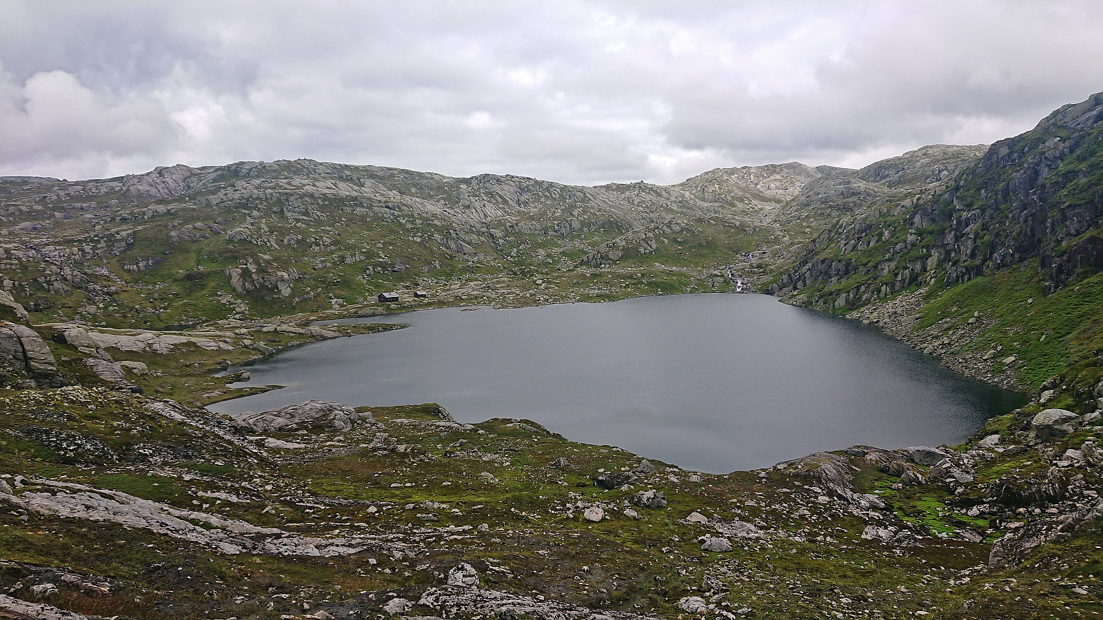
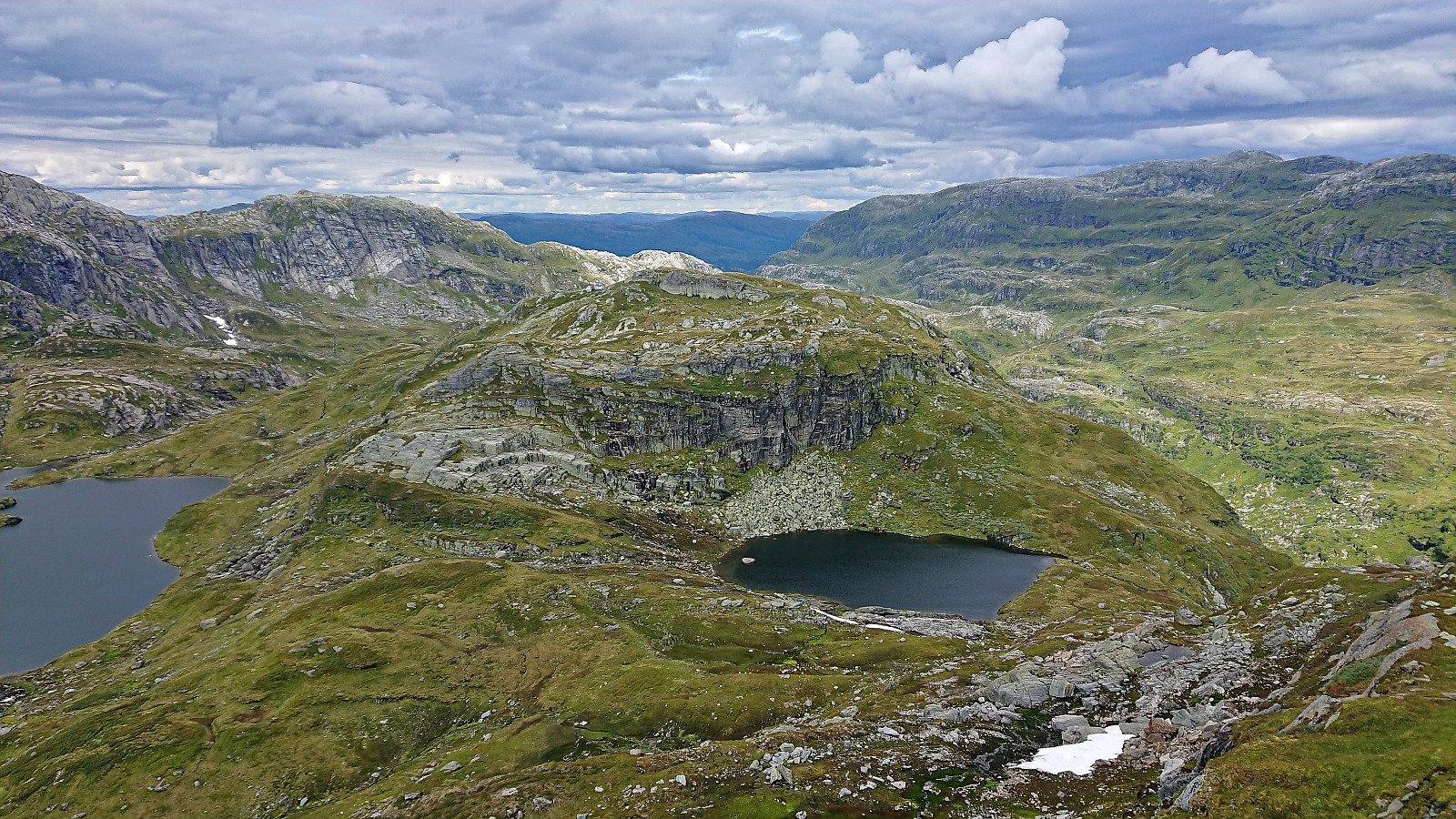
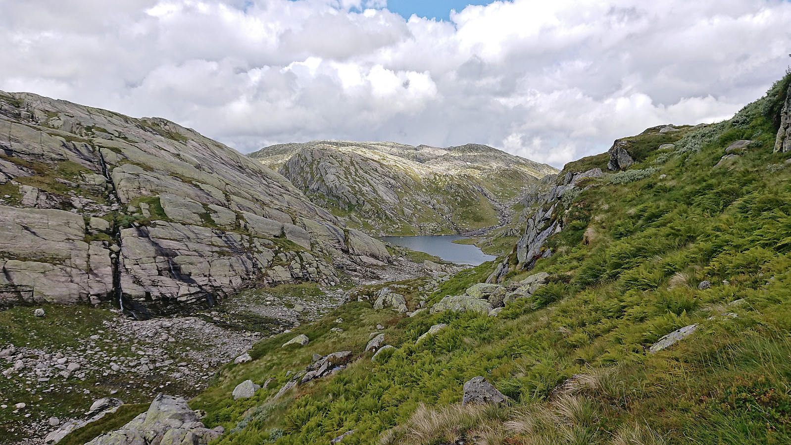
Raundalsryggen from Reimegrend to Øyeflaten
- Date:
- 02.09.2023
- Characteristic:
- Hillwalk
- Duration:
- 10:14h
- Distance:
- 30.4km
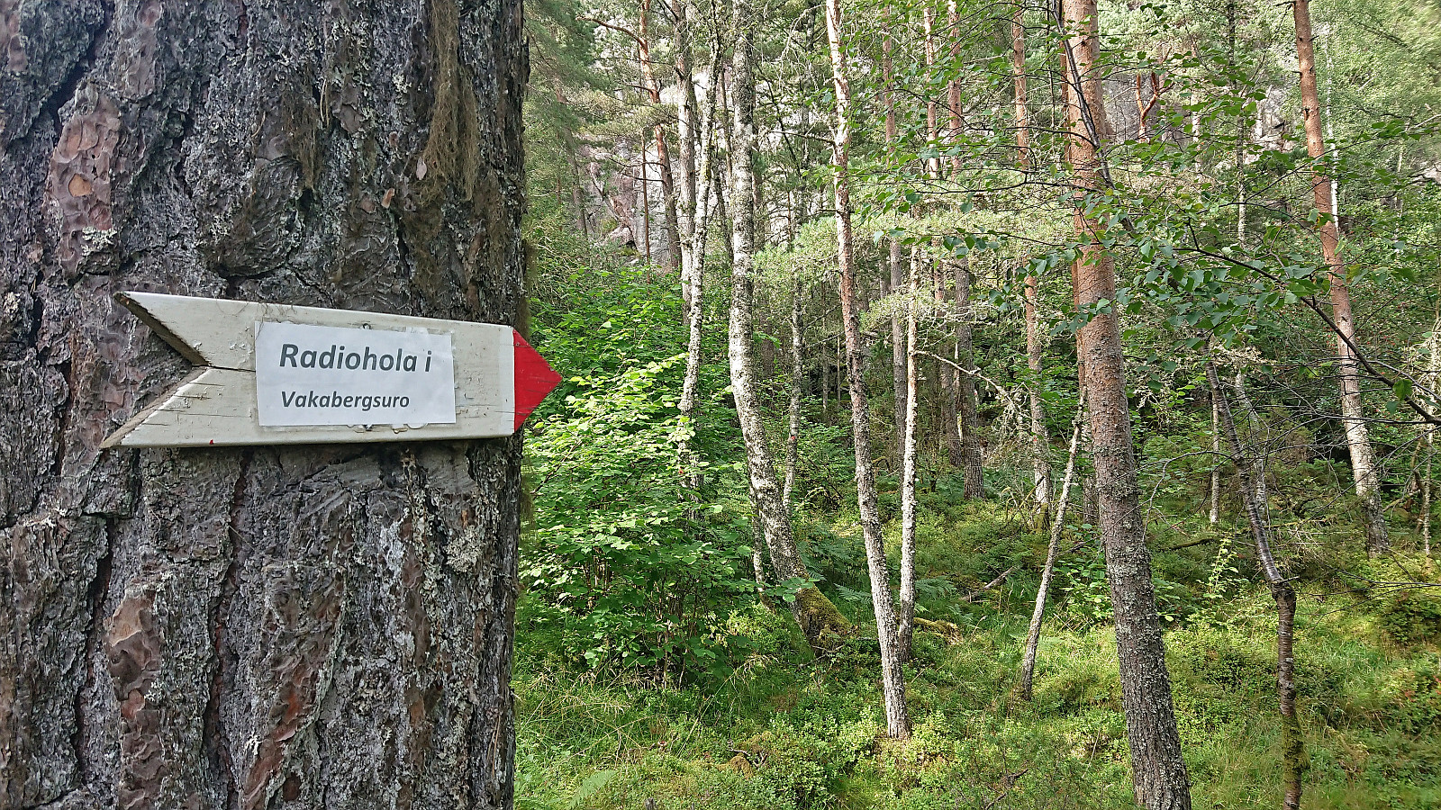
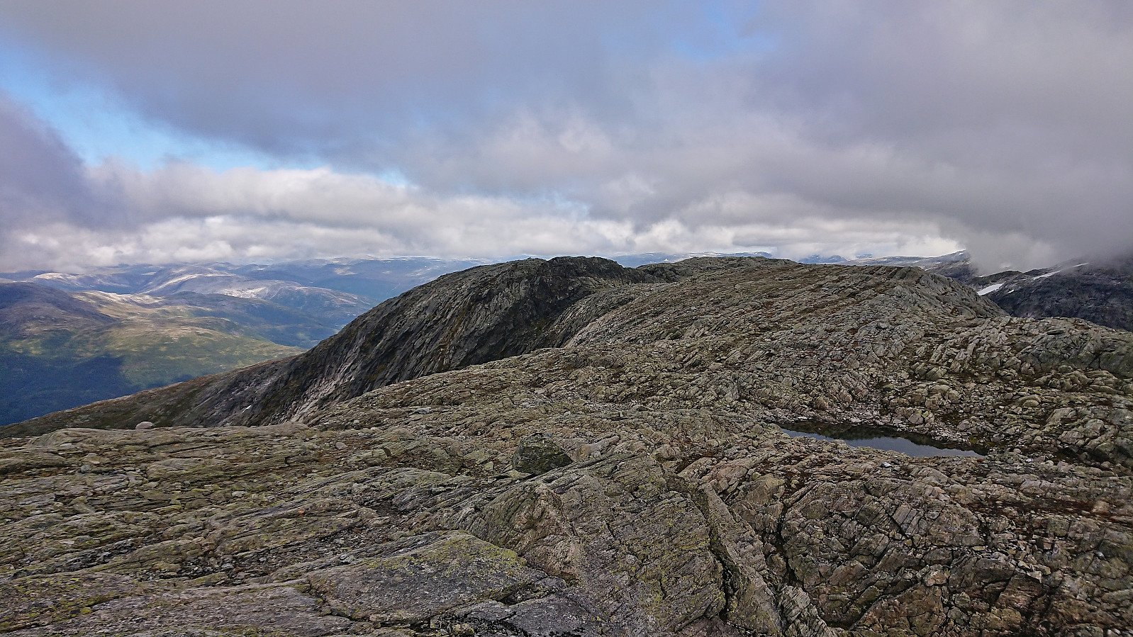 Started by taking the train to Reimegrend and after safely crossing to the south side of the railroad tracks I followed the river east, first off-trail and then on a little used path that included a small wooden bridge. Just after the bridge I turned south towards the river along a trail which I thought would bring me to the bridge across Raundalselvi . This trail however pretty much came to an end at a small island northwest of the bridge and I had to find my own way to the bridge from there. Thankfully, the water level in the river was not very high and I managed to leave the island and get to the bridge without getting wet.
After crossing the bridge I followed a trail southeast to Vetlaheggstølen and Mysedalen. While walking along the river was nice, the trail was clearly not very frequently used and disappeared several times. From Vetlaheggstølen >>>
Started by taking the train to Reimegrend and after safely crossing to the south side of the railroad tracks I followed the river east, first off-trail and then on a little used path that included a small wooden bridge. Just after the bridge I turned south towards the river along a trail which I thought would bring me to the bridge across Raundalselvi . This trail however pretty much came to an end at a small island northwest of the bridge and I had to find my own way to the bridge from there. Thankfully, the water level in the river was not very high and I managed to leave the island and get to the bridge without getting wet.
After crossing the bridge I followed a trail southeast to Vetlaheggstølen and Mysedalen. While walking along the river was nice, the trail was clearly not very frequently used and disappeared several times. From Vetlaheggstølen >>>
Dyrdalsrunden
- Date:
- 30.08.2023
- Characteristic:
- Hillwalk
- Duration:
- 6:30h
- Distance:
- 14.3km
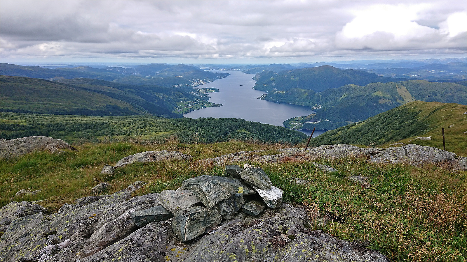
 Left work early for a hike with two colleagues following the so-called Dyrdalsrunden, i.e. a hike following the ridges around Dyrdalsvatnet . Excellent views along the way but the trails were overall not of the best quality and rather muddy. On the way back to the car I made a small detour on my own to Bontveit søyle . This included a steep ascent from the east with lots of fallen trees to crawl over/under as a I got close to the trig marker and an equally steep descent south along the ridge. So while the main hike can be highly recommended, a visit of Bontveit søyle is clearly more of an acquired taste.
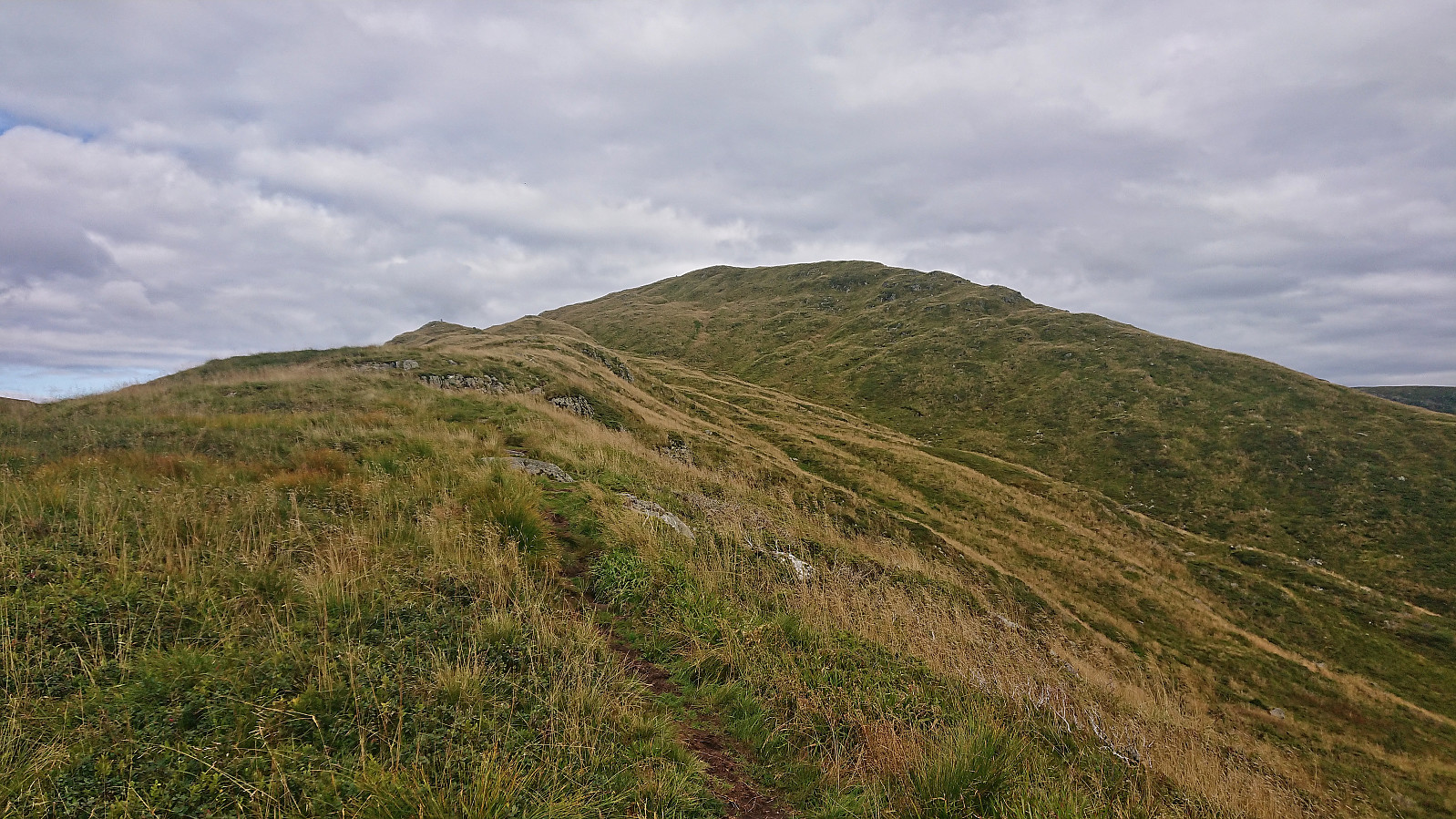
Sundagsfjellet, Fridalsnova and Vest for Vestrebotn
- Date:
- 26.08.2023
- Characteristic:
- Hillwalk
- Duration:
- 11:26h
- Distance:
- 25.9km
 A return to Modalen with Petter to visit the final two peaks he had not yet visited in Nordhordland. Petter picked me up at my place at 06:30 and after around 1.5 hours of driving we parked at the small parking lot in Heimdal and were soon ready to begin our hike up Norddalen.
In Norddalen there is a trail marked with red T's, however both the trail and the trail markers were often difficult to spot and we ended up losing the trail a couple of times. But given that the main direction was pretty obvious, i.e. head up the valley, this was not a big problem. The wet surfaces and the many slippery rocks however provided more of a challenge and meant that we had to proceed with care. Note that trying to follow the markers is still very much recommended as there were several maze-like passages in between large boulders where the markers >>>
A return to Modalen with Petter to visit the final two peaks he had not yet visited in Nordhordland. Petter picked me up at my place at 06:30 and after around 1.5 hours of driving we parked at the small parking lot in Heimdal and were soon ready to begin our hike up Norddalen.
In Norddalen there is a trail marked with red T's, however both the trail and the trail markers were often difficult to spot and we ended up losing the trail a couple of times. But given that the main direction was pretty obvious, i.e. head up the valley, this was not a big problem. The wet surfaces and the many slippery rocks however provided more of a challenge and meant that we had to proceed with care. Note that trying to follow the markers is still very much recommended as there were several maze-like passages in between large boulders where the markers >>>
Ørneberget and Furukammen
- Date:
- 24.08.2023
- Characteristic:
- Hillwalk
- Duration:
- 0:55h
- Distance:
- 3.9km
 Short local evening hike.
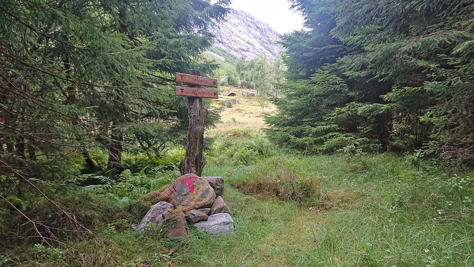
Taket, Vardadalsbu and Eldhusfjellet
- Date:
- 20.08.2023
- Characteristic:
- Hillwalk
- Duration:
- 7:50h
- Distance:
- 18.2km
 After Friday's long hike from Hamlagrøvatnet to Norheimsund I was not really planning on more long hikes this weekend. However, when petter (Petter Bjørstad) contacted me and asked if I wanted to go hiking on Sunday I of course could not resist and quickly said yes. We decided on Modalen and an attempt at visiting three of the four peaks that Petter had not yet visited in this area.
Petter picked me up at 07:30 and after a 1.5 hours drive we arrived at Steinsland where we found parking right next to the marked trailhead for Vardadalsbu . While the trailhead was marked, the trail quality was low. In fact, early on we were wondering if we were on a trail at all. Soon the familiar red trail markers however started appearing, and while the trail was still weak, it could now be followed without too much difficulty.
The trail was quite steep though. From the trailhead the trail climbed >>>
After Friday's long hike from Hamlagrøvatnet to Norheimsund I was not really planning on more long hikes this weekend. However, when petter (Petter Bjørstad) contacted me and asked if I wanted to go hiking on Sunday I of course could not resist and quickly said yes. We decided on Modalen and an attempt at visiting three of the four peaks that Petter had not yet visited in this area.
Petter picked me up at 07:30 and after a 1.5 hours drive we arrived at Steinsland where we found parking right next to the marked trailhead for Vardadalsbu . While the trailhead was marked, the trail quality was low. In fact, early on we were wondering if we were on a trail at all. Soon the familiar red trail markers however started appearing, and while the trail was still weak, it could now be followed without too much difficulty.
The trail was quite steep though. From the trailhead the trail climbed >>>
Hamlagrøvatnet to Norheimsund
- Date:
- 18.08.2023
- Characteristic:
- Hillwalk
- Duration:
- 8:37h
- Distance:
- 29.6km
 Given the excellent weather forecast I took the Friday off to try one of my more ambitious hiking plans: walking from Hamlagrøvatnet in Bergsdalen to Steinsdalsfossen in Norheimsund. The main goal was to visit the three remaining summits I had left along this route.
I started by taking the train to Dale and the bus to the western end of Hamlagrøvatnet. Officially the last bus stop was at Rødland/Røydland, but given that the bus driver had plenty of time before the return journey to Dale he was kind enough to drive me all the way to the lake, saving me about half an hour of walking along the road.
From Hamlagrøosen I basically followed the marked trail to Vending . However, when the trail entered Langagjelet, and was about to ascend the final small hill before descending to the cabin, I turned northwest >>>
Given the excellent weather forecast I took the Friday off to try one of my more ambitious hiking plans: walking from Hamlagrøvatnet in Bergsdalen to Steinsdalsfossen in Norheimsund. The main goal was to visit the three remaining summits I had left along this route.
I started by taking the train to Dale and the bus to the western end of Hamlagrøvatnet. Officially the last bus stop was at Rødland/Røydland, but given that the bus driver had plenty of time before the return journey to Dale he was kind enough to drive me all the way to the lake, saving me about half an hour of walking along the road.
From Hamlagrøosen I basically followed the marked trail to Vending . However, when the trail entered Langagjelet, and was about to ascend the final small hill before descending to the cabin, I turned northwest >>>
Fagerdalsfjellet and Midtneset
- Date:
- 17.08.2023
- Characteristic:
- Hillwalk
- Duration:
- 0:33h
- Distance:
- 2.5km
 Short local evening hike for a quick test of my new hiking shoes.
Norddalsfjellet, Sørdalsfjellet and Saudalsnovi
- Date:
- 12.08.2023
- Characteristic:
- Hillwalk
- Duration:
- 8:05h
- Distance:
- 21.0km
 Initially I had other hiking plans for this Saturday, but when Fjellsamleren (Endre Myrdal Olsen) asked if I wanted to join him on a hike in Norddalen at the end of Øvstedalen, an area that is pretty much unreachable by public transport, I of course quickly changed my plans. Endre picked me up at my place at 08:15 and after driving as far up Øvstedalen as possible, passing through two gates on a narrow gravel road, we found parking near the end of the road at Øykholmane and were ready to start hiking around 09:45.
The road quickly turned into a wet trail that we followed via a couple of cabins. After crossing the river on a wooden bridge, and managing to avoid the grazing cows in the area, we left the cabins and trail behind and headed off-trail towards Kyrahjellen, which should provide us an easy ascent route to Norddalsfjellet (incorrectly >>>
Initially I had other hiking plans for this Saturday, but when Fjellsamleren (Endre Myrdal Olsen) asked if I wanted to join him on a hike in Norddalen at the end of Øvstedalen, an area that is pretty much unreachable by public transport, I of course quickly changed my plans. Endre picked me up at my place at 08:15 and after driving as far up Øvstedalen as possible, passing through two gates on a narrow gravel road, we found parking near the end of the road at Øykholmane and were ready to start hiking around 09:45.
The road quickly turned into a wet trail that we followed via a couple of cabins. After crossing the river on a wooden bridge, and managing to avoid the grazing cows in the area, we left the cabins and trail behind and headed off-trail towards Kyrahjellen, which should provide us an easy ascent route to Norddalsfjellet (incorrectly >>>
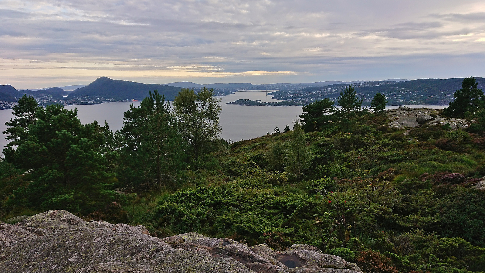
Borgundnuten
- Date:
- 06.08.2023
- Characteristic:
- Hillwalk
- Duration:
- 2:32h
- Distance:
- 7.1km
 The last day of my 2023 summer holiday was spent travelling to Borgundøya for an ascent of Borgundnuten . I started by taking the high-speed passenger ferry from Strandkaien in Bergen to Borgundøy. This included a transfer to a corresponding ferry at Leirvik and in total took about two hours.
Upon arriving at Borgundøya I followed the paved road to the marked trailhead southeast of the summit and from there followed the marked trail all the way to the large summit cairn. Besides meeting maybe a dozen other hikers at the start of the hike (and one during the descent), I had the mountain all to myself and could fully enjoy the excellent panoramic views.
Descended along the same route to the paved road (only adding a short detour to Storaskarnuten ), making sure to call the boat to let them know that I would like to be picked up on their way >>>
The last day of my 2023 summer holiday was spent travelling to Borgundøya for an ascent of Borgundnuten . I started by taking the high-speed passenger ferry from Strandkaien in Bergen to Borgundøy. This included a transfer to a corresponding ferry at Leirvik and in total took about two hours.
Upon arriving at Borgundøya I followed the paved road to the marked trailhead southeast of the summit and from there followed the marked trail all the way to the large summit cairn. Besides meeting maybe a dozen other hikers at the start of the hike (and one during the descent), I had the mountain all to myself and could fully enjoy the excellent panoramic views.
Descended along the same route to the paved road (only adding a short detour to Storaskarnuten ), making sure to call the boat to let them know that I would like to be picked up on their way >>>
Vossavardane, Hotten and Nordnuken
- Date:
- 05.08.2023
- Characteristic:
- Hillwalk
- Duration:
- 5:50h
- Distance:
- 13.7km
 A return to Tjørndalen to visit a couple of minor not previously visited peaks and to see if there were any cloudberries to be found. The former went all according to plan, but the latter was not a big success as we found maybe ten berries in total. There were lots of blueberries though. On the way back to the car I also made a minor detour on my own to the summit of Nordnuken where I managed to find a route that was much better than expected.
