Archive - Date
Archive - Activity
-
Bike trip (111)
- Bike trip - mixed (25)
- Bike trip - road (86)
-
Drive (9)
- Car drive (9)
-
Other trip (3)
- Kayaking (3)
-
Ski trip (116)
- Backcountry skiing (69)
- Cross-country skiing (47)
- Trip by foot (1898)
Collected lists
-
Utvalgte topper og turmål i Bergen
(349/351)
 99%
99% -
Alle topper i Bergen
(393/400)
98%
-
Voss ≥ 100m pf.
(96/98)
97%
-
Opptur Hordaland
(144/159)
90%
-
Stasjoner på Bergensbanen
(33/40)
82%
-
Ulvik ≥ 100m pf.
(30/38)
78%
-
Hordaland ≥ 100m pf.
(624/863)
72%
-
Mjølfjell PF > 100m
(21/31)
67%
-
Jondal ≥ 100m pf.
(15/23)
65%
-
Dagsturhyttene i Vestland
(36/61)
59%
-
Sunnhordland PF >= 100m
(105/186)
56%
-
Hordaland: Hardanger PF>=100m
(196/359)
54%
-
DNT-hytter i Hordaland
(23/45)
51%
-
Kvinnherad ≥ 100m pf.
(40/79)
50%
-
Eidfjord ≥ 100m pf.
(13/42)
30%
-
Sogndal ≥ 100m pf.
(23/81)
28%
-
Gulen ≥ 100m pf.
(15/54)
27%
-
Vik i Sogn ≥ 100m pf.
(10/46)
21%
-
Sogn - Sør for Sognefjorden PF>=100m
(31/159)
19%
-
DNT-hytter i Sogn og Fjordane
(8/47)
17%

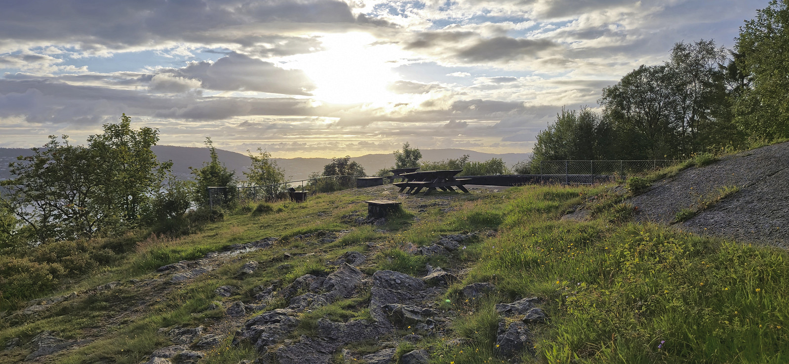
Ørneberget and Furukammen
- Date:
- 21.08.2024
- Characteristic:
- Hillwalk
- Duration:
- 1:55h
- Distance:
- 4.3km
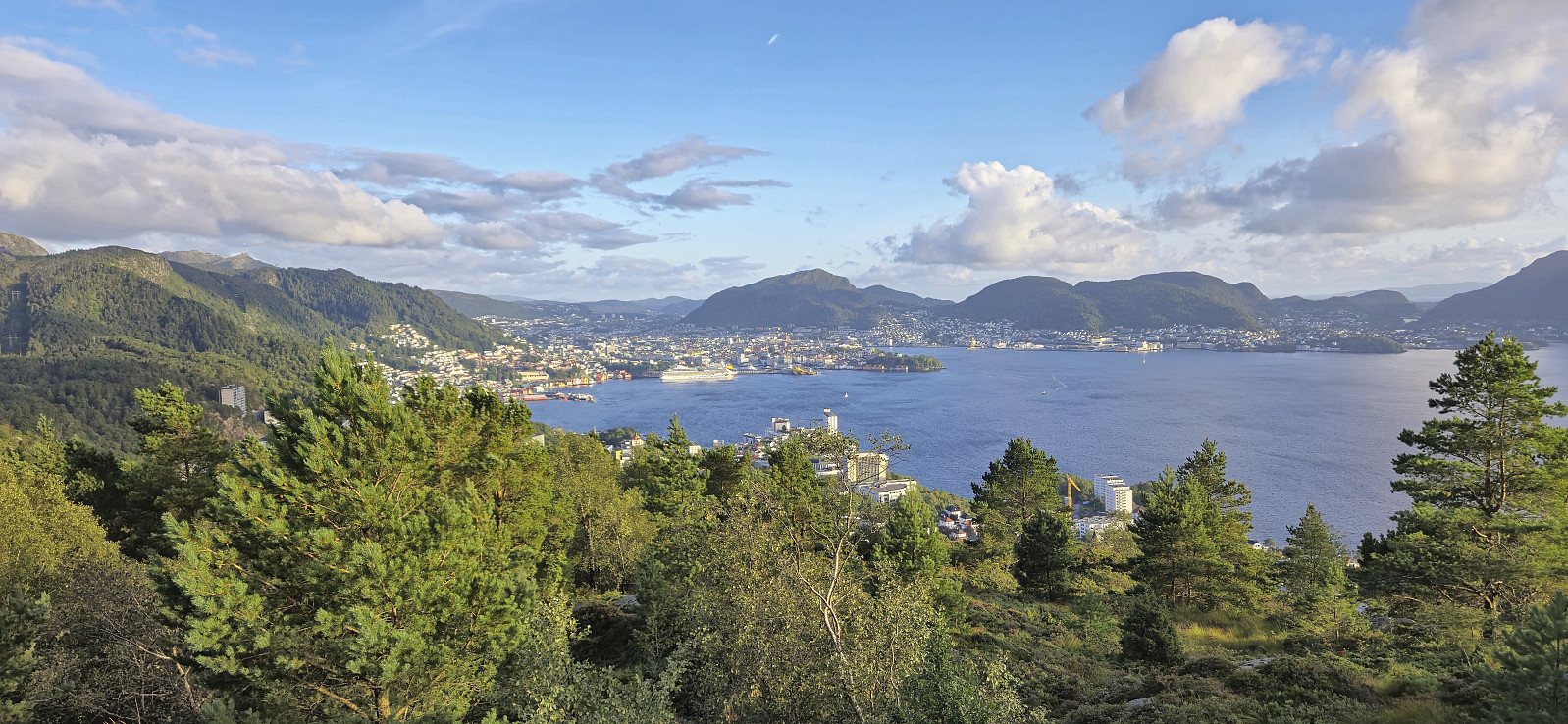 Short local hike on a rare sunny evening.
Åstveitskogen and Åstveitvågen
- Date:
- 18.08.2024
- Characteristic:
- Hillwalk
- Duration:
- 1:37h
- Distance:
- 5.6km
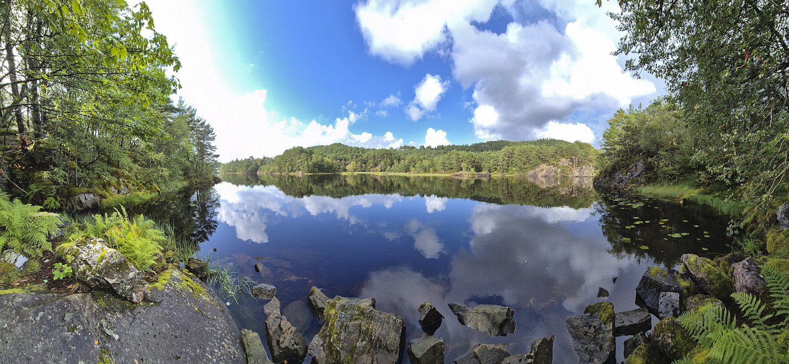 A return to Åstveitskogen to explore some of the trails I did not check out during my last visit . This time I also completed the trip around Åstveitvatnet and included a short detour down to Åstveitvågen. Lots of slippery roots and muddy areas after the recent rain showers, but overall a very nice short hike.
Fagerdalsfjellet
- Date:
- 13.08.2024
- Characteristic:
- Hillwalk
- Duration:
- 0:28h
- Distance:
- 1.9km
 Short local evening hike.
Hanakamb from Kvitno
- Date:
- 11.08.2024
- Characteristic:
- Hillwalk
- Duration:
- 5:09h
- Distance:
- 9.0km
 Sunday hike to Hanakamb organized by Voss Utferdslag . I started by taking an early train to Voss where I met up with the other hikers for the drive to Kvitno via the ferry from Kvanndal to Utne. Upon arriving at the trailhead the small parking lot with room for perhaps 2-3 cars was already full and we therefore parked on the other side of the road (although this is probably more of a bus stop, i.e. be prepared for potential parking tickets if going for this option).
After a shortcut from the marked trailhead we passed by Kvitno kraftverk and continued on a tractor road up to the start of the marked trail just where the road came to an end. A steep and sometimes slippery trail then took us up to the beautiful Raunsdalsvatnet. This section was overall straightforward but one should pay extra care towards the end where >>>
Sunday hike to Hanakamb organized by Voss Utferdslag . I started by taking an early train to Voss where I met up with the other hikers for the drive to Kvitno via the ferry from Kvanndal to Utne. Upon arriving at the trailhead the small parking lot with room for perhaps 2-3 cars was already full and we therefore parked on the other side of the road (although this is probably more of a bus stop, i.e. be prepared for potential parking tickets if going for this option).
After a shortcut from the marked trailhead we passed by Kvitno kraftverk and continued on a tractor road up to the start of the marked trail just where the road came to an end. A steep and sometimes slippery trail then took us up to the beautiful Raunsdalsvatnet. This section was overall straightforward but one should pay extra care towards the end where >>>
Jonahornet, Tofjellet, Gulbergnotten and Vikanuten
- Date:
- 01.08.2024
- Characteristic:
- Hillwalk
- Duration:
- 8:22h
- Distance:
- 19.7km
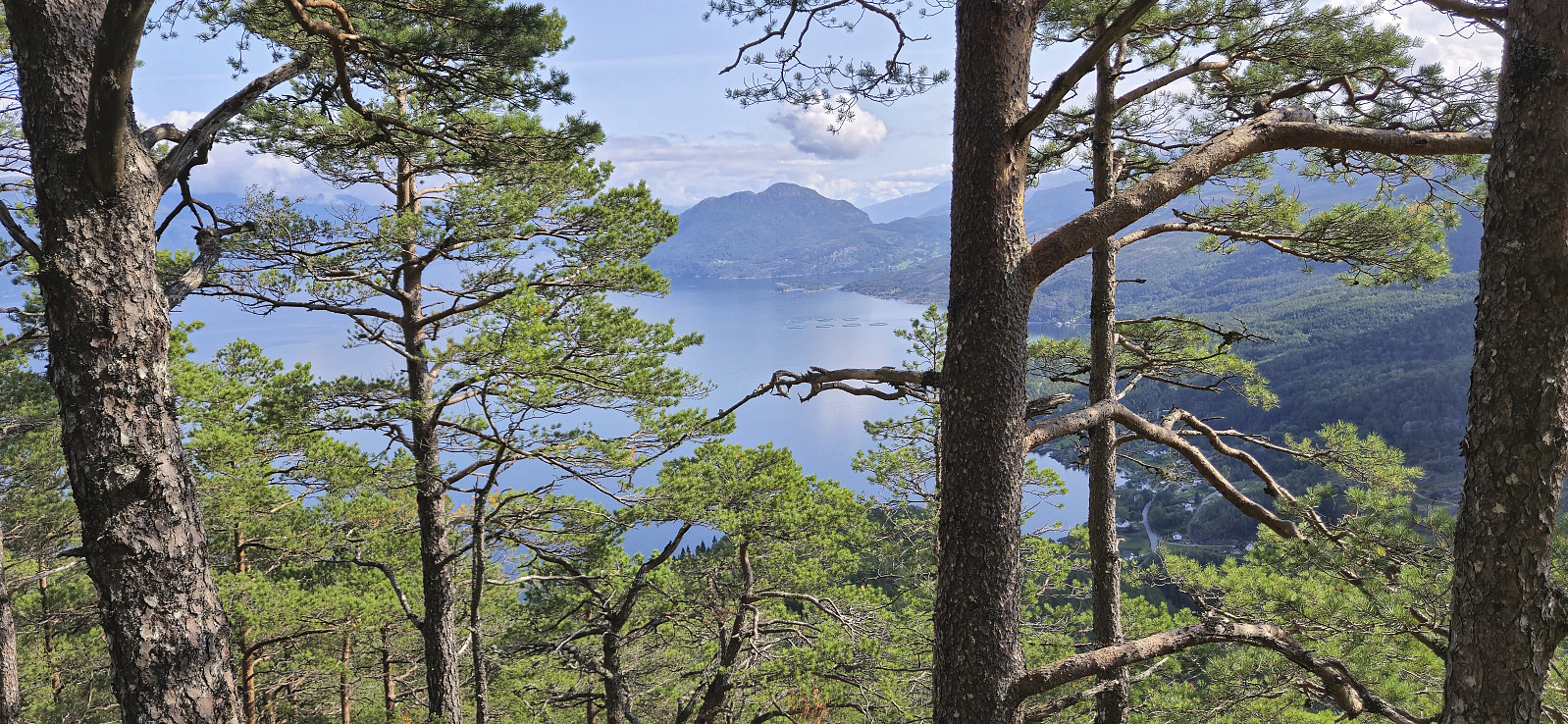 A hike to the three peaks just north of Jondal had been on my radar for a while. Ideally, I would like to start from the north and hike via the three peaks on my way to Jondal. Getting to the trailhead at Selsvik by public transport is however difficult. Or so I had thought. But based on my recent success of using the express boat from Norheimsund to visit Grimsnuten , I figured out that it should be possible to do something similar here as well. After a bit of digging I even found out that there is a corresponding bus from Herand towards Jondal that would get me to the wanted starting location and thus leave room for a potential bonus peak before taking the ferry and bus home from Jondal.
I therefore once more took the bus to Norheimsund and then the express boat, but this time getting off at Herand. A short bus ride later I arrived at the main road >>>
A hike to the three peaks just north of Jondal had been on my radar for a while. Ideally, I would like to start from the north and hike via the three peaks on my way to Jondal. Getting to the trailhead at Selsvik by public transport is however difficult. Or so I had thought. But based on my recent success of using the express boat from Norheimsund to visit Grimsnuten , I figured out that it should be possible to do something similar here as well. After a bit of digging I even found out that there is a corresponding bus from Herand towards Jondal that would get me to the wanted starting location and thus leave room for a potential bonus peak before taking the ferry and bus home from Jondal.
I therefore once more took the bus to Norheimsund and then the express boat, but this time getting off at Herand. A short bus ride later I arrived at the main road >>>
Grimsnuten from Utne
- Date:
- 29.07.2024
- Characteristic:
- Hillwalk
- Duration:
- 6:45h
- Distance:
- 16.1km
 I had initially planned to visit Grimsnuten via the ferry from Kvanndal to Utne, but when discovering that during the summer there is an express boat from Norheimsund I concluded that this would be an even better option. After starting by taking the bus from Bergen I therefore switched to the express boat at Norheimsund and could enjoy excellent views from the fjord for about 55 minutes before arriving at Utne. (Note that there is only a 10-minute transfer window in Norheimsund, hence one has to hope that the bus is on time. We were only around four minutes late and thus made the boat without any issues.)
Upon arriving at Utne I followed in the footsteps of Rune Blomberg and his trip report from 2012 . This made it straightforward to locate the marked trailhead after a short walk along the paved road and a much shorter walk along a gravel road. The sign at the trailhead >>>
I had initially planned to visit Grimsnuten via the ferry from Kvanndal to Utne, but when discovering that during the summer there is an express boat from Norheimsund I concluded that this would be an even better option. After starting by taking the bus from Bergen I therefore switched to the express boat at Norheimsund and could enjoy excellent views from the fjord for about 55 minutes before arriving at Utne. (Note that there is only a 10-minute transfer window in Norheimsund, hence one has to hope that the bus is on time. We were only around four minutes late and thus made the boat without any issues.)
Upon arriving at Utne I followed in the footsteps of Rune Blomberg and his trip report from 2012 . This made it straightforward to locate the marked trailhead after a short walk along the paved road and a much shorter walk along a gravel road. The sign at the trailhead >>>
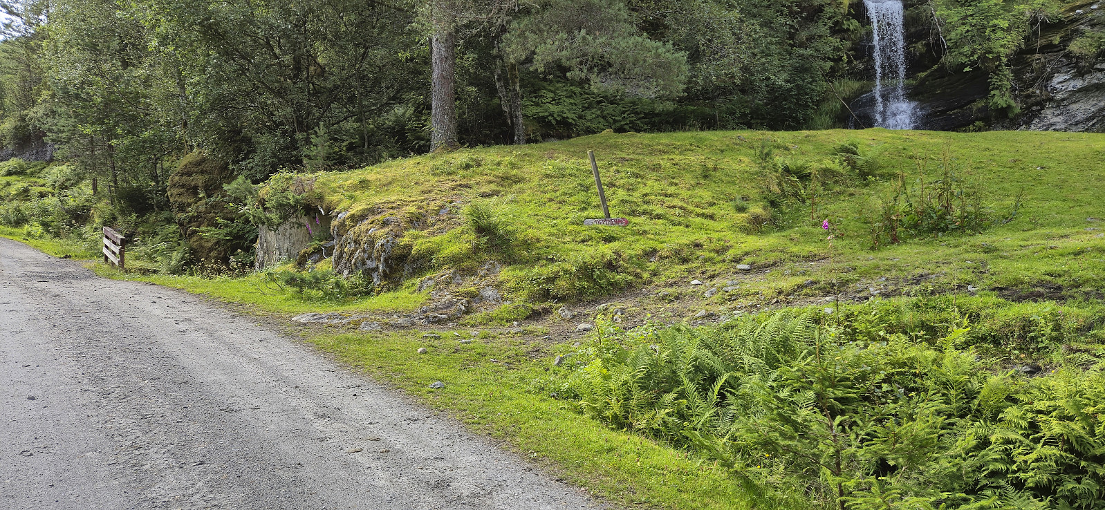
Stanghelle to Dale via Smørstakken
- Date:
- 27.07.2024
- Characteristic:
- Hillwalk
- Duration:
- 3:53h
- Distance:
- 12.0km
 Due to an unstable weather forecast I opted for a return to Stanghelle with the main objective of visiting Smørstakken . As I got off the train I was welcomed by an intensive rain shower. I tried waiting it out at the station, but finally gave up and started the hike, and except for short breaks it would not really stop raining for another 2.5 hours.
I started along the same trail as for my previous hike in the area , but quickly deviated and instead followed the marked trail to Varden på Åsen for some nice views. After turning back I followed the marked trail to Berget and Smørstakken . The trail was overall easy to follow but there was a short steep section along the ridge with overhanging powerlines. There was a wire to hold on to though. Both Berget and Smørstakken provided excellent views, especially north along Veafjorden from Smørstakken.
From Smørstakken >>>
Due to an unstable weather forecast I opted for a return to Stanghelle with the main objective of visiting Smørstakken . As I got off the train I was welcomed by an intensive rain shower. I tried waiting it out at the station, but finally gave up and started the hike, and except for short breaks it would not really stop raining for another 2.5 hours.
I started along the same trail as for my previous hike in the area , but quickly deviated and instead followed the marked trail to Varden på Åsen for some nice views. After turning back I followed the marked trail to Berget and Smørstakken . The trail was overall easy to follow but there was a short steep section along the ridge with overhanging powerlines. There was a wire to hold on to though. Both Berget and Smørstakken provided excellent views, especially north along Veafjorden from Smørstakken.
From Smørstakken >>>
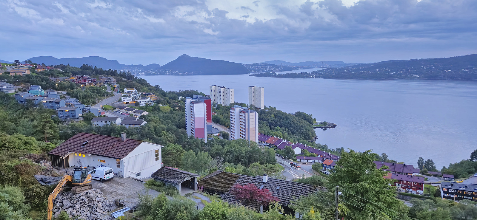
Ørneberget and Hellen festning
- Date:
- 26.07.2024
- Characteristic:
- Hillwalk
- Duration:
- 1:07h
- Distance:
- 4.8km
 Short local evening hike on a day with highly variable weather.
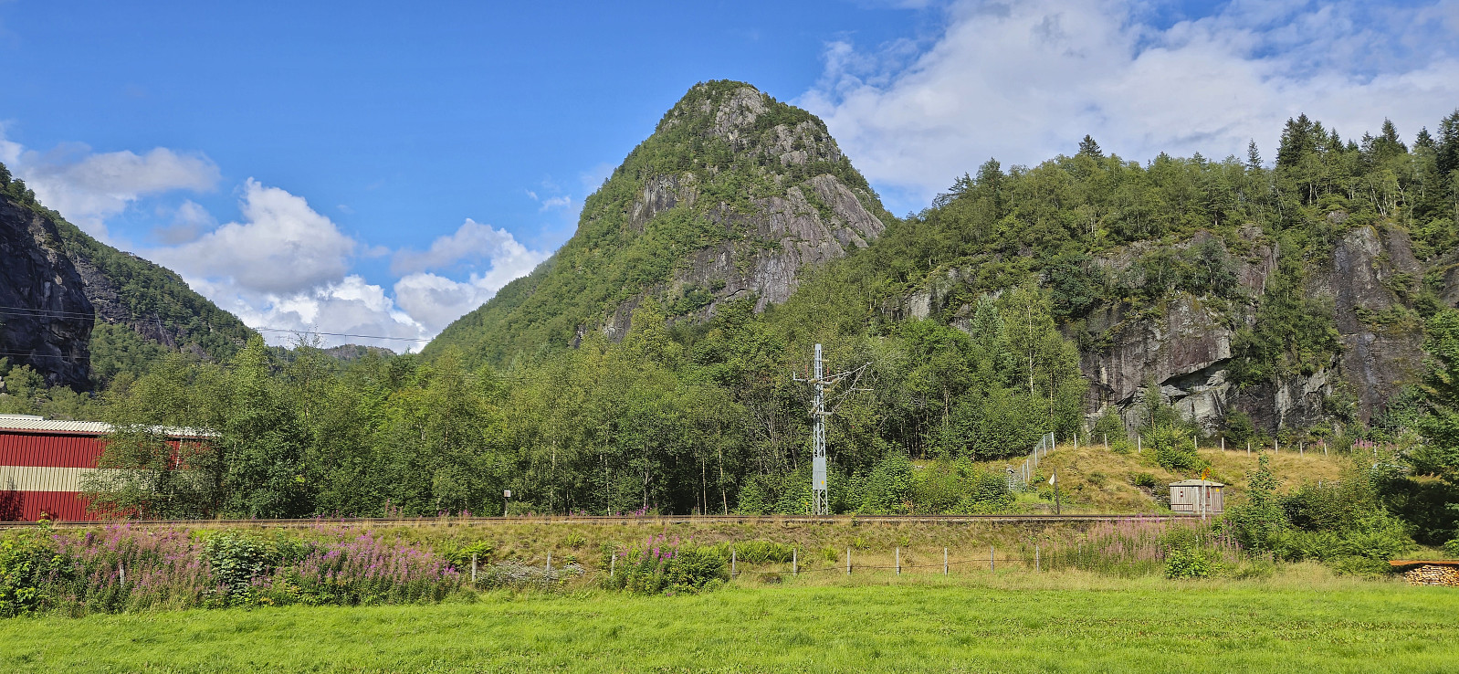
Urdeggi, Skjelinganosi and Skabotsvarden
- Date:
- 23.07.2024
- Characteristic:
- Hillwalk
- Duration:
- 6:16h
- Distance:
- 18.7km
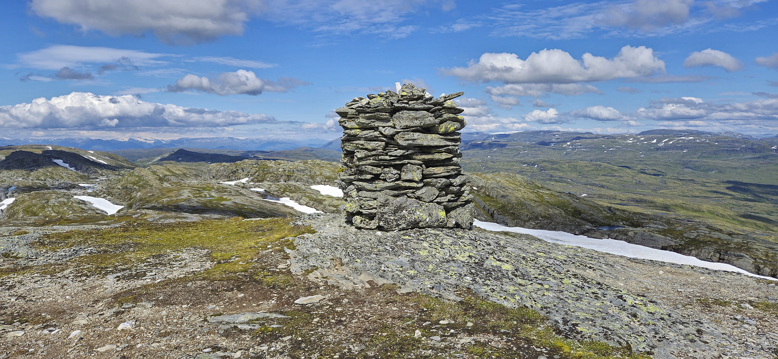 For the second time this summer I hitched a ride to Vikafjellet where I was dropped off at Nordre Skjelingen and could start my ascent of Urdeggi via the gravel road between the cabins. After passing the final cabin I found my own way to the summit. This was straightforward and the summit provided spectacular views.
From Urdeggi I first walked south on a trail along the ridge, but later headed more directly to the gravel road to the southwest to begin my ascent of Skjelinganosi . The ascent looked steep from a distance but turned out to be a marked trail with small cairns leading the way. Once more the views were impressive, especially near the steep north face.
After a short lunch break, I headed south/southwest via Skjelinganosi Sør to Skabotsvarden . No trails here as far as I could tell but the terrain was easy to traverse and did not present >>>
For the second time this summer I hitched a ride to Vikafjellet where I was dropped off at Nordre Skjelingen and could start my ascent of Urdeggi via the gravel road between the cabins. After passing the final cabin I found my own way to the summit. This was straightforward and the summit provided spectacular views.
From Urdeggi I first walked south on a trail along the ridge, but later headed more directly to the gravel road to the southwest to begin my ascent of Skjelinganosi . The ascent looked steep from a distance but turned out to be a marked trail with small cairns leading the way. Once more the views were impressive, especially near the steep north face.
After a short lunch break, I headed south/southwest via Skjelinganosi Sør to Skabotsvarden . No trails here as far as I could tell but the terrain was easy to traverse and did not present >>>
Joskarfjellet and Høgafjellet
- Date:
- 18.07.2024
- Characteristic:
- Hillwalk
- Duration:
- 9:30h
- Distance:
- 30.0km
 Warning: This hike contains a steep off-trail descent. Please read the report carefully to see if this is something you are comfortable with.
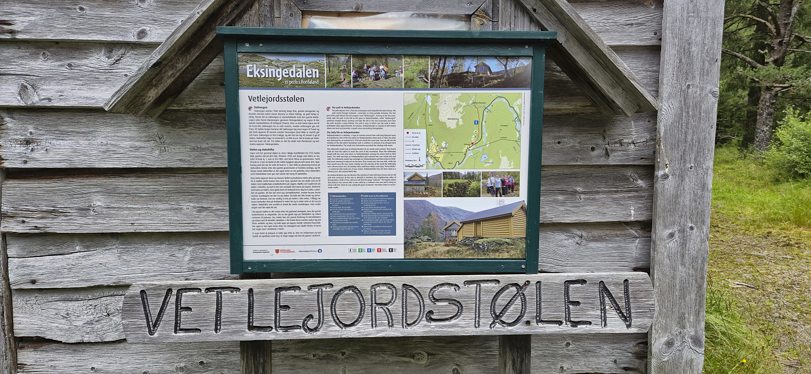
I started by taking the train to Dale and the bus to Eksingedalen where I got off at "Modalstunnelen sør" (the bus continued through the tunnel). The first part of the hike therefore consisted of walking east along the road to Vetlejord. Here I easily located the marked trailhead for Vetlejordsstølen and proceeded to follow the marked trail until it ended at two cabins. The trail was overall rather wet and muddy but except for a small herd of cattle that had to be avoided early on, it could be followed without any issues.
From Vetlejordsstølen I headed off-trail to the start of the ridge of Joskarfjellet (or Joskardfjellet as it is named on PB). This was overall straightforward >>>
Warning: This hike contains a steep off-trail descent. Please read the report carefully to see if this is something you are comfortable with.
I started by taking the train to Dale and the bus to Eksingedalen where I got off at "Modalstunnelen sør" (the bus continued through the tunnel). The first part of the hike therefore consisted of walking east along the road to Vetlejord. Here I easily located the marked trailhead for Vetlejordsstølen and proceeded to follow the marked trail until it ended at two cabins. The trail was overall rather wet and muddy but except for a small herd of cattle that had to be avoided early on, it could be followed without any issues.
From Vetlejordsstølen I headed off-trail to the start of the ridge of Joskarfjellet (or Joskardfjellet as it is named on PB). This was overall straightforward >>>
