Archive - Date
Archive - Activity
-
Bike trip (111)
- Bike trip - mixed (25)
- Bike trip - road (86)
-
Drive (9)
- Car drive (9)
-
Other trip (3)
- Kayaking (3)
-
Ski trip (116)
- Backcountry skiing (69)
- Cross-country skiing (47)
- Trip by foot (1898)
Collected lists
-
Utvalgte topper og turmål i Bergen
(349/351)
 99%
99% -
Alle topper i Bergen
(393/400)
98%
-
Voss ≥ 100m pf.
(96/98)
97%
-
Opptur Hordaland
(144/159)
90%
-
Stasjoner på Bergensbanen
(33/40)
82%
-
Ulvik ≥ 100m pf.
(30/38)
78%
-
Hordaland ≥ 100m pf.
(624/863)
72%
-
Mjølfjell PF > 100m
(21/31)
67%
-
Jondal ≥ 100m pf.
(15/23)
65%
-
Dagsturhyttene i Vestland
(36/61)
59%
-
Sunnhordland PF >= 100m
(105/186)
56%
-
Hordaland: Hardanger PF>=100m
(196/359)
54%
-
DNT-hytter i Hordaland
(23/45)
51%
-
Kvinnherad ≥ 100m pf.
(40/79)
50%
-
Eidfjord ≥ 100m pf.
(13/42)
30%
-
Sogndal ≥ 100m pf.
(23/81)
28%
-
Gulen ≥ 100m pf.
(15/54)
27%
-
Vik i Sogn ≥ 100m pf.
(10/46)
21%
-
Sogn - Sør for Sognefjorden PF>=100m
(31/159)
19%
-
DNT-hytter i Sogn og Fjordane
(8/47)
17%

Morkafjellet from Verpelstad
- Date:
- 18.01.2025
- Characteristic:
- Hillwalk
- Duration:
- 2:56h
- Distance:
- 7.0km
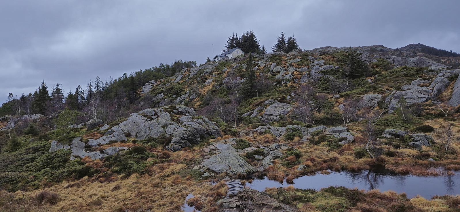
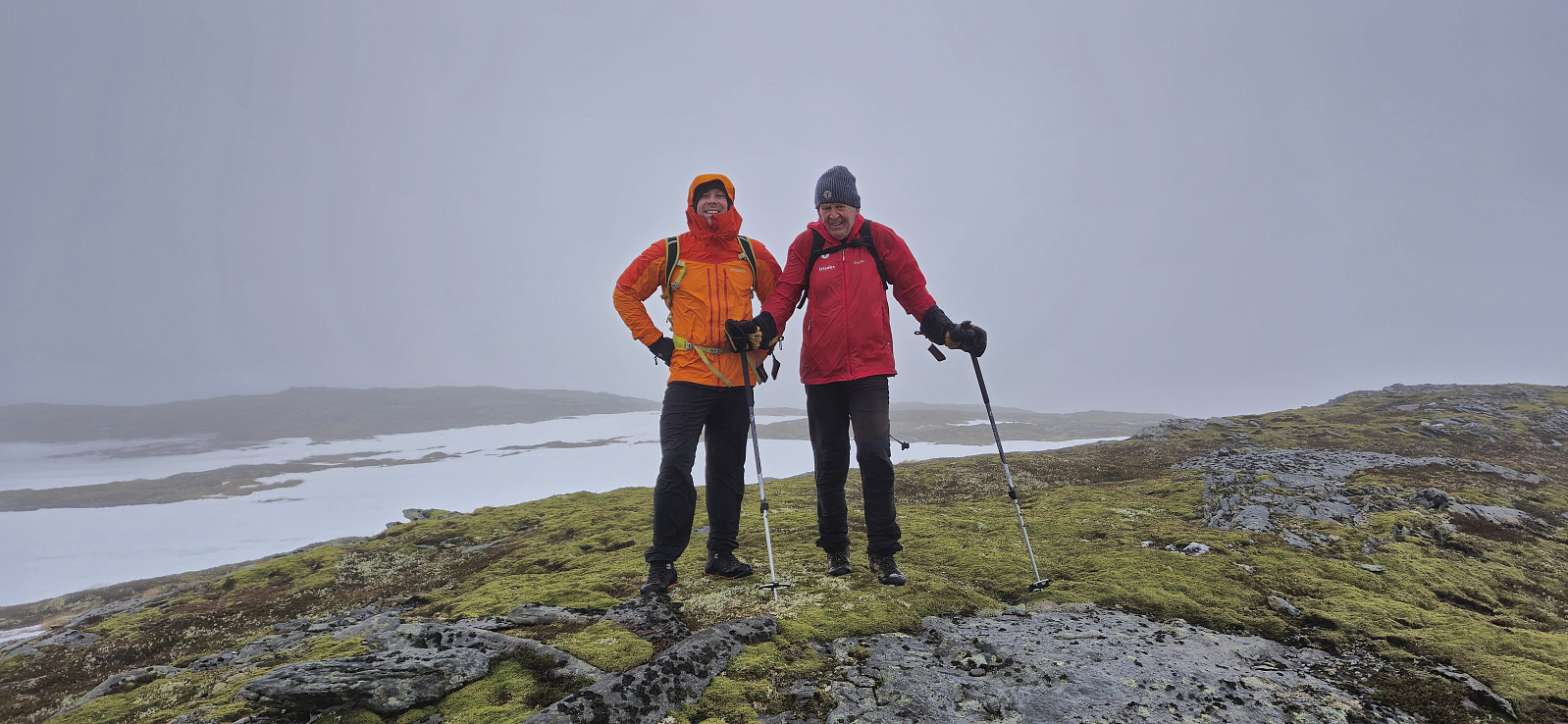 After three days on the couch due to a bad cold, I recovered just in time for a short Saturday hike to Morkafjellet with Petter and Endre . Petter picked me up at my place at 08:00 and we met up with Endre at the surprisingly large parking lot at Verpelstad a bit more than an hour later.
Thanks to an external report we easily located the unmarked trailhead behind the houses just northeast of the parking lot and from there followed a partially marked trail all the way to Verpelstadstølen (except for doing our own "shortcut" just below the cabin when briefly losing the trail, see the return track for the correct route).
From Verpelstadstølen there was a weaker trail up the first steep slope but soon we were simply making our own way towards the summit. There were several large patches of snow that had to be crossed but there was significantly less snow than expected for the middle of >>>
After three days on the couch due to a bad cold, I recovered just in time for a short Saturday hike to Morkafjellet with Petter and Endre . Petter picked me up at my place at 08:00 and we met up with Endre at the surprisingly large parking lot at Verpelstad a bit more than an hour later.
Thanks to an external report we easily located the unmarked trailhead behind the houses just northeast of the parking lot and from there followed a partially marked trail all the way to Verpelstadstølen (except for doing our own "shortcut" just below the cabin when briefly losing the trail, see the return track for the correct route).
From Verpelstadstølen there was a weaker trail up the first steep slope but soon we were simply making our own way towards the summit. There were several large patches of snow that had to be crossed but there was significantly less snow than expected for the middle of >>>
Kubrekka from Nedre Sandven
- Date:
- 11.01.2025
- Characteristic:
- Hillwalk
- Duration:
- 1:52h
- Distance:
- 4.8km
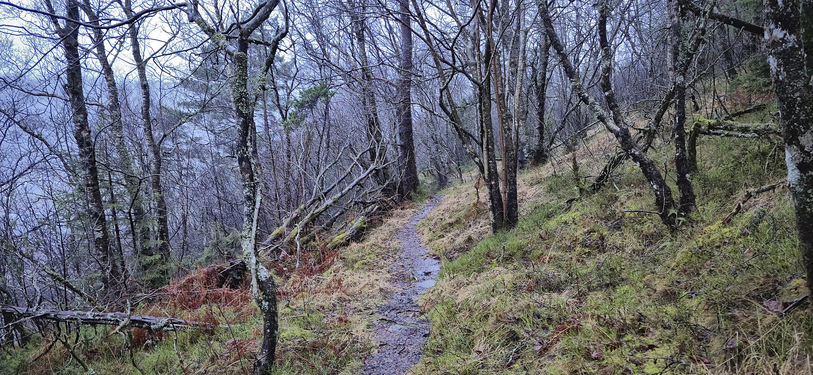
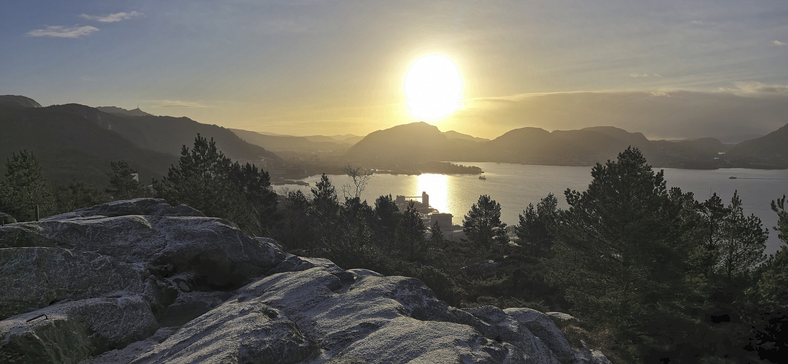
 When my initial plan to ski across Vidden was cancelled after seeing a picture of how little snow was left at Rundemanen , I instead went for yet another minor peak on the Alle topper i Bergen list , namely Kubrekka . I started from the bus stop at Nedre Sandven and from there followed the snow-covered gravel road north until being less than 200 meters from the summit. I then put on the gaiters and headed off-trail towards the summit in knee-deep snow. As I got closer to the summit the deep snow was replaced by a dense forest of spruce trees with tons of dry branches trying to block the way. The summit itself had no views and is generally of no interest to normal hikers. I returned the same way and then took the bus back home from Øvre Sandven.
Søyleåsen and Storeklubben
- Date:
- 04.01.2025
- Characteristic:
- Hillwalk
- Duration:
- 1:39h
- Distance:
- 5.0km
 A short winter adventure in Arna to ascend two recently added peaks on the Alle topper i Bergen list . I got off the bus at "Haukeland sør" and after a short walk south along the main road I started my ascent to Søyleåsen , first along the road up to the house south of the summit and then off-trail in knee-deep snow to the highest point. No views from the summit but a nice view across Søylevatnet could be obtained further south.
I followed my footprints back to the main road and then headed east to Eikeli and Storeklubben . The area on the west side of the road north of the houses was blocked by an electric fence and I therefore continued another 200 meters before beginning my off-trail ascent, also here in deep snow. The summit was easily reached and was thankfully just outside the fenced area. Limited views and I quickly returned >>>
A short winter adventure in Arna to ascend two recently added peaks on the Alle topper i Bergen list . I got off the bus at "Haukeland sør" and after a short walk south along the main road I started my ascent to Søyleåsen , first along the road up to the house south of the summit and then off-trail in knee-deep snow to the highest point. No views from the summit but a nice view across Søylevatnet could be obtained further south.
I followed my footprints back to the main road and then headed east to Eikeli and Storeklubben . The area on the west side of the road north of the houses was blocked by an electric fence and I therefore continued another 200 meters before beginning my off-trail ascent, also here in deep snow. The summit was easily reached and was thankfully just outside the fenced area. Limited views and I quickly returned >>>
Stemmesegga from Haus terminal
- Date:
- 30.12.2024
- Characteristic:
- Hillwalk
- Duration:
- 3:21h
- Distance:
- 10.2km
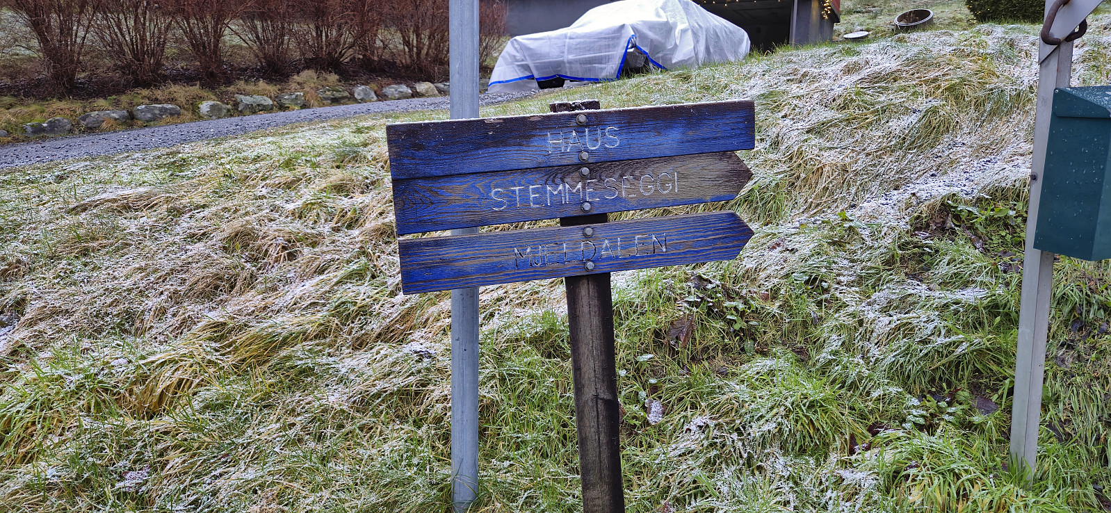 A revisit of Stemmesegga at Osterøy for the same reason as my recent revisit of Liafjellet , i.e. to make sure that I had in fact visited the highest point. I started from Haus bus terminal and from there took the steep shortcut via Nedre Verkane to Verkane before following the road up to the marked trailhead. The wet trail was largely covered by snow and thus most likely more difficult to spot than usual. I still managed to ascend to the summit area without too much trouble. The highest point was easily located around 140 meters north of the large cairn, a location I do not remember passing by on my previous visit. After a couple of pictures I descended southeast to Mjelddalen, where the final stretch took longer than expected due lots of traces of recent logging activity. I therefore did not make the planned bus and instead extended the hike >>>
Søre Midtfjellet and Skredderdalen
- Date:
- 29.12.2024
- Characteristic:
- Hillwalk
- Duration:
- 1:50h
- Distance:
- 7.7km
 Sunday hike from Starefossen to Munkebotn via Søre Midtfjellet and Skredderdalen. Made it to Fjellveien before it started raining.
Seimsheia from Arna stasjon
- Date:
- 28.12.2024
- Characteristic:
- Hillwalk
- Duration:
- 1:03h
- Distance:
- 4.8km
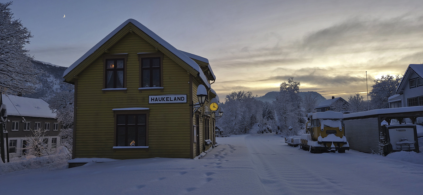
 Yesterday I noticed that five additional minor peaks had been added to the Alle topper i Bergen list . Just what I needed to generate the required motivation for a hike on yet another gray and wet day during my Christmas holiday. I settled on Seimsheia and started by taking the train to Arna from where I followed the roads until getting close to the summit. For the final 200 meters I followed various trails and thus arrived at the summit without any issues. The summit area showed signs of human activity including several swings and a plastic shelter but did not provide any views. From the summit I followed a wet trail to the road to the west and proceeded to follow the roads back to the train station . On the way I also made a short stop at the old train station . More information about the old station (in Norwegian) can be found here .
Engjeviksrinden and Høghaugen
- Date:
- 26.12.2024
- Characteristic:
- Hillwalk
- Duration:
- 1:28h
- Distance:
- 4.9km
 On Christmas Day I discovered that a total of eight new minor peaks had been added to the Alle topper i Bergen list during Christmas Eve. Perfect for exploration during a gray and wet Christmas holiday. I decided to start with the two new peaks east of Bahus and after a short walk along Engevikvegen, I left the road and completed the short final off-trail ascent to the summit of Engjeviksrinden . There were plenty of deer tracks and the highest point was thus easily reached. The limited views however made for a short visit.
I returned to the road via a more direct route and immediately started the ascent to Høghaugen via various deer tracks that took me almost all the way to the summit. Here there were at least three competing highest points, hence I simply visited all of them. Limited views here as well, although the low-hanging clouds >>>
On Christmas Day I discovered that a total of eight new minor peaks had been added to the Alle topper i Bergen list during Christmas Eve. Perfect for exploration during a gray and wet Christmas holiday. I decided to start with the two new peaks east of Bahus and after a short walk along Engevikvegen, I left the road and completed the short final off-trail ascent to the summit of Engjeviksrinden . There were plenty of deer tracks and the highest point was thus easily reached. The limited views however made for a short visit.
I returned to the road via a more direct route and immediately started the ascent to Høghaugen via various deer tracks that took me almost all the way to the summit. Here there were at least three competing highest points, hence I simply visited all of them. Limited views here as well, although the low-hanging clouds >>>
Liafjellet and Havrheia
- Date:
- 23.12.2024
- Characteristic:
- Hillwalk
- Duration:
- 1:47h
- Distance:
- 5.5km
 A revisit of Liafjellet in Os due to the summit recently having been correctly moved around 70 meter east from the large cairn to a small hill right next to the trail that is about 2 meters higher. The exact highest point was not straightforward to identify due to the relatively dense vegetation but at least the summit area was easy to get to. After visiting the most likely summit locations I continued to the large cairn before doubling back and starting my descent via the small hill Havrheia . Note that while the map does not indicate a trail across Havrheia, I was in fact on a trail the whole time, and at the end connected with the gravel road down to Ytre Moberg. From there I followed the roads to Osøyro for the bus back to Bergen.
Ørneberget and Rognåsen
- Date:
- 20.12.2024
- Characteristic:
- Hillwalk
- Duration:
- 1:40h
- Distance:
- 6.2km
 Short local hike on the first day of my extended Christmas holiday.
Vågahovda
- Date:
- 08.12.2024
- Characteristic:
- Hillwalk
- Duration:
- 1:02h
- Distance:
- 1.8km
 After our ascent of Røyrfjellet Øst , Petter and I drove south to Bjørnafjorden for a visit of Vågahovda - a recent addition to the Bjørnafjorden ≥ 100m pf. list with no previously reported ascents. We found parking at the start of Austefjordvegen just southeast of the summit and after crossing the main road we began our ascent.
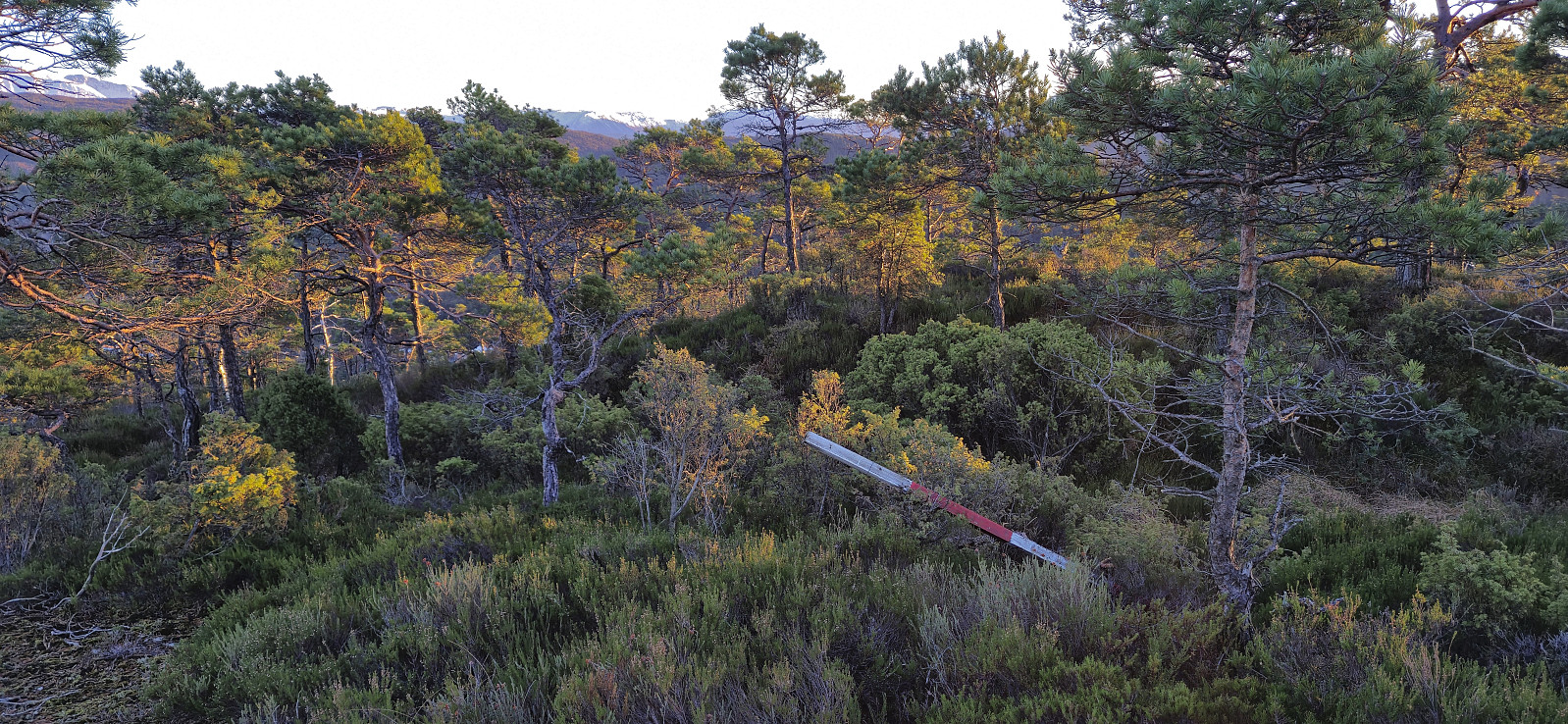
No trails but there were plenty of deer tracks making the progress relatively straightforward. On our way to the highest point we made a short detour to where Vågahovda was indicated on the map. Here we came across a fallen trig marker. From there we completed the rest of the distance to the summit, or rather summits, as there were at least two options. There is also a third option about 100 meters to the west, however the lidar data indicates that this point is around 20 cm lower (but may still be worth a visit due to potentially better views?). >>>
After our ascent of Røyrfjellet Øst , Petter and I drove south to Bjørnafjorden for a visit of Vågahovda - a recent addition to the Bjørnafjorden ≥ 100m pf. list with no previously reported ascents. We found parking at the start of Austefjordvegen just southeast of the summit and after crossing the main road we began our ascent.
No trails but there were plenty of deer tracks making the progress relatively straightforward. On our way to the highest point we made a short detour to where Vågahovda was indicated on the map. Here we came across a fallen trig marker. From there we completed the rest of the distance to the summit, or rather summits, as there were at least two options. There is also a third option about 100 meters to the west, however the lidar data indicates that this point is around 20 cm lower (but may still be worth a visit due to potentially better views?). >>>
