Archive - Date
Archive - Activity
-
Bike trip (110)
- Bike trip - mixed (25)
- Bike trip - road (85)
-
Drive (9)
- Car drive (9)
-
Other trip (3)
- Kayaking (3)
-
Ski trip (116)
- Backcountry skiing (69)
- Cross-country skiing (47)
- Trip by foot (1884)
Collected lists
-
Utvalgte topper og turmål i Bergen
(348/349)
 99%
99% -
Alle topper i Bergen
(391/398)
98%
-
Voss ≥ 100m pf.
(96/98)
97%
-
Opptur Hordaland
(144/159)
90%
-
Stasjoner på Bergensbanen
(33/40)
82%
-
Ulvik ≥ 100m pf.
(28/38)
73%
-
Hordaland ≥ 100m pf.
(622/863)
72%
-
Mjølfjell PF > 100m
(21/31)
67%
-
Jondal ≥ 100m pf.
(15/23)
65%
-
Dagsturhyttene i Vestland
(36/61)
59%
-
Sunnhordland PF >= 100m
(105/186)
56%
-
Hordaland: Hardanger PF>=100m
(194/359)
54%
-
DNT-hytter i Hordaland
(23/45)
51%
-
Kvinnherad ≥ 100m pf.
(40/79)
50%
-
Eidfjord ≥ 100m pf.
(13/42)
30%
-
Sogndal ≥ 100m pf.
(23/81)
28%
-
Gulen ≥ 100m pf.
(15/54)
27%
-
Vik i Sogn ≥ 100m pf.
(10/46)
21%
-
Sogn - Sør for Sognefjorden PF>=100m
(31/159)
19%
-
DNT-hytter i Sogn og Fjordane
(8/47)
17%

Reinskarnuten from Ørneberget
- Date:
- 12.10.2025
- Characteristic:
- Hillwalk
- Duration:
- 9:09h
- Distance:
- 26.3km
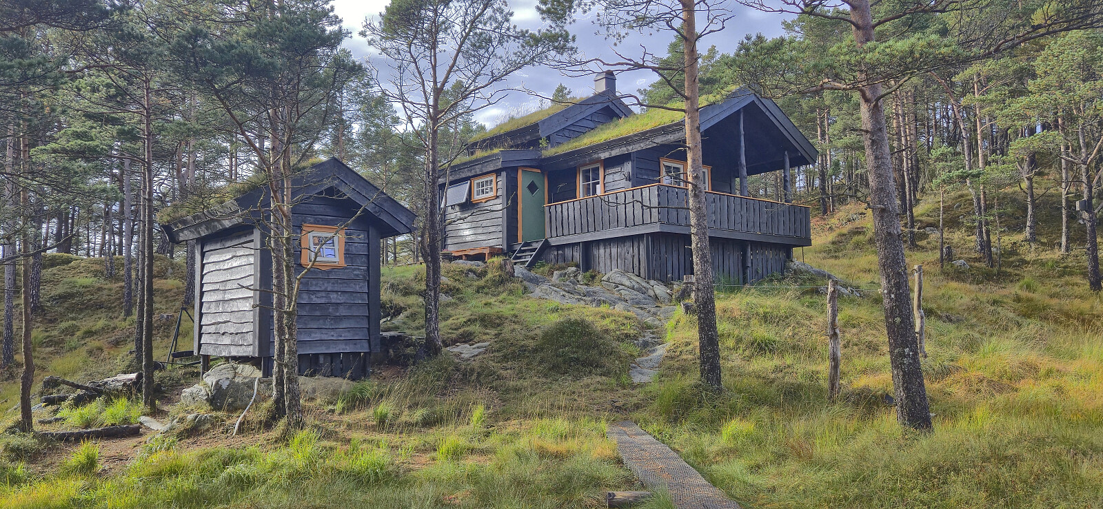
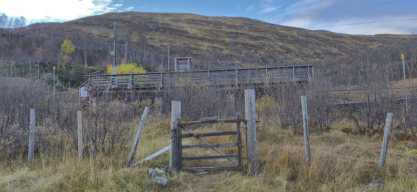 I caught the first local train from Bergen to Ørneberget and was ready to start hiking shortly after nine. The trail from the train station down to Mjølfjell Ungdomsherberge had probably seen better days but did not present any challenges. I also made sure to have a quick look at Katteli , a cabin I had visited over three decades ago when being a pupil at Bergen Katedralskole.
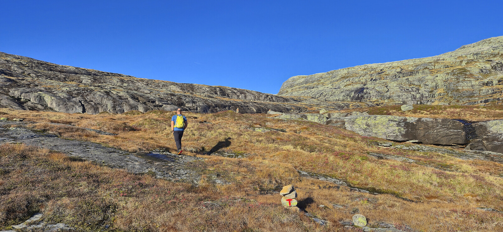
Next, I followed the gravel road south to Slondalsvatnet from where I continued via a trail along the lake to Slondal and to Brauåni as the sun was rising. South of Brauåni I started on what the signs called Fagerdalsrunden before later leaving this route at Kvitli. Here I crossed the stream via a small bridge and continued on a weak trail marked by cairns (although there probably could have been a couple more) up to Kvannjolevatnet.
In order to continue the ascent from Kvannjolevatnet, >>>
I caught the first local train from Bergen to Ørneberget and was ready to start hiking shortly after nine. The trail from the train station down to Mjølfjell Ungdomsherberge had probably seen better days but did not present any challenges. I also made sure to have a quick look at Katteli , a cabin I had visited over three decades ago when being a pupil at Bergen Katedralskole.
Next, I followed the gravel road south to Slondalsvatnet from where I continued via a trail along the lake to Slondal and to Brauåni as the sun was rising. South of Brauåni I started on what the signs called Fagerdalsrunden before later leaving this route at Kvitli. Here I crossed the stream via a small bridge and continued on a weak trail marked by cairns (although there probably could have been a couple more) up to Kvannjolevatnet.
In order to continue the ascent from Kvannjolevatnet, >>>
Five summits north of Brekkedalen
- Date:
- 05.10.2025
- Characteristic:
- Hillwalk
- Duration:
- 7:45h
- Distance:
- 22.8km
 For the second weekend in a row , Endre picked me up at my place in Lønborg shortly after 07:00 for a drive to Voss. This time we however continued northeast to Stalheim and Brekkedalen. Along the way we saw lots of traces of Amy - the storm that had passed over Hordaland the night before, and even had to avoid a wire stretched halfway across the road in order to get to Stalheim Hotel, but thankfully the trees that had blocked the road had already been removed.
After paying the 50 kr toll at the start of Brekkedalsvegen we drove up to Tverraldskaret. Here we parked the car next to the road and then followed the gravel road back down to Kinnarbakken and onwards to Vikset.
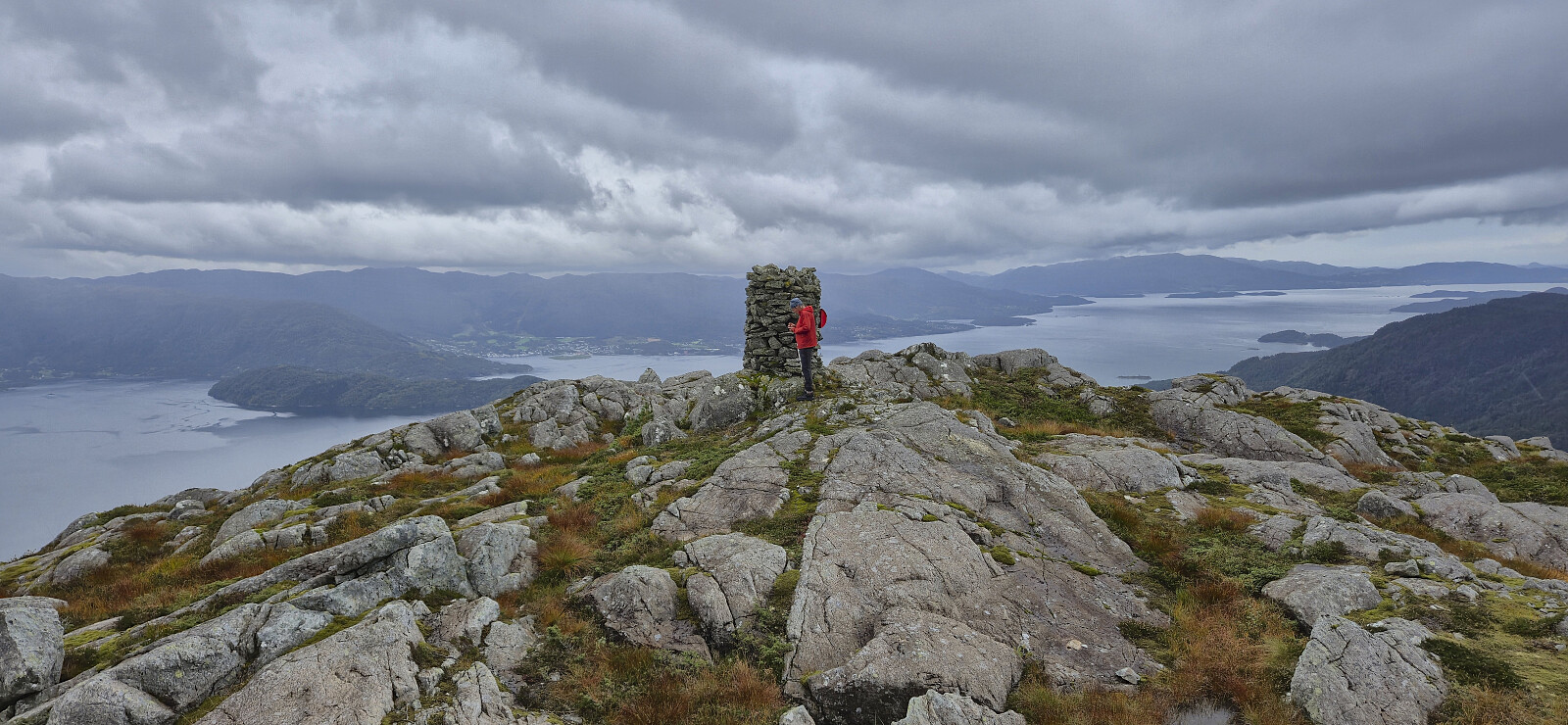
From Vikset we followed an unmarked, and at times quite weak (we lost it a couple of times), trail up to Viksetskaret. Here we turned west and headed off-trail to the summit of Solheimsfjellet , which provided excellent >>>
For the second weekend in a row , Endre picked me up at my place in Lønborg shortly after 07:00 for a drive to Voss. This time we however continued northeast to Stalheim and Brekkedalen. Along the way we saw lots of traces of Amy - the storm that had passed over Hordaland the night before, and even had to avoid a wire stretched halfway across the road in order to get to Stalheim Hotel, but thankfully the trees that had blocked the road had already been removed.
After paying the 50 kr toll at the start of Brekkedalsvegen we drove up to Tverraldskaret. Here we parked the car next to the road and then followed the gravel road back down to Kinnarbakken and onwards to Vikset.
From Vikset we followed an unmarked, and at times quite weak (we lost it a couple of times), trail up to Viksetskaret. Here we turned west and headed off-trail to the summit of Solheimsfjellet , which provided excellent >>>
Ørneberget NV and Furukammen
- Date:
- 30.09.2025
- Characteristic:
- Hillwalk
- Duration:
- 0:48h
- Distance:
- 3.4km
 Short local hike after work.
Herdabreida and Kistenuten from Øyaset
- Date:
- 27.09.2025
- Characteristic:
- Hillwalk
- Duration:
- 5:09h
- Distance:
- 11.8km
 After our ascent of Eggjane , we drove the short distance southeast to Øyaset where we found parking next to the road. Note that the use of the gravel road from Rong to Øyaset requires you to pay a fee of 50 kr. This can be paid by Vipps, however there was no cell phone reception at the start of the gavel road nor at Øyaset, and we therefore did not manage to pay until halfway up the first ascent.
Our initial plan had been to ascend off-trail on the westside of Kaldåni, but after easily crossing the small river from Furevatnet we got a better look at the terrain and decided to abandon that idea. Briefly we considered following the dry Kaldåni but quickly gave up on that idea as well and instead started on a trail east of it. This turned out to be a very good choice as this trail would take us all the way to the top of the steep gorge made by the river >>>
After our ascent of Eggjane , we drove the short distance southeast to Øyaset where we found parking next to the road. Note that the use of the gravel road from Rong to Øyaset requires you to pay a fee of 50 kr. This can be paid by Vipps, however there was no cell phone reception at the start of the gavel road nor at Øyaset, and we therefore did not manage to pay until halfway up the first ascent.
Our initial plan had been to ascend off-trail on the westside of Kaldåni, but after easily crossing the small river from Furevatnet we got a better look at the terrain and decided to abandon that idea. Briefly we considered following the dry Kaldåni but quickly gave up on that idea as well and instead started on a trail east of it. This turned out to be a very good choice as this trail would take us all the way to the top of the steep gorge made by the river >>>
Eggjane via Kulset
- Date:
- 27.09.2025
- Characteristic:
- Hillwalk
- Duration:
- 3:40h
- Distance:
- 11.7km
 Endre picked me up at my place shortly after 07:00 and together we drove to Voss and Bordalen where we parked at Nyestølen p-plass .
The original plan had been to continue all the way to Kulset, but due to a locked gate at the start of the gravel road , we had to do the extra 200 vertical meters on foot. This was however straightforward and it did not take long before we could begin on the marked trail to Horgaholet. Here we left the trail and continued off-trail to the top of Eggjane . Excellent panoramic views from the summit, however a strong cold wind resulted in short stay before returning the same way. In summary, a nice hike, largely along a marked trail, which can be highly recommended.
Back in the car, we drove the short distance southeast to Øyaset to ascend Herdabreida and Kistenuten .
Endre picked me up at my place shortly after 07:00 and together we drove to Voss and Bordalen where we parked at Nyestølen p-plass .
The original plan had been to continue all the way to Kulset, but due to a locked gate at the start of the gravel road , we had to do the extra 200 vertical meters on foot. This was however straightforward and it did not take long before we could begin on the marked trail to Horgaholet. Here we left the trail and continued off-trail to the top of Eggjane . Excellent panoramic views from the summit, however a strong cold wind resulted in short stay before returning the same way. In summary, a nice hike, largely along a marked trail, which can be highly recommended.
Back in the car, we drove the short distance southeast to Øyaset to ascend Herdabreida and Kistenuten .
Kampestølsrusta, Giskanuten and Nordvest for Jonåsen
- Date:
- 20.09.2025
- Characteristic:
- Hillwalk
- Duration:
- 4:15h
- Distance:
- 11.1km
 After ascending Holmedalsfjellet , Petter and I drove the short distance north to Tveitedalen p-plass . Here we left the car behind and continued on a gravel road on the east side of Bakkastølsvatnet. After crossing a bridge north of the lake we then made our way off-trail towards the summit of Kampestølsrusta , following deer tracks whenever these seem to head in the wanted direction.
Except for one steepish section that required a bit of easy route-finding, we had no real challenges getting up to the ridge which we then proceeded to follow via several false summits to arrive at the highest point. We did not stay long before descending the same way and then followed a road used for skiing that took us to the bridge on the west side of Bakkastølsvatnet. Petter than returned to the car, while I started my off-trail ascent to Giskanuten , a summit he had already visited >>>
After ascending Holmedalsfjellet , Petter and I drove the short distance north to Tveitedalen p-plass . Here we left the car behind and continued on a gravel road on the east side of Bakkastølsvatnet. After crossing a bridge north of the lake we then made our way off-trail towards the summit of Kampestølsrusta , following deer tracks whenever these seem to head in the wanted direction.
Except for one steepish section that required a bit of easy route-finding, we had no real challenges getting up to the ridge which we then proceeded to follow via several false summits to arrive at the highest point. We did not stay long before descending the same way and then followed a road used for skiing that took us to the bridge on the west side of Bakkastølsvatnet. Petter than returned to the car, while I started my off-trail ascent to Giskanuten , a summit he had already visited >>>
Holmedalsfjellet from Holmedal
- Date:
- 20.09.2025
- Characteristic:
- Hillwalk
- Duration:
- 1:53h
- Distance:
- 5.5km
 I was picked up by Petter at my place at 07:15 for the drive to Gjermundshamn and the 09:00-ferry to Årsnes. After another hour of driving we arrived at Holmedal to start our ascent of Holmedalsfjellet . There were no proper parking spaces but after talking to some of the locals we were allowed to park more or less at the start of a tractor road which would take us most of the way to the summit.
To our surprise, the tractor road, and the later trail, was marked with red T's, although most of the markers were very faded and often difficult to spot. When the tractor road later came to an end, we continued on a weak and wet trail that took us to a second tractor road which we then follow until it turned into a trail that, although rather weak, could be followed all the way to the summit.
There was a large cairn near >>>
I was picked up by Petter at my place at 07:15 for the drive to Gjermundshamn and the 09:00-ferry to Årsnes. After another hour of driving we arrived at Holmedal to start our ascent of Holmedalsfjellet . There were no proper parking spaces but after talking to some of the locals we were allowed to park more or less at the start of a tractor road which would take us most of the way to the summit.
To our surprise, the tractor road, and the later trail, was marked with red T's, although most of the markers were very faded and often difficult to spot. When the tractor road later came to an end, we continued on a weak and wet trail that took us to a second tractor road which we then follow until it turned into a trail that, although rather weak, could be followed all the way to the summit.
There was a large cairn near >>>
Ørneberget and Furukammen
- Date:
- 17.09.2025
- Characteristic:
- Hillwalk
- Duration:
- 0:55h
- Distance:
- 3.8km
 Local evening hike.
Vetlafjellet via Stalheim
- Date:
- 13.09.2025
- Characteristic:
- Hillwalk
- Duration:
- 6:00h
- Distance:
- 25.8km
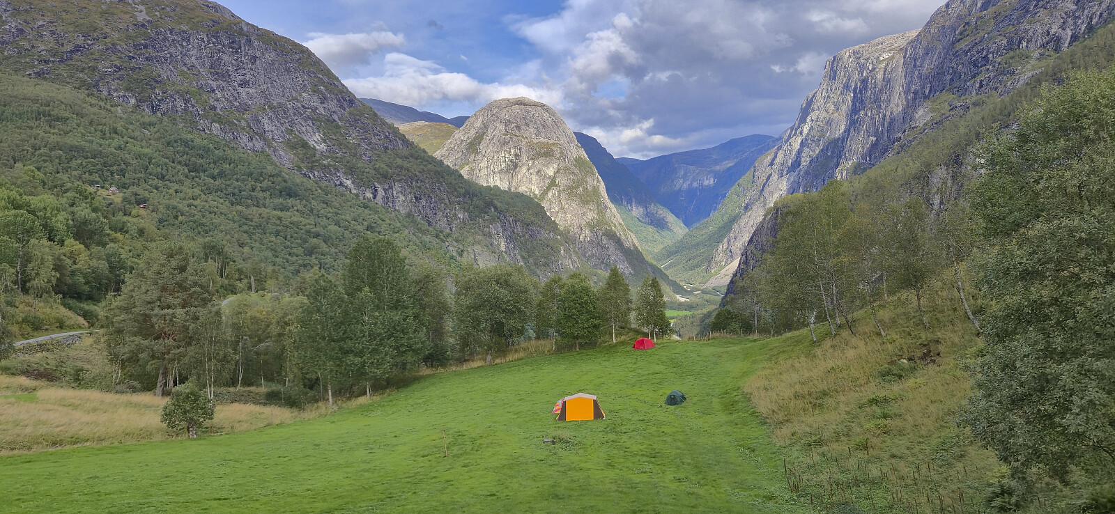 After taking the train to Voss I continued by bus to Stalheim. Usually, the bus stops outside Stalheim Hotel but due to an event filling up the large parking lot outside the hotel, which the buses need to be able to return to the main road, I had to get off at the start of Stalheimsvegen instead. This did not make much of a difference though and I quickly covered the extra distance along the paved road before starting on the gravel road up Brekkedalen. (Note that if coming by car there is a 100 kr toll that can be paid by Vipps.)
The long walk up to Tverraldskaret was less boring than expected, largely thanks to the excellent views along the way, and while I did not meet any other hikers there were lots of sheep and cows around, in addition to farmers in the process of gathering their sheep before the winter. >>>
After taking the train to Voss I continued by bus to Stalheim. Usually, the bus stops outside Stalheim Hotel but due to an event filling up the large parking lot outside the hotel, which the buses need to be able to return to the main road, I had to get off at the start of Stalheimsvegen instead. This did not make much of a difference though and I quickly covered the extra distance along the paved road before starting on the gravel road up Brekkedalen. (Note that if coming by car there is a 100 kr toll that can be paid by Vipps.)
The long walk up to Tverraldskaret was less boring than expected, largely thanks to the excellent views along the way, and while I did not meet any other hikers there were lots of sheep and cows around, in addition to farmers in the process of gathering their sheep before the winter. >>>
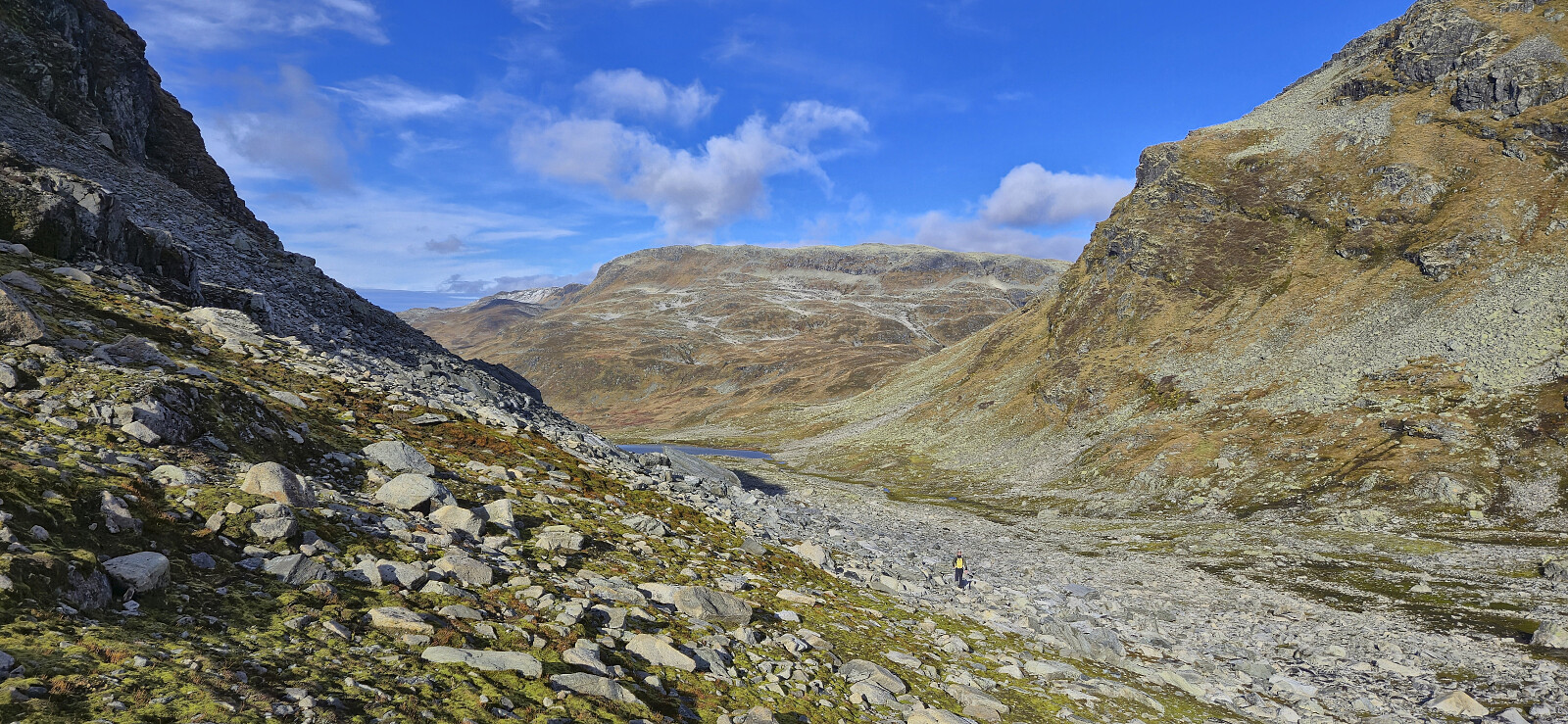
Austdalsnuten
- Date:
- 07.09.2025
- Characteristic:
- Hillwalk
- Duration:
- 8:46h
- Distance:
- 17.5km
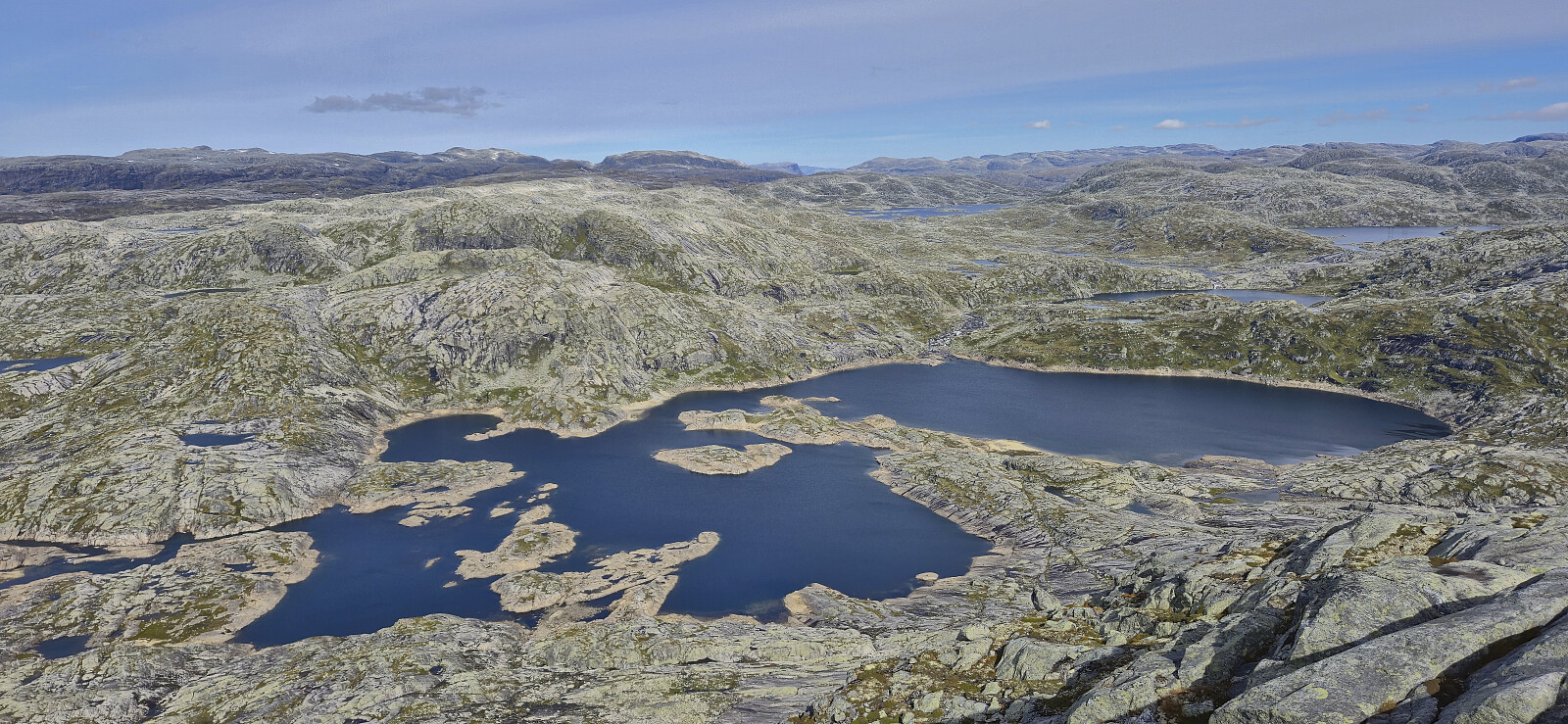 Sunday hike to Austdalsnuten organized by Voss Utferdslag . After catching a very early train from Bergen, I caught up with the other hikers at Voss shortly before 08:00 for the roughly 1.5-hour bus ride to Austdalsvatnet. When getting off the bus we were at over 1000 meters above sea level and only 1.3 km from the summit, but given the terrain, including Austdalsvatnet blocking our way, we had to do a rather long detour before starting the real ascent from the south.
On our way to the smaller lakes south of Austdalsnuten we partly followed a route used by the local farmers when transporting their sheep to their summer grazing areas. There were even small cairns showing the way but these were not always easy to spot and we thus made good use of our local guide. The clue seemed to be to be patient and ascend high enough >>>
Sunday hike to Austdalsnuten organized by Voss Utferdslag . After catching a very early train from Bergen, I caught up with the other hikers at Voss shortly before 08:00 for the roughly 1.5-hour bus ride to Austdalsvatnet. When getting off the bus we were at over 1000 meters above sea level and only 1.3 km from the summit, but given the terrain, including Austdalsvatnet blocking our way, we had to do a rather long detour before starting the real ascent from the south.
On our way to the smaller lakes south of Austdalsnuten we partly followed a route used by the local farmers when transporting their sheep to their summer grazing areas. There were even small cairns showing the way but these were not always easy to spot and we thus made good use of our local guide. The clue seemed to be to be patient and ascend high enough >>>
