Archive - Date
Archive - Activity
-
Bike trip (110)
- Bike trip - mixed (25)
- Bike trip - road (85)
-
Drive (9)
- Car drive (9)
-
Other trip (3)
- Kayaking (3)
-
Ski trip (116)
- Backcountry skiing (69)
- Cross-country skiing (47)
- Trip by foot (1893)
Collected lists
-
Utvalgte topper og turmål i Bergen
(349/350)
 99%
99% -
Alle topper i Bergen
(393/398)
98%
-
Voss ≥ 100m pf.
(96/98)
97%
-
Opptur Hordaland
(144/159)
90%
-
Stasjoner på Bergensbanen
(33/40)
82%
-
Ulvik ≥ 100m pf.
(28/38)
73%
-
Hordaland ≥ 100m pf.
(622/863)
72%
-
Mjølfjell PF > 100m
(21/31)
67%
-
Jondal ≥ 100m pf.
(15/23)
65%
-
Dagsturhyttene i Vestland
(36/61)
59%
-
Sunnhordland PF >= 100m
(105/186)
56%
-
Hordaland: Hardanger PF>=100m
(194/359)
54%
-
DNT-hytter i Hordaland
(23/45)
51%
-
Kvinnherad ≥ 100m pf.
(40/79)
50%
-
Eidfjord ≥ 100m pf.
(13/42)
30%
-
Sogndal ≥ 100m pf.
(23/81)
28%
-
Gulen ≥ 100m pf.
(15/54)
27%
-
Vik i Sogn ≥ 100m pf.
(10/46)
21%
-
Sogn - Sør for Sognefjorden PF>=100m
(31/159)
19%
-
DNT-hytter i Sogn og Fjordane
(8/47)
17%

Åsen i Samdalen
- Date:
- 29.07.2025
- Characteristic:
- Hillwalk
- Duration:
- 2:17h
- Distance:
- 6.5km
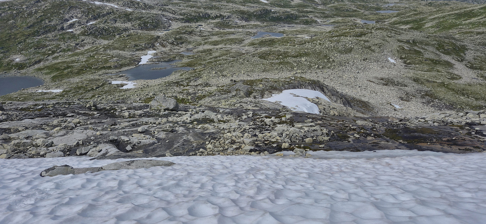
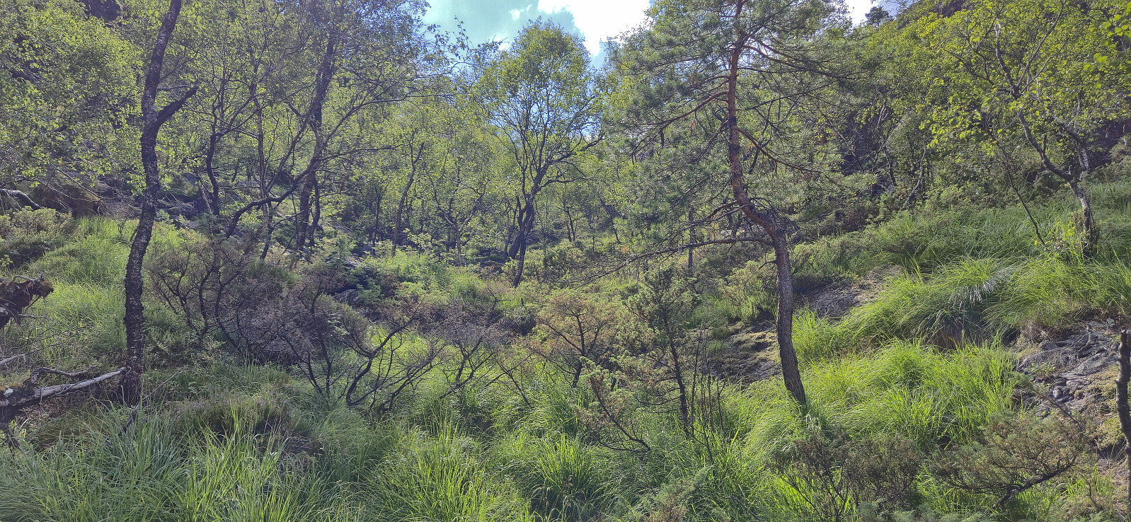 For my ascent of Åsen I took inspiration from one of Helwig 's three visits and made an attempt to replicate their steep ascent from the north . After getting off the bus at the last stop in Hausdalen, I walked the short distance along the gravel road for an easy crossing of the river, skipping the unstable bridge and instead using a couple of steeping stones to easily cross to the other side without getting my shoes wet.
When approaching the steep ascent I noticed that it seemed to mainly consist of small and large rocks. This was fine at first but when the steepness increased, I started wondering about the stability and moved to the left. Here I came across a weak trail/animal track that avoided most of the rocks and actually resulted in a relatively easy ascent.
The terrain soon became much less steep and I continued southwest until >>>
For my ascent of Åsen I took inspiration from one of Helwig 's three visits and made an attempt to replicate their steep ascent from the north . After getting off the bus at the last stop in Hausdalen, I walked the short distance along the gravel road for an easy crossing of the river, skipping the unstable bridge and instead using a couple of steeping stones to easily cross to the other side without getting my shoes wet.
When approaching the steep ascent I noticed that it seemed to mainly consist of small and large rocks. This was fine at first but when the steepness increased, I started wondering about the stability and moved to the left. Here I came across a weak trail/animal track that avoided most of the rocks and actually resulted in a relatively easy ascent.
The terrain soon became much less steep and I continued southwest until >>>
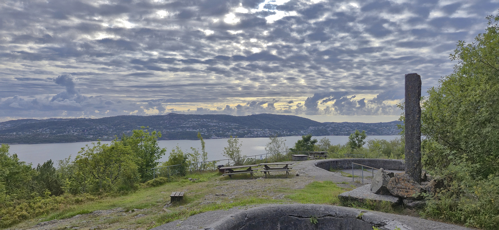
Across Hellen festning
- Date:
- 28.07.2025
- Characteristic:
- Hike
- Duration:
- 0:45h
- Distance:
- 3.6km
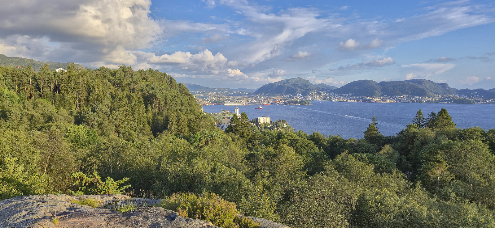 Short local evening hike.
Hyvingen, Grånakken and Giljafjell from Ålvik
- Date:
- 27.07.2025
- Characteristic:
- Hillwalk
- Duration:
- 7:48h
- Distance:
- 24.4km
 Started by taking the train to Voss and from there continued by bus to Ålvik. Here I easily located the marked trailhead and proceeded to follow the marked trail towards Roaldsdalen. The first part was quite steep and potentially difficult if wet or icy, although there were rope-based railings for extra safety. No need for these today though. As I continued north at the first forking of the trail at Krossfuru, the terrain turned much less steep and I could enjoy a nice walk along Dalselvi until the trail forked again and began winding its way up to Oskarborg and Toppen.
The trail to Oskarborg was often rather weak, especially at this time of the year when partially hidden by the tall grasses, however, with a few exceptions, the red markers were easy to follow. For extra safety, given that the trail >>>
Started by taking the train to Voss and from there continued by bus to Ålvik. Here I easily located the marked trailhead and proceeded to follow the marked trail towards Roaldsdalen. The first part was quite steep and potentially difficult if wet or icy, although there were rope-based railings for extra safety. No need for these today though. As I continued north at the first forking of the trail at Krossfuru, the terrain turned much less steep and I could enjoy a nice walk along Dalselvi until the trail forked again and began winding its way up to Oskarborg and Toppen.
The trail to Oskarborg was often rather weak, especially at this time of the year when partially hidden by the tall grasses, however, with a few exceptions, the red markers were easy to follow. For extra safety, given that the trail >>>
Across Hellen festning
- Date:
- 26.07.2025
- Characteristic:
- Hike
- Duration:
- 0:39h
- Distance:
- 3.2km
 Short local Saturday hike after spending all of Friday hiking at Hallingskeid .
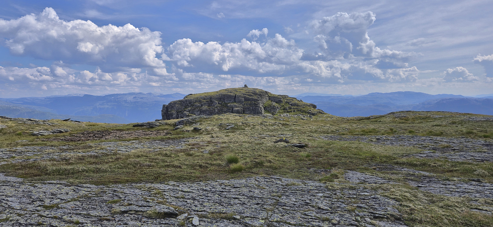
Vestre Låghellerhøgdene, Storhaugane and Søre Grøndalsnuten
- Date:
- 25.07.2025
- Characteristic:
- Hillwalk
- Duration:
- 7:08h
- Distance:
- 23.0km
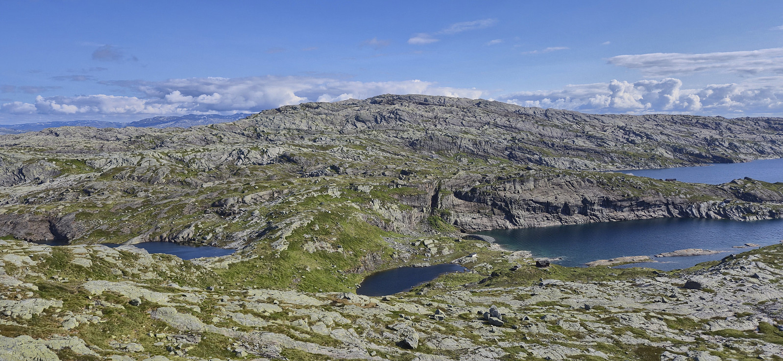
 After getting off the train at Hallingskeid , I continued southeast along Rallarvegen with the goal to cross the river via a bridge between Låghellervatnet and Høghellervatnet that I had spotted on the map. However, upon arriving it became clear that this crossing was not going to happen. All that was left of the bridge were the two supporting wires. There was nothing to do but continue east to find another place to cross.
North of Låghellerbotnen I left the gravel road and after fording a small stream I could finally start my ascent to Vestre Låghellerhøgdene . The off-trail ascent to the summit was straightforward. I made sure to visit both competing highest points, with the eastern one being ever so slightly higher (maybe only 1 cm?) while the western one contained the remains of a fallen down trig marker.
I turned my attention >>>
After getting off the train at Hallingskeid , I continued southeast along Rallarvegen with the goal to cross the river via a bridge between Låghellervatnet and Høghellervatnet that I had spotted on the map. However, upon arriving it became clear that this crossing was not going to happen. All that was left of the bridge were the two supporting wires. There was nothing to do but continue east to find another place to cross.
North of Låghellerbotnen I left the gravel road and after fording a small stream I could finally start my ascent to Vestre Låghellerhøgdene . The off-trail ascent to the summit was straightforward. I made sure to visit both competing highest points, with the eastern one being ever so slightly higher (maybe only 1 cm?) while the western one contained the remains of a fallen down trig marker.
I turned my attention >>>
Storsåta from Hjortlandsvegen
- Date:
- 24.07.2025
- Characteristic:
- Hillwalk
- Duration:
- 2:00h
- Distance:
- 6.5km
 Tried two alternative routes to/from Storsåta . The ascent route was ok but the trail was quite weak at times, while the descent route, except for the upper part, followed a much nicer trail. Maybe next time I'll instead go for the righthand option where the trail from Hjortlandsvegen forks early on.
Skora, Rustene and Straumsrinden
- Date:
- 23.07.2025
- Characteristic:
- Hillwalk
- Duration:
- 1:25h
- Distance:
- 4.9km
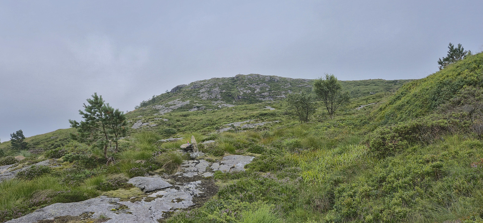
 With a weather forecast including potential afternoon thunderstorms, I decided to stay relatively local and at low altitude. The result was a return to Hausdalen for a visit of yet another minor peak on the Alle topper i Bergen list . After getting off the bus at "Samdal sag" I shortly continued north along the main road before following the tractor road to south towards Ulvvatnet.
Just before the bridge at the northwestern end of Ulvvatnet, I left the tractor road and followed a deer track across the stream to connect with an older tractor road took me very close to Skora . All that remained was a short off-trail ascent to the highest point.
I descended via various deer tracks until reconnecting with the old tractor road and then followed the same route back to the main road. With rolling thunder in the distance, >>>
With a weather forecast including potential afternoon thunderstorms, I decided to stay relatively local and at low altitude. The result was a return to Hausdalen for a visit of yet another minor peak on the Alle topper i Bergen list . After getting off the bus at "Samdal sag" I shortly continued north along the main road before following the tractor road to south towards Ulvvatnet.
Just before the bridge at the northwestern end of Ulvvatnet, I left the tractor road and followed a deer track across the stream to connect with an older tractor road took me very close to Skora . All that remained was a short off-trail ascent to the highest point.
I descended via various deer tracks until reconnecting with the old tractor road and then followed the same route back to the main road. With rolling thunder in the distance, >>>
Cycling: Fjellveien and Skansemyren
- Date:
- 22.07.2025
- Characteristic:
- Bike trip - road
- Duration:
- 1:19h
- Distance:
- 16.7km
 Short evening cycling trip after finally replacing the very old brake pads on my equally old bike.
Hellen festning and Furukammen
- Date:
- 21.07.2025
- Characteristic:
- Hike
- Duration:
- 1:07h
- Distance:
- 4.5km
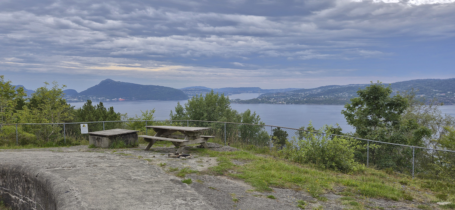 Short local evening hike.
Hovlandsskuten and Håfjellet from Skånevik
- Date:
- 20.07.2025
- Characteristic:
- Hillwalk
- Duration:
- 7:28h
- Distance:
- 19.2km
 After another early breakfast, I checked out of Skånevik Fjordhotel and left behind most of my luggage to be picked up at the end of the hike. I started following the road east before turning southeast and ascending Åsheimsvegen. When the gravel road forked west of Valdra I crossed Valdraelva via a bridge and continued on a tractor road until it came to an end near a couple of cabins close to Måsahaugen.
Just as I was about to start on the route taking me up to the uppermost cabin called Takhaug, I spotted the one thing that I'd rather not see just before setting out on a longer off-trail part of a hike: a viper slithering away to my left. Hoping that more were not hiding in the tall gras, I continued across a wet area before following the weak traces of a tractor road that seemed to be more used by ATVs.
When >>>
After another early breakfast, I checked out of Skånevik Fjordhotel and left behind most of my luggage to be picked up at the end of the hike. I started following the road east before turning southeast and ascending Åsheimsvegen. When the gravel road forked west of Valdra I crossed Valdraelva via a bridge and continued on a tractor road until it came to an end near a couple of cabins close to Måsahaugen.
Just as I was about to start on the route taking me up to the uppermost cabin called Takhaug, I spotted the one thing that I'd rather not see just before setting out on a longer off-trail part of a hike: a viper slithering away to my left. Hoping that more were not hiding in the tall gras, I continued across a wet area before following the weak traces of a tractor road that seemed to be more used by ATVs.
When >>>
