Archive - Date
Archive - Activity
-
Bike trip (96)
- Bike trip - mixed (21)
- Bike trip - road (75)
-
Drive (6)
- Car drive (6)
-
Other trip (2)
- Kayaking (2)
-
Ski trip (98)
- Backcountry skiing (59)
- Cross-country skiing (39)
- Trip by foot (1473)
Collected lists
-
Utvalgte topper og turmål i Bergen
(300/306)
 98%
98% -
Alle topper i Bergen
(334/350)
95%
-
Øytopper Hordaland
(25/27)
92%
-
Vaksdal ≥ 100m pf.
(58/63)
92%
-
Søyler (fastmerker) i Bergen
(90/100)
90%
-
Nordhordland PF >= 100m
(197/221)
89%
-
Fitjar ≥ 100m pf.
(6/7)
85%
-
Opptur Hordaland
(133/159)
83%
-
Modalen ≥ 100m pf.
(23/30)
76%
-
Hordaland ≥ 500m pf.
(23/30)
76%
-
Masfjorden ≥ 100m pf.
(42/55)
76%
-
Kvam ≥ 100m pf.
(32/44)
72%
-
Stasjoner på Bergensbanen
(26/36)
72%
-
Voss ≥ 100m pf.
(67/97)
69%
-
Hordaland ≥ 100m pf.
(499/862)
57%
-
Dagsturhyttene i Vestland
(31/60)
51%
-
Sunnhordland PF >= 100m
(81/186)
43%
-
DNT-hytter i Hordaland
(18/45)
40%
-
Hordaland: Hardanger PF>=100m
(116/357)
32%
-
Kvinnherad ≥ 100m pf.
(25/79)
31%

"Strafferunde" towards Hardangerjøkulen...
- Date:
- 17.05.2024
- Characteristic:
- Backcountry skiing
- Duration:
- 2:28h
- Distance:
- 10.2km
 Upon returning to Finse after completing Jøkulrunden I now had two choices: forget about the lost climbing skin and simply take the train back to Bergen or make a second ascent towards Hardangerjøkulen in an attempt to locate the skin and take the next train instead.
After a short break I decided on the latter and started my "strafferunde" across Finsevatnet. During my ascent to Appelsinhytta I asked several of the skiers coming the other way if they had seen a single orange climbing skin during their descent but none had.
Just below Appelsinhytta I spotted something in the distance that looked promising, however it turned out to be a small stuffed animal (more on than later), and my search had to continue. But not long after Appelsinhytta, shortly before the marked route takes a sharp left turn, I again spotted something in the distance >>>
Upon returning to Finse after completing Jøkulrunden I now had two choices: forget about the lost climbing skin and simply take the train back to Bergen or make a second ascent towards Hardangerjøkulen in an attempt to locate the skin and take the next train instead.
After a short break I decided on the latter and started my "strafferunde" across Finsevatnet. During my ascent to Appelsinhytta I asked several of the skiers coming the other way if they had seen a single orange climbing skin during their descent but none had.
Just below Appelsinhytta I spotted something in the distance that looked promising, however it turned out to be a small stuffed animal (more on than later), and my search had to continue. But not long after Appelsinhytta, shortly before the marked route takes a sharp left turn, I again spotted something in the distance >>>
Jøkulrunden on May 17th!
- Date:
- 17.05.2024
- Characteristic:
- Backcountry skiing
- Duration:
- 4:46h
- Distance:
- 22.5km
 For the first time I decided to have a go at celebrating May 17th (Norway's constitution day) at Finse. I therefore took the morning train from Bergen to Finse where I was ready to start skiing shortly after the train arrived at 10:30. As expected I was far from alone and could simply follow the constant stream of skiers heading towards Hardangerjøkulen . The so-called Jøkulrunden, a roundtrip via the highest point of the glacier, is also marked with wooden sticks during the spring but these were not really needed today.
While I had started from Finse in a T-shirt, and many others were skiing in shorts, a relatively strong and cold wind resulted in a change to warmer clothing soon after passing by Appelsinhytta . For the same reason, the stops at both Jøkulhytta and the summit were cut short. Before continuing on Jøkulrunden I also >>>
For the first time I decided to have a go at celebrating May 17th (Norway's constitution day) at Finse. I therefore took the morning train from Bergen to Finse where I was ready to start skiing shortly after the train arrived at 10:30. As expected I was far from alone and could simply follow the constant stream of skiers heading towards Hardangerjøkulen . The so-called Jøkulrunden, a roundtrip via the highest point of the glacier, is also marked with wooden sticks during the spring but these were not really needed today.
While I had started from Finse in a T-shirt, and many others were skiing in shorts, a relatively strong and cold wind resulted in a change to warmer clothing soon after passing by Appelsinhytta . For the same reason, the stops at both Jøkulhytta and the summit were cut short. Before continuing on Jøkulrunden I also >>>
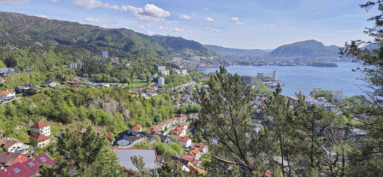
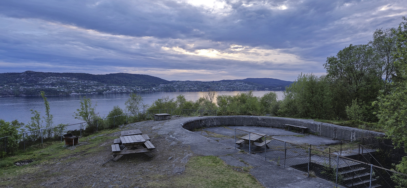
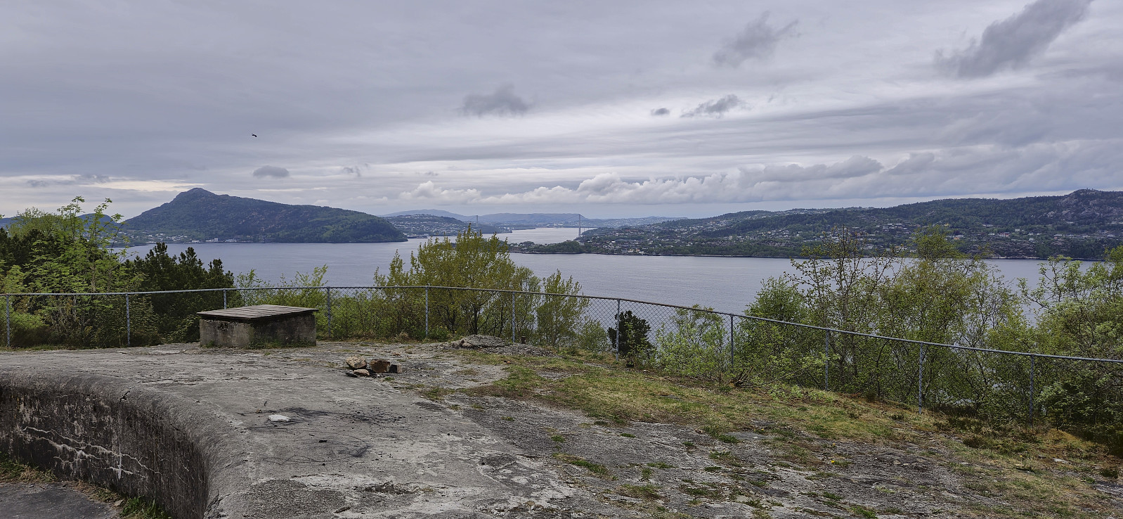
Across Hellen festning
- Date:
- 16.05.2024
- Characteristic:
- Hike
- Duration:
- 0:38h
- Distance:
- 3.2km
 Short local evening hike after returning home from three days at a meeting in Brussels.
Onen from Austdalen
- Date:
- 12.05.2024
- Characteristic:
- Backcountry skiing
- Duration:
- 7:39h
- Distance:
- 20.7km
 For the second Sunday in a row I caught an early train to Voss to going skiing with Voss Utferdslag . This time our goal was Onen in Ulvik/Eidfjord . At 08:00 we were transported by bus from Voss to Osa and then up to Austdalen p-plass at around 760 meters above the sea level. During the summer it is possible to drive much further but today we could put on the skies only a couple hundred meters after leaving the parking lot.
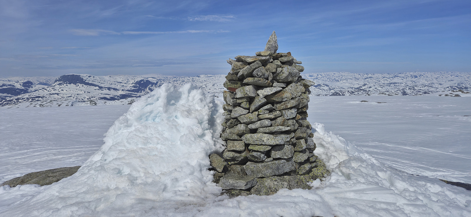
We followed the road to Austdølvatnet before taking a shortcut up to Langvatnet. When walking along the dam we briefly had to take of the skis a couple of times but we after a lunch break next to the lake we could put the skis back on and begin the final ascent to the summit. The summit was reached without any issues and provided an excellent panoramic view. After a short break next to the summit cairn we returned the same way, including another >>>
For the second Sunday in a row I caught an early train to Voss to going skiing with Voss Utferdslag . This time our goal was Onen in Ulvik/Eidfjord . At 08:00 we were transported by bus from Voss to Osa and then up to Austdalen p-plass at around 760 meters above the sea level. During the summer it is possible to drive much further but today we could put on the skies only a couple hundred meters after leaving the parking lot.
We followed the road to Austdølvatnet before taking a shortcut up to Langvatnet. When walking along the dam we briefly had to take of the skis a couple of times but we after a lunch break next to the lake we could put the skis back on and begin the final ascent to the summit. The summit was reached without any issues and provided an excellent panoramic view. After a short break next to the summit cairn we returned the same way, including another >>>
Furukammen and Helleveien
- Date:
- 11.05.2024
- Characteristic:
- Hike
- Duration:
- 2:10h
- Distance:
- 5.4km
 Short local on a warm Saturday.
Across Hellen festning
- Date:
- 10.05.2024
- Characteristic:
- Hike
- Duration:
- 0:37h
- Distance:
- 3.1km
 Short local evening hike.
Gaukavarden and Hinderåsen
- Date:
- 09.05.2024
- Characteristic:
- Hillwalk
- Duration:
- 1:23h
- Distance:
- 4.8km
 A short hike in Arna to visit Gaukavarden and Hinderåsen (the latter added as its own PB-element). I got off at "Haukeland sør" and followed Brattlandsvegen until just west of the summit. From there I headed off-trail to the summit which was easily reached. The views were limited by the low-hanging clouds but I could at least see Haukelandsvatnet.
I descended north along a weak trail that turned into a tractor road before connecting with the gravel road north of Gaukavarden. Next, I made a quick visit of Hinderåsen , which despite its name (directly translates into "obstacle hill"), could be ascended without any issues. It even provided ok views to the north with Loneheia visible in the distance.
While there was a weak trail continuing north from the highest point, after passing through a gate, I decided to not >>>
A short hike in Arna to visit Gaukavarden and Hinderåsen (the latter added as its own PB-element). I got off at "Haukeland sør" and followed Brattlandsvegen until just west of the summit. From there I headed off-trail to the summit which was easily reached. The views were limited by the low-hanging clouds but I could at least see Haukelandsvatnet.
I descended north along a weak trail that turned into a tractor road before connecting with the gravel road north of Gaukavarden. Next, I made a quick visit of Hinderåsen , which despite its name (directly translates into "obstacle hill"), could be ascended without any issues. It even provided ok views to the north with Loneheia visible in the distance.
While there was a weak trail continuing north from the highest point, after passing through a gate, I decided to not >>>
Across Hellen festning
- Date:
- 07.05.2024
- Characteristic:
- Hike
- Duration:
- 0:36h
- Distance:
- 3.1km
 Short local evening hike.
Skiing from Vikafjellet to Bavallen
- Date:
- 05.05.2024
- Characteristic:
- Backcountry skiing
- Duration:
- 10:26h
- Distance:
- 34.3km
 Sunday skiing trip from Vikafjellet to Bavallen organized by the Norwegian Trekking Association , or more specifically Voss Utferdslag . I started by taking an early train to Voss where I met up with the rest of the group for the bus ride to Vikafjellet. We were dropped off at the parking lot at the start of Sendedalen and were finally ready to start skiing shortly before 09:30.
After an initial easy start along the lakes in Sendedalen we put on the climbing skins and began the ascent to Rjupeskaret followed by the first descent of the day to Murane where we had our first lunch break. From Murane we ascended towards Blåeggi where I made a short detour on my own to the summit before rejoining the rest of the group just north of Mykjedalsvatnet for the ascent to Skreieggi where we all visited the large summit cairn.
We had our second lunch break northwest of Svartenut, where we were joined by a couple >>>
Sunday skiing trip from Vikafjellet to Bavallen organized by the Norwegian Trekking Association , or more specifically Voss Utferdslag . I started by taking an early train to Voss where I met up with the rest of the group for the bus ride to Vikafjellet. We were dropped off at the parking lot at the start of Sendedalen and were finally ready to start skiing shortly before 09:30.
After an initial easy start along the lakes in Sendedalen we put on the climbing skins and began the ascent to Rjupeskaret followed by the first descent of the day to Murane where we had our first lunch break. From Murane we ascended towards Blåeggi where I made a short detour on my own to the summit before rejoining the rest of the group just north of Mykjedalsvatnet for the ascent to Skreieggi where we all visited the large summit cairn.
We had our second lunch break northwest of Svartenut, where we were joined by a couple >>>
Furukammen
- Date:
- 04.05.2024
- Characteristic:
- Hike
- Duration:
- 2:31h
- Distance:
- 4.5km
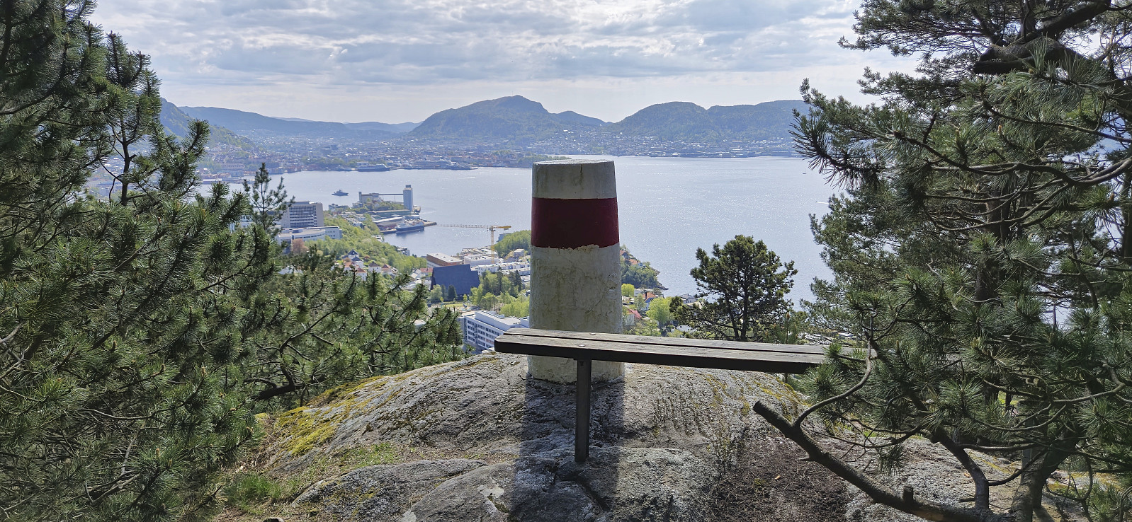 Short local Saturday hike.
