Archive - Date
Archive - Activity
-
Bike trip (108)
- Bike trip - mixed (25)
- Bike trip - road (83)
-
Drive (9)
- Car drive (9)
-
Other trip (3)
- Kayaking (3)
-
Ski trip (113)
- Backcountry skiing (67)
- Cross-country skiing (46)
- Trip by foot (1844)
Collected lists
-
Utvalgte topper og turmål i Bergen
(343/344)
 99%
99% -
Alle topper i Bergen
(390/397)
98%
-
Voss ≥ 100m pf.
(96/98)
97%
-
Opptur Hordaland
(144/159)
90%
-
Stasjoner på Bergensbanen
(31/40)
77%
-
Ulvik ≥ 100m pf.
(28/38)
73%
-
Hordaland ≥ 100m pf.
(617/863)
71%
-
Mjølfjell PF > 100m
(21/31)
67%
-
Jondal ≥ 100m pf.
(15/23)
65%
-
Sunnhordland PF >= 100m
(105/186)
56%
-
Dagsturhyttene i Vestland
(33/61)
54%
-
Hordaland: Hardanger PF>=100m
(189/359)
52%
-
DNT-hytter i Hordaland
(23/45)
51%
-
Kvinnherad ≥ 100m pf.
(40/79)
50%
-
Sogndal ≥ 100m pf.
(23/81)
28%
-
Eidfjord ≥ 100m pf.
(10/42)
23%
-
Vik i Sogn ≥ 100m pf.
(10/46)
21%
-
Gulen ≥ 100m pf.
(10/54)
18%
-
DNT-hytter i Sogn og Fjordane
(8/47)
17%
-
Sogn - Sør for Sognefjorden PF>=100m
(26/159)
16%

Vardafjellet, Kallvikanipa and Pina from Kallestadsundet
- Date:
- 12.12.2020
- Characteristic:
- Hillwalk
- Duration:
- 5:32h
- Distance:
- 16.7km
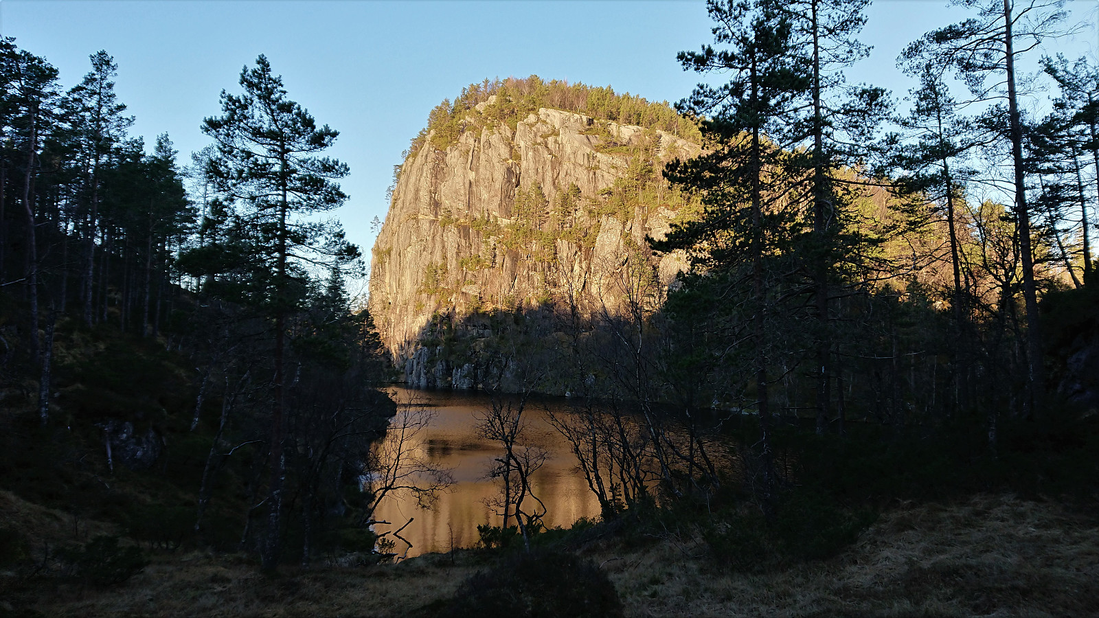 I started by taking the bus (or rather buses) to the bridge across Kallestadsundet. (Note that this would usually also involve a train ride from Bergen to Dale, but no trains today due to scheduled work on the train track.) After crossing the bridge, I continued along the roads to Kallestad where I attempted to locate the (unmarked) trailhead for Vardafjellet . I initially failed (see the descent route for the proper trail), but quickly found the proper trail. The first part of the trail was not marked, but it did not take long before red markers started appearing.
The red trail markers made it relatively straightforward to follow the trail almost all the way to the summit of Vardafjellet, although I did lose the markers when I had about 150 meters left. By then I could spot the large antenna south of the >>>
I started by taking the bus (or rather buses) to the bridge across Kallestadsundet. (Note that this would usually also involve a train ride from Bergen to Dale, but no trains today due to scheduled work on the train track.) After crossing the bridge, I continued along the roads to Kallestad where I attempted to locate the (unmarked) trailhead for Vardafjellet . I initially failed (see the descent route for the proper trail), but quickly found the proper trail. The first part of the trail was not marked, but it did not take long before red markers started appearing.
The red trail markers made it relatively straightforward to follow the trail almost all the way to the summit of Vardafjellet, although I did lose the markers when I had about 150 meters left. By then I could spot the large antenna south of the >>>
Across Hellen festning
- Date:
- 11.12.2020
- Characteristic:
- Hike
- Duration:
- 0:35h
- Distance:
- 3.1km
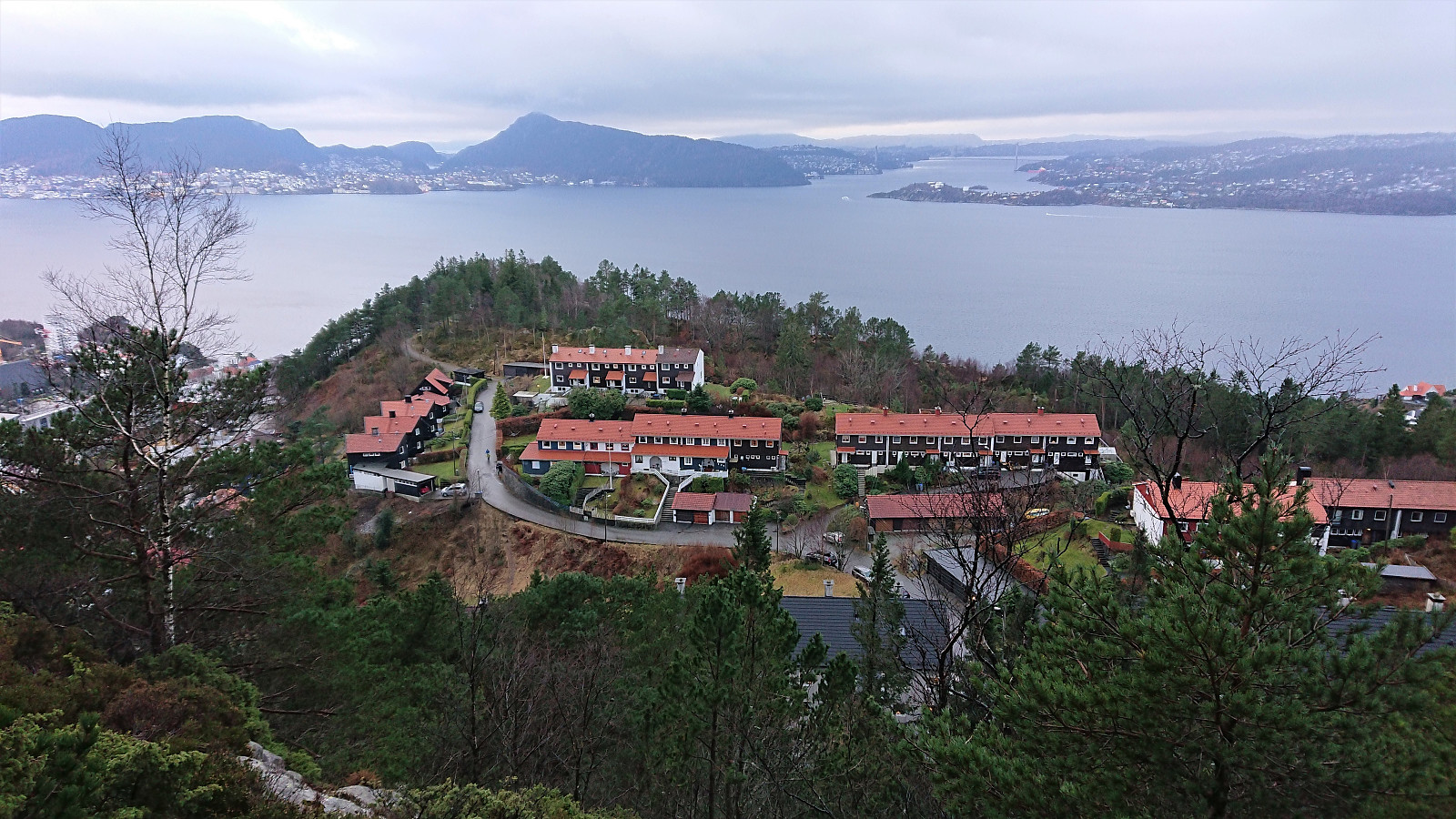
 Short local evening hike.
Fagerdalsskaret and Ørneberget
- Date:
- 10.12.2020
- Characteristic:
- Hillwalk
- Duration:
- 1:04h
- Distance:
- 4.5km
 Short local hike before it got dark.
Ørneberget, Rognåsen and Håmanen
- Date:
- 09.12.2020
- Characteristic:
- Hillwalk
- Duration:
- 1:49h
- Distance:
- 8.2km
 Left the home office early for a short local hike before it got too dark.
Across Hellen festning
- Date:
- 08.12.2020
- Characteristic:
- Hike
- Duration:
- 0:36h
- Distance:
- 3.1km
 Short local evening hike in light rain.
Hellen festning and Hellemyrstien
- Date:
- 06.12.2020
- Characteristic:
- Hike
- Duration:
- 2:04h
- Distance:
- 7.8km
 Short local hike after yesterday's longer hike in Åsane.
Hetlebakksåta and Birkelandsnipa from Ervika
- Date:
- 05.12.2020
- Characteristic:
- Hillwalk
- Duration:
- 4:43h
- Distance:
- 17.9km
 A revisit of Hetlebakksåta and Birkelandsnipa but this time starting from Ervika, or rather from the final bus stop at Breistein, and visiting both peaks on the same hike. The marked trailhead at the start of Ervikskaret was easily located. However, when the trail split into a blue trail and an orange trail, I first began on the orange trail, but quickly returned and followed the blue trail instead as it seemed to head more in the direction I wanted to go.
When reaching the top of Ervikskaret, I made a quick detour to Erviknipa before completing the ascent to Breisteinsåta and onwards to Hetlebakksåta . From Hetlebakksåta I followed the unmarked trail down to Hetlebakka, making a quick stop at the small hill of Svartafjellet on the way.
Upon reaching Hetlebakka, I followed in the footsteps of samasplund (Sam Asplund) and thus made a short detour via the smaller ridge northeast of Birkelandsnipa >>>
A revisit of Hetlebakksåta and Birkelandsnipa but this time starting from Ervika, or rather from the final bus stop at Breistein, and visiting both peaks on the same hike. The marked trailhead at the start of Ervikskaret was easily located. However, when the trail split into a blue trail and an orange trail, I first began on the orange trail, but quickly returned and followed the blue trail instead as it seemed to head more in the direction I wanted to go.
When reaching the top of Ervikskaret, I made a quick detour to Erviknipa before completing the ascent to Breisteinsåta and onwards to Hetlebakksåta . From Hetlebakksåta I followed the unmarked trail down to Hetlebakka, making a quick stop at the small hill of Svartafjellet on the way.
Upon reaching Hetlebakka, I followed in the footsteps of samasplund (Sam Asplund) and thus made a short detour via the smaller ridge northeast of Birkelandsnipa >>>
Hellen festning and Furukammen
- Date:
- 03.12.2020
- Characteristic:
- Hike
- Duration:
- 1:00h
- Distance:
- 5.1km
 Short local evening hike.
Hellen festning, Ørneberget NV and Hellemyrstien
- Date:
- 01.12.2020
- Characteristic:
- Hike
- Duration:
- 2:54h
- Distance:
- 7.3km
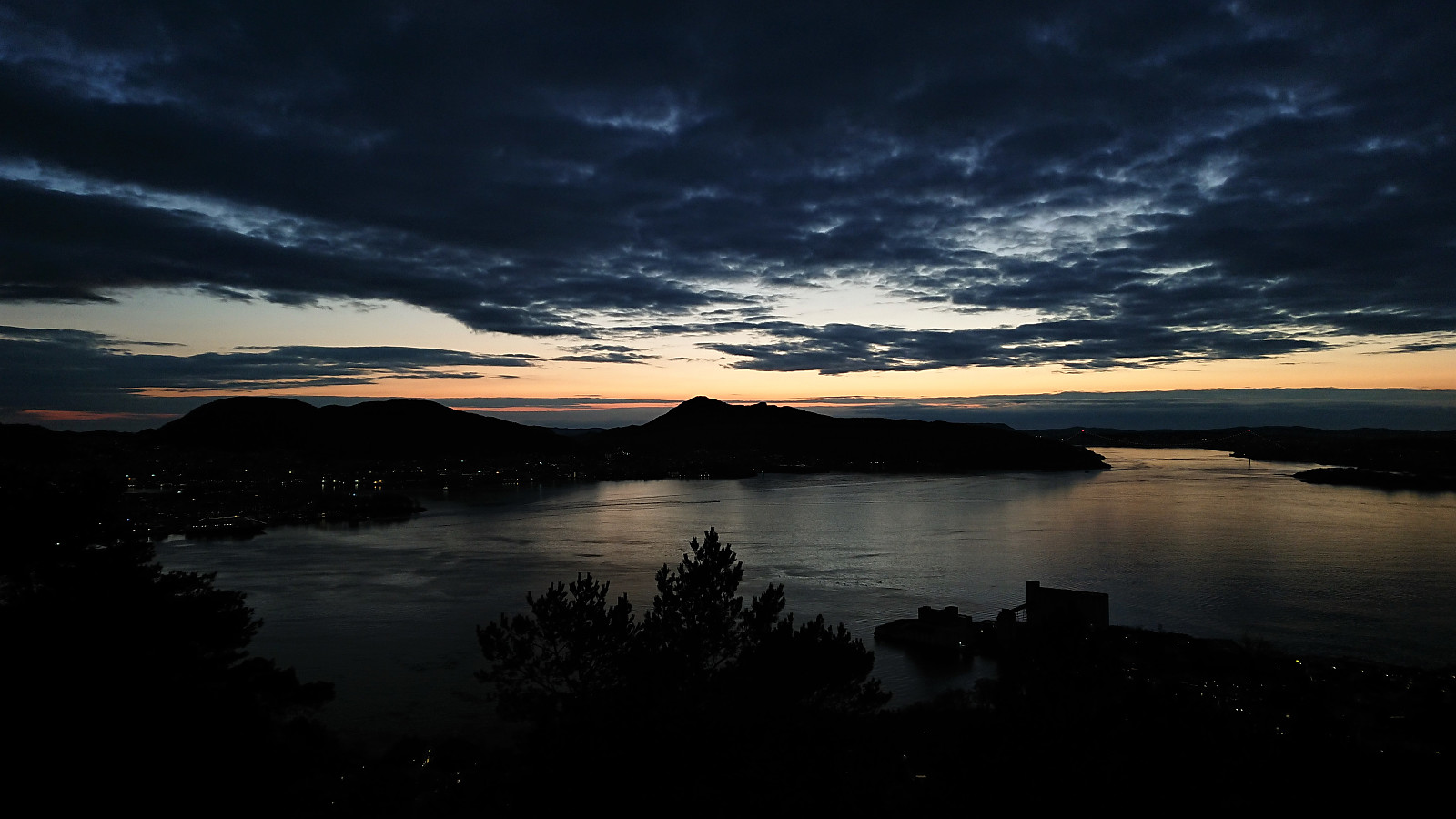
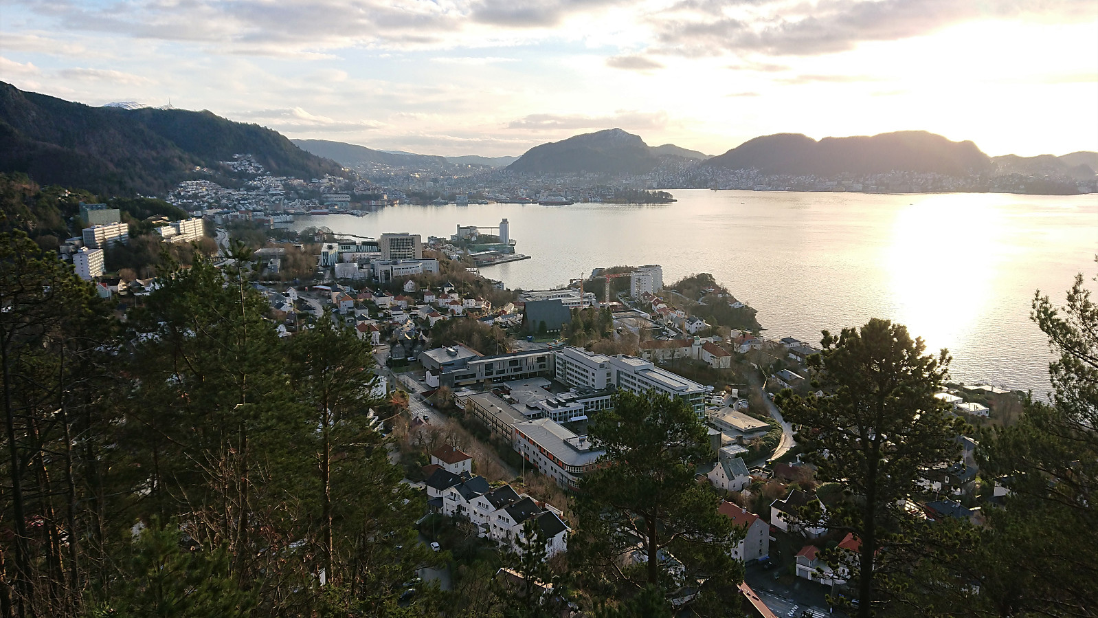
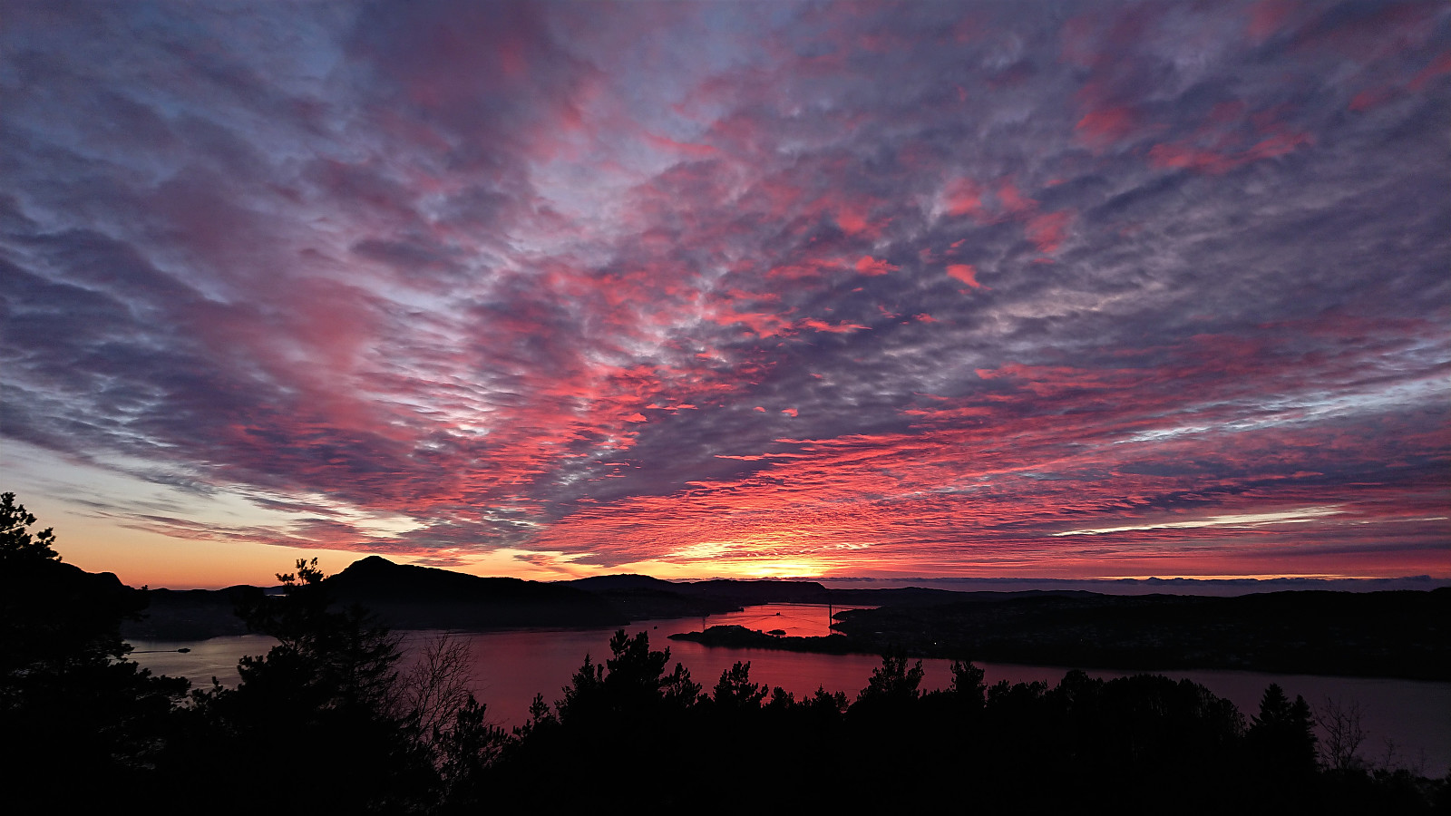 Left the home office earlier than usual to catch the sunset.
Ørneberget, Rognåsen and Håmanen
- Date:
- 29.11.2020
- Characteristic:
- Hillwalk
- Duration:
- 2:58h
- Distance:
- 8.4km
 Local hike in slightly better weather than expected.
