Archive - Date
Archive - Activity
-
Climbing (3)
- Alpine climbing (3)
-
Ski trip (36)
- Backcountry skiing (2)
- Randonnée/Telemark (34)
- Trip by foot (8)
Peakbook-Friends


Favourite trips


Stølsmaradalstinden
- Date:
- 17.05.2015
- Characteristic:
- Randonnée/Telemark
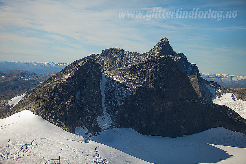 An 8 hour ski tour Turtagrø-Stølsmaradalstind-Turtagrø up Riingsdalen, with a 45 degree steep descent of the "main couloir/ridge" on Stølsmaradalstind. Descent grade 4.3/E2. On the photo you can see the couloir:
Lavskar
- Date:
- 10.04.2015
- Characteristic:
- Randonnée/Telemark
- Duration:
- 10:00h
 A 10 hours roundtrip Turtagrø-Lavskar-Turtagrø. There is a 45-50 degrees steep climb to the Lavskar col and a 45 degrees descent onto the glacier below. The climb feels a bit exposed and ideally you should bring ropes.
Route: Skin up the Skagadals valley to "Hytta på Bandet", then cross the glacier towards the Lavskar ridge and climb up the 200-250m couloir/ridge to Lavskar. Ski down to the Stølsmaradalsbreen via a 45 degrees steep wall/ridge. Skin and ski back to Turtagrø via Riingsdalen.
Towards Lavskar from "Hytta på bandet":
"Hytta på bandet":
Store Skagastølstind from Lavskar:
Store Skagastølstind from Lavskar:
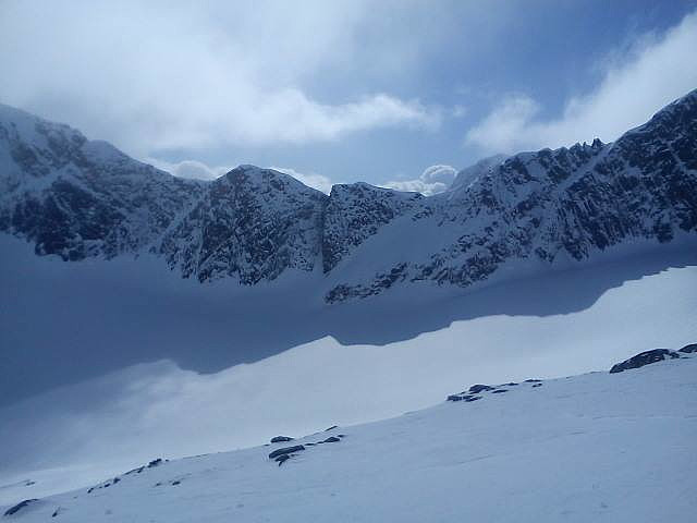
Looking down the "Lavskar couloir". The top is exposed and you should bring a rope.
A 10 hours roundtrip Turtagrø-Lavskar-Turtagrø. There is a 45-50 degrees steep climb to the Lavskar col and a 45 degrees descent onto the glacier below. The climb feels a bit exposed and ideally you should bring ropes.
Route: Skin up the Skagadals valley to "Hytta på Bandet", then cross the glacier towards the Lavskar ridge and climb up the 200-250m couloir/ridge to Lavskar. Ski down to the Stølsmaradalsbreen via a 45 degrees steep wall/ridge. Skin and ski back to Turtagrø via Riingsdalen.
Towards Lavskar from "Hytta på bandet":
"Hytta på bandet":
Store Skagastølstind from Lavskar:
Store Skagastølstind from Lavskar:
Looking down the "Lavskar couloir". The top is exposed and you should bring a rope.
Gjertvasstinden
- Date:
- 09.04.2015
- Characteristic:
- Randonnée/Telemark
 A ski ascent/descent from Turtagrø-Skogadalsbøen, up a 40 degrees glacier. 10 hours.
Gjertvasstind (2351m) and Store Styggedalstind (2387m):
Several beautiful "ski lines" on the north face of the Skagastølsmassif:
The top ridge:
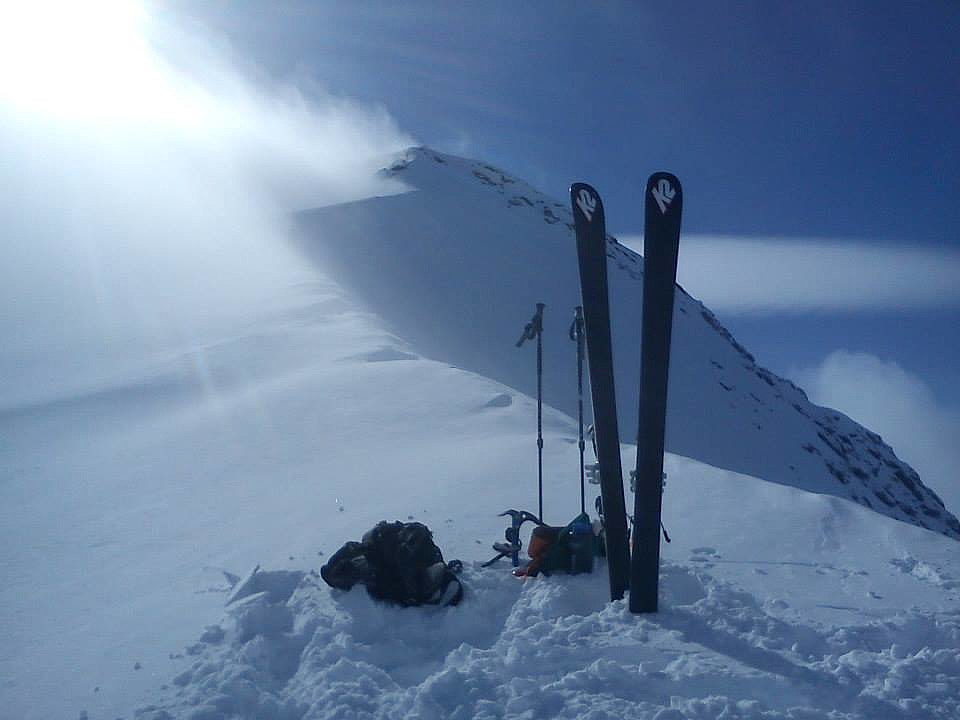
Selfie with skis:
Towards Styggedalstind (2387m) from the top:
A ski ascent/descent from Turtagrø-Skogadalsbøen, up a 40 degrees glacier. 10 hours.
Gjertvasstind (2351m) and Store Styggedalstind (2387m):
Several beautiful "ski lines" on the north face of the Skagastølsmassif:
The top ridge:
Selfie with skis:
Towards Styggedalstind (2387m) from the top:
North ridge of the "Dome de Gouter"
- Date:
- 04.04.2013
- Characteristic:
- Randonnée/Telemark
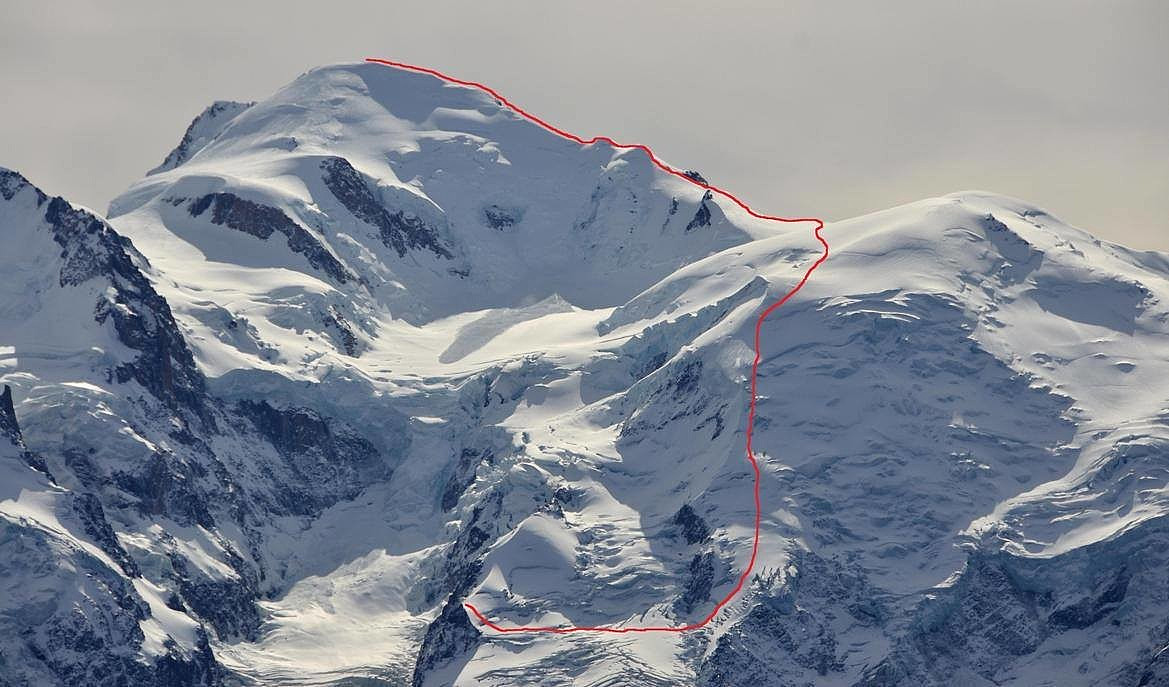 An attempt to climb the Mt. Blanc on skis via the north ridge of the Dome de Gouter. Aborted due to unstable weather. The route is safer than the classical route but steeper and more difficult.
In the picture you can see the Grand Mulet hut to the left. You skin across the glacier and start climbing at the arete in the middle og the picture. The classical route goes to the left of this arete and is exposed to crevasses and avalanche. The weather is unstable and you do not want to get stuck on the arete or above the arete in bad weather.
An attempt to climb the Mt. Blanc on skis via the north ridge of the Dome de Gouter. Aborted due to unstable weather. The route is safer than the classical route but steeper and more difficult.
In the picture you can see the Grand Mulet hut to the left. You skin across the glacier and start climbing at the arete in the middle og the picture. The classical route goes to the left of this arete and is exposed to crevasses and avalanche. The weather is unstable and you do not want to get stuck on the arete or above the arete in bad weather.

