Archive - Date
Archive - Activity
-
Climbing (23)
- Alpine climbing (9)
- Sport climbing (11)
- Via ferrata (2)
-
Drive (1)
- Car drive (1)
-
Other winter trip (3)
- Snowshoe trip (3)
-
Ski trip (62)
- Backcountry skiing (3)
- Cross-country skiing (1)
- Randonnée/Telemark (58)
- Trip by foot (137)


Favourite trips
Favourite peaks


Steinskartinden
- Date:
- 10.04.2019
- Characteristic:
- Randonnée/Telemark
- Duration:
- 2:06h
- Distance:
- 6.3km
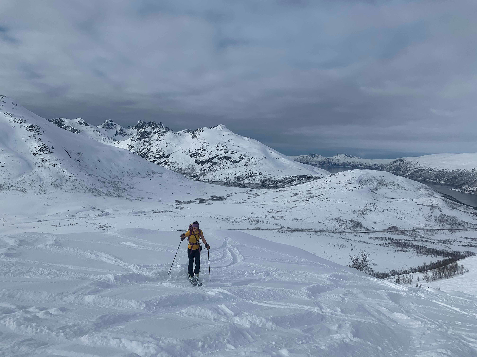 If I had 10kr for every time i started a rapport with 'Yr had forecast sun'...The plan was originally Skittentind but contrary to the sun yr had promised, there was a lot of cloud cover and we decided on Steinskarstinden instead.
Everything was looking really tracked out so we were pretty sure the trip down wouldn't be the best. The elevation gain was gradual and accompanied by hearing about Hannah's most recent himalayas expedition.
A surprisingly short trip and we reached the top just as I started thinking about my first kvikklunsj for the day :) Lovely views over Kvaløya, and with not a breath of wind it was stunning to see the ocean as flat as a pancake.
Got a few nice turns towards the top but it quickly turned into survival skiing over the bumpy old tracks. Was even lucky enough to get >>>
If I had 10kr for every time i started a rapport with 'Yr had forecast sun'...The plan was originally Skittentind but contrary to the sun yr had promised, there was a lot of cloud cover and we decided on Steinskarstinden instead.
Everything was looking really tracked out so we were pretty sure the trip down wouldn't be the best. The elevation gain was gradual and accompanied by hearing about Hannah's most recent himalayas expedition.
A surprisingly short trip and we reached the top just as I started thinking about my first kvikklunsj for the day :) Lovely views over Kvaløya, and with not a breath of wind it was stunning to see the ocean as flat as a pancake.
Got a few nice turns towards the top but it quickly turned into survival skiing over the bumpy old tracks. Was even lucky enough to get >>>
Vannkista
- Date:
- 08.04.2019
- Characteristic:
- Randonnée/Telemark
- Duration:
- 3:17h
- Distance:
- 12.7km
 Flott turrapport kan leses på otto (Otto Lund) .
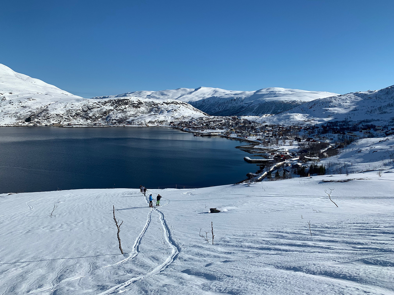
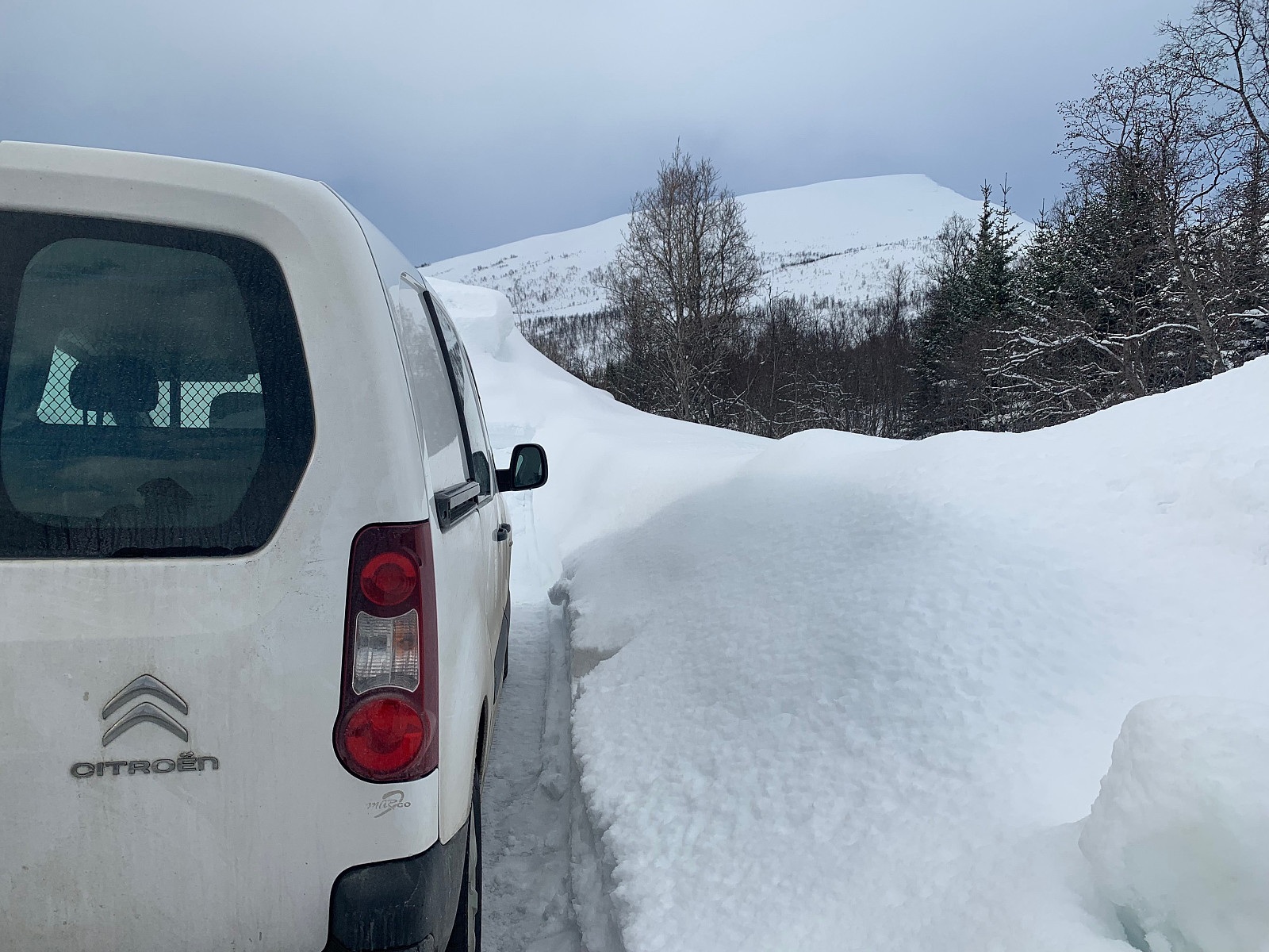
After driving to Hansnes and taking the 10.30ferry, the trip started in the warmest conditions this year to date. We drove a few hundred meters to the left of the ferry and parked along side of the road and set a trail up through the forrest. We gained elevation pretty slowly and had a somewhat long approach. The view behind us was absolutely stunning, and at around 4.5km we got our sights on the summit. We could see a big group heading up from the right coming from the village. From around 650moh we started gaining elevation more steadily and otto ran up to the top as he could see some clouds coming in. We reached the top soon after but were covered in clouds and snow, so unfortunately no nice view for us today :(
Difficult conditions on the way down with extremely >>>
Flott turrapport kan leses på otto (Otto Lund) .
After driving to Hansnes and taking the 10.30ferry, the trip started in the warmest conditions this year to date. We drove a few hundred meters to the left of the ferry and parked along side of the road and set a trail up through the forrest. We gained elevation pretty slowly and had a somewhat long approach. The view behind us was absolutely stunning, and at around 4.5km we got our sights on the summit. We could see a big group heading up from the right coming from the village. From around 650moh we started gaining elevation more steadily and otto ran up to the top as he could see some clouds coming in. We reached the top soon after but were covered in clouds and snow, so unfortunately no nice view for us today :(
Difficult conditions on the way down with extremely >>>
Tåketur til Ullstinden
- Date:
- 07.04.2019
- Characteristic:
- Randonnée/Telemark
- Duration:
- 4:00h
- Distance:
- 9.9km
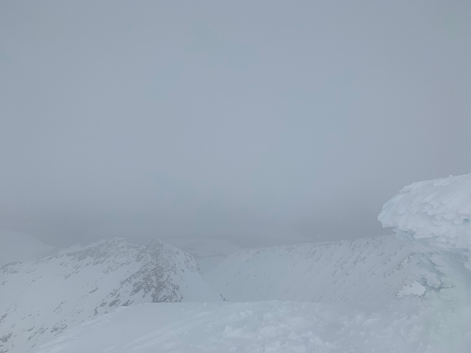
 The sun we started the day with quicky turned into thick clouds, snow and two whiteouts as soon as we started gaining elevation. We parked in the parking at oldervik and followed the tracks up through the forrest. After we came up over the tree line we were soon in low clouds and kept following the tracks to around 600moh where we got our first whiteout. After a break in the wind tent we kept heading up. Once we got to the top we were still trapped in tight clouds, we waited for it to clear up but unfortunately got really unlocky with no view whatsoever :(
Awesome snow on the trip down and really fun skiing. Definitely be back soon. Takk for turen Pauke!
The sun we started the day with quicky turned into thick clouds, snow and two whiteouts as soon as we started gaining elevation. We parked in the parking at oldervik and followed the tracks up through the forrest. After we came up over the tree line we were soon in low clouds and kept following the tracks to around 600moh where we got our first whiteout. After a break in the wind tent we kept heading up. Once we got to the top we were still trapped in tight clouds, we waited for it to clear up but unfortunately got really unlocky with no view whatsoever :(
Awesome snow on the trip down and really fun skiing. Definitely be back soon. Takk for turen Pauke!
Hatten
- Date:
- 05.04.2019
- Characteristic:
- Randonnée/Telemark
 My favourite wine producer from Germany was visiting Tromsø this week, so I had the pleasure of taking him and his family out on a ski trip. They had been on one trip to Lilleblåmann during their visit already, and we were a group of very different abilities and fitness levels, so I thought hatten would be great for them. Terrible icy snow up until around 450moh but nice snow from there to the top. Sikkelig påskestemning!
Rismålheia
- Date:
- 26.03.2019
- Characteristic:
- Randonnée/Telemark
- Duration:
- 2:30h
- Distance:
- 8.0km
 The first day with somewhat decent weather in over a week :) Quite a long drive from town, around 1 hour, and we took a right turn off the main road in Mjelde and parked at the mechanics there. We could see the summit from the car and decided to take the left ridge up. After we walked in a bit we thought it would be more time efficient to take the steeper ridge on the right. After we came closer we realised there was a lot of steep hangs, and traversed back to the left and followed that ridge up.
We thought that powder season was over for this year with last weeks mild weather but the conditions were great. After some discussion about the snow we decided it was stable enough to ski down the steeper hangs on the right. Great skiing all the way down to the car.
Once we got back we discovered the >>>
The first day with somewhat decent weather in over a week :) Quite a long drive from town, around 1 hour, and we took a right turn off the main road in Mjelde and parked at the mechanics there. We could see the summit from the car and decided to take the left ridge up. After we walked in a bit we thought it would be more time efficient to take the steeper ridge on the right. After we came closer we realised there was a lot of steep hangs, and traversed back to the left and followed that ridge up.
We thought that powder season was over for this year with last weeks mild weather but the conditions were great. After some discussion about the snow we decided it was stable enough to ski down the steeper hangs on the right. Great skiing all the way down to the car.
Once we got back we discovered the >>>
Hemmeligskogen
- Date:
- 18.03.2019
- Characteristic:
- Randonnée/Telemark
- Duration:
- 2:30h
- Distance:
- 4.5km
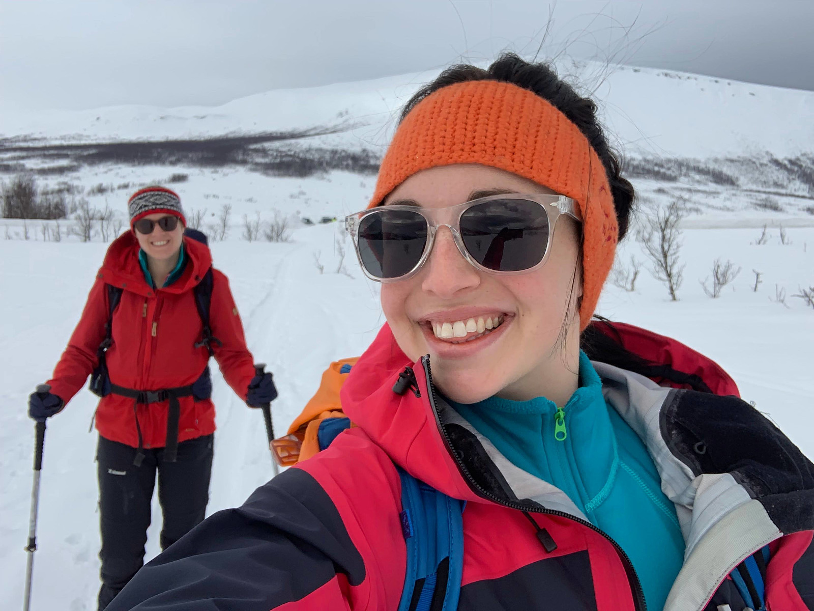
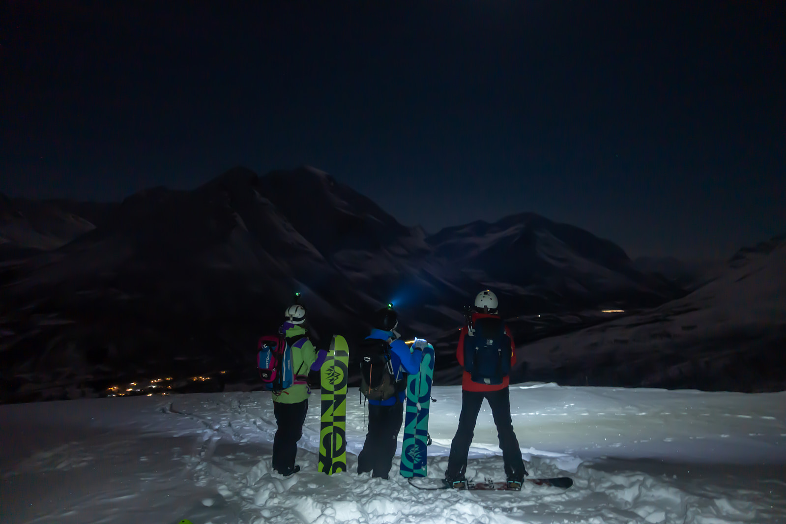 A girls trip after work to Hemmeligskogen i Ramsfjord. We started walking around 6pm and with almost a full moon we didn't need our headlights until we got ready for the trip down.
The terrain was very varied with steeper hangs and quite a lot of old tree stumps. The trail was well trodden and my skins were sliding so I ended up walking my own path. Lots of kick turns on the way up. No wind at all when we came to Storkollen, with a great view over Ramsfjorden towards Durmålstinden and the mountains beside it.
A fun trip down in great, soft snow. Some sections with really steep hangs and some tight forrest. We chose to stay more to the right of the main path walking up on the way down. Forgot to stop my watch before we got back to Tromsø :D Takk for turen Eva, Pauke og Kari!
A girls trip after work to Hemmeligskogen i Ramsfjord. We started walking around 6pm and with almost a full moon we didn't need our headlights until we got ready for the trip down.
The terrain was very varied with steeper hangs and quite a lot of old tree stumps. The trail was well trodden and my skins were sliding so I ended up walking my own path. Lots of kick turns on the way up. No wind at all when we came to Storkollen, with a great view over Ramsfjorden towards Durmålstinden and the mountains beside it.
A fun trip down in great, soft snow. Some sections with really steep hangs and some tight forrest. We chose to stay more to the right of the main path walking up on the way down. Forgot to stop my watch before we got back to Tromsø :D Takk for turen Eva, Pauke og Kari!
Tomasjordtinden
- Date:
- 17.03.2019
- Characteristic:
- Randonnée/Telemark
- Duration:
- 3:42h
- Distance:
- 8.8km
 Yr bommet helt i dag! Sun and no wind had been on the forecast for a whole week so the plan was Ullstinden and sikkelig påskestemning. Tromsø was covered in low clouds when we woke up and after checking the cloud cover/wind speeds on Windy we realised we would have to head inland and decided on Tomasjordtinden. We parked on the edge of a driveway and followed the old ski tracks that led up to the right of a big white house.
Some tight trees that thankfully didn’t persist for too long and soon we were over the tree line. We were walking in the shadow side the whole way up so it was a lot colder than expected. The terrain changed to big slopes covered in really nice, fluffy powder so we were getting excited for the trip down.
After a small hot chocolate break we headed right along the ridge >>>
Yr bommet helt i dag! Sun and no wind had been on the forecast for a whole week so the plan was Ullstinden and sikkelig påskestemning. Tromsø was covered in low clouds when we woke up and after checking the cloud cover/wind speeds on Windy we realised we would have to head inland and decided on Tomasjordtinden. We parked on the edge of a driveway and followed the old ski tracks that led up to the right of a big white house.
Some tight trees that thankfully didn’t persist for too long and soon we were over the tree line. We were walking in the shadow side the whole way up so it was a lot colder than expected. The terrain changed to big slopes covered in really nice, fluffy powder so we were getting excited for the trip down.
After a small hot chocolate break we headed right along the ridge >>>
Finnkollen
- Date:
- 16.03.2019
- Characteristic:
- Randonnée/Telemark
- Duration:
- 2:00h
- Distance:
- 5.7km
 The weather was shifting a lot, and in the space of driving to Kattfjord it had been snow and sunshine twice. It was snowing heavily when we parked next to Kattfjordskole but decided to give the trip a try anyway. We followed a small path to the right side of a house which met the lysløype after a few minutes.
We followed the lysløype up and gained elevation quite slowly. We came off lysløype and started breaking trail at tverrelva. There was lots of powder so me and … took turns breaking trail. Once we came over the tree line and started heading for the summit the weather turned for the worse and we got stuck in a complete white out. Paal was already ahead of us but we decided not to go any further as his tracks were already covered.
We got changed and waited for him to come down. Really >>>
The weather was shifting a lot, and in the space of driving to Kattfjord it had been snow and sunshine twice. It was snowing heavily when we parked next to Kattfjordskole but decided to give the trip a try anyway. We followed a small path to the right side of a house which met the lysløype after a few minutes.
We followed the lysløype up and gained elevation quite slowly. We came off lysløype and started breaking trail at tverrelva. There was lots of powder so me and … took turns breaking trail. Once we came over the tree line and started heading for the summit the weather turned for the worse and we got stuck in a complete white out. Paal was already ahead of us but we decided not to go any further as his tracks were already covered.
We got changed and waited for him to come down. Really >>>

