Archive - Date
Archive - Activity
-
Climbing (23)
- Alpine climbing (9)
- Sport climbing (11)
- Via ferrata (2)
-
Drive (1)
- Car drive (1)
-
Other winter trip (3)
- Snowshoe trip (3)
-
Ski trip (62)
- Backcountry skiing (3)
- Cross-country skiing (1)
- Randonnée/Telemark (58)
- Trip by foot (137)


Favourite trips
Favourite peaks


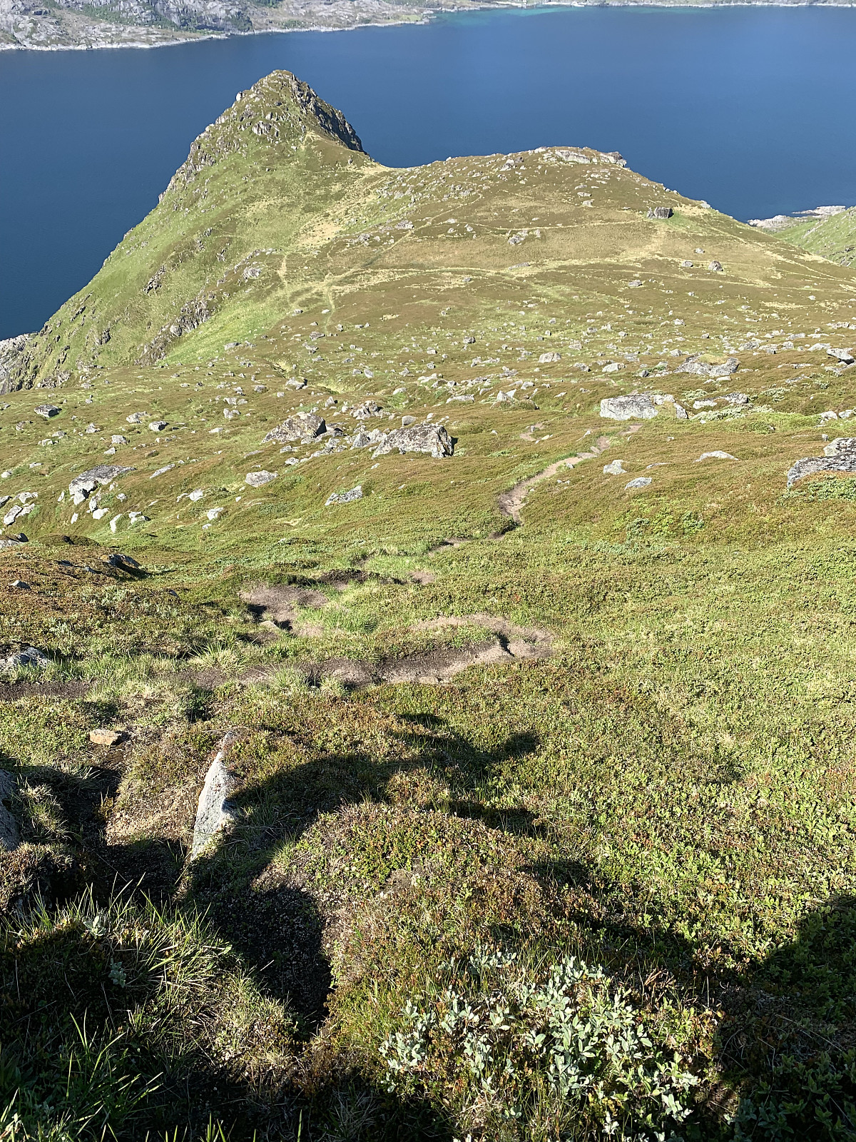
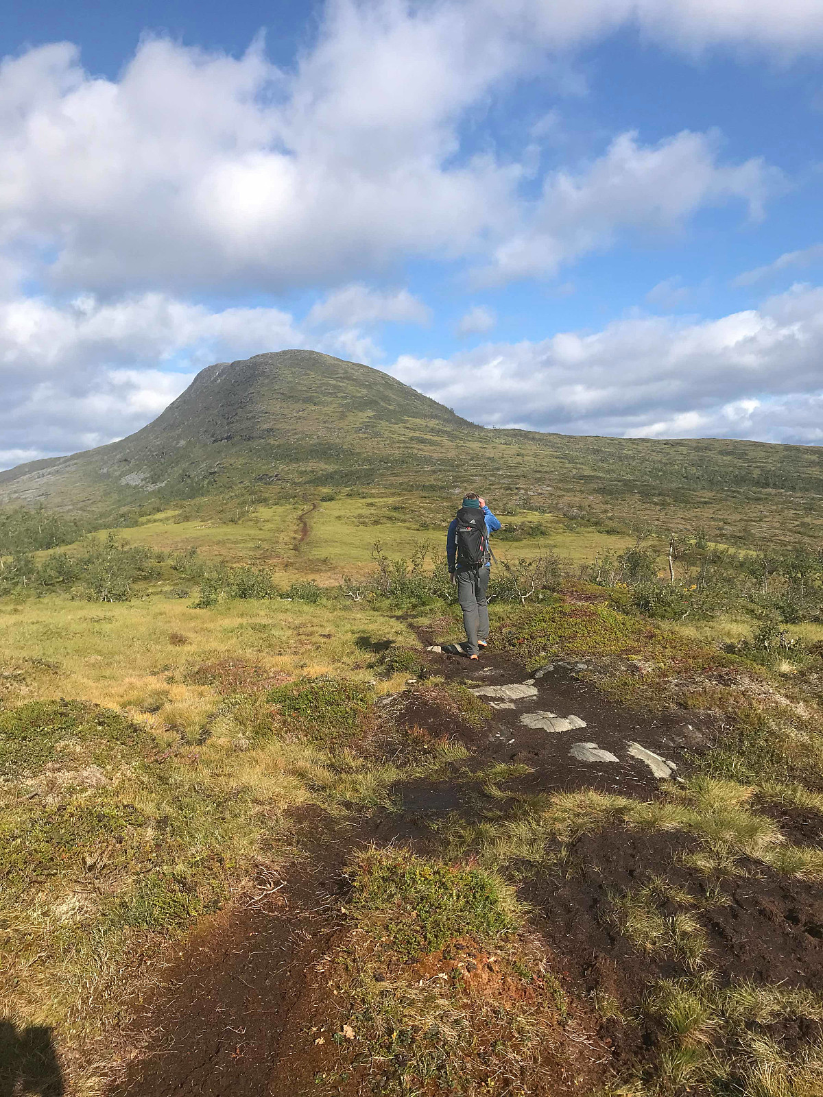
Rundfjellet
- Date:
- 16.06.2019
- Characteristic:
- Hillwalk
- Duration:
- 2:52h
- Distance:
- 7.5km
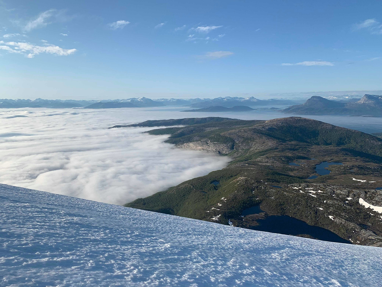
 Woke up to (yet another) day of sunshine, so a rest day after Stjerntinden was not on the cards! We weren’t expecting much from our hike up Rundfjellet but were really surprised by a great hike. A wet path at the start but a great path none the less, effective elevation gains and great views. We walked along the ridge and had a nice long lunch break in the sun. We saved 400m on the way down by sliding on the snow fields that were to our right during the ascent which was wonderful.
Skottinden
- Date:
- 14.06.2019
- Characteristic:
- Hillwalk
- Duration:
- 3:08h
- Distance:
- 6.8km
 Skottinden has a really interesting profile from the road but is surprisingly simple to hike, which made it a good candidate for our 'rest day' before Stjerntinden. We parked just before the gate and followed the private road up to the start of the trail. The trail started to the left of the red house # 550. We gained elevation quickly on a great trail, before flattening out around 400moh and then following the trail steeply up the ridge. We had wonderful views in all directions. Warm and with no wind, we had a lunch break at the top and started heading back down.
Hermannsdalstinden
- Date:
- 13.06.2019
- Characteristic:
- Hillwalk
- Duration:
- 4:34h
- Distance:
- 9.3km
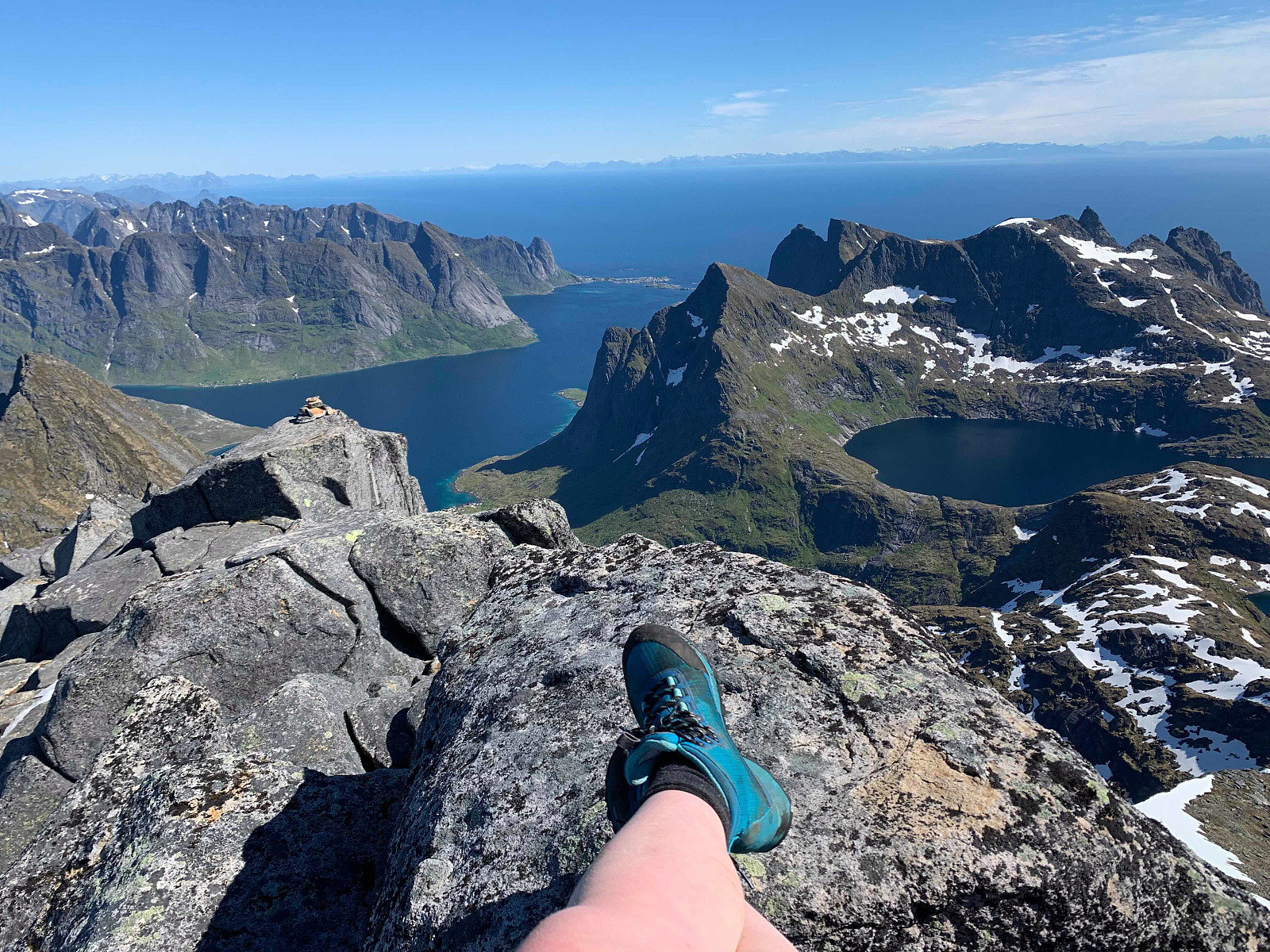 When we woke up to an unbelievable third day of sun in a row, we decided today had to be Hermanndalstinden :) We organised at the ticket office in reine for the reinefjorden boat to take us into forsfjorden so we could start the hike.
The trail starts to the right after we hopped off the boat and we started gaining elevation quickly, through a really wet and rocky trail. The view just kept getting more and more ridiculous as we gained elevation so there was quite a few pauses for photos along the way.
After around 45min we came to a flatter section, where we took the path to the right and headed down around 75moh and started gaining elevation again. Here the trail became total rubbish for a while, and was quite exposed in places,before we passed some ropes and chains and started getting better >>>
When we woke up to an unbelievable third day of sun in a row, we decided today had to be Hermanndalstinden :) We organised at the ticket office in reine for the reinefjorden boat to take us into forsfjorden so we could start the hike.
The trail starts to the right after we hopped off the boat and we started gaining elevation quickly, through a really wet and rocky trail. The view just kept getting more and more ridiculous as we gained elevation so there was quite a few pauses for photos along the way.
After around 45min we came to a flatter section, where we took the path to the right and headed down around 75moh and started gaining elevation again. Here the trail became total rubbish for a while, and was quite exposed in places,before we passed some ropes and chains and started getting better >>>
Himmeltinden
- Date:
- 12.06.2019
- Characteristic:
- Hillwalk
- Duration:
- 3:32h
- Distance:
- 9.0km
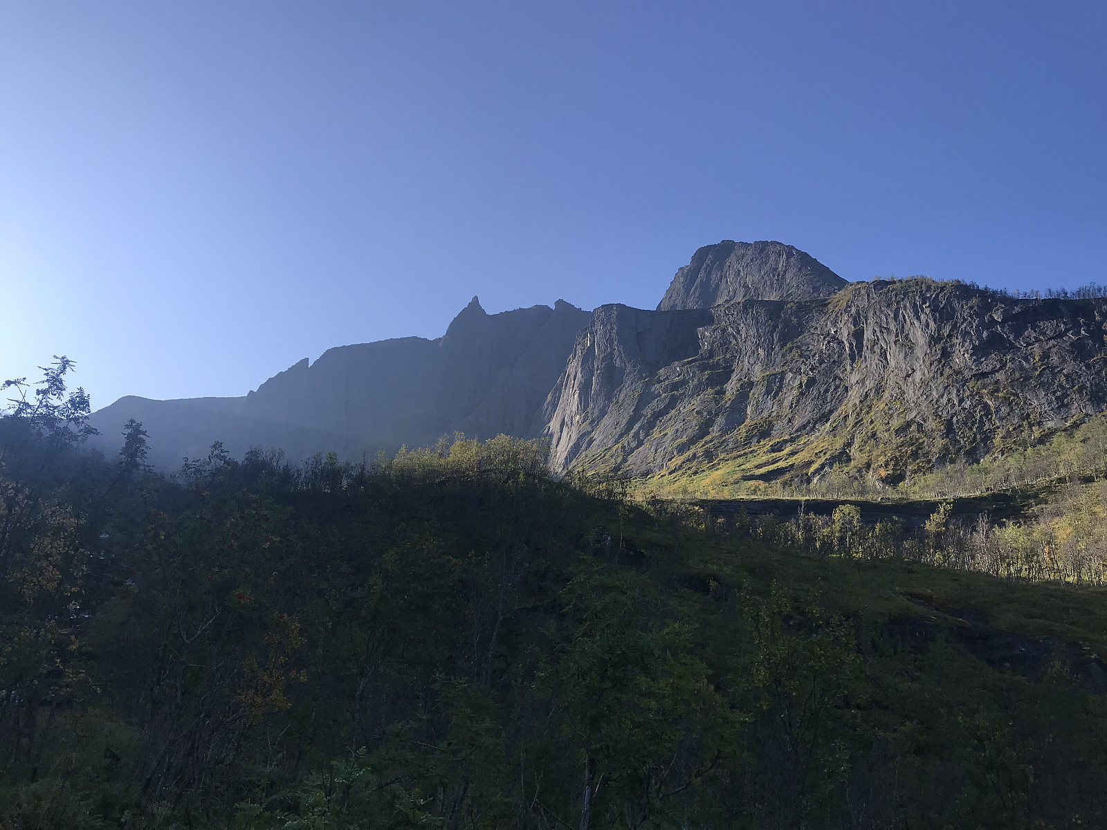
 A wonderful hike on a terrific path and first class view over Lofoten's nicest beaches :)
We parked at Haukeland beach and followed the road leading up to the right of the tunnel, following the path that led up to the left and through a gate. Shortly we took to the left at the signpost for Himmeltinden and from here it was just to follow a really good, dry path all the way to the top. The first top is marked clearly by a big rock pillar. We continued across a few snow patches onto the true top where the antenna is, had a small lunch break and then headed back down the path. Takk for turen Otto, Inger Lise & Paal! :)
A wonderful hike on a terrific path and first class view over Lofoten's nicest beaches :)
We parked at Haukeland beach and followed the road leading up to the right of the tunnel, following the path that led up to the left and through a gate. Shortly we took to the left at the signpost for Himmeltinden and from here it was just to follow a really good, dry path all the way to the top. The first top is marked clearly by a big rock pillar. We continued across a few snow patches onto the true top where the antenna is, had a small lunch break and then headed back down the path. Takk for turen Otto, Inger Lise & Paal! :)
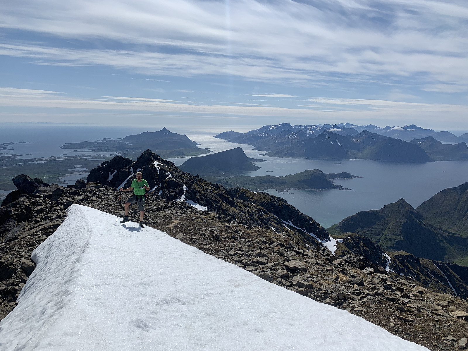
Kremtur til Higravtinden
- Date:
- 11.06.2019
- Characteristic:
- Hillwalk
- Duration:
- 5:40h
- Distance:
- 7.6km
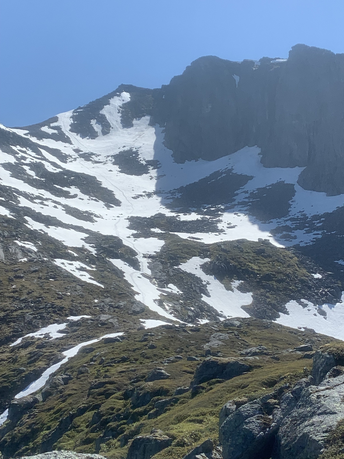
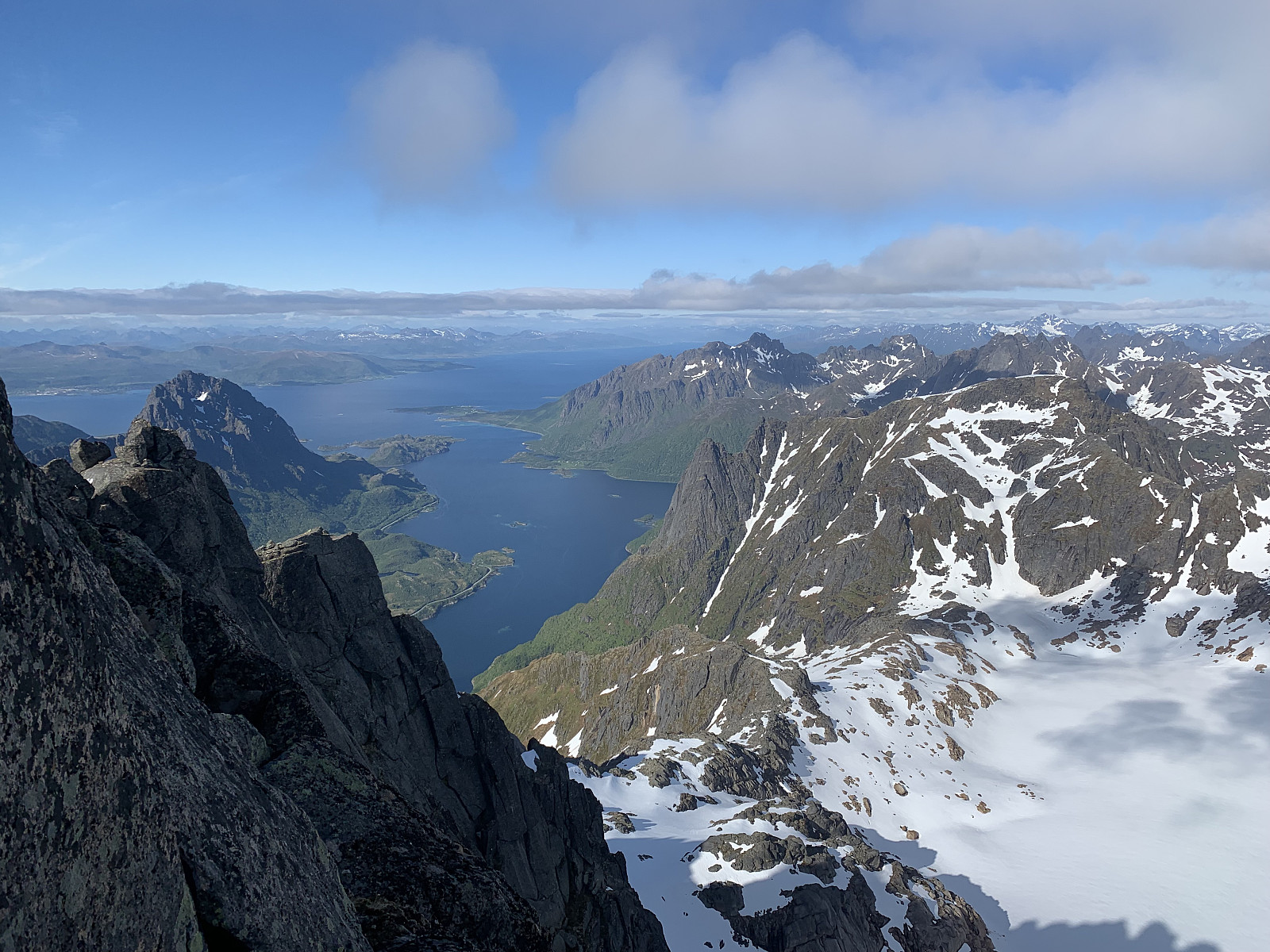 Lofoten på sølvfat! The decision to try Higravtinden was taken on the boat from Skutvik to Svolvær. We were sceptical about how much snow would be in the top section, so packed crampons & ice axes. We parked by the side of what looks like a sammfunshus and headed up an old road to the right of the parking. We hopped over a gate and followed the path upwards. A great path for the most part, a few sections with loose stones but pleasantly dry & easy terrain.
After just over an hour, at around 680moh we had reached the snow couloir and stopped to put crampons on. The couloir was around 30 degrees here, but it was late afternoon and the snow was pretty slushy so heading up wasn't a problem.As the couloir narrowed out and got closer to 50 degrees, we walked with the ice axes until we reached >>>
Lofoten på sølvfat! The decision to try Higravtinden was taken on the boat from Skutvik to Svolvær. We were sceptical about how much snow would be in the top section, so packed crampons & ice axes. We parked by the side of what looks like a sammfunshus and headed up an old road to the right of the parking. We hopped over a gate and followed the path upwards. A great path for the most part, a few sections with loose stones but pleasantly dry & easy terrain.
After just over an hour, at around 680moh we had reached the snow couloir and stopped to put crampons on. The couloir was around 30 degrees here, but it was late afternoon and the snow was pretty slushy so heading up wasn't a problem.As the couloir narrowed out and got closer to 50 degrees, we walked with the ice axes until we reached >>>
Hansbakkfjellet
- Date:
- 07.06.2019
- Characteristic:
- Hillwalk
- Duration:
- 3:53h
- Distance:
- 7.9km
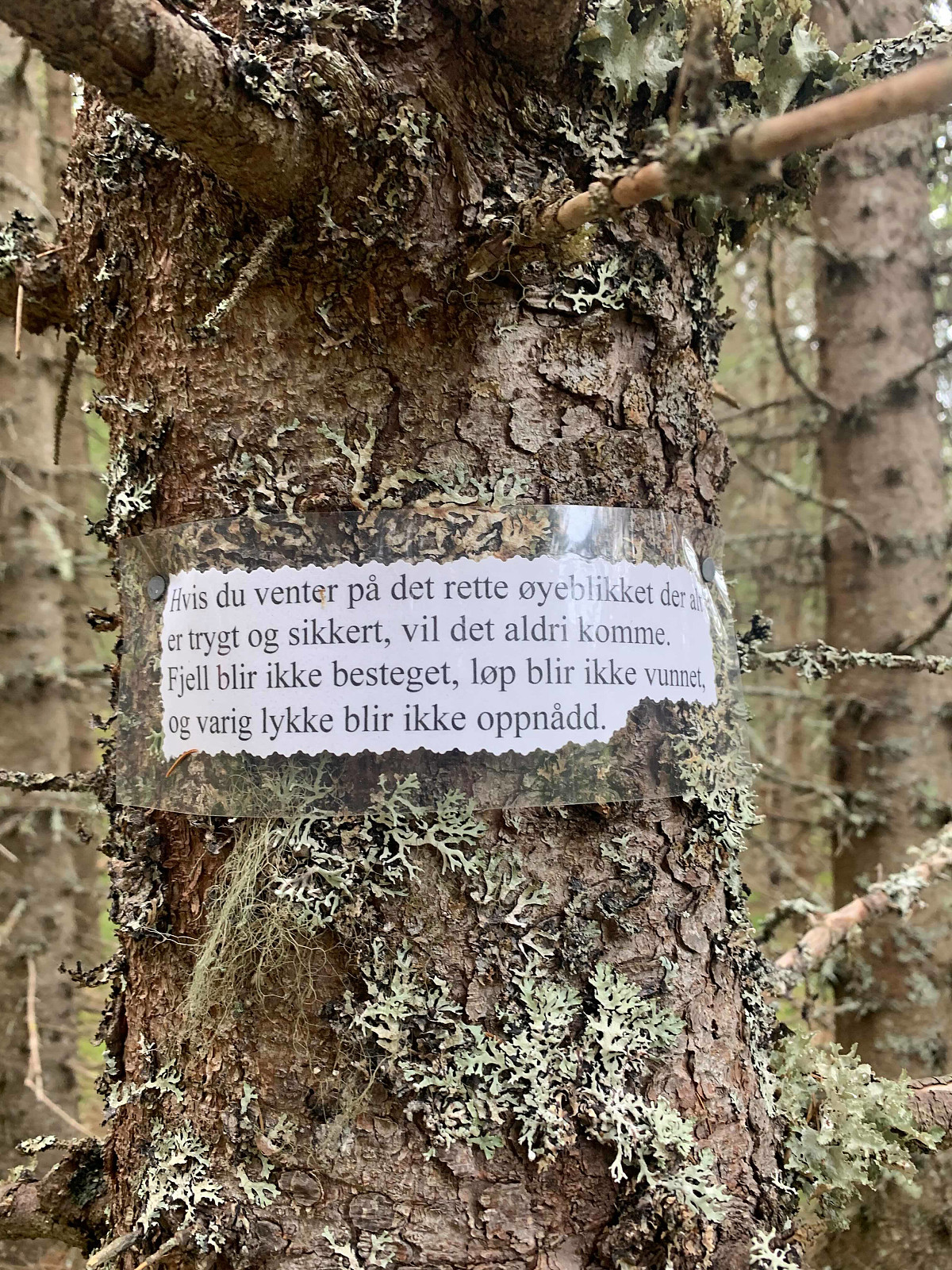 A suprising terningkast 6! After getting rained out during an early climbing session at Sleppen klatrefelt, we decided to give Hansbakkfjellet a try as the weather looked more promising in the afternoon. We drove to hestbakken and parked by the side of a white house. We continued walking up the private road, to another property and a small, weak path led off to the right. The trail soon turned surprisingly into a drømmesti and we gained elevation steadily and slowly. It looks like one of the locals enjoys words of encouragement on his hikes, and we found lots of thoughtful quotes printed out and pinned to the trees :)
Once we had come out of the treeline and had the pass in sight, the trail disappeared and we headed up a steeper section of grass until we came to the pass around 500moh. We continued >>>
A suprising terningkast 6! After getting rained out during an early climbing session at Sleppen klatrefelt, we decided to give Hansbakkfjellet a try as the weather looked more promising in the afternoon. We drove to hestbakken and parked by the side of a white house. We continued walking up the private road, to another property and a small, weak path led off to the right. The trail soon turned surprisingly into a drømmesti and we gained elevation steadily and slowly. It looks like one of the locals enjoys words of encouragement on his hikes, and we found lots of thoughtful quotes printed out and pinned to the trees :)
Once we had come out of the treeline and had the pass in sight, the trail disappeared and we headed up a steeper section of grass until we came to the pass around 500moh. We continued >>>
Hatten - Hamarøy
- Date:
- 06.06.2019
- Characteristic:
- Hillwalk
- Duration:
- 2:41h
- Distance:
- 6.0km
 After driving down from Tromsø during the day, we decided on a late afternoon trip to Hatten. Årets første fottur! We parked at Tortenåsen and followed the tractor path for a few hundred meters that ended up being an excellent little path that we followed all the way to the top. There had been an avalanche here in the course of the winter, so we had to pick our way around quite a few broken trees. The path continued the whole way to the big silver ladder as an aid to come right to the top. The view was wonderful, all the way over to Lofoten in the west and mainland, including Stetind, in the east.
We enjoyed ourselves in the sun for a while and then started heading down. Had forgotten how much longer the trip down takes without skiis...Takk for en ordentlig kosetur uglefisk (Paal Andre Lund)
After driving down from Tromsø during the day, we decided on a late afternoon trip to Hatten. Årets første fottur! We parked at Tortenåsen and followed the tractor path for a few hundred meters that ended up being an excellent little path that we followed all the way to the top. There had been an avalanche here in the course of the winter, so we had to pick our way around quite a few broken trees. The path continued the whole way to the big silver ladder as an aid to come right to the top. The view was wonderful, all the way over to Lofoten in the west and mainland, including Stetind, in the east.
We enjoyed ourselves in the sun for a while and then started heading down. Had forgotten how much longer the trip down takes without skiis...Takk for en ordentlig kosetur uglefisk (Paal Andre Lund)
Roalden
- Date:
- 10.09.2018
- Characteristic:
- Hillwalk
- Duration:
- 3:30h
- Distance:
- 6.8km
 Amazing weather in Senja today meant a tough decision between Breidtinden and Roalden. Paal has already done Breidtinden and felt like trying something new so Roalden it was!
We parked by the side of the church/cemetery and followed a marked trail into the valley. A muddy start with quite a lot of swamp, the first 300m in elevation were pretty wet. But we were quickly up on a dry path and the views just got more and more breathtaking, I thought this hike was seriously stunning!!! The path was very, very well marked and easy to walk on. Vi koste oss masse :) takk for turen uglefisk (Paal Andre Lund)
Amazing weather in Senja today meant a tough decision between Breidtinden and Roalden. Paal has already done Breidtinden and felt like trying something new so Roalden it was!
We parked by the side of the church/cemetery and followed a marked trail into the valley. A muddy start with quite a lot of swamp, the first 300m in elevation were pretty wet. But we were quickly up on a dry path and the views just got more and more breathtaking, I thought this hike was seriously stunning!!! The path was very, very well marked and easy to walk on. Vi koste oss masse :) takk for turen uglefisk (Paal Andre Lund)
Store Blåmann
- Date:
- 06.09.2018
- Characteristic:
- Hillwalk
 A muddy start to the trail, but soon we hit the rocks and scrambling and my shoes dried out. Was difficult to follow the path over the rocks, so pretty often we walked off course and ended up pulling ourselves over much bigger rocks than we should have. It got easier to stay on course when we started noticing the green markers about 300m from the top (I think). Was a great, fun hike, takk for turen uglefisk (Paal Andre Lund)
Astritind
- Date:
- 26.08.2018
- Characteristic:
- Hillwalk
- Duration:
- 3:27h
- Distance:
- 12.7km
 Definitely the windiest hike I've done to date! A cosy mountain with a really slow elevation gain, which worked pretty well as I spent the whole trip battling the wind to try and walk in a straight line! We walked about 5km in until we came to the ridge, which looked and was good fun to scramble over. The path was great and easy to walk on with almost no loose stones :) Takk for turen otto (Otto Lund) og uglefisk (Paal Andre Lund)

