Archive - Date
Archive - Activity
-
Climbing (23)
- Alpine climbing (9)
- Sport climbing (11)
- Via ferrata (2)
-
Drive (1)
- Car drive (1)
-
Other winter trip (3)
- Snowshoe trip (3)
-
Ski trip (62)
- Backcountry skiing (3)
- Cross-country skiing (1)
- Randonnée/Telemark (58)
- Trip by foot (137)


Favourite trips
Favourite peaks


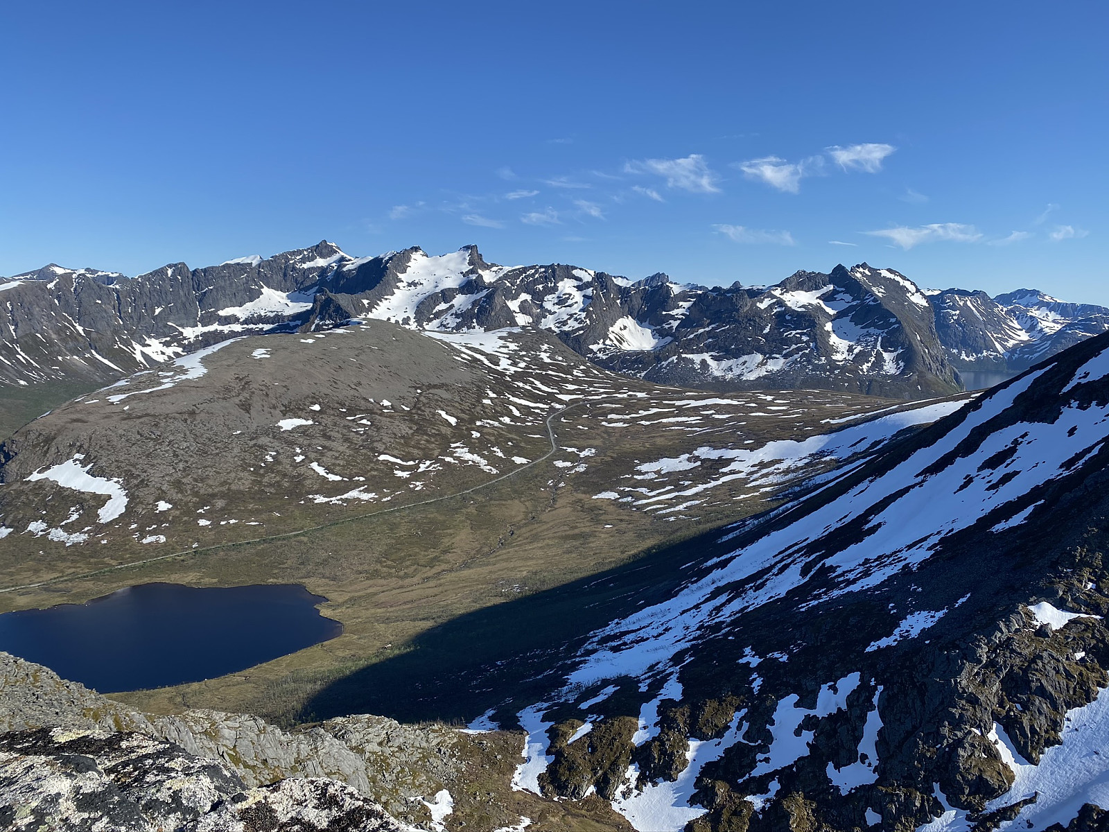
Hatten
- Date:
- 29.06.2020
- Characteristic:
- Hike
- Duration:
- 2:34h
- Distance:
- 6.9km
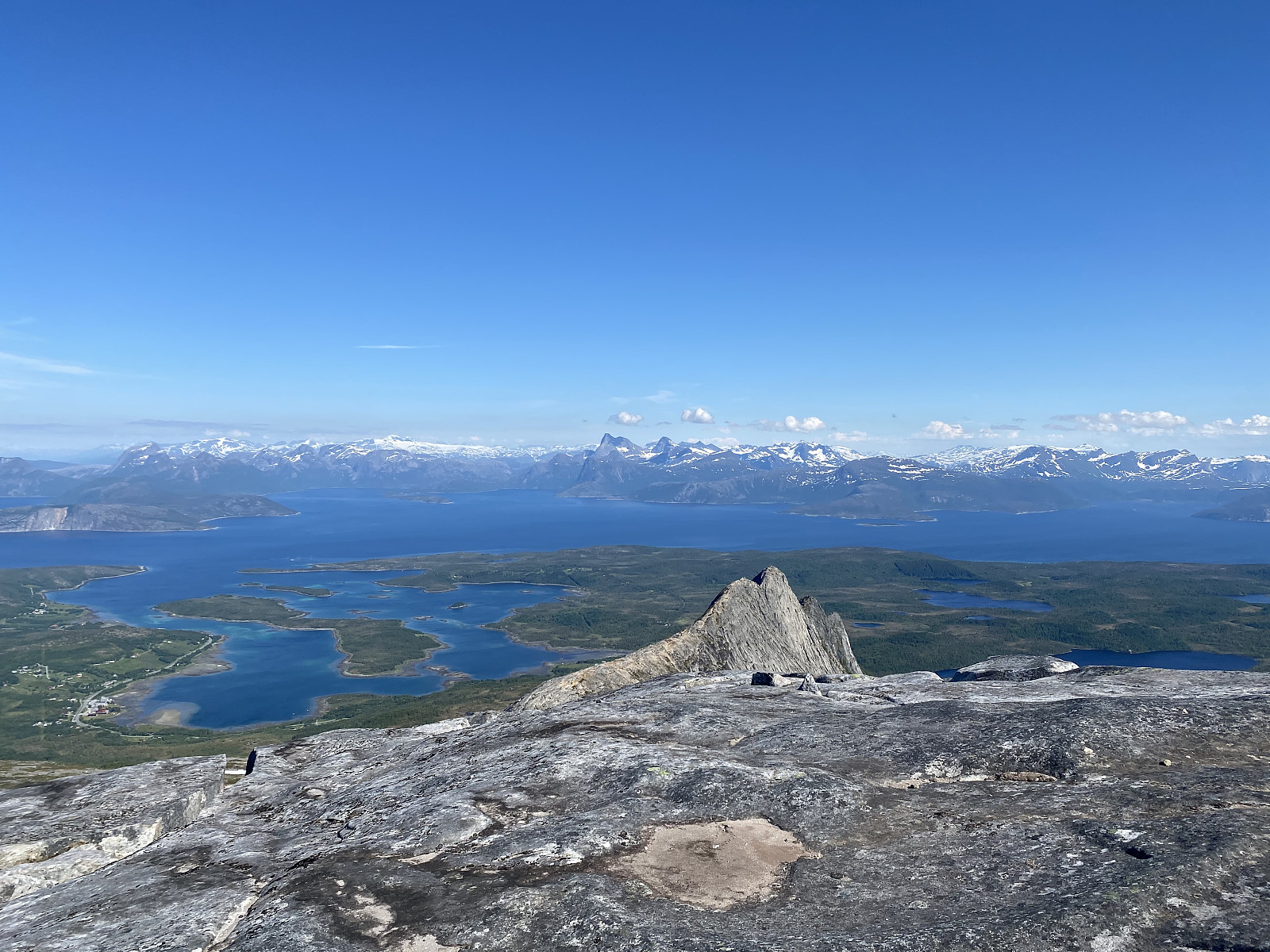 Denne fine turen gikk jeg første gang i fjor, og den var en bra kandidat for en kort tur før fergen over til Lødingen. En del mer myk grus etter skogen enn jeg husker. Nydelig utsikt i alle regninger fra toppen - fint å se mot Stetind som er årets største klatre-mål :)
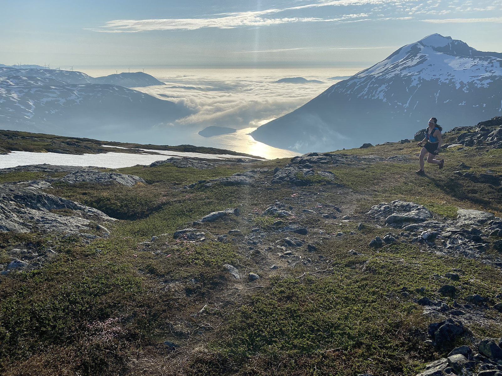
Litlvasstuva x 2
- Date:
- 28.06.2020
- Characteristic:
- Jogging
- Duration:
- 0:43h
- Distance:
- 4.0km
 Fin terrengløp, men alt for varmt, 25 grader kl18 på kvelden betydde kun to laps før jeg måtte gi meg.
Hamarøyskaftet
- Date:
- 27.06.2020
- Characteristic:
- Alpine climbing
- Duration:
- 8:39h
- Distance:
- 9.4km
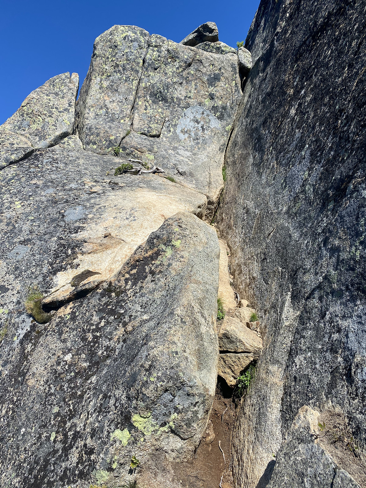 I first saw Hamarøyskaftet from a plane on the way to Tromsø, and ever since then have hoped to climb it. I did a fair amount of research before setting off, and found the report written by Olepetter (Ole-Petter Andersen) very helpful :)
After parking along Halsnesveien we followed a nice path until the route began at a shallow diedral. The path up was pretty logical, and soon we came to the first section of climbing, a layback along a thin crack. From here it was a short walk until the next steep section, a steep gully. The gully had good hand holds and wouldn´t be a problem for anyone comfortable with klyving. The path became more difficult to follow after this, and we came to what we thought was the third pitch, a relatively okay layback.
After heading past this pitch, we came to the real third pitch, the real layback >>>
I first saw Hamarøyskaftet from a plane on the way to Tromsø, and ever since then have hoped to climb it. I did a fair amount of research before setting off, and found the report written by Olepetter (Ole-Petter Andersen) very helpful :)
After parking along Halsnesveien we followed a nice path until the route began at a shallow diedral. The path up was pretty logical, and soon we came to the first section of climbing, a layback along a thin crack. From here it was a short walk until the next steep section, a steep gully. The gully had good hand holds and wouldn´t be a problem for anyone comfortable with klyving. The path became more difficult to follow after this, and we came to what we thought was the third pitch, a relatively okay layback.
After heading past this pitch, we came to the real third pitch, the real layback >>>
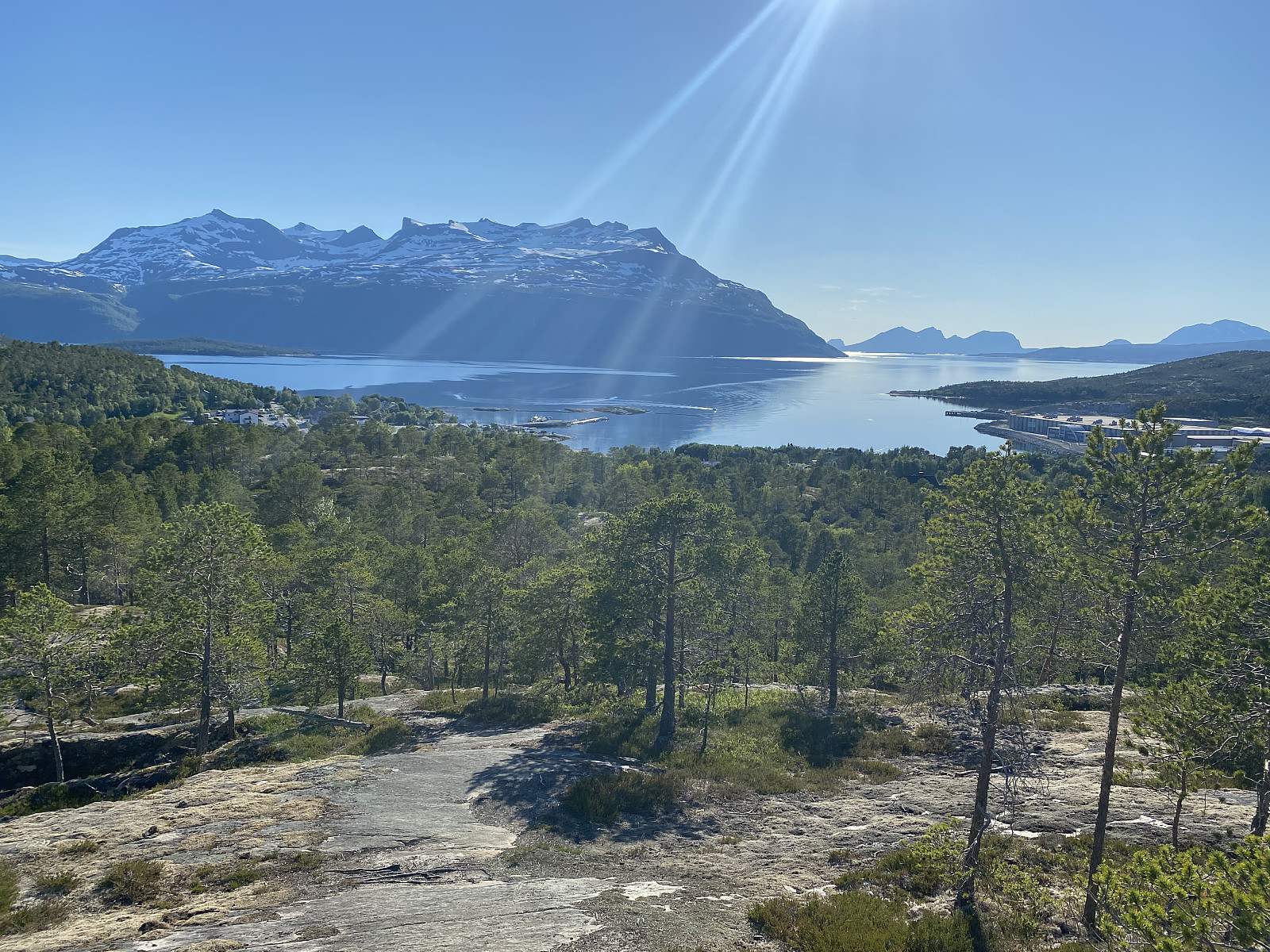
Synnøvjordtinden
- Date:
- 24.06.2020
- Characteristic:
- Hike
- Duration:
- 1:53h
- Distance:
- 7.8km
 Terrengløp sesongen er nå i gang, med en fin tur til Synnøvhordtinden med Martine. Nydelig kveld, med havtåke som kom rullende inn mens vi var på toppen. Bløt sti, men kun noen få snøpartier :)
Himmel og Hav - Mellomtinden
- Date:
- 20.06.2020
- Characteristic:
- Alpine climbing
- Duration:
- 10:00h
 Shorts & sports bra weather all day was a great start to the climbing season!
After a swampy approach we used about 45? minutes trying to find the notoriously mysterious Himmel og Hav. We walked up and down, then backwards, then called some friends, and after getting an extra pitch in, we came to the real start, where we saw the two old pegs everyone had mentioned. Here Brede led what we would find afterwards to be a more difficult variation of the first pitch, but what turned out to be really nice climbing after an awkward off-width start. Nicely placed ledges made for great belay stations. Brede also led the next pitch, again really nice climbing, before I led the final pitch to the top.
Time went super fast in the wall, and soon we had been out for 10 hours and I was pretty sunburnt.
Shorts & sports bra weather all day was a great start to the climbing season!
After a swampy approach we used about 45? minutes trying to find the notoriously mysterious Himmel og Hav. We walked up and down, then backwards, then called some friends, and after getting an extra pitch in, we came to the real start, where we saw the two old pegs everyone had mentioned. Here Brede led what we would find afterwards to be a more difficult variation of the first pitch, but what turned out to be really nice climbing after an awkward off-width start. Nicely placed ledges made for great belay stations. Brede also led the next pitch, again really nice climbing, before I led the final pitch to the top.
Time went super fast in the wall, and soon we had been out for 10 hours and I was pretty sunburnt.
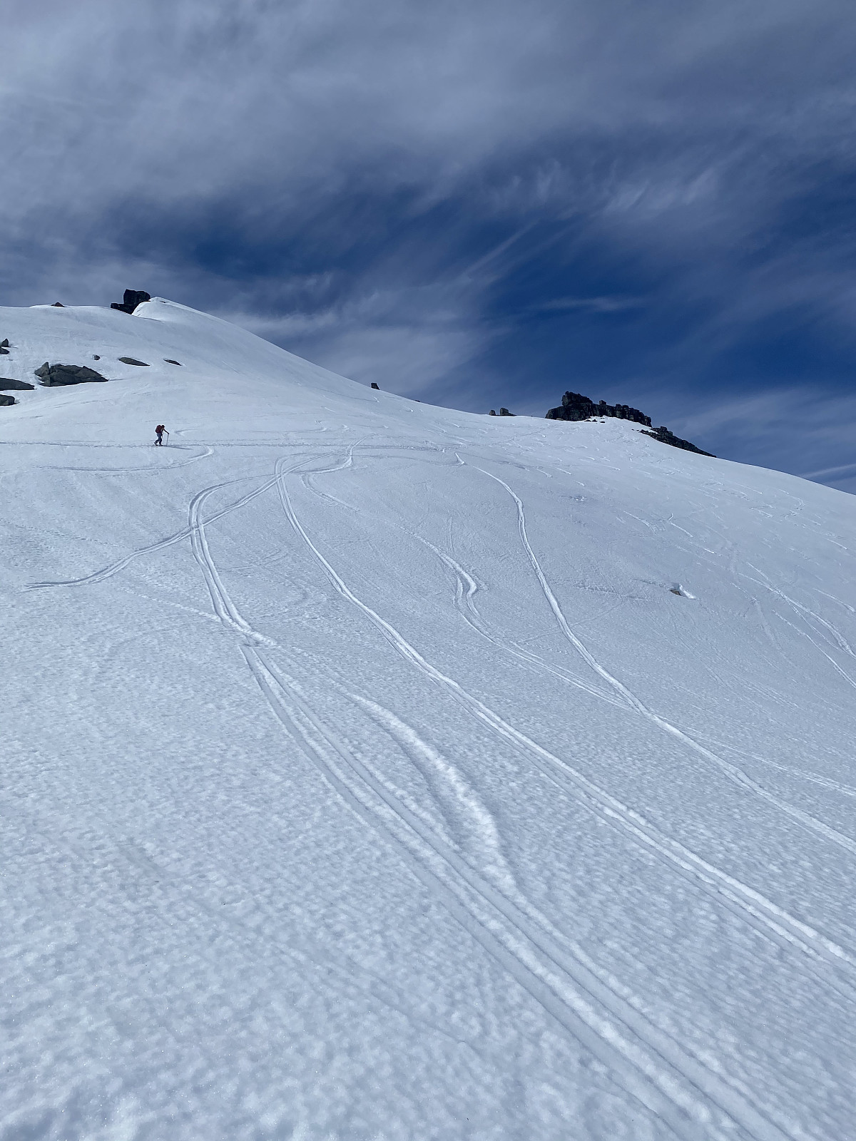
Storstolpan
- Date:
- 13.06.2020
- Characteristic:
- Randonnée/Telemark
- Distance:
- 8.9km
 Our second ski trip for the day :) We carried our skis only 10 meters from the car, and from here up it was smooth sailing. Headed around the lake to the right before up the steeper section of the face, and then heading towards the top. A really lovely evening that got a bit cloudier while we were on the summit. Great conditions the whole evening and perfect slush the whole way down.
Tusen takk for en nydelig tur Martine!
Our second ski trip for the day :) We carried our skis only 10 meters from the car, and from here up it was smooth sailing. Headed around the lake to the right before up the steeper section of the face, and then heading towards the top. A really lovely evening that got a bit cloudier while we were on the summit. Great conditions the whole evening and perfect slush the whole way down.
Tusen takk for en nydelig tur Martine!
Hollendaren
- Date:
- 13.06.2020
- Characteristic:
- Randonnée/Telemark
- Duration:
- 5:00h
- Distance:
- 9.5km
 Endelig, siste 1000m topp på Kvaløya i boksen! :)
The normal route looked like a real pain, with lots of on again - off again with skis, so Martine decided the most effective way up would be the best. After walking around 20 mins with our skis on our back, we reached the start of the snow felt and skinned up to the gully. Here I realized my ice axe wasn't attached to my backpack, which added a few extra meters of elevation. Won´t make that mistake again! From here skis went on the packs and we booted up the gully. From the top of the gully we headed towards the top. Incredible 360 degree views!
Nice slush on the way down, with a bit of luggeføre, and nice slush halfway down the gully, but it became icier as it got narrower. From here we down climbed the narrowest section of the gully, before >>>
Endelig, siste 1000m topp på Kvaløya i boksen! :)
The normal route looked like a real pain, with lots of on again - off again with skis, so Martine decided the most effective way up would be the best. After walking around 20 mins with our skis on our back, we reached the start of the snow felt and skinned up to the gully. Here I realized my ice axe wasn't attached to my backpack, which added a few extra meters of elevation. Won´t make that mistake again! From here skis went on the packs and we booted up the gully. From the top of the gully we headed towards the top. Incredible 360 degree views!
Nice slush on the way down, with a bit of luggeføre, and nice slush halfway down the gully, but it became icier as it got narrower. From here we down climbed the narrowest section of the gully, before >>>
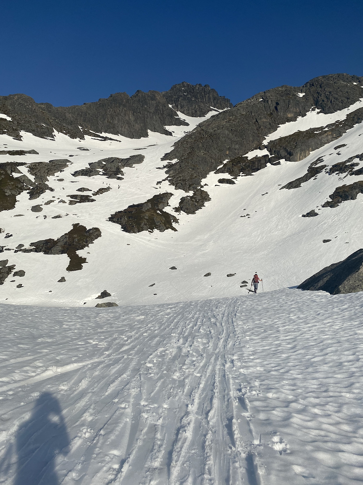
Stormoa
- Date:
- 06.06.2020
- Characteristic:
- Randonnée/Telemark
- Duration:
- 3:29h
- Distance:
- 5.3km
Stormoa had been on the list for a long time, and with summer well underway in Senja, I thought starting higher up was a good idea. We parked just after the tunnel at the side of the lake and picked a natural path up towards the saddle before the ridge. Hot today, but lots of wind, made for chilly conditions heading up the bowl. There was a waterfall forming in the middle of the valley, so we stayed well to the left of this until crossing, and then well to the right. Lots of snow had melted off the ridge, so the ridge was a mixed ascent. Around 50m from the top we had to turn around, as the snow conditions got too difficult. The snow had started melting from the ridge and was rotten around the stones, which meant we fell through with every step. We tried to continue the ascent more on the north >>>

