Archive - Date
Archive - Activity
-
Climbing (23)
- Alpine climbing (9)
- Sport climbing (11)
- Via ferrata (2)
-
Drive (1)
- Car drive (1)
-
Other winter trip (3)
- Snowshoe trip (3)
-
Ski trip (62)
- Backcountry skiing (3)
- Cross-country skiing (1)
- Randonnée/Telemark (58)
- Trip by foot (137)


Favourite trips
Favourite peaks


Synnøvjordtinden
- Date:
- 24.06.2020
- Characteristic:
- Hike
- Duration:
- 1:53h
- Distance:
- 7.8km
 Terrengløp sesongen er nå i gang, med en fin tur til Synnøvhordtinden med Martine. Nydelig kveld, med havtåke som kom rullende inn mens vi var på toppen. Bløt sti, men kun noen få snøpartier :)
Himmel og Hav - Mellomtinden
- Date:
- 20.06.2020
- Characteristic:
- Alpine climbing
- Duration:
- 10:00h
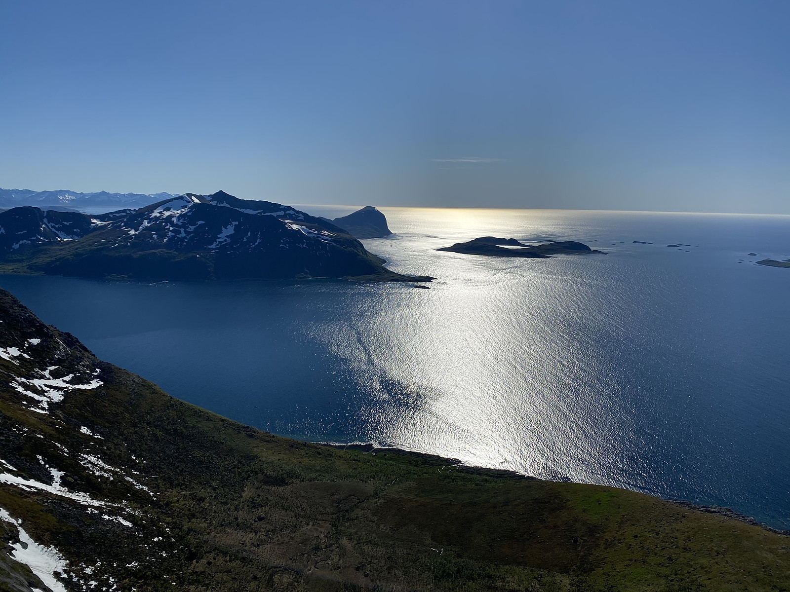 Shorts & sports bra weather all day was a great start to the climbing season!
After a swampy approach we used about 45? minutes trying to find the notoriously mysterious Himmel og Hav. We walked up and down, then backwards, then called some friends, and after getting an extra pitch in, we came to the real start, where we saw the two old pegs everyone had mentioned. Here Brede led what we would find afterwards to be a more difficult variation of the first pitch, but what turned out to be really nice climbing after an awkward off-width start. Nicely placed ledges made for great belay stations. Brede also led the next pitch, again really nice climbing, before I led the final pitch to the top.
Time went super fast in the wall, and soon we had been out for 10 hours and I was pretty sunburnt.
Shorts & sports bra weather all day was a great start to the climbing season!
After a swampy approach we used about 45? minutes trying to find the notoriously mysterious Himmel og Hav. We walked up and down, then backwards, then called some friends, and after getting an extra pitch in, we came to the real start, where we saw the two old pegs everyone had mentioned. Here Brede led what we would find afterwards to be a more difficult variation of the first pitch, but what turned out to be really nice climbing after an awkward off-width start. Nicely placed ledges made for great belay stations. Brede also led the next pitch, again really nice climbing, before I led the final pitch to the top.
Time went super fast in the wall, and soon we had been out for 10 hours and I was pretty sunburnt.
Storstolpan
- Date:
- 13.06.2020
- Characteristic:
- Randonnée/Telemark
- Distance:
- 8.9km
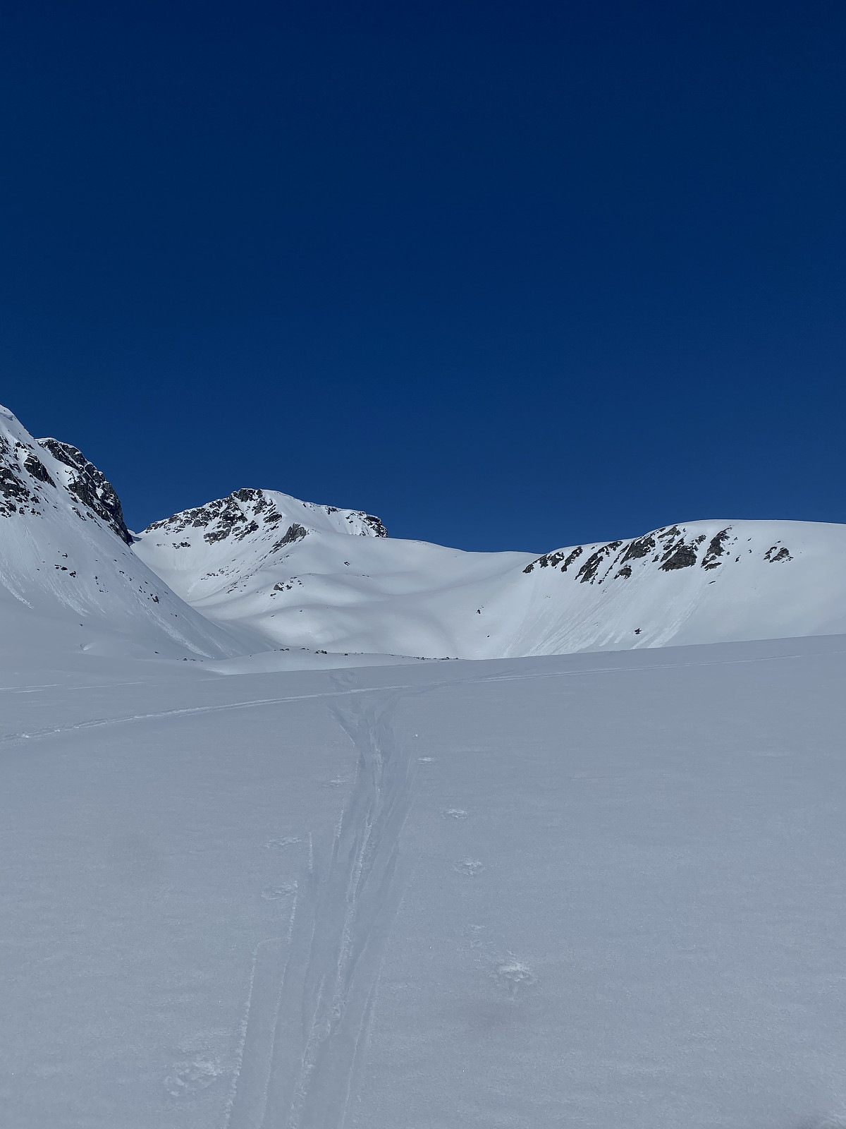
 Our second ski trip for the day :) We carried our skis only 10 meters from the car, and from here up it was smooth sailing. Headed around the lake to the right before up the steeper section of the face, and then heading towards the top. A really lovely evening that got a bit cloudier while we were on the summit. Great conditions the whole evening and perfect slush the whole way down.
Tusen takk for en nydelig tur Martine!
Our second ski trip for the day :) We carried our skis only 10 meters from the car, and from here up it was smooth sailing. Headed around the lake to the right before up the steeper section of the face, and then heading towards the top. A really lovely evening that got a bit cloudier while we were on the summit. Great conditions the whole evening and perfect slush the whole way down.
Tusen takk for en nydelig tur Martine!
Hollendaren
- Date:
- 13.06.2020
- Characteristic:
- Randonnée/Telemark
- Duration:
- 5:00h
- Distance:
- 9.5km
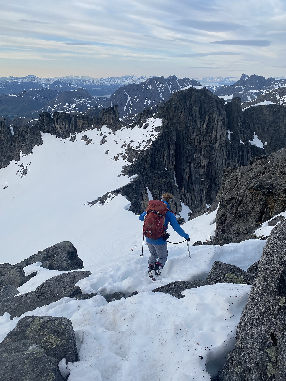
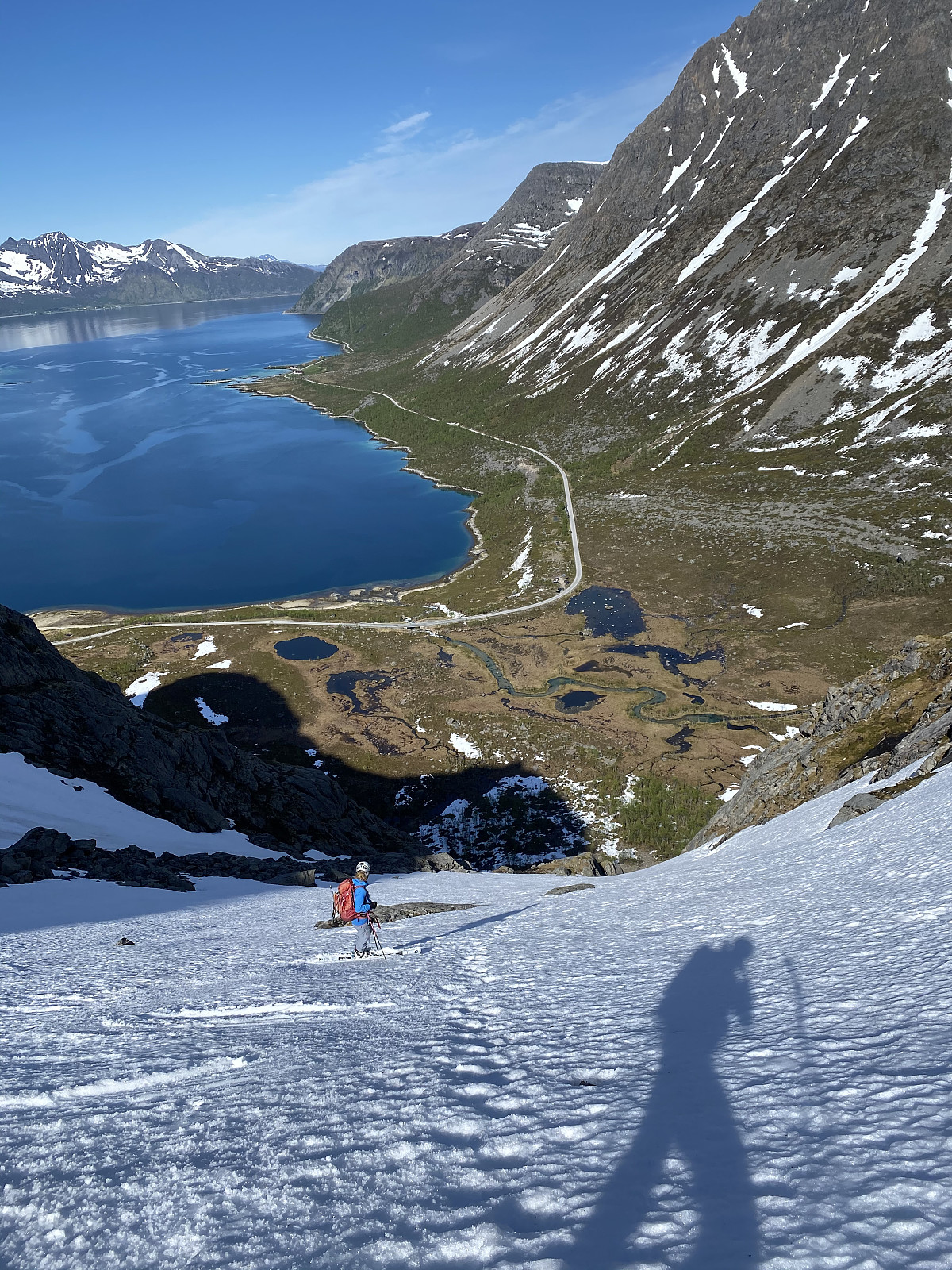 Endelig, siste 1000m topp på Kvaløya i boksen! :)
The normal route looked like a real pain, with lots of on again - off again with skis, so Martine decided the most effective way up would be the best. After walking around 20 mins with our skis on our back, we reached the start of the snow felt and skinned up to the gully. Here I realized my ice axe wasn't attached to my backpack, which added a few extra meters of elevation. Won´t make that mistake again! From here skis went on the packs and we booted up the gully. From the top of the gully we headed towards the top. Incredible 360 degree views!
Nice slush on the way down, with a bit of luggeføre, and nice slush halfway down the gully, but it became icier as it got narrower. From here we down climbed the narrowest section of the gully, before >>>
Endelig, siste 1000m topp på Kvaløya i boksen! :)
The normal route looked like a real pain, with lots of on again - off again with skis, so Martine decided the most effective way up would be the best. After walking around 20 mins with our skis on our back, we reached the start of the snow felt and skinned up to the gully. Here I realized my ice axe wasn't attached to my backpack, which added a few extra meters of elevation. Won´t make that mistake again! From here skis went on the packs and we booted up the gully. From the top of the gully we headed towards the top. Incredible 360 degree views!
Nice slush on the way down, with a bit of luggeføre, and nice slush halfway down the gully, but it became icier as it got narrower. From here we down climbed the narrowest section of the gully, before >>>
Stormoa
- Date:
- 06.06.2020
- Characteristic:
- Randonnée/Telemark
- Duration:
- 3:29h
- Distance:
- 5.3km
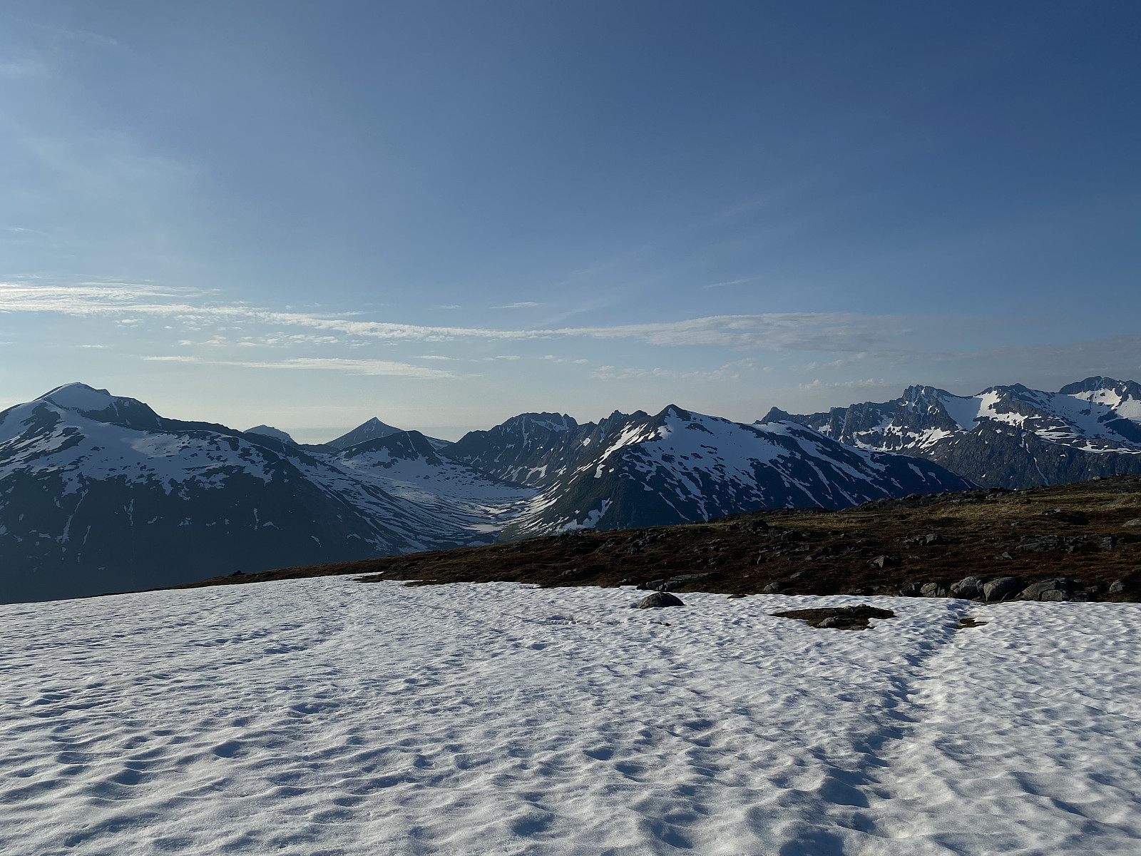
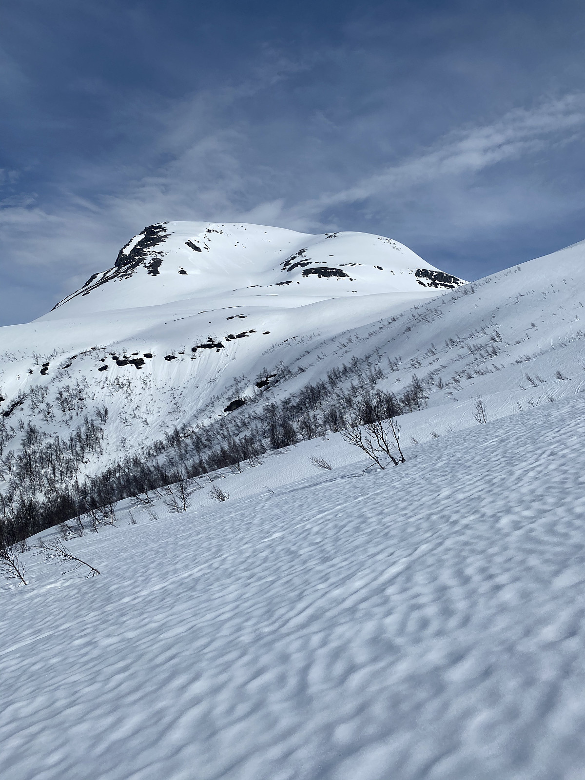
Stormoa had been on the list for a long time, and with summer well underway in Senja, I thought starting higher up was a good idea. We parked just after the tunnel at the side of the lake and picked a natural path up towards the saddle before the ridge. Hot today, but lots of wind, made for chilly conditions heading up the bowl. There was a waterfall forming in the middle of the valley, so we stayed well to the left of this until crossing, and then well to the right. Lots of snow had melted off the ridge, so the ridge was a mixed ascent. Around 50m from the top we had to turn around, as the snow conditions got too difficult. The snow had started melting from the ridge and was rotten around the stones, which meant we fell through with every step. We tried to continue the ascent more on the north >>>
Blåtinden
- Date:
- 31.05.2020
- Characteristic:
- Randonnée/Telemark
- Duration:
- 5:00h
- Distance:
- 11.0km
 Spring is finally starting to arrive! Still plenty of snow and we could walk with skiis from the roadside :) No tracks made for an interesting trip through the forrest with pretty wet snow below the tree line. Nice slush afterwards, but stepper sections on the ridge ( 600-900moh) were a lot wetter, though the snow appeared stable and was sitting pretty well. Really nice skiing down through the bowl with a bit of luggeføre. Nice to be alone on a mountain that’s so popular. Takk for turen pauke!
Kvasstinden rundt
- Date:
- 23.05.2020
- Characteristic:
- Randonnée/Telemark
- Duration:
- 6:57h
- Distance:
- 20.5km
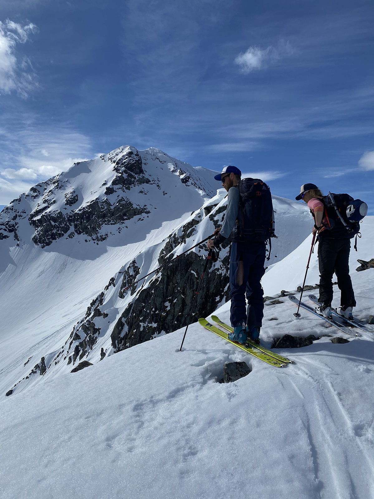 Kvasstinden is a less-visited peak in Nord-lenangen. The most straight forward route would be to start in Storvoll and walk along the fjord, but higher temperatures meant Sten & Martine thought it would be better to walk via Bjørndalen and avoid the rotten snow. We parked at Bjørndal and followed tracks up through Bjørndalen just after 7am, before heading left in the valley once the terrain flattened out. The plan was to glide north east and down to around 60moh before we started gaining elevation again. We found a short cut down one of the east facing flanks of Bjørnskarstinden and got some fun skiing in, before heading up Kvasstinden.
Stunning views in all directions from the top, and nice varied terrain. Great slush conditions skiing down from the top, and we glided into the valley >>>
Kvasstinden is a less-visited peak in Nord-lenangen. The most straight forward route would be to start in Storvoll and walk along the fjord, but higher temperatures meant Sten & Martine thought it would be better to walk via Bjørndalen and avoid the rotten snow. We parked at Bjørndal and followed tracks up through Bjørndalen just after 7am, before heading left in the valley once the terrain flattened out. The plan was to glide north east and down to around 60moh before we started gaining elevation again. We found a short cut down one of the east facing flanks of Bjørnskarstinden and got some fun skiing in, before heading up Kvasstinden.
Stunning views in all directions from the top, and nice varied terrain. Great slush conditions skiing down from the top, and we glided into the valley >>>
Nordre Solltinden
- Date:
- 22.05.2020
- Characteristic:
- Randonnée/Telemark
- Duration:
- 3:48h
- Distance:
- 6.3km
 Øytopper over 1000m.
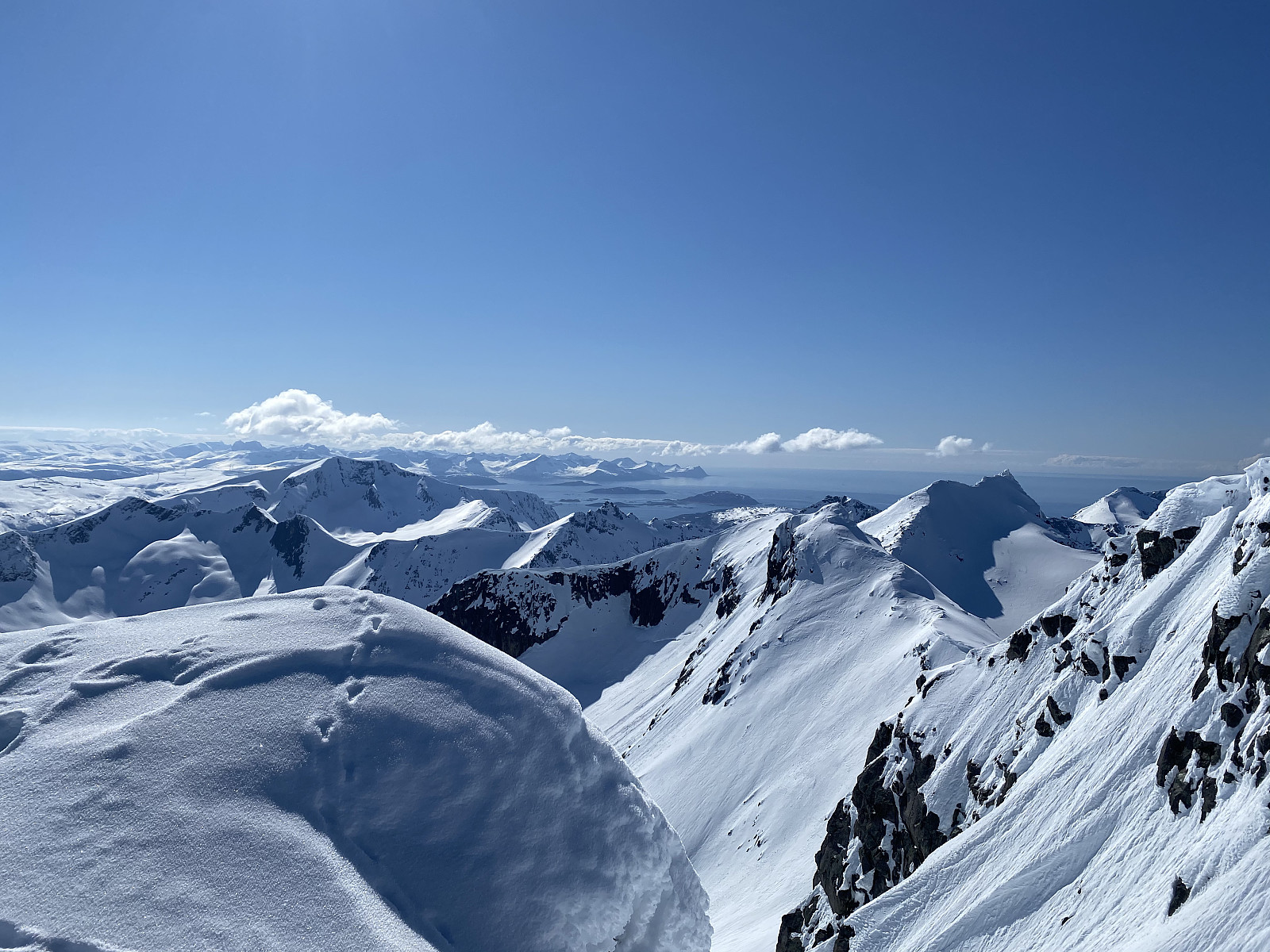
High temperatures and avalanche danger made me think a ridge formation would be the best option for today, and Rema1000 was still on the list. We parked just after the small bridge at Nordre Åborsneset and followed the right side of the river up towards the ridge. The first day of shorts weather for this year :) From here it was easy terrain along the ridge until around 850moh where the top flank started getting steeper. After digging a snow profile, we decided the snow was stable enough to boot up but not stable enough to ski. We parked the skiis and headed to the top on foot. Amazing views of Ringvassøya and over to Lyngen. After downclimbing to our skiis we had fantastic slush the whole way down, with the last hundred elevation or so really wet, heavy snow. Takk for >>>
Øytopper over 1000m.
High temperatures and avalanche danger made me think a ridge formation would be the best option for today, and Rema1000 was still on the list. We parked just after the small bridge at Nordre Åborsneset and followed the right side of the river up towards the ridge. The first day of shorts weather for this year :) From here it was easy terrain along the ridge until around 850moh where the top flank started getting steeper. After digging a snow profile, we decided the snow was stable enough to boot up but not stable enough to ski. We parked the skiis and headed to the top on foot. Amazing views of Ringvassøya and over to Lyngen. After downclimbing to our skiis we had fantastic slush the whole way down, with the last hundred elevation or so really wet, heavy snow. Takk for >>>
Skitntinden (skitoppen)
- Date:
- 21.05.2020
- Characteristic:
- Randonnée/Telemark
- Duration:
- 3:08h
- Distance:
- 9.5km
 Endelig, varmt vær og sol i Tromsø! Begynte som tre, men etter innsjøen ble det snu-tur på de andre to i følget grunnet gnagsår. Høy temperaturer og mye sol hadde ført til høy skredfare og jeg ville ikke gå alene; men fikk hive meg på turen til et hyggelig par som var bak oss, Morten & Adele. Finfin utsikt fra toppen og fin slush-kjøring på vei ned, men på de vest-vendte sider var det veldig lett å utløse våte skred.

