Archive - Date
Archive - Activity
-
Other winter trip (2)
- Snowshoe trip (2)
- Trip by foot (147)

Collected lists
-
Tromsø ≥ 100m pf.
(28/211)
 13%
13% -
Troms ≥ 1000m pf.
(3/36)
8%
-
Munros
(6/283)
2%

Snyfjellet & Nonsbu
- Date:
- 20.09.2015
- Characteristic:
- Hike
- Duration:
- 5:05h
- Distance:
- 22.0km
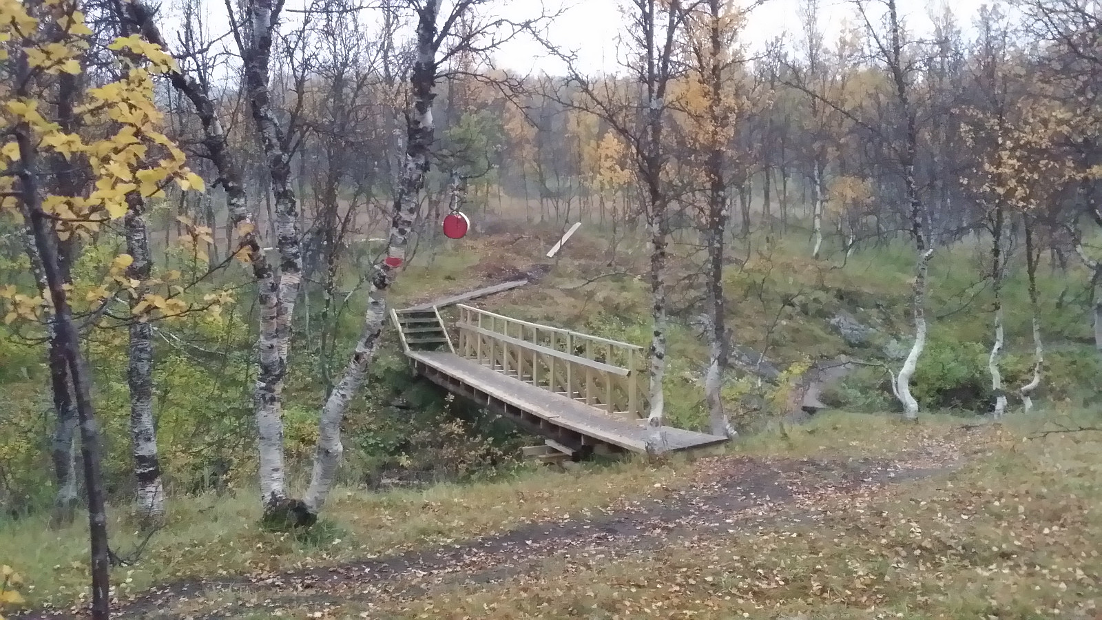 Idag hadde æ lyst på langtur uten alt for bratte stigninger. Valget fallt på Ti på Topp-turen Nonsbu, og da kunne æ jo likevel ta en tur opp til Snyfjellet (pf>100) når æ allikevel var så nært. Så bare å pakke sekken å kjøre ut til den store parkeringsplassen i Tønsvik.
Turen startet på stor vei tillpasset til biltrafikk, men veien blei etter kvert smalere og smalere og blei til en sti. Godt skiltet mot Nonsbu i veikryss. Rimelig vått etter regnet igår, men det var godt om planker å gå på over myrmarken, og en ordentlig bru for å krysse elva et sted.
Ifølge kartet på PeakBook sku det gå en liten sti opp til Snyfjellet fra stien til Nonsbu. Sia æ ikkje fant stien tok æ av mot fjellet omtrent der det var markert på kartet at den sku være og gikk opp offroad. Dårlig >>>
Idag hadde æ lyst på langtur uten alt for bratte stigninger. Valget fallt på Ti på Topp-turen Nonsbu, og da kunne æ jo likevel ta en tur opp til Snyfjellet (pf>100) når æ allikevel var så nært. Så bare å pakke sekken å kjøre ut til den store parkeringsplassen i Tønsvik.
Turen startet på stor vei tillpasset til biltrafikk, men veien blei etter kvert smalere og smalere og blei til en sti. Godt skiltet mot Nonsbu i veikryss. Rimelig vått etter regnet igår, men det var godt om planker å gå på over myrmarken, og en ordentlig bru for å krysse elva et sted.
Ifølge kartet på PeakBook sku det gå en liten sti opp til Snyfjellet fra stien til Nonsbu. Sia æ ikkje fant stien tok æ av mot fjellet omtrent der det var markert på kartet at den sku være og gikk opp offroad. Dårlig >>>
Sørvikaksla
- Date:
- 24.08.2015
- Characteristic:
- Hike
- Duration:
- 1:20h
- Distance:
- 2.4km
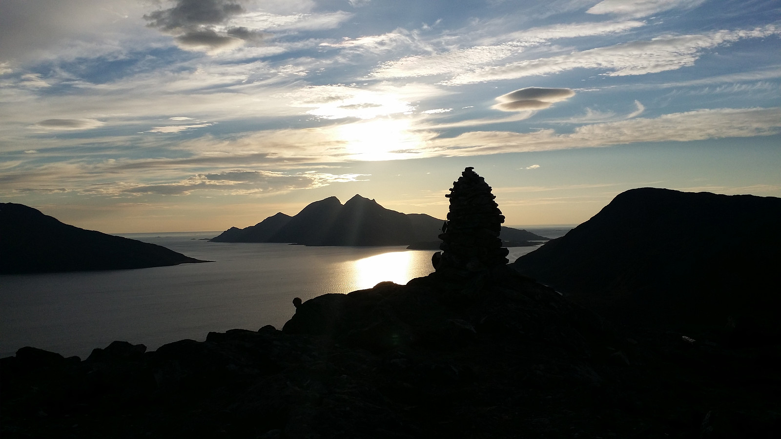
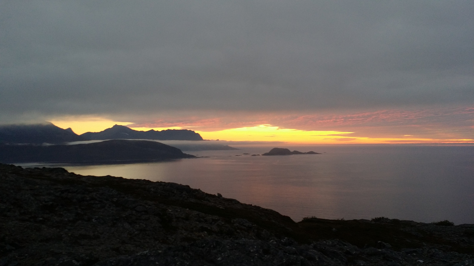 Fann en Ti på Topp-skilt atme veien sør from Brensholmen, med en liten parkeringslomma på andre sia veien. Rimelig lettgådd terreng med blandning av stier og steinur, med røde markeringer fra Ti på Topp å følge. Flott utsikt fra toppen i solnedgang.
Med på tur: Helene
Fann en Ti på Topp-skilt atme veien sør from Brensholmen, med en liten parkeringslomma på andre sia veien. Rimelig lettgådd terreng med blandning av stier og steinur, med røde markeringer fra Ti på Topp å følge. Flott utsikt fra toppen i solnedgang.
Med på tur: Helene
Nattmålsfjellet
- Date:
- 20.08.2015
- Characteristic:
- Walk
- Duration:
- 1:45h
- Distance:
- 4.4km
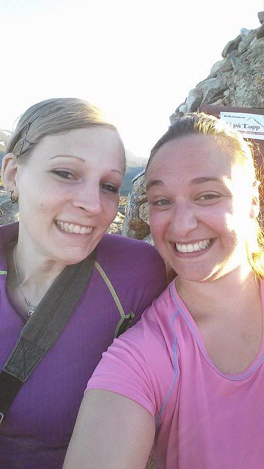 Ti på Topp 2015. Med på tur: Helene.
Store Blåmann
- Date:
- 16.08.2015
- Characteristic:
- Hillwalk
- Duration:
- 6:39h
- Distance:
- 6.8km
 Endelig ble det idag ti å ta turen opp Kvaløyas høyeste fjell Store Blåmann. Pakket ryggsekkene og kjørte ut til Slettneset kor det var parkeringslomma for 4-5 biler. Og så direkt på lett klyving etter å krysset veien. Deretter sti, stein og planker å gå på gjennom myrlandet.
Etter kvert meir steneit. Og plutselig så vi et reinsdyr som hadde det veldi travelt å komme sæ ned for fjellet. Deretter rett inn i en liten skog, fortsatt på lav høyde. Og vegetasjonen fulgte den alt meit bratte stien opp. Litt lett klyving men fortsatt rimelig lett tur.
Etter kvert blei det meir utydelig sti, meir store steiner, og masse klyving. Det var rimelig gott med små varder som viste veien, men allikevel var det litt vanskelig å se nedenfra ka for en rute som var best å ta sæ opp på. Etter >>>
Endelig ble det idag ti å ta turen opp Kvaløyas høyeste fjell Store Blåmann. Pakket ryggsekkene og kjørte ut til Slettneset kor det var parkeringslomma for 4-5 biler. Og så direkt på lett klyving etter å krysset veien. Deretter sti, stein og planker å gå på gjennom myrlandet.
Etter kvert meir steneit. Og plutselig så vi et reinsdyr som hadde det veldi travelt å komme sæ ned for fjellet. Deretter rett inn i en liten skog, fortsatt på lav høyde. Og vegetasjonen fulgte den alt meit bratte stien opp. Litt lett klyving men fortsatt rimelig lett tur.
Etter kvert blei det meir utydelig sti, meir store steiner, og masse klyving. Det var rimelig gott med små varder som viste veien, men allikevel var det litt vanskelig å se nedenfra ka for en rute som var best å ta sæ opp på. Etter >>>
Stor-Kjølen
- Date:
- 11.08.2015
- Characteristic:
- Hillwalk
- Duration:
- 3:02h
- Distance:
- 10.0km
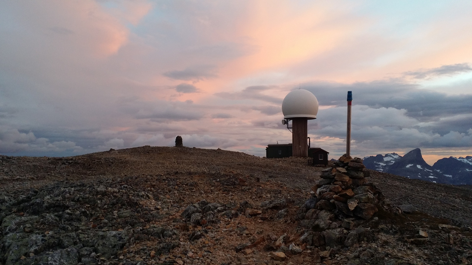 Ti på Topp tur 2015. Tenkte egentlig bare gå opp Jamnfjellet sia klokka var over 21, men når æ vel kommet mæ ut på tur kan det være litt vanskelig å la være å fortsette å gå ;) Tydelig markert sti fra parkeringsplassen opp til Jamnfjellet, deretter umarkert men rimelig god sti videre mot Kjølen. Siste kilometer over steinur har ingen sti, men værstasjonen på toppen av Kjølen viser vei. Kort pause i varmebua og så ned omtrent samme vei igjen.
Trehørningen
- Date:
- 11.08.2015
- Characteristic:
- Hike
- Duration:
- 0:54h
- Distance:
- 3.5km
 Ti på Topp 2015. Mange som var ute på tur idag. Parkerte ved parkeringslomma på sørsia av fjellet. Gikk kort stykke øst kor et Ti på Topp skilt visede kor stien begynte. Tydelig og lettgådd sti heile veien opp til toppen. Veldig flott utsikt for liten anstrengelse. Samme tur ned igjen.
Geitnausa
- Date:
- 04.08.2015
- Characteristic:
- Hillwalk
- Duration:
- 4:35h
- Distance:
- 14.5km
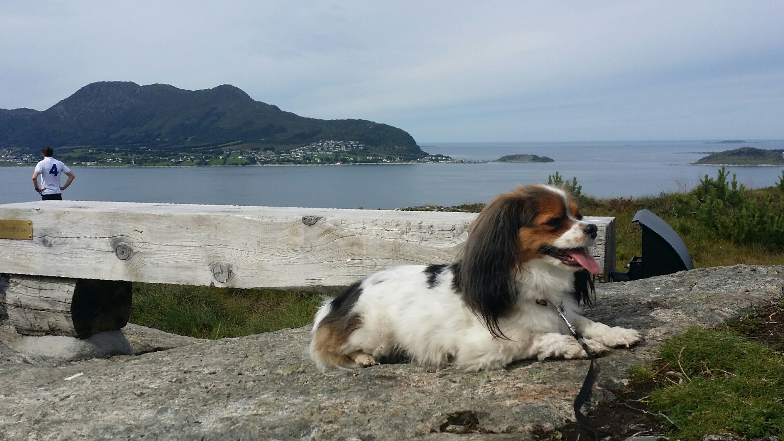
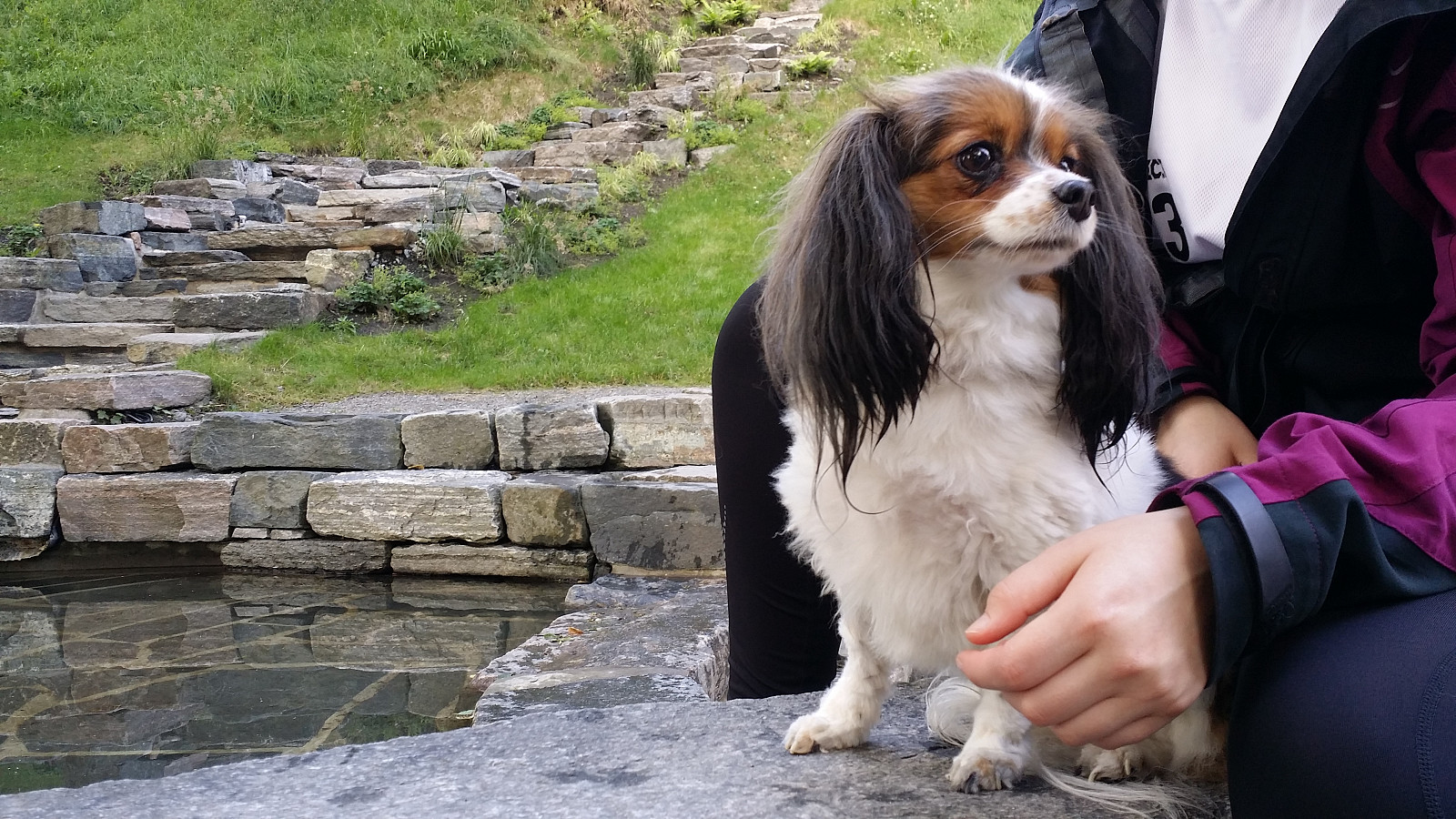
 Tok buss 618 til Spjelkavik og gikk forbi Lillevatnet mot Spjelkavikstadion og innom et boligstrøk før vi kom til en god tursti. Gott vær men meldt lyn og torden, så litt forsiktig rutevalg med tanke på bikkja. Jo lenger opp vi kom jo meir våtmark og gjørma, nokka Lille Pernille likte å gå i for å kjøle sæ ned i det varme været. Mange små tre-"bruer" over våte deler av stien, men også mange våte partier å krysse uten dem. Noen i denne bygda like å sette opp skilt for det var vanvittig gott me skilt til alle mulige hytter og andre ting atme stien.
Etter kvert så kom vi oss opp på litt høyde, men selv over 400 moh var det bitvis vått å gå. Men der fann vi den første lille toppen, Vestre Spjelkavikfjellet. Sia det no var fritt for trer så var det god utsikt >>>
Tok buss 618 til Spjelkavik og gikk forbi Lillevatnet mot Spjelkavikstadion og innom et boligstrøk før vi kom til en god tursti. Gott vær men meldt lyn og torden, så litt forsiktig rutevalg med tanke på bikkja. Jo lenger opp vi kom jo meir våtmark og gjørma, nokka Lille Pernille likte å gå i for å kjøle sæ ned i det varme været. Mange små tre-"bruer" over våte deler av stien, men også mange våte partier å krysse uten dem. Noen i denne bygda like å sette opp skilt for det var vanvittig gott me skilt til alle mulige hytter og andre ting atme stien.
Etter kvert så kom vi oss opp på litt høyde, men selv over 400 moh var det bitvis vått å gå. Men der fann vi den første lille toppen, Vestre Spjelkavikfjellet. Sia det no var fritt for trer så var det god utsikt >>>
Heissa pf.≥50m
- Date:
- 03.08.2015
- Characteristic:
- Hike
- Duration:
- 4:20h
- Distance:
- 12.6km
 Turen starta med buss 618 ut til Heissa. Første turmål var Heissas høgste punkt Sukkertoppen. Så vi gjikk mot Hessa skole og sukkertoppvegen. Litt skjult mellom to hus fant æ en skilt som viste vei mot stien til toppen. God sti, men bitvis veldi gjørmat, heile veien til toppen. Veldi fin utsikt alle retninger. Kort pause og så ned igjen til neste turmål: Skolefjellet. Her var det litt vanskelig å finne en vei opp, men etter litt lett klatring opp noen steiner bak et elhus kom vi til en sti (æ var nødt å løfte hunden opp til stien). Fin sti, men vanskelig å finne en tur ned uten å gå gjennom noens hage eller ta samme sti tilbake.
To av fire fjell. Neste på tur var Pilen og Olsfjellet som ligger like ved kverandre. Pilen hadde noe (dårlig) skilting fra Stikk Ut, så godt å vite >>>
Turen starta med buss 618 ut til Heissa. Første turmål var Heissas høgste punkt Sukkertoppen. Så vi gjikk mot Hessa skole og sukkertoppvegen. Litt skjult mellom to hus fant æ en skilt som viste vei mot stien til toppen. God sti, men bitvis veldi gjørmat, heile veien til toppen. Veldi fin utsikt alle retninger. Kort pause og så ned igjen til neste turmål: Skolefjellet. Her var det litt vanskelig å finne en vei opp, men etter litt lett klatring opp noen steiner bak et elhus kom vi til en sti (æ var nødt å løfte hunden opp til stien). Fin sti, men vanskelig å finne en tur ned uten å gå gjennom noens hage eller ta samme sti tilbake.
To av fire fjell. Neste på tur var Pilen og Olsfjellet som ligger like ved kverandre. Pilen hadde noe (dårlig) skilting fra Stikk Ut, så godt å vite >>>
Signalen
- Date:
- 02.08.2015
- Characteristic:
- Hike
- Duration:
- 1:06h
- Distance:
- 2.8km
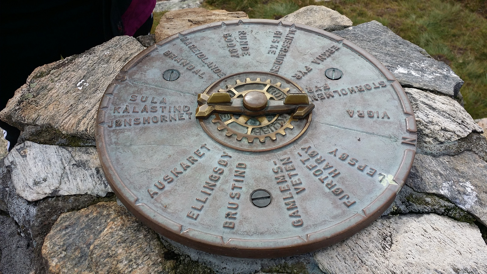 Signalen er eneste toppen med pf >100 på Valderøya i Giske kommune. Nært å kjøre fra Ålesund, fant parkering på sørsia av øya. Greit sti heile veien, og fleire små topper å komme sæ opp på for dem som vill. Fulgte heilt enkelt stien opp til Signalen via Litle Måsetua og så samme tursti tilbake.
Med på tur: Therese og Lille Pernille.
Signalen er eneste toppen med pf >100 på Valderøya i Giske kommune. Nært å kjøre fra Ålesund, fant parkering på sørsia av øya. Greit sti heile veien, og fleire små topper å komme sæ opp på for dem som vill. Fulgte heilt enkelt stien opp til Signalen via Litle Måsetua og så samme tursti tilbake.
Med på tur: Therese og Lille Pernille.
Aksla
- Date:
- 31.07.2015
- Characteristic:
- Walk
- Duration:
- 1:14h
- Distance:
- 3.2km
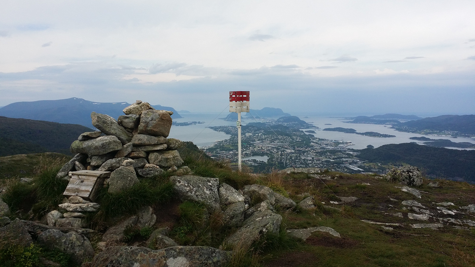
 Tur gjennom byparken i Ålesund, opp di 418 trappetrinnene till Fjellstua og videre på sti (og litt på bilvei) til Nørvøyas høyeste punkt Aksla. Lettgådd tur. Gikk samme vei tilbake.
Med på tur: Therese og Lille Pernille
Tur gjennom byparken i Ålesund, opp di 418 trappetrinnene till Fjellstua og videre på sti (og litt på bilvei) til Nørvøyas høyeste punkt Aksla. Lettgådd tur. Gikk samme vei tilbake.
Med på tur: Therese og Lille Pernille

