
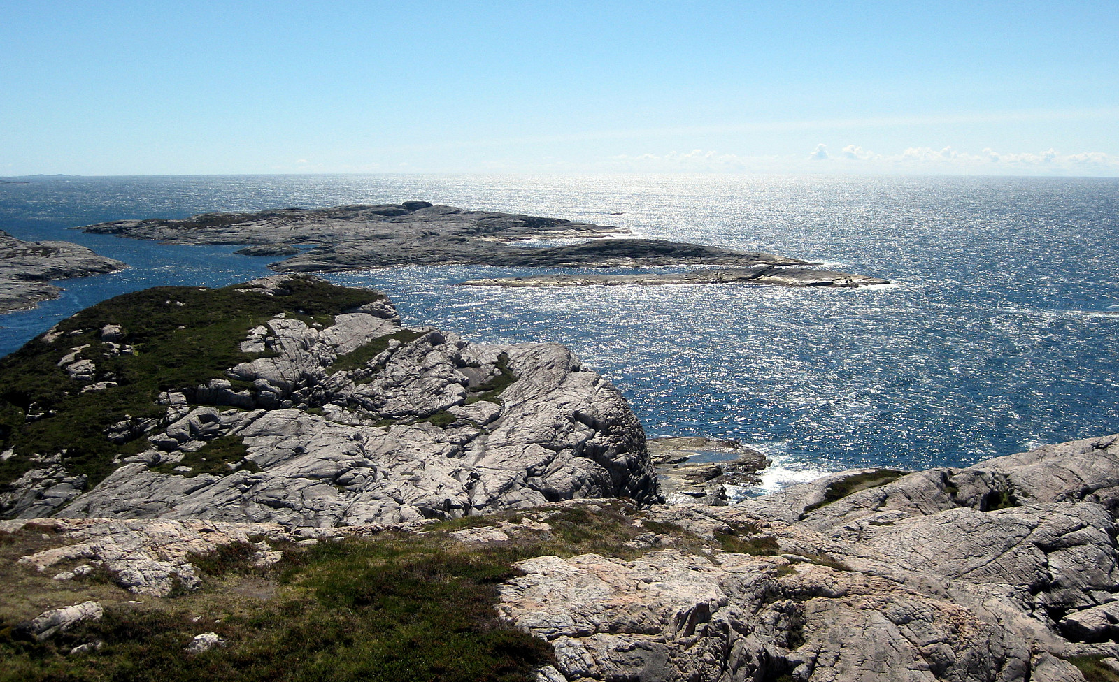
Skogsøytua (21.06.2014)

Geschrieben von HHauser (Helwig Hauser)

| Startpunkt | Bridge before Herdlevær (10m) |
|---|---|
| Endpunkt | Bridge before Herdlevær (10m) |
| Tourcharakter | Wanderung |
| Tourlänge | 2h 00min |
| Entfernung | 4,8km |
| Höhenmeter | 232m |
| GPS |
|
| Besteigungen | Skogsøytua (49m) | 21.06.2014 |
|---|
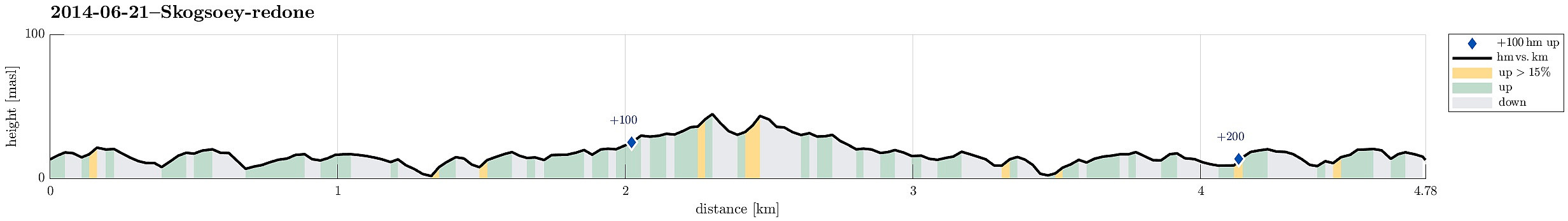
Note that this track has been created a posteriori, i.e., from memory, not automatically recorded.
Trip Summary
Again and again a nice little hike to the outermost rocks of Øygarden!


Benutzerkommentare