
Hananipa (18.05.2014)

Geschrieben von HHauser (Helwig Hauser)

| Startpunkt | Skulestad (340m) |
|---|---|
| Endpunkt | Skulestad (340m) |
| Tourcharakter | Bergtour |
| Tourlänge | 4h 00min |
| Entfernung | 11,2km |
| Höhenmeter | 732m |
| GPS |
|
| Besteigungen | Hananipa (717m) | 18.05.2014 |
|---|---|---|
| Trollabotshaugen (678m) | 18.05.2014 | |
| Besuche anderer PBE | Skulstad p-plass (340m) | 18.05.2014 |
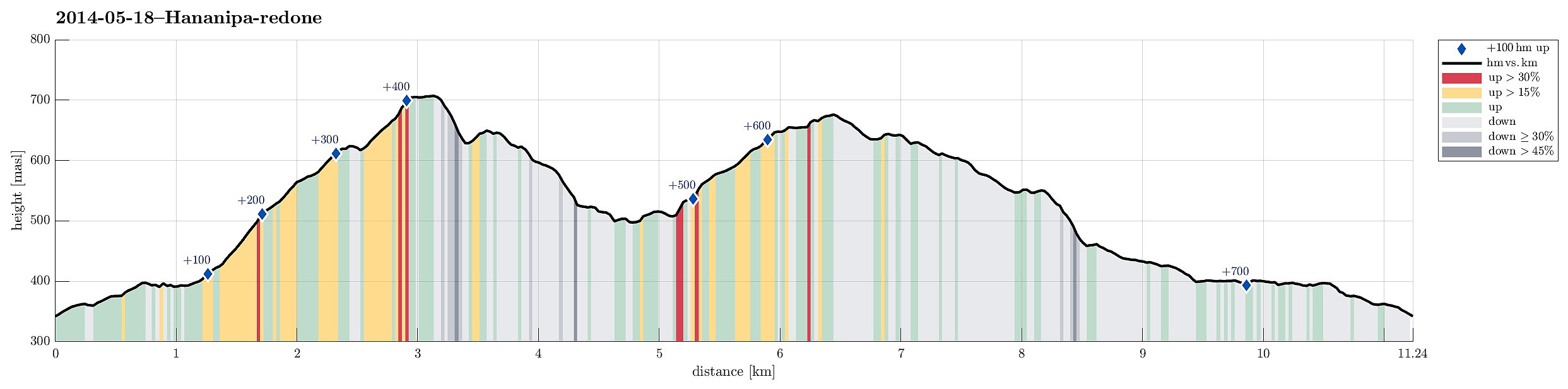
Note that this track has been created a posteriori, i.e., from memory, not automatically recorded.
Trip Summary
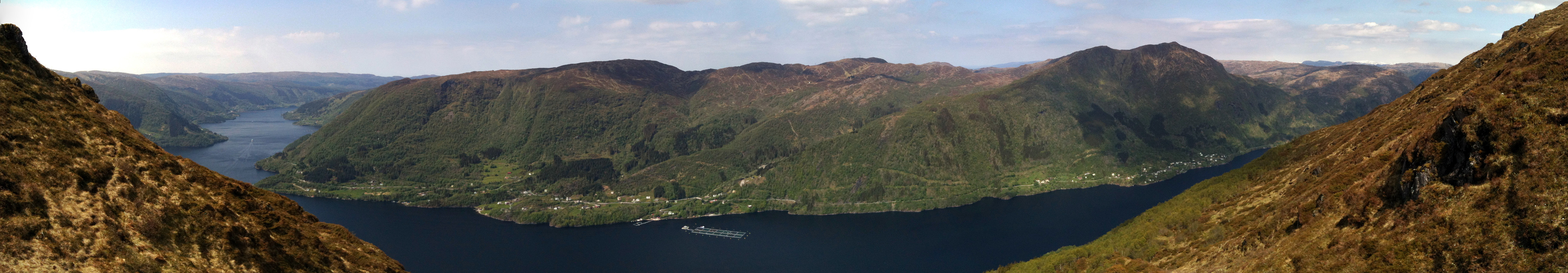
Hananipa from Skulestad (and back via Trollabotshaugen) was a nice round tour in beautiful landscape and with fantastic views over the fjord!
Useful Resources
Web page WestCoastPeaks.com provides useful information about Hananipa, Raudnipa, Krånipa, and Raudfjell
and also Petter Bjørstad has a useful page about Hananipa.
Web page UT.no from the Norwegian Trekking Association recommends this hike up and down Hananipa (only part of our hike, though).


Benutzerkommentare