
Fanafjellet from Fana (25.01.2026)

Geschrieben von HHauser (Helwig Hauser)

| Startpunkt | Fana (30m) |
|---|---|
| Endpunkt | Fana (30m) |
| Tourcharakter | Wanderung |
| Tourlänge | 3h 30min |
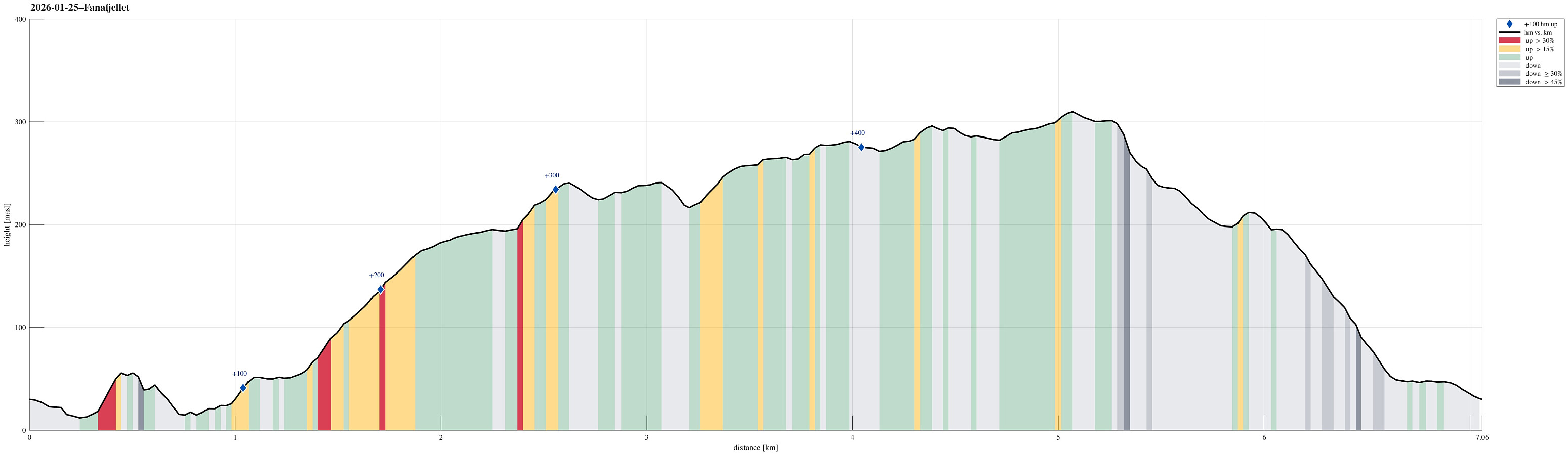
| Entfernung | 7,1km |
| Höhenmeter | 490m |
| GPS |
|
| Besteigungen | Folldalshaugane (300m) | 25.01.2026 |
|---|---|---|
| Grønafjellet (244m) | 25.01.2026 | |
| Kolhushaugen (217m) | 25.01.2026 | |
| Lyseskarfjellet (313m) | 25.01.2026 | |
| Marietoppen (57m) | 25.01.2026 |
Trip Summary
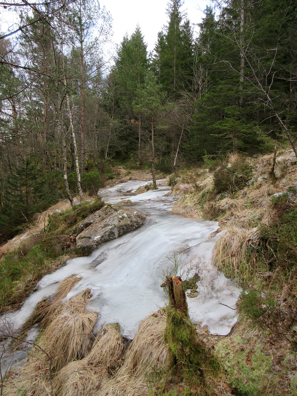
We thought that all the frozen ground condition would be just right for an excursion to Fanafjellet (which on a regular day can be very wet, especially when walking around up there off-trail). We parked in Fana near Fanastølen and then started our hike with a short ascent to Marietoppen. While Marietoppen is just a small hill, it is actually interesting to find extended remains from WWII defense structures on its top. After this initial visit to Marietoppen, we then aimed to find a good way up to Fanafjellet. While we first considered checking an opportunity to do this "straight up" in the south of Marietoppen, we then decided that walking a small detour via Saganeset would bring us nicely up to a proper trail at Høgaberget. When near Bukkamyrane at about 175masl, we then followed a route towards the southwest. Just a few height meters further up, we departed from the trail, heading further towards the southwest (instead of completing the ascent to the heights of Fanafjellet at once). After passing Salbuholene, we ascended out of the forest, and quickly enjoyed some very nice views. To make our hike a nice round, we then walked over to Grønafjellet, before turning towards the south. From there, we then found a connection over to Brunane in order to connect with a trail (not Jubilæumsstien) over Skarafjellet. Following this trail, we crossed over Folldalshaugane to get to Lysekarfjellet. After a short break with some minimal lunch, we then used Jubilæumsstien to get back down to Fana. On the way down, we first needed to navigate some rather extended ice fields. Then there was a chance to quickly include Kolhushaugen and it was fun to see a quite developed resting place right on top of it! :-)
Photos
Selected photos are available as Google photo album.
Useful Resources
See also the related FB-page Hiking around Bergen, Norway.


Benutzerkommentare