
Ørnafjellet and Lyderhorn from Nedberget (24.01.2026)

Geschrieben von HHauser (Helwig Hauser)

| Startpunkt | Nedberget (65m) |
|---|---|
| Endpunkt | Nedberget (65m) |
| Tourcharakter | Wanderung |
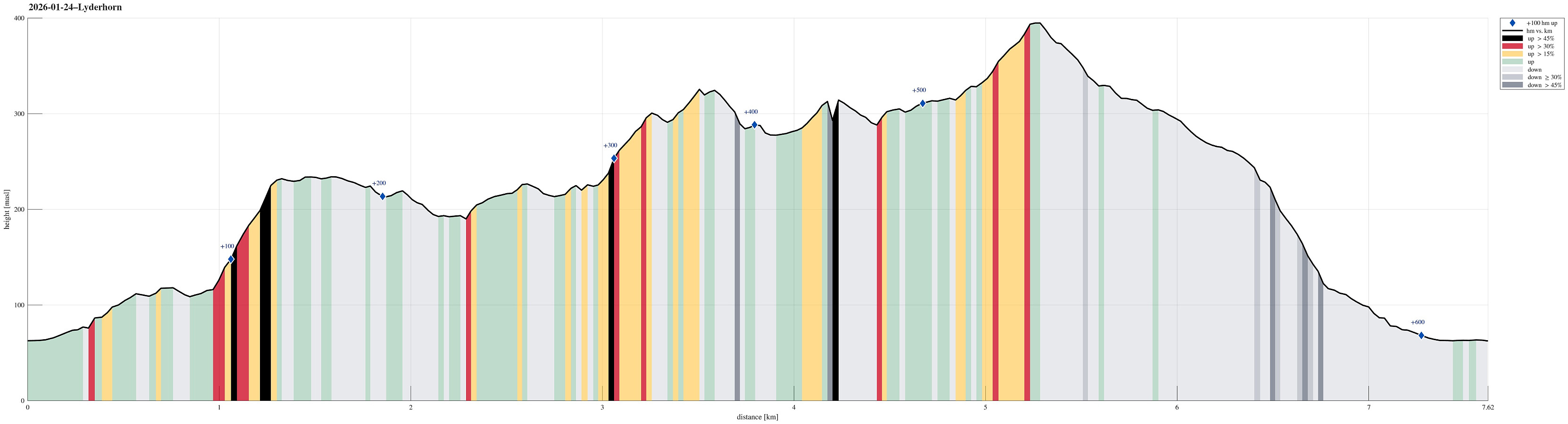
| Tourlänge | 3h 00min |
| Entfernung | 7,6km |
| Höhenmeter | 600m |
| GPS |
|
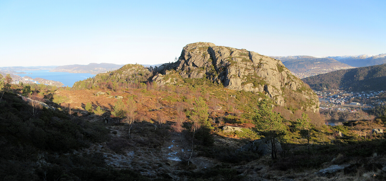
| Besteigungen | Lyderhorn (396m) | 24.01.2026 |
|---|---|---|
| Skjenafjellet (319m) | 24.01.2026 | |
| Ørnafjellet (329m) | 24.01.2026 | |
| Ørnafjellet Nord (304m) | 24.01.2026 | |
| Besuche anderer PBE | Lyderhornhytten (lokalitet) (396m) | 24.01.2026 |
Trip Summary
We aimed at some nice excursion, not too far out, and chose Ørnafjellet, i.e., the little sister or brother of Lyderhorn. To get there, we decided to park near Nedberget at Kjøkkelvik and hike up from there. The ascent through the forest was just fine, even though there was quite a bit of ice (especially in the rather narrow part before reaching the heights). Once up, we then started to surround Skåleviksvatnet in order to get over to Ørnafjellet and ascend it from the north. After visiting Ørnafjellet, we continued our little round on the heights to Skjenafjellet. There, we decided that including Lyderhorn, also, was just the right thing to do. After visiting Lyderhorn, then, we just walked back down to Nedberget to complete the hike.
Photos
Selected photos are available as Google photo album.
Useful Resources
See also the related FB-page Hiking around Bergen, Norway.
On web page prominent-mountains.no, there's a useful page about Lyderhorn.


Benutzerkommentare