
Sauafjellet via Heiane from Rolsvåg (05.04.2025)

Geschrieben von HHauser (Helwig Hauser)

| Startpunkt | Rolsvåg (30m) |
|---|---|
| Endpunkt | Rolsvåg (30m) |
| Tourcharakter | Wanderung |
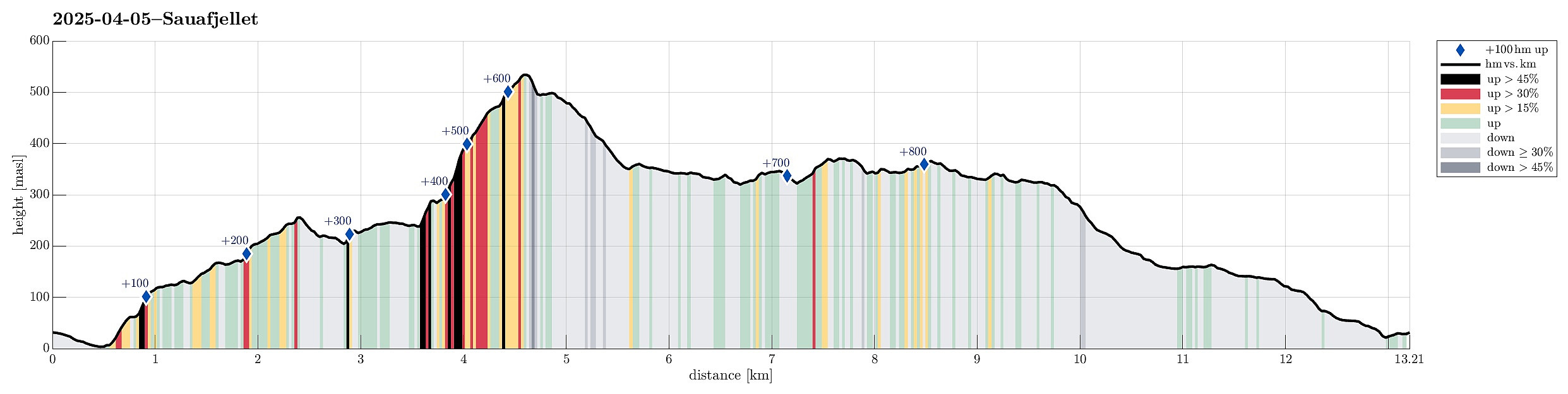
| Tourlänge | 5h 45min |
| Entfernung | 13,2km |
| Höhenmeter | 874m |
| GPS |
|
| Besteigungen | Heiane (257m) | 05.04.2025 |
|---|---|---|
| Sauafjellet (538m) | 05.04.2025 | |
| Trollhaugen (373m) | 05.04.2025 |
Trip Summary
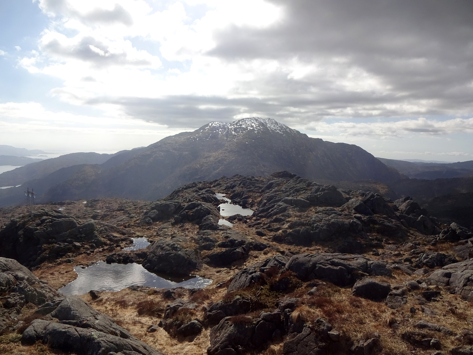
The idea was to visit Sauafjellet (from Rolsvåg). We parked near Vågasanden, right next to Solbjørgsvegen. The plan was to first hike to Heiane, in the southeast of Sauafjellet, before then connecting to the northeastern ridge of Sauafjellet. On the map, it had looked promising to start near Furneset (off trail) and then hike northwards up to Heiane. After getting around house 759 (and a dog that seemed moderately excited), we then made quick and nice progress upwards. Almost straight northwards, we soon found ourselves on Heiane, enjoying views already in all directions. As we had remembered from last time, a bit of careful navigation is recommended north of Heiane (the terrain is a bit rugged and several small lakes are around there, too). We still found a good traverse without any back-and-forth. Within not too long, we arrived at the northeastern ridge of Sauafjellet, starting our ascent there. Even though this ridge is quite steep in some places, the condition was just right and the ascent went without any difficulties. Next the top of Sauafjellet, we enjoyed a short lunch break, before continuing to connect to Store Brekkevatnet. Avoiding the steepest parts by first heading to the southwest, we eventually found a very reasonable way to get down to the lake. We then followed the gravel road to the junction, where "all roads meet" (from further down in Hausdalen, from the Sandelva valley, and from where we just came). Before starting the hike, we had considered to also include a short extra-round to visit Trollhaugen a bit further in the west. Enjoying the nice day, we thus decided to just do that. Hiking to Trollhaugen across the heights in the south of Brekkedalen was very nice and smooth and within a short time we arrived at Trollhaugen. Even though Trollhaugen is clearly a minor hill, surrounded by prominent tops (Sydpolen, Hausdalshorgi, Sveningen, etc.), one can enjoy some nice view (to exactly these tops) from Trollhaugen. We then continued our hike, making a small round that would bring us to Litla Brekkevatnet (and the trail that connects Sveningen and Hausdalen). Completing this small extra-round, we came back to the junction, but this time we chose the route into the valley of Sandelva (to get back to Rolsvåg). Walking down this valley offered also some nice views, especially "back up" into the direction of Gullfjellet. At the bottom end of this valley, we came out on Solbjørgvegen near to the car. All in all, most of this hike was off-trail (with some steep parts), which caused that we were quite satisfied (with no need to add yet another extra-round) once we were back at the car. Nice! :-)
Photos
Selected photos are available as Google photo album.
Useful Resources
See also the related FB-page Hiking around Bergen, Norway.
Petter Bjørstad has a useful page about Sauafjellet and also web page WestCoastPeaks.com provides useful information about Sauafjellet.


Benutzerkommentare