
Bufjellet from Torsvika (10.02.2024)

Geschrieben von hbar (Harald Barsnes)

| Startpunkt | Torsvika (28m) |
|---|---|
| Endpunkt | Torsvika (28m) |
| Tourcharakter | Bergtour |
| Tourlänge | 1h 14min |
| Entfernung | 3,5km |
| Höhenmeter | 231m |
| GPS |
|
| Besteigungen | Bufjellet (242m) | 10.02.2024 |
|---|
Bufjellet from Torsvika
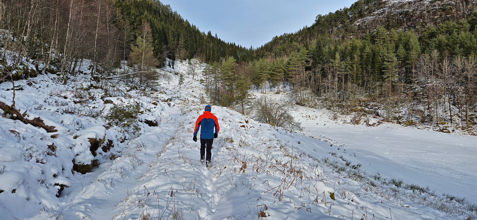
After our visit of Duesundfjellet, we drove the short distance to Torsvika to start our ascent of Bufjellet. Finding a place to park was more difficult than we had hoped though. In the end we decided to drive up to Sleirsvegen 148 and park at the start of the tractor road. We looked around for people to check if this was ok but did not find anybody and concluded that the snow-covered tractor road would most like not be used this Saturday.
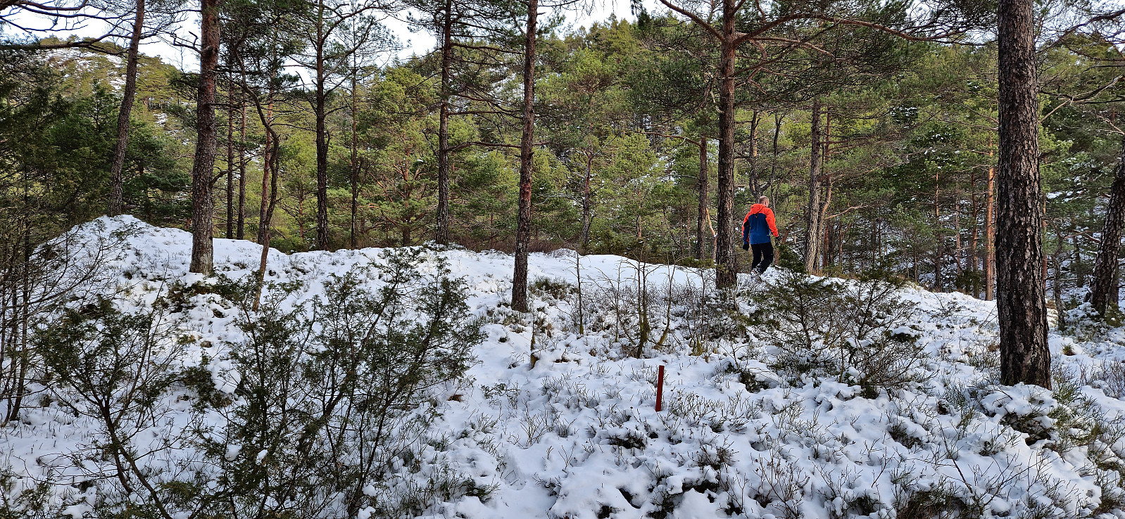
We started by following the tractor road north before turning southeast and heading off-trail for the ridge we assumed could be followed to the summit (partly based on previous trip reports). However, we soon happened upon a marked trail that seemed to lead more directly towards the summit and decided to follow it instead. But when this trail started heading back towards the tractor road it became clear that we were most likely following the trail in the wrong direction!
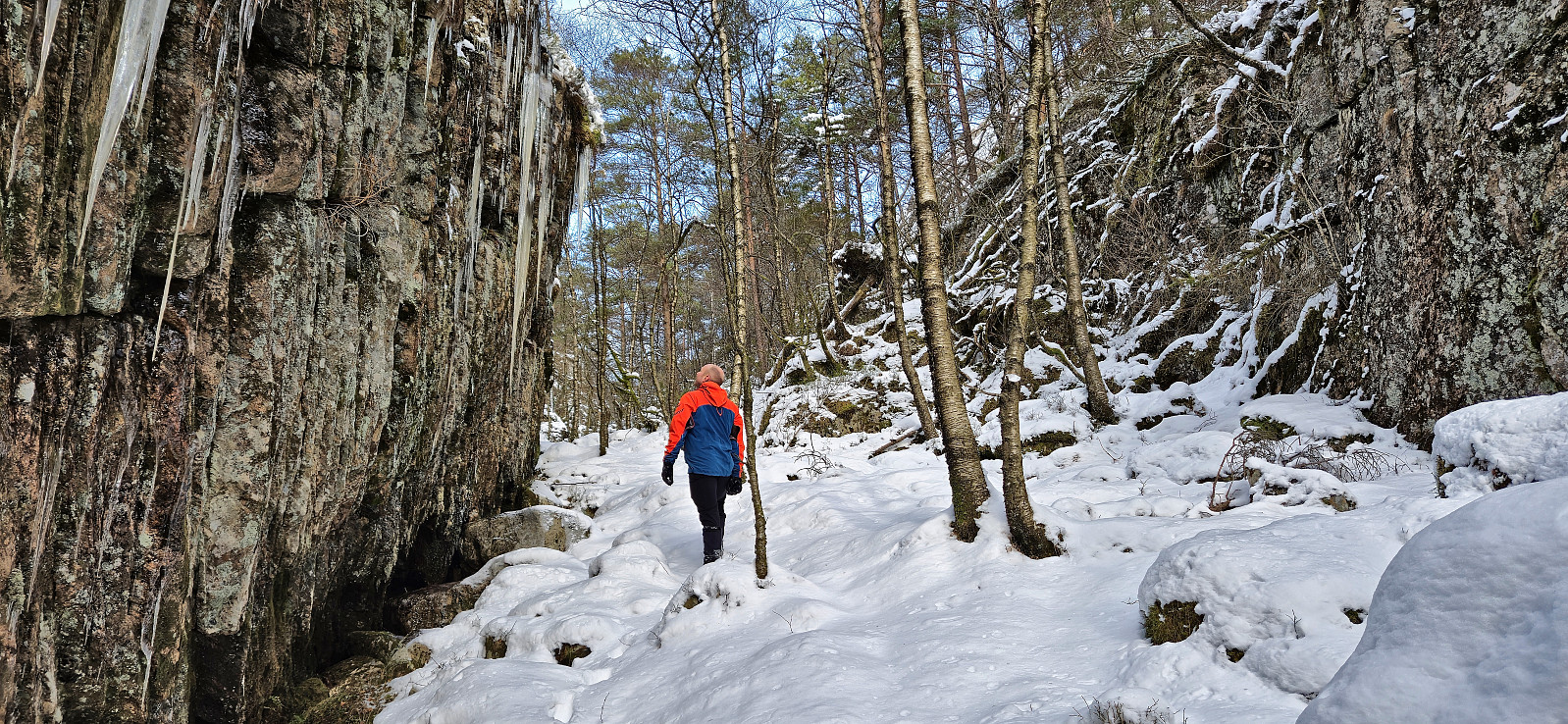
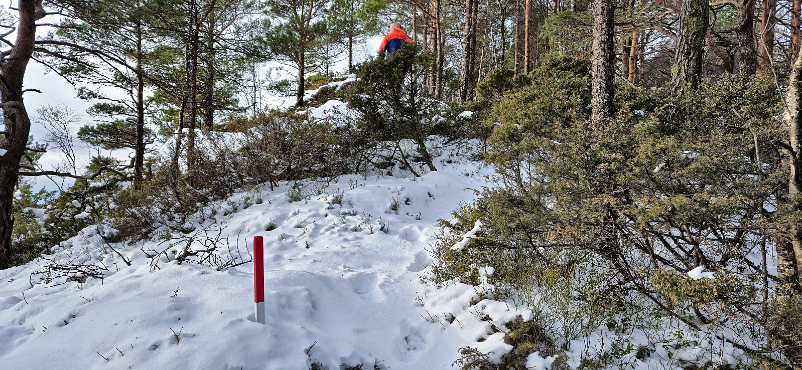
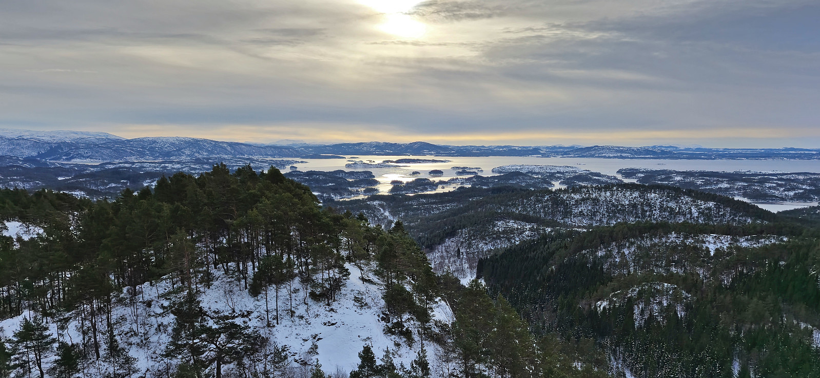
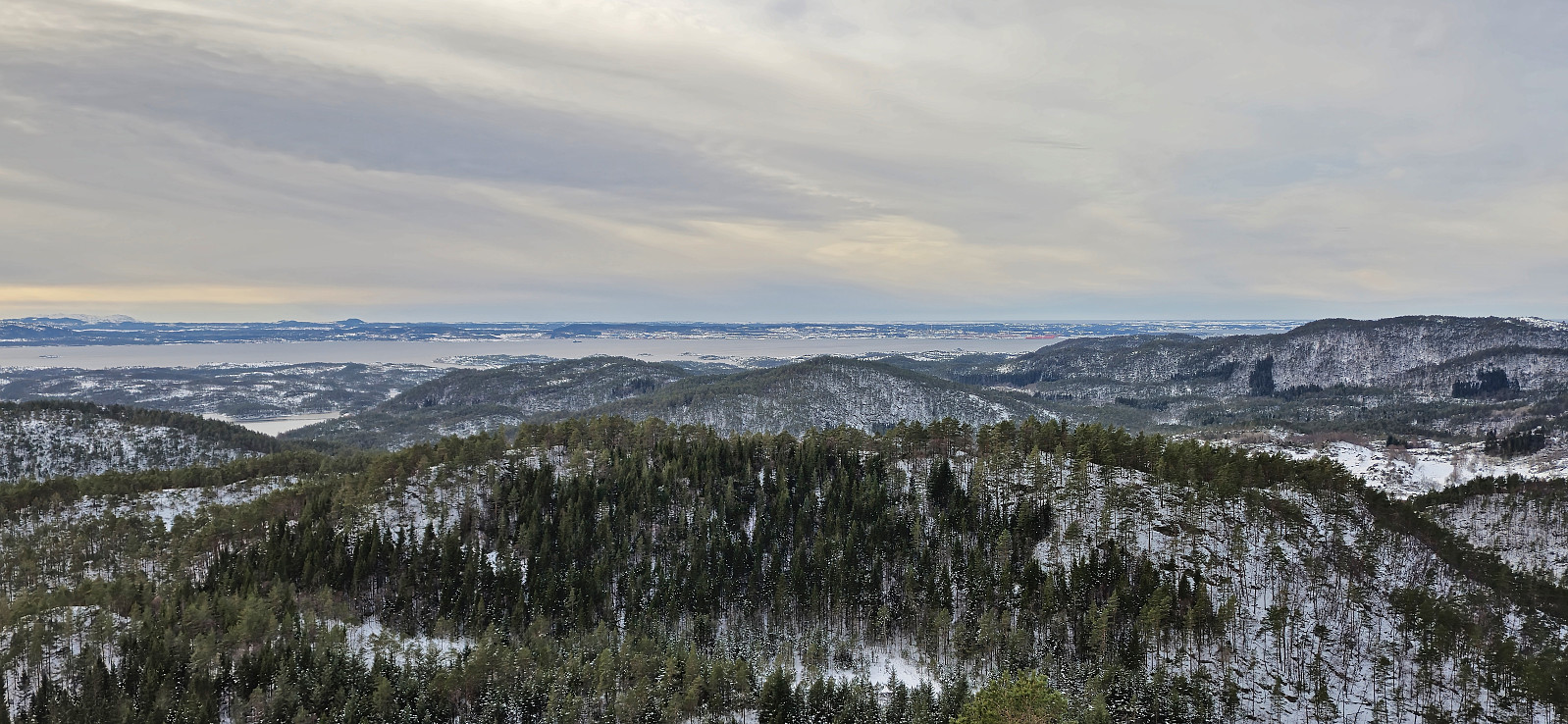
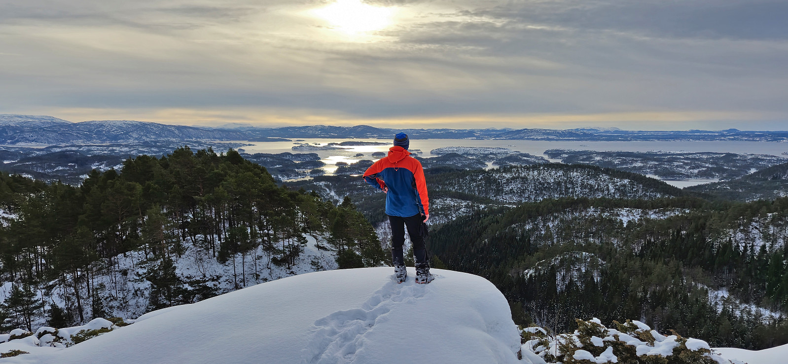
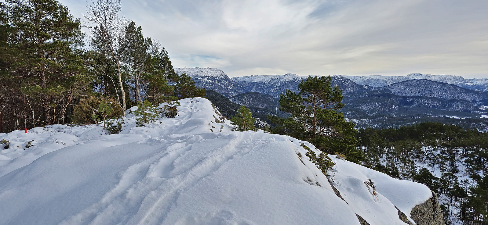
Instead of turning back we left the marked trail and headed off-trail towards the summit. This involved some easy scrambling at the beginning but was otherwise straightforward. As we approached the summit we again came across trail markers but by then we were almost at the summit and they were not really needed. The summit provided excellent panoramic views. Much better than expected.
We descended along more or less the same route, except for following the marked trail at the end to more easily connect with the tractor road. We also attempted to follow the marked trail when we left the summit but gave up when the markers seemed to head east and not south. It could be that we gave up too soon though.
To conclude, the views from the summit can definitely be recommended and our route can be followed without too much trouble. However, there is most likely a marked trail all the way to the summit as well, hence it is probably worth trying to follow this one instead.
Next up: Brunane.
| Startzeitpunkt | 10.02.2024 11:27 (UTC+01:00) |
| Endzeitpunkt | 10.02.2024 12:41 (UTC+01:00) |
| Gesamtzeit | 1h 14min |
| Zeit in Bewegung | 1h 09min |
| Pausenzeit | 0h 4min |
| Gesamtschnitt | 2,8km/h |
| Bewegungsschnitt | 3,0km/h |
| Entfernung | 3,5km |
| Höhenmeter | 230m |


Benutzerkommentare