
Solbakkafjellet from Hausdalen (05.08.2023)

Geschrieben von HHauser (Helwig Hauser)

| Startpunkt | Haugland (60m) |
|---|---|
| Endpunkt | Haugland (60m) |
| Tourcharakter | Wanderung |
| Tourlänge | 3h 00min |
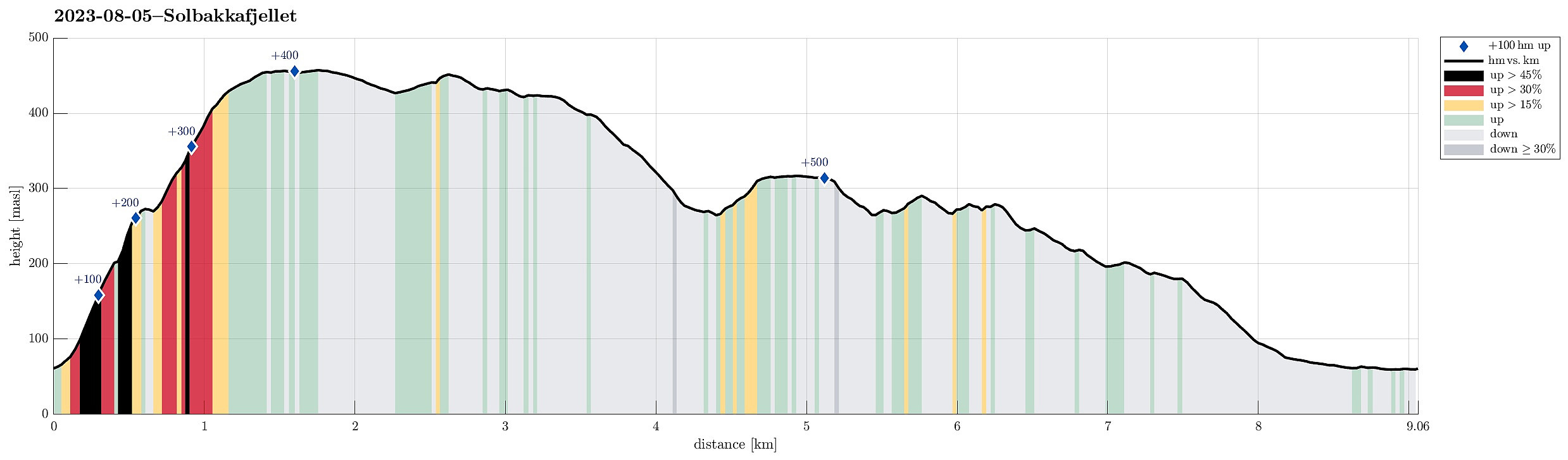
| Entfernung | 9,1km |
| Höhenmeter | 573m |
| GPS |
|
| Besteigungen | Solbakkafjellet (459m) | 05.08.2023 |
|---|---|---|
| Solbakkafjellet NØ (453m) | 05.08.2023 | |
| Stemmedalshaugane (319m) | 05.08.2023 | |
| Besuche anderer PBE | Frotveitelva bro (263m) | 05.08.2023 |
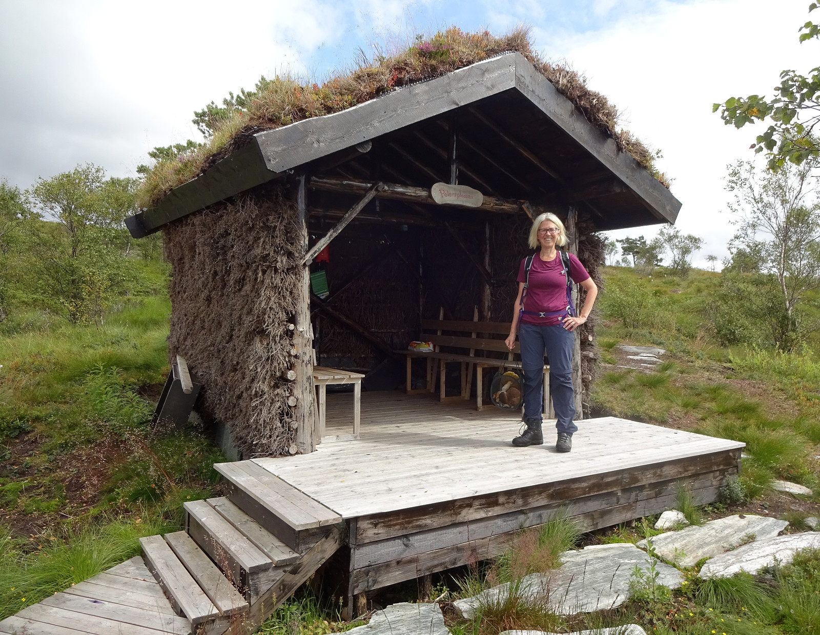
| Petersplassen (433m) | 05.08.2023 | |
| Smogakampen (275m) | 05.08.2023 | |
| Søylen på Stemmedalshaugane (317m) | 05.08.2023 | |
| Varden på Solbakkafjellet (456m) | 05.08.2023 |
Trip Summary
Since we had not been there for a while, we thought that hiking up to Solbakkafjellet once again may nice. This time, however, we decided to approach it from Hausdalen near Haugland. Driving into Hausdalen, we found a place near Haugland, where we could leave the car for a few hours. From there, we started to approach Solbakkafjellet "straight up" (without any trail). The southeastern flank of Solbakkafjellet (Skoralia) is steep and occasionally one needs to find a way around some obstacles on the way up. Still, ascending "straight up" is not really difficult. Within not too long, we accordingly arrived at the top of Solbakkafjellet, paying Petersplassen a short visit (we could not remember this place from our last visit). We then crossed over the long top-ridge of Solbakkafjellet, heading into northeastern direction. Near Svarthamrane, we then paid attention to not miss the spot, where we wanted to connect to a trail that would lead us down to Frotveitelva. Even though this trail is marked well on the map, it's rather difficult to see in real, especially where it forks off the trail that leads down to Storstølen (there are some markers on some trees, though!). Once on (or slightly below) the right ridge, though, the trail became much more apparent and stepping it down was nice and easy. At about 275masl, then, we stepped out onto a gravel road that extends there in parallel to Frotveitelva (on its western side). After only follolwing this gravel road southwards for a couple of meters, we then used a nice little brdige over Frotveitelva to get to the other side (we thought that making a detour up to Stemmedalshaugane may possibly be nice). After quickly stepping up to Stemmedalshaugane, we concluded that they are not the most impressive heights to visit, turned around and went back to the gravel road, using the same bridge once again. Then, on our way down to Fjelltveit, we checked the vista point at Smogakampen, which indeed offers a very nice view across Fjelltveit. We then followed the gravel road down (to about 180masl, where it makes a sharp turn towards the east). Since we wished to get back to Haugland, we decided to follow a minor trail (or "trail") from there, which lead us down to Haugland in a more direct way. All this worked quite well so that we did not have to walk a long stretch along the main road through Hausdalen, once we were back down. All in all, a nice hike, especially up on the heights of Solbakkafjellet.
Photos
Selected photos are available as Google photo album.
Useful Resources
See also the related FB-page Hiking around Bergen, Norway.
Web page WestCoastPeaks.com provides useful information about Solbakkafjellet and also Petter Bjørstad has a useful page about Solbakkafjellet.
Web page UT.no from the Norwegian Trekking Association recommends another hike over Solbakkafjellet.


Benutzerkommentare