
Bekkarhalsen at Skøyteneset (25.06.2023)

Geschrieben von HHauser (Helwig Hauser)

| Startpunkt | Mefjordvær (25m) |
|---|---|
| Endpunkt | Mefjordvær (25m) |
| Tourcharakter | Spaziergang |
| Tourlänge | 4h 00min |
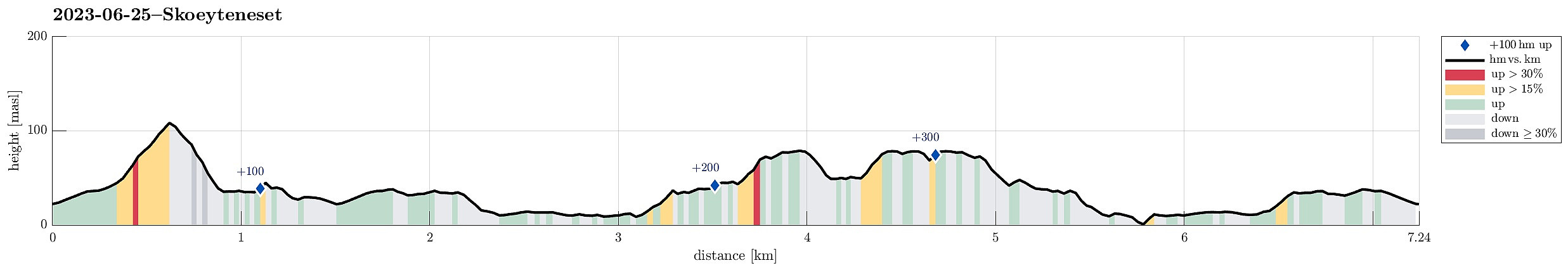
| Entfernung | 7,3km |
| Höhenmeter | 384m |
| GPS |
|
| Besteigungen | Knuten (110m) | 25.06.2023 |
|---|---|---|
| Besuche anderer PBE | Bekkarhalsen/Skøyteneset (80m) | 25.06.2023 |
Trip Summary
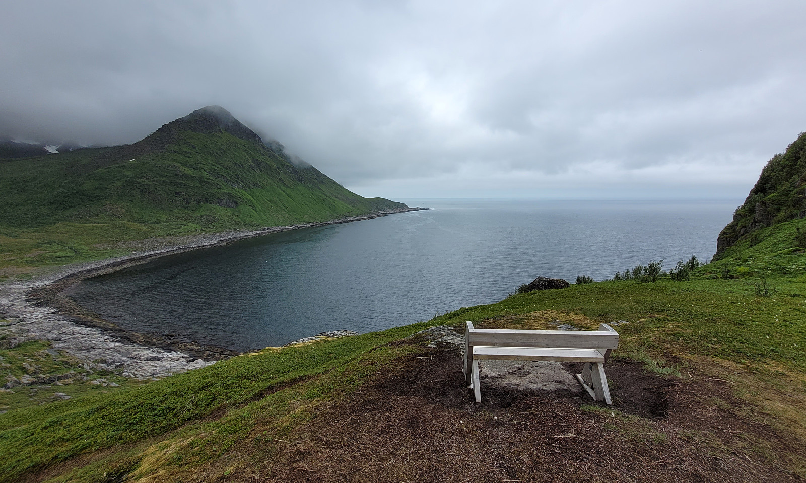
With no major mountain tops to see (due to low hanging clouds), we decided to make another excursion along the shoreline -- this time to Skøyteneset from Medfjordvær. We parked near Knuten in the north of Mefjordvær and walked up to Halsen, first. Then we included Knuten, which offers some nice views (even though it's not really high). We then also stepped down to the small lighthouse in the north of Knuten, before returning to Mefjordvær along the outer route around Knuten on its eastern side (probably the connection for those, who have to work at the lighthouse; or had to, previously). After this short Knuten intermezzo, we then headed out to Skøyteneset along the marked trail in the west of Knutevika, reading first about Russehula and then about Munken. Further out, the trail leads upwards to Bekkarhalsen at Skøyteneset. There, we enjoyed some very nice views and also a pleasant break! :-) To then get back, again, we followed the same trail as first out to Skøyteneset.
Photos
Selected photos are available as Google photo album.
Useful Resources
See also the related FB-page Hiking around Bergen, Norway.


Benutzerkommentare