
Biking around Nordåsvatnet (03.06.2023)

Geschrieben von HHauser (Helwig Hauser)

| Startpunkt | Varden (45m) |
|---|---|
| Endpunkt | Varden (45m) |
| Tourcharakter | Fahrradtour gemischt |
| Tourlänge | 2h 00min |
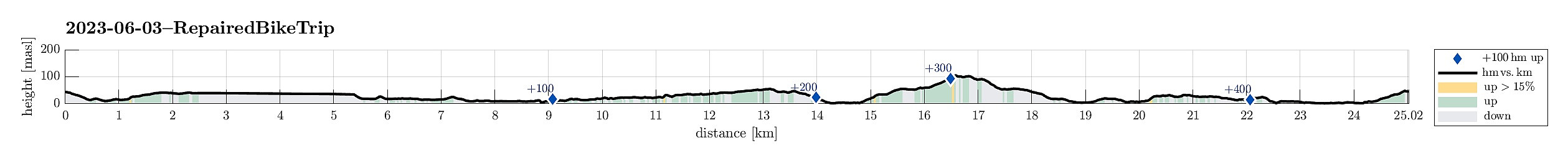
| Entfernung | 25,0km |
| Höhenmeter | 479m |
| GPS |
|
| Besuche anderer PBE | Fyllingsdalstunnelen - Oasensiden (34m) | 03.06.2023 |
|---|---|---|
| Skjoldabukta (5m) | 03.06.2023 | |
| Straume bro (5m) | 03.06.2023 | |
| Sælen kirke p-plass (15m) | 03.06.2023 |
Trip Summary
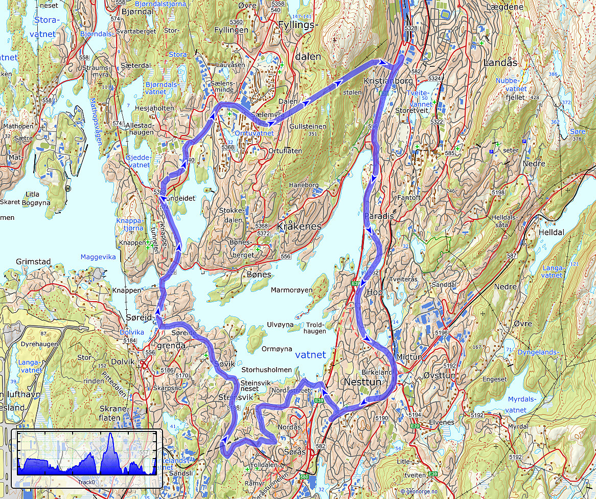
We had a bike to pick up and wished to ride a little round -- not at the least to also see that it was functioning as well as expected. We started the joint ride at the bike shop near the light rail station at Kristianborg, heading first southwards along Kanalveien and then following the track of the no longer existing railway into the direction of Nesttun. At the church of Skjold, we then turned right and cycled down to Skjoldbukta along Harald Skjolds veg. From there, we then cycled up to Nordåsvegen, which we then followed "all around" Nordåsen. On the south, we then descended to Steinsvikvegen. Following Steinsvikvegen around Steinsviken and Søviken, we connected to Søreide and from there further northwards to Sandeidet. All in all, a nice bike ride! :-)
Useful Resources
See also the related FB-page Hiking around Bergen, Norway.


Benutzerkommentare