
Borgafjellet and Møsnuken (05.04.2022)

Geschrieben von hbar (Harald Barsnes)

| Startpunkt | Solstrand hotel (15m) |
|---|---|
| Endpunkt | Ulvenskiftet (43m) |
| Tourcharakter | Bergtour |
| Tourlänge | 6h 15min |
| Entfernung | 15,7km |
| Höhenmeter | 830m |
| GPS |
|
| Besteigungen | Borgafjellet (353m) | 05.04.2022 |
|---|---|---|
| Hegglandsfjellet (459m) | 05.04.2022 | |
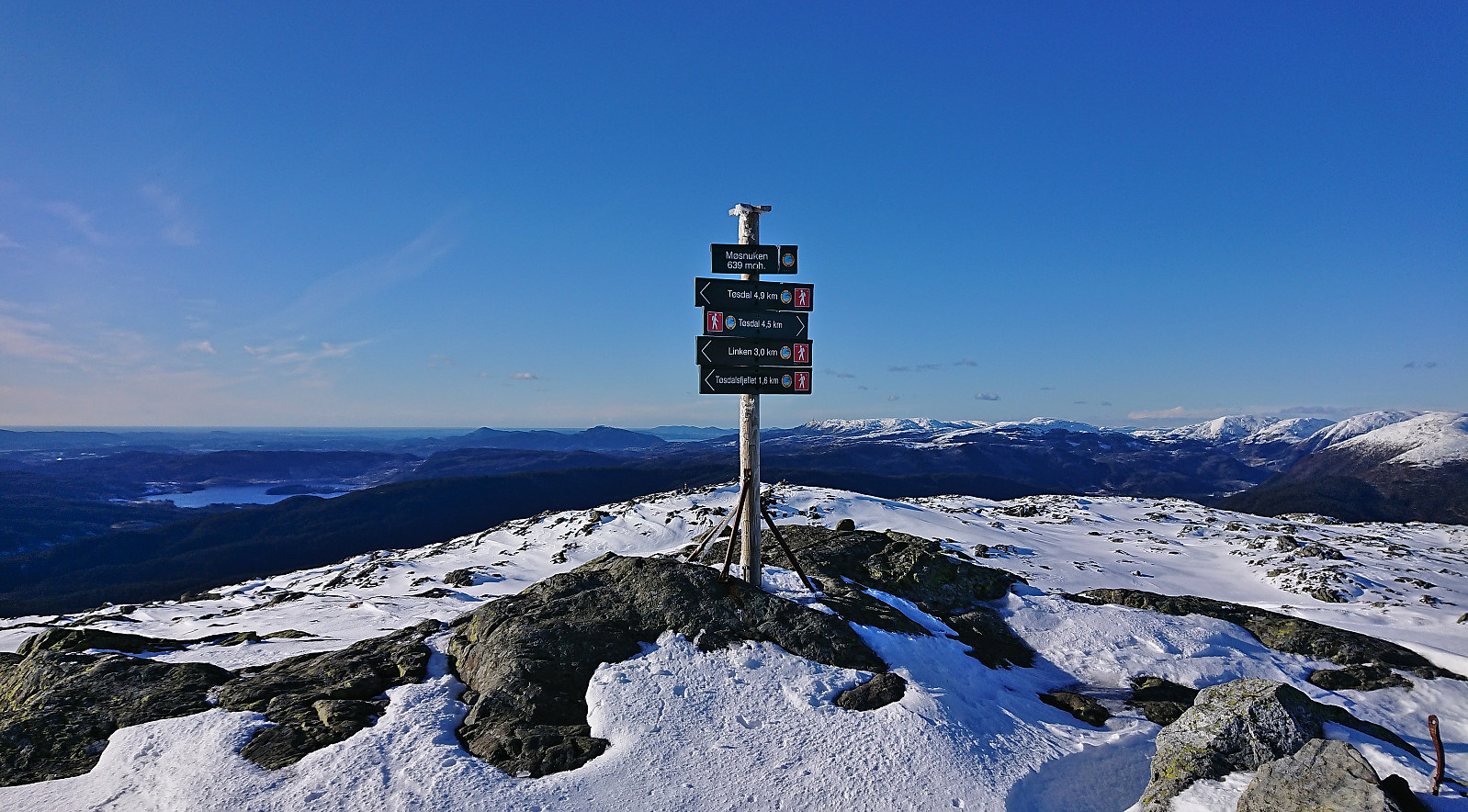
| Møsnuken (639m) | 05.04.2022 | |
| Storafjellet (592m) | 05.04.2022 | |
| Søre Såta (578m) | 05.04.2022 | |
| Besuche anderer PBE | Borgafjellet p-lomme (80m) | 05.04.2022 |
| Borgly (354m) | 05.04.2022 | |
| Borgabuo (349m) | 05.04.2022 | |
| Tøsdalen parkering (60m) | 05.04.2022 |
Borgafjellet and Møsnuken
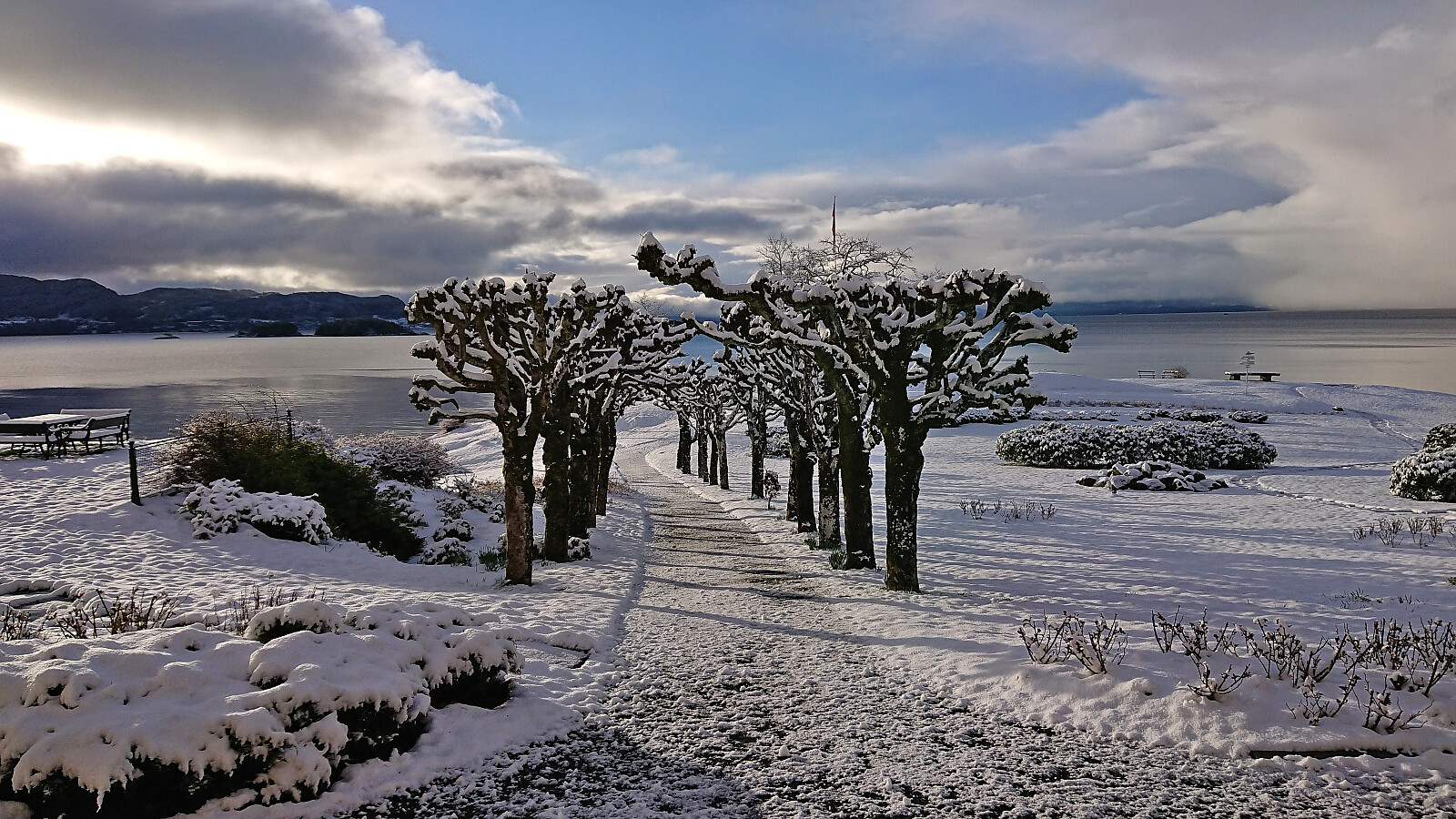
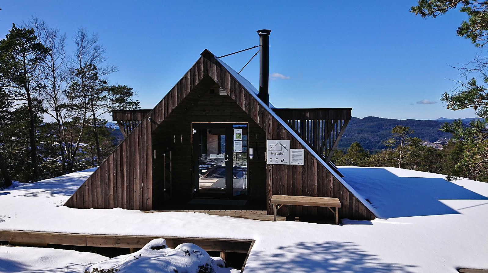
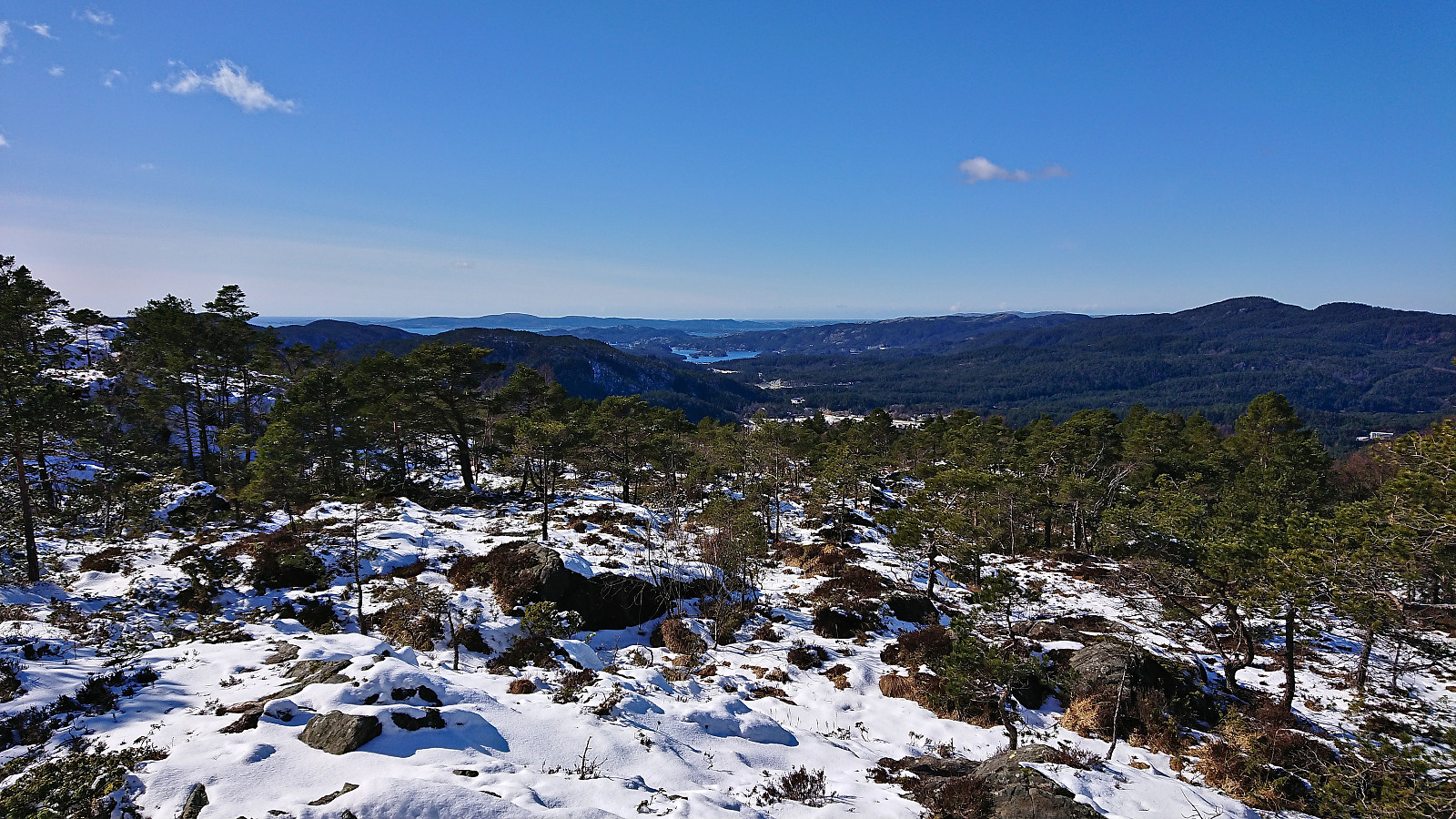
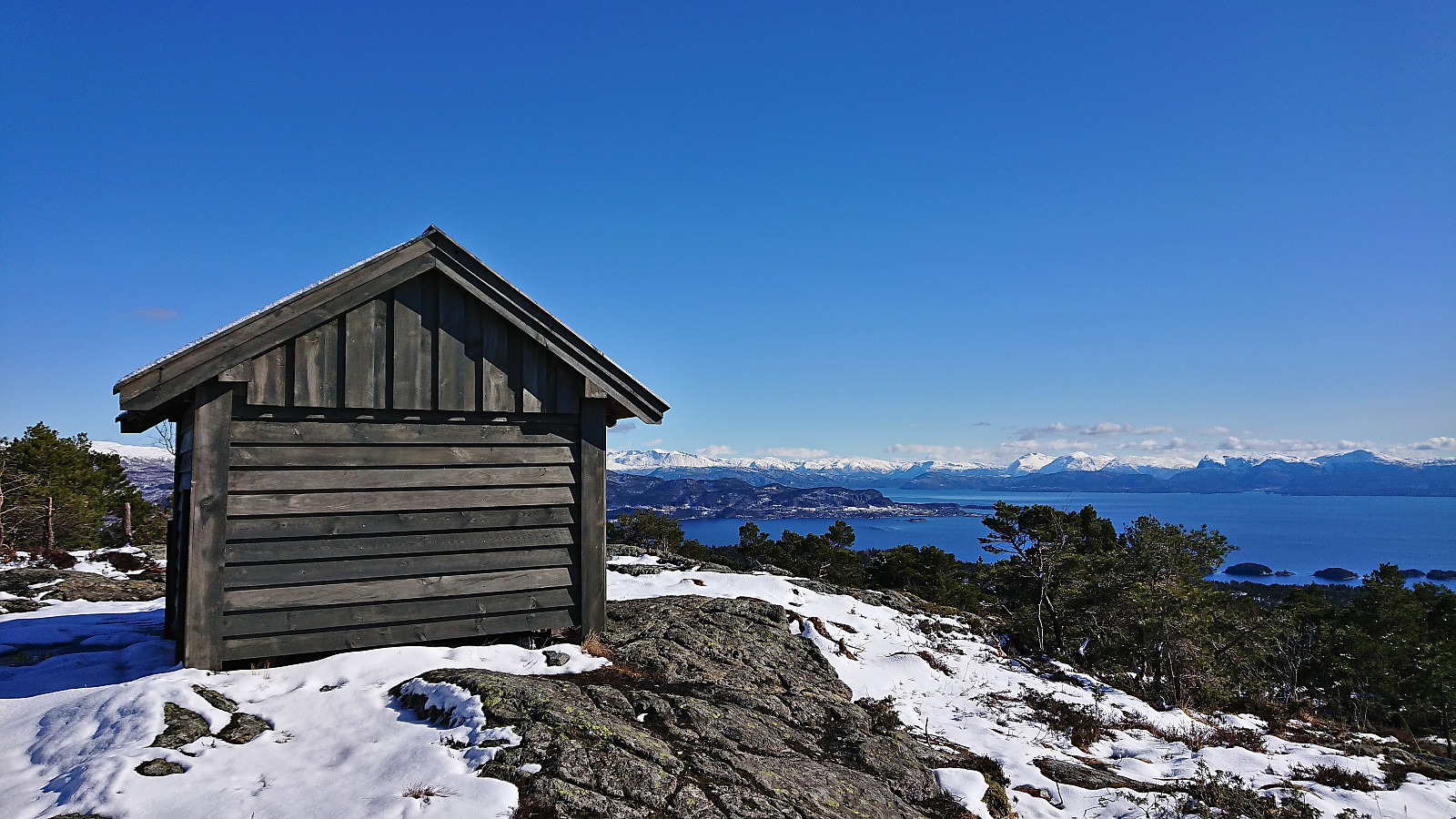
When a meeting at Solstrand ended after a late lunch, I had originally planned to take the ferry across the fjord to go hiking in Fusa. However, after waking up to a snow-covered Solstrand, it was clear that my hike would take significantly longer than planned and I would be at risk of not catching the all-important bus back to Bergen. I therefore decided to play it safe and instead do a revisit of Borgafjellet and Møsnuken. At least this would allow me to visit the new dagsturhytte at Borgafjellet, in addition to some other minor summits I had not previously visited.
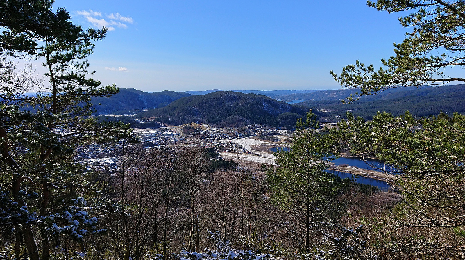
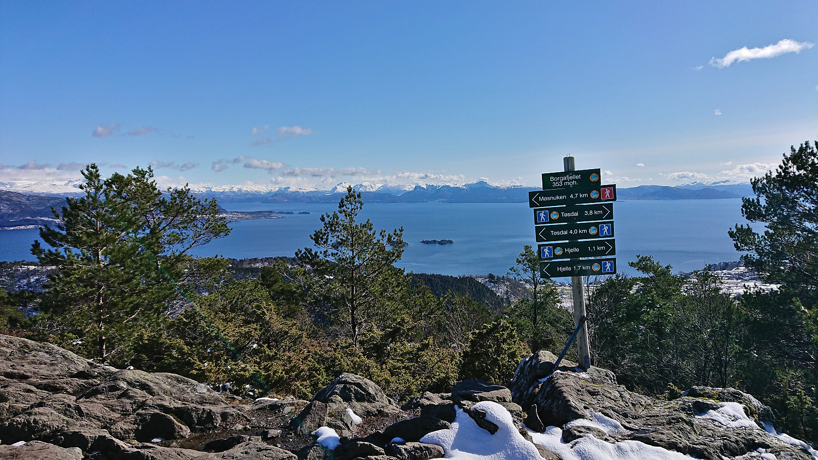
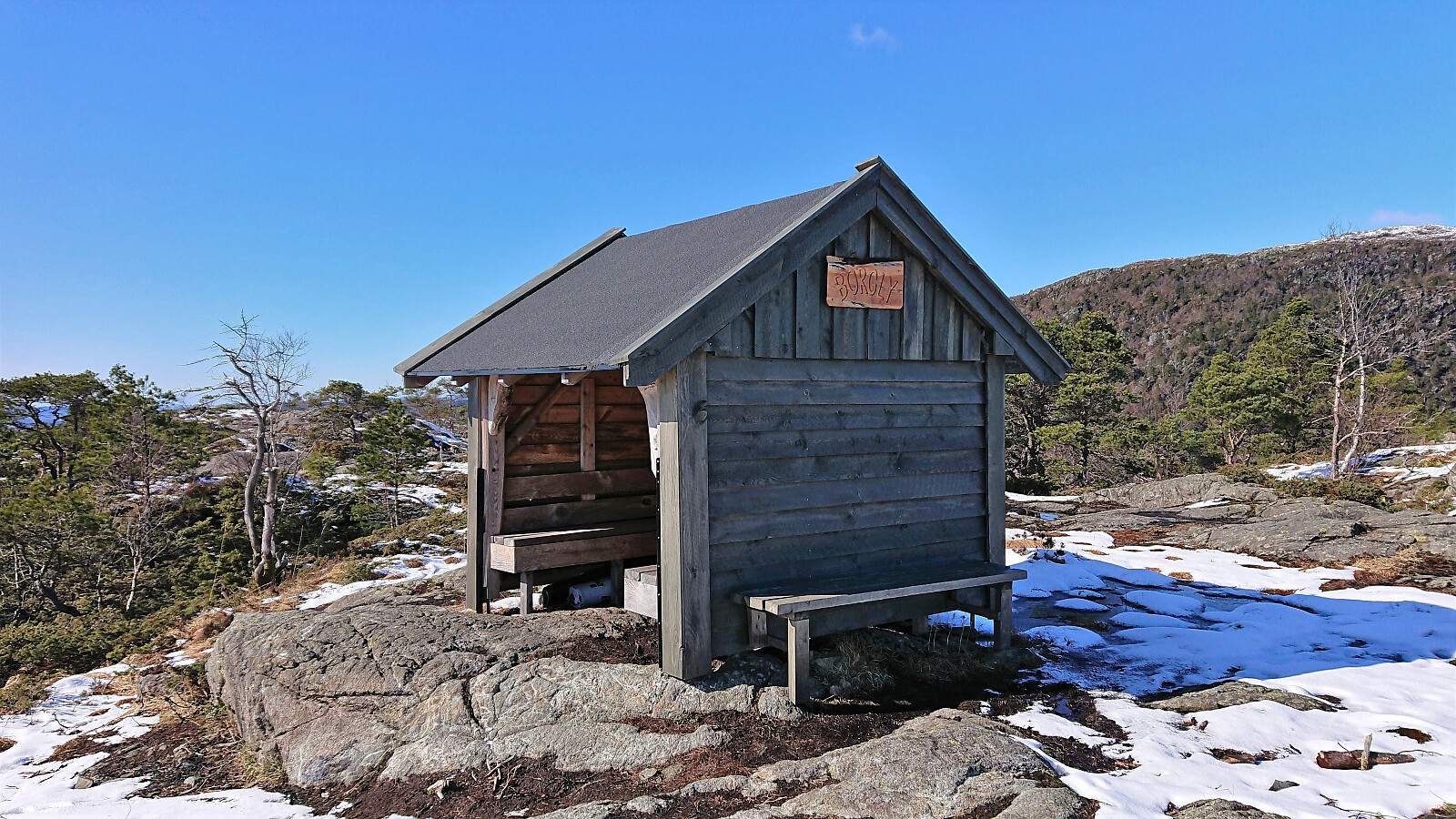
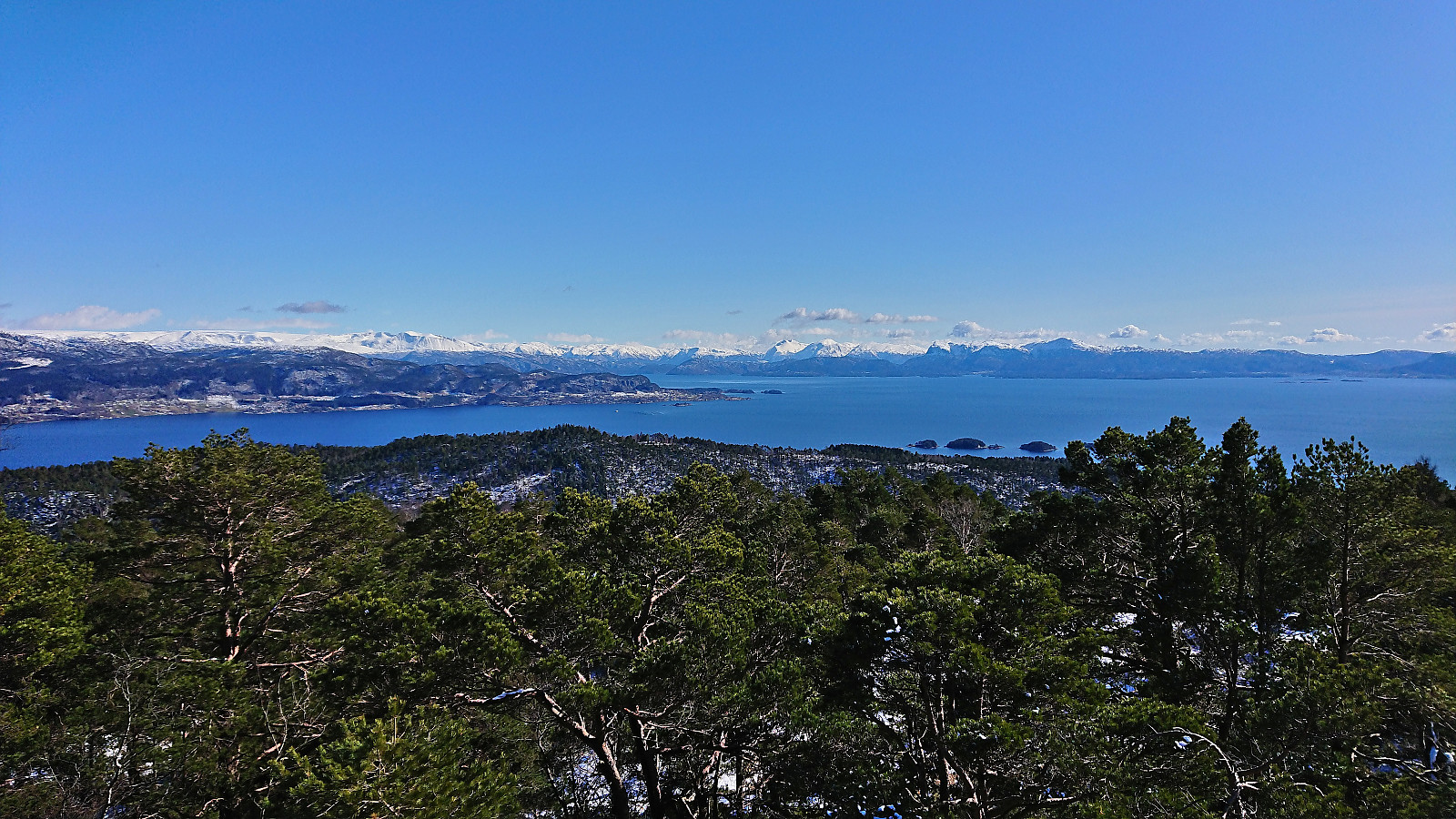
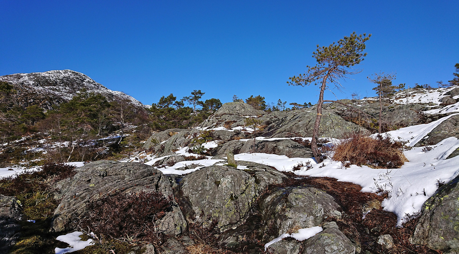
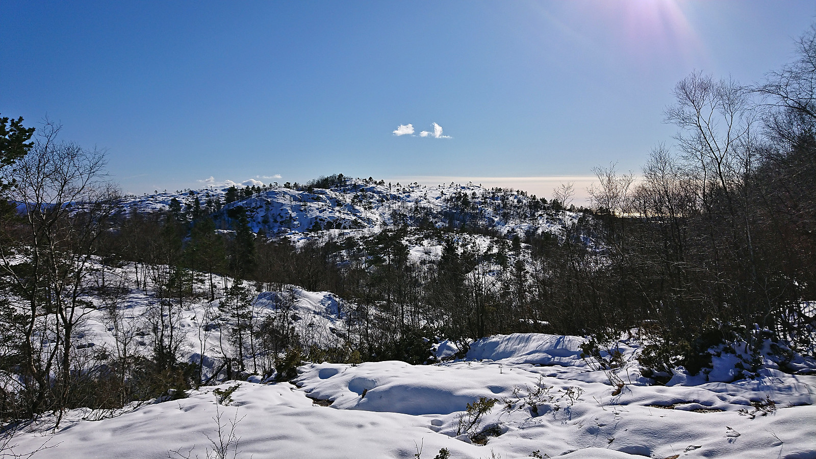
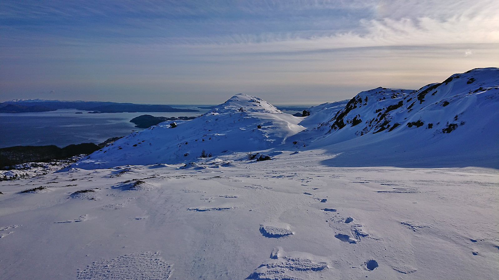
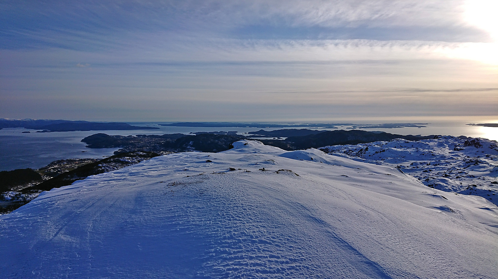
When the rest of my colleagues embarked on the bus back to Bergen, I began my hike from Solstrand and soon arrived at the steep ascent to Borgafjellet. Little to no snow at the start, but it gradually increased as I got closer to the summit, with perhaps a couple of centimeters covering the area around Borgabuo. Borgabuo was however not the only new addition since my last hike at Borgafjellet. There was now also a new shelter called Borgly right next to the trail at Høgehaugen, with excellent views to the many snow-covered peaks across the fjord.
As I got closer to Hegglandsfjellet, the amount of snow continued to increase and soon the gaiters had to come on in order to stop snow from getting into my boots. On the way to Hegglandsfjellet I partly followed a trail, at least there were occasional trail markers and small cairns, but it was hard to tell given the snow. I'm therefore not sure if the trail passes close by the summit or not. But in any case, the summit could be easily reached.
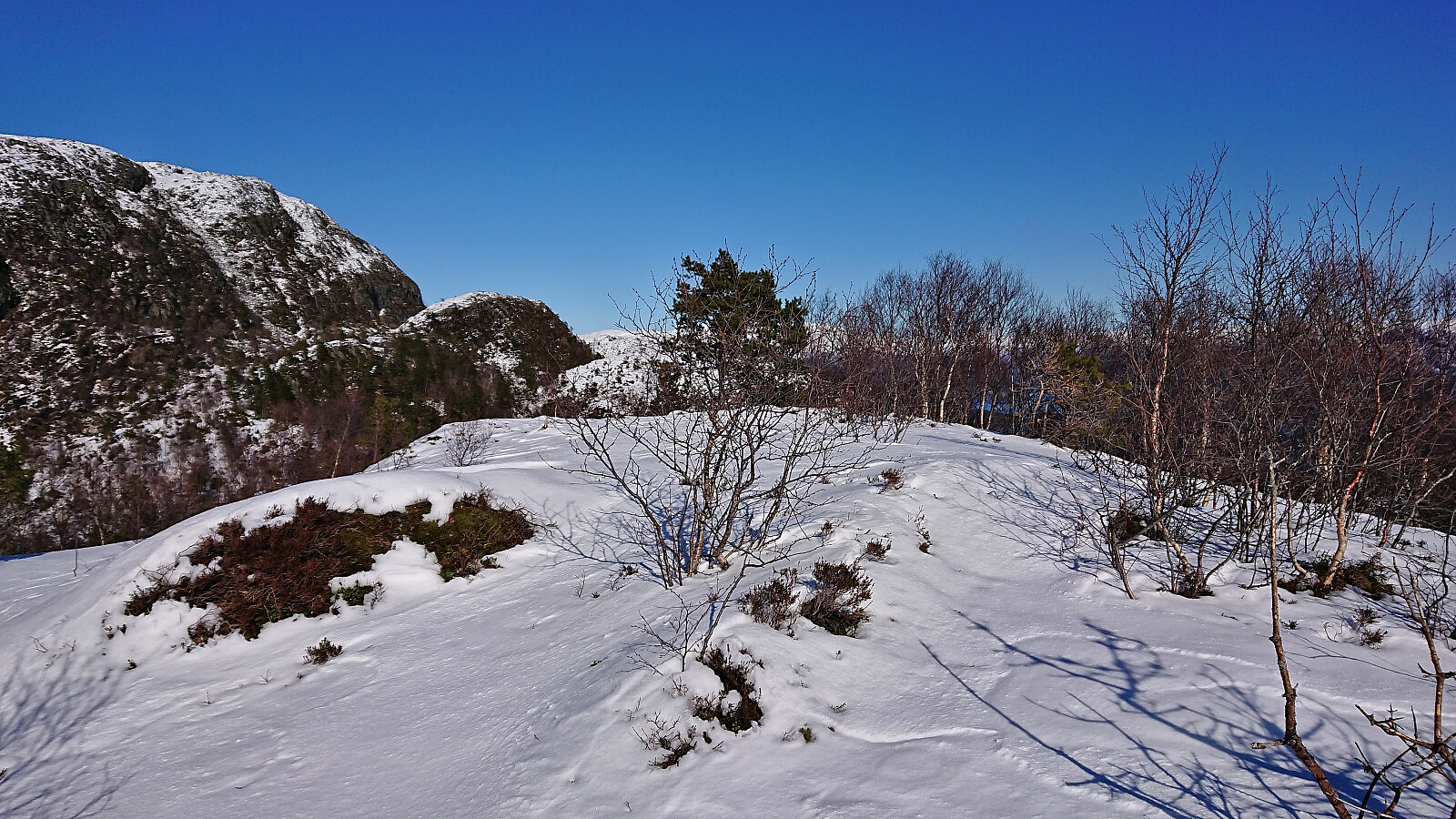
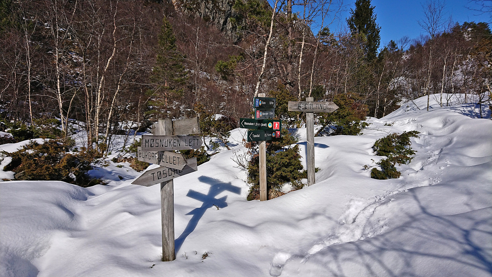
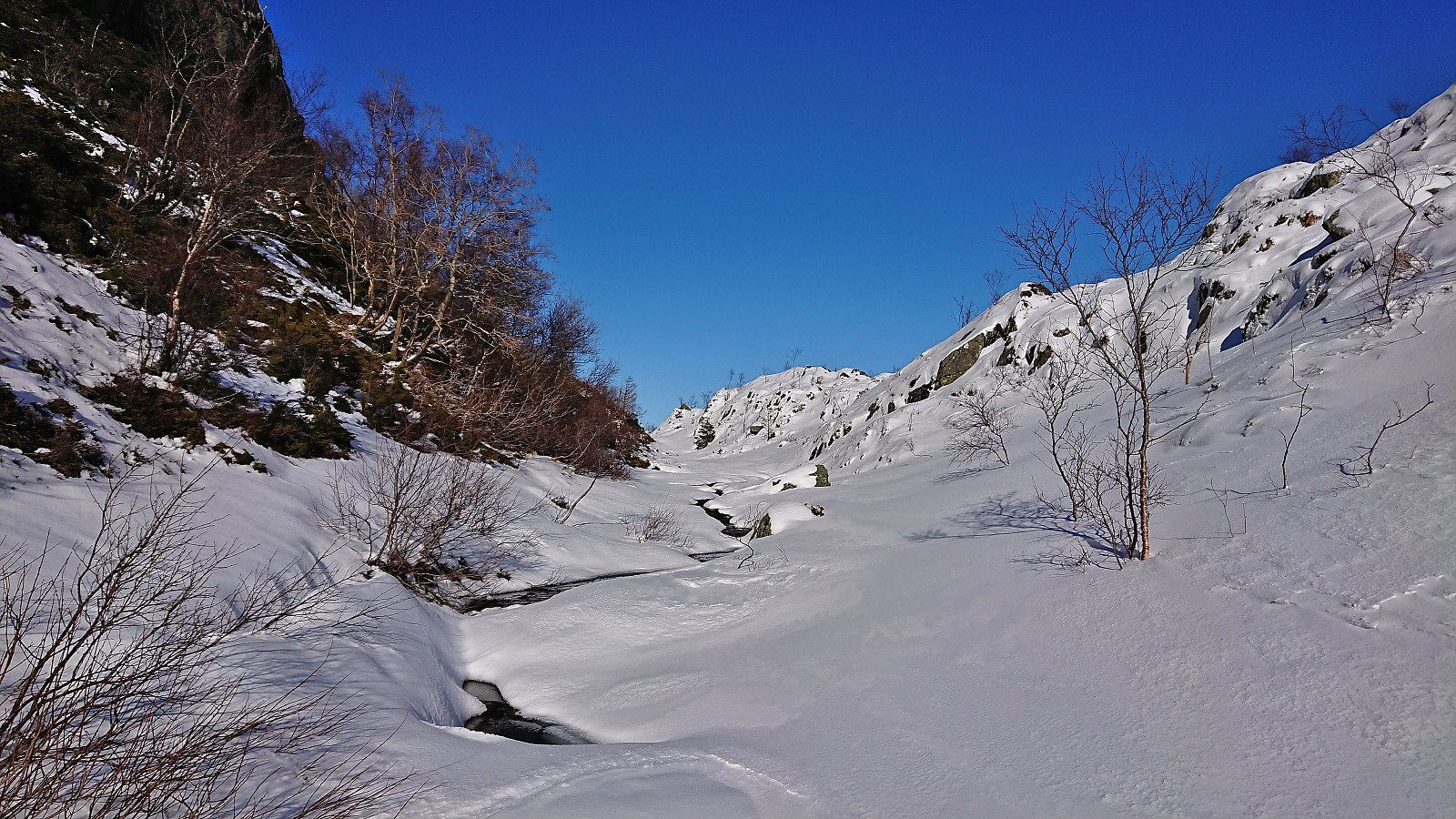
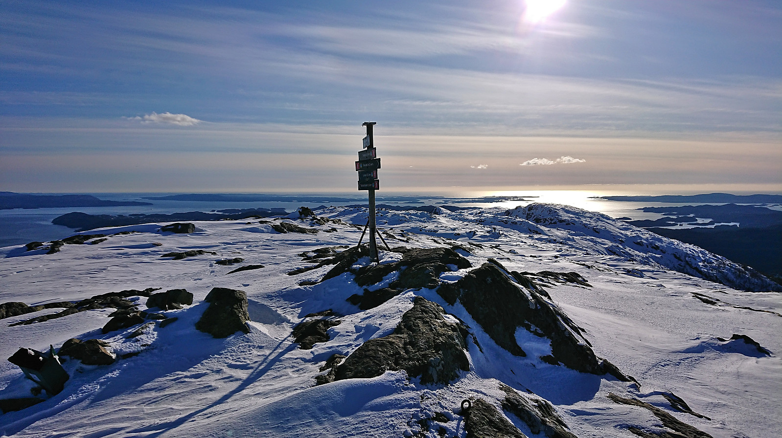
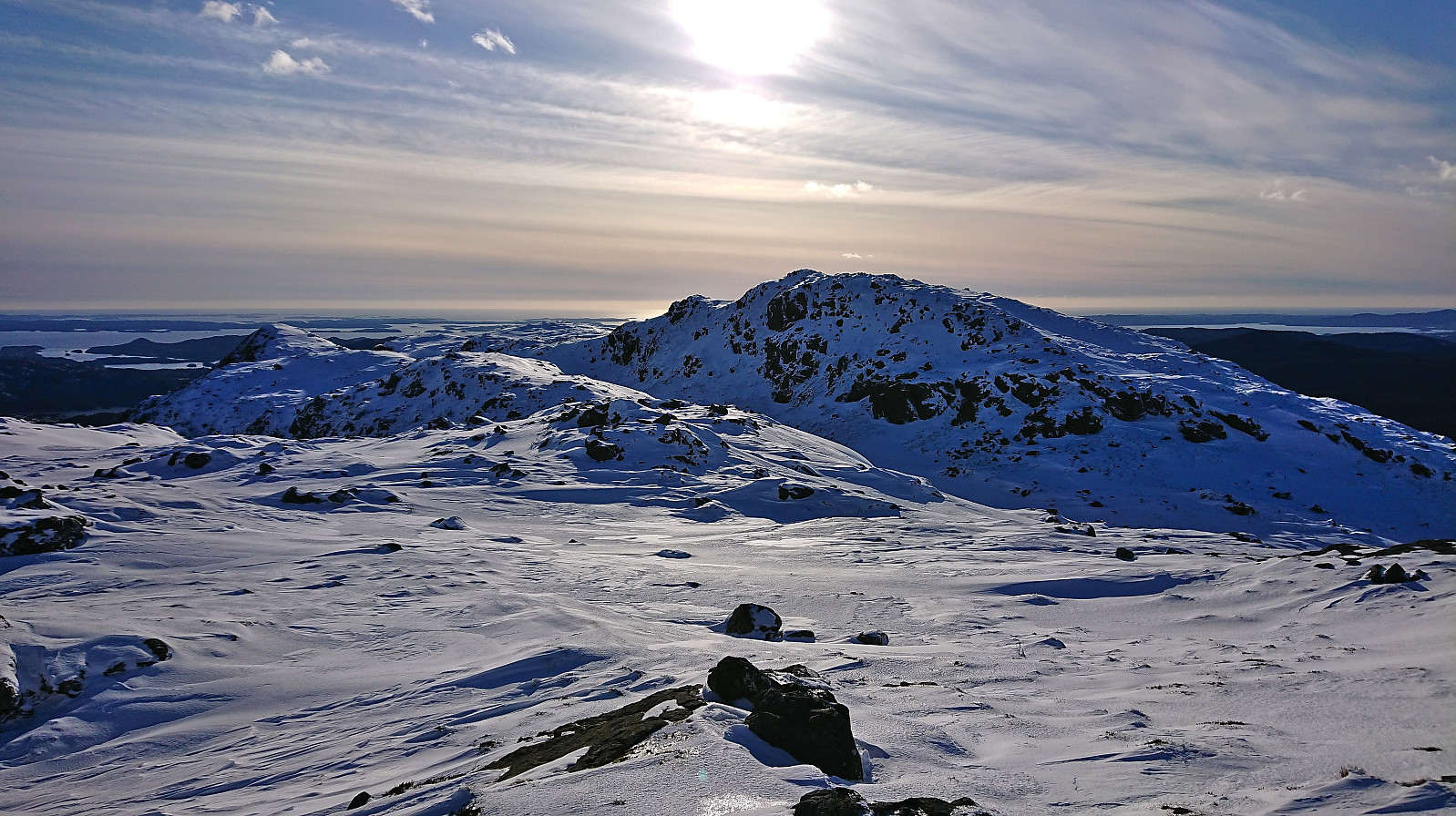
From Hegglandsfjellet, I returned to the main trail to Møsnuken where I quickly abandoned the steep route and instead went for the longer route that heads northeast before later turning south towards the summit. But while this route is labeled "lett", i.e. easy, on the signs, the increasingly deep snow made for anything but an easy hike. At the start I could at least follow in the footprints of another hiker, but as these footprints soon turned towards the steep route after all, I left them behind and from there had to find my own way.
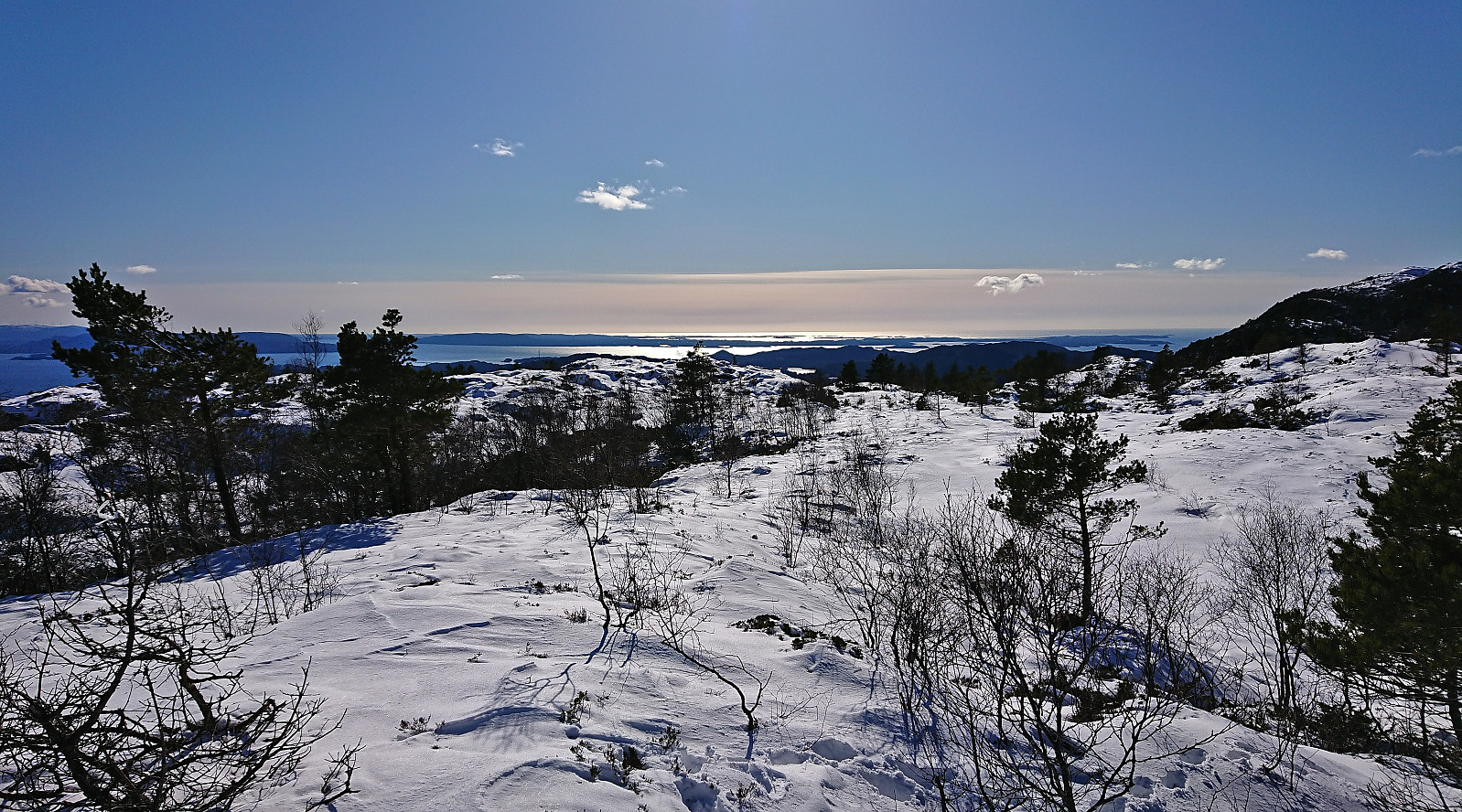
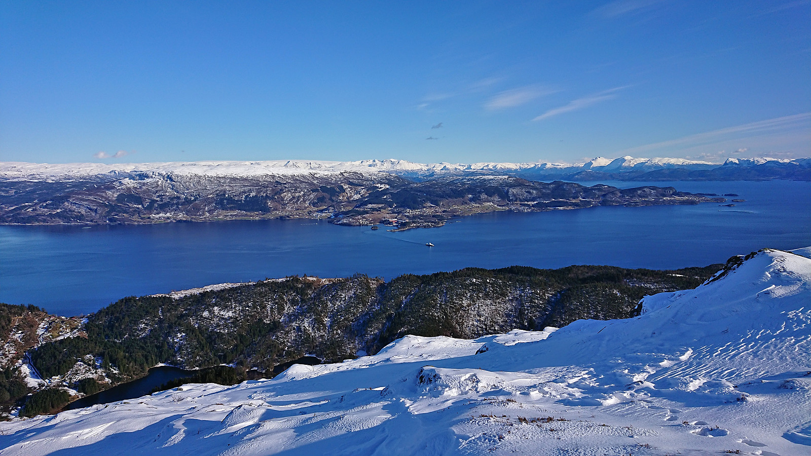
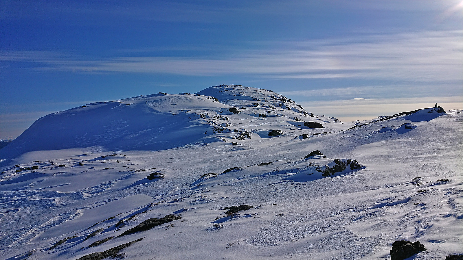
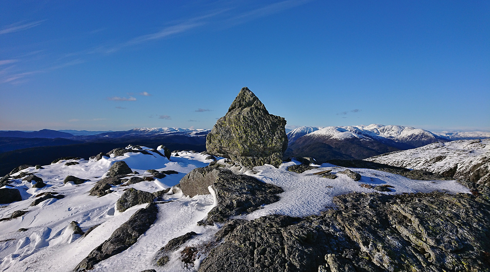
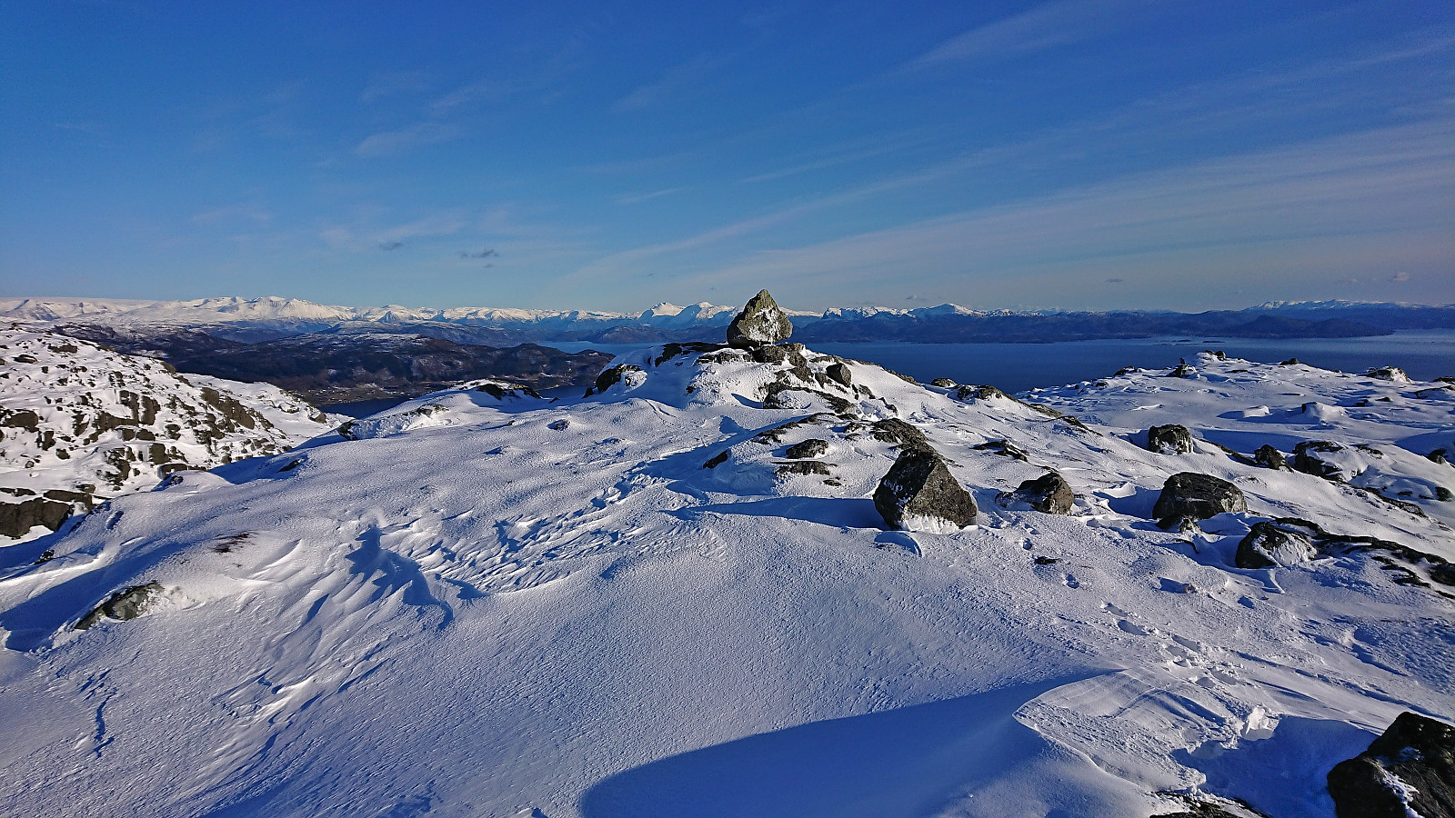
After what felt like forever, I finally reached the summit of Møsnuken and could enjoy the excellent panoramic views. By now the wind had however started to pick up, hence I did not stay long before starting by descent southwest to Tyssdal. Here I again came across a single set of footprints, which I partly followed, but overall I just found my own way. Quick visits of Storafjellet and Søra Såta were also included. Both minor summits I had passed close by earlier but not bothered summiting.
Only when I started descending into the main valley south of Tyssdalsfjellet did the snow finally disappear and I could enjoy the relief of firm ground under my boots. I managed to make a wrong turn when the trail forked towards the end though, and ended up walking along a tractor road with lots of crossing fallen trees instead of the standard trail. But in any case, it did not take long before I was on the paved road and could start the final walk to the main road for the bus home.
In summary, a very nice hike with spectacular views that was made significantly tougher by the deep snow, hence probably recommended to rather do this hike in the summer tine. (But at least I made the right choice of postponing the planned hike in Fusa, as I would clearly have struggled to get to the end of the hike in time for the bus back to Bergen.)

| Startzeitpunkt | 05.04.2022 14:09 (UTC+01:00 SZ) |
| Endzeitpunkt | 05.04.2022 20:25 (UTC+01:00 SZ) |
| Gesamtzeit | 6h 15min |
| Zeit in Bewegung | 5h 44min |
| Pausenzeit | 0h 31min |
| Gesamtschnitt | 2,5km/h |
| Bewegungsschnitt | 2,7km/h |
| Entfernung | 15,7km |
| Höhenmeter | 830m |


Benutzerkommentare