
Finsteraarhorn (11.07.2021)

Geschrieben von hmsv1 (Hannah Vickers)
| Startpunkt | Finsteraarhorn hut (3.021m) |
|---|---|
| Endpunkt | Finsteraarhorn hut (3.029m) |
| Tourcharakter | Hochtour |
| Tourlänge | 7h 15min |
| Entfernung | 10,5km |
| Höhenmeter | 1.111m |
| GPS |
|
| Besteigungen | Finsteraarhorn (4.274m) | 11.07.2021 |
|---|---|---|
| Besuche anderer PBE | Finsteraarhornhütte (3.048m) | 11.07.2021 |
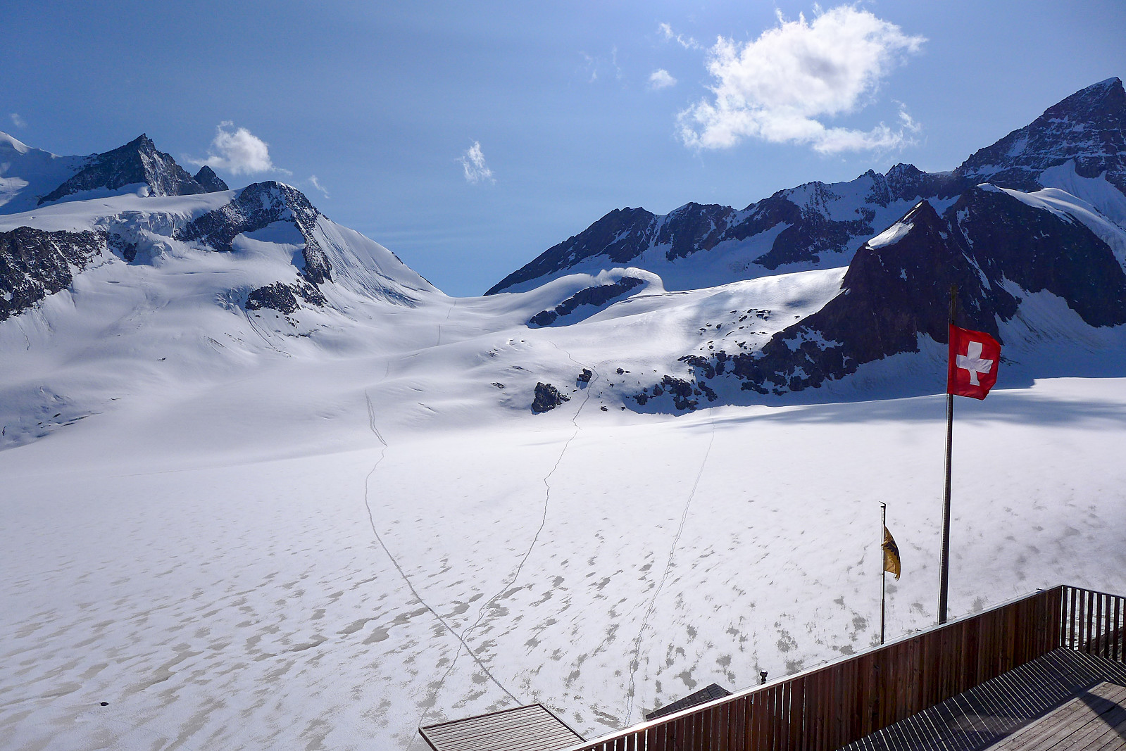
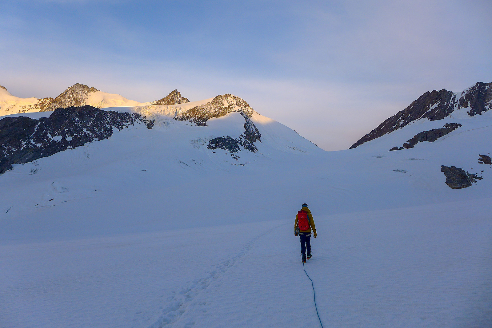
After having been up the Gross Grünhorn & Grunegghorn and walking over to the Finsteraarhorn hut the previous day, the plan was to climb the Finsteraarhorn via the upper southeast ridge (also referred to as the Sudroute in Martin Moran’s guidebook) as it would hopefully provide a more interesting route to the summit compared with the standard route from the Finsteraarhorn hut via the southwest flank and northwest ridge. However, since the entire southeast ridge was still looking very snowy when we checked it out from the summit of the Gross Grunhorn, we ended up changing our plans to do the standard route instead. Moreover, it seemed like there were going to be very few teams doing the normal route anyway, so there wasn’t much chance of it being too busy. Meteoblue had forecasted some early morning fog so I was expecting to have a quite chilled out breakfast at 4 am the following morning, but instead we woke to clear skies, so there was no excuse to hang around and have a later start! Nevertheless, since I’d not slept that well I was feeling a bit tired and decided it wouldn’t be a bad idea to let the other two pairs of climbers start before us, expecting that they would probably move faster. One pair was a Swedish guide who was climbing with a Swiss guest, and the others were two Czech guys (might have got this wrong but they were from somewhere in eastern europe I think). The path leading up to the glacier on the south side of the Finsteraarhorn was very direct, starting from right behind the hut and ascended pretty steeply. It was a bit of a shock start to the day for legs that had not yet woken up! We walked in a very gentle pace though and after about half an hour of walking it was already light enough to not need to use headtorches anymore. The edge of the glacier was in sight and we’d caught up with the other 2 teams despite having left 10-15 minutes later. Tracks up the glacier that people had made the previous day were no longer visible though since the overnight wind had transported snow and filled them in, so the two Czech guys who were in front were plodding slowly up the glacier and re-breaking the trail. I don’t think they lasted long though since Swedish guide Olov was soon taking over and doing all the work. We decided it would be a wise idea to take our time putting on our harnesses and an extra jacket on……
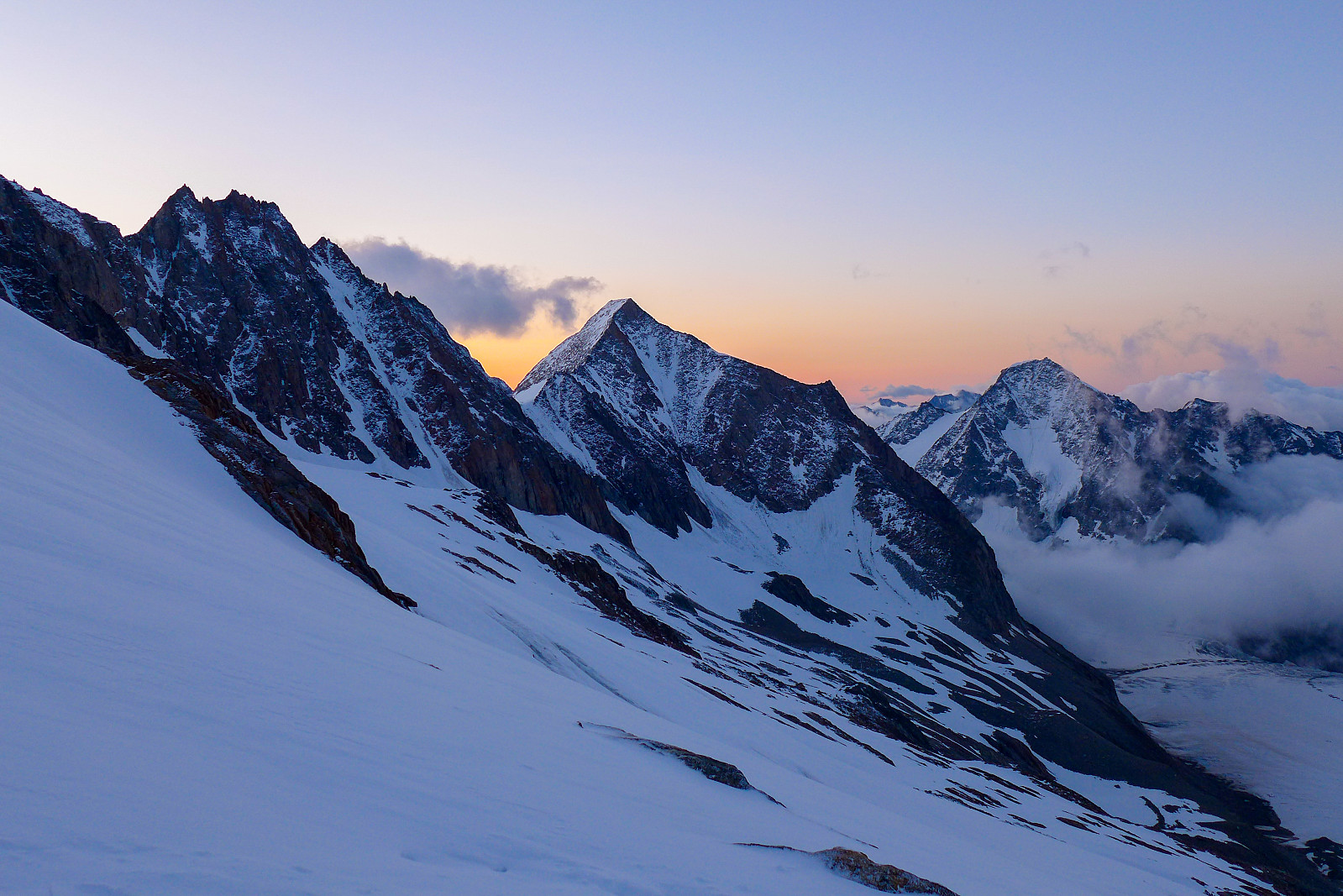
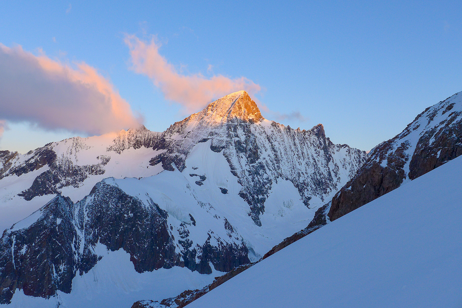

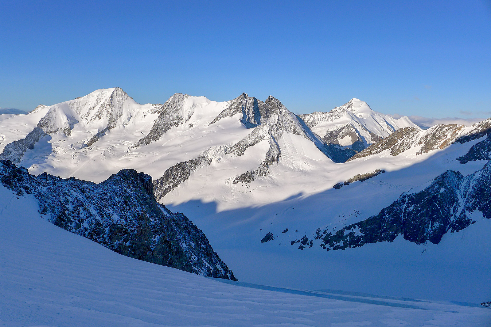
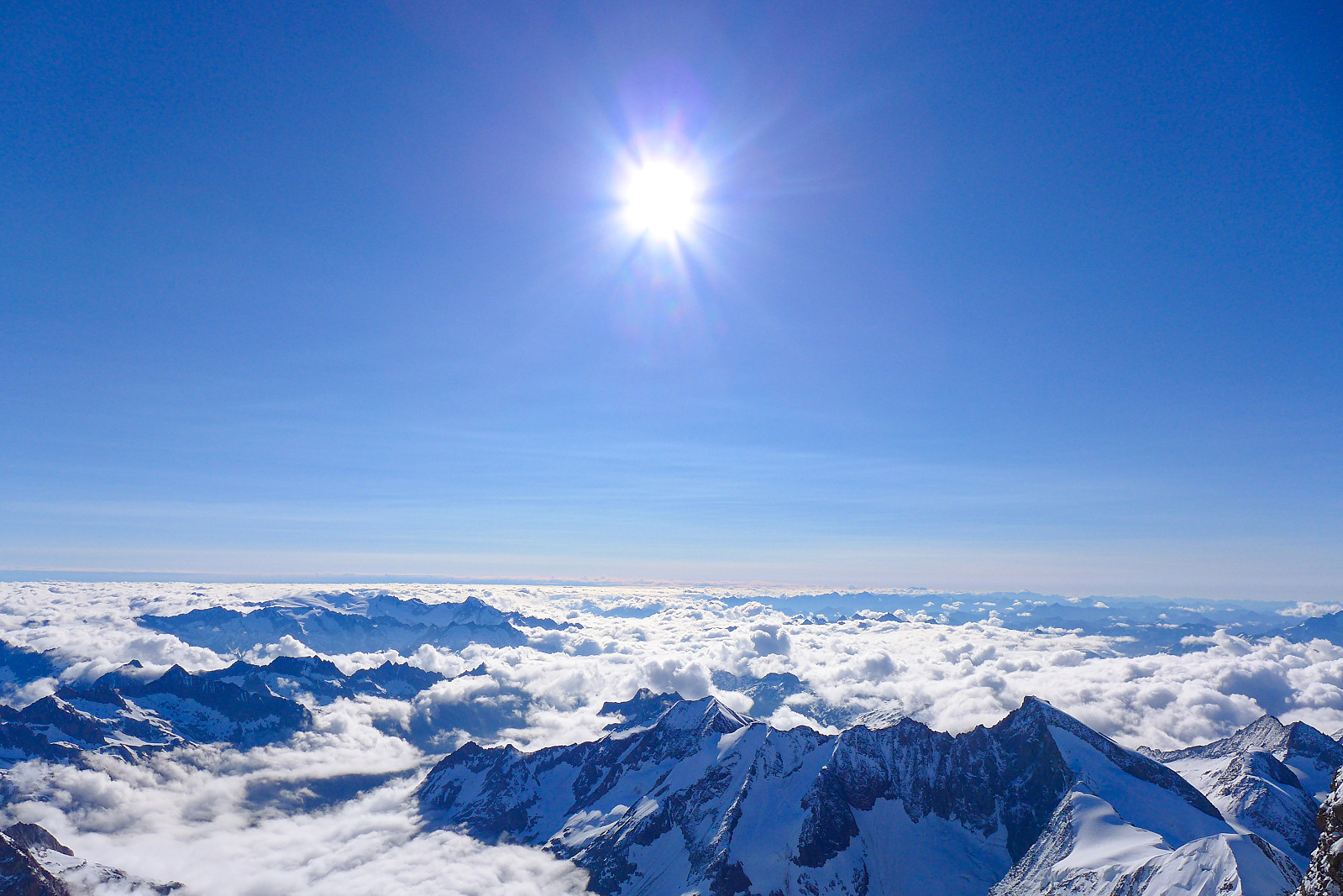

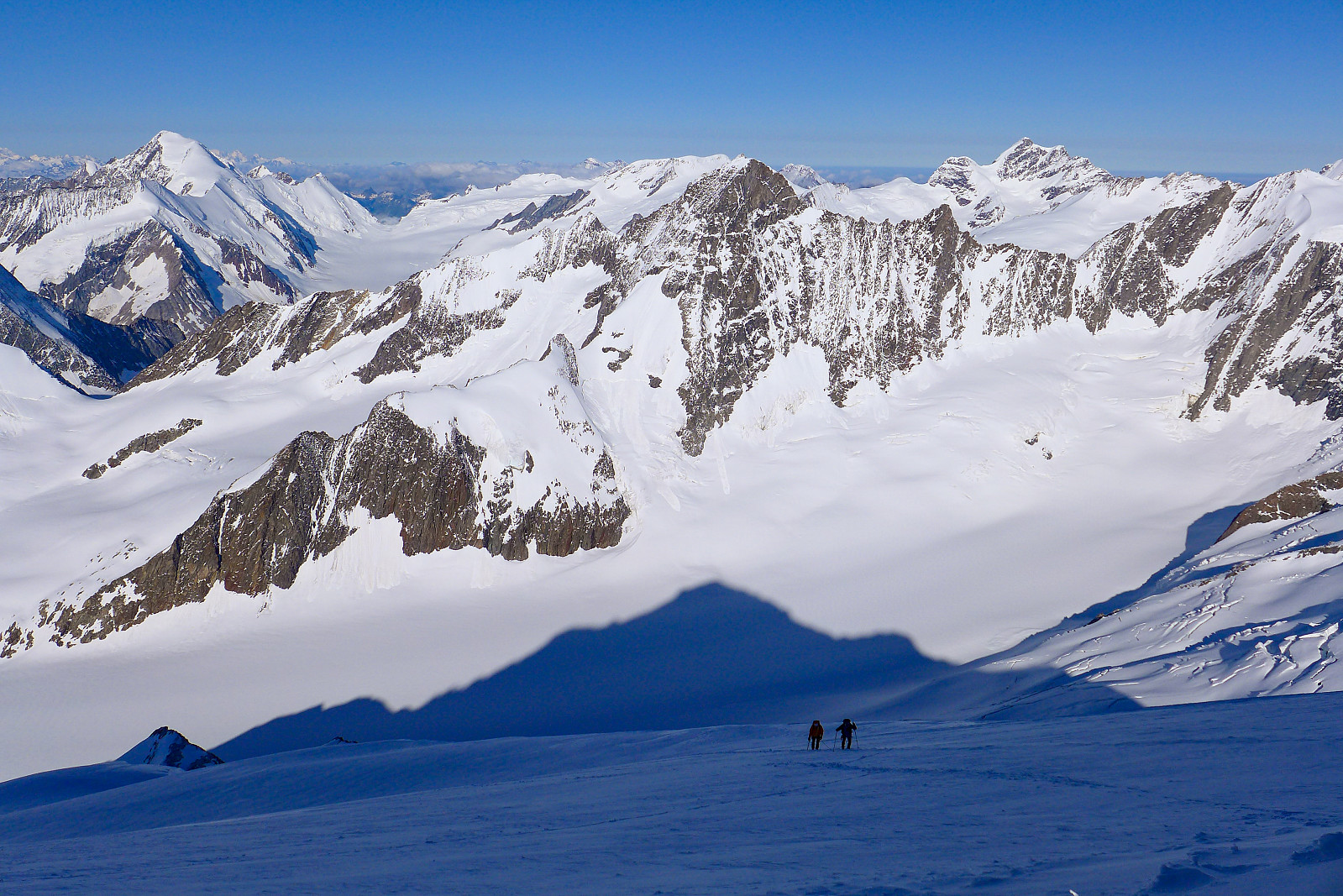
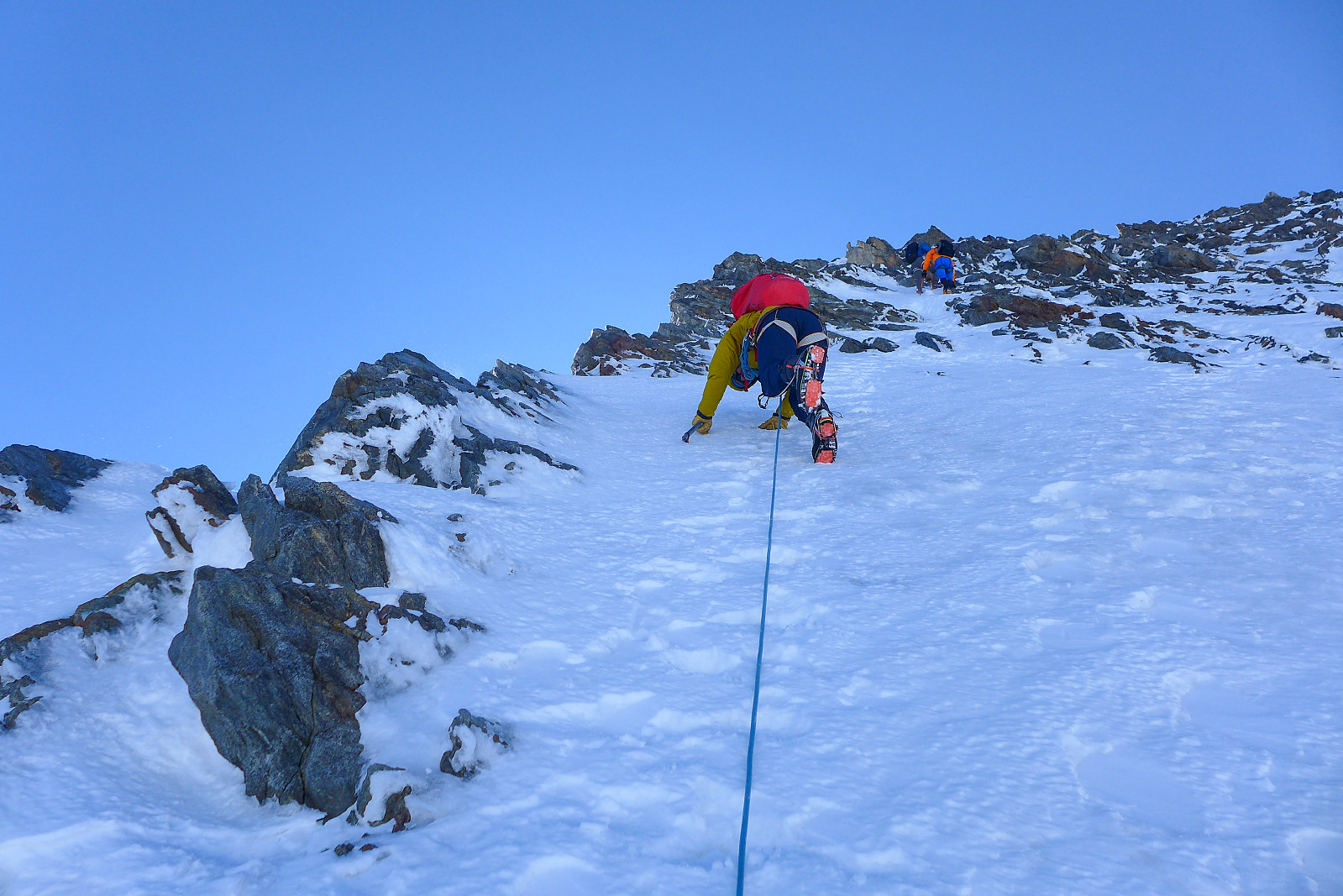

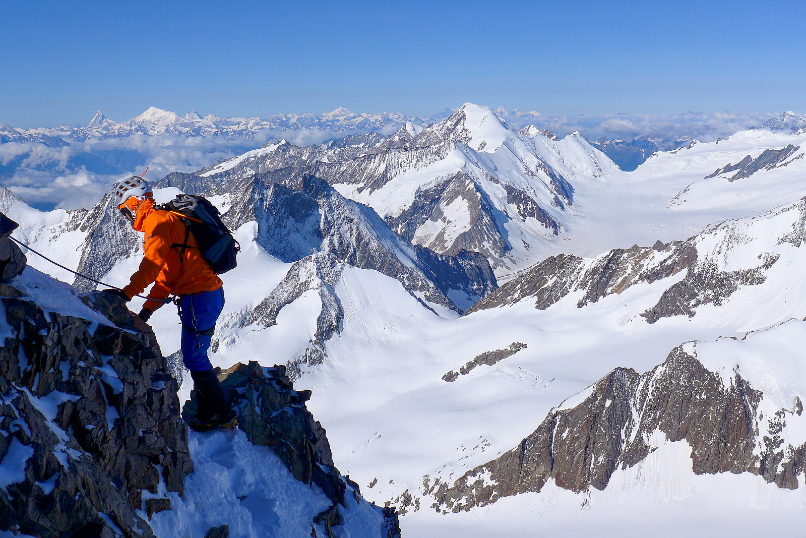
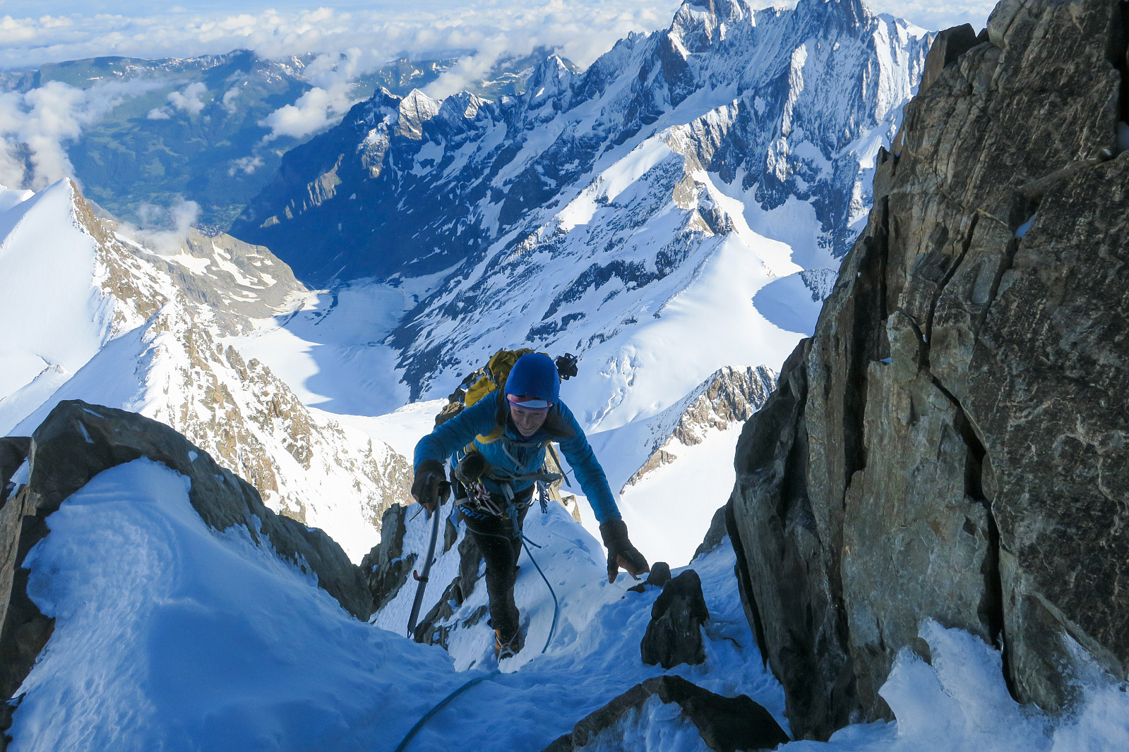
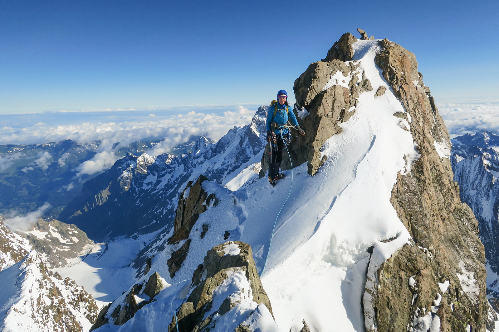
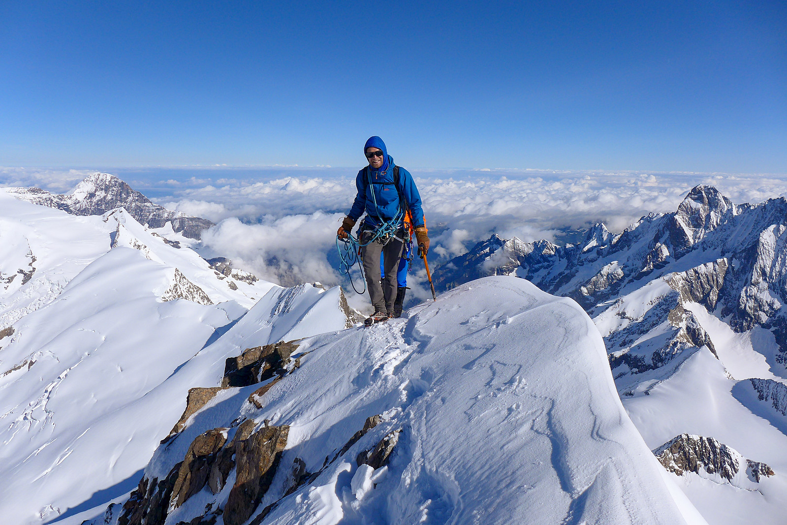
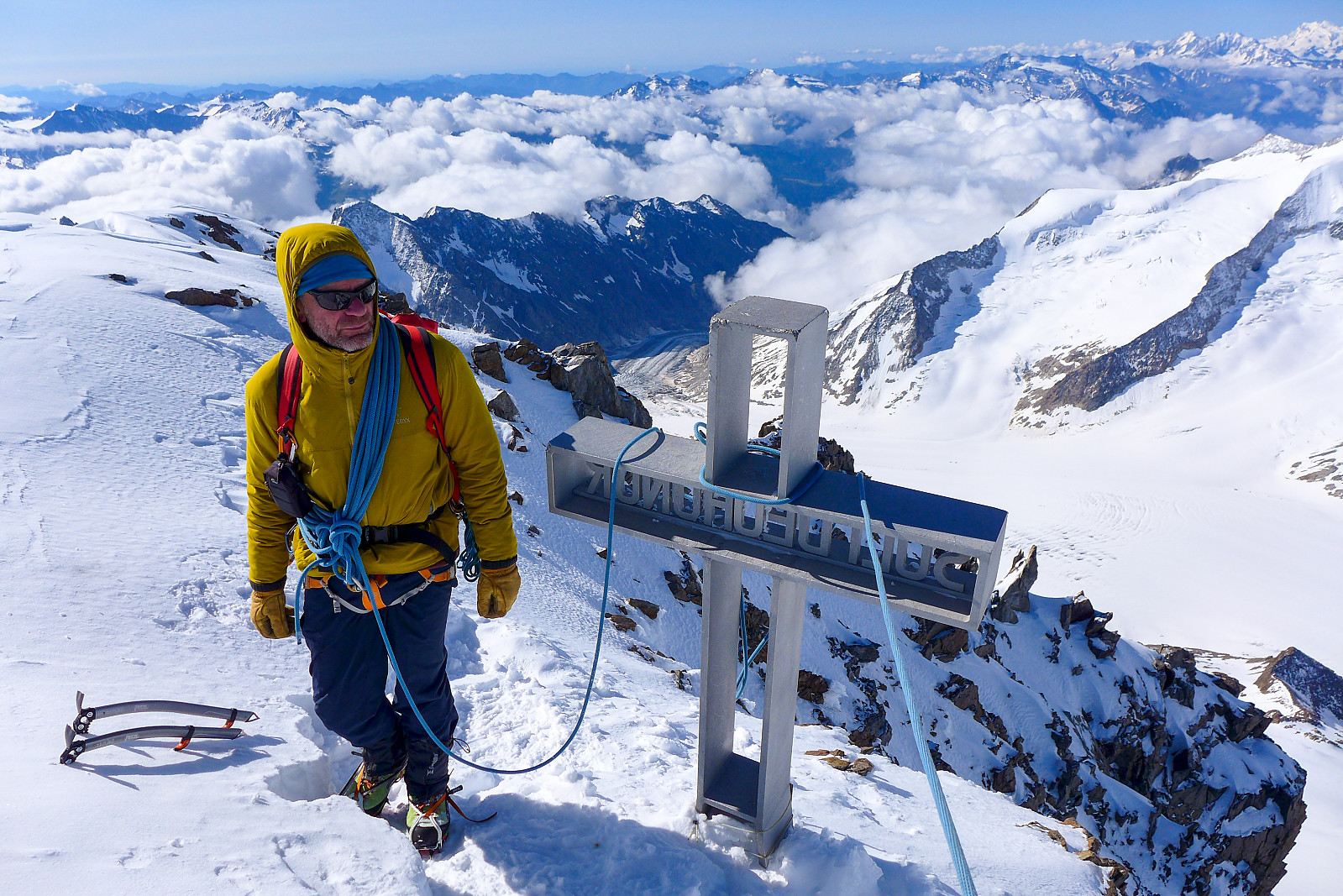
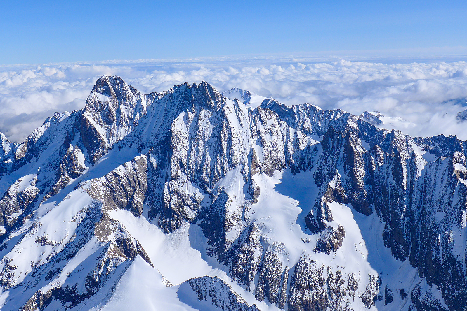
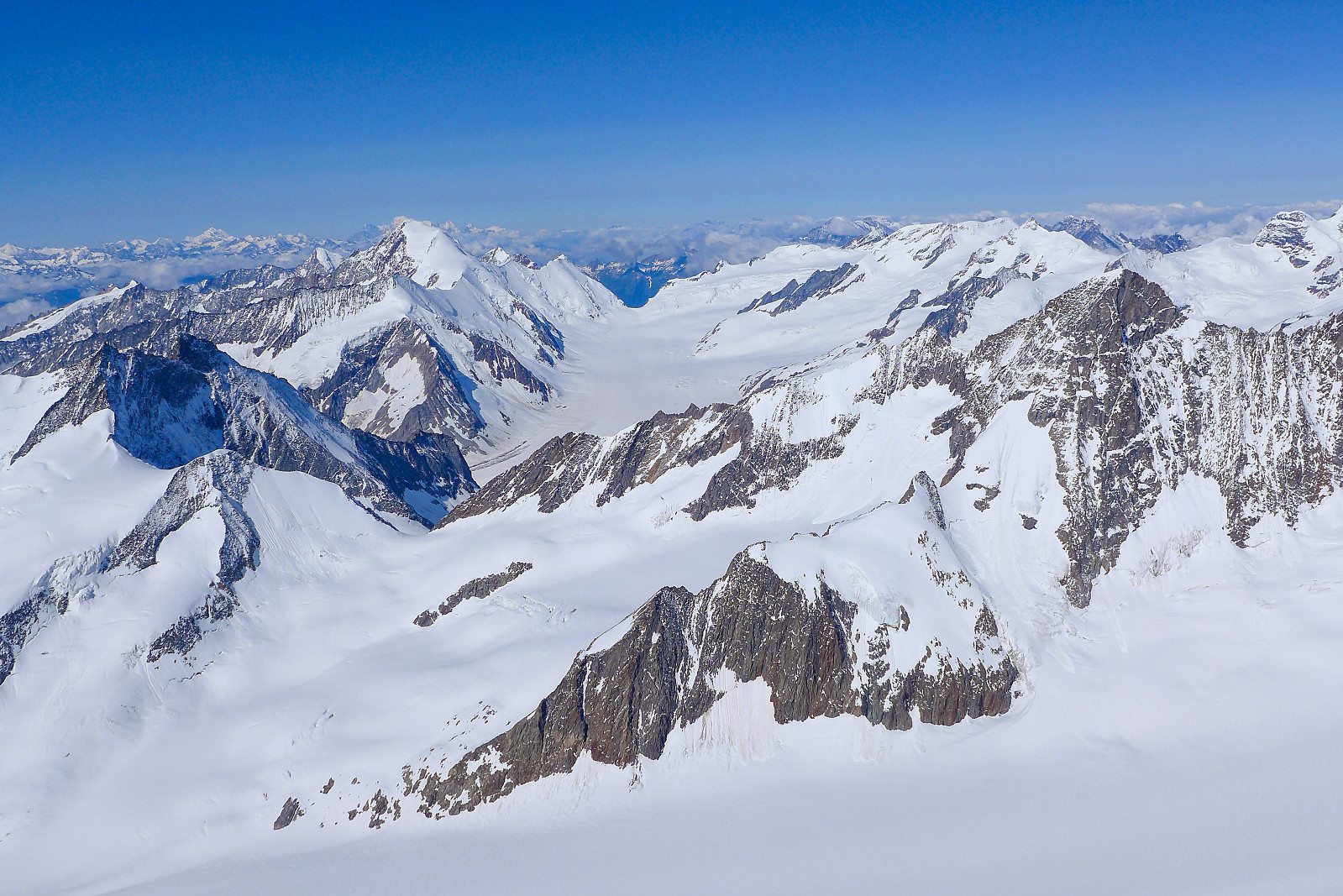
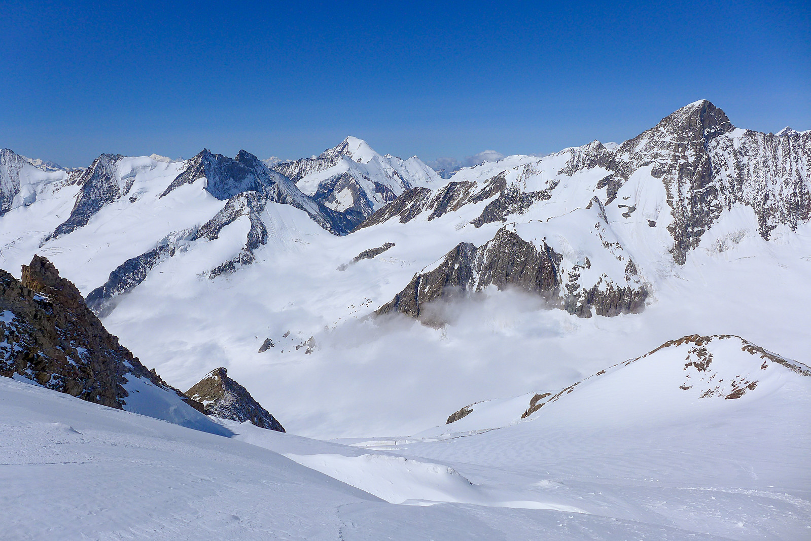
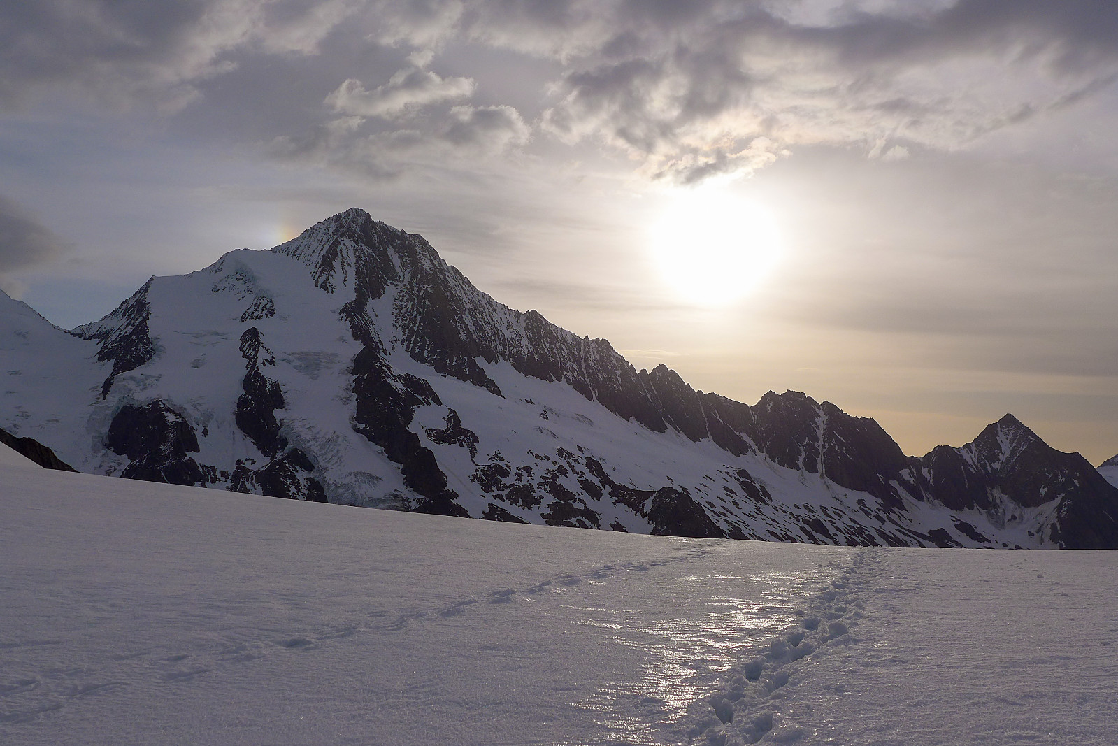
The sun rose pretty slowly today but the sky was filled with some pretty orange colors for a while. Progress was steady and it took about another hour to reach the Fruhstucksplatz on the southwest ridge. By now my tired legs felt pretty good and I was surprised to feel like I was in my best form of the whole holiday by this point. There was a pretty fierce wind blowing on the other side of the ridge where we needed to head for to reach the Hugisattel though so we found a sheltered spot on the east side of the ridge to put on yet another jacket, mitts and crampons. Another hour of plodding followed and we had reached the Hugisattel after about 2h 30. It was good to finally feel a bit of warmth from the sunshine here too, though it didn’t last too long because once we started to climb the ridge above the Hugisattel we were quite quickly back in the shade again. The ridge was very nicely plastered in snow (apparently not normal summer conditions) and made it a fun mixed scramble on rocks and steeper snow sections with the stunning Schreckhorn and Lauteraarhorn in the background. It wasn’t really an airy narrow ridge like the southwest ridge of the Gross Grunhorn, but it was at least easy enough to keep scrambling/climbing more or less continuously (even with mitts on), which was quite useful in these chilly conditions. Despite being only about 200 m from the Hugisattel to the summit, it took about 1.5 hours to climb the ridge. Had we been in the sun for most of the time I wouldn’t have minded if the ridge had been several hundred metres longer, but given how cold it was I was actually quite glad to get to the top as soon as possible :-) The views from the top were really stunning, pretty much like the previous day’s summit views from the Gross Grunhorn. I couldn’t stop looking at view across to the snow-plastered Schreckhorn and Lauteraarhorn, and the jagged ridgeline east of the Lauteraarhorn. It was like the Bernese Oberland equivalent of the Chamonix Aiguilles or something. Yet another cool summit had to be descended though, so after some 15 minutes on the top we began the careful descent back down to the Hugisattel, though we got a bit held up along the way since Olov and his guy weren’t moving at quite the same pace as us. If it hadn’t been cold I probably wouldn’t have felt too impatient, but I kind of regretted that we hadn’t left the top before them! Anyway, once down at the Hugisattel again it was a straightforward walk back down the same way we’d came. Most of the tracks that had been made a few hours earlier had once again been filled in by wind-transported snow, so being the first team going down we ended up having to re-break the trail again. Fortunately the trail below the Fruhstucksplatz hadn’t been affected quite so much by the wind and it was really quick to descend this last part of the glacier. Interestingly the walk back down on the rocks/path to the hut seemed to take forever and felt like a lot longer than when we’d walked up it earlier in the day – despite that I was feeling a lot more lethargic at the start of the day. But it was at least nice to know that the hut and cold drinks were not far now and we didn’t have to walk back up anything to get to it. Probably the first summit of this holiday which didn’t have a demoralizing uphill part at the end of the day :-) We were back down before midday so it felt like a bit of a luxury to eat a civilized lunch at the hut and have plenty of time to take an afternoon nap before dinner since we were planning to stay another night at the Finsteraarhorn hut before embarking on the 20km walk back out to Fiesch the following day.


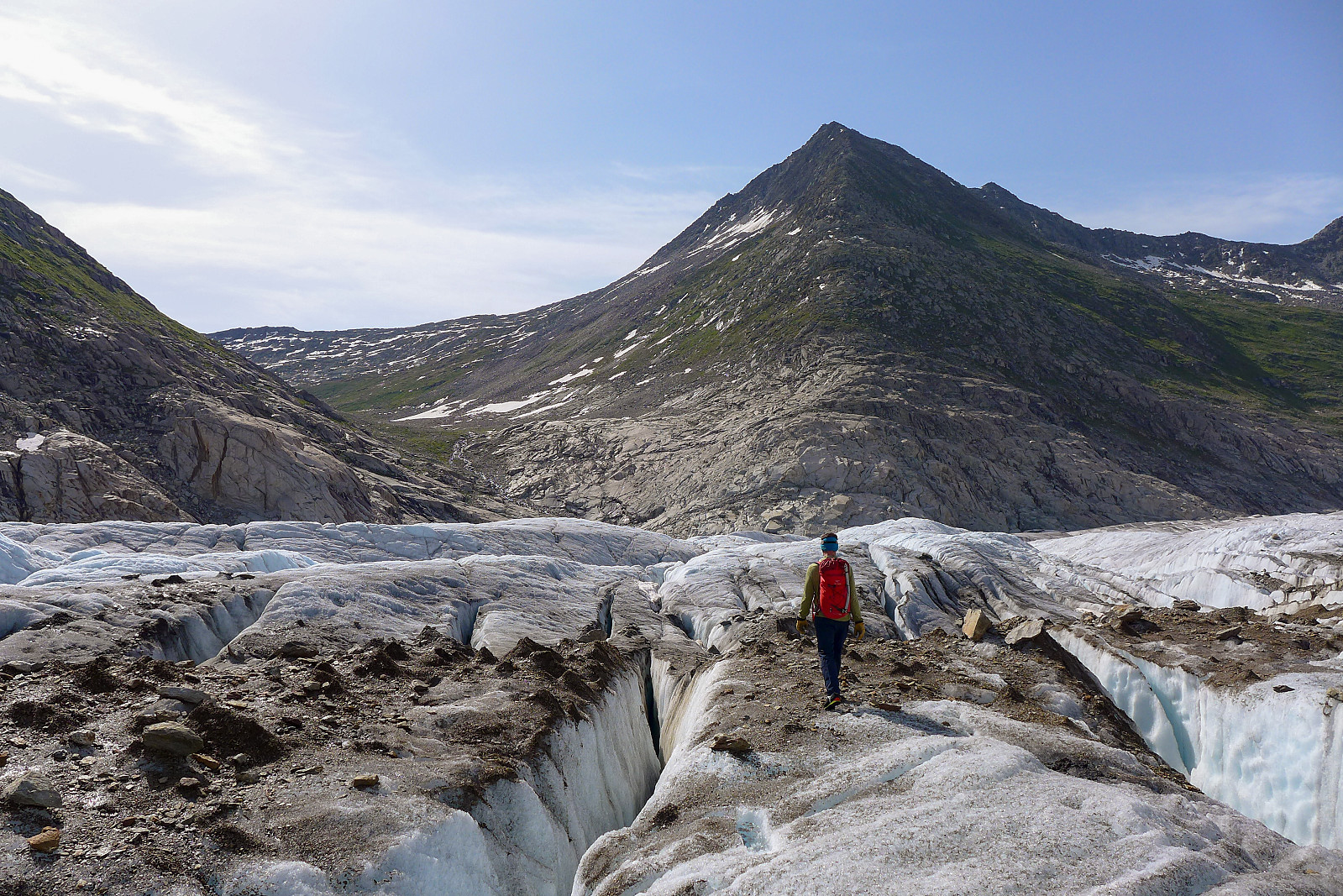
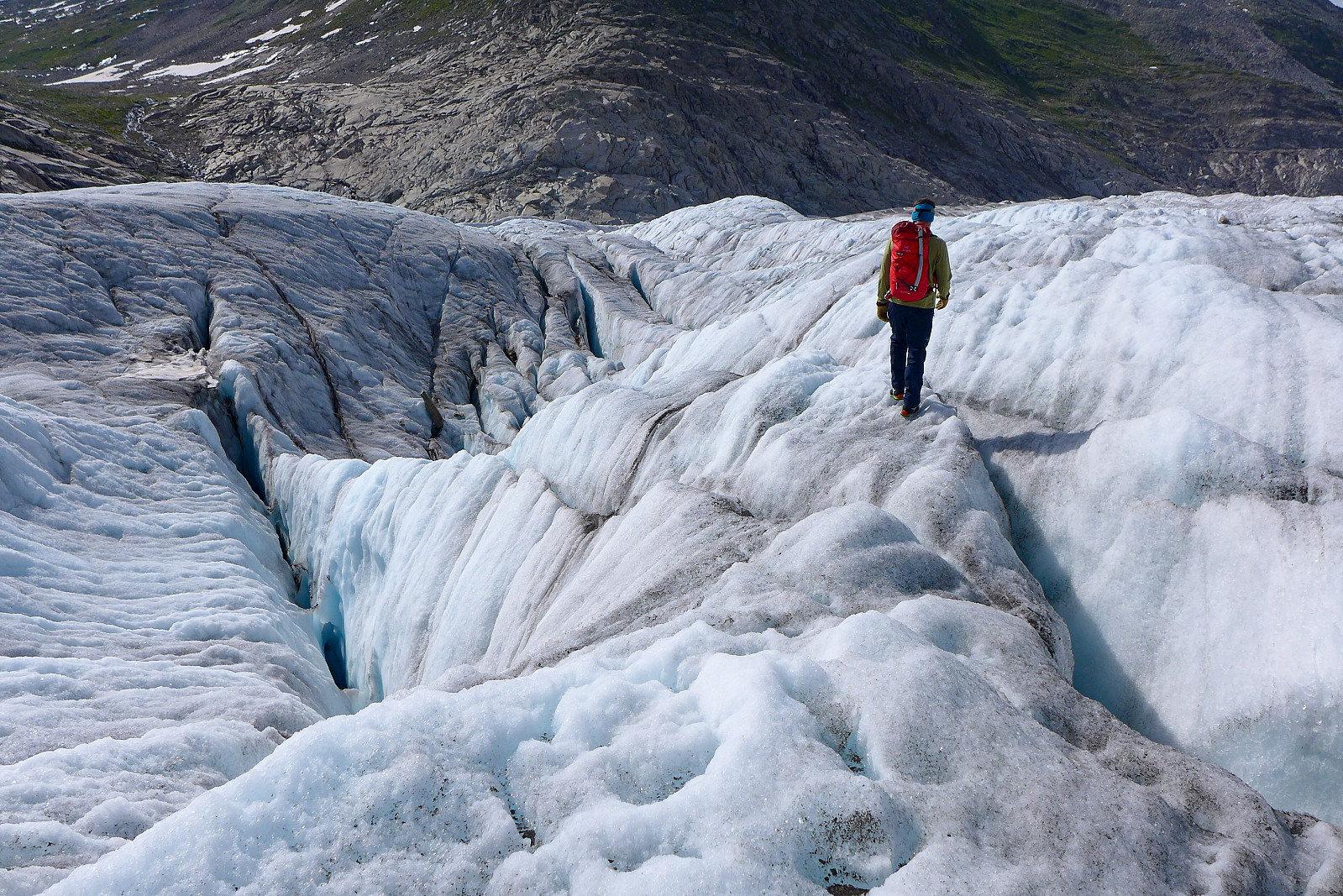
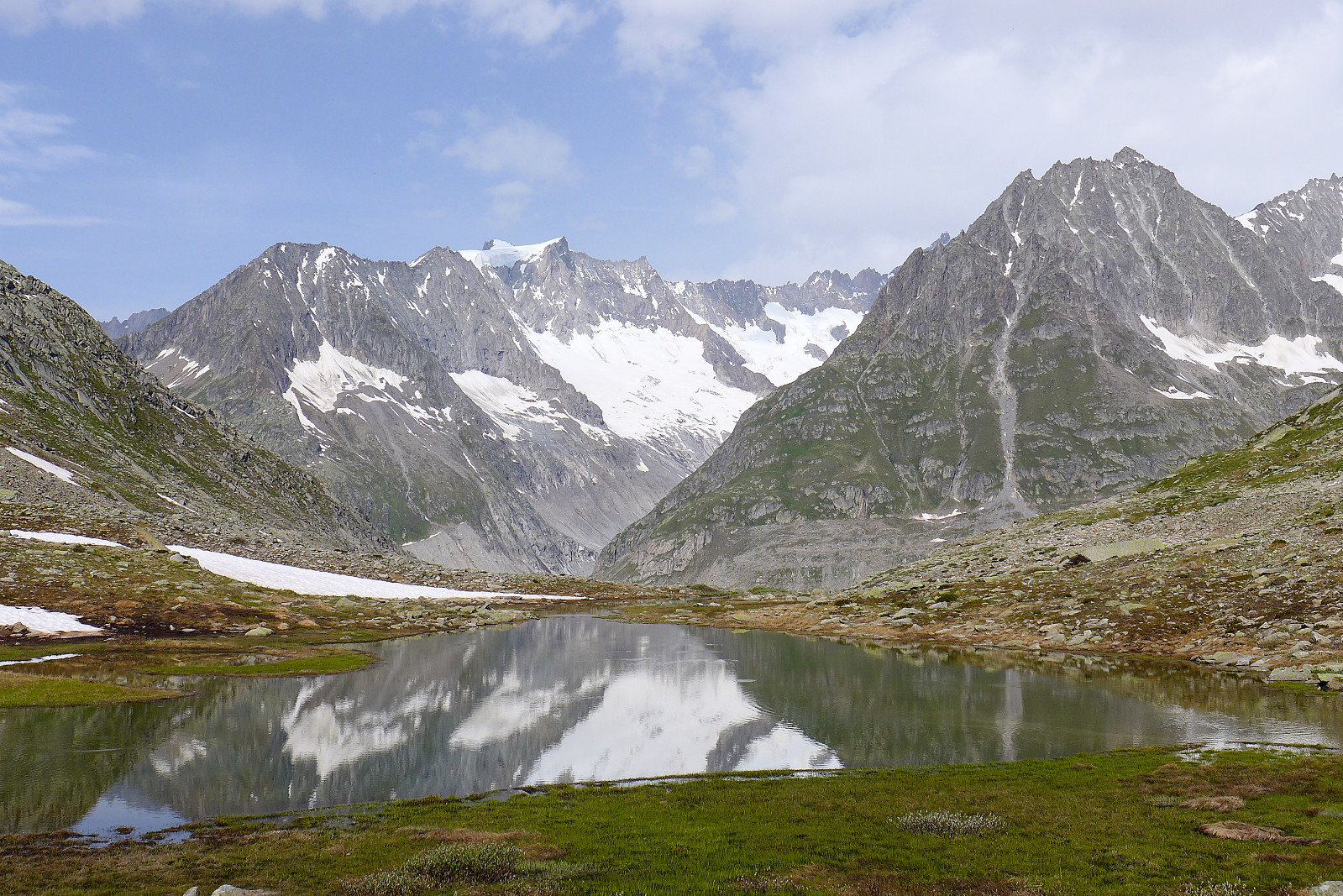
The walk out itself was somewhat unexciting in comparison with the two summit days, but when we left the hut in somewhat overcast and windy weather, it felt like we’d made the most of the 3-day weather window. It was quite fascinating to see how quickly the Aletschgletscher had transformed after only a few days with sunshine, having walked up a pristine white glacier on the Friday and now walking back out it looked like a grey, crevassed mess after the new snow had been burned off by the few days of strong sun. Several kilometers of crevasse hopping followed before we were finally back at the path going up to Marjelensee. In total the walk to Fiesch took about 6 hours, even with only a few breaks, but my feet were definitely the most relieved to be finished with the hike out. Scarpa Phantom Techs are comfortable but I doubt they were made for long walks.... Thanks to Graham for the fantastic few days in the Oberland to finish off the two weeks climbing together. The weather might not have been so cooperative, but the excellent company made up for that!
| Startzeitpunkt | 11.07.2021 04:44 (UTC+01:00 SZ) |
| Endzeitpunkt | 11.07.2021 12:00 (UTC+01:00 SZ) |
| Gesamtzeit | 7h 15min |
| Zeit in Bewegung | 7h 14min |
| Pausenzeit | 0h 1min |
| Gesamtschnitt | 1,5km/h |
| Bewegungsschnitt | 1,5km/h |
| Entfernung | 10,5km |
| Höhenmeter | 1.110m |


Benutzerkommentare