
Round around Lerøyna (05.06.2021)

Geschrieben von HHauser (Helwig Hauser)

| Startpunkt | Lerøyna ferry stop (2m) |
|---|---|
| Endpunkt | Lerøyna ferry stop (2m) |
| Tourcharakter | Bergtour |
| Tourlänge | 2h 30min |
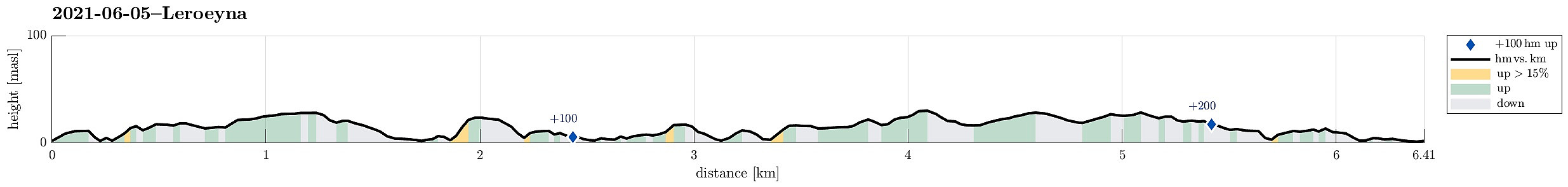
| Entfernung | 6,4km |
| Höhenmeter | 227m |
| GPS |
|
| Besuche anderer PBE | Greftvikdalen (WWII fangeleir) (7m) | 05.06.2021 |
|---|
Trip Summary
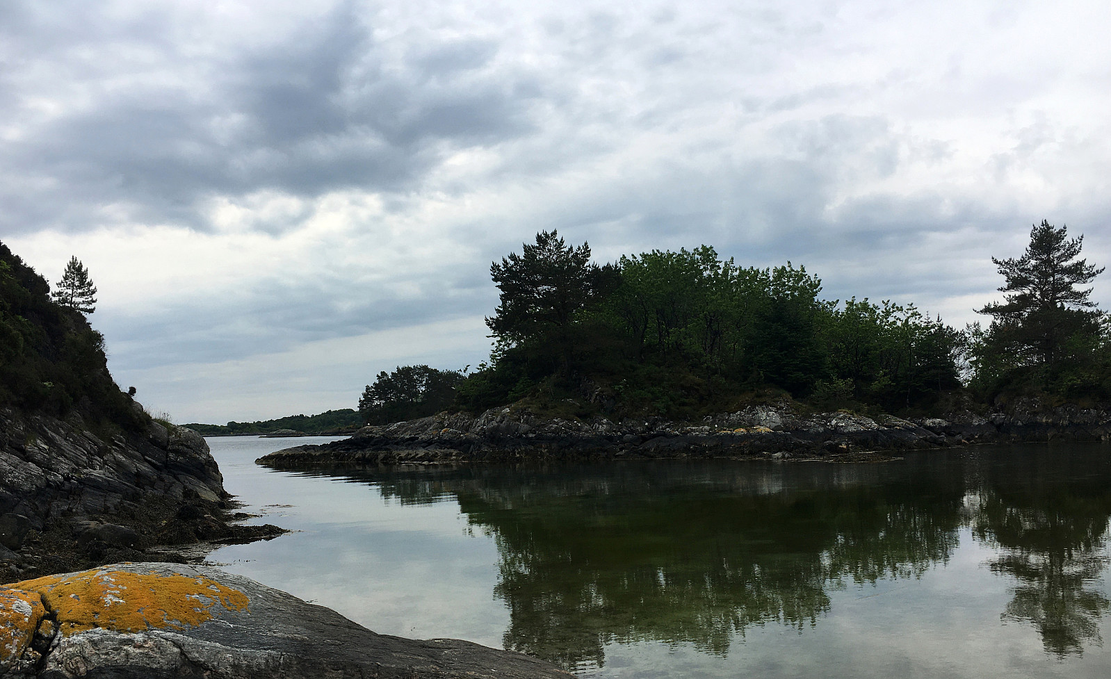
We thought to explore one of the nearby islands and chose Lerøyna, between Hjellestad and Klokkarvik. Leaving the car in Hjellestad, we took the ferry to Lerøyna, landing on the very western side. Aiming at one round around the island, we started in southeastern direction. Within about 100m from the ferry stop, we came to the place, where during WWII a POW camp was (in Greftvikdalen). Walking through one of the tunnels from that camp (most of them have been closed off by now), we came to a place, right next to Lerøyosen, which is eerily idyllic, given the grim past of this place. From there, we stepped through the green into southeastern direction, passing by a larger number of relatively new houses at the sea in their north. Continuing again through a bit of green (a little further east), we walked by a soccer field and connected to road Fuglavika thereafter. Instead of following this road, however, we continued through the "wild", crossing Kråkedalen in southeastern direction soon after (one needs to note that terrain and vegetation not necessarily cooperate in the best possible way there; making progress "through the wild" requires some additional dedication). After finally getting through a bit of thick vegetation, we ended up in lovely Storlarken. Continuing from there, we crossed over to the next bay (with Landbelekholmen in it) in the north of Åsneset. Descending towards the shore a bit early, we needed to get back up basically right again, without getting very far along the somewhat steepish shoreline (not exactly a detour to recommend). A little later, however, we came down to the sea, again, but a bit further into the northeast, where it was then much easier to continue along the shore. At the shallow inside of this bay, right behind Landbelekholmen, we then enjoyed a short break, before continuing further on our round around Lerøyna. This then brought us further northwards, a little off the shore, before reconnecting with the shore near Seljehølen. From there, we then took a trail away from the shore and towards Storavatnet in the middle of Lerøyna. Following another trail from there, we connected to Lerøyvegen. After following this road for a bit, and just before getting back to the ferry stop, we took another detour to have a look at what previously was the old school of Lerøyna. Then, we made it back to the ferry stop, after once again visiting Greftvikdalen briefly.
Photos
Selected photos are available as Google photo album.
Useful Resources
See also the related FB-page Hiking around Bergen, Norway.
Web page UT.no from the Norwegian Trekking Association recommends another hike on Lerøyna.


Benutzerkommentare