
Tverrfjellet from Bidne (06.08.2020)

Geschrieben von HHauser (Helwig Hauser)

| Startpunkt | Bidne (400m) |
|---|---|
| Endpunkt | Bidne (400m) |
| Tourcharakter | Wanderung |
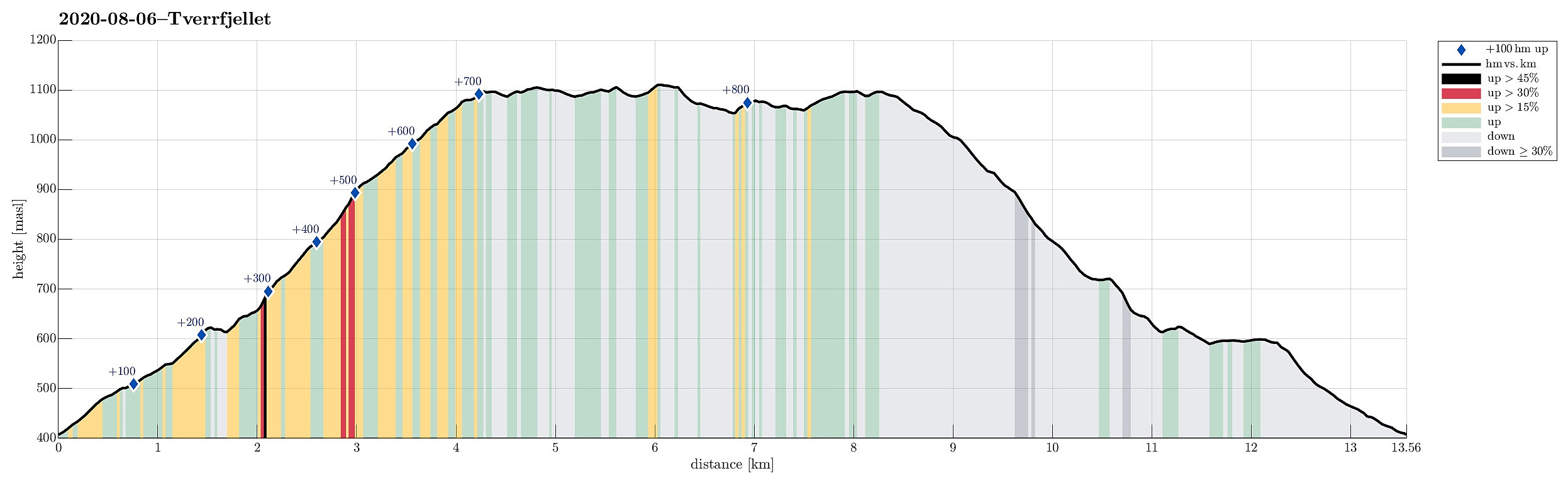
| Tourlänge | 5h 00min |
| Entfernung | 13,6km |
| Höhenmeter | 893m |
| GPS |
|
| Besteigungen | Såta (1.102m) | 06.08.2020 |
|---|---|---|
| Tverrfjellet (1.113m) | 06.08.2020 |
Trip Summary
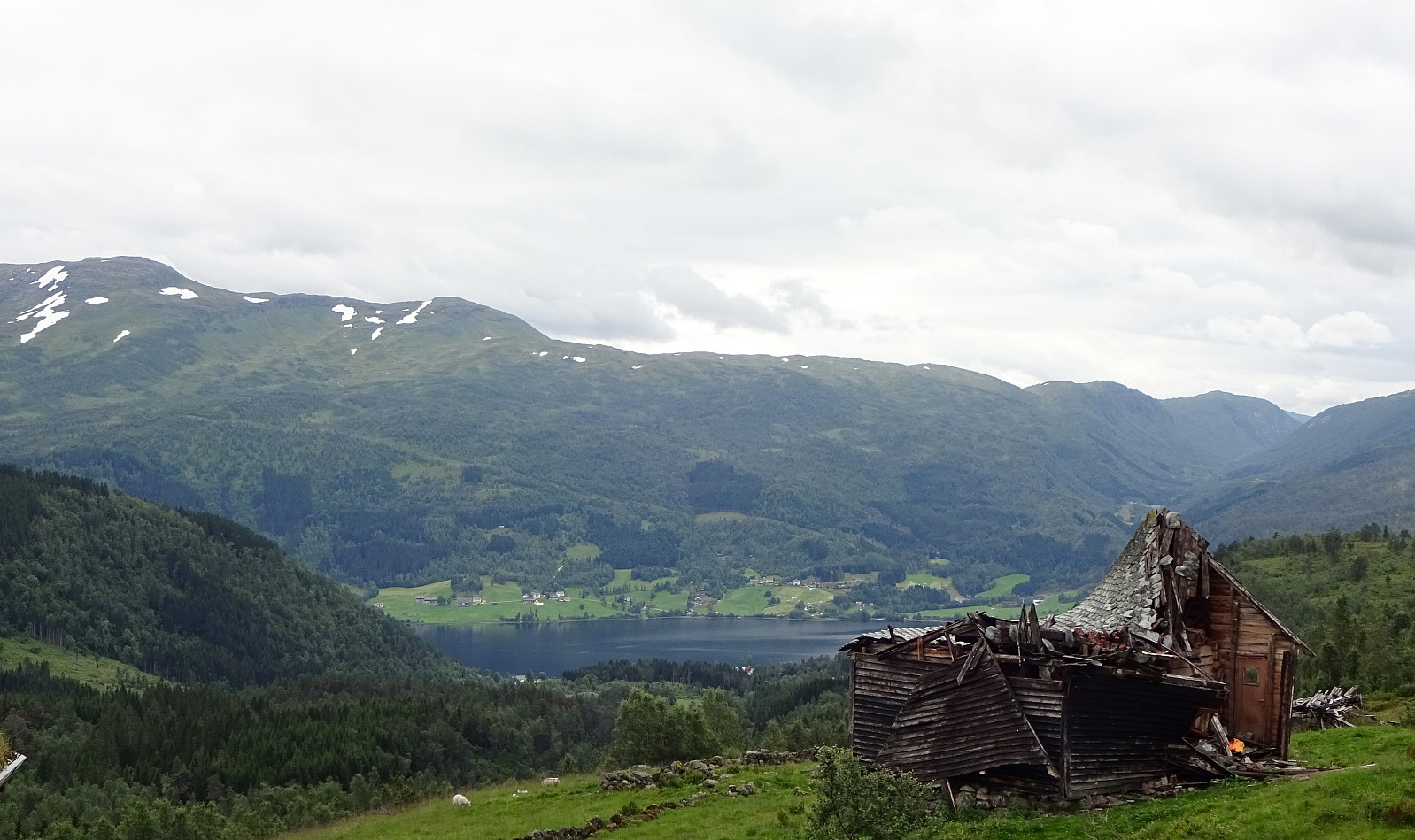
The weather forecast was moderately OK (quite a bit overcast with realistic chances for some rain), so we aimed for a moderate hike, bringing us not too high up (and into the clouds). Since we had not been there before and expected at least some nice views from up there, our choice was to hike up to Tverrfjellet from Oppheim. We thus drove to Oppheim first and then left the main road (E16) near Framnes to drive up a simple road into the direction of Bidne. A few meters after reaching Bidne (that's about one kilometer from E16), we turned right (eastwards) and drove a few meters more towards Bidneshovden. There, we parked and started our hike (in northern direction, on a forest road). We followed the forest road northwards, staying on the western side of Sundsvålselvi, steadily ascending into the direction of Svorto. At about 610mosl, we crossed Svorteelvi and reached Svorto only a few minutes later. There, we needed to watch out for the trail-head (up to Såta on Tverrfjellet); within a few minutes we could eventually locate it (this trail is not marked, but it's quite straight-forward to follow it, once you are on it). Following this trail, we continued our ascent, staying on the eastern side of Svorteelvi (and Svortebotnen), turning gradually into a northern direction. From about 900mosl, when leaving the tree-line behind, one basically continues across the grassy southern hillside of Tverrfjellet, aiming northerwards at Såta (the one "high-point" of Tverrfjellet that is standing out a little bit). Once on Såta, we first enjoyed the nice view from there, especially into the direction of Oppheim. Then, we started to walk over the plateau-like heights of Tverrfjellet to get to "the other side" of Tverrfjellet (on its northern side). Visiting two smaller "tops" along the way, we soon after arrived at the northern end of Tverrfjellet, looking further into the direction of Vikafjellet. From there, the highest point on Tverrfjellet, we then started our return, following a slightly different (more western) route back. Once down to Svorto, again, and just on the other (southern) side of Svorteelvi, we then chose "the high route" back, instead of following the forest road that we had taken up. This way, we "emerged" from a stretch of intermediate heights north of Bidne, where we connected to the road, which we then followed down to our car. All in all, this hike turned out to be a little longer than originally thought. One reason is, maybe, that the plateau-like heights of Tverrfjellet are non-small and exploring "them all" adds a few kilometers to the hike.
Photos
Selected photos are available as Google photo album.
Useful Resources
See also the related FB-page Hiking around Bergen, Norway.
Petter Bjørstad has a useful page about Tverrfjellet and also web page WestCoastPeaks.com provides useful information about Tverrfjellet and Svolefjell.


Benutzerkommentare