
Round Trip in the Simien Mountains (22.11.2019)


Geschrieben von Solan (Atle Solholm)

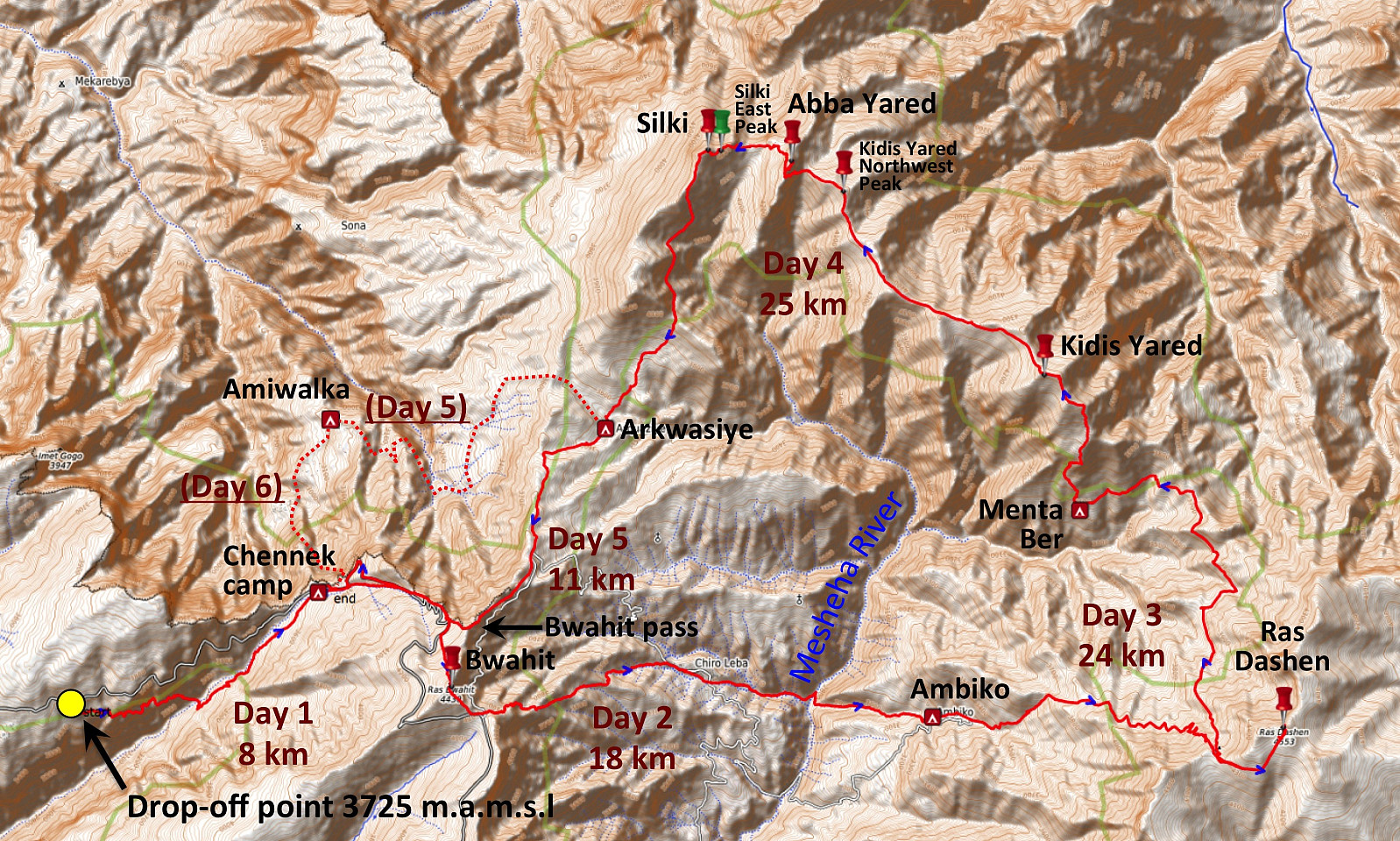
| Startpunkt | Drop Off Point on Inatiye (3.725m) |
|---|---|
| Endpunkt | Chenneck Camp Site (3.625m) |
| Tourcharakter | Hochtour |
| Tourlänge | 96h 21min |
| Entfernung | 86,7km |
| Höhenmeter | 13.400m |
| GPS |
|
| Besteigungen | Abba Yared (4.409m) | 22.11.2019 |
|---|---|---|
| Bwahit (4.430m) | 22.11.2019 | |
| Kidis Yared (4.453m) | 22.11.2019 | |
| Ras Dejen (4.557m) | 22.11.2019 | |
| Silki (4.420m) | 22.11.2019 | |
| Silki East Peak (4.390m) | 22.11.2019 | |
| Kidis Yared Northwest Peak (4.320m) | 22.11.2019 08:00 | |
| Besuche anderer PBE | Ambiko (3.140m) | 22.11.2019 |
| Chennek (3.625m) | 22.11.2019 | |
| Arkwasiye (3.540m) | 22.11.2019 08:00 | |
| Menta Ber (3.560m) | 22.11.2019 08:00 |
Introduction
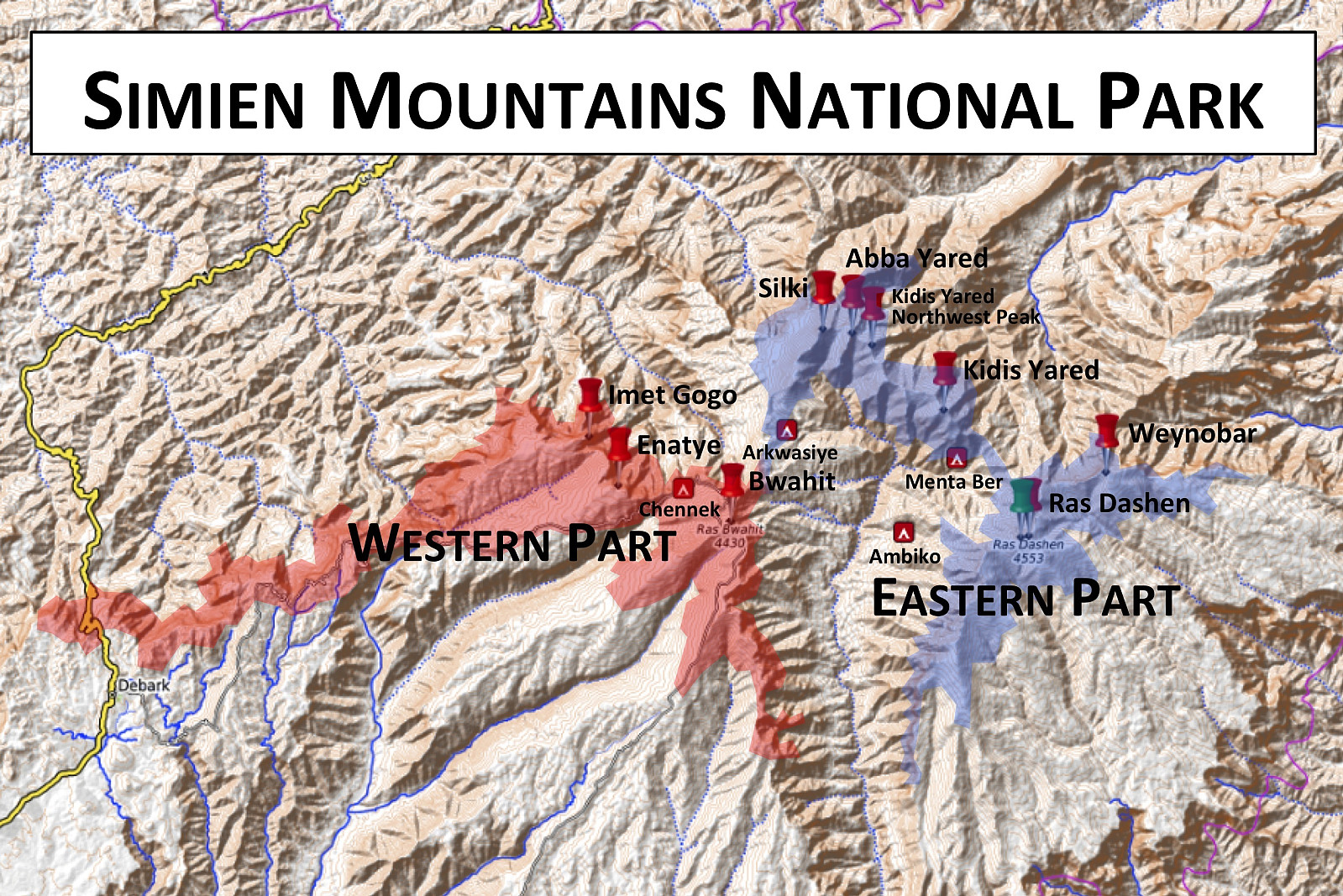
I think this mountain hike, which I did along with my youngest daughter Vår vaarsolholm (Vår Solholm), our mountain guide Enyew Fikru and a park ranger; is one of the most spectacular hikes that I've ever done. Within just five days, we summited the mountains of Ras Bwahit (4,430 m.a.m.s.l.), Ras Dashen (4,553 meters), Kidis Yared (4,453 meters), Abba Yared (4,409 meters) and Silki (4,420 meters). I had communicated very thoroughly with Dawit (Dave) Yohannes of Ras Dejen Tours in advance of our journey, and we had planned the trip in detail. I knew Dave quite well from the previous year [i.e. 2018], when I visited Gondar, the Simien Mountains, Bahir Dar and The Blue Nile Falls along with my wife; and we had been friends on Facebook since then, hence our communication was now all on Messenger. [You may reach Dave at daveyohannes@yahoo.com or at +251 91 364 4690]. Now, the Simien Mountains National Park has a western part and an eastern part (Image #2). As I had previously visited the western part, with Imet Gogo, Inatie and Ras Bwahit; I now wanted to visit the eastern part of the park, and especially so in order to summit Ras Dashen. The itinerary that I suggested to Dave, as I was writing to him on Messenger, therefore, was as follows:
- Day 1: We drive from Gondar via Debark to Chennek Camp.
- Day 2: We summit Ras Bwahit and continue into Mesheha Valley and up to Ambiko Camp.
- Day 3: We summit Ras Dashen, continue to Mount Weynobar, and then descend to Menta Ber.
- Day 4: We summit Kidis Yared and Mount Silki, and then descend to Arkwasiye.
- Day 5: We return from Arkwasiye to Chennek Camp.
- Day 6: We drive back from Chennek Camp via Debark to Gondar.
Prior to writing to Dave, I had studied the "Simen Mountains World Heritage Site" map (University of Bern, 3rd edition 2010) in detail, and I had also seen the mountains of Dashen, Kidis Yared and Silki from a distance when climbing Bwahit in November 2018; hence this plan of mine wasn't something I had just taken out of thin air. Dave immediately approved of my plan, but had two additional suggestions:
- On day 1 he suggested a drop-off close to the village of Ambaras, with a first day trek through the valley of the Argin village up to Chennek, a local trail that he knew particularly well from his childhood, when he used part of the route on his way to and from school.
- On day 5 he suggested a hike from Arkwasiye to the village of Amwalka in stead of back up to Chenneck, with camping at the Amwalka school; and then a trek up from Amwalka to Chenneck on day 6 prior to pick-up and transport back to Debark and Gondar.
Furthermore, we had an understanding, that on day 3, if we were to arrive too late at the summit of Ras Dashen, we were going to skip Mount Weynobar, and likewise on day 4, if climbing Kidis Yared took too long a time, we would skip Mount Silki.
![#3: From the western part of the Simien Mountains National Park: Enatye (4,070 m.a.m.s.l), Shayno Sefer (3,962 m.a.m.s.l.) and Imet Gogo (3,927 m.a.m.s.l.). These are the most commonly visited mountains in the park, along with Mount Bwahit, or Ras Bwahit (4,430 m.a.m.s.l.), from which this image was captured. [Image from 2018].](https://images1.peakbook.org/images/14939/Solan_20200330_5e812dd52a0d5.jpg?p=xtralarge)
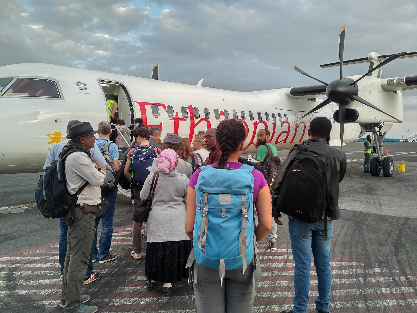
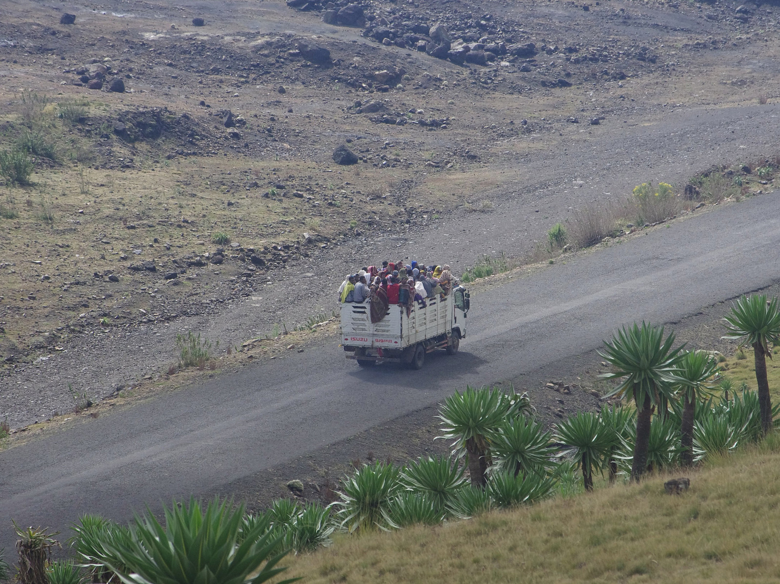
I went to Ethiopia for work at the Tikkur Anbessa (Black Lion) Hospital in Addis Ababa at turn of months between October and November, my daughter joined me there in Addis on November 16th; and together we went by plane from Addis to Gonder a few days later. Dave picked us up at Gonder airport according to our agreement. We spent the night at a Gondar hotel, and early the next morning we were off for Debark and Gondar in a Toyota HiAce of Dave's. We stopped at Debark, where we registered at the official park office, and Dave payed for our permits to enter the park (as that was included in the price that he had offered us). We then had a cup of coffee at a little café on the other side of the road, just beside Dave's little office building, where we met with our guide Enyew, and also the ranger that was going to join us for our hike. While we were having coffee, and discussing our route, Dave's Toyota Land Cruiser was loaded with all the necessary gear for the journey. Within the park, we had a brief stop at the Shankaber Camp Site, to pick up Morat, our chef and his dish washer, along with the gear that they were going to use for cooking. This is actually part of the Simien Mountain's trekking consept: The staff that are with you throughout the journey always includes a guide, a chef, a dish washer, a ranger, and a number of mule drivers that will be guiding the mules that will carry your stuff. The number of mules and mule drivers usually corresponds to the number of participants in the group. The number of rangers also depends on the size of the group. For a small group there will be only one ranger, for a medium sized group they will be two; and for a larger group of tourists there will be three rangers.
Day 1: From drop-off to the Chennek Camp Site.
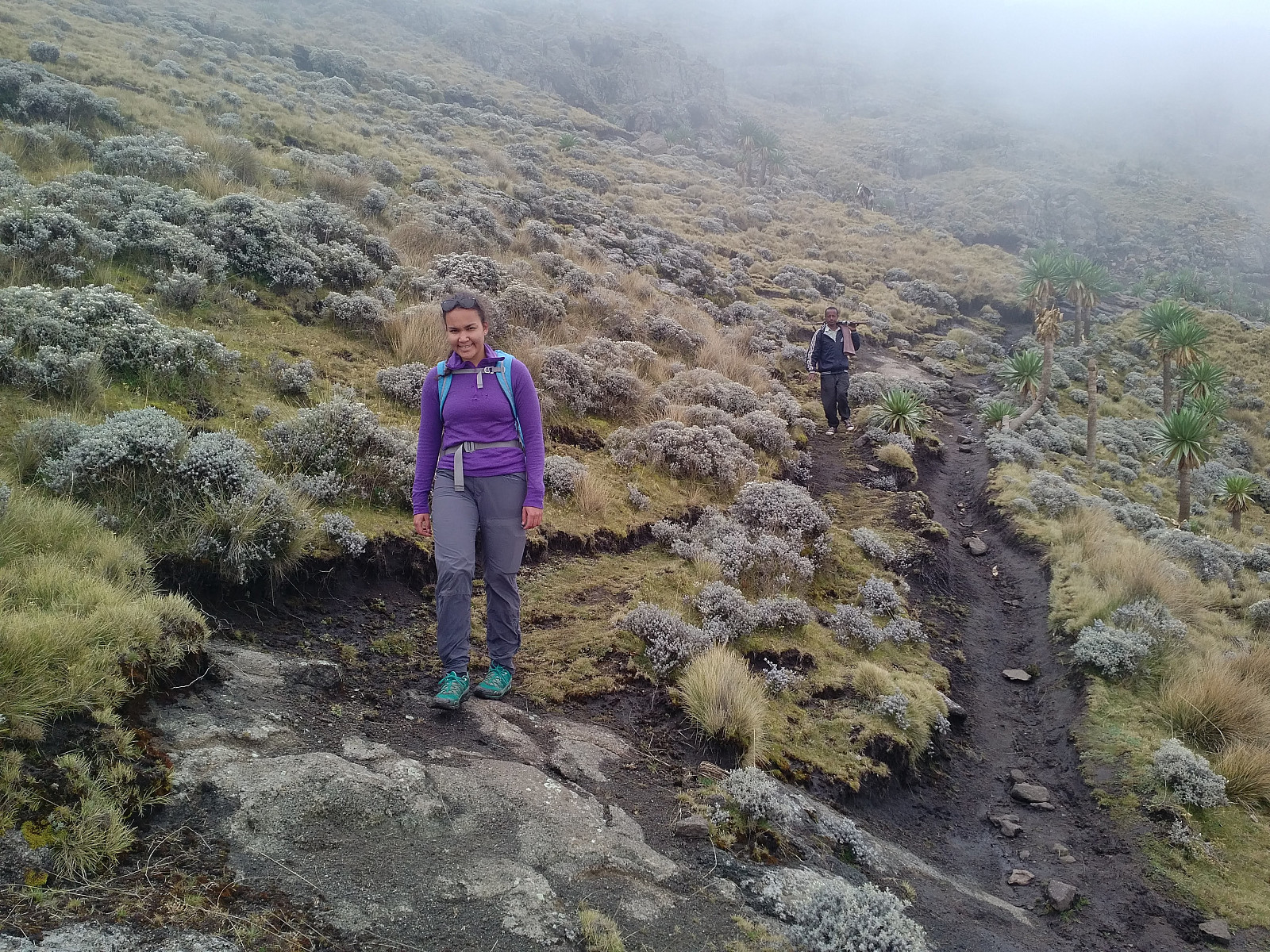
They dropped us off close to the village of Ambaras, as Dave had suggested: Me, my daughter, Enyew and the ranger; while Dave, the chef and the dishwasher continued towards the Chennek camp site in the car. And that was when I realized why Dave had suggested this trek of a few kilometers already on the first day. It's also part of the concept: They want the chef and the gear to arrive at the camp site well in advance of the group of trekkers, so when you arrive at the camp site, your tent will already be up, and the dinner will be in the making.
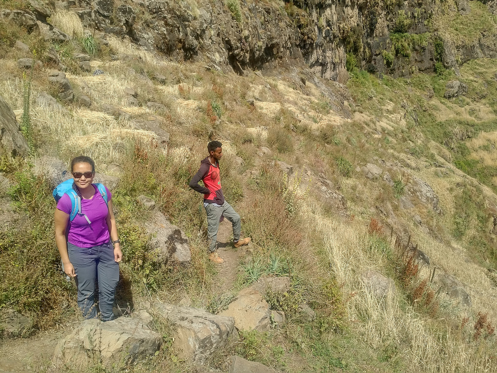

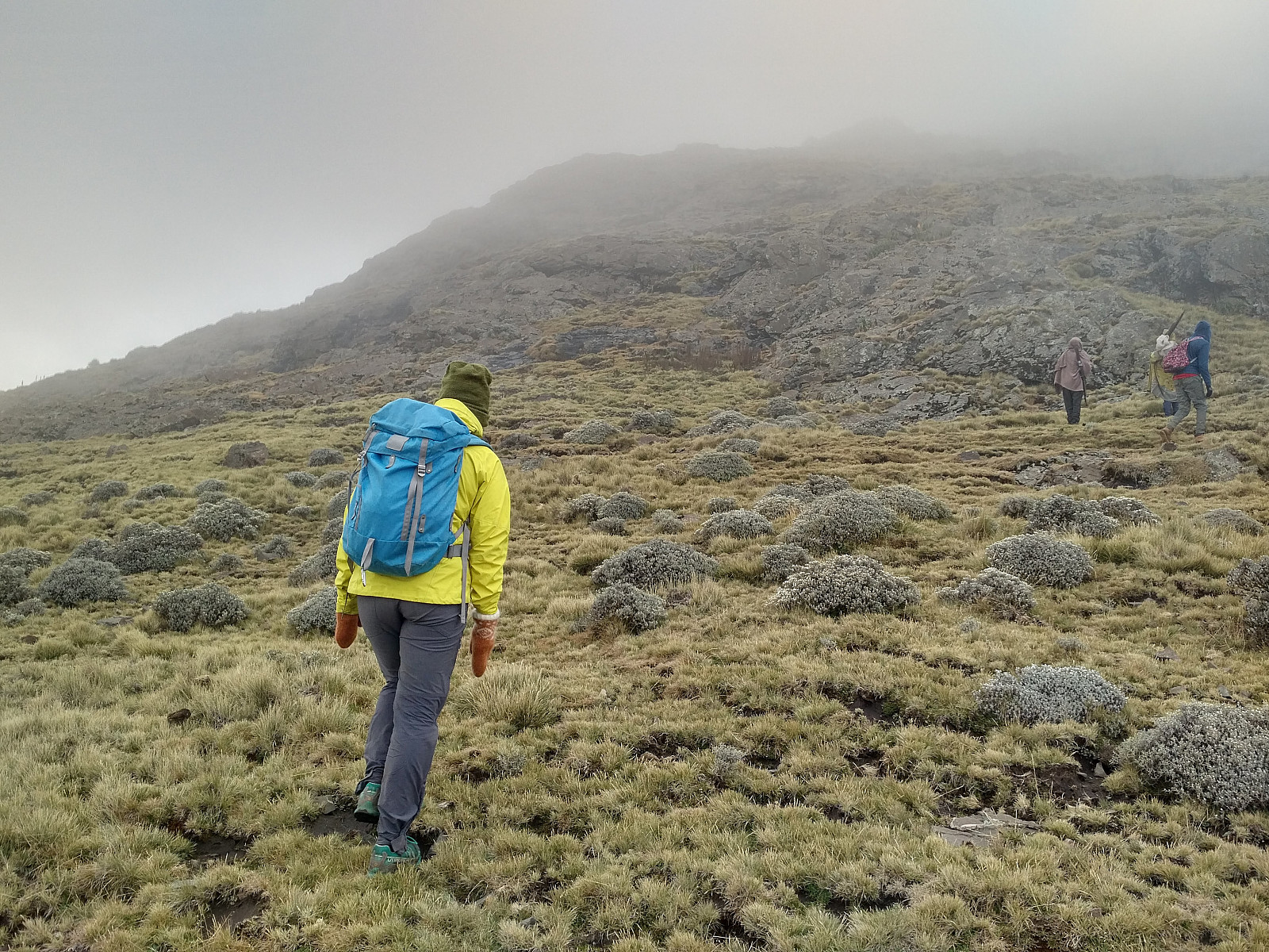
The landscape was picturesque. We were walking high up in the mountainside of a beautiful valley, with small villages interspersed within an agricultural landscape, in part composed of barley fields, and in part composed of pasture land. At the bottom of the valley we could see the Belegez River. The path that we were following was running high up in the mountain side. All of a sudden it did split in to, however; with one path continuing along the north side of the valley, whereas the other track went down to the bottom of the valley, and then continued towards Chennek on the south side of the valley. Enyew told us we were free to choose which of the trails we would like to follow. We figured out that going down to the bottom of the valley, and then climb up on the other side of it would be a good way to become acclimatized to the high elevation, and so we chose that option. We had been dropped of at about 3,700 m.a.m.s.l., we crossed the river at about 3,260 m.a.m.s.l.; and then we had to climb back up to 3,625 m.a.m.s.l., the elevation of the Chennek Camp Site.

It took us just about 2 hours and 15 minutes to hike from the drop off point to Chennek. That's the advantage of being such a small group, i.e. just me and my daughter, along with the guide and the ranger. You do save some money if you join a larger group of tourists, but when you're just a small group that you're well acquainted with, you can walk in the pace of your desire (as a group), and you don't have to wait for strangers that are less fit or less acclimatized to the altitude; nor do you have to feel that you're slowing the group down, if the group is mainly composed of people that are better fit than yourself.


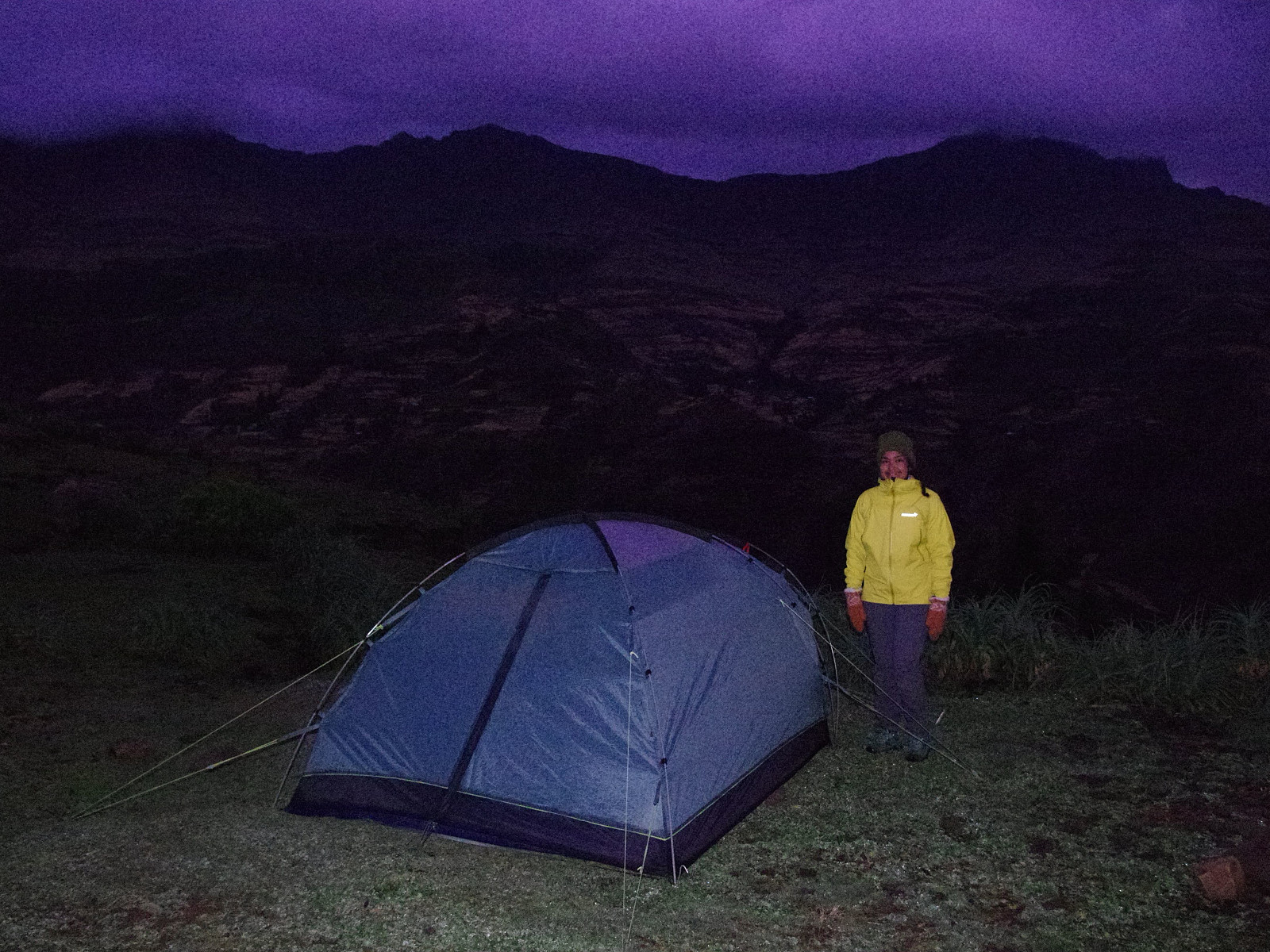
At Chennek our tent was already up, and we were served tea, biscuits and a nut mix that included roasted teff grains outside of our tent. Dinner was served about two hours later. We went early to bed this evening, in order to wake up early next morning and embark on our trip into the valley behind Ras Bwahit.
Day 2: From Chennek over the Bwahit summit to Ambiko.
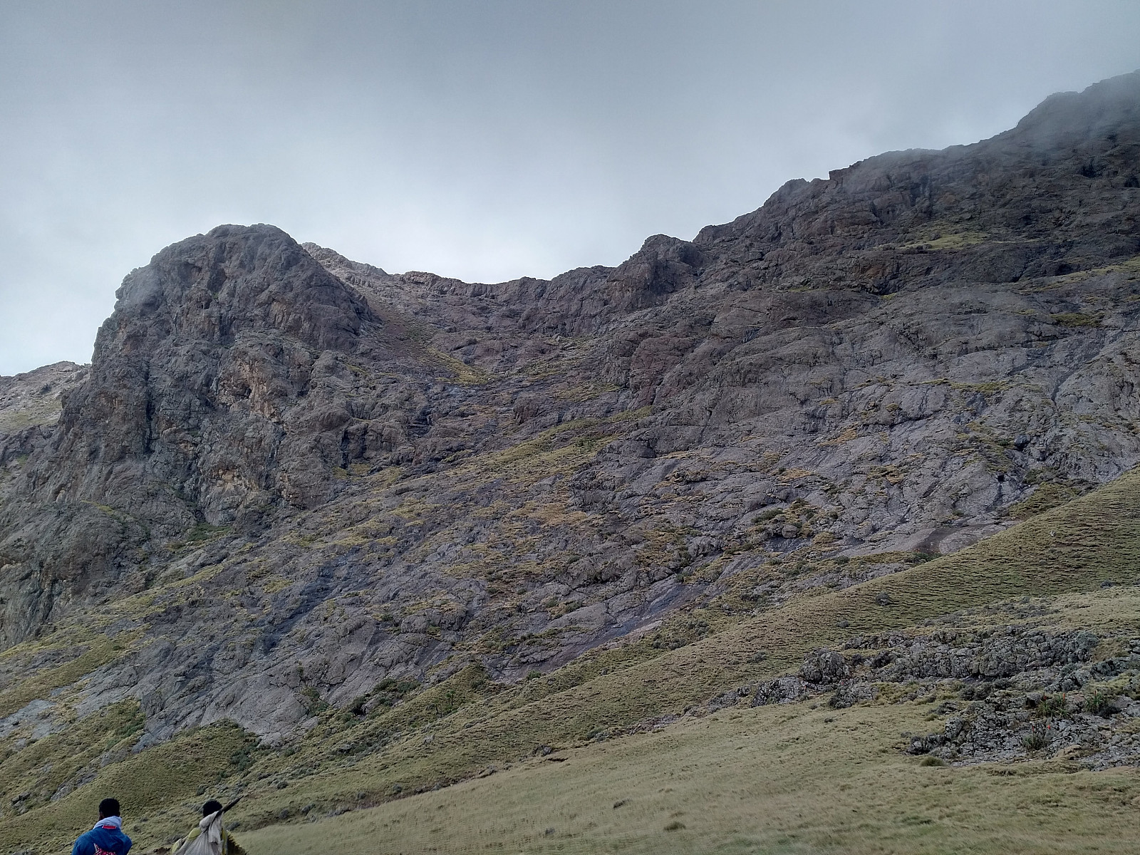
The four of us set out a little before 7 a.m. on this beautiful morning; me, my daughter, Enyew and the ranger. Our first target for this 2nd day fas Mount Bwahit, or Ras Bwahit. [The Amharic word Ras means Head, hence Ras Bwahit means the head, or summit of Bwahit, and Ras Dashen is the head, or summit of Mount Dashen]. The elevation of Ras Bwahit is 800 meters above the Chennek camp site, and the trail up there is 4.8 km. Climbing 800 meters from 3625 to 4330 is, however, completely different from climbing from sea level up to 800 meters, something we are quite used to from Norway. The climb up to Ras Bwahit, therefore, took us about 2 hours and 15 minutes, including some short stops for photographing and the like.

There is a mountain road that makes its way up the north face of Bwahit, and then winds around the western aspect of the mountain, before descending into the Mesheha Valley and the Chiro Leba village. From Chennek to Bwahit there's a trail that you follow most of the way, but it you go by the common route, you also follow the mountain road for part of the climb. We had just left the road at 4100 m.a.m.s.l., when we saw Dave, the chef and the dish washer passing in the Land Cruiser on the road beneath us. Again, Dave wanted the chef, and all the equipment, to arrive at the Ambiko Camp Site well in advance of us; and by taking them by car all the way down to Chiro Leba, they were going to have only about 6 km and a two hours walk to Ambiko.

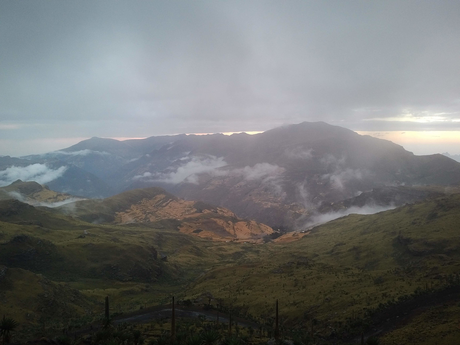
For us, however, the trek was going to be about 18 km, which was going to take us almost 7 hours. The weather was nice, however, and at Ras Bwahit (4430 m.a.m.s.l.) the view was magnificent. You could see into the broad Mesheha Valley, that lies between Ras Bwahit and Ras Dashen; and you could see all the large mountains on the other side of the valley, i.e. Dashen, Kidis Yared, and Mount Silki. The broad and deep Mesheha Valley is the main reason so few tourists actually visit Ras Dashen. In order to climb Dashen when coming from the western part of the park (see above), you have to climb Bwahit, or at least get up to the Bwahit Pass (4200 m.a.m.s.l.), then descend into the Mesheha Valley, and cross the Mesheha River at 2840 m.a.m.s.l., before you embark on Mount Dashen. The common thing to do, then, is to spend a night at the Ambiko Camp Site (3140 m.a.m.s.l.), as we were planning to do; leaving an ascent of only about 1400 meters for the day of summiting Ras Dashen. [The second reason why such a very low percentage of the tourists actually visit Ras Dashen, is the poor marketing that is done. The main marketing that is done, features "Hiking in the Simien Mountains", and not trekking to Ras Dashen, but that is another story...]. The remote location of Ras Dashen, and the challenge of crossing the Mesheha valley in order to get there, is probably also the reason the guides are trying to sell off Bwahit to the tourists as the second highest mountain in Ethiopia; even though both Mount Weynobar (4465 m.a.m.s.l.) and Kidis Yared (4453 m.a.m.s.l.) are higher than Bwahit. Some may of course argue, that since Weynobar has a vertical separation of less than 500 meters, it shouldn't be considered a separate mountain; but a part of Mount Dashen. Kidis Yared, however, has a vertical separation of about 700 meters, and should, in my opinion, definitely be considered a separate mountain; keeping in mind that the vertical separation of Bwahit isn't more than about 790 meters either.
A large number of French speaking tourists, maybe 20 or 30 of them, were also summiting Bwahit while we were there; all of them wearing runners' start numbers, I guess they were participating in some kind of mountain marathon or mountain half marathon. We didn't stay long at the summit of Bwahit, but after just a short stop for photographing and for some chocolate, we started descending into the valley. My daughter, who had been in Ethiopia for only 5 days, felt a little nausea at the Bwahit summit, but it soon disappeared now that we were descending into the Mesheha Valley. Descending took time, though, as you have to descend almost 1600 meters before you reach the Mesheha River in the bottom of the valley. We passed through the village of Chiro Leba, and noticed that some other tourists on their way to Ambiko had stopped at a local café in order to eat. We were not yet hungry, however, so we continued through the village, and then all the way down to the bottom of the valley, where we crossed the river before we sat down at the riverbank to eat our lunch.
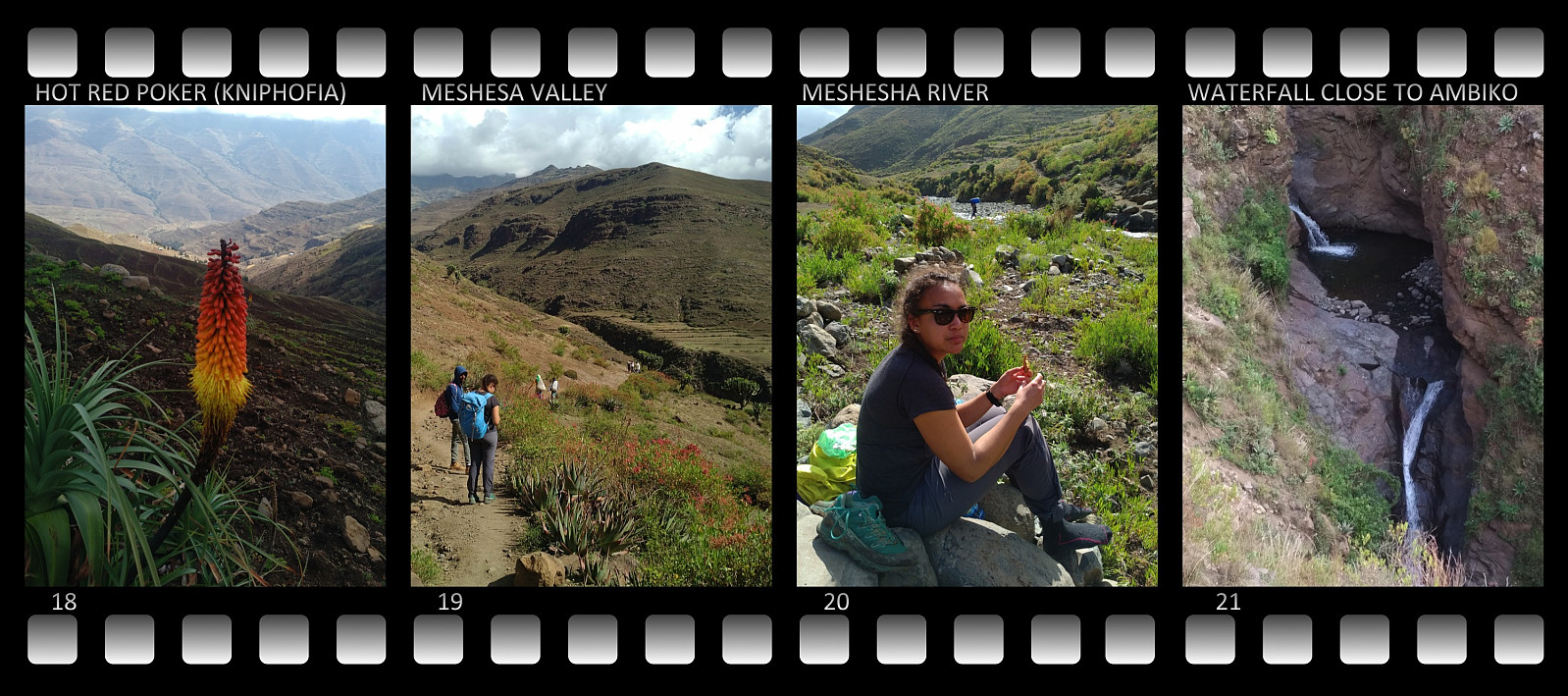
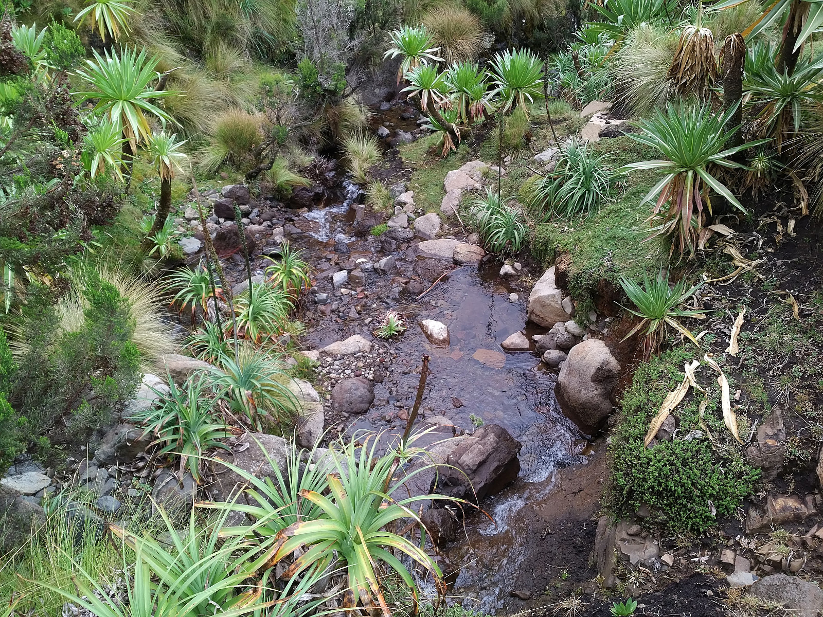
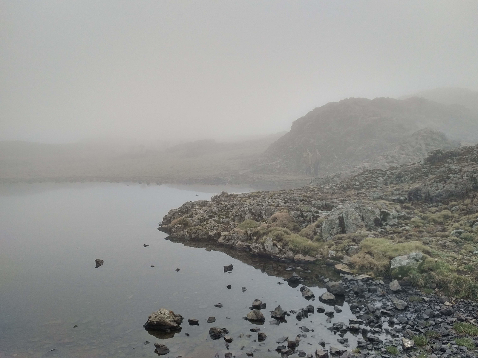
After a lunch brake of about 25 minutes, we started our climb towards the Ambiko camp site. The difference in elevation between Ambiko and the river bank is only about 360 meters, and the climb was done in 55 minutes. At Ambiko we were welcomed by Morat and the dishwasher, with snacks and a cup of tea outside our tent. We were also kind of assaulted by local tradesmen, who wanted to sell us coke and various souvenirs. I bargained with them for a while, just to se how low they were willing to go for a coke; but I dropped buying one, as we had just brought with us a certain amount of money, and any money used during our hike would eventually reduce the size of the tip that I could pay our companions (i.e. the guide, the chef, the dishwasher, the ranger and the mule drivers) when the journey was over. Ambiko is very beautifully located just meters from a little creek, the very same creek as we had seen as we were climbing from the bottom of the Mesheha valley towards the camp site (image #21). A local guy at Ambiko actually offered us a shower, and pointed at a little hut at the edge of the camping lot. It might have been nice enough, but you would probably have to pay a bit for it, though prices at places like this can always be reduced a little if you bother to bargain a little for the price (but you have to put up a poker face while bargaining, and pretend that you're really not interested). According to what I was told, however, this "shower" was all based on water carried from the creek in buckets, and it was all cold water, as there were no pipelines and no water heating facility in the village. With only cold water available in the shower hut, it was actually a good option to just go down to the creek and wash yourself a little. Had we been up to having a real bath, I don't think it would be too difficult to find a little pond in the creek where you could submerge after soaping yourself; but the temperature of the water is quite low at this altitude, so you probably wouldn't stay very long under water.
Day 3: Summiting Ras Dashen, and continuing to the Menta Ber Village.
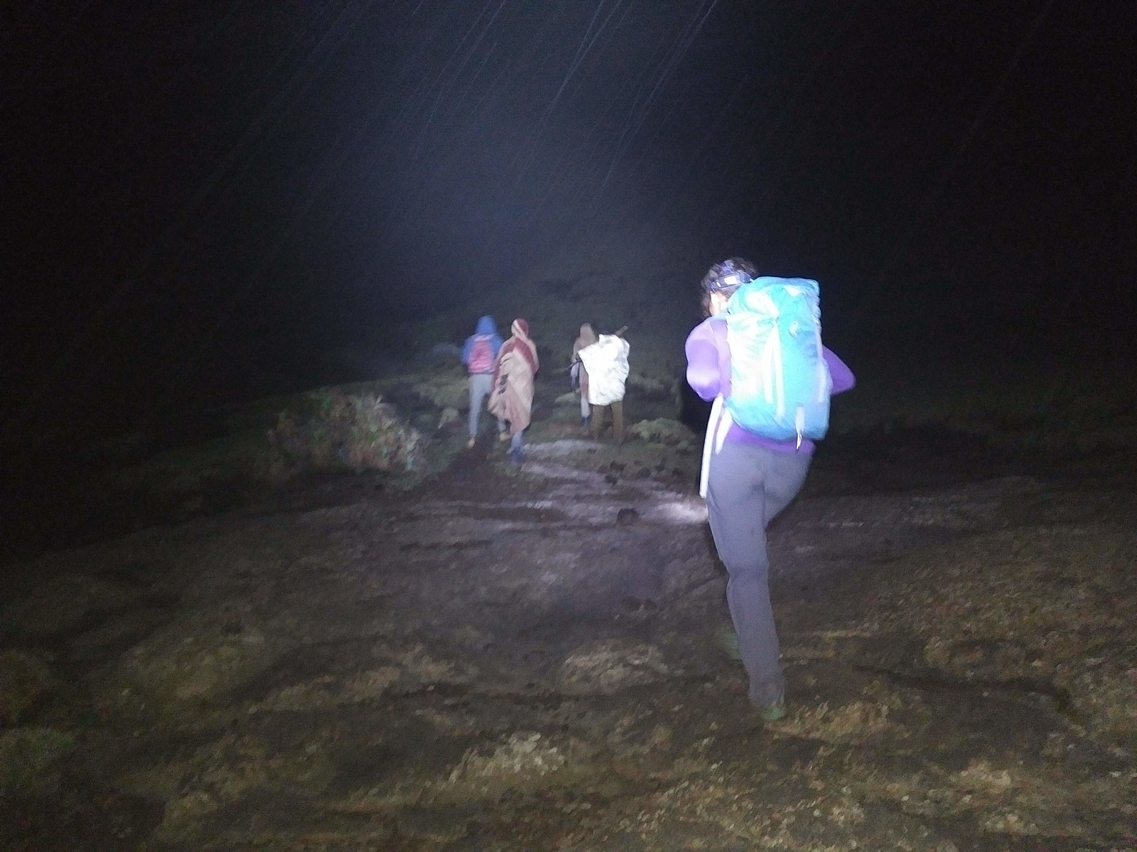
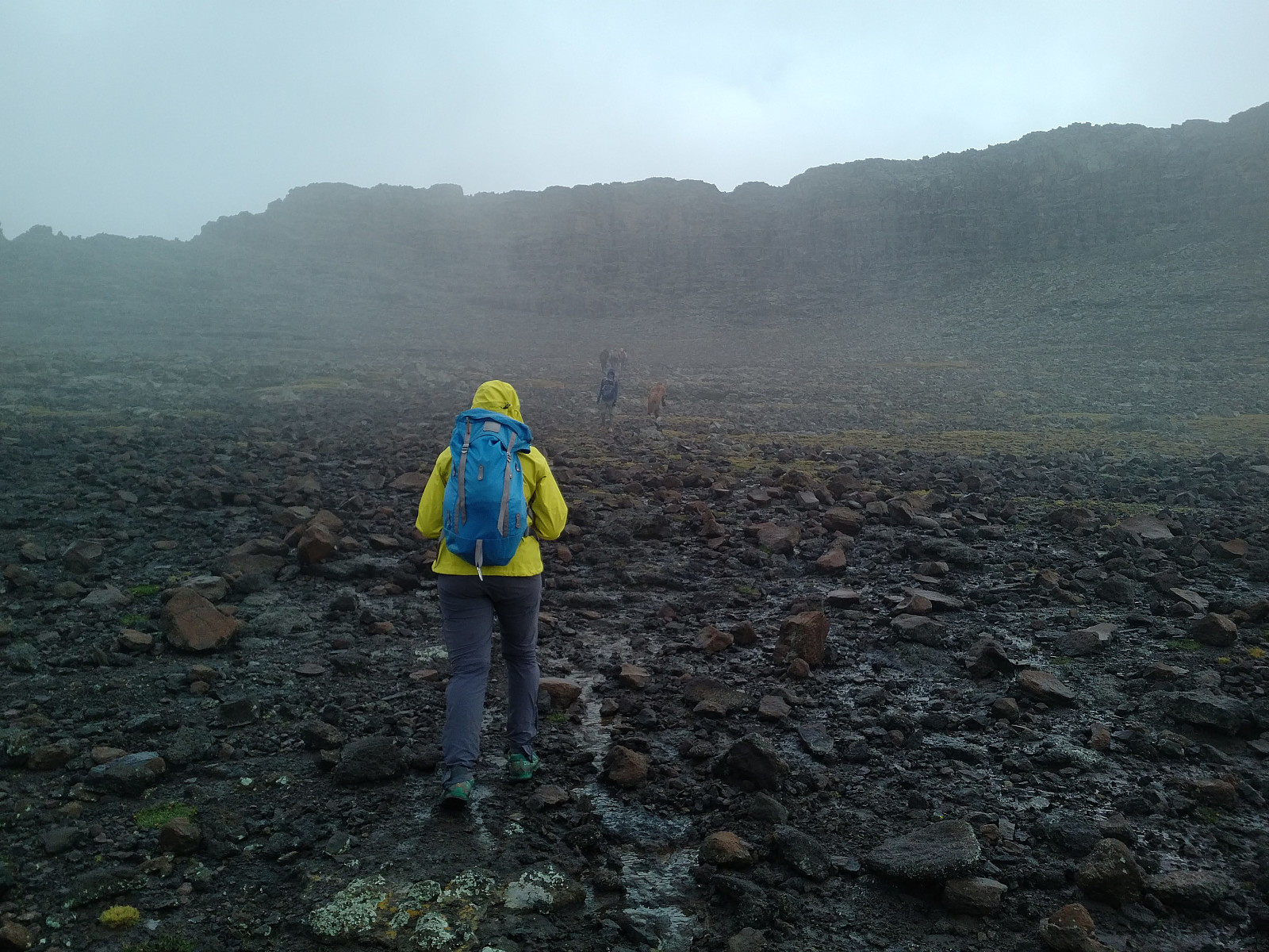
We woke up at 2 o'clock the next morning, packed our gear, had pancakes with honey for breakfast, and started trekking a few minutes before 4. Part of the concept that most tour operators have for the Dashen summiting, is to set out pretty early from the Ambiko camp site in order to reach the summit before sunrise; as the sunrise is said to be extremely beautiful on Ras Dashen. On this day, however it was quite cloudy, hence we could not expect an opportunity to behold the sunrise from up there; even if we were to reach the summit in time. Our trek started along a dark and quite steep trail. We all had headlamps on, however, and our guide and ranger both knew the way from previous trips, so we had no problem finding our way. We were accompanied along our route by a number of men from Ambiko; locals that were bringing chocolate, beverages and souvenirs that they were going to sell at the summit.
As we were ascending up the mountain side, we noticed lights behind us, as well as lights ahead of us; and realized that the other groups, that we had seen in the camp in the evening, had also embarked early on the climb. After a while, the trail that we were following met with a road that was winding its way upwards along the mountain side, and from this point our trail followed that road. The road is the same as the one going from Chennek via Bwahit to Chiro Leba (see above). It crosses the Mesheha river about a kilometer and a half south of where we had crossed the river on our way to Ambiko, and then makes its way upwards along the west side of Mount Dashen. I was a bit surprised that a road has been built almost to the Dashen summit. Enyew told us, however, that this part of the road has not been maintained for years, and it can't even be used by an ordinary 4WD at places. There was, however, a group about a year ago, he could tell us, that used the road to climb the mountain with ATVs.

We followed the road upwards, but made a shortcut between two hairpin bends a couple of places. As twilight appeared, weather was still quite foggy, though it had stopped raining, and the fog gave the mountain a very mysterious look. At some point, the fog disappeared, however, and little by little you could discern the outline of another mountain to the left of us; and as light became brighter, you could see it was the majestic Kidis Yared standing there (Image #23). We soon caught up with the group in front of us, and walked past them; and a little later, the group that had been behind us from the start caught up with us and hurried ahead of us.

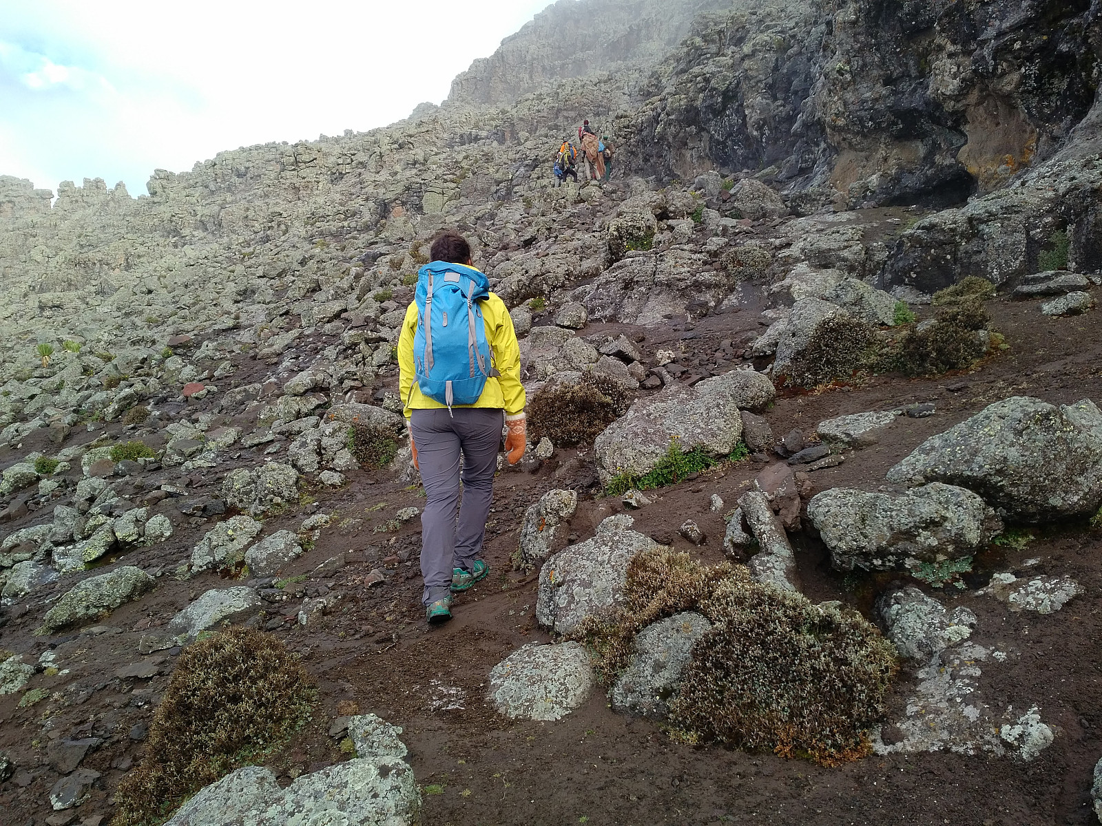
The road that we were following doesn't go all the way up to the summit, so we left the road at about 200 elevation meters below the summit. After leaving the road, the trail then winds around a slightly lower peak just west of Ras Dashen; and just as we reached the south side of that peak, we could se the Ras Dashen in front of us (Image #24). We had a short stop at this point for a few pictures, and also to put on more clothes; as the temperature was getting gradually lower, and we also expected it to be a bit windy at the summit. The last few elevation meters up to the summit were of course the hardest, mainly due to the thin air; but in part also because the track was stony, and you need to climb with both arms and legs for the final few meters or so. The hike from Ambiko to Ras Dashen reminds me a little bit of the climb to Mount Slogen back home in Norway; i.e. the track is steadily steep all the way from outset to summit; and then, as you approach the top, there is a final 50 elevation meters that you really need to climb, in order to conquer the summit.

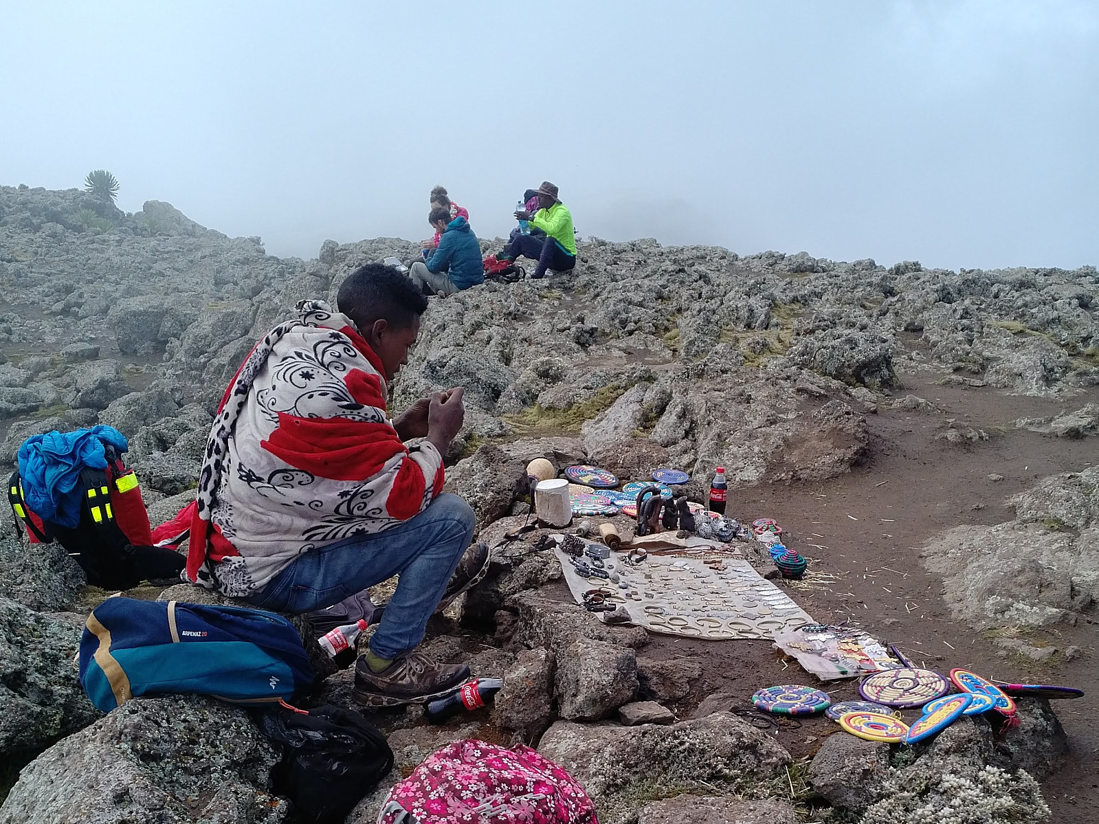
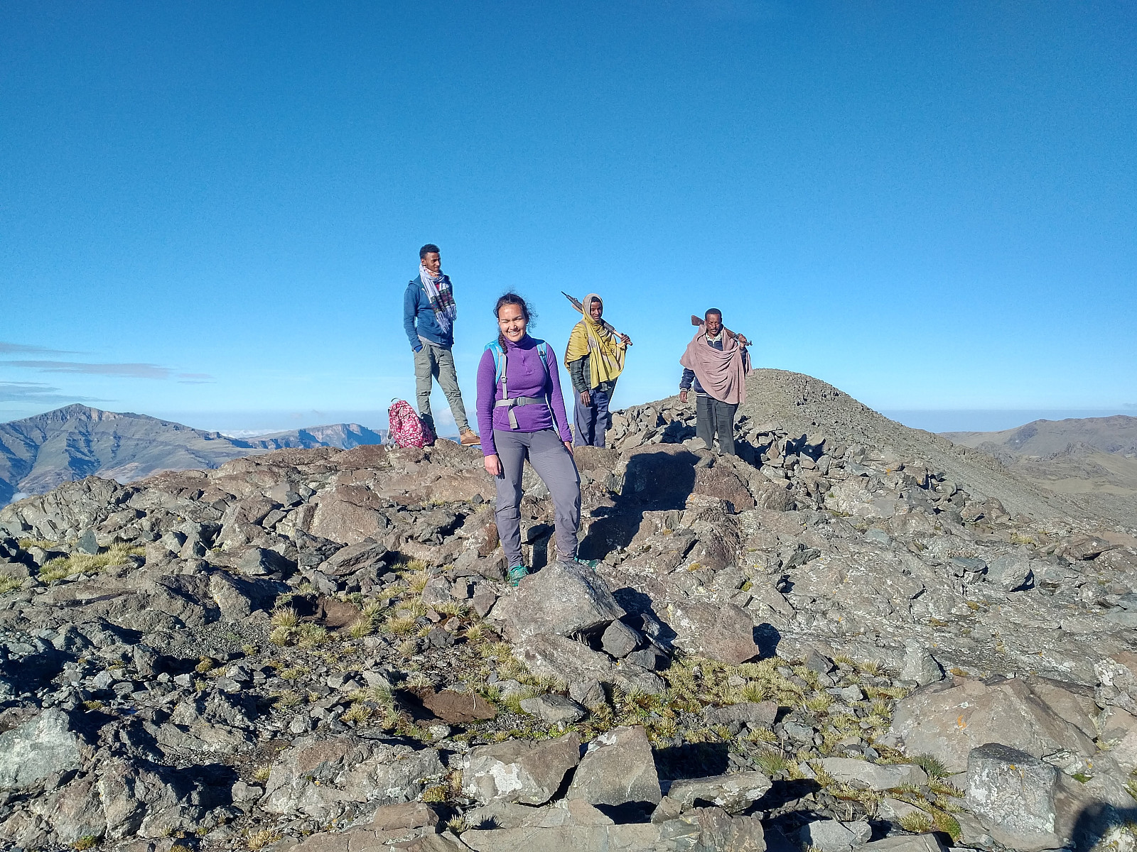
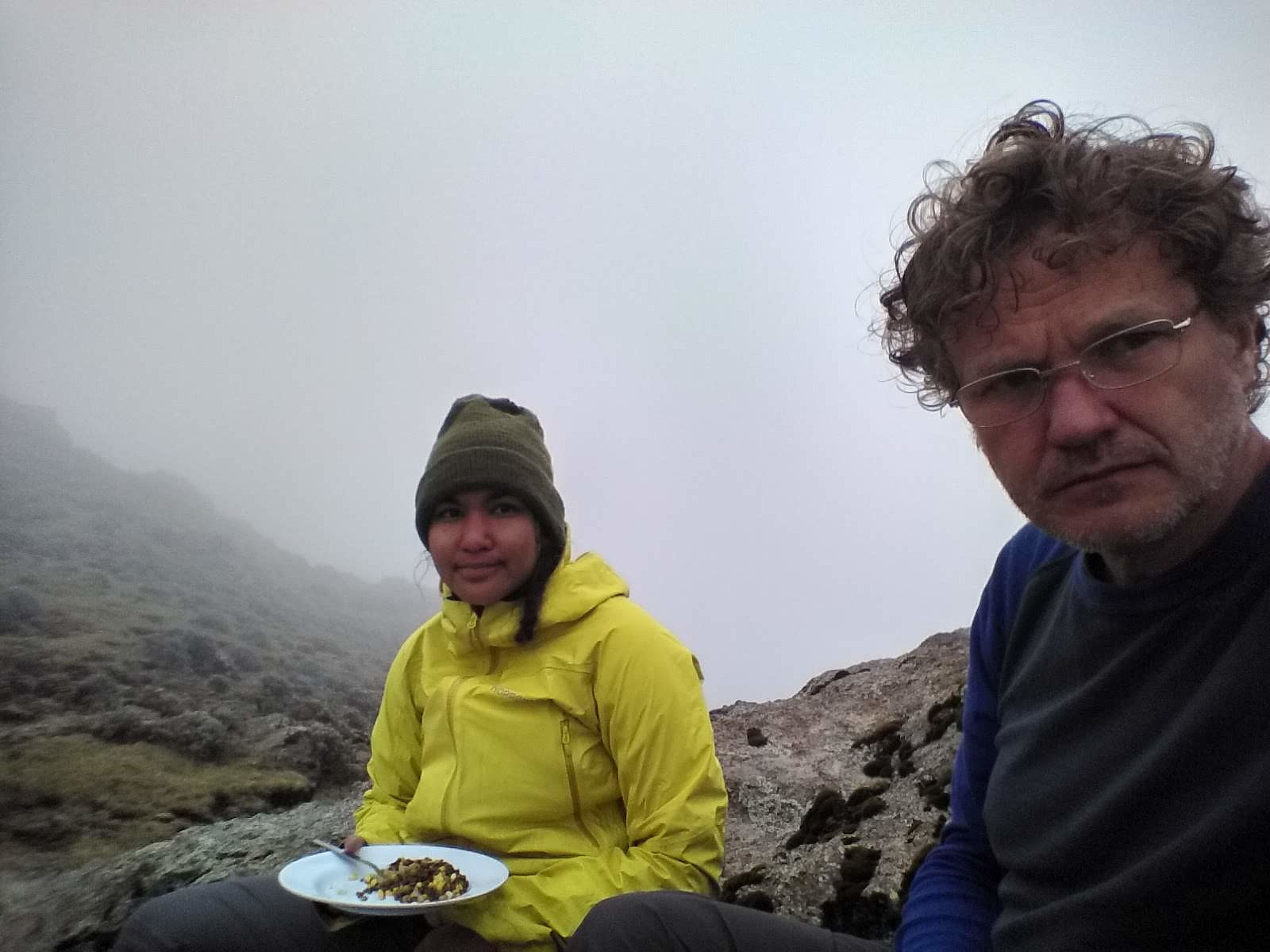
It was a good feeling to be on the head, or summit of the mountain, though we couldn’t see a thing, apart from the clouds, the mountain, and our fellow climbers. Ras Dashen was by no means as crowded by tourists as Ras Bwahit, but the local salesmen had none the less rushed to the summit ahead of us, and lined up their merchandise for sale. There was various types of chocolate, Coke, Fanta, and locally produced souvenirs. I didn’t buy anything from the guys on Bwahit, and I didn’t buy anything from the guys up here. I think our guide, as well as our ranger, found it a little bit embarrassing that we didn’t buy anything from the locals; but when I explained to them that it would diminish their tip if I started buying things, they both thought it was a wise decision not to buy anything here. Fortunately for the salesmen, there were more tourists on the mountain this day, many of whom were actually quite good customers.

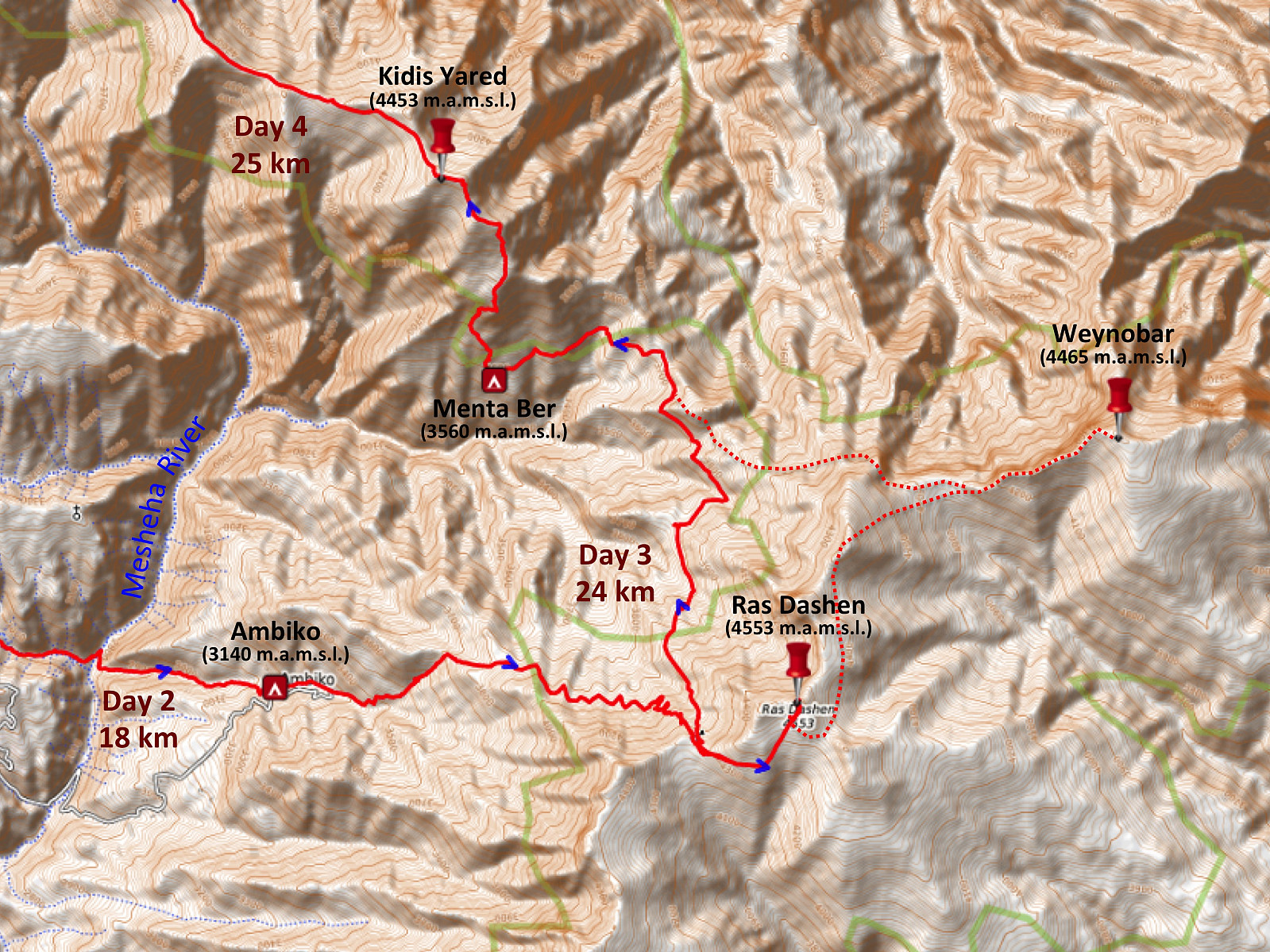
We had a number of photos taken on the summit (Images ## 28-32); and then we embarked on our climb down, and on our hike to the village of Menta Ber. According to my original plan, and included in the price that we had paid for our round trip in the Simien Mountains, we should’ve continued from Ras Dashen to Mount Weynobar before heading towards Menta Ber (Dotted line on image #33). There were two reasons that we decided to skip Weynobar, however. First, my daughter had said to me on the previous evening that one mountain of this altitude was probably going to be enough on one day, and second, none of us had ever been to Weynobar; including our guide and our ranger, so we would need at least a fairly nice weather in order to find our way, and now it was all cloudy up here. So we headed towards Menta Ber, and to be honest, my daughter was quite right; the distance from Mount Dashen down to Menta Ber was much longer than I had been able to figure out from the map that I had with me. This day's hike actually proved to become 24 km even without Weynobar; 11 km from Ambiko to Ras Dashen, and then another 13 km from Ras Dashen to Menta Ber. Had we gone via Weynobar on our way to Menta Ber, this day's hike would've exceeded 30 km.

For the first part of our way from Ras Dashen to Menta Ber, we were simply backtracking the very trail and road that we had used to get to Ras Dashen. After 2.5 km, however, we took a trail that parted from the road on the right side. This trail descended quite steeply into the valley between Mount Dashen and Kidis Yared, until, about 6 km from Ras Dashen, we came to a mountain ridge, from where we could actually see the village of Menta Ber. We sat down on some stones right there, to have the lunch that Morat, our chef, had sent with us for the day’s journey. While eating, Enyew explained to us that despite the fact that we could see over to Menta Ber, just across the valley from where we were sitting, it would still take some hours for us to get there, as we had to go all the way around the valley to get there. It is also possible he said, to follow a trail that goes all the way to the bottom of the valley, and then up to Menta Ber; but the climb up from the bottom of the valley was steep and quite hard, so we weren’t going to save any time by taking that shortcut. In stead, we more or less followed the elevation curves around the valley; I say more or less, because there was actually a gradual, though limited, drop in elevation towards the location of Menta Ber. Here and there we had to cross a little creek, and at 10 km from the summit of Ras Dashen we crossed over from Mount Dashen to Mount Kidis Yared on top of the mountain ridge that connects the two mountains, as Menta Ber is located at 3,560 m.a.m.s.l. in the mountain side of Kidis Yared.
We arrived at Menta Ber in early afternoon. Our chef Morat, the dishwasher, and the two muledrivers were already there; they had not gone with us to Ras Dashen, but rather taken a shorter route directly from Ambiko to Menta Ber. They had already raised our tents, and dinner was now being prepared in the kitchen tent. Menta Ber is not really a camp site, it's just a local village, but Dave had made an agreement with the local people there, that we could camp beside the church of the village. I don't know how much he had to pay them for the permission to camp there, but to us that didn't matter, as it was anyway included in what we had paid to him. We had a wonderful meal at nightfall, and then we went to bed early, in order to get ready for an early start next morning. As we were going to bed, Enyew and the ranger instructed us to take our shoes and everything into our inner tent; and not leave such things in the outer tent, as we usually do in ordinary camp sites in the park. "It's just a precaution," they explained, "to make sure your shoes aren't stolen; as it may be difficult to walk back to Chennek Camp without shoes."
Day 4: Climbing Kidis Yared, Abba Yared, and Mount Silki.
The next morning we woke up early again; not as early as the previous morning, but early enough to have breakfast, and then start hiking before 5 o'clock. I was quite eager to climb both Kidis Yared and Silki on this day, especially since the weather had forced us to skip Weynobar the previous day. I had discussed my original plan thoroughly with Enyew, our guide, and shown him on the map that it ought to be possible to climb Kidis Yared from Menta Ber, and then just follow the mountain ridge over to Silki; and finally descend from Mount Silki to the village of Arkwasiye, our destination for the day. Enyew had in turn discussed this possibility with the locals, i.e. the inhabitants of Menta Ber; and one of them, who knew the mountain, had agreed to guide us along the route.
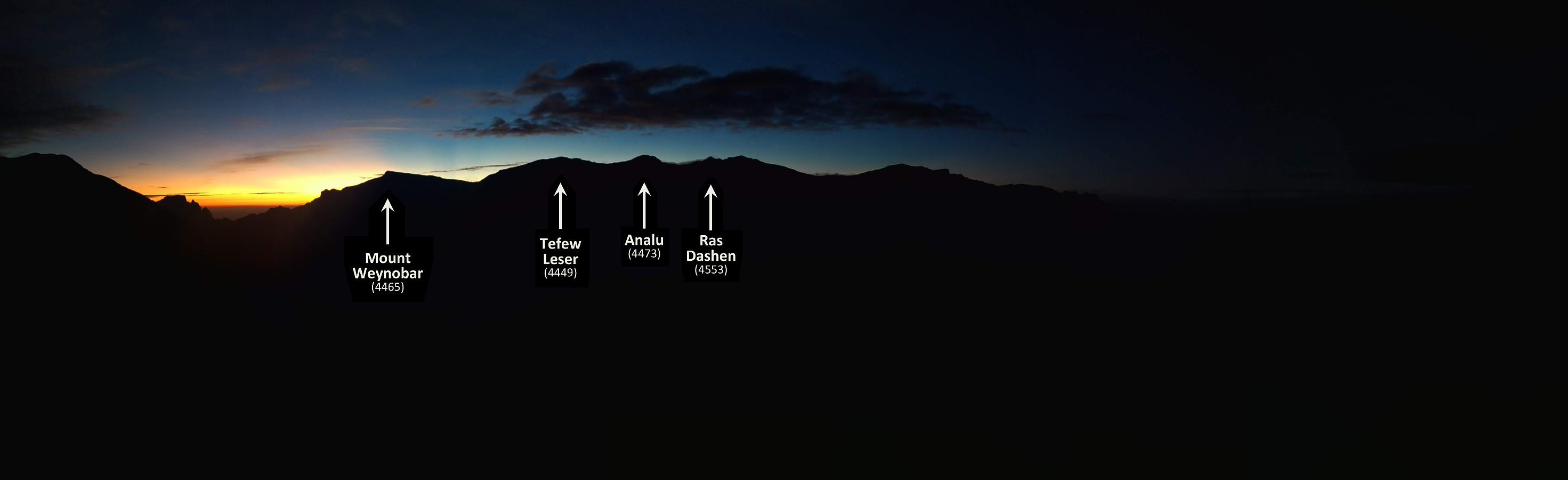
Our additional guide for the day led us straight up the mountainside from Menta Ber, in a quite steep climb, until we were upon the south east ridge of Kidis Yared; i.e. the ridge that connects the mountain with Ras Dashen, though we entered the ridge much higher up compared to where we had followed it from Dashen to Menta Ber on the previous day. The weather was very nice this morning, and just as we arrived on the mentioned ridge leading up to Kidis Yared, there was an extremely beautiful sunrise that nicely outlined the mountain peaks of Weynobar, Tefew Leser, Analu and Ras Dashen (Image #38).

We continued in at northwest direction towards the summit of Kidis Yared. We had a hard time trying to keep up with the ranger and our two guides, but we were better off than we had been the previous two days; so we had a feeling that acclimatization works. We soon arrived at a mountain peak that our new guide told us is the one held to be the summit of Kidis Yared (Image #42). The only problem with that statement is that there was another peak (i.e. the one visible in the background of image #42), just about 400 meters further ahead, which seemed to be a little bit higher than the one we were currently standing upon. The guide from Menta Ber obviously wasn't quite sure about the matter himself, 'cause when he saw the skepticism in our faces, he immediately added that "at least, that's what we have always been told". Well, my GPS proved the ancient tradition to be wrong in this case. As we headed on to the next peak, the display showed the second peak to be about 14 meters higher than the first one, with a saddle only about 10 meters deep (measured from the first peek) in between them.

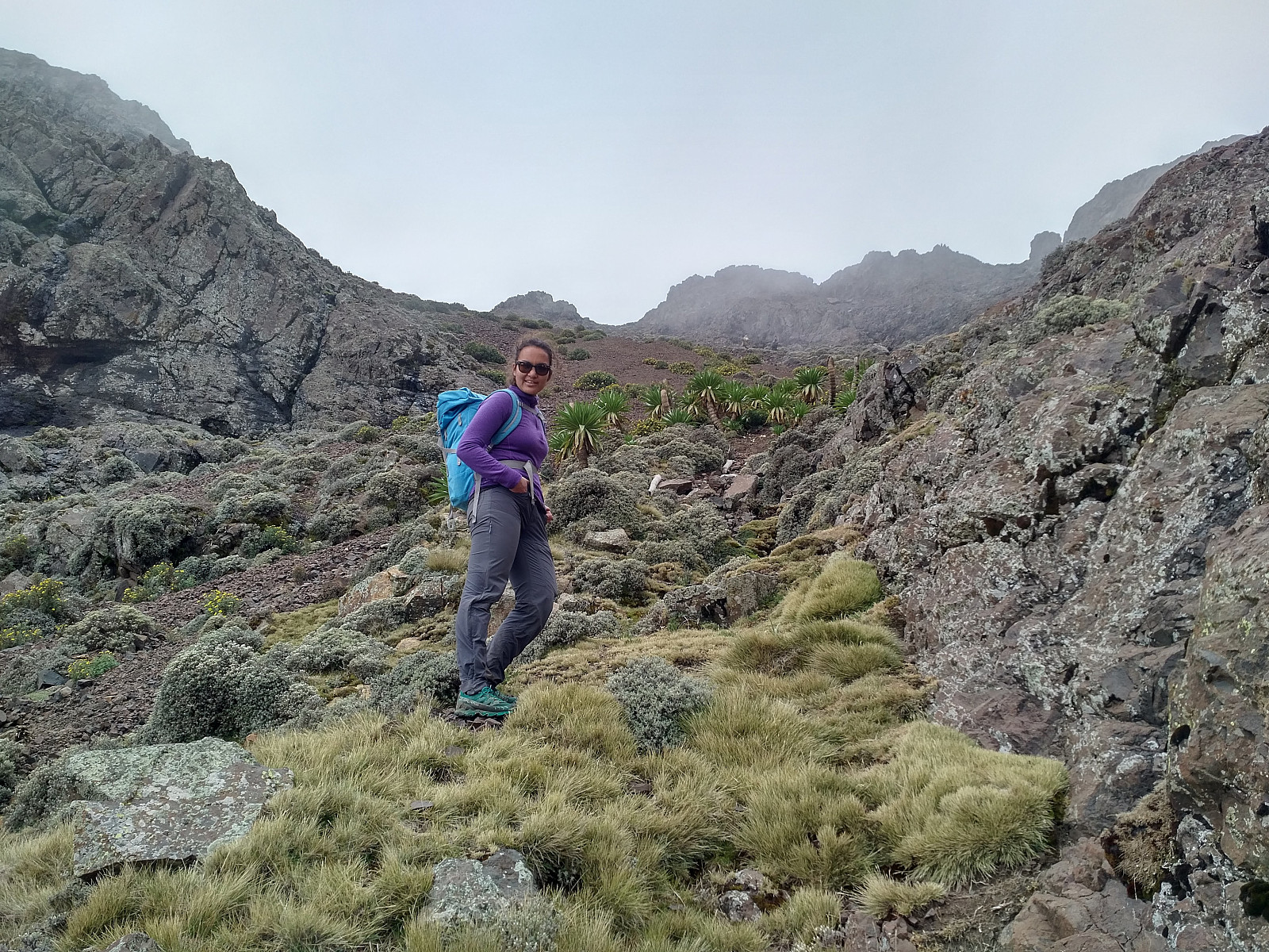
Having made sure we had visited the actual summit of Kidis Yared, we carried on in a northwest direction. Now, Kidis Yared has a number of peaks that are interconnected by a high mountain ridge that is running in zig-zag formation in between them. We didn't actually summit every single one of the peaks, as there had been made a nice trail alongside many of them; the purpose of which was probably to better connect various villages on both sides of the mountain, making it quicker for the local villagers to trek from a village on one side of the mountain to one on the other. Enyew was thrilled when he saw the nice path that had been made (image #43), and started making plans about even taking other tourists on this route, as this part of the park obviously had a lot to offer. Prior to our trek, while we were having coffee in Debark, Dave had said to me that if we had to choose between Kidis Yared and Silki, we should go for Silki, because it was closer to the lowlands, and had a much better view. Well, I don't think he was right. It's true, we couldn't see much of the lowlands from this part of our trek, but there was amazing mountains and valleys in every direction; and the view was just spectacular. Whether the view was just as spectacular even from Mount Silki, I do not know, because it got cloudy before we managed to get there. Nevertheless, the view from Kidis Yared was so magnificent, I wouldn't have opted for a different route even if someone had payed me to skip that mountain.
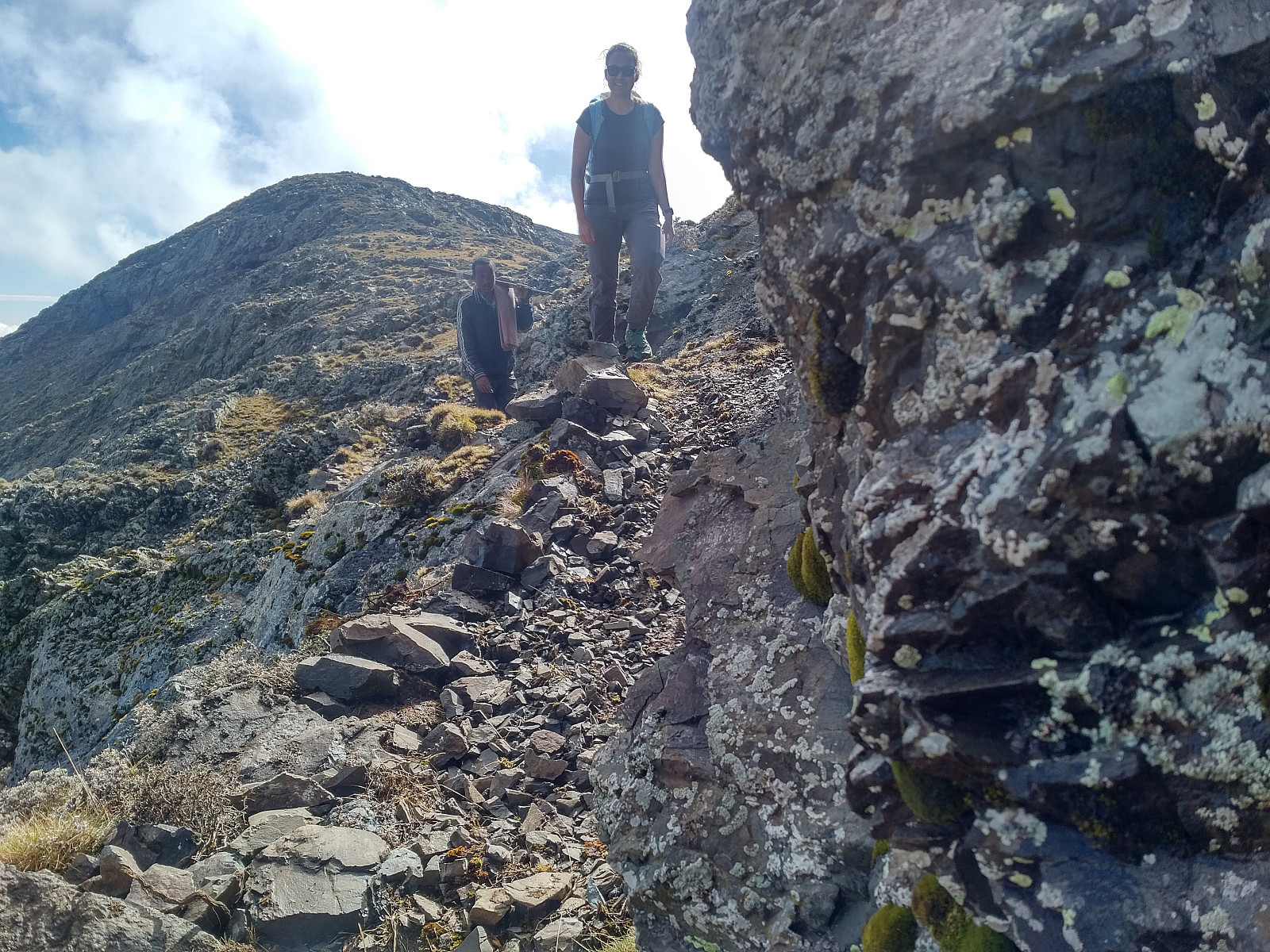
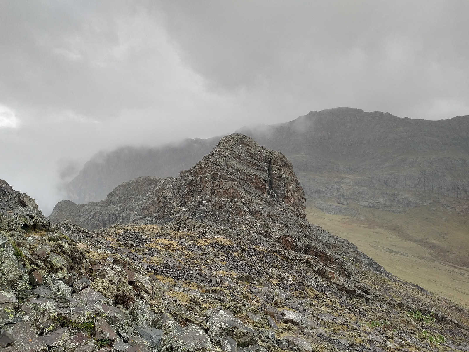
The trail went a bit up and down, and as we were approaching the northwest end of the mountain, according to the map, we just had to climb one more peak, i.e. the one that I have just termed Kidis Yared Northwest Peak, which is again 4320 m.a.m.s.l. We pushed ourselves towards the summit of this one, and as we arrived at the top, we suddenly realized there was a huge wall standing in front of us. I have to admit we hadn't seen this coming. What looked like a huge wall in front of us, was actually the Abba Yared, a mountain located between Kidis Yared and Silki; and this mountain was somehow blocking the way further on to Mount Silki. The mountain is marked out on the Simen Mountains World Heritage Map, very well, but the elevation between the contour lines on that map is 100 meters; so it was impossible to figure out from the map how steep Mount Abba Yared actually was. Well, we either had to climb across it, or we would have to go around it. From the size of the mountain, my guess would be that our journey would become at least 5 km longer if we were to go around it on the left side; and maybe as much as 10 km longer if we were to encompass it on the right side, so I suggested that we climb across it.

"Climbing up that steep mountain side would be insane," my daughter protested. "Well, it's not worse than climbing from Mount Ytstetind to Mount Trolltind back home in Norway," I said to her, in reference to a climb that we had done in August this year. "Yes, but that actually was insane," she insisted, so my argument was not even close to convincing her. Nevertheless, I made my suggestion to Enyew, who had just discussed the matter with a guy that we came across lying in the grass. Enyew looked at me, and answered: "Yes, climbing across this mountain would be possible for us," he answered, "but we don't know if it will be possible for you." "Oh yes it is," I insisted, we have climbed far steeper and more dangerous mountains than that back home in Norway," I argued. "Let's at least try it, I said; we can always turn and go back down if we find out it's too steep. I finally got it my way, and we started climbing.

The climb up the south side of Abba Yared was quite steep, but not as steep as it looked from afar; and I think most people moderately used to mountain climbing could do the climb. Or to put it in some perspective: If you're able to climb the last 50 elevation meters up to the summit of Ras Dashen; you're probably able to climb these 200 elevation meters up the south face of Abba Yared as well. As we reached the top edge of Abba Yared, we could see there was a nice path down on the other side of the mountain. We realized, however, that the summit proper of Abba Yared was a little bit east of where we were standing. Eager to make it to the summit, we made our way along the mountain ridge towards what seemed to be the highest point; me, my daughter and Enyew. The ranger, and the guide from Menta Ber didn't care about standing on the highest point of the mountain, so they waited for us by the trail, until we were back.

The short distance from our trail over to the summit proved to include two places where you really had to climb, including one spot at which there was a substantial risk of being killed if you were to fall down. We managed quite well, however; all three of us. And we were able to have our photos shot at the summit. We climbed back to the others, and then embarked on our climbing down into the notch between Abba Yared and Silki. On our way down, we encountered a little pond that we passed by. Due to the misty weather, the pond and its surroundings had a very mysterious look (Image #54). We continued down, however, until we reached the lowest point between Abba Yared and Mount Silki. There, at about 4150 m.a.m.s.l., we sat down to have our lunch.

While we were having our lunch, I thoroughly studied my map; both to have an idea about the distance left to Arkwasiye, and in order not to have more big surprises on our way. Our problem right now was that none of us had actually been at this point was before. Enyew had been honest about it from the beginning, that he had never followed the mountain ridge from Kidis Yared to Silki; and that was why he had hired the local guide from Menta Ber. The guy from Menta Ber had been quite familiar with Kidis Yared, and it seemed like he had climbed Silki from Arkwasiye at some time, but I don't think he had climbed Abba Yared at any time, nor had he been in the notch between Abba Yared and Silki. This is a challenge with the Simien Mountains, however. As Enyew had previously pointed out to us, most tourists just visit the western part of the Simien Mountains National Park; and those who take further than that mostly just visit Ras Dashen. As a result, less than 20% of the guides and rangers working in the park have visited Ras Dashen, and even fewer have ever visited Kidis Yared and Mount Silki. In my opinion, however, the eastern part of the park is at least as fascinating as the western part of the park; hence there should be a potential to further develop a concept of tourism even in the eastern part of the park; has these mountains definitely have a lot to offer.
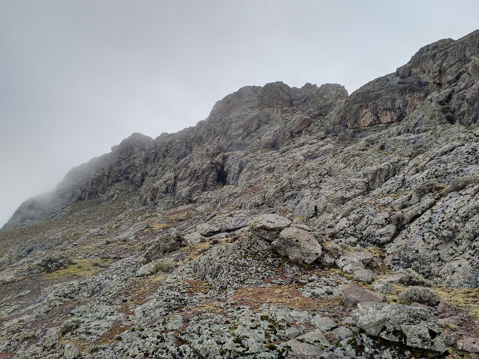
As soon as we had consumed our lunch, we started our climb onto Mount Silki, the last mountain of the trek of this particular day. Both Enyew and our guide from Menta Ber had been to Silki before, but none of them had climbed Mount Silki from the east, and right now the weather was indeed quite foggy, so we couldn't see more than about 50 meters ahead of us. We were in good spirits right now, however, as the lunch that Morat had prepared for us was giving us new strength. As we were climbing, the mountain became steeper and steeper, until our climb became even steeper than the one up the south side of Abba Yared; and we were climbing using both hands and feet. We finally reached something that seemed like the summit, but Enyew wasn't quite sure, because he didn't recognize the place.
All of a sudden, the clouds lifted for a brief moment, however, and we could see a peak slightly higher than the one that we were currently standing on top of; and we realized that was the true summit of Mount Silki. We climbed down towards the notch between the two peaks, but that proved even more challenging than it had been to climb up from the east side. We somehow managed, however, and finally we made our way up towards the highest point of Mount Silki. We didn't spend much time on the summit, however, as it had started lightening and thundering not very many kilometers from where we were standing (based on counting the number seconds from the flash to the rumbling), and I figured the summit of the mountain could indeed be a very dangerous place to be. We were there just long enough to shoot a few photos, and then we headed down along the south ridge of the mountain. While at the summit, both Enyew and the guy from Menta Ber recognized the place, as they had both previously been there. As we descended, they had a discussion about whether we should continue along the south west ridge of Silki towards Arkwasiye, or rather follow a trail that Enyew knew on the east side of the mountain. Had the weather been nice, we would have opted for the mountain ridge, as it would have offered a nice view towards the lowlands, but as the weather was still quite cloudy, we decided to go down to the trail, and then follow it down to the village.
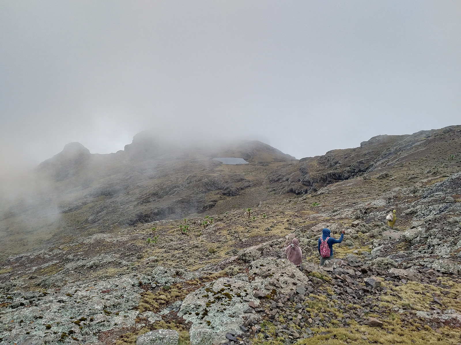
The trail that Enyew suggested was one crossing over from one side of the Silki/Yared mountain range to the other, running between Mount Silki and Abba Yared; and Enyew had actually pointed it out to us at lunch time. On our way down to the trail, we saw a group of Gelada Monkeys living in some caves, but they were a bit too far away to have any good pictures of them. As we reached the trail, we still had more than 4 km to go before we would reach Arkwasiye, and by now we were becoming increasingly exhausted. We had some chocolate in order to "boost up our energy", and that worked pretty well. We crossed a south east mountain ridge extending from the south ridge of Silki, and once we were on top of that ridge, we could see the village of Arkwasiye. The path down to the village now seemed straight forward, as it was all downhill, but it had been raining heavily in the village while we had been on Mount Silki, so the trail was extremely muddy, and the mud was slippery and also tended to stick to our shoes, making the last two or three km of this days trek a bit strenuous.
We arrived at Arkwasiye shortly before twilight. Morat, our chef, the dishwasher, and the two mule drivers were already there waiting for us. They had taken the much shorter valley route from Menta Ber to Arkwasiye, and had already been waiting for us a few hours. Enyew was no longer as enthusiastic about taking other tourists along the route that we had just completed as he had been in the morning, as our GPS tracking showed that we had trekked more than 25 km. "But we made it in just about 13 hours, I said to him, but then he answered "that's true, but many other tourists would use 20 hours on this trek; so in order to develop it as a concept for visitors to the park, you would need another camp in between Menta Ber and Arkwasiye." Well, that may not be quite straight forward to do, as camping within the precincts of the national is prohibited, and the entire mountain ridge between Kidis Yared and Silki is within the national park (Image #2). I suggested a village called Degeriwa as a future camp site for trekking in the eastern part of the national park. This village is located about 3400 m.a.m.s.l. just south of Abba Yared, and I pointed out that a hike from Menta Ber via Kidis Yared to Degeriwa, and from Degeriwa via Silki to Arkwasiye on two successive days removes the need to climb the steep east side of Abba Yared, and that could make the trip more accessible for many. He was not convinced though, as this part of the park is a bit remotely located, and will probably remain attractive only for tourists with a special interest.
While we were waiting for dinner at arkwasiye, a lot of locals gathered around our tents, to have a chat with our guide and our ranger. When they heard that we were planning to continue to Amiwalka the next day, and then from Amiwalka back to Chennek the following day; they told us it was currently not possible to trek from Amiwalka to Chennek, as a land slide had carried away part of the trail up to Chennek. When we heard of that, we decided to skip Amiwalka altogether, and just go back to Chennek the next morning. Enyew insisted, however, that we should do some trekking even the day after the next, since we had already payed for it, so we made an agreement to climb one of the mountains close to Chenneck (i.e. Enatye or Meche Awoknesh) on our last day in the park.
Day 5: Returning from Arkwasiye to Chenneck over the Bwahit Pass.
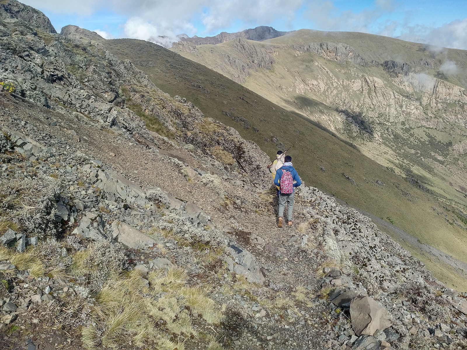
Next morning, we woke up at a more "normal" time than what we had done on the previous two days, had breakfast, and started trekking towards Chennek around half past ten in the morning. It was a beautiful day, the sun was shining; and the view, as we climbed the Bwahit mountain was amazing. There actually has been built a road all the way down to Arkwasiye, but it hasn't been much in use; and it is no longer well maintained. Nevertheless, it worked quite well as a nice and broad path for mountain trekking (Image #62). Along the extent of the western part of the Simien Mountains, there is a rather sharp escarpment that separates the mountains from the so-called lowland just north of them. It's a bit funny that this area with plains, hills and meadows have been termed The Lowland, because it's mostly all above 2000 m.a.m.s.l.; but compared to the majestic mountains that flank the escarpment this is, of course, quite a bit lower.
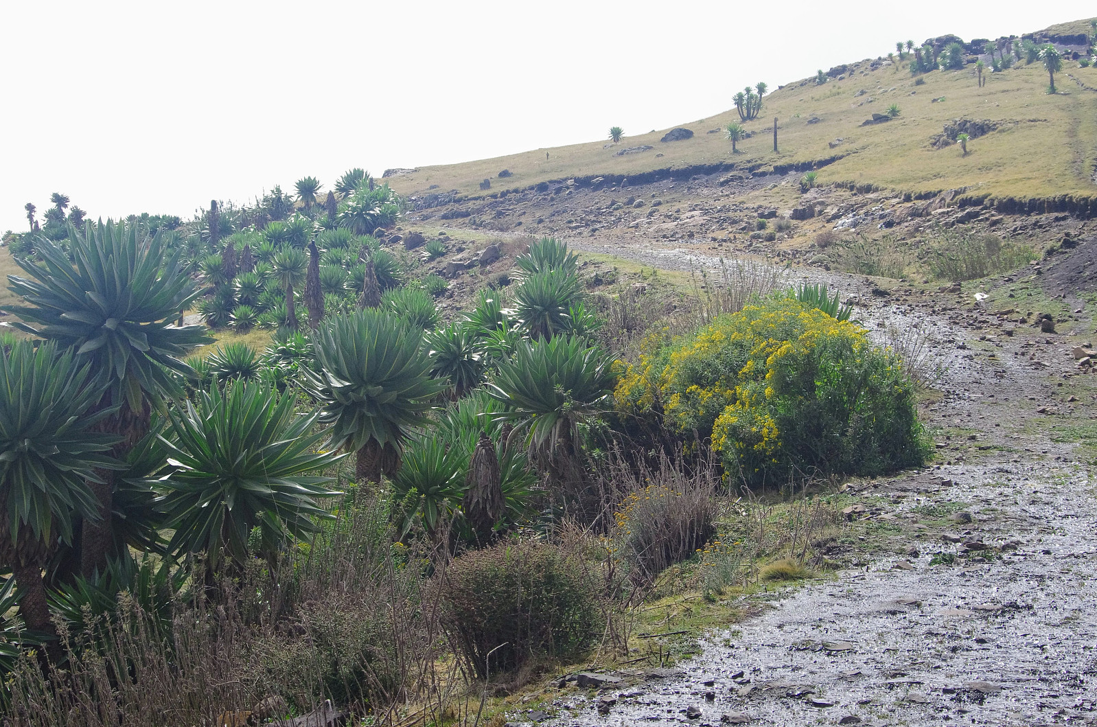
Image #3 shows how Imet Gogo, Shayno Sefer, and Enatye all have very steep cliff sides that make them throne above the lowland. So also with Mount Bwahit, though it doesn't seem that way when you're beholding the mountain from Ras Dashen or from Kidis Yared. Bwahit has a ridge that extends from the summit in a northern direction, a ridge that connects it with Mount Silki, and obstructs the view of the lowlands when you see the mountain from Ambiko, Ras Dashen or Menta Ber. And when you're looking at Bwahit from the Chennek Camp area, the Meche Awoknesh mountain is obstructing the view, so as to prevent you from seeing the escarpment on the northwest side of Bwahit even from this side of the mountain. Now, Arkwasiye is located on the ridge between Bwahit and Silki, and so in order to walk from Arkwasiye to Chenneck, you either have to descend on the west side of the ridge and get down to Amiwalka and climb up the escarpment to Chennek from there; or you have to follow the ridge up to the Bwahit Pass at 4200 m.a.m.s.l., and then cross over to the Chennek side of Bwahit at the Bwahit pass. The escarpment between the mountains and the lowland forms the entire north side of the Meche Awoknesh, and even extends onto the ridge between Bwahit and Silki. Before you reach the Bwahit Pass when coming from Arkwasiye, therefore, you can't cross over to the Chennek side of the mountain, as you would then have to fly 2 or 3 km over the lowlands (see image #63).
![#63: The map highlights the Lowlands in green. Notice how close the escarpment between the Highlands and the Lowlands is to the summit of Ras Bwahit. There is a narrow passageway extremely close to the escarpment at 4200 m.a.m.s.l. [i.e. about 230 meters below the summit of Bwahit]. When crossing over from the western part of the park to the eastern (or wise versa), you have to either 1) cross over at the Bwahit Pass, 2) cross over at the summit or south of the summit of Bwahit (as we did on our way to Ras Dashen), or 3) you can cross over via the Lowlands. As the Lowland option was currently unavailable due to an earth slide, and as we had already summited Bwahit on this journey; we chose the Bwahit Pass for our return to Chennek.](https://images1.peakbook.org/images/14939/Solan_20200504_5eaf4134b2409.jpg?p=xtralarge)
Being unable to reach Chennek via the Amiwalka route due to the earth slide, we were thus heading towards the Bwahit Pass on this beautiful morning. A third option would of course have been to go all the way up to the summit of Bwahit, but on this day there was no point in doing so, as we had already been on the summit of Bwahit just a few days before. When we had walked about two thirds of the trek between Arkwasiye and the Bwahit Pass, we were joined by the road that goes from Chiro Leba to Chennek (Image #64). For some kilometers this road is running parallel to the trail that we were following; the trail is just a little bit higher up in the mountain side. The trail, or path, then crosses over to the Chennek side of the mountain at the Bwahit Pass, whereas the road continues past the summit of the mountain, and crosses over a little less than a kilometer south of the summit (Image #65).

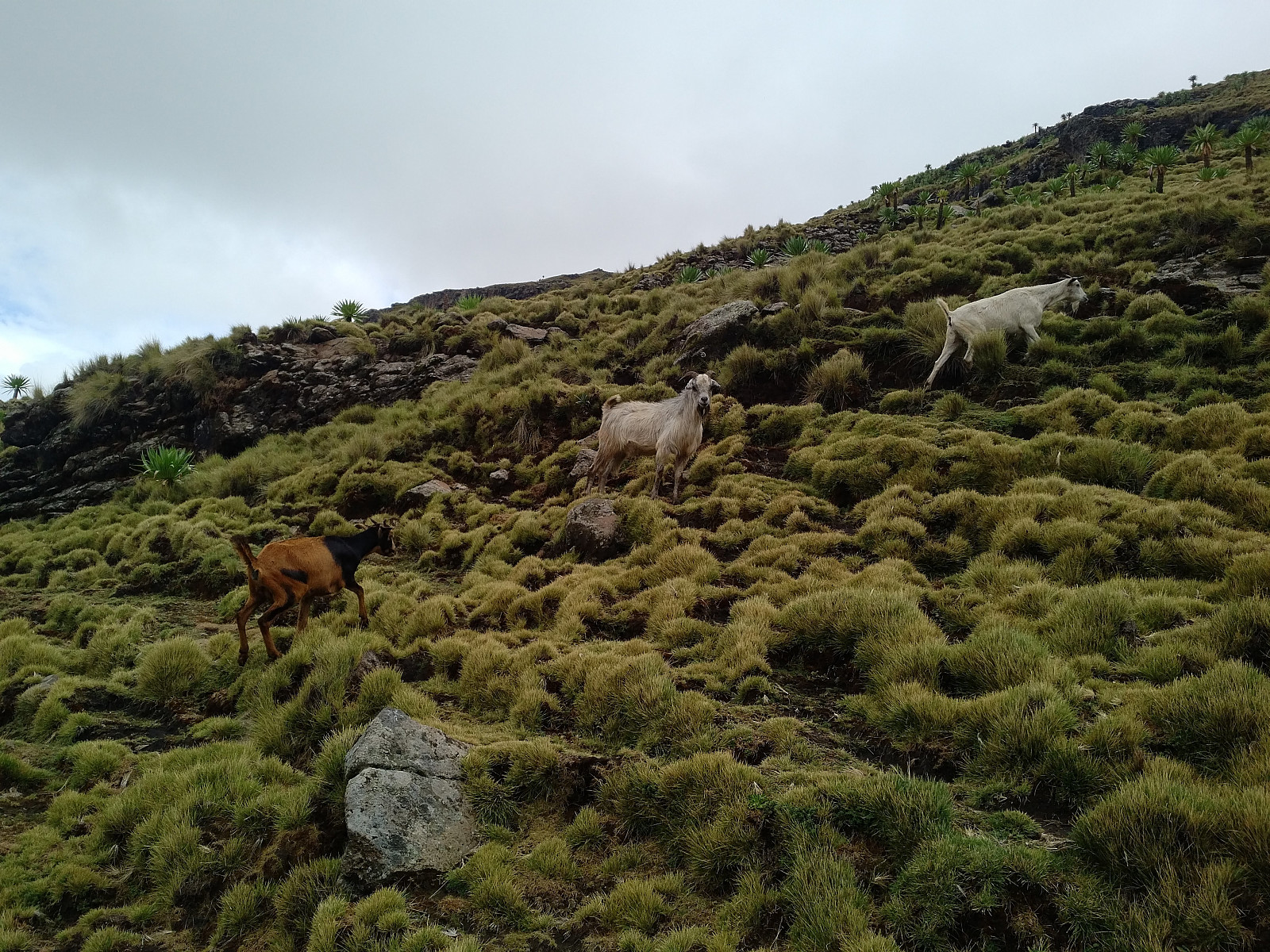
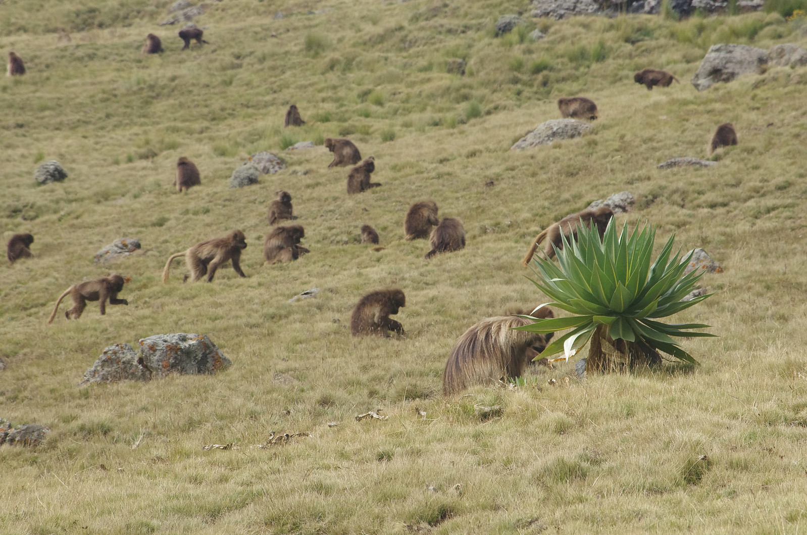
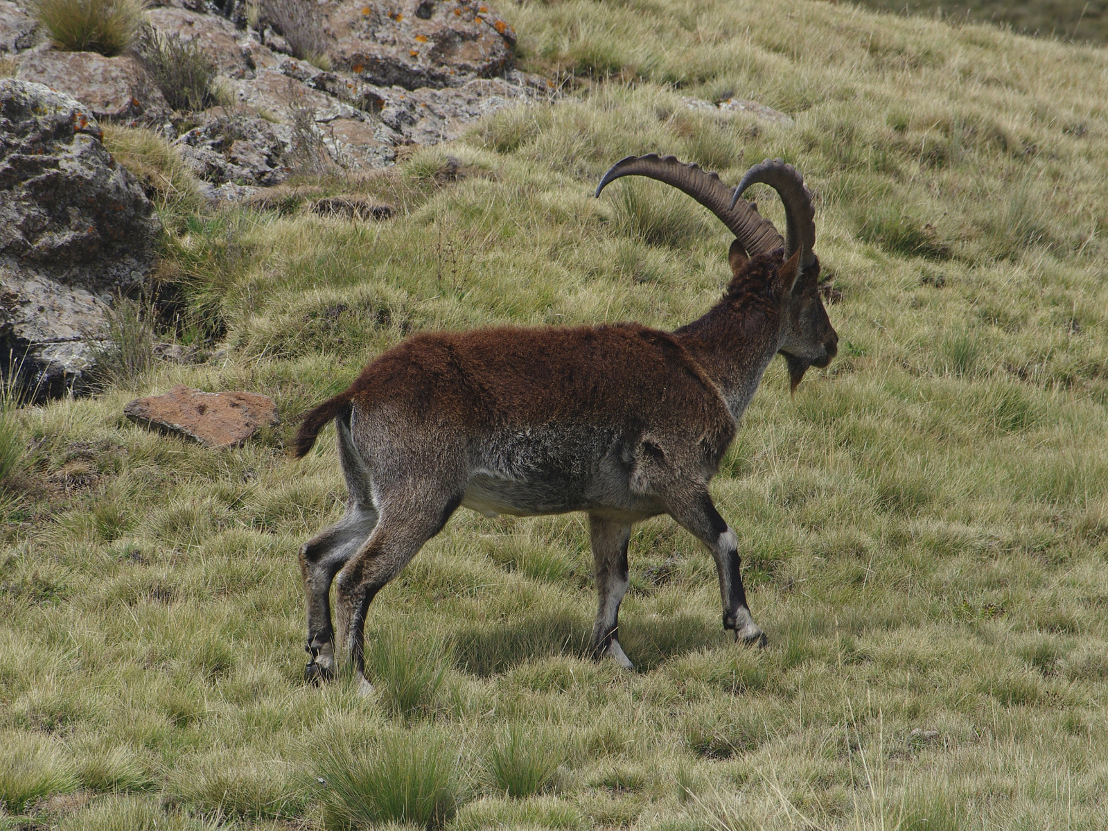
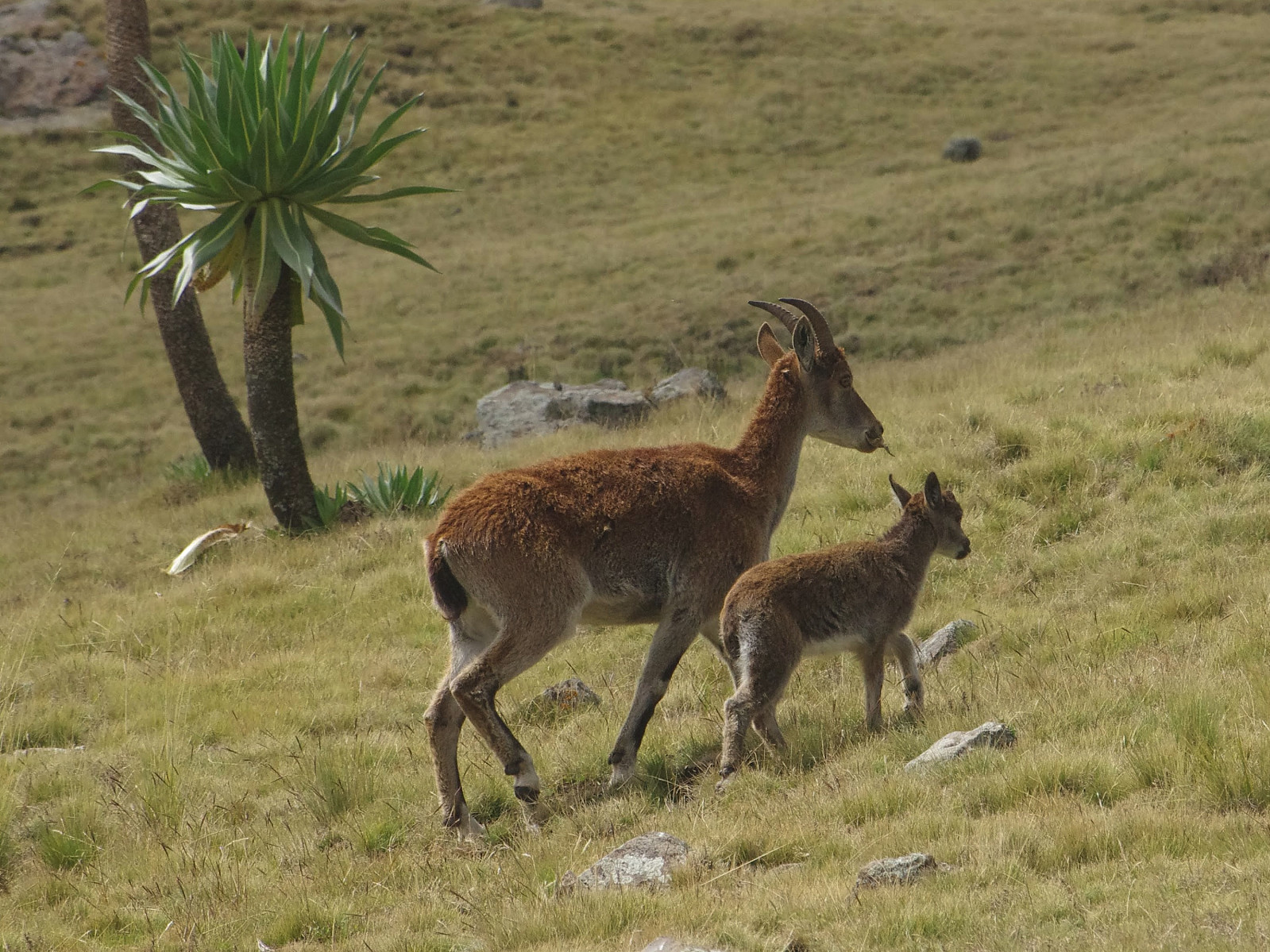
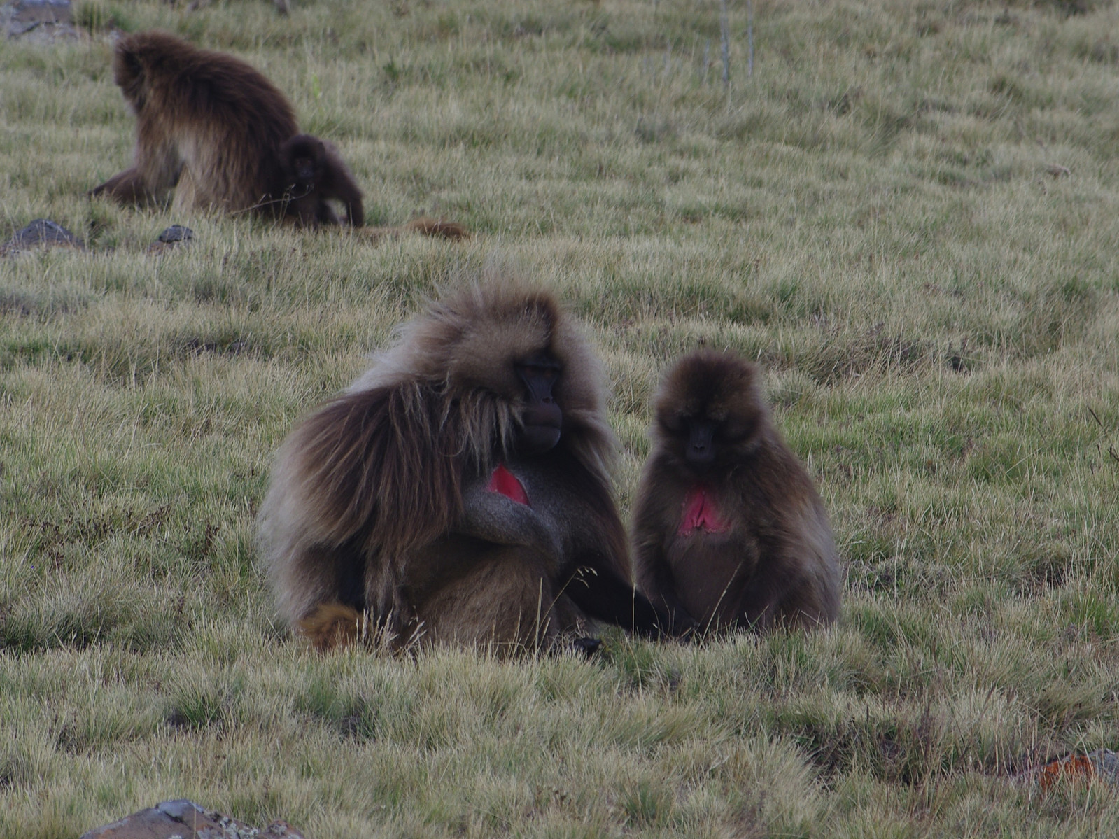
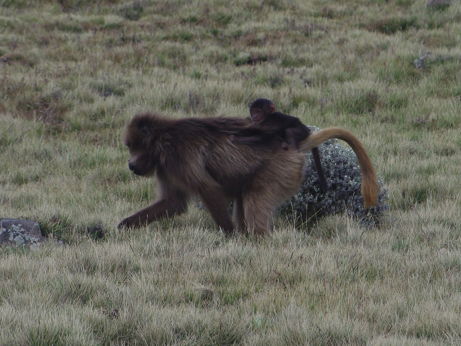
Throughout our five day trip in the Simien Mountains we had now and then seen some Ibexes or some Gelada monkeys from afar, but we hadn't really been in close contact with any of the wildlife of the Simien Mountains. As we were now heading towards the Bwahit Pass on this beautiful morning, however, there were all of a sudden a huge number of Gelada Monkeys around us (Image # 66). I grabbed my camera, and made some shots of the monkeys, but we continued walking, though at a slightly slower pace; and moments later, we were in the middle of a large Ibex herd (Image #67). The monkeys and the Ibexes didn't seem to bother each other, nor did they seem to be bothered by us. These animals were probably quite used to tourist groups in the area, and since hunting them is prohibited in the park, they are not afraid of humans.

We continued slowly, in order not to scare the animals, and I tried to make as little noise as I could when switching to a telephoto lens on my DSLR camera. We didn't have to sneak in on the animals, however. As long as we walked slowly without making noise, they were actually sneaking in on us; and they came close enough that I really got some nice photos of them (Images ##68-71). Once we had past these animal flocks, the terrain quickly became more stony, and the vegetation ceased. We then came to the foot of a steep rock, and from there the path was winding upwards in a steep manner between huge rocks; and then suddenly you were at the edge of the mountain, looking ahead at the Chennek side in front of you, while having a steep cliff on the right side of you, with a valley that is actually part of the lowlands. Unfortunately, I didn't capture any images of this passage, but this is what is known as the Bwahit Pass. The pass is safe enough for you, provided that you have at least some mountain experience (if you're able to climb Ras Dashen, you're also able to get through the Bwahit Pass), but it is quite tricky for the mules, and it really does require some skill for the mule drivers to get their animals safely through this passage.
From the Bwahit Pass, the remaining trail to Chennek is all downhill. The path that we had used when ascending Bwahit a few days earlier, was likely to be quite muddy, as it had been raining quite heavily the previous days; so we figured out it was wiser to take the road down to Chennek. Nevertheless, it still didn't take us more than about an hour to get from the Bwahit Pass down to the Chennek Camp. Morat and the mule drivers had almost caught up with us while we were photographing the monkeys and the ibexes, and then they had hurried past us just after the Bwahit Pass. As we arrived at the Chennek camp site, they were already putting up our tents, and it didn't take Morat long before he could offer us something to eat.


Benutzerkommentare