
Breheimen, day 5: from Stølsdalen back to Skjolden (28.07.2019)

Geschrieben von HHauser (Helwig Hauser)

| Startpunkt | Stølsdalen (1.035m) |
|---|---|
| Endpunkt | Turtagrø (880m) |
| Tourcharakter | Wanderung |
| Tourlänge | 6h 00min |
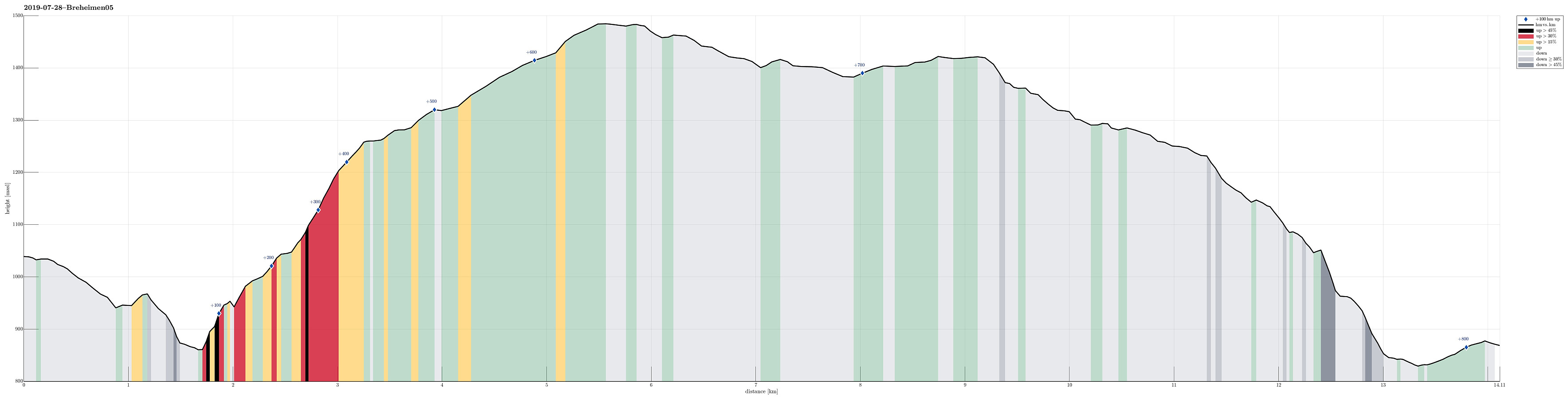
| Entfernung | 14,1km |
| Höhenmeter | 812m |
| GPS |
|
| Besteigungen | Nosafjellet (1.485m) | 28.07.2019 |
|---|---|---|
| Besuche anderer PBE | Stølsdalen (1.035m) | 28.07.2019 |
| Turtagrø Hotell (883m) | 28.07.2019 | |
| Turtagrø parkering (881m) | 28.07.2019 |
Trip Summary
After day #4 of our five days hike through Breheimen, we continued from Stølsdalen with the goal to get to Turtagrø.
Nosafjellet
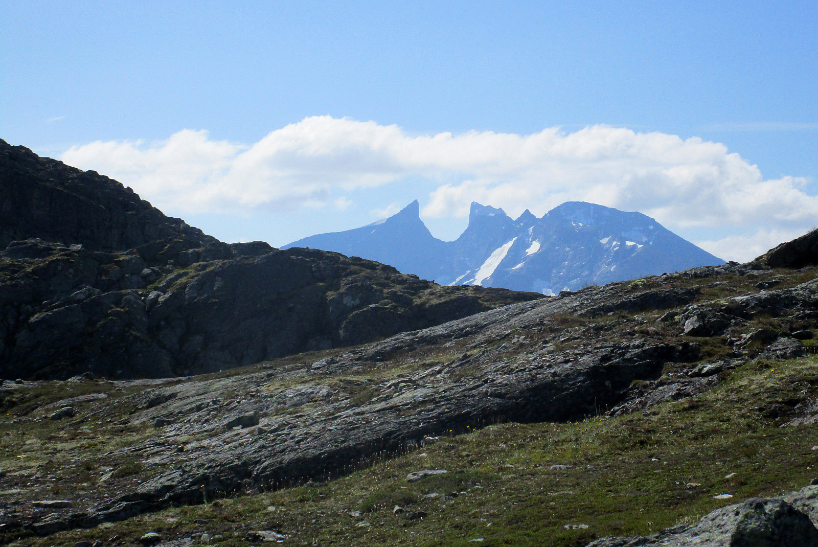
We first descended along Øvre Liagrø to get down into the valley (down to about 850mosl), before then ascending again on the other side (towards Skålabotnskaret). The first stretch upwards is interesting as it is quite steep and leading through a narrow valley, before one gets out and into Nedre Liagrø. From there, it's then nicely upwards until one gets to Skålabotnskaret at about 1340mosl. There, we decided to deviate from the marked trail in order to include Nosafjellet, also. Following the ridge west of the marked trail, we easily got close to Nosafjellet and also the final ascent was non-difficult (one needs to look a little to find a good spot). On the top of Nosafjellet, we enjoyed excellent views in all directions.
Down via Gjesingedalen
When making the plans for the day (at Stølsdalen), we considered to continue from Nosafjellet to Nausanosi (in its southwest) and from there downwards via Nausane to the road #55. Even though we tried in different ways, we hadn't managed to find out, whether this descent via Nausane would be reasonably possible at all. Once at Nosafjellet, we identified Nausanosi (there seems to be a mast that's reasonably visible) and hiked into this direction, mostly following the ridge of Nosafjellet in southwestern direction. Soon it became clear that in order to reach Nausanosi, we would have to descend into Seljeskårdalen, a little west of Nosafjellet. When getting closer, however, we found out that a substantial cliff separated us from the bottom of Seljaskårdalen. We decided to walk along the cliff (in northeastern direction!), because we had a hope that we would find a place, where descending would be OK. After basically having hiked back along all of the ridge of Nosafjellet, we eventually gave up on our idea to connect to Nausanosi. Instead, we rounded Nosafjellet in its north and continued into the direction of Gjesingedalen. This very green and smooth valley is very different from the rough and gray Nosafjellet, and descending into it from Nosafjellet (even though steep at times) offered some nice views. Once down in Gjesingedalen, the remainder of the hike to Turtagrø was straight-forward, following the marked trail.
End of Day 5
At Turtagrø, i.e., this big place for many tourists, we quickly decided that we would not like to stay there, but instead try to get back to our car in Skjolden. Since we were quite a bit too early for the bus, we tried hitchhiking and indeed, after a while, we were lucky to be picked up by a nice guy from Skjolden! After this nice hiking day #5, we decided to add a bonus hike (near Førde)! :-)
Photos
Selected photos are available as Google photo album.
Useful Resources
See also the related FB-page Hiking around Bergen, Norway.
The National Park Breheimen has its own home page.
Web page UT.no from the Norwegian Trekking Association recommends a similar hike, but from Turtagrø to Stølsdalen.


Kommentarer