Archiv - Nach Datum
Archiv - Nach Aktivität
-
Andere Tour (3)
- Kayaking (3)
-
Fahrradtour (110)
- Fahrradtour Straße (85)
- Fahrradtour gemischt (25)
-
Fahrzeugtour (9)
- Autotour (9)
-
Fußtour (1884)
- Bergtour (1114)
- Jogging (1)
- Spaziergang (59)
- Wanderung (710)
-
Skitour (116)
- Langlauf (47)
- Tourenskilauf (69)
Gesammelte Listen
-
Utvalgte topper og turmål i Bergen
(348/349)
 99%
99% -
Alle topper i Bergen
(391/398)
98%
-
Voss ≥ 100m pf.
(96/98)
97%
-
Opptur Hordaland
(144/159)
90%
-
Stasjoner på Bergensbanen
(33/40)
82%
-
Ulvik ≥ 100m pf.
(28/38)
73%
-
Hordaland ≥ 100m pf.
(622/863)
72%
-
Mjølfjell PF > 100m
(21/31)
67%
-
Jondal ≥ 100m pf.
(15/23)
65%
-
Dagsturhyttene i Vestland
(36/61)
59%
-
Sunnhordland PF >= 100m
(105/186)
56%
-
Hordaland: Hardanger PF>=100m
(194/359)
54%
-
DNT-hytter i Hordaland
(23/45)
51%
-
Kvinnherad ≥ 100m pf.
(40/79)
50%
-
Eidfjord ≥ 100m pf.
(13/42)
30%
-
Sogndal ≥ 100m pf.
(23/81)
28%
-
Gulen ≥ 100m pf.
(15/54)
27%
-
Vik i Sogn ≥ 100m pf.
(10/46)
21%
-
Sogn - Sør for Sognefjorden PF>=100m
(31/159)
19%
-
DNT-hytter i Sogn og Fjordane
(8/47)
17%

Hakkesetstølen
- Datum:
- 15.09.2019
- Tourcharakter:
- Bergtour
- Tourlänge:
- 2:02h
- Entfernung:
- 5,2km
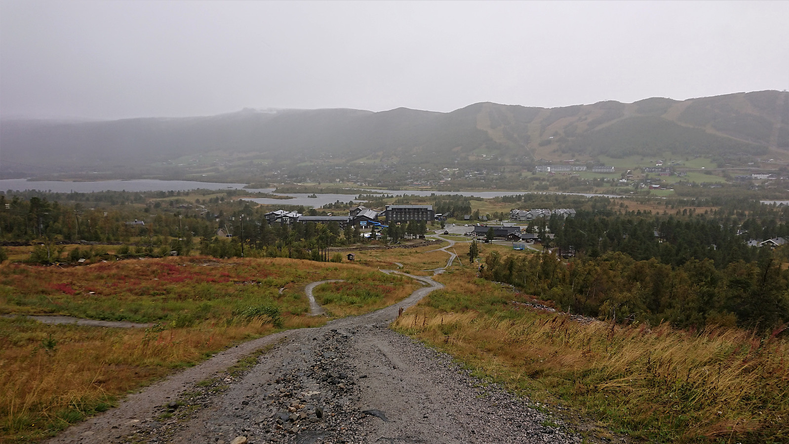 We parked at the large parking lot at the start of Hakkesetvegen and followed the gravel road all the way to Hakkesetstølen , with the rain from above (or rather from the side due to the strong winds) turning to wet snow along the way. After enjoying hot chocolates at Hakkesetstølen we followed the marked, but sometimes pretty wet, trail back towards Geilo. Upon reaching the gravel road we ditched the trail and instead followed the gravel road down to Vestlia Resort.
Kvitafjellet, Bakkaheii, Stølshorgi and Jonshorgi
- Datum:
- 08.09.2019
- Tourcharakter:
- Bergtour
- Tourlänge:
- 7:50h
- Entfernung:
- 19,3km
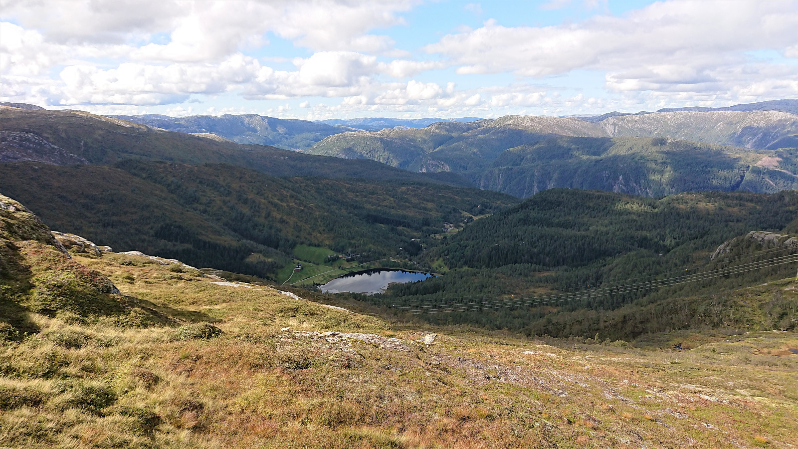 Warning: This hike includes a short steep off-trail descent into Tuftedalen that is most likely not to everyone's liking. Consider the track with care!
I started by taking the train to Bolstadøyri where I was picked up by a colleague coming by car. This had the benefit that the surprisingly steep and narrow gravel road up to Rasdalen was more quickly covered compared to my initial plan of walking up from the train station. At Rasdalsvatnet, we were asked by a local farmer to pass through a gate and park at a second parking lot 100 meters up the road, as a helicopter pick-up was planned later that same day. The first parking lot is probably the one generally recommended for visitors though.
We followed the marked trail along the river, crossing at Røyrbakken, and soon arrived at Vibotnen. The >>>
Warning: This hike includes a short steep off-trail descent into Tuftedalen that is most likely not to everyone's liking. Consider the track with care!
I started by taking the train to Bolstadøyri where I was picked up by a colleague coming by car. This had the benefit that the surprisingly steep and narrow gravel road up to Rasdalen was more quickly covered compared to my initial plan of walking up from the train station. At Rasdalsvatnet, we were asked by a local farmer to pass through a gate and park at a second parking lot 100 meters up the road, as a helicopter pick-up was planned later that same day. The first parking lot is probably the one generally recommended for visitors though.
We followed the marked trail along the river, crossing at Røyrbakken, and soon arrived at Vibotnen. The >>>
Helleneset, Ørneberget and Hellen festning
- Datum:
- 07.09.2019
- Tourcharakter:
- Bergtour
- Tourlänge:
- 2:08h
- Entfernung:
- 10,3km
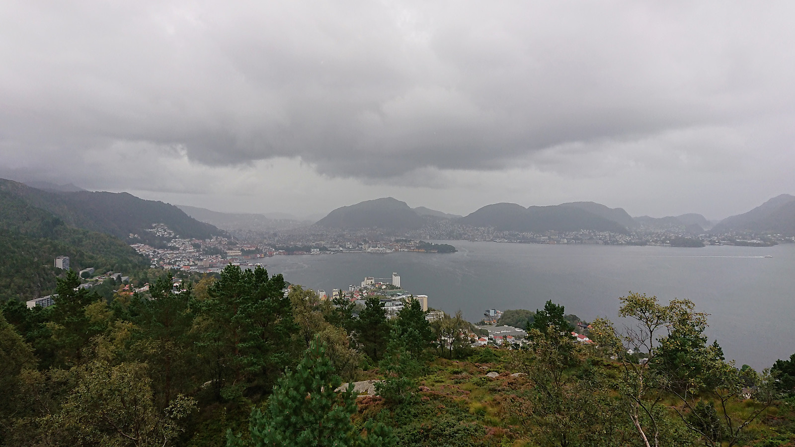
 Local hike in excellent September weather.
Veten from Grøvlesvingen
- Datum:
- 01.09.2019
- Tourcharakter:
- Bergtour
- Tourlänge:
- 2:36h
- Entfernung:
- 9,9km
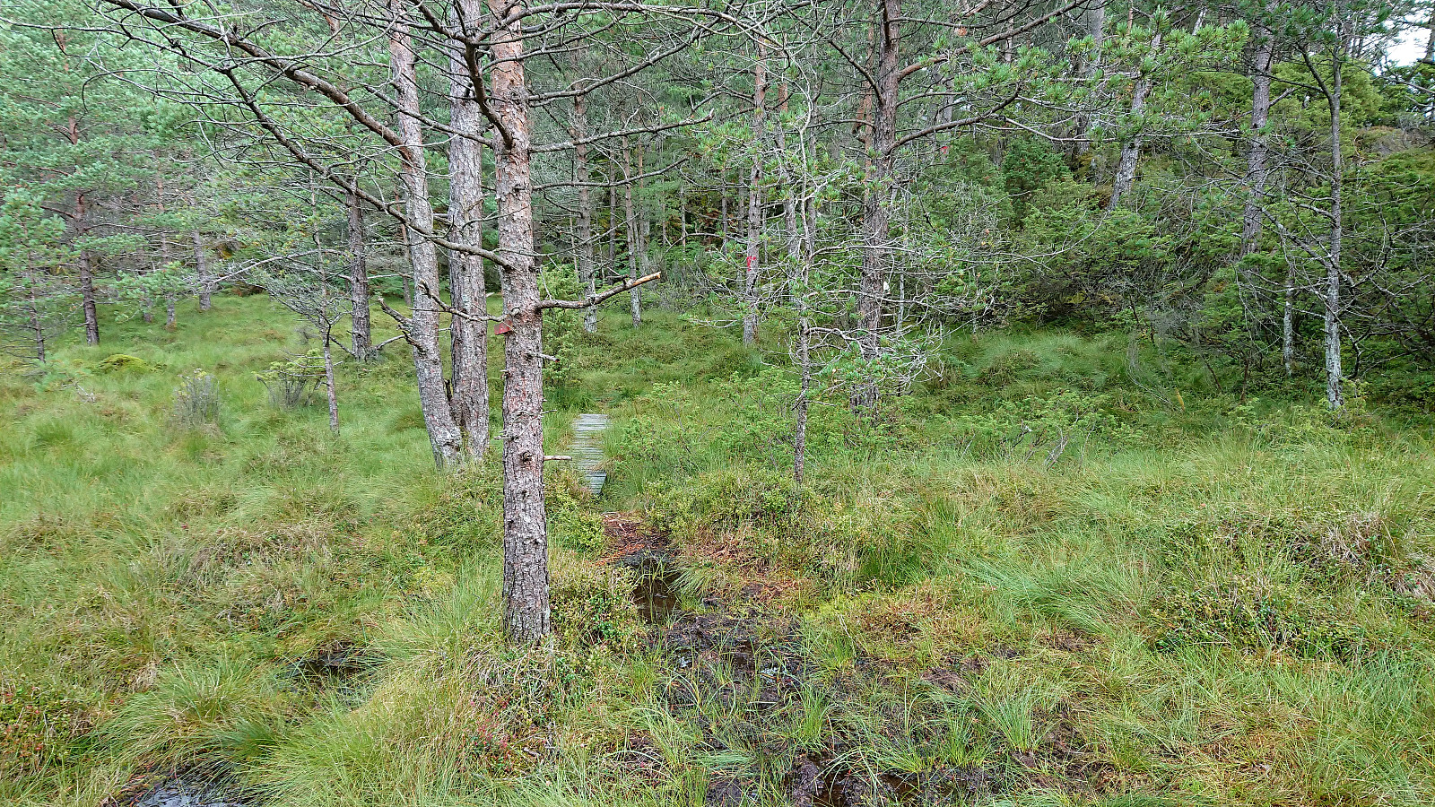
 Another revisit of Veten i Åsane , but this time starting from Grøvlesvingen. Just as I was getting off the bus it started raining heavily, which made it more difficult to confer with the GPS. I still managed to get to the gravel road on the other side of the main road, but was here surprised to find a "no entry" sign. I therefore backtracked a bit and instead followed a weak trail that would hopefully take me around the construction site.
This trail however quickly disappeared and soon I was back on the gravel road anyway, taking me northwest and thus away from the summit. I did meet a couple of people coming the opposite way though, so maybe the "no entry" sign is ignored by the locals on Sundays?
Later the road finally turned southeast towards the summit. I did not stay on it for very >>>
Another revisit of Veten i Åsane , but this time starting from Grøvlesvingen. Just as I was getting off the bus it started raining heavily, which made it more difficult to confer with the GPS. I still managed to get to the gravel road on the other side of the main road, but was here surprised to find a "no entry" sign. I therefore backtracked a bit and instead followed a weak trail that would hopefully take me around the construction site.
This trail however quickly disappeared and soon I was back on the gravel road anyway, taking me northwest and thus away from the summit. I did meet a couple of people coming the opposite way though, so maybe the "no entry" sign is ignored by the locals on Sundays?
Later the road finally turned southeast towards the summit. I did not stay on it for very >>>
Ørneberget and Furukammen
- Datum:
- 31.08.2019
- Tourcharakter:
- Bergtour
- Tourlänge:
- 2:01h
- Entfernung:
- 8,6km
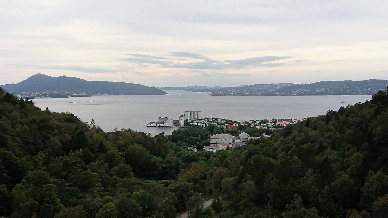 Short local hike across Ørneberget and via Munkebotn on the return.
Ørneberget
- Datum:
- 23.08.2019
- Tourcharakter:
- Bergtour
- Tourlänge:
- 1:16h
- Entfernung:
- 6,3km
 Short local hike across Ørneberget.
Veten, Skaftefjellet and Loddo
- Datum:
- 21.08.2019
- Tourcharakter:
- Bergtour
- Tourlänge:
- 7:50h
- Entfernung:
- 29,1km
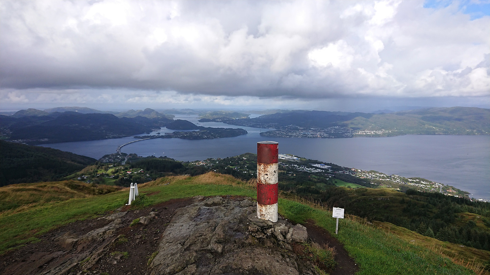
 Not the best weather for hiking so far for this last week of my late summer holiday. So when the Wednesday forecast was finally showing better conditions, I got up early in the morning and took the first boat from Strandkaiterminalen in Bergen to Bekkjarvik. The first part of the hike consisted of walking along the road to the start of the trail towards Veten north of Ugleneset. No sidewalks except for at the very beginning, but thankfully the amount of traffic was limited.
The trailhead was unmarked as far as I could tell, but easy to locate. I followed the initial tractor road through a couple of gates and when the road came to an end continued on a wet trail. The trail soon connected with a larger muddy trail, which I then followed west to the summit of Veten, providing excellent views in all >>>
Not the best weather for hiking so far for this last week of my late summer holiday. So when the Wednesday forecast was finally showing better conditions, I got up early in the morning and took the first boat from Strandkaiterminalen in Bergen to Bekkjarvik. The first part of the hike consisted of walking along the road to the start of the trail towards Veten north of Ugleneset. No sidewalks except for at the very beginning, but thankfully the amount of traffic was limited.
The trailhead was unmarked as far as I could tell, but easy to locate. I followed the initial tractor road through a couple of gates and when the road came to an end continued on a wet trail. The trail soon connected with a larger muddy trail, which I then followed west to the summit of Veten, providing excellent views in all >>>
Kjeringafjell from Kleppa
- Datum:
- 15.08.2019
- Tourcharakter:
- Bergtour
- Tourlänge:
- 5:25h
- Entfernung:
- 19,0km
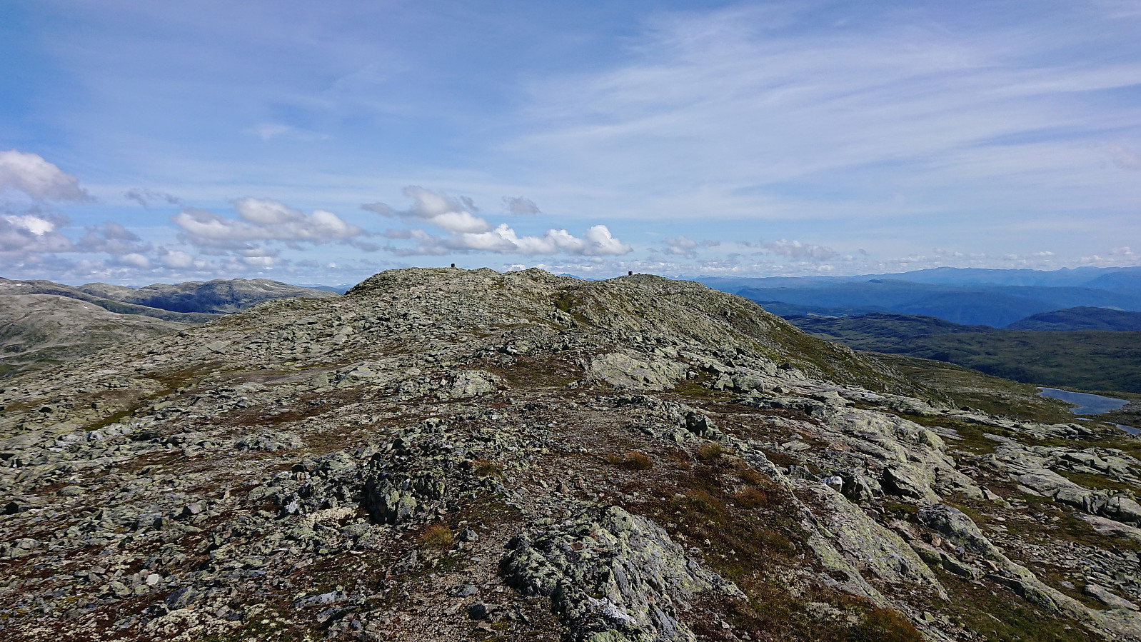 I started from the parking lot at Kleppa and from there tried to follow the signs to Kjeringafjell (or rather Kjeringi as used on the signs). The first sign indicated that it was only 6.2 km to the summit, which I found odd, given that earlier PB reports showed distances closer to 10 km. However, most, if not all, of these were from skiing trips, so perhaps the summer route was shorter.
The signs did not always include Kjeringi though, resulting in multiple checks of the GPS to make sure that I was choosing the correct option when the trail split. This became much easier when getting above the tree line, but then the signs were not really needed anymore anyway. After leaving the gravel road, there were also a couple of wet sections, but most could easily be avoided by following the trail next to the tractor road instead of the >>>
I started from the parking lot at Kleppa and from there tried to follow the signs to Kjeringafjell (or rather Kjeringi as used on the signs). The first sign indicated that it was only 6.2 km to the summit, which I found odd, given that earlier PB reports showed distances closer to 10 km. However, most, if not all, of these were from skiing trips, so perhaps the summer route was shorter.
The signs did not always include Kjeringi though, resulting in multiple checks of the GPS to make sure that I was choosing the correct option when the trail split. This became much easier when getting above the tree line, but then the signs were not really needed anymore anyway. After leaving the gravel road, there were also a couple of wet sections, but most could easily be avoided by following the trail next to the tractor road instead of the >>>
Flot and Flotshaugen
- Datum:
- 12.08.2019
- Tourcharakter:
- Bergtour
- Tourlänge:
- 1:10h
- Entfernung:
- 3,5km
 Short hike across Flot . This time also including a visit to Flotshaugen . This minor summit is easy to access, but the very limited views means that most hikers will probably be happy skipping it and sticking with only the visitor register .
Skjerdingane Øst from Laugadalen
- Datum:
- 09.08.2019
- Tourcharakter:
- Bergtour
- Tourlänge:
- 6:39h
- Entfernung:
- 18,3km
 Given that our attempt to reach Skjerdingane Øst earlier in the week had to be abandoned due to bad weather , we simply had to give it another go as soon as the conditions improved. We followed the same trail up Laugadalen as last time, and also a pretty similar route from Laugavatnet to Styggebotngrovi, i.e. first along the weak trail from Laugavatnet and then finding our own way next to the stream.
As mentioned in the previous report, our plan was to follow in the footsteps of arntfla (Arnt Flatmo) (see his trip report here ), which of course today was made easier by the fact that we now knew where to locate the start of the trail in Styggebotngrovi. To summarize, the trick is to head to the bottom of Styggebotngrovi and start heading up on the eastern (i.e. right-hand) side of the gorge. A weak trail should then shortly appear.
At this time of the year the trail was lined >>>
Given that our attempt to reach Skjerdingane Øst earlier in the week had to be abandoned due to bad weather , we simply had to give it another go as soon as the conditions improved. We followed the same trail up Laugadalen as last time, and also a pretty similar route from Laugavatnet to Styggebotngrovi, i.e. first along the weak trail from Laugavatnet and then finding our own way next to the stream.
As mentioned in the previous report, our plan was to follow in the footsteps of arntfla (Arnt Flatmo) (see his trip report here ), which of course today was made easier by the fact that we now knew where to locate the start of the trail in Styggebotngrovi. To summarize, the trick is to head to the bottom of Styggebotngrovi and start heading up on the eastern (i.e. right-hand) side of the gorge. A weak trail should then shortly appear.
At this time of the year the trail was lined >>>
