Archiv - Nach Datum
Archiv - Nach Aktivität
-
Andere Tour (3)
- Kayaking (3)
-
Fahrradtour (108)
- Fahrradtour Straße (83)
- Fahrradtour gemischt (25)
-
Fahrzeugtour (9)
- Autotour (9)
-
Fußtour (1834)
- Bergtour (1087)
- Jogging (1)
- Spaziergang (55)
- Wanderung (691)
-
Skitour (112)
- Langlauf (46)
- Tourenskilauf (66)
Gesammelte Listen
- Utvalgte topper og turmål i Bergen
- Alle topper i Bergen
- Voss ≥ 100m pf.
- Opptur Hordaland
- Stasjoner på Bergensbanen
- Ulvik ≥ 100m pf.
- Hordaland ≥ 100m pf.
- Mjølfjell PF > 100m
- Jondal ≥ 100m pf.
- Sunnhordland PF >= 100m
- Dagsturhyttene i Vestland
- Hordaland: Hardanger PF>=100m
- DNT-hytter i Hordaland
- Kvinnherad ≥ 100m pf.
- Sogndal ≥ 100m pf.
- Vik i Sogn ≥ 100m pf.
- Gulen ≥ 100m pf.
- DNT-hytter i Sogn og Fjordane
- Eidfjord ≥ 100m pf.
- Sogn - Sør for Sognefjorden PF>=100m
Låveidrusta
- Datum:
- 10.02.2024
- Tourcharakter:
- Bergtour
- Tourlänge:
- 0:39h
- Entfernung:
- 1,9km
 After the visit of Hesthovden it was time for Låveidrusta , where there should be a marked trail all the way to the summit. We parked at the start of a sideroad to the north and briefly followed the sideroad before heading south and ascending towards the summit. There were some trail markers but we quickly lost these and simply found our own way to the highest point and did not come across any real challenges. Limited views from the summit and we quickly returned along the same route before continuing to Klettane .
Hesthovden
- Datum:
- 10.02.2024
- Tourcharakter:
- Bergtour
- Tourlänge:
- 0:51h
- Entfernung:
- 2,7km
 Upon arriving at the start of the tractor road where we planned to start our hike to Hesthovden , after visiting Brunane , we once again struggled to find proper parking. After a brief discussion about whether the car was blocking traffic or not, Endre concluded that given that there were two ways of driving from the main road to the tractor road we could block one of them without it being an issue. I was less certain.
We followed the tractor road northwest and passed through a gate before the road started winding its way upwards. When the tractor road came to an end we headed off-trail towards the summit and reached it without any real challenges. After visiting both the trig marker and an alternative summit to the northwest, we returned along the same route.
When we were almost back at the car, we met a local farmer >>>
Brunane from Frøyset kyrkje
- Datum:
- 10.02.2024
- Tourcharakter:
- Bergtour
- Tourlänge:
- 1:09h
- Entfernung:
- 3,0km
 The third peak on our seven mountain hike in Masfjorden was Brunane . After the visit of Bufjellet , Endre and I therefore drove the short distance to Frøyset where we found parking close to the church. Here we talked to one of the locals and was given excellent advice on how to locate the trailhead which was only a couple of hundred meters to the northeast. The trailhead was easily located and we began the initial steep ascent to Fløya .
Fløya provided a great overview of Frøyset and the panoramic views were much better than expected from such a modest altitude. After a nice chat with another local outside a small wooden shelter, and signing the visitor register, we continued along the trail to Brunane. The terrain was now much less steep and the summit was reached without any issues. Limited views due to lots of trees >>>
Bufjellet from Torsvika
- Datum:
- 10.02.2024
- Tourcharakter:
- Bergtour
- Tourlänge:
- 1:14h
- Entfernung:
- 3,5km
 After our visit of Duesundfjellet , we drove the short distance to Torsvika to start our ascent of Bufjellet . Finding a place to park was more difficult than we had hoped though. In the end we decided to drive up to Sleirsvegen 148 and park at the start of the tractor road. We looked around for people to check if this was ok but did not find anybody and concluded that the snow-covered tractor road would most like not be used this Saturday.
We started by following the tractor road north before turning southeast and heading off-trail for the ridge we assumed could be followed to the summit (partly based on previous trip reports). However, we soon happened upon a marked trail that seemed to lead more directly towards the summit and decided to follow it instead. But when this trail started heading back towards the tractor >>>
Duesundfjellet from Duesund Brannstasjon
- Datum:
- 10.02.2024
- Tourcharakter:
- Bergtour
- Tourlänge:
- 0:52h
- Entfernung:
- 1,8km
 Initially, Endre and I were going skiing this weekend, but due to worsening weather forecasts we decided to abandon those plans and instead leave the skis at home and head to the northwestern part of Masfjorden. This was an area that neither of us had visited before and hence there should be lots of relatively easy peaks to ascend. I had made a rough plan the evening before that included up to seven peaks, depending on how long each of them would take.
We started by driving to Masfjordnes where we arrived almost half an hour before the ferry to Duesund. After a short drive on the other side of the fjord, we parked next to Duesund Brannstasjon and easily located the stone steps marking the start of the trail to Duesundfjellet .
The trail was overall easy to follow, and there was even the occasional trail marker, >>>
Hylkje to Haukås via Stuhaugen and Jonsterhaug søyle
- Datum:
- 04.02.2024
- Tourcharakter:
- Bergtour
- Tourlänge:
- 1:46h
- Entfernung:
- 6,4km
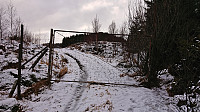 I had come across a potential new candidate for the Søyler (fastmerker) i Bergen list at Hylkjeneset and decided to have a closer look as the information at bergenskart.no did not reveal the type of trig marker. From the bus stop at Hylkje I followed the roads to Hylkjeneset and the marked trailhead for Geitskaret.
The marked trail provided excellent views across Sørfjorden to Osterøy but did not pass by the highest point at the small hill Stuhaugen where the trig marker was supposed to be (now added as its own PB-element). However, just as I was about to leave the trail and head the final short off-trail distance to the summit I did came across a trig marker, but not of the kind I had expected and not at the correct location. This one was of the taller type held up by metal wires and was located at the lower hill less than 100 meters southeast >>>
Ørneberget and Hellen festning
- Datum:
- 30.01.2024
- Tourcharakter:
- Bergtour
- Tourlänge:
- 0:54h
- Entfernung:
- 4,1km
Bjørnåsen and Fuglen
- Datum:
- 28.01.2024
- Tourcharakter:
- Bergtour
- Tourlänge:
- 1:37h
- Entfernung:
- 7,5km
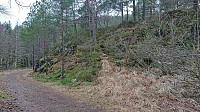 In the report from my visit of Bjørnåsen in 2021 I had commented that the trail seemed to continue towards a slightly lower hill to the north called Fuglen and that perhaps this had to be explored one day. With Fuglen recently having been added as its own PB-element, that day had arrived. This time I arrived on foot via the cycling and walking path from the bus stop at Kalandseidet.
I first followed the same trail as last time to Bjørnåsen and from there continued north in the direction of Fuglen. While there was a weak trail, and even some trail markers, I quickly lost the trail and was left finding my own way. The terrain however did not present any challenges and the highest point of Fuglen was easily reached.
As expected, Fuglen provided the same limited views as Bjørnåsen and I did not stay long before descending off-trail to reconnect with the >>>
Ørneberget and Furukammen
- Datum:
- 25.01.2024
- Tourcharakter:
- Bergtour
- Tourlänge:
- 0:59h
- Entfernung:
- 4,5km
Alvehaugen and Høyde ved Janaflaten
- Datum:
- 21.01.2024
- Tourcharakter:
- Bergtour
- Tourlänge:
- 0:36h
- Entfernung:
- 2,2km
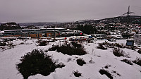 On a gray Sunday where the rain showers did their best to melt the recent snow and make all surfaces slippery, I once again turned to the Alle topper i Bergen list and decided on two minor hills just east of Sotrabroen.
First up was Alvehaugen which could be spotted immediately after getting off the bus. Getting to the summit however required a bit more work but could be fairly easily done via a short off-trail ascent from the north.
I descended the same way and headed the short distance south to Høyde ved Janaflaten . Here the ascent was easier than expected as most of the trees shown covering the summit in previous trip reports had been removed and it was now simply a matter of walking up to the highest point. While the removal of the trees had resulted in better views, it was still a rather uninteresting small hill.
The short hike was then concluded >>>


