Archiv - Nach Datum
Archiv - Nach Aktivität
-
Andere Tour (3)
- Kayaking (3)
-
Fahrradtour (117)
- Fahrradtour Straße (88)
- Fahrradtour gemischt (29)
-
Fahrzeugtour (9)
- Autotour (9)
-
Fußtour (1912)
- Bergtour (1126)
- Jogging (2)
- Spaziergang (60)
- Wanderung (724)
-
Skitour (116)
- Langlauf (47)
- Tourenskilauf (69)
Gesammelte Listen
-
Utvalgte topper og turmål i Bergen
(351/352)
 99%
99% -
Alle topper i Bergen
(396/401)
98%
-
Voss ≥ 100m pf.
(96/98)
97%
-
Opptur Hordaland
(144/159)
90%
-
Stasjoner på Bergensbanen
(33/40)
82%
-
Ulvik ≥ 100m pf.
(30/38)
78%
-
Hordaland ≥ 100m pf.
(625/863)
72%
-
Mjølfjell PF > 100m
(21/31)
67%
-
Jondal ≥ 100m pf.
(15/23)
65%
-
Dagsturhyttene i Vestland
(38/62)
61%
-
Sunnhordland PF >= 100m
(106/186)
56%
-
Hordaland: Hardanger PF>=100m
(196/359)
54%
-
DNT-hytter i Hordaland
(25/46)
54%
-
Kvinnherad ≥ 100m pf.
(41/79)
51%
-
Eidfjord ≥ 100m pf.
(13/42)
30%
-
Sogndal ≥ 100m pf.
(23/81)
28%
-
Gulen ≥ 100m pf.
(15/54)
27%
-
Vik i Sogn ≥ 100m pf.
(10/46)
21%
-
Sogn - Sør for Sognefjorden PF>=100m
(31/159)
19%
-
DNT-hytter i Sogn og Fjordane
(8/47)
17%

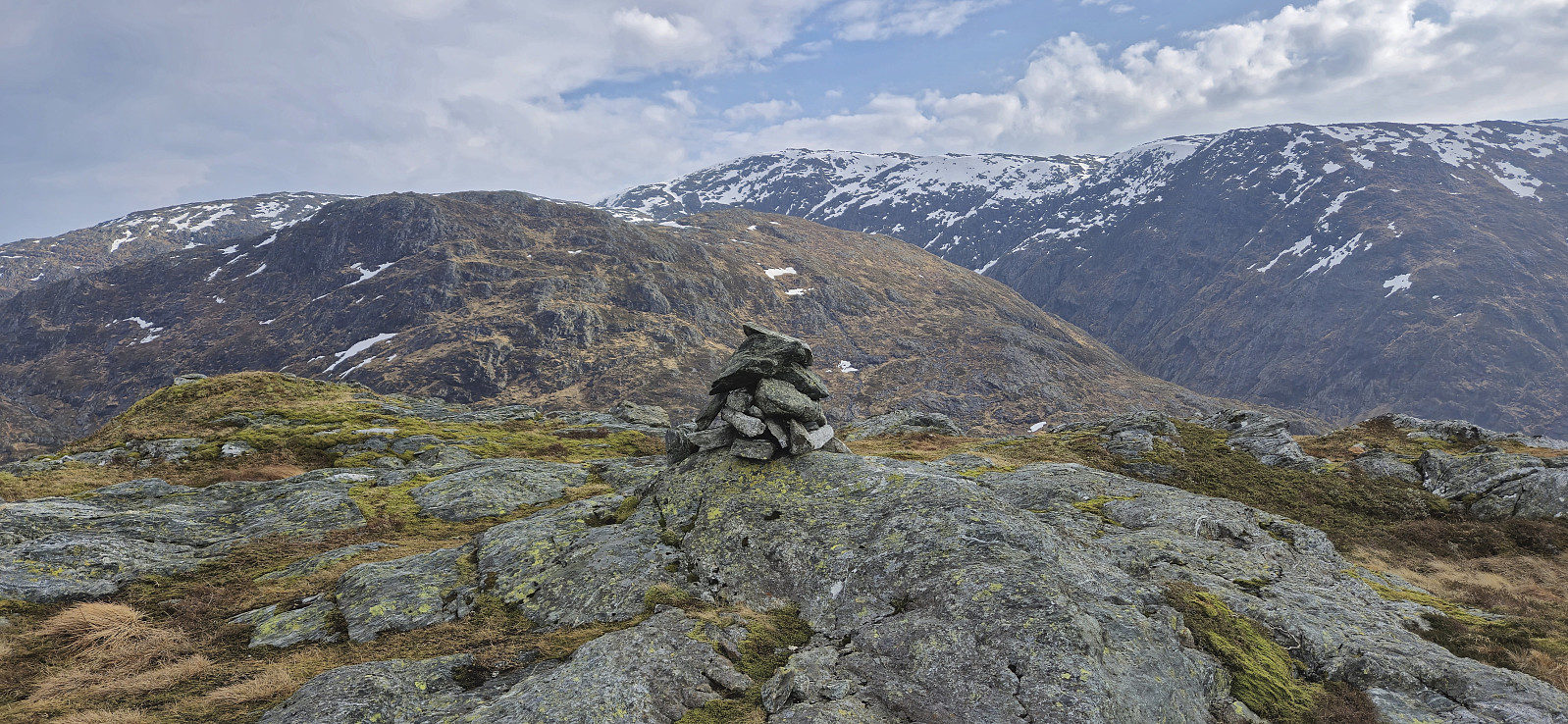
Bergshovda
- Datum:
- 29.03.2025
- Tourcharakter:
- Bergtour
- Tourlänge:
- 1:09h
- Entfernung:
- 2,5km
 After completing the ascent of Åsen , we drove the short distance northeast to the crossroads of Matersvegen, Myklebustvegen and Blådalsvegen for our final ascent of the day, namely Bergshovda . We left the car next to the road and from there tried to follow Pål’s trip report . However, as it did not contain a GPS-track we had to rely on our best attempts at interpreting his written description.
This started out well enough and after first heading northwest without a trail we came across the trail mentioned by Pål and then proceeded to try to follow it. Calling it a trail seemed like an exaggeration though as it looked more like a deer track, but perhaps one of the more frequently used ones. We do not know whether we actually followed the exact same route from there on though, but at least our trail/deer track made sure that we got to the >>>
After completing the ascent of Åsen , we drove the short distance northeast to the crossroads of Matersvegen, Myklebustvegen and Blådalsvegen for our final ascent of the day, namely Bergshovda . We left the car next to the road and from there tried to follow Pål’s trip report . However, as it did not contain a GPS-track we had to rely on our best attempts at interpreting his written description.
This started out well enough and after first heading northwest without a trail we came across the trail mentioned by Pål and then proceeded to try to follow it. Calling it a trail seemed like an exaggeration though as it looked more like a deer track, but perhaps one of the more frequently used ones. We do not know whether we actually followed the exact same route from there on though, but at least our trail/deer track made sure that we got to the >>>
Åsen
- Datum:
- 29.03.2025
- Tourcharakter:
- Bergtour
- Tourlänge:
- 1:09h
- Entfernung:
- 2,2km
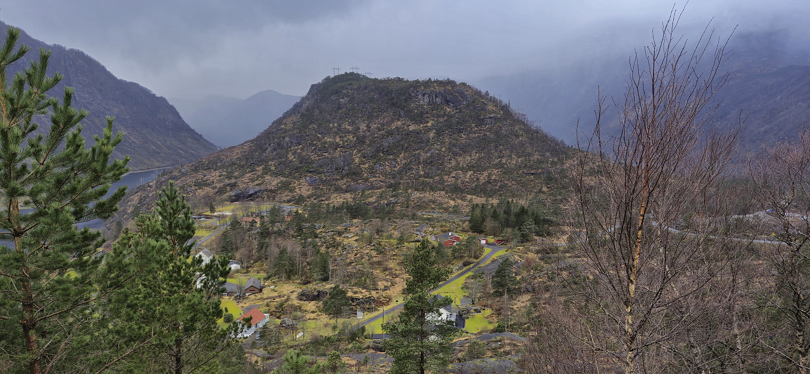 With Ingahogg and Tindafjellet in the bag, we drove the short distance from the parking lot at Fjellhaugen Skisenter to the top of the pass between Indre Matre and Opstveit. Here there was room for a couple of cars without hindering the traffic or blocking access to the recycling station. In light rain that would thankfully soon stop, we then followed various deer tracks up to the ridge leading to Åsen .
Getting to the ridge involved a short steep section that we managed to avoid when later descending but was otherwise straightforward. It was then just a matter of following various deer tracks on our way to the summit. Despite being the lowest summit of the day, it actually provided the best views, mainly as we were now under the layer of dense fog, however the views were marred by the overhanging powerlines.
We returned more or less the same way and then >>>
With Ingahogg and Tindafjellet in the bag, we drove the short distance from the parking lot at Fjellhaugen Skisenter to the top of the pass between Indre Matre and Opstveit. Here there was room for a couple of cars without hindering the traffic or blocking access to the recycling station. In light rain that would thankfully soon stop, we then followed various deer tracks up to the ridge leading to Åsen .
Getting to the ridge involved a short steep section that we managed to avoid when later descending but was otherwise straightforward. It was then just a matter of following various deer tracks on our way to the summit. Despite being the lowest summit of the day, it actually provided the best views, mainly as we were now under the layer of dense fog, however the views were marred by the overhanging powerlines.
We returned more or less the same way and then >>>
Tindafjellet from Fjellhaugen Skisenter
- Datum:
- 29.03.2025
- Tourcharakter:
- Bergtour
- Tourlänge:
- 2:14h
- Entfernung:
- 4,4km
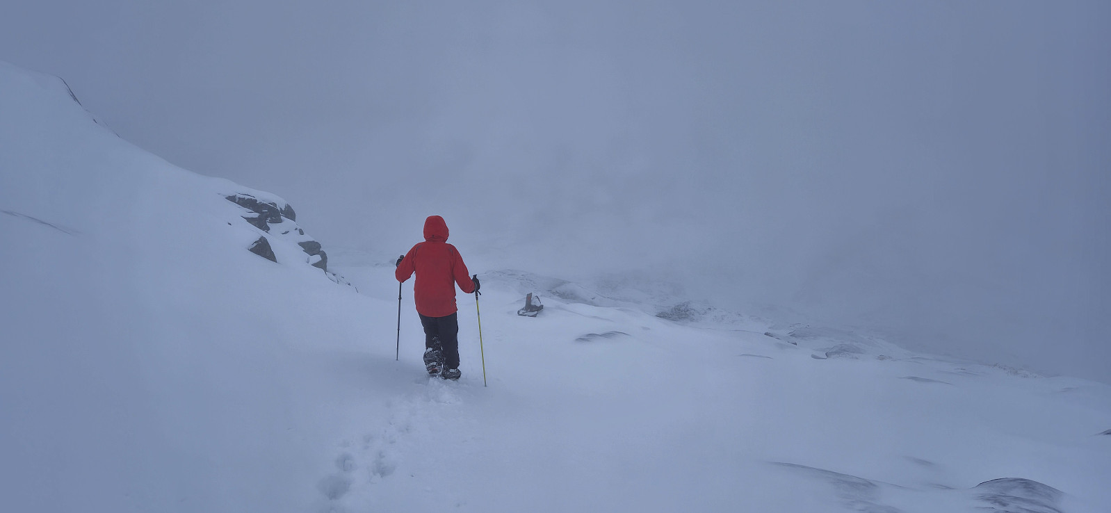
 Warning: This hike includes a steep off-trail ascent/descent. Read the report carefully.
After our ascent of Ingahogg , and quick stop in the car for Petter to change to warmer gloves, we once more left the parking lot at Fjellhaugen Skisenter but this time heading southwest towards Tindafjellet . First, we partially followed the roads used for cross-country skiing before heading off-trail towards the summit.
Getting up to around 725 meters was straightforward. Here we shortly followed a relatively flat area north before turning west and completing the final ascent to the summit. This included a rather steep but not very long section that is perhaps more challenging under different conditions and that may also be prone to small avalanches. Today there was however the perfect combination of not enough snow for avalanches but enough such that we could make our own footholds >>>
Warning: This hike includes a steep off-trail ascent/descent. Read the report carefully.
After our ascent of Ingahogg , and quick stop in the car for Petter to change to warmer gloves, we once more left the parking lot at Fjellhaugen Skisenter but this time heading southwest towards Tindafjellet . First, we partially followed the roads used for cross-country skiing before heading off-trail towards the summit.
Getting up to around 725 meters was straightforward. Here we shortly followed a relatively flat area north before turning west and completing the final ascent to the summit. This included a rather steep but not very long section that is perhaps more challenging under different conditions and that may also be prone to small avalanches. Today there was however the perfect combination of not enough snow for avalanches but enough such that we could make our own footholds >>>
Ingahogg from Fjellhaugen Skisenter
- Datum:
- 29.03.2025
- Tourcharakter:
- Bergtour
- Tourlänge:
- 2:03h
- Entfernung:
- 5,6km
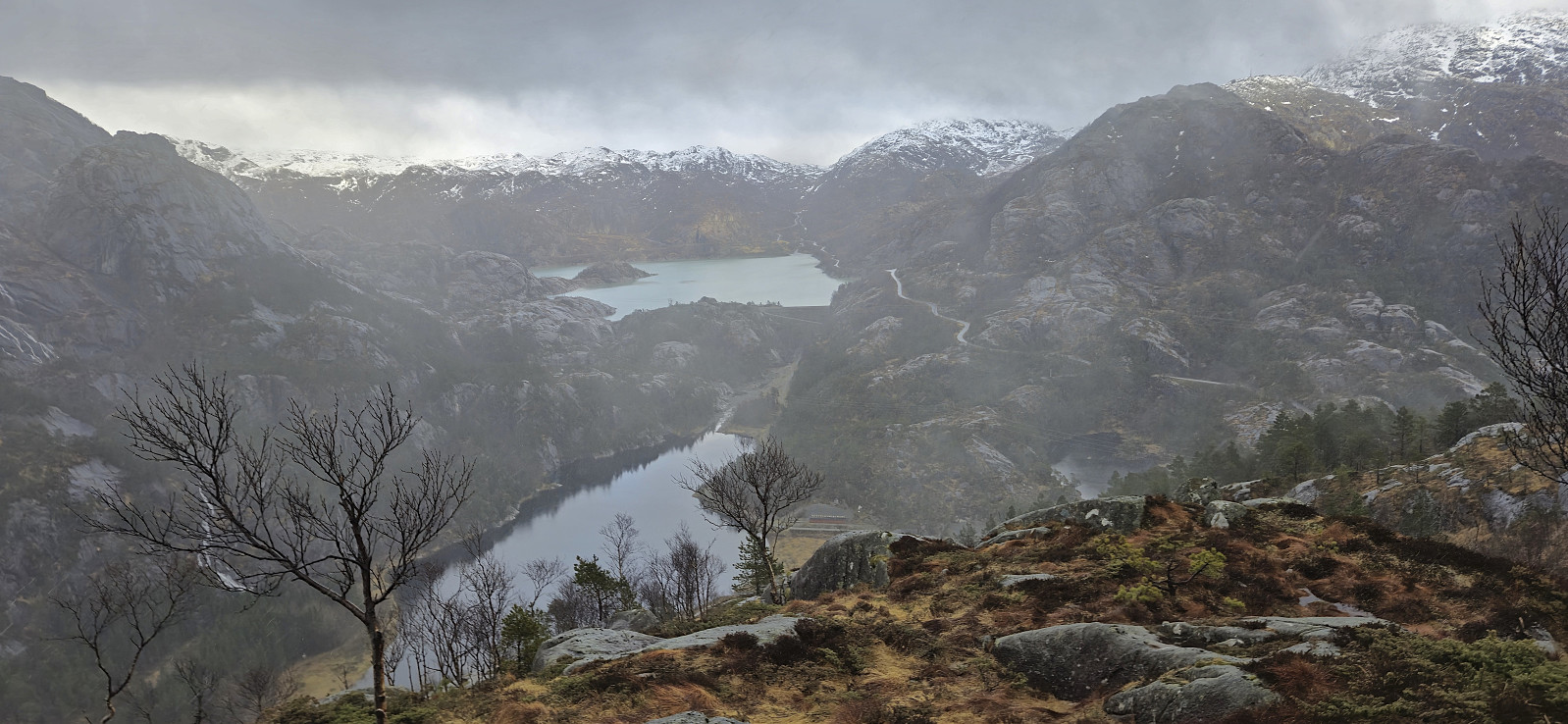
 Due to Petter being otherwise engaged on the very nice-looking Sunday, we had to make the best out of a gray Saturday and therefore left early from Bergen to catch the 09:00 ferry from Gjermundshamn to Årsnes. The day before we had decided on the area north and northwest of Åkra and the goal to ascend up to four summits that neither of us had yet visited. First up was Ingahogg .
We parked at the parking lot next to Fjellhaugen Skisenter , which, given the unusually warm winter was completely free of snow, even though it was still only the end of March. From the parking lot we first tried to follow the marked trail to the summit but quickly lost the trail and instead simply found our own way to the top of the ski lift. Here we came across the first sign for Ingahogg and from there on it was relatively easy to follow the markers to the summit, with >>>
Due to Petter being otherwise engaged on the very nice-looking Sunday, we had to make the best out of a gray Saturday and therefore left early from Bergen to catch the 09:00 ferry from Gjermundshamn to Årsnes. The day before we had decided on the area north and northwest of Åkra and the goal to ascend up to four summits that neither of us had yet visited. First up was Ingahogg .
We parked at the parking lot next to Fjellhaugen Skisenter , which, given the unusually warm winter was completely free of snow, even though it was still only the end of March. From the parking lot we first tried to follow the marked trail to the summit but quickly lost the trail and instead simply found our own way to the top of the ski lift. Here we came across the first sign for Ingahogg and from there on it was relatively easy to follow the markers to the summit, with >>>
Stølsnuten from Sandvin
- Datum:
- 22.03.2025
- Tourcharakter:
- Bergtour
- Tourlänge:
- 4:04h
- Entfernung:
- 8,3km
 Strong winds at high altitudes made me postpone my planned skiing trip. To enjoy the otherwise excellent weather I therefore instead went for a long 3.5-hour bus ride to Odda to ascend Stølsnuten . When finally getting off the bus at Sandvin I was welcomed by signs of "Private road" and "No trespassing” but concluded that walking along the gravel roads should still be ok and continued across the bridge. The start of the steep and relatively rough gravel road up the unmarked trailhead was easily located and when the road ended I continued on an equally steep trail heading to Lauvås .
When the trail later split (more clearly on the map than in reality), I followed the weaker of the two options and headed more directly towards Storenuten . This involved a tiny bit of easy scrambling but all of the potentially >>>
Strong winds at high altitudes made me postpone my planned skiing trip. To enjoy the otherwise excellent weather I therefore instead went for a long 3.5-hour bus ride to Odda to ascend Stølsnuten . When finally getting off the bus at Sandvin I was welcomed by signs of "Private road" and "No trespassing” but concluded that walking along the gravel roads should still be ok and continued across the bridge. The start of the steep and relatively rough gravel road up the unmarked trailhead was easily located and when the road ended I continued on an equally steep trail heading to Lauvås .
When the trail later split (more clearly on the map than in reality), I followed the weaker of the two options and headed more directly towards Storenuten . This involved a tiny bit of easy scrambling but all of the potentially >>>
Stoltzekleiven and Sandviksfjellet
- Datum:
- 19.03.2025
- Tourcharakter:
- Bergtour
- Tourlänge:
- 1:52h
- Entfernung:
- 6,2km
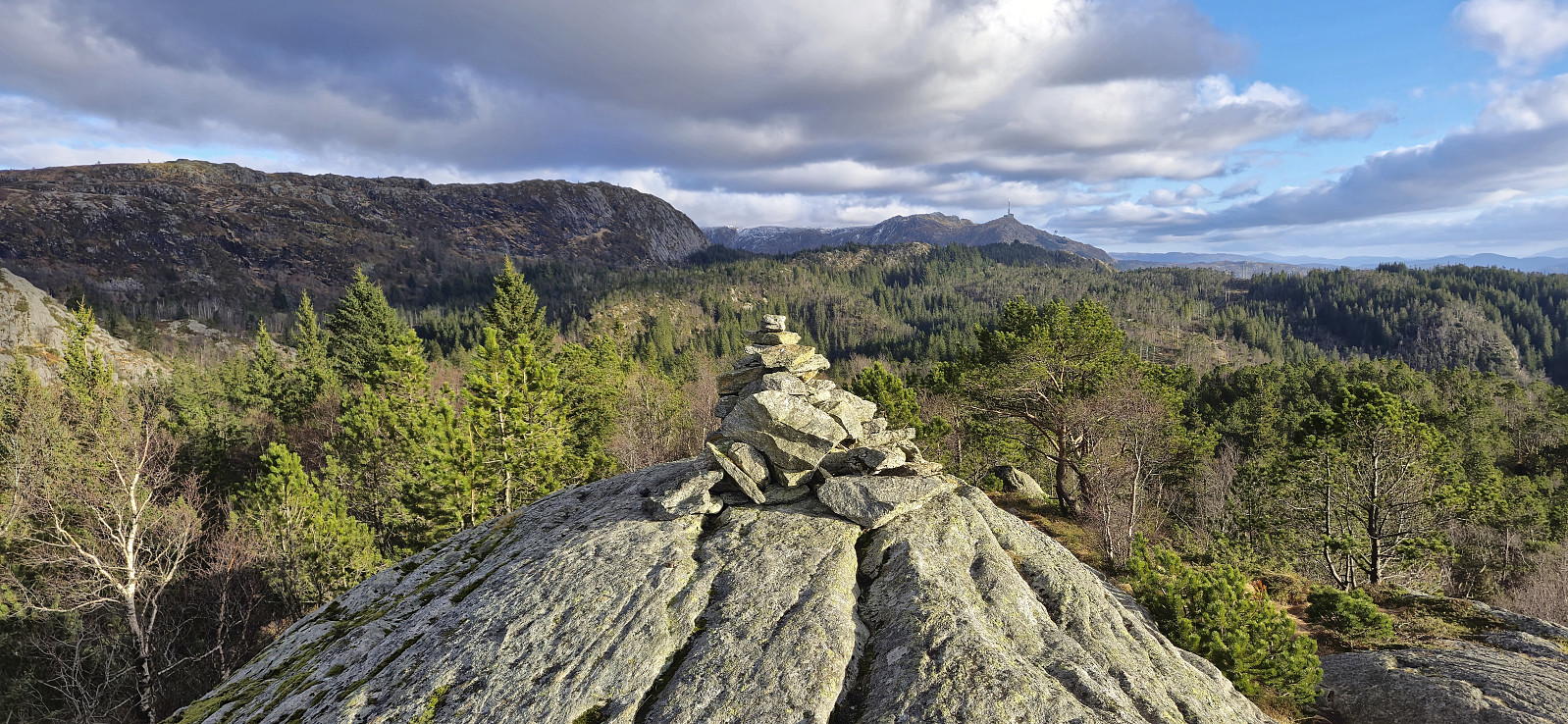 Short hike after work showing one of my colleagues the trail up Stoltzekleiven . I let my colleague decide the tempo and we made it to the top in 23 minutes and 30 seconds. After a short detour to the summit of Sandviksfjellet we followed the gravel road down to the bus stop at Gamle Bergen.
Trollhaugen from Hausdal snuplass
- Datum:
- 14.03.2025
- Tourcharakter:
- Bergtour
- Tourlänge:
- 2:41h
- Entfernung:
- 9,9km
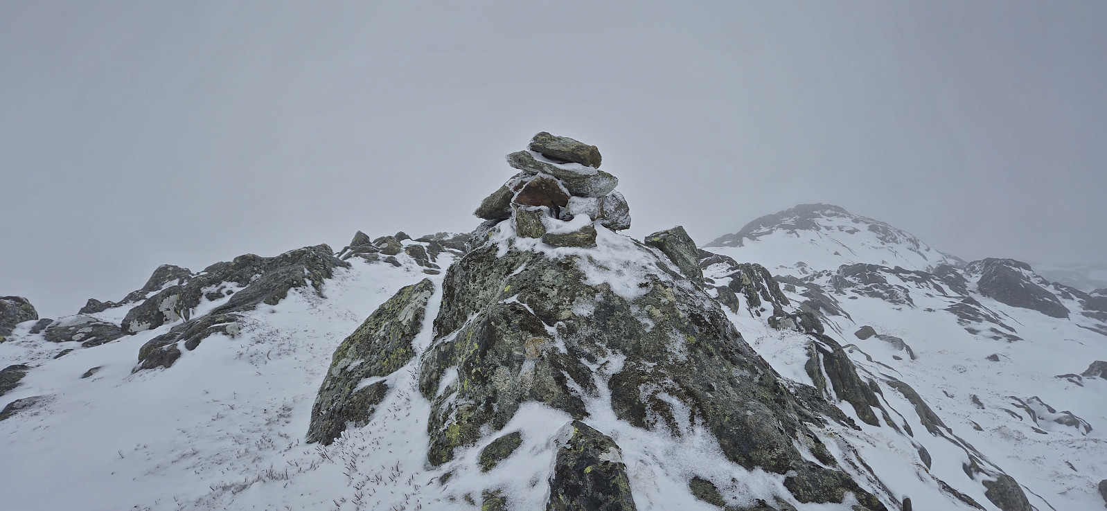
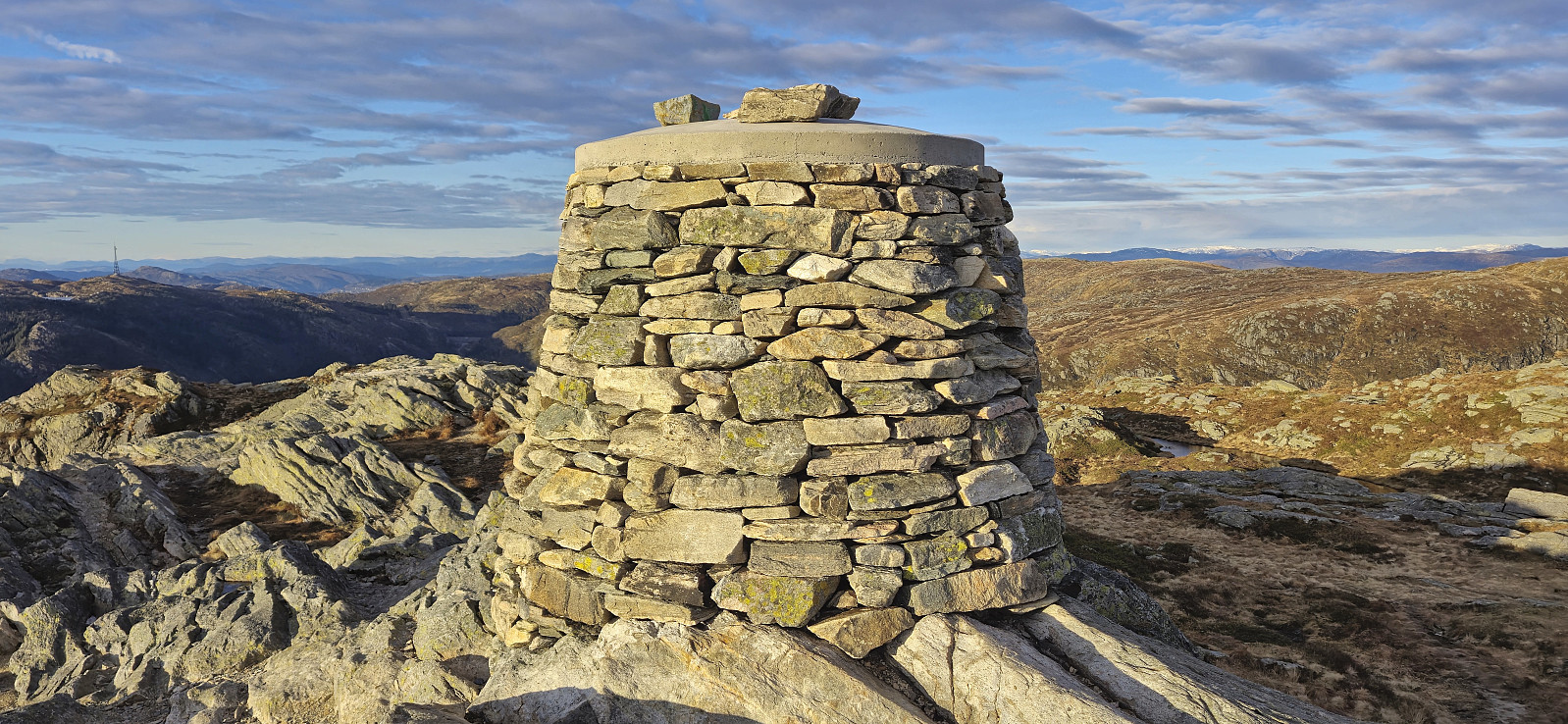
 By postponing my Friday lunch break and starting the weekend early, I managed to squeeze in a short hike to at least enjoy the tail end of a very nice day. I started my hike from the final bus stop in Hausdalen and pretty much followed the same route as Kjell to the top of Trollhaugen .
This included first walking northeast along the gravel road and then turning southwest towards the summit via the private cabin Brekkestøl. From the cabin there was initially a weak trail but it soon disappeared and I was left with finding my own way. This was however straightforward and it did not take long before I arrived at the summit. Here I had my very late lunch break next to the cairn before turning back and following more or less the same route back to the bus stop.
To conclude, a hike to Trollhaugen can definitely be recommended. Clearly >>>
By postponing my Friday lunch break and starting the weekend early, I managed to squeeze in a short hike to at least enjoy the tail end of a very nice day. I started my hike from the final bus stop in Hausdalen and pretty much followed the same route as Kjell to the top of Trollhaugen .
This included first walking northeast along the gravel road and then turning southwest towards the summit via the private cabin Brekkestøl. From the cabin there was initially a weak trail but it soon disappeared and I was left with finding my own way. This was however straightforward and it did not take long before I arrived at the summit. Here I had my very late lunch break next to the cairn before turning back and following more or less the same route back to the bus stop.
To conclude, a hike to Trollhaugen can definitely be recommended. Clearly >>>
Ulriken from Haukeland sykehus
- Datum:
- 12.03.2025
- Tourcharakter:
- Bergtour
- Tourlänge:
- 3:08h
- Entfernung:
- 7,0km
 Hike to Ulriken after work with some of my colleagues. After getting to the top of Oppstemten we followed the newly marked route to the real summit of Ulriken and the recently rebuilt cairn, before descending via Stormfuglen .
Gullbotn to Takvam via Steinfjellet, Ramfjellet and Onuken
- Datum:
- 09.03.2025
- Tourcharakter:
- Bergtour
- Tourlänge:
- 6:51h
- Entfernung:
- 19,2km
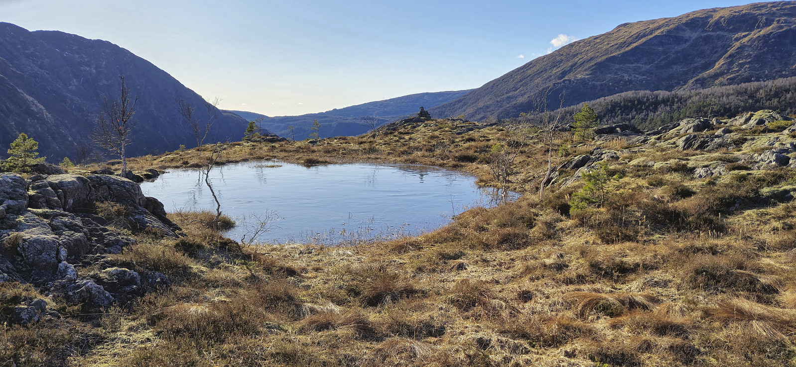
 Ever since turning back just below the summit of Steinfjellet last summer , I knew that I one day had to return to complete the job. This time I arrived by bus from Bergen and started by following the trails up to where Gullbotn is indicated on the map. Last time we had tried to ascend from the east, so this time I therefore ascended further south before later turning north towards the highest point. Much easier and the summit was reached without any real challenges.
From Steinfjellet I continued north to Ramfjellet . Getting there was overall straightforward, but I did lose around 230 vertical meters in the process. After a quick lunch break north of the summit, with better views than from the summit itself, I turned back and headed south for Romslabotn. Just before starting the ascent to Romslabotsriden, I came across five deer, where two of them even took the time >>>
Ever since turning back just below the summit of Steinfjellet last summer , I knew that I one day had to return to complete the job. This time I arrived by bus from Bergen and started by following the trails up to where Gullbotn is indicated on the map. Last time we had tried to ascend from the east, so this time I therefore ascended further south before later turning north towards the highest point. Much easier and the summit was reached without any real challenges.
From Steinfjellet I continued north to Ramfjellet . Getting there was overall straightforward, but I did lose around 230 vertical meters in the process. After a quick lunch break north of the summit, with better views than from the summit itself, I turned back and headed south for Romslabotn. Just before starting the ascent to Romslabotsriden, I came across five deer, where two of them even took the time >>>
Fagerdalsfjellet and Hellemyrstien
- Datum:
- 08.03.2025
- Tourcharakter:
- Bergtour
- Tourlänge:
- 1:34h
- Entfernung:
- 5,7km
 Local Saturday hike exploring a (for me) new trail on the northern side of Ørneberget with unusual views into Eidsvågen and Jordalen.
