Archiv - Nach Datum
Archiv - Nach Aktivität
-
Andere Tour (3)
- Kayaking (3)
-
Fahrradtour (111)
- Fahrradtour Straße (86)
- Fahrradtour gemischt (25)
-
Fahrzeugtour (9)
- Autotour (9)
-
Fußtour (1897)
- Bergtour (1120)
- Jogging (1)
- Spaziergang (60)
- Wanderung (716)
-
Skitour (116)
- Langlauf (47)
- Tourenskilauf (69)
Gesammelte Listen
-
Utvalgte topper og turmål i Bergen
(349/351)
 99%
99% -
Alle topper i Bergen
(393/400)
98%
-
Voss ≥ 100m pf.
(96/98)
97%
-
Opptur Hordaland
(144/159)
90%
-
Stasjoner på Bergensbanen
(33/40)
82%
-
Ulvik ≥ 100m pf.
(30/38)
78%
-
Hordaland ≥ 100m pf.
(624/863)
72%
-
Mjølfjell PF > 100m
(21/31)
67%
-
Jondal ≥ 100m pf.
(15/23)
65%
-
Dagsturhyttene i Vestland
(36/61)
59%
-
Sunnhordland PF >= 100m
(105/186)
56%
-
Hordaland: Hardanger PF>=100m
(196/359)
54%
-
DNT-hytter i Hordaland
(23/45)
51%
-
Kvinnherad ≥ 100m pf.
(40/79)
50%
-
Eidfjord ≥ 100m pf.
(13/42)
30%
-
Sogndal ≥ 100m pf.
(23/81)
28%
-
Gulen ≥ 100m pf.
(15/54)
27%
-
Vik i Sogn ≥ 100m pf.
(10/46)
21%
-
Sogn - Sør for Sognefjorden PF>=100m
(31/159)
19%
-
DNT-hytter i Sogn og Fjordane
(8/47)
17%

Ørneberget and Ørneberget NV
- Datum:
- 04.01.2026
- Tourcharakter:
- Bergtour
- Tourlänge:
- 1:01h
- Entfernung:
- 3,0km
 Short local Sunday hike.
Ørneberget
- Datum:
- 03.01.2026
- Tourcharakter:
- Bergtour
- Tourlänge:
- 0:56h
- Entfernung:
- 2,9km
 Short local Saturday hike.
Skiing: Rundemanen
- Datum:
- 02.01.2026
- Tourcharakter:
- Langlauf
- Tourlänge:
- 3:47h
- Entfernung:
- 14,9km
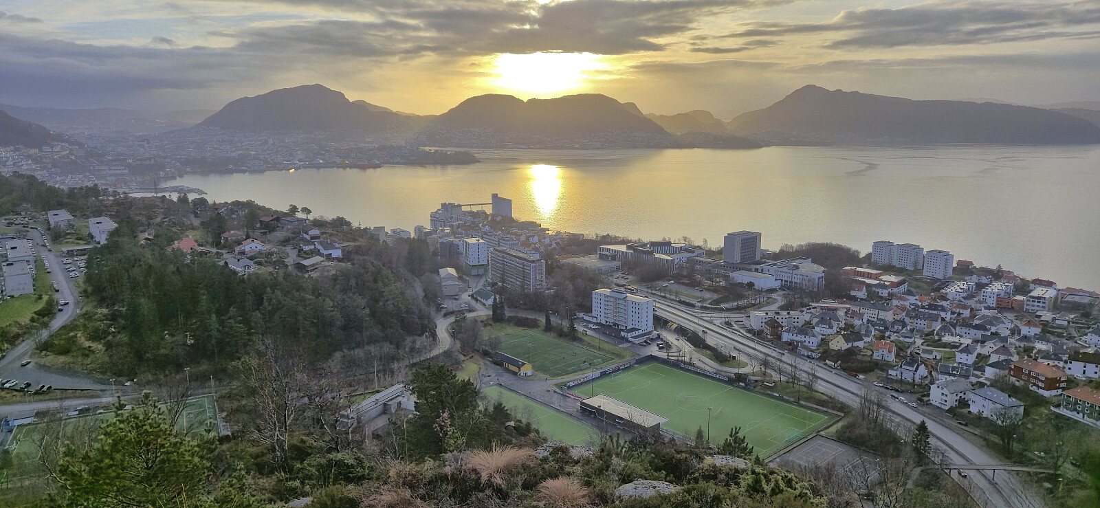
 Skiing from Fløyen to Rundemanen with my dad. When returning to Brushytten he returned to Fløibanen while I continued home to Lønborg.
Hellemyrstien and Sandviksfjellet
- Datum:
- 01.01.2026
- Tourcharakter:
- Bergtour
- Tourlänge:
- 2:59h
- Entfernung:
- 9,6km
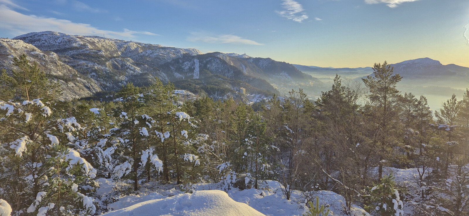
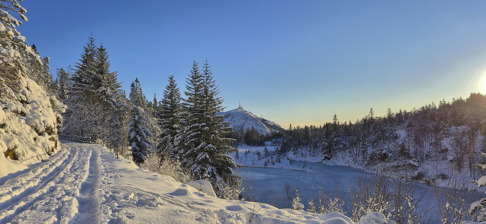
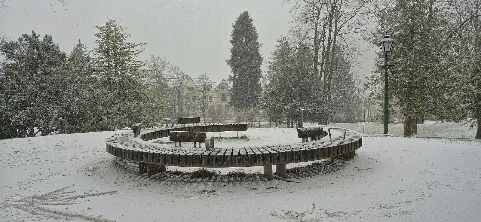
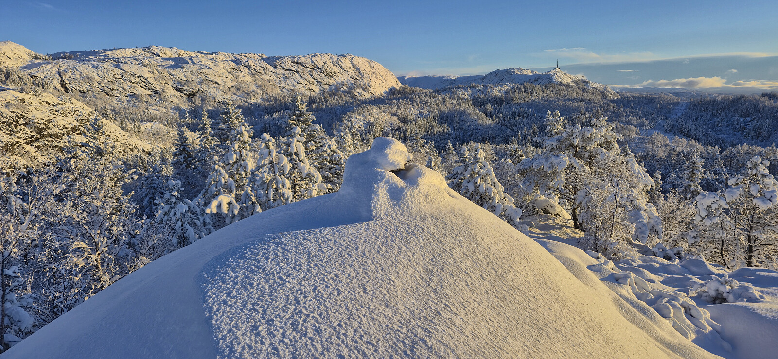 The first hike of 2026 in a winter wonderland of new snow!
Across Hellen festning
- Datum:
- 31.12.2025
- Tourcharakter:
- Wanderung
- Tourlänge:
- 0:41h
- Entfernung:
- 3,2km
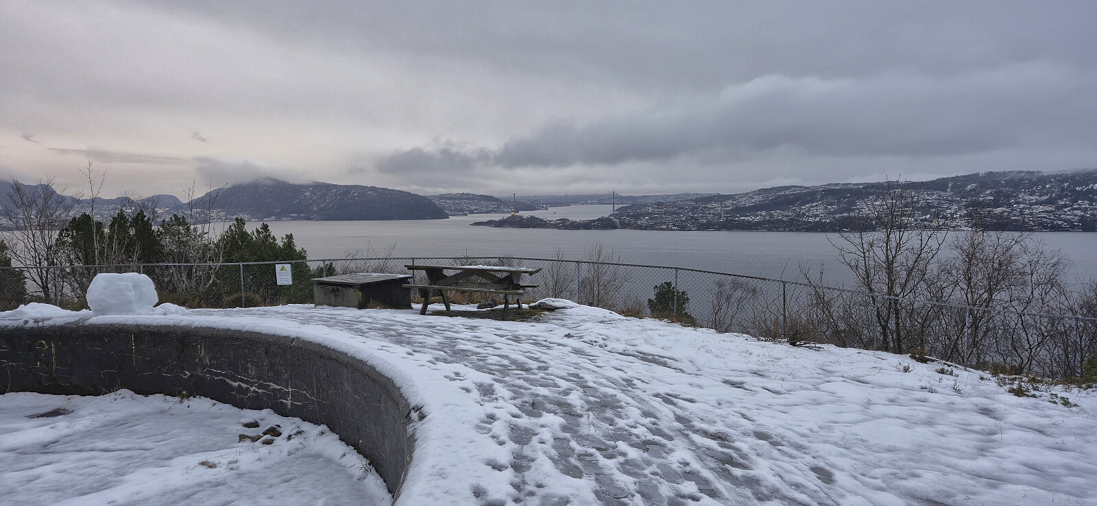 The last hike of 2025 across a slippery Hellen festning in between rain showers.
Nygårdshøyden
- Datum:
- 30.12.2025
- Tourcharakter:
- Spaziergang
- Tourlänge:
- 0:30h
- Entfernung:
- 2,4km
 A short walk to a location I have passed by many times but never bothered to register a visit until it was added as its own PB-element one day earlier.
Ådnagavlen from Eide to Seim
- Datum:
- 29.12.2025
- Tourcharakter:
- Bergtour
- Tourlänge:
- 3:49h
- Entfernung:
- 12,7km
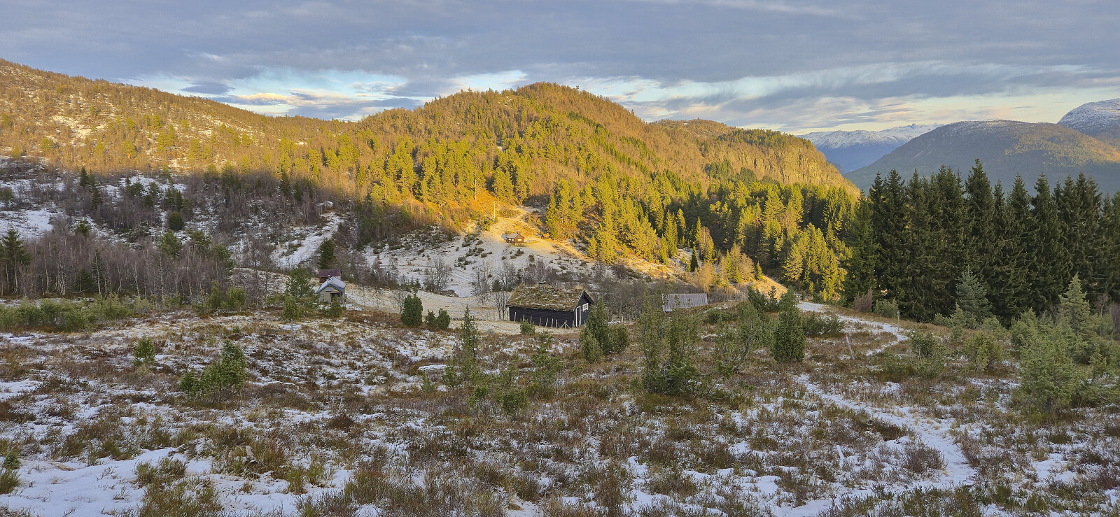
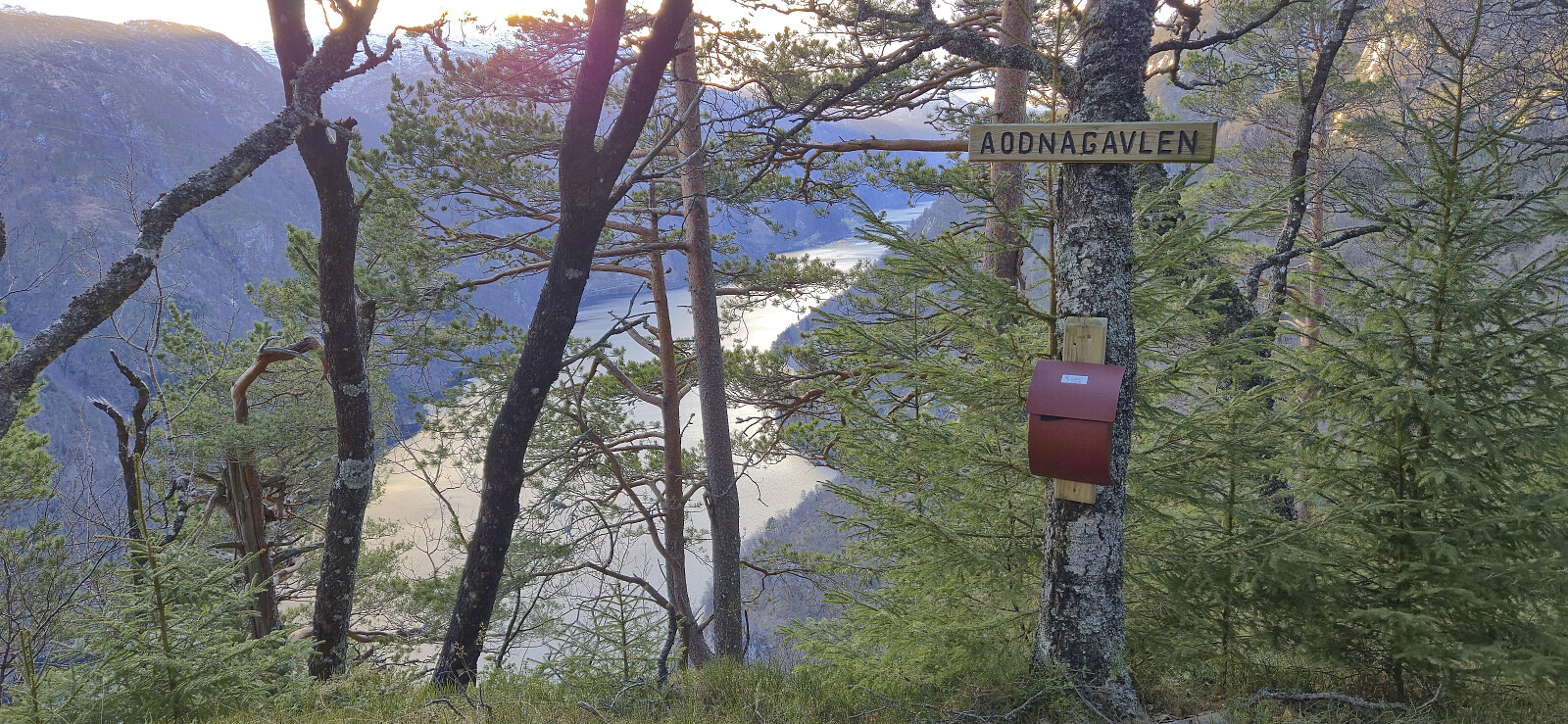 With a vertical separation of 99.5, Ådnagavlen is just shy of the 100 meters required to be part of the Hordaland ≥ 100m pf. list , and (partly) as a result it only had one previous ascent registered on PB. When preparing for my hike, I initially struggled to find any details regarding recommended trails from Eide. This however changed when learning that the locals refer to the peak as Aodnagavlen, with the most useful resource being a route description (in Norwegian) from Granvin Turlag .
After taking the train to Voss and the bus to Granvin terminal, I continued southwest along the main road to Jaunsen Gjestgjevarstad where I came across the first sign for Aodnagavlen. From there on it was relatively straightforward to follow the red trail markers. As recommended in the route description I however left the marked trail for a short detour along the impressive world war II trenches >>>
With a vertical separation of 99.5, Ådnagavlen is just shy of the 100 meters required to be part of the Hordaland ≥ 100m pf. list , and (partly) as a result it only had one previous ascent registered on PB. When preparing for my hike, I initially struggled to find any details regarding recommended trails from Eide. This however changed when learning that the locals refer to the peak as Aodnagavlen, with the most useful resource being a route description (in Norwegian) from Granvin Turlag .
After taking the train to Voss and the bus to Granvin terminal, I continued southwest along the main road to Jaunsen Gjestgjevarstad where I came across the first sign for Aodnagavlen. From there on it was relatively straightforward to follow the red trail markers. As recommended in the route description I however left the marked trail for a short detour along the impressive world war II trenches >>>
Ørneberget and Rognåsen
- Datum:
- 28.12.2025
- Tourcharakter:
- Bergtour
- Tourlänge:
- 1:28h
- Entfernung:
- 6,1km
 Short local Sunday hike.
Across Hellen festning
- Datum:
- 27.12.2025
- Tourcharakter:
- Wanderung
- Tourlänge:
- 0:37h
- Entfernung:
- 3,1km
 Short local hike after returning from Sogndal to Bergen by boat.
Røvhaugane and Skjeggen
- Datum:
- 26.12.2025
- Tourcharakter:
- Bergtour
- Tourlänge:
- 3:56h
- Entfernung:
- 13,0km
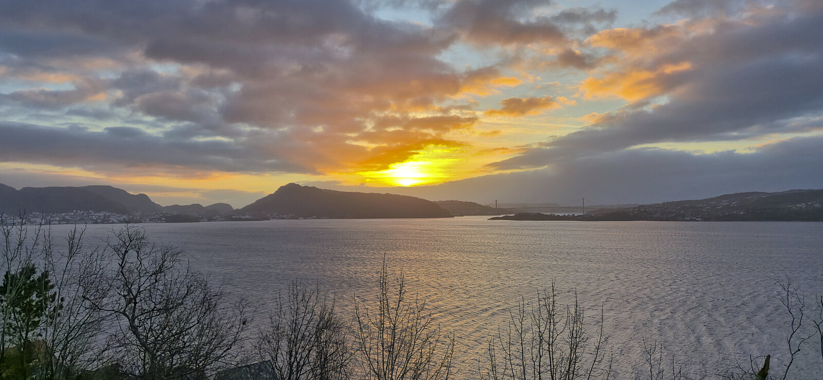
 After a joint hike via Røvhaugane to Åberge, I continued on my own along the gravel road to Hølsete before following the marked trail via Ljøtaholet to the excellent viewpoint at Skjeggen and finally returning to Sogndalsfjøra via Hølsete.
