Archiv - Nach Datum
Archiv - Nach Aktivität
-
Andere Tour (3)
- Kayaking (3)
-
Fahrradtour (111)
- Fahrradtour Straße (86)
- Fahrradtour gemischt (25)
-
Fahrzeugtour (9)
- Autotour (9)
-
Fußtour (1897)
- Bergtour (1120)
- Jogging (1)
- Spaziergang (60)
- Wanderung (716)
-
Skitour (116)
- Langlauf (47)
- Tourenskilauf (69)
Gesammelte Listen
-
Utvalgte topper og turmål i Bergen
(349/351)
 99%
99% -
Alle topper i Bergen
(393/400)
98%
-
Voss ≥ 100m pf.
(96/98)
97%
-
Opptur Hordaland
(144/159)
90%
-
Stasjoner på Bergensbanen
(33/40)
82%
-
Ulvik ≥ 100m pf.
(30/38)
78%
-
Hordaland ≥ 100m pf.
(624/863)
72%
-
Mjølfjell PF > 100m
(21/31)
67%
-
Jondal ≥ 100m pf.
(15/23)
65%
-
Dagsturhyttene i Vestland
(36/61)
59%
-
Sunnhordland PF >= 100m
(105/186)
56%
-
Hordaland: Hardanger PF>=100m
(196/359)
54%
-
DNT-hytter i Hordaland
(23/45)
51%
-
Kvinnherad ≥ 100m pf.
(40/79)
50%
-
Eidfjord ≥ 100m pf.
(13/42)
30%
-
Sogndal ≥ 100m pf.
(23/81)
28%
-
Gulen ≥ 100m pf.
(15/54)
27%
-
Vik i Sogn ≥ 100m pf.
(10/46)
21%
-
Sogn - Sør for Sognefjorden PF>=100m
(31/159)
19%
-
DNT-hytter i Sogn og Fjordane
(8/47)
17%

Cycling: Glasskaråsen and Våganeset
- Datum:
- 04.08.2021
- Tourcharakter:
- Fahrradtour Straße
- Tourlänge:
- 3:12h
- Entfernung:
- 24,8km
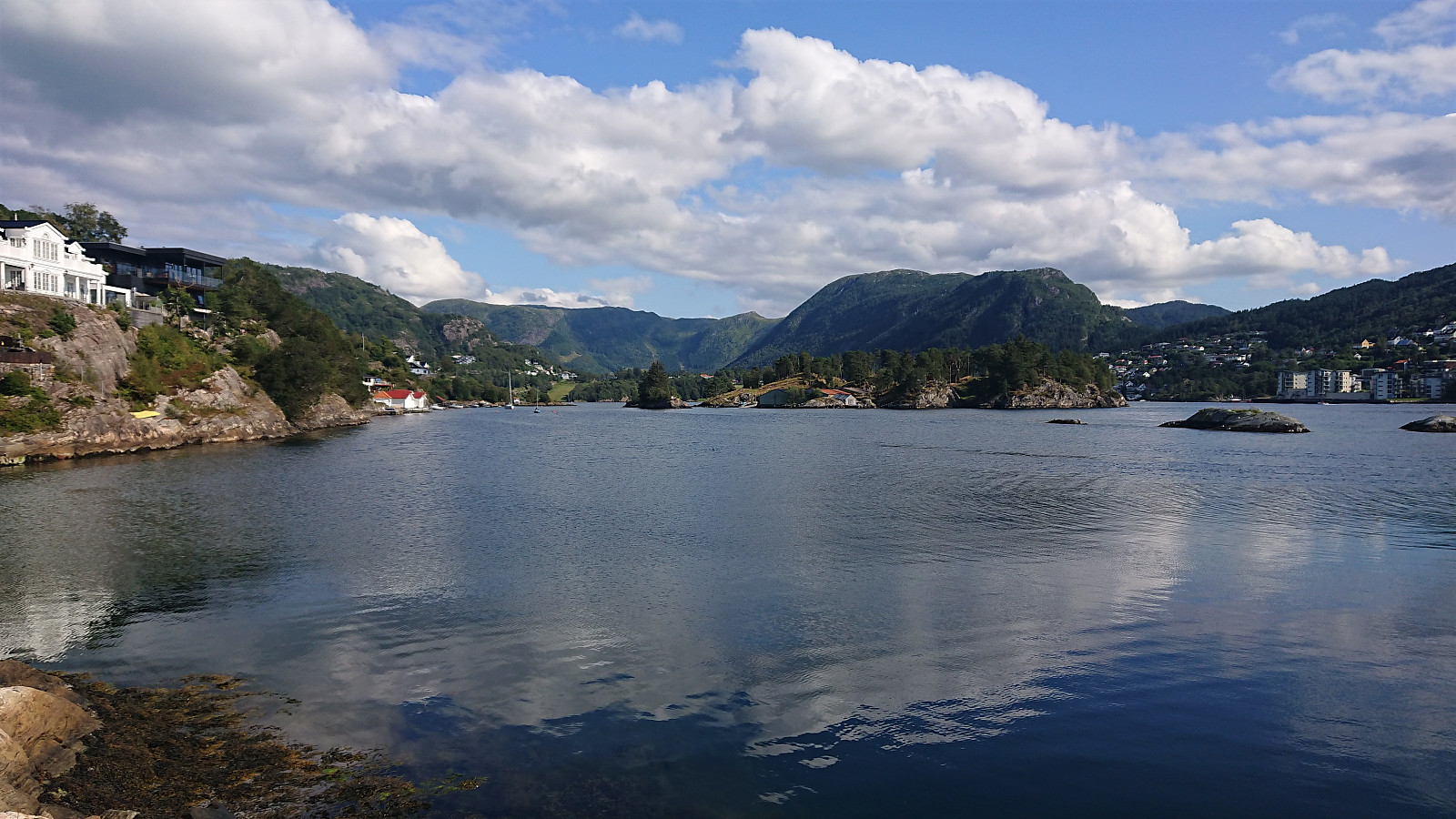 Short local cycling trip exploring Glasskaråsen and Våganeset/Nedre Åstveit.
Rødsaksla
- Datum:
- 03.08.2021
- Tourcharakter:
- Bergtour
- Tourlänge:
- 1:43h
- Entfernung:
- 4,3km
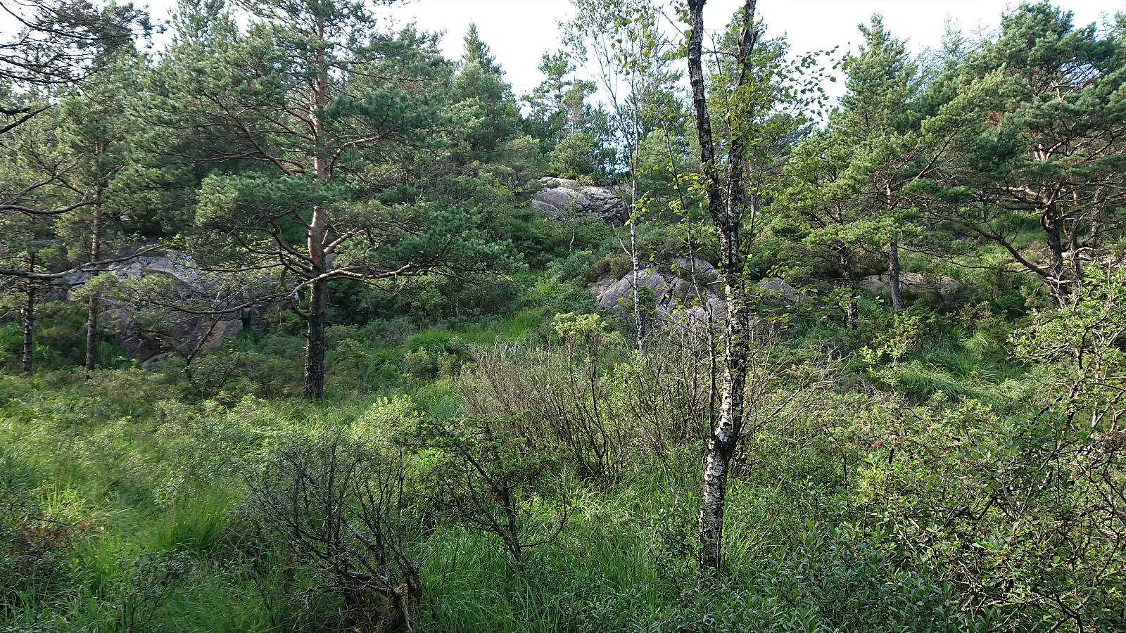 Afternoon hike with the goal of visiting Rødsaksla , a minor summit on the Alle topper i Bergen list. I started by taking the bus to Rød, where I for some reason thought that I ought to get off at the bus stop referred to as "Rød nord, Bergen", while the correct one would have been "Rød sør, Bergen" which is located right next to the trailhead. But after a short 500 meters walk along the road I arrived at the unmarked trailhead discovered by knutsverre (Knut S. Andersen) and Astrid (Astrid S. Andersen) on their hike to Rødsaksla a couple of months earlier .
This resulted in it being straightforward to get pretty close to the summit, even though the trail turned rather weak towards the end. (Note that as the GPS track indicates, I also made a short attempt at a more direct shortcut by following an alternative trail early on. But decided to return to the main trail when the alternative trail ended in a wet >>>
Afternoon hike with the goal of visiting Rødsaksla , a minor summit on the Alle topper i Bergen list. I started by taking the bus to Rød, where I for some reason thought that I ought to get off at the bus stop referred to as "Rød nord, Bergen", while the correct one would have been "Rød sør, Bergen" which is located right next to the trailhead. But after a short 500 meters walk along the road I arrived at the unmarked trailhead discovered by knutsverre (Knut S. Andersen) and Astrid (Astrid S. Andersen) on their hike to Rødsaksla a couple of months earlier .
This resulted in it being straightforward to get pretty close to the summit, even though the trail turned rather weak towards the end. (Note that as the GPS track indicates, I also made a short attempt at a more direct shortcut by following an alternative trail early on. But decided to return to the main trail when the alternative trail ended in a wet >>>
Across Hellen festning
- Datum:
- 02.08.2021
- Tourcharakter:
- Wanderung
- Tourlänge:
- 0:36h
- Entfernung:
- 3,1km
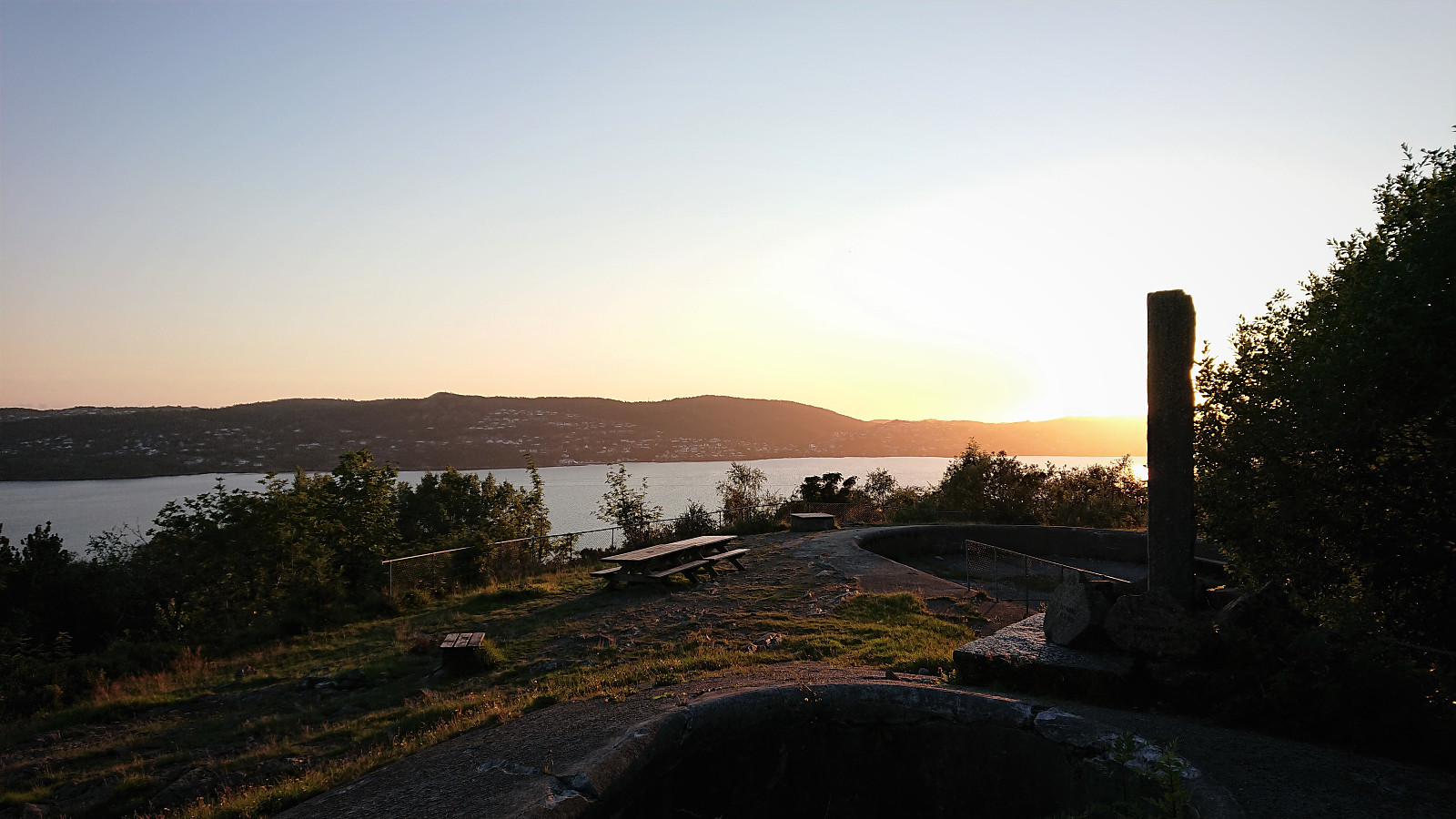 Short local evening hike after driving home from Sogndal.
Fannaråken from Turtagrø
- Datum:
- 01.08.2021
- Tourcharakter:
- Bergtour
- Tourlänge:
- 7:49h
- Entfernung:
- 19,2km
 We drove from Sogndal to Turtagrø and parked at the opposite side of the road from Turtagrø Hotell . Lots of other hikers at Turtagrø, but as soon as we started on the trail towards Helgedalen, the number of people rapidly decreased and we soon found ourselves all on our own. (In fact, we would meet less than 50 people for the entire hike.) We shortly connected with the gravel road in Helgedalen, which we then proceeded to follow until reaching the marked trail for Fannaråken below Ekrehytta.
After this easy start of just over 200 vertical meters spread out over a bit less than 5 km, the real hike started with another 900 meters left to climb over less than half the distance. The trail was clearly marked and overall easy to follow, and there were only a couple of short sections early on where hikers with a severe fear of heights might struggle. We actually >>>
We drove from Sogndal to Turtagrø and parked at the opposite side of the road from Turtagrø Hotell . Lots of other hikers at Turtagrø, but as soon as we started on the trail towards Helgedalen, the number of people rapidly decreased and we soon found ourselves all on our own. (In fact, we would meet less than 50 people for the entire hike.) We shortly connected with the gravel road in Helgedalen, which we then proceeded to follow until reaching the marked trail for Fannaråken below Ekrehytta.
After this easy start of just over 200 vertical meters spread out over a bit less than 5 km, the real hike started with another 900 meters left to climb over less than half the distance. The trail was clearly marked and overall easy to follow, and there were only a couple of short sections early on where hikers with a severe fear of heights might struggle. We actually >>>
