Archiv - Nach Datum
Archiv - Nach Aktivität
-
Andere Wintertour (3)
- Schneeschuhtour (3)
-
Fahrzeugtour (1)
- Autotour (1)
- Fußtour (137)
-
Klettern (23)
- Alpinklettern (9)
- Klettersteig (2)
- Sportklettern (11)
-
Skitour (62)
- Langlauf (1)
- Randonnée/Telemark (58)
- Tourenskilauf (3)


Gesammelte Listen
-
Norges 1000 største fjell målt i primærfaktor
(45/1000)
 4%
4%

Lieblingstouren
Lieblingsgipfel


Snømannen og Lavangstinden
- Datum:
- 28.08.2021
- Tourcharakter:
- Bergtour
- Tourlänge:
- 4:10h
- Entfernung:
- 18,9km
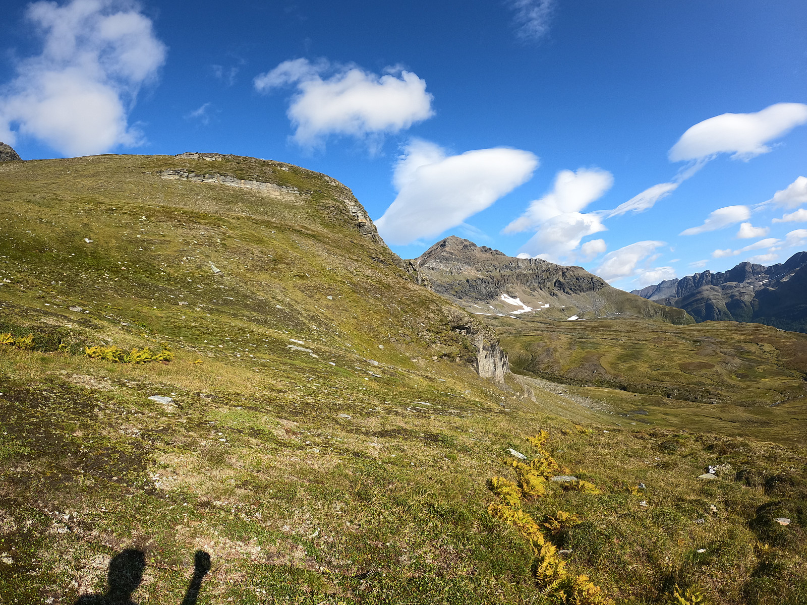 Mest parten av denne turen foregikk uten en tydelig sti, men terrenget var såpas fint at turen var hovedsakelig løpbar (i hvert fall nedover) :)
Parkerte ved siden av benken og ti på topp skiltet i Elvås. Herifra løpte jeg opp en grusvei, og over et jorda før jeg kom på en fin, tydelig sti. Fulgte stien videre og krysset et myrparti før jeg møt en firehjulingvei som var forferdelig gjørmete og ganske irriterende å gå på. På Norgeskart står det at stien skal ta av til venstre, men jeg kunne ikke se noe og fortsatt bare i samme retning. Når jeg kom opp på ca 500moh flatet terrenget ut og man fikk god oversikt over dalen videre mot snømannen. Her så jeg en veistikke et stykke unna mot vest, som jeg løpte mot før jeg begynte å ta høyde igjen. Dette viste seg til å være helt >>>
Mest parten av denne turen foregikk uten en tydelig sti, men terrenget var såpas fint at turen var hovedsakelig løpbar (i hvert fall nedover) :)
Parkerte ved siden av benken og ti på topp skiltet i Elvås. Herifra løpte jeg opp en grusvei, og over et jorda før jeg kom på en fin, tydelig sti. Fulgte stien videre og krysset et myrparti før jeg møt en firehjulingvei som var forferdelig gjørmete og ganske irriterende å gå på. På Norgeskart står det at stien skal ta av til venstre, men jeg kunne ikke se noe og fortsatt bare i samme retning. Når jeg kom opp på ca 500moh flatet terrenget ut og man fikk god oversikt over dalen videre mot snømannen. Her så jeg en veistikke et stykke unna mot vest, som jeg løpte mot før jeg begynte å ta høyde igjen. Dette viste seg til å være helt >>>
Litle Durmålstinden
- Datum:
- 14.08.2021
- Tourcharakter:
- Bergtour
- Tourlänge:
- 4:55h
- Entfernung:
- 14,6km
 Denne turen ble veldig fin, med en del variert terreng og mye fastere stein enn man finner nok i resten Lyngen.
Vi parkerte langs veien i en stor parkeringsplass nært Rydeng og begynte å løpe opp en overgrodd firehjulingsvei, før vi krysset inntil et beiteområde for sau. Her var stien sporadisk på sin beste, men hovedsakelig ikke eksisterende. Det var en del lyng og terrenget ble mer tung gått mens vi tok høydemeter mot den haugen som på kartet heter Moskofjellet. Etter å ha kommet gjennom noen busker kom vi over ´skoggrensen´ og terrenget var lettgått ned mot Svartvatnet. Her møt vi en fin sti som vi løpt på langs vatnet, før vi ankom steinuren.
Vi siktet litt mer mot nord for å komme inntil hva så ut som den minst løs del av uren. Her gikk det helt kurant å komme opp på >>>
Denne turen ble veldig fin, med en del variert terreng og mye fastere stein enn man finner nok i resten Lyngen.
Vi parkerte langs veien i en stor parkeringsplass nært Rydeng og begynte å løpe opp en overgrodd firehjulingsvei, før vi krysset inntil et beiteområde for sau. Her var stien sporadisk på sin beste, men hovedsakelig ikke eksisterende. Det var en del lyng og terrenget ble mer tung gått mens vi tok høydemeter mot den haugen som på kartet heter Moskofjellet. Etter å ha kommet gjennom noen busker kom vi over ´skoggrensen´ og terrenget var lettgått ned mot Svartvatnet. Her møt vi en fin sti som vi løpt på langs vatnet, før vi ankom steinuren.
Vi siktet litt mer mot nord for å komme inntil hva så ut som den minst løs del av uren. Her gikk det helt kurant å komme opp på >>>
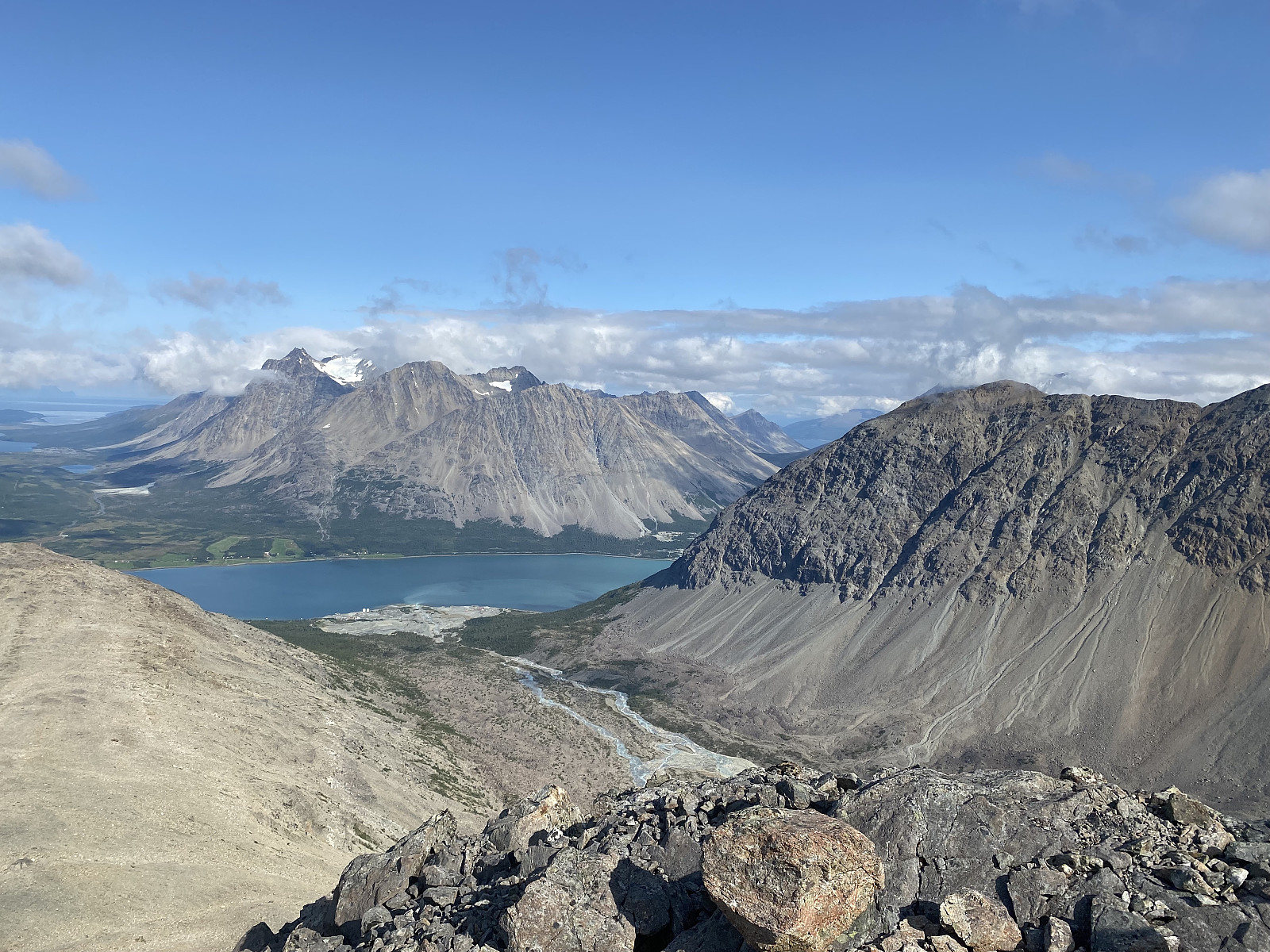
Store Kågtinden
- Datum:
- 07.08.2021
- Tourcharakter:
- Bergtour
- Tourlänge:
- 3:51h
- Entfernung:
- 13,0km
 Etter jeg endelig fikk tatt helg sent på lørdags ettermiddag, satt jeg kurs mot Kågen. Jeg hadde glemt helt av at det fortsatt er tunnelarbeid fra fastlandet, og det ble noen minutters panikk før research teamet ga beskjed at jeg kunne rekke kolonnekjøring kl21 om jeg skynde meg :)
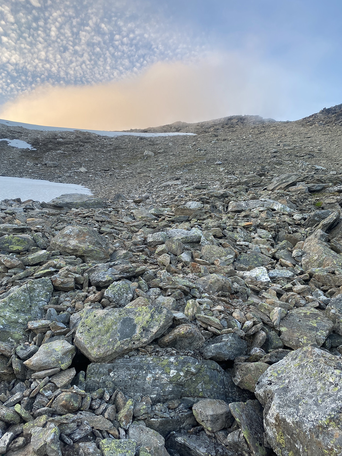
Jeg parkerte ved en stor parkeringsplass, og startstedet for turen er markert med skilt. Jeg begynte å løpe opp anleggsveien en plass etter 2130, men det var 2145 før jeg innså at jeg ikke hadde startet klokken. Stien videre til Store Kågtinden var markert med en varde på høyre siden av veien rundt 250moh. Herifra var det en sti av varierende synlighet inn i dalen. Man kom straks til det første av mye steinur, og herifra gikk det betydelig saktere. Det var hovedsakelig store stein og det gikk helt fint >>>
Etter jeg endelig fikk tatt helg sent på lørdags ettermiddag, satt jeg kurs mot Kågen. Jeg hadde glemt helt av at det fortsatt er tunnelarbeid fra fastlandet, og det ble noen minutters panikk før research teamet ga beskjed at jeg kunne rekke kolonnekjøring kl21 om jeg skynde meg :)
Jeg parkerte ved en stor parkeringsplass, og startstedet for turen er markert med skilt. Jeg begynte å løpe opp anleggsveien en plass etter 2130, men det var 2145 før jeg innså at jeg ikke hadde startet klokken. Stien videre til Store Kågtinden var markert med en varde på høyre siden av veien rundt 250moh. Herifra var det en sti av varierende synlighet inn i dalen. Man kom straks til det første av mye steinur, og herifra gikk det betydelig saktere. Det var hovedsakelig store stein og det gikk helt fint >>>
Vasskartinden
- Datum:
- 30.07.2021
- Tourcharakter:
- Bergtour
- Tourlänge:
- 3:59h
- Entfernung:
- 9,4km
 Fjelltopper over 1000m på Norske øyer
Skulle egentlig ta en kort, rolig løpetur i dag, men våknet til mer sol enn var meldt. Bestemte meg for å prøve Vasskartinden, og etter litt research viste det seg at turen kommer til å foregå i ganske treigt terreng.
Jeg kjørte av hovedveien etter Vasskaret skiltet, og kjørt videre opp grusveien før jeg ankom en gård rett under fjellet. Her var det masse gamle biler og en traktorvei som gikk rett inn mot Vasskartinden. Parkerte bilen her og fulgte traktorveien, først klarte jeg å løpe inn til selve huset på gården før jeg skjønte at det ikke var dit jeg skulle. Løpte deretter ut igjen, og siktet meg mot fjellet. I følge Norgeskart er det sti her, men jeg fant knapt tegn på mennesker. Det var bare å traske opp i bratt overgrodd terreng, >>>
Fjelltopper over 1000m på Norske øyer
Skulle egentlig ta en kort, rolig løpetur i dag, men våknet til mer sol enn var meldt. Bestemte meg for å prøve Vasskartinden, og etter litt research viste det seg at turen kommer til å foregå i ganske treigt terreng.
Jeg kjørte av hovedveien etter Vasskaret skiltet, og kjørt videre opp grusveien før jeg ankom en gård rett under fjellet. Her var det masse gamle biler og en traktorvei som gikk rett inn mot Vasskartinden. Parkerte bilen her og fulgte traktorveien, først klarte jeg å løpe inn til selve huset på gården før jeg skjønte at det ikke var dit jeg skulle. Løpte deretter ut igjen, og siktet meg mot fjellet. I følge Norgeskart er det sti her, men jeg fant knapt tegn på mennesker. Det var bare å traske opp i bratt overgrodd terreng, >>>
Snøtinden
- Datum:
- 29.07.2021
- Tourcharakter:
- Bergtour
- Tourlänge:
- 4:00h
- Entfernung:
- 15,3km
 Fjelltopper over 1000m på Norske øyer
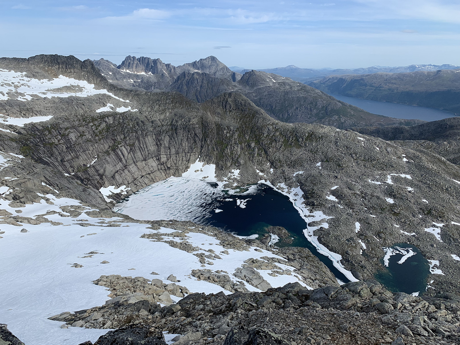
Etter jeg parkerte bilen ved veiens ende i Ånstad (Munnhågen?) fulgte jeg grusveien og etter hvert en godt markert, upåklagelig sti videre inn i dalen mot Stillelva. Fra stillelva fulgte jeg skilting mot Måsan. Her var stien av litt dårligere kvalitet, men fortsatt tydelig og godt markert. Når man ankommer postkassen Måsan, svinger man i nordlig retning over en liten hump før man får sitt første blikk mot de siste 500 høydemeterne opp Snøtinden. Her oppe var det utrolig fint, med nydelig utsikt over fjorden til fastlandet og rolla, samt mot Ristinden og Åtinden (som begge to fortsatt er på listen).
Herifra var det sporadisk sti etter sau, men det var ikke vits å følge disse og jeg siktet meg mot den renna midt på fjellet. Terrenget ble >>>
Fjelltopper over 1000m på Norske øyer
Etter jeg parkerte bilen ved veiens ende i Ånstad (Munnhågen?) fulgte jeg grusveien og etter hvert en godt markert, upåklagelig sti videre inn i dalen mot Stillelva. Fra stillelva fulgte jeg skilting mot Måsan. Her var stien av litt dårligere kvalitet, men fortsatt tydelig og godt markert. Når man ankommer postkassen Måsan, svinger man i nordlig retning over en liten hump før man får sitt første blikk mot de siste 500 høydemeterne opp Snøtinden. Her oppe var det utrolig fint, med nydelig utsikt over fjorden til fastlandet og rolla, samt mot Ristinden og Åtinden (som begge to fortsatt er på listen).
Herifra var det sporadisk sti etter sau, men det var ikke vits å følge disse og jeg siktet meg mot den renna midt på fjellet. Terrenget ble >>>
Øst for Smalaktinden
- Datum:
- 14.07.2021
- Tourcharakter:
- Bergtour
- Tourlänge:
- 4:00h
- Entfernung:
- 13,1km
 En vakkert tur i nydelige omgivelser. Turen begynte i overgrodd fjellterreng, og vi kom etterhvert inntil en fin sti. Terrenget var ganske våt med en del myr. Turen fortsatt ved siden av elven, og her holdt vi helt til høyre før vi eventuelt krysset elven ved toppen av dalen. Her siktet vi oss mot ryggen, som må være noe av det løseste stein jeg har vært borti siden Store Kvænangstinden :) Nydelig utsikt mot det fineste toppene i Lyngen, bla. jiehkkevárri. Vi returnerte samme vei.
Soria Moria Traversen
- Datum:
- 11.08.2019
- Tourcharakter:
- Bergtour
- Tourlänge:
- 4:30h
- Entfernung:
- 9,5km
 Øytopper ≥ 1000 meter (fastland)
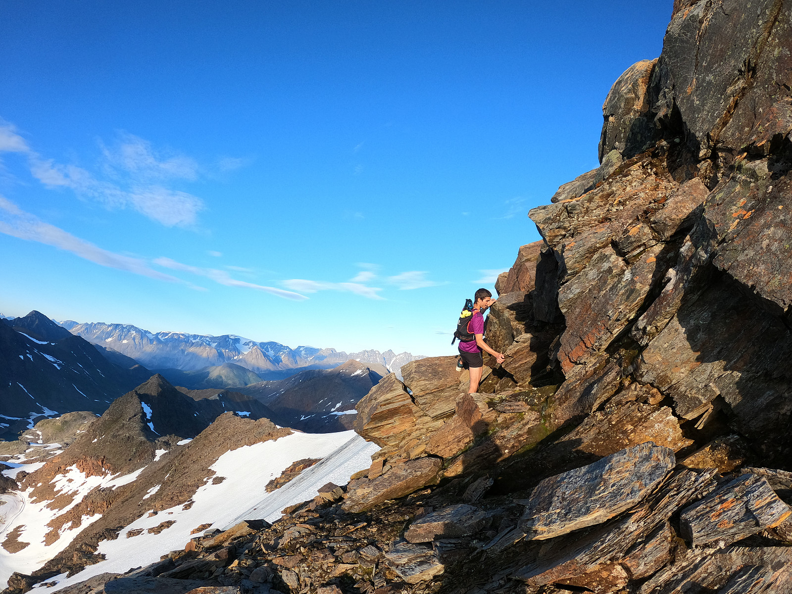
Another Sunday of scrambling with hmsv1 (Hannah Vickers) :) We hiked from left to right, starting from following the path from the parking lot and then taking to the left over a boulder field and continuing on up to top 884. Once we reached top 884 we were rewarded with stunning views over the entire ridge. From here we had some sections of good scrambling and came to Hannahs nervous point - two parallell rocks with a 2 meter drop down. Fun! After this, it was easy going up to Storsteinnestinden, where the views were magnificent. We continued onto Leirholstinden, encountering one awkward bit of scrambling that was exposed below. There is some rocks assembled as someone has tried to make stairs, but we found it easier to pull ourselves up just to the left of these. From here we >>>
Øytopper ≥ 1000 meter (fastland)
Another Sunday of scrambling with hmsv1 (Hannah Vickers) :) We hiked from left to right, starting from following the path from the parking lot and then taking to the left over a boulder field and continuing on up to top 884. Once we reached top 884 we were rewarded with stunning views over the entire ridge. From here we had some sections of good scrambling and came to Hannahs nervous point - two parallell rocks with a 2 meter drop down. Fun! After this, it was easy going up to Storsteinnestinden, where the views were magnificent. We continued onto Leirholstinden, encountering one awkward bit of scrambling that was exposed below. There is some rocks assembled as someone has tried to make stairs, but we found it easier to pull ourselves up just to the left of these. From here we >>>
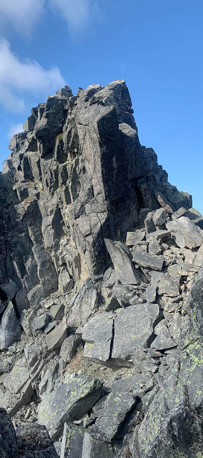
Store Kvænangstind - skrekk og gru!
- Datum:
- 09.08.2019
- Tourcharakter:
- Bergtour
- Tourlänge:
- 9:08h
- Entfernung:
- 21,7km
 We had arranged the day before to get a boat ride in to Meiland with a local, so we met him at Klubbeneshamn at 9am. The first challenge of the day was getting around the locked gate on the jetty, and with the sun shining we began walking around 9.30am, following a tractor path up from the few cabins. Soon the path turned into a great, well trodden trail through the forrest for around 45minutes until we came to Storvatnet. Along the way we met a local who was picking cloudberries and asked where we were going. He laughed and said nothing but 'Ha - Skrekk og gru!'. Once we reached the lake we stopped and discussed the weather, as it looked like the full sun and 15 degrees that Yr had forecast wasn’t going to be right. It was heavily overcast and around 8 degrees. Otto messaged Martin, who >>>
Middagstinden
- Datum:
- 07.08.2019
- Tourcharakter:
- Bergtour
- Tourlänge:
- 5:07h
- Entfernung:
- 11,3km
 Øytopper ≥ 1000 meter (fastland)
Undoubtably one of the best views on Kvaløya and the best, most challenging scrambling I've done to date. We parked in the big parking place opposite Tverrfjellet and followed the path up to the left hand side of the river. Around 500moh the trail flattened out, the trail disappeared and we followed the right hand side of Tverrfjellvatnet in easy terrain and over sturdy rocks. After around 45 minutes we started gaining elevation again, this time up looser rocks. The views were already stunning back over Katfjordeidet, over to Blåskredtinden and sommarøya.
We picked a path over the rocks until we came to a point where we could see two steep stone pillars. From here we scrambled around to the left which was very exposed. After completing this section we thought >>>
Øytopper ≥ 1000 meter (fastland)
Undoubtably one of the best views on Kvaløya and the best, most challenging scrambling I've done to date. We parked in the big parking place opposite Tverrfjellet and followed the path up to the left hand side of the river. Around 500moh the trail flattened out, the trail disappeared and we followed the right hand side of Tverrfjellvatnet in easy terrain and over sturdy rocks. After around 45 minutes we started gaining elevation again, this time up looser rocks. The views were already stunning back over Katfjordeidet, over to Blåskredtinden and sommarøya.
We picked a path over the rocks until we came to a point where we could see two steep stone pillars. From here we scrambled around to the left which was very exposed. After completing this section we thought >>>

