
Bildøybakken (18.04.2014)

Written by HHauser (Helwig Hauser)

| Start point | Skjergardsvegen (40m) |
|---|---|
| Endpoint | Skjergardsvegen (40m) |
| Characteristic | Hike |
| Duration | 3h 00min |
| Distance | 7.6km |
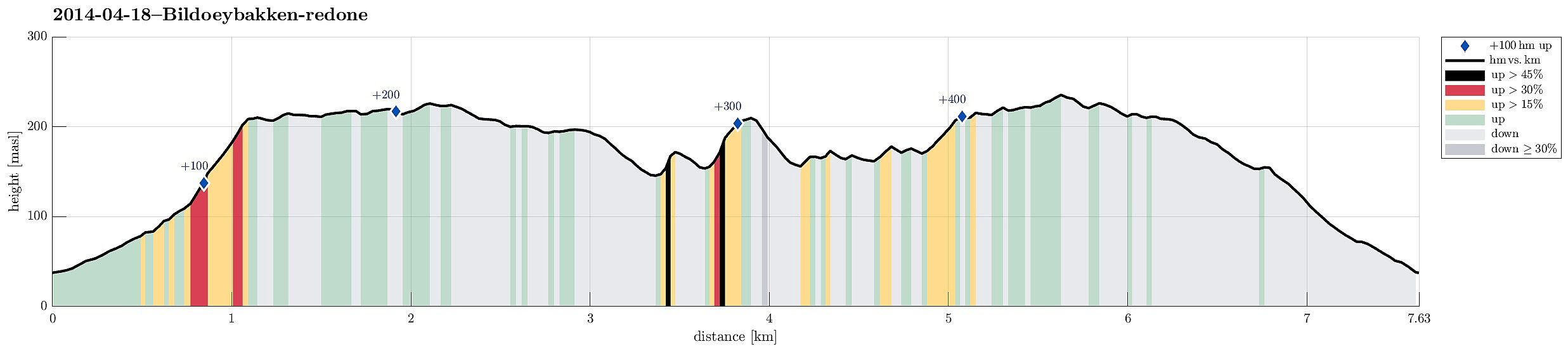
| Vertical meters | 450m |
| GPS |
|
| Ascents | Bildøybakken (220m) | 18.04.2014 |
|---|---|---|
| Skinntikavarden (238m) | 18.04.2014 | |
| Skitnafenet (239m) | 18.04.2014 | |
| Vardafjell (231m) | 18.04.2014 |
Note that this track has been created a posteriori, i.e., from memory, not automatically recorded.
Trip Summary
Nice and easy tour -- not much up, actually, but great views over the North Sea! One could also connect further to Pyttane and/or Liatårnet -- really a great hiking area! Note that parts of this tour (between km 3.6 and km 4.5) were without path, while still easy to go.
Useful Resources
Web page WestCoastPeaks.com provides useful information about Liatårnet
and also Petter Bjørstad has a useful page about Liatårnet.


User comments