
Nordre Soltinden (22.09.2013)


Skrevet av hmsv1 (Hannah Vickers)
| Startsted | Nordre Åborsneset |
|---|---|
| Turtype | Fjelltur |
| Turlengde | 5t 30min |
| Distanse | 10,0km |
| Kart |
|
| Bestigninger | Nordre Solltinden (1000moh) | 22.09.2013 |
|---|
The original plan this weekend was to go on a trip up Store Kågtinden with Ann Kristin (anngjel (Ann Kristin Gjelsten)) but we ended up dropping those plans partly because I woke up with a cold on the saturday and also because both yr and storm couldn't make up their minds if there was going to be good or less-than-satisfactory weather for sunday. Since it was about 3.5 hours to drive round to Kågen, we decided it was a bit of a long trip to risk being disappointed by the weather. So we ended up taking a spontaneous trip to Nordre Soltinden instead.
It wasn't the finest start to a sunday trip, I was not feeling completely in top form after not having slept well, and there was a light drizzle when I met up with Ann Kristin at the ICA Langnes car park at kl.11. Nevertheless, it seemed a bit of a shame to drop another trip so we drove to Ringvassøya anyway and hoped that we might find somewhat drier conditions there. The route started from just north of a bridge at Nordre Åborsneset and it was quite useful for us that there stood a sign on the left hand side by the track marked 'Soltinden'. Unfortunately with me walking in front, we completely missed the red route-markings and found ourselves doing a bit of unintended bush-wandering to get above the forest.
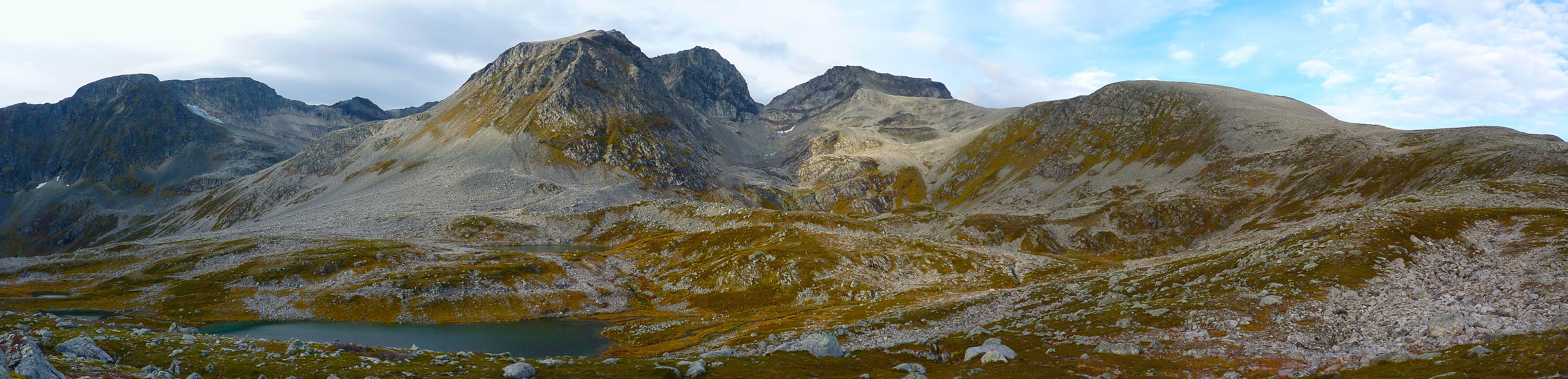
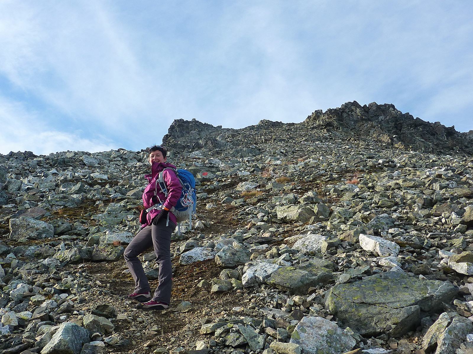
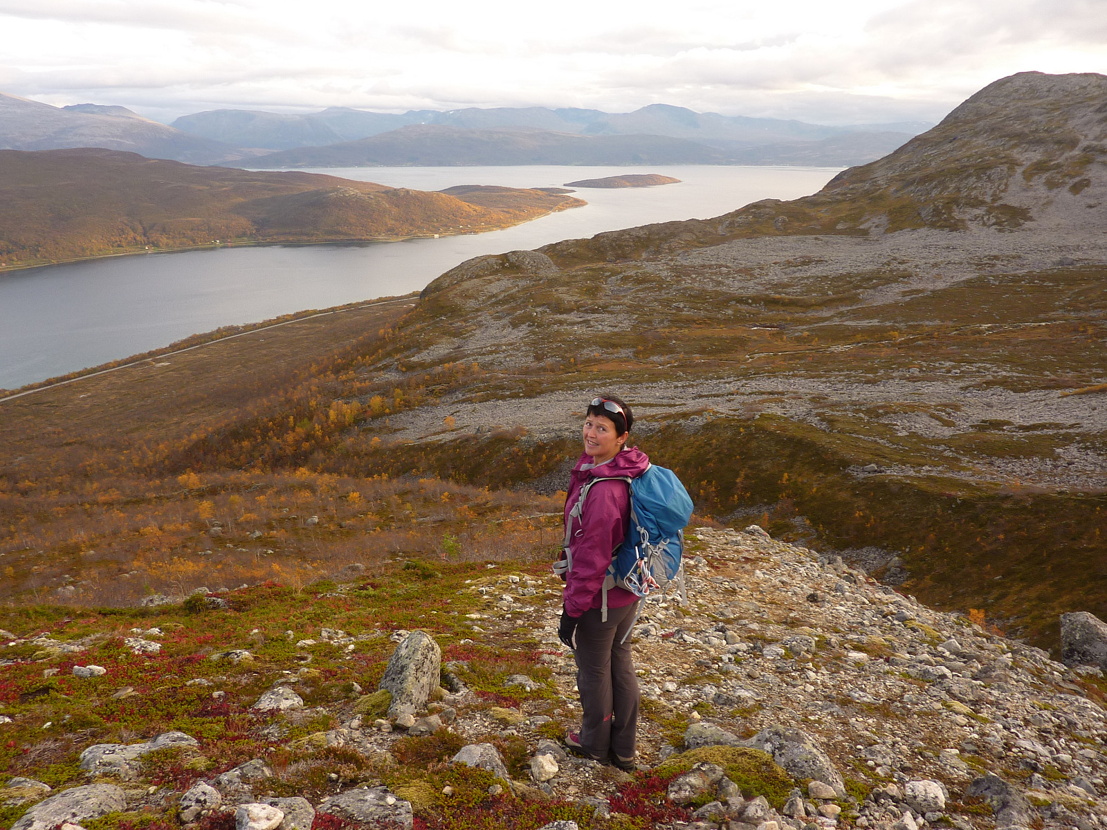
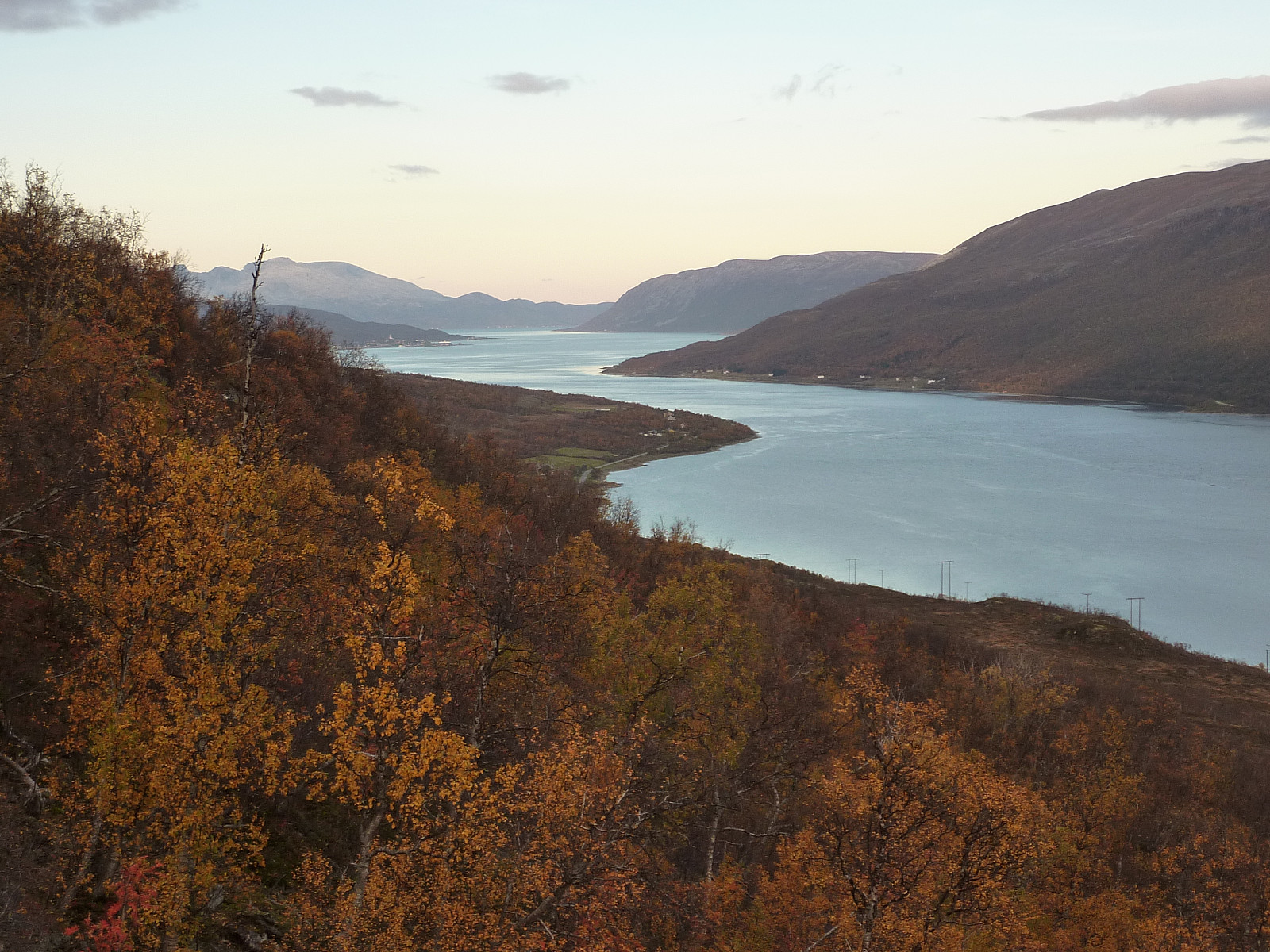
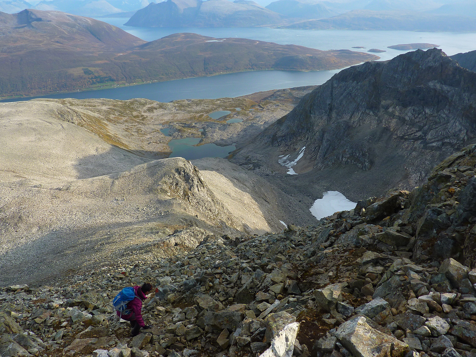
At least now with the autumn season upon us, the trees and bushes weren't so thick and dense and it wasn't too much of nightmare. But it took a little extra time before we finally hit the ridge/spur which the route was supposed to follow. Fortunately we caught sight of some red-painted sticks and were soon en-route again. Now there were pretty good views of Bjørnskardtinden, Åborsdaltinden and Soltinden in front of us. Surprisingly interesting-looking peaks here actually. We continued up the broad, gently rising ridge for a good while. It became flat after some time which was a bit boring. Good thing the weather was starting to become nice though, we hadn't expected to see any sun, or blue sky - but here it seemed we'd picked the right direction for a trip today.
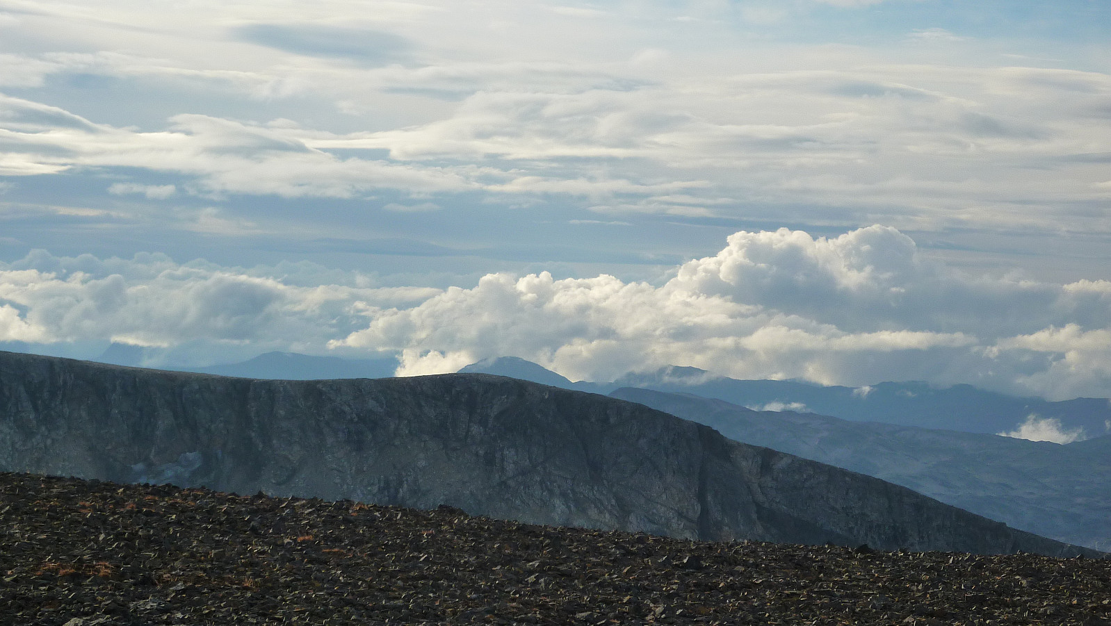
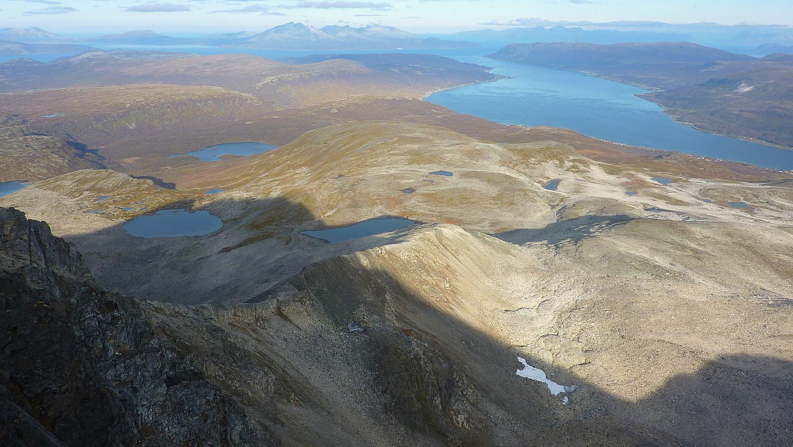
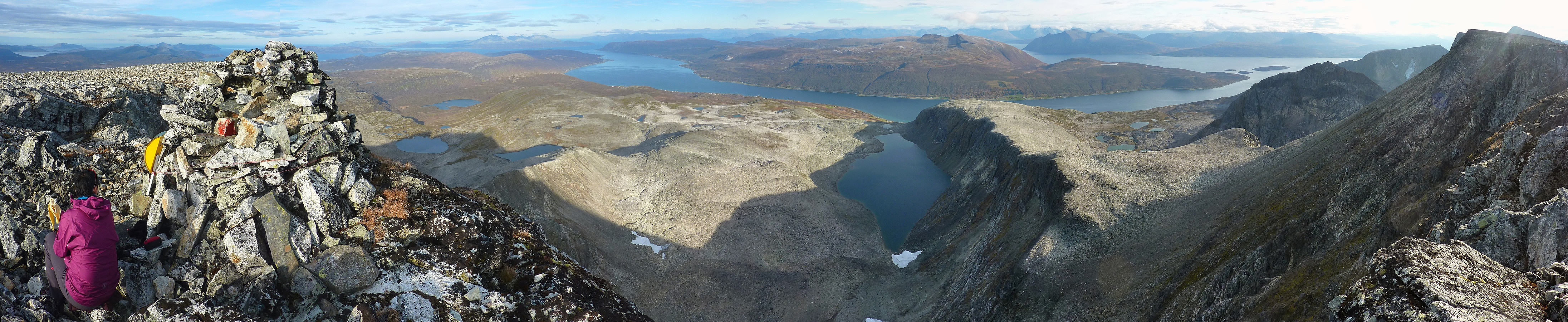
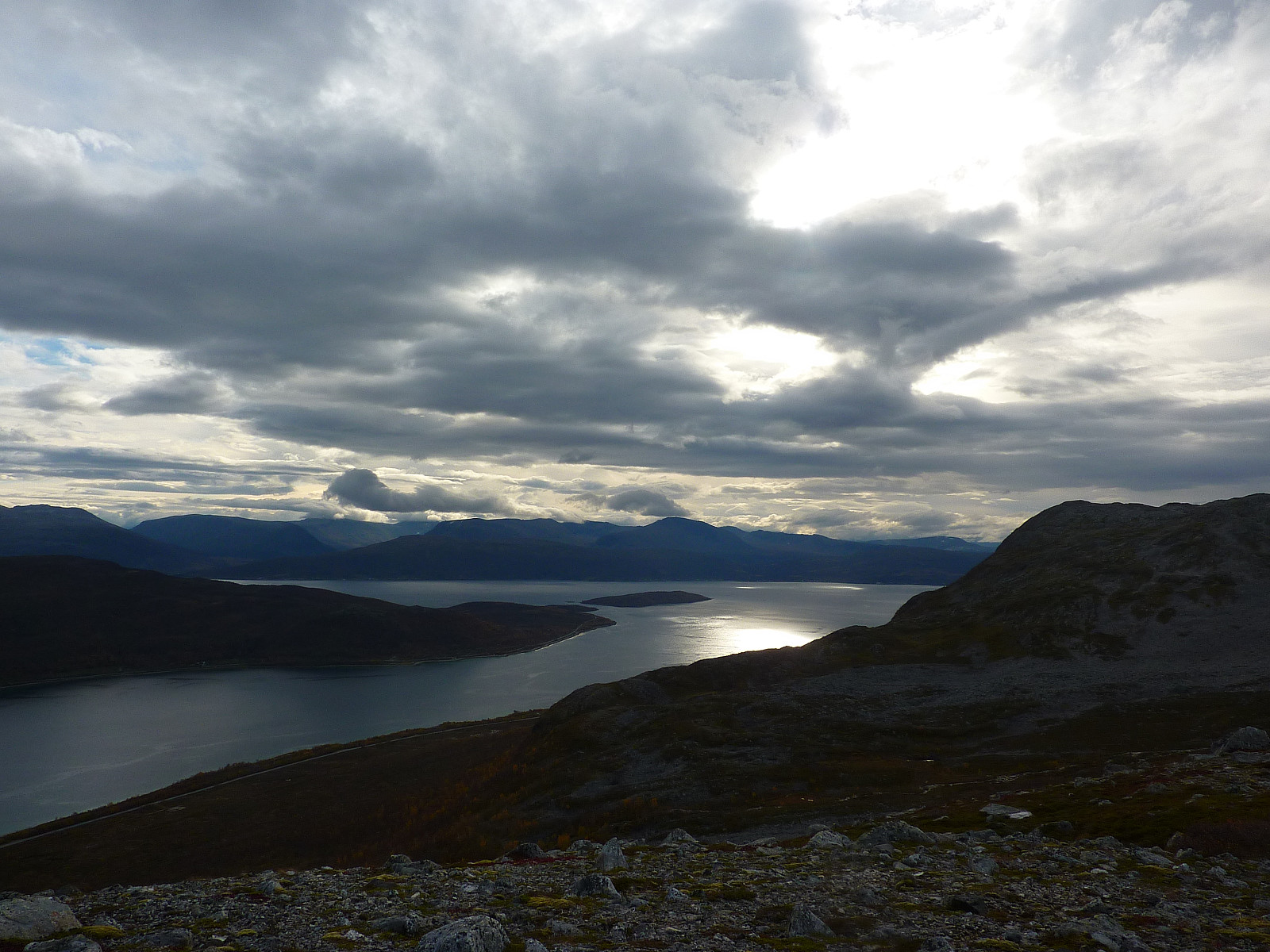
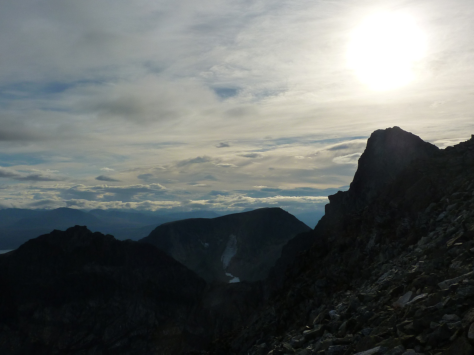
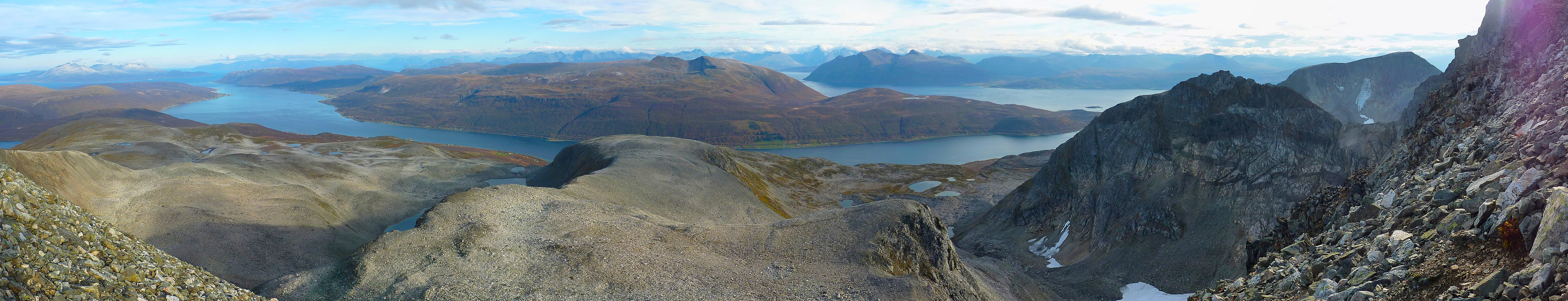
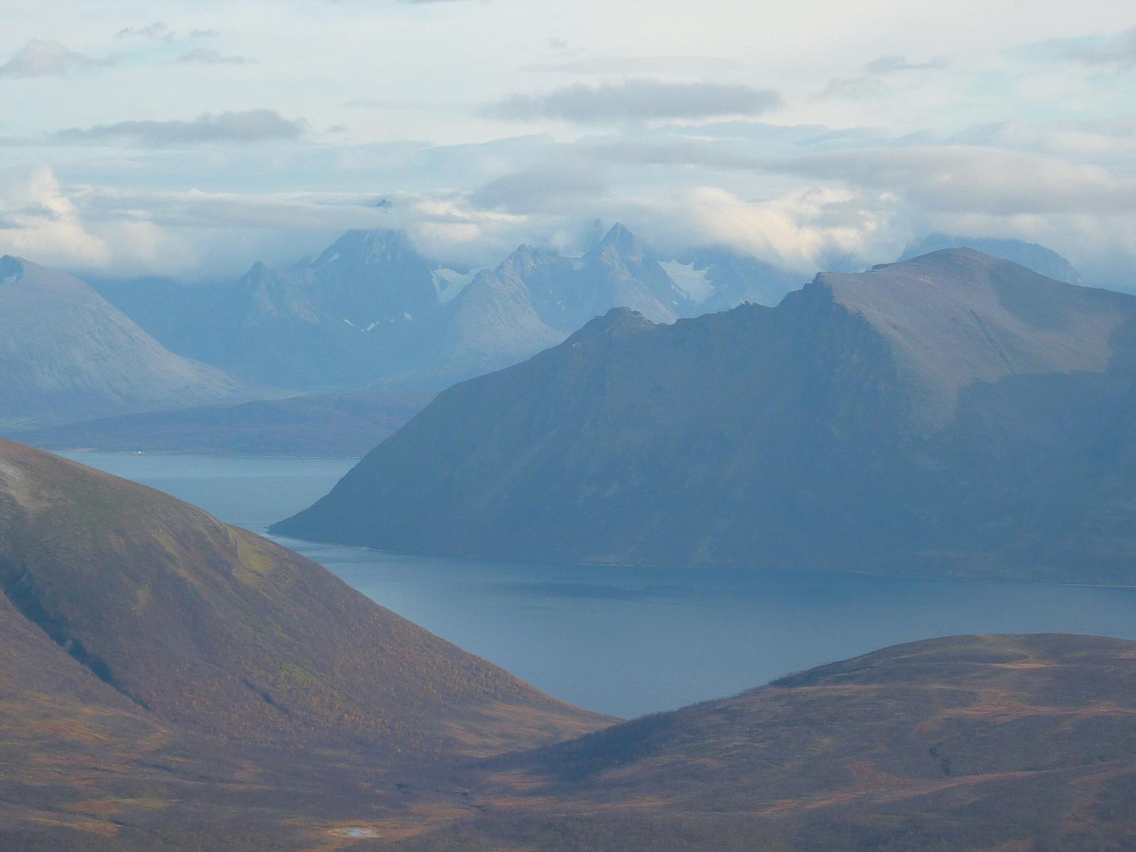
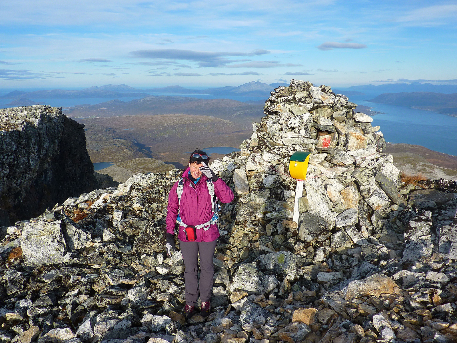
The last 200m in height gain were not the nicest, and probably the steepest part of the whole walk (not more than about 30 deg. though). Didn't really make it more pleasant that there were a lot of loose rocks. Both Ann Kristin and I had already started to think about how unpleasant the way down was going to be before we'd even got to the top! At least a sort of path helped to make the terrain a little easier-going than it otherwise would have been. We used just over 2.5 hours to get to the summit, which was fortunately not too windy. Confusing that the varden for the 'Rema 1000' top is at 992moh even though you have to walk past the 1000moh summit to get to it! Views towards all the islands were superb, although most of the mainland and everywhere west of us were still covered in cloud. Even though it was a little annoying that we'd dropped the Kågtinden trip, at least we'd got our fair share of decent trip weather after all - without having to travel so far to get it.
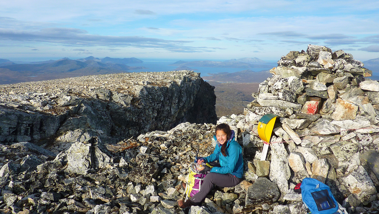
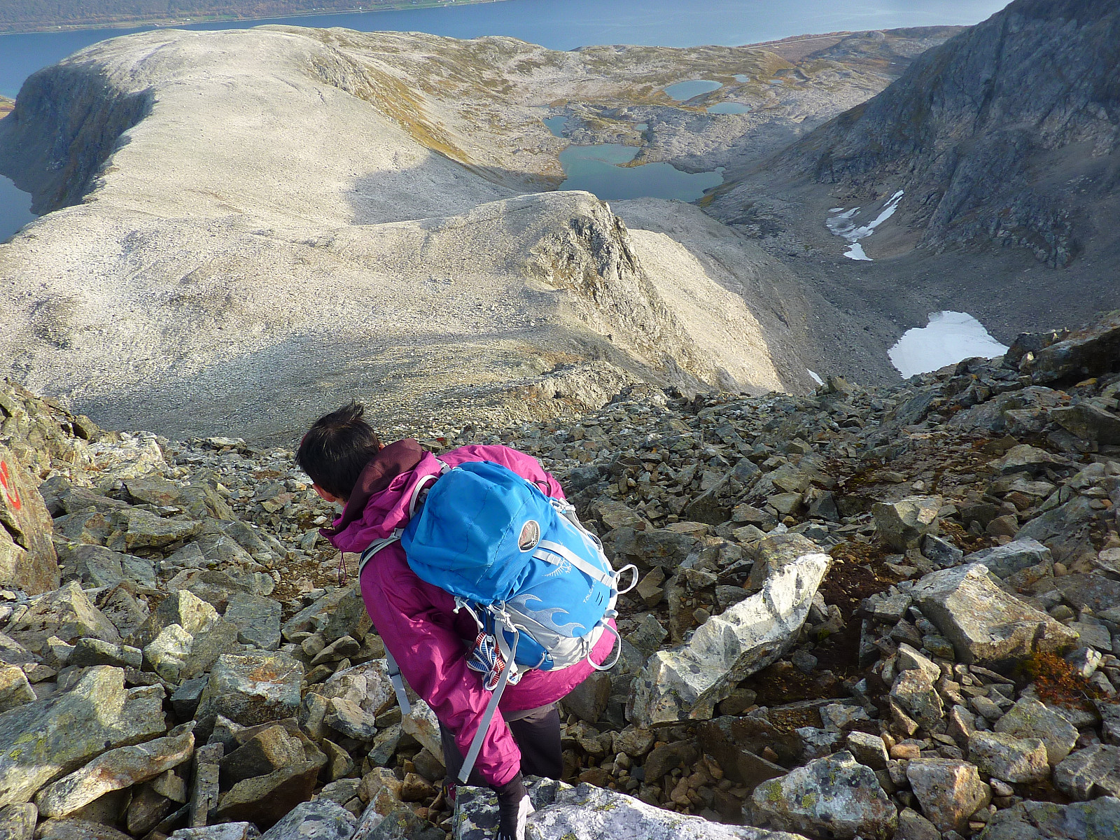
We signed the book in the box, ate lunch and then began the descent back to the car. The first few hundred metres were every bit as slow and unpleasant to walk as we'd anticipated but the rest of the way back down was pretty straightforward. It paid off to spend a little time looking out for the red-coloured sticks and rocks, and we managed to stay on the marked trail all the way :-) It was definitely more pleasant than the bush-wandering we'd encountered earlier!


Kommentarer