
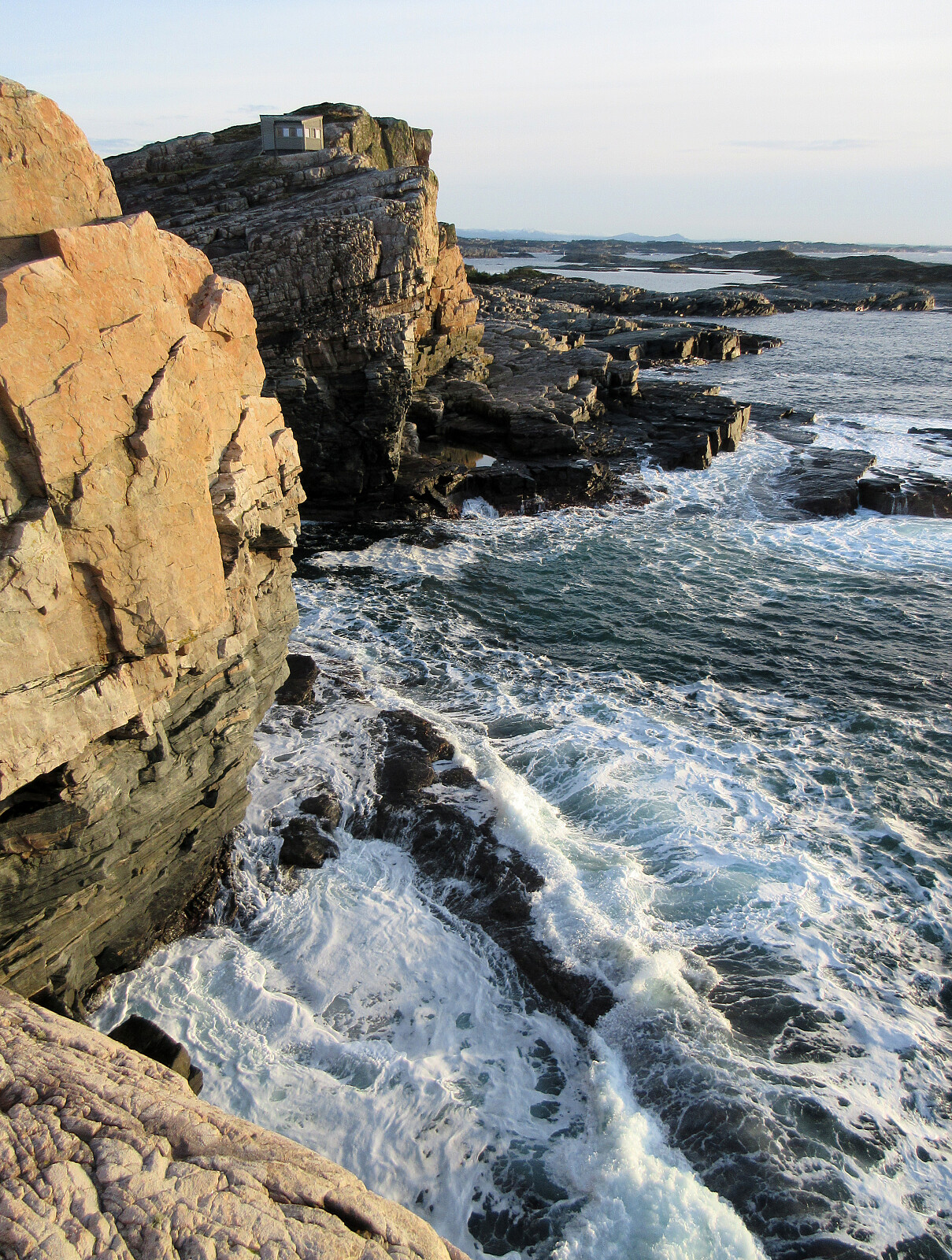
Skogsøyna on a nice winter day (17.01.2026)

Geschrieben von HHauser (Helwig Hauser)

| Startpunkt | Herdleværsvegen (15m) |
|---|---|
| Endpunkt | Herdleværsvegen (15m) |
| Tourcharakter | Bergtour |
| Tourlänge | 2h 00min |
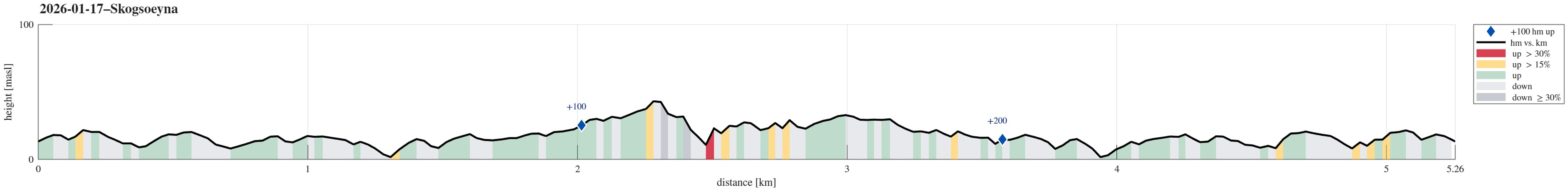
| Entfernung | 5,3km |
| Höhenmeter | 281m |
| GPS |
|
| Besteigungen | Skogsøytua (49m) | 17.01.2026 |
|---|---|---|
| Besuche anderer PBE | Hildringsbu (33m) | 17.01.2026 |
Note that this track has been created from memory, i.e., it was not recorded automatically.
Trip Summary
With a friend, visiting from abroad, we chose Skogsøyna as a very nice outing option. Following the main trail, which by now has been upgraded in multiple places, we soon reached Skogsøytua at the southwestern end of the island. After walking around the spectacular cliff area out there, we then walked basically the same (main) trail back. As always very nice to visit Skogsøyna!
Photos
Selected photos are available as Google photo album.
Useful Resources
See also the related FB-page Hiking around Bergen, Norway.


Benutzerkommentare