
Nakadake (Kuju mountains) from Makinoto Pass (28.06.2025)

Written by HHauser (Helwig Hauser)

| Start point | Makinoto Pass (1,320m) |
|---|---|
| Endpoint | Makinoto Pass (1,320m) |
| Characteristic | Hike |
| Duration | 5h 00min |
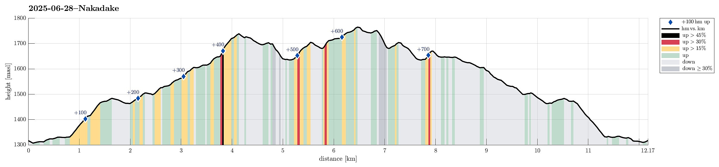
| Distance | 12.2km |
| Vertical meters | 761m |
| GPS |
|
| Ascents | Hossho (1,762m) | 28.06.2025 |
|---|---|---|
| Kujusan (1,787m) | 28.06.2025 | |
| Kutsukake (1,503m) | 28.06.2025 | |
| Nakadake (1,791m) | 28.06.2025 | |
| Tengugajo (1,785m) | 28.06.2025 | |
| Visits of other PBEs | Makinoto Pass Trailhead (1,330m) | 28.06.2025 |
| Mt. Kuju shelter (1,635m) | 28.06.2025 |
Trip Summary
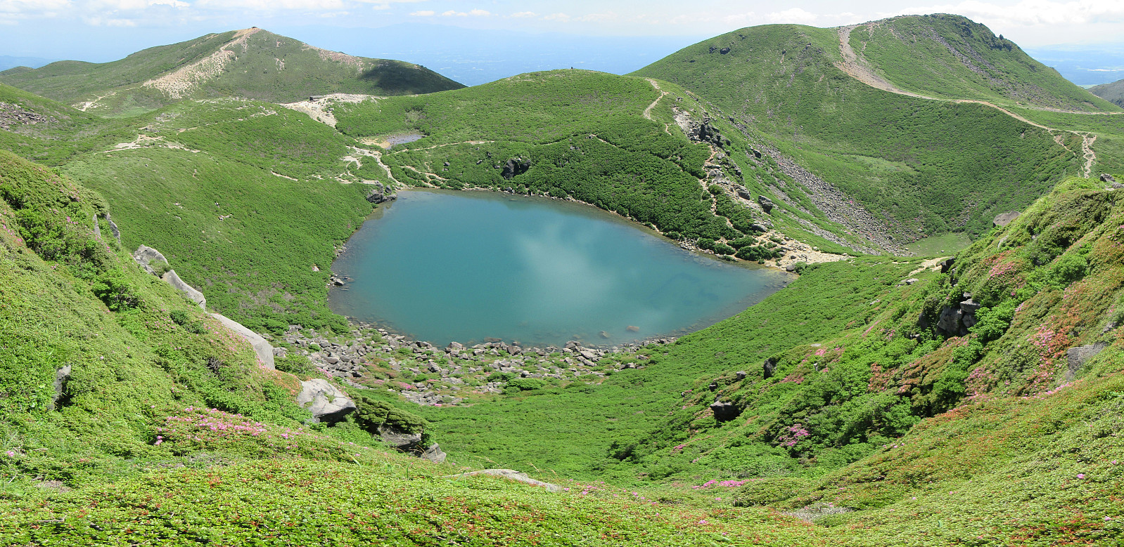
It was one of our goals for our visit to Kyushu to make a nice hike near Mt. Aso and this hike in the Kuju mountains, north of the massive caldera of volcano Aso, seemed very nice from its description. To get started, we drove to the Makinoto Pass in the West of Mt. Nakadake, but found that all parking spots had been taken, already. A bit further down the road, however, we found a place, where we could leave the car. After first walking back to the pass, we then followed the main trail in easterly direction. Gaining height steadily, we came to a place, where it was to Mt. Ogigahana to the right, and to "all other tops" to the left. Just shortly after choosing the latter option, we then followed a side-trail (without any signs) to get up to Mt. Hossho (not choosing the "main route" up to this top, which is a bit further to the East). This minor trail, however, brought us (a bit steeply, at times) up to the southwestern ridge of Mt. Hossho, which offered numerous nice views in all directions! From Mt. Hossho, we continued (in southeasterl direction) into the direction of the Mt. Kuju shelter (along the main trail). From there, we hiked further eastwards, up to a spot, where it was to the right to Mt. Kuju and to the left to Mt. Nakadake (and other tops). While one of us ascended to Mt. Kuju from this spot, I continued into the direction of Nakadake. This brought me by the nice mountain lake, which is surrounded by several tops "all around". I then made it to Nakadake, first, before beginning my return hike via Mt. Tengugajo (right north of the lake). We then met, again, where the trails had split, and hiked the main trail down to Makinoto Pass. In principle, this hike is simply nice and not too demanding. This day, however, was very, very hot, and hiking many hours in the sun was mostly a "battle" against the heat. Exploring these mountains, documenting impressive volcanism, was clearly a strong experience!
Photos
Selected photos are available as Google photo album.
Useful Resources
See also the related FB-page Hiking around Bergen, Norway.


User comments