
Satzberg etc. (16.03.2025)

Geschrieben von HHauser (Helwig Hauser)

| Startpunkt | An der Niederhaid (275m) |
|---|---|
| Endpunkt | An der Niederhaid (275m) |
| Tourcharakter | Bergtour |
| Tourlänge | 2h 00min |
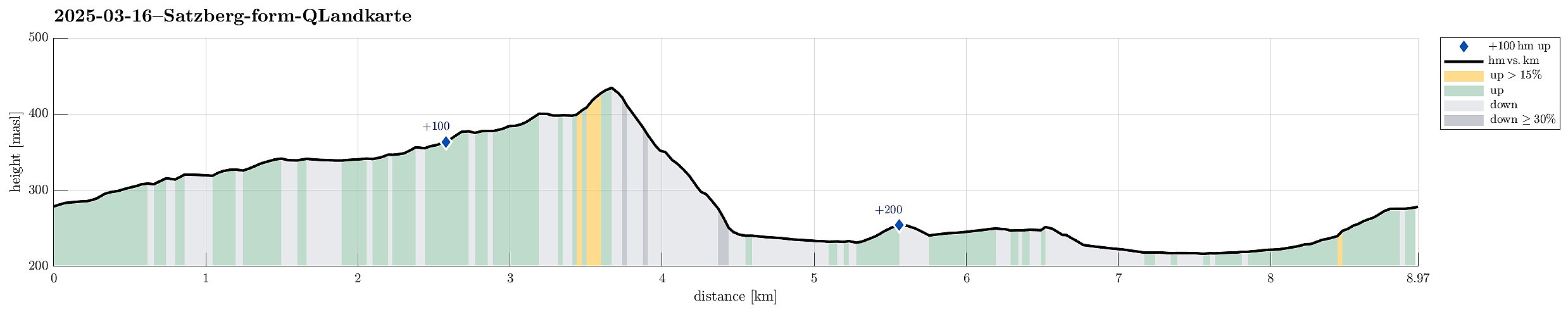
| Entfernung | 9,0km |
| Höhenmeter | 279m |
| GPS |
|
| Besteigungen | Satzberg (435m) | 16.03.2025 |
|---|
Trip Summary
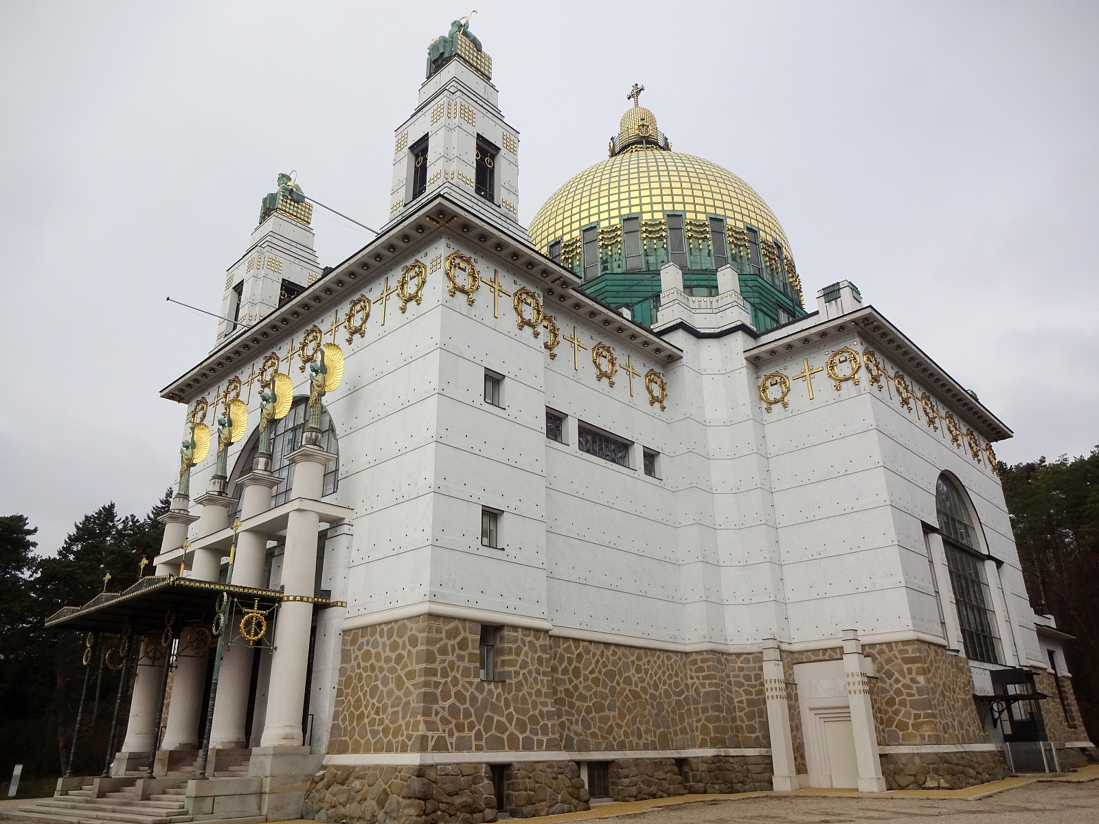
I wished to get some fresh air around my head and thus started a walk without a particular goal in the beginning. At first, I thought that it would be nice to pass by the Otto Wagner church "Am Steinhof". From there, I continued northwards. But instead of following "the usual tracks" up to Jubiläumswarte, I eventually headed in a more westward direction with the goal to get up to Satzberg. From there, I found a new track (at least for me) down to Hüttelbergstraße. After taking a quick look at the Otto Wagner Villa of Ernst Fuchs -- just from the outside --, I then connected to the cemetary of Hütteldorf, before starting my return leg. Besides the generally nice walk, it also was nice to see the signs of spring (some nice flowers in the forest for example).
Photos
Selected photos are available as Google photo album.
Useful Resources
See also the related FB-page Hiking around Bergen, Norway.


Benutzerkommentare