
Midtfjell from Sjusete (16.03.2024)

Written by hbar (Harald Barsnes)

| Start point | Sjusete vinterparkering (416m) |
|---|---|
| Endpoint | Sjusete vinterparkering (416m) |
| Characteristic | Backcountry skiing |
| Duration | 5h 00min |
| Distance | 13.3km |
| Vertical meters | 913m |
| GPS |
|
| Ascents | Midtfjell (1,255m) | 16.03.2024 |
|---|---|---|
| Visits of other PBEs | Sjusete vinterparkering (416m) | 16.03.2024 |
Midtfjell from Sjusete


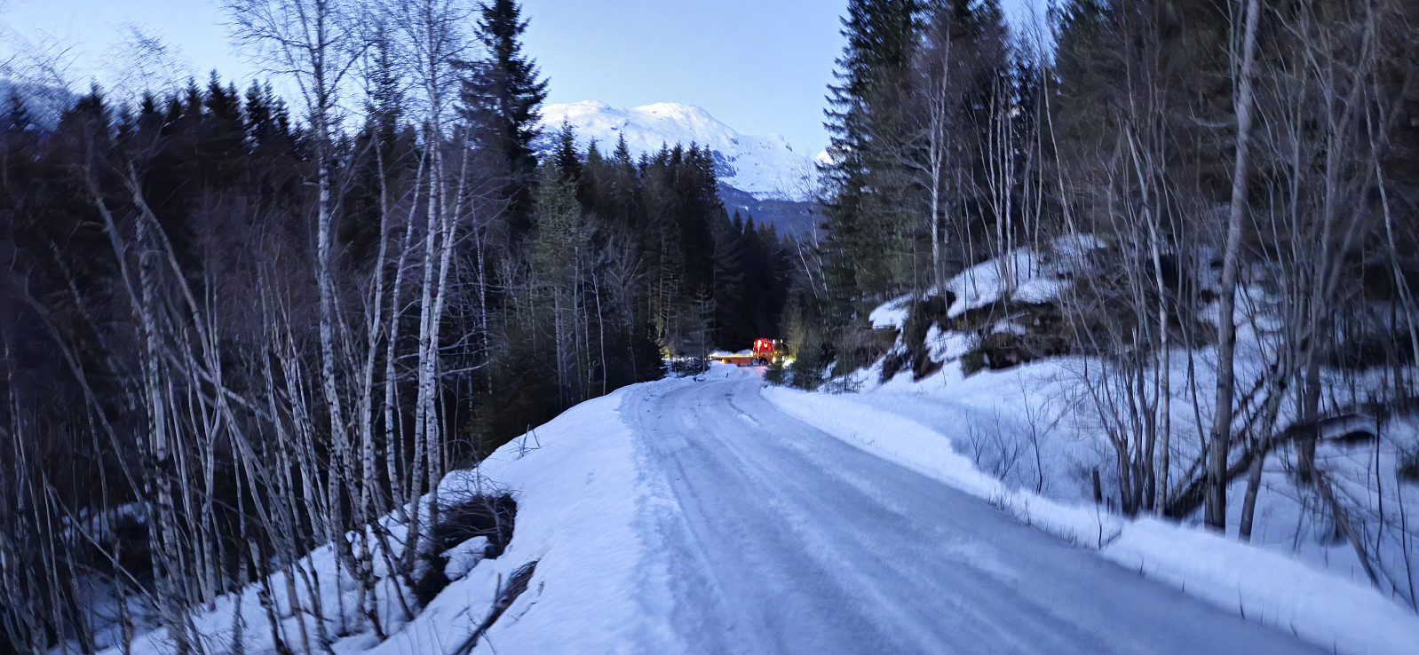
Inspired by an external trip report at tinderangel.no describing what looked like a very nice skiing trip from Sjusete to Midtfjell, Endre and I once more drove from Bergen in the direction of Voss but this time headed for Ulvik and the winter parking lot at Sjusete. As we approached the center of Ulvik we left the main road and instead followed a narrow gravel road southwest up from Vambheim. This included passing through an open gate just north of Gjerdet, but whether this gate is always open remains unknown.
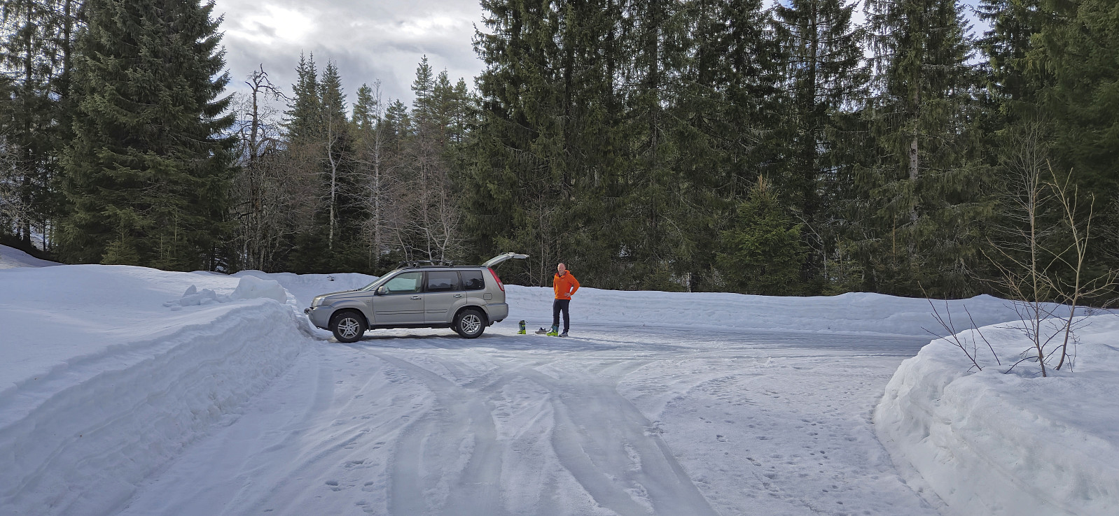
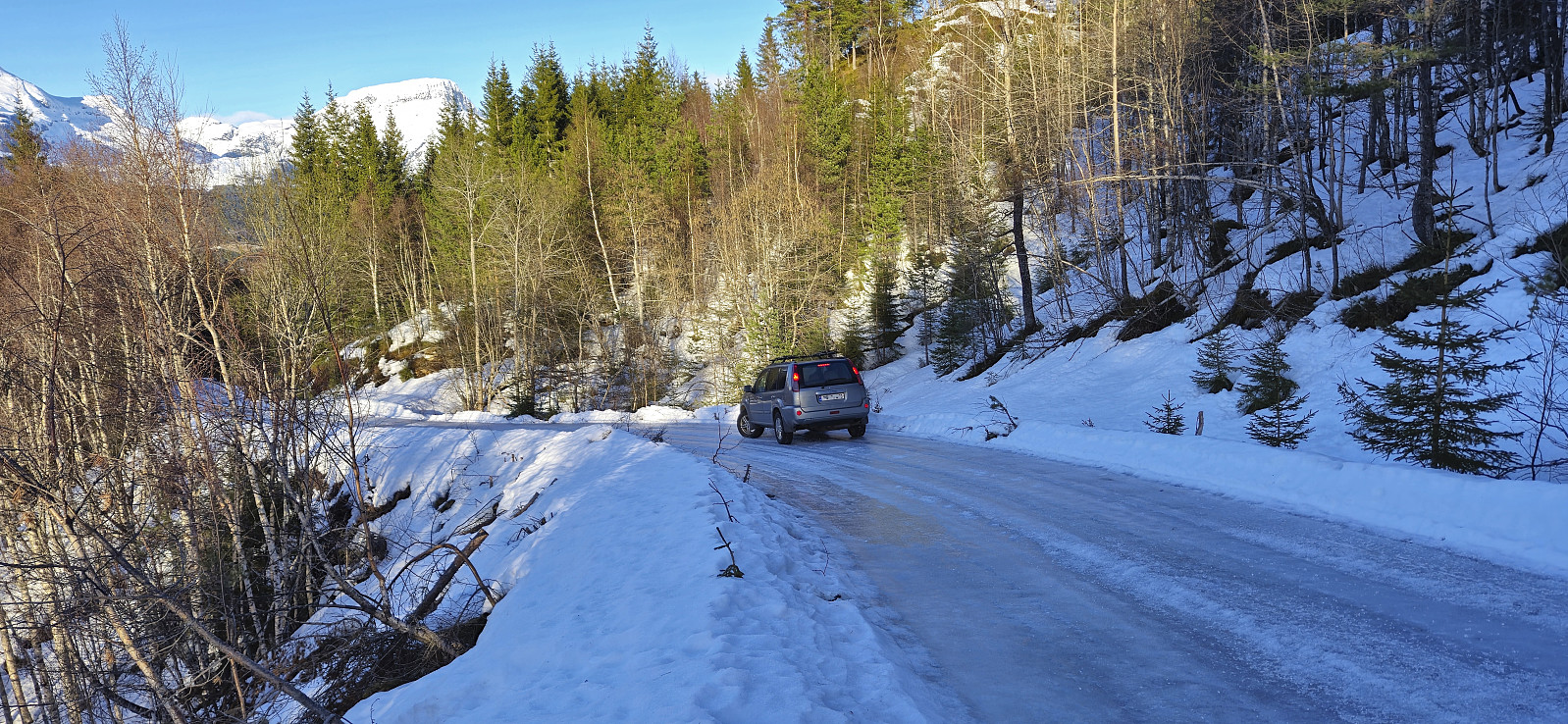
Done with this one potential hurdle we continued up to the parking lot at Sjusete, noticing that the gravel road was rather icy towards the end but hoping that this would improve before the descent later in the day. Plenty of space at the parking lot, in fact we were the only car and, expect for coming across a fresh scooter trail during the descent, we did not see any people for the entire trip.
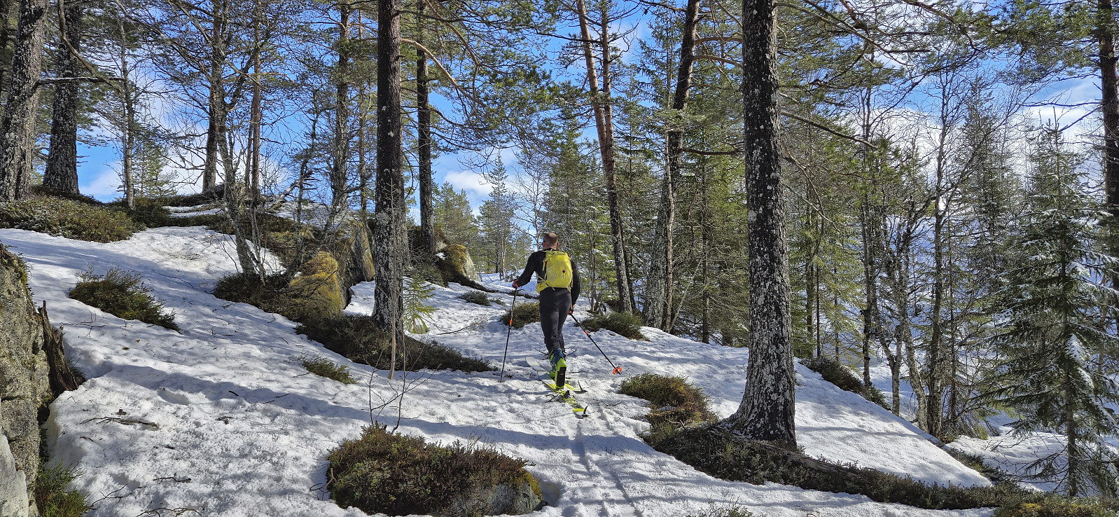
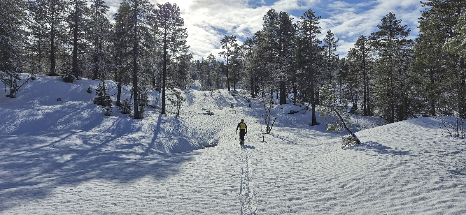
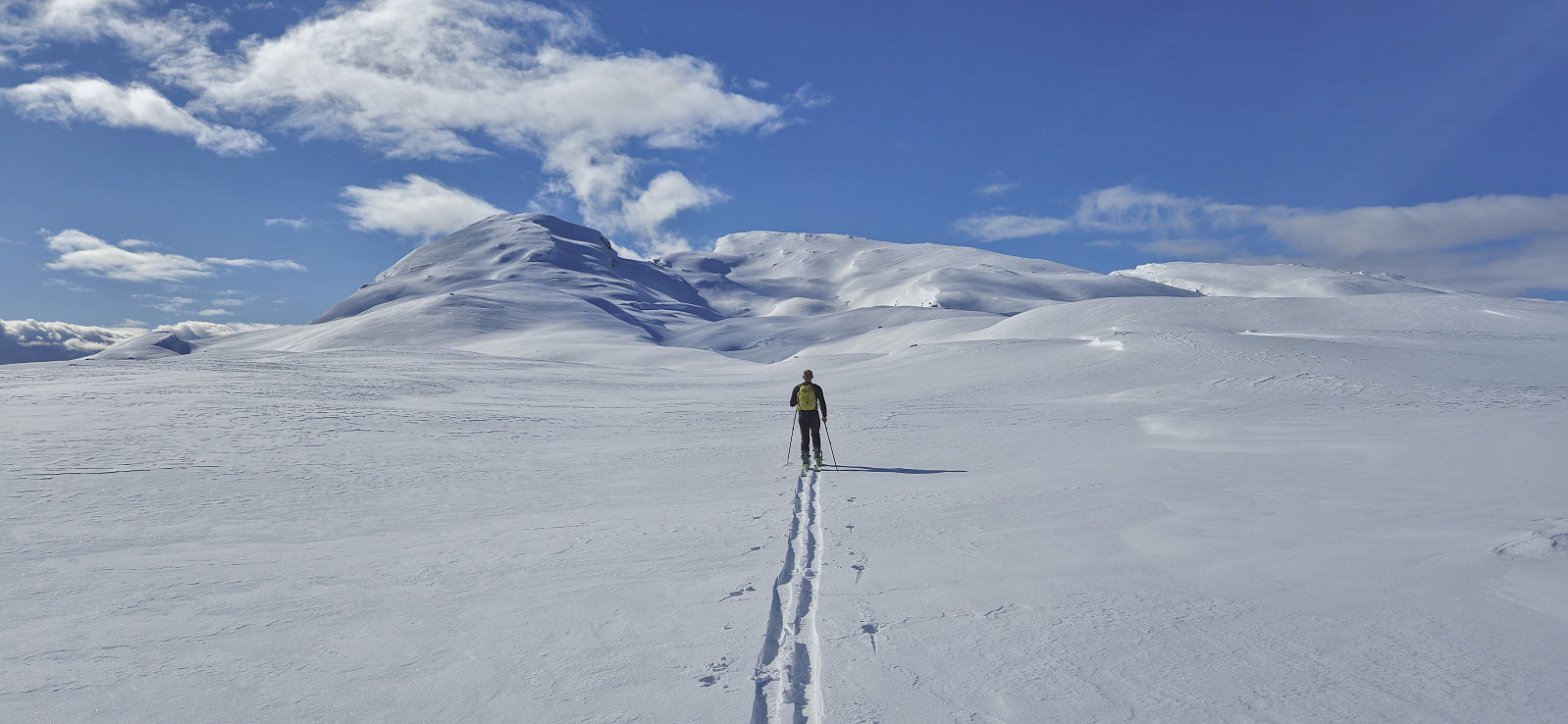
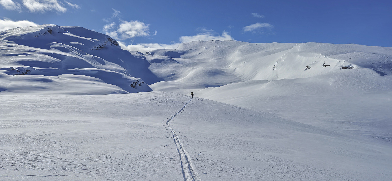
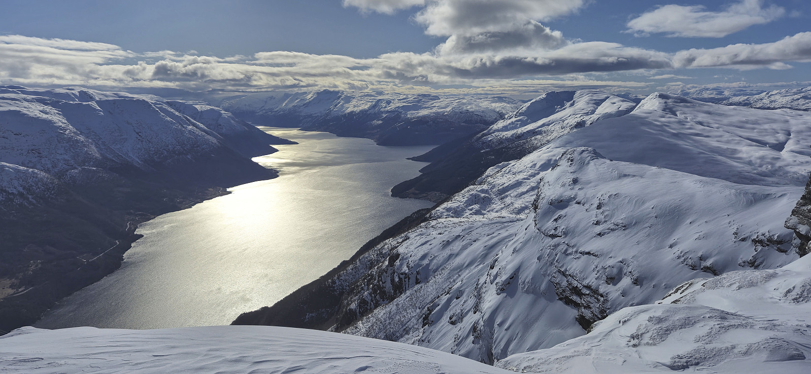
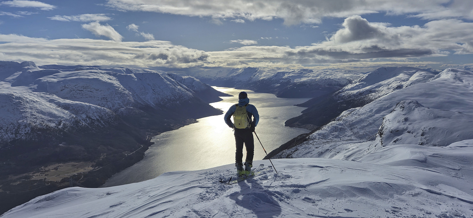
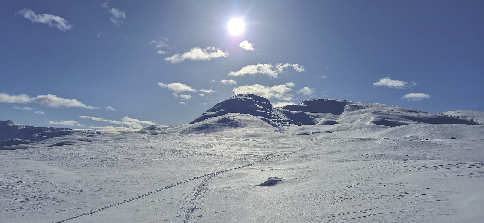
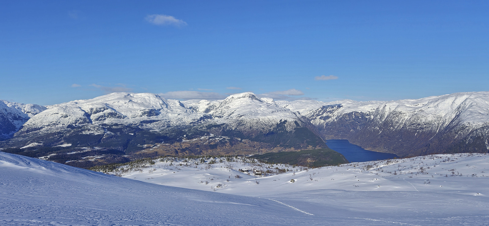
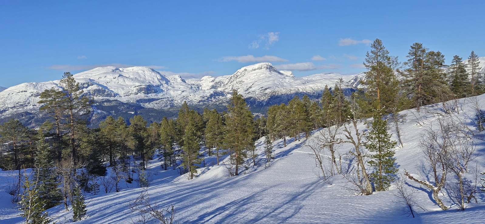
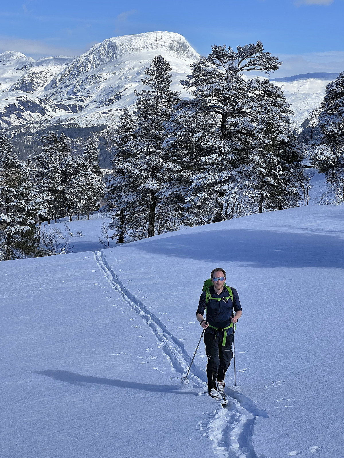
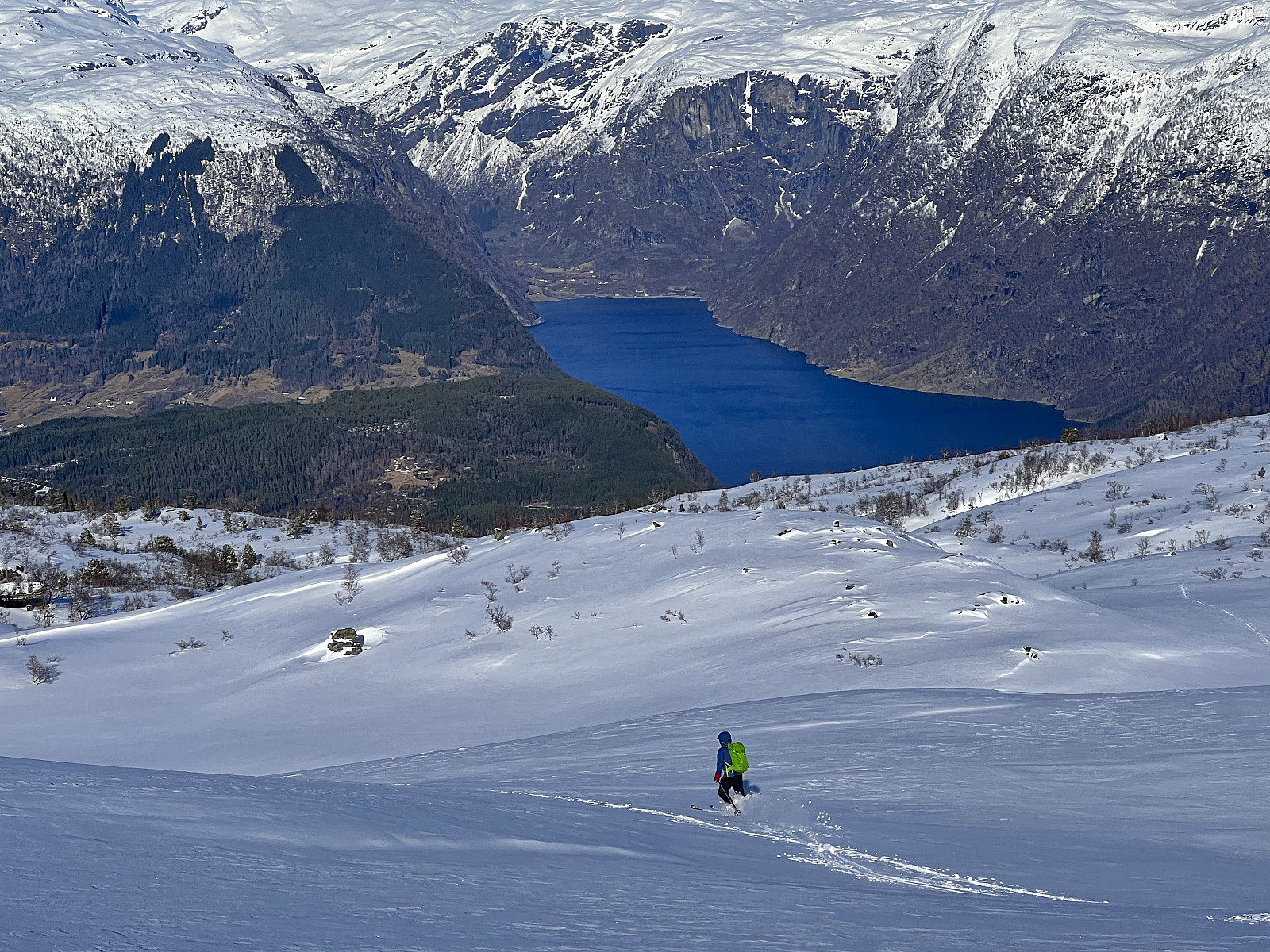
The skis came on at the parking lot but given the recent new snow there were no trails to follow and we therefore had to find our own way towards the summit. At times, and most notably at the beginning, this included lots of trees and small hills that we had to navigate our way around. Soon the terrain however opened up and we could enjoy excellent skiing conditions, warm sunshine and gradually improving views.
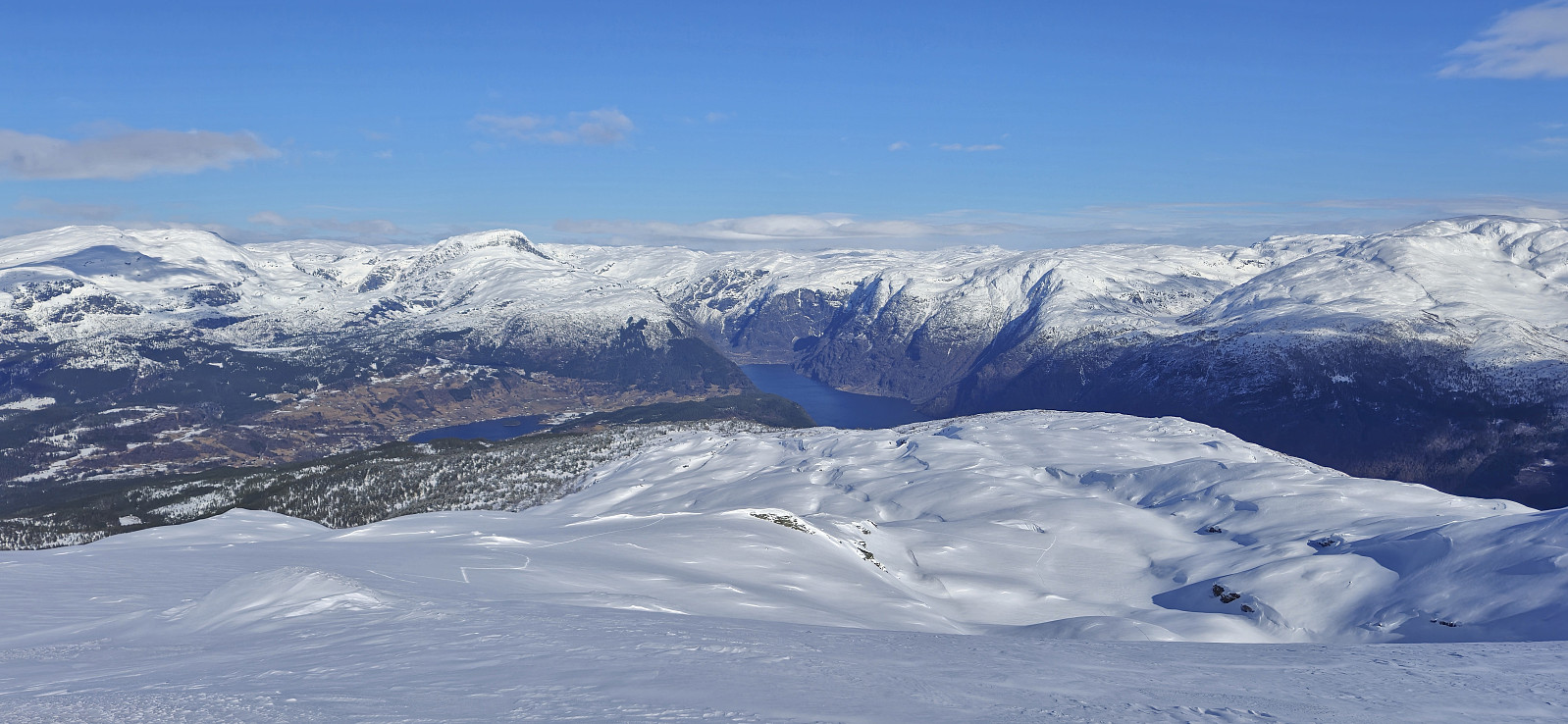
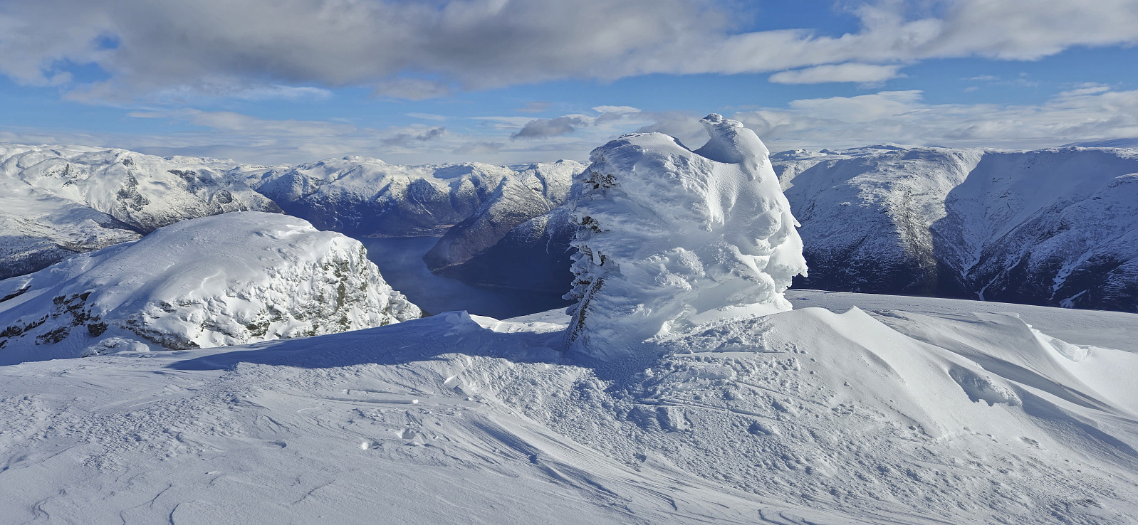
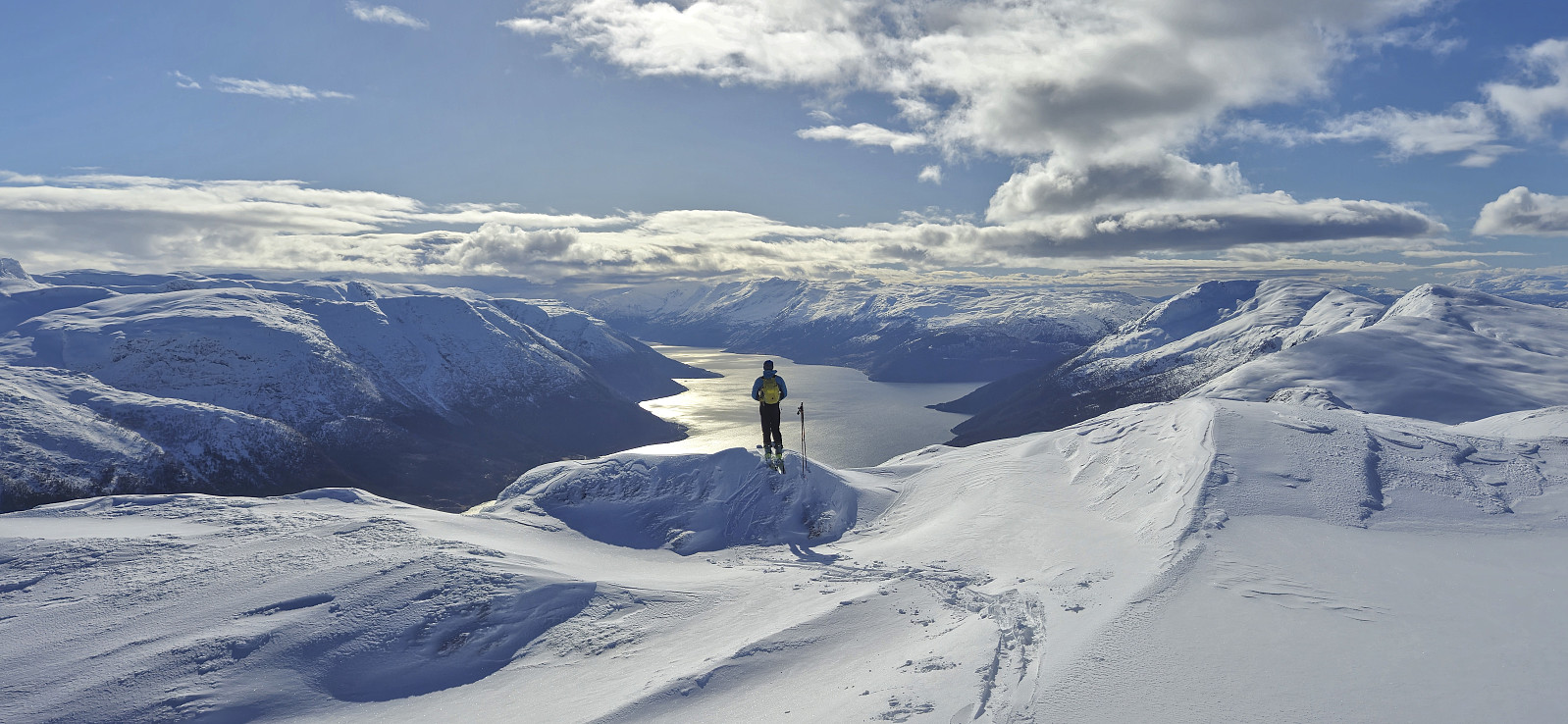
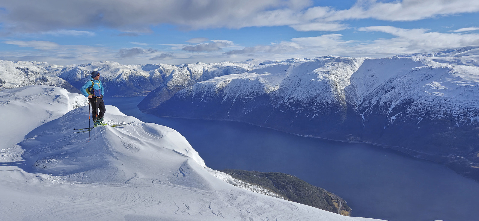
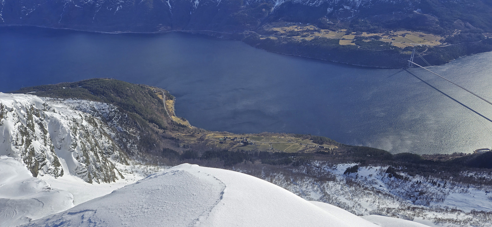
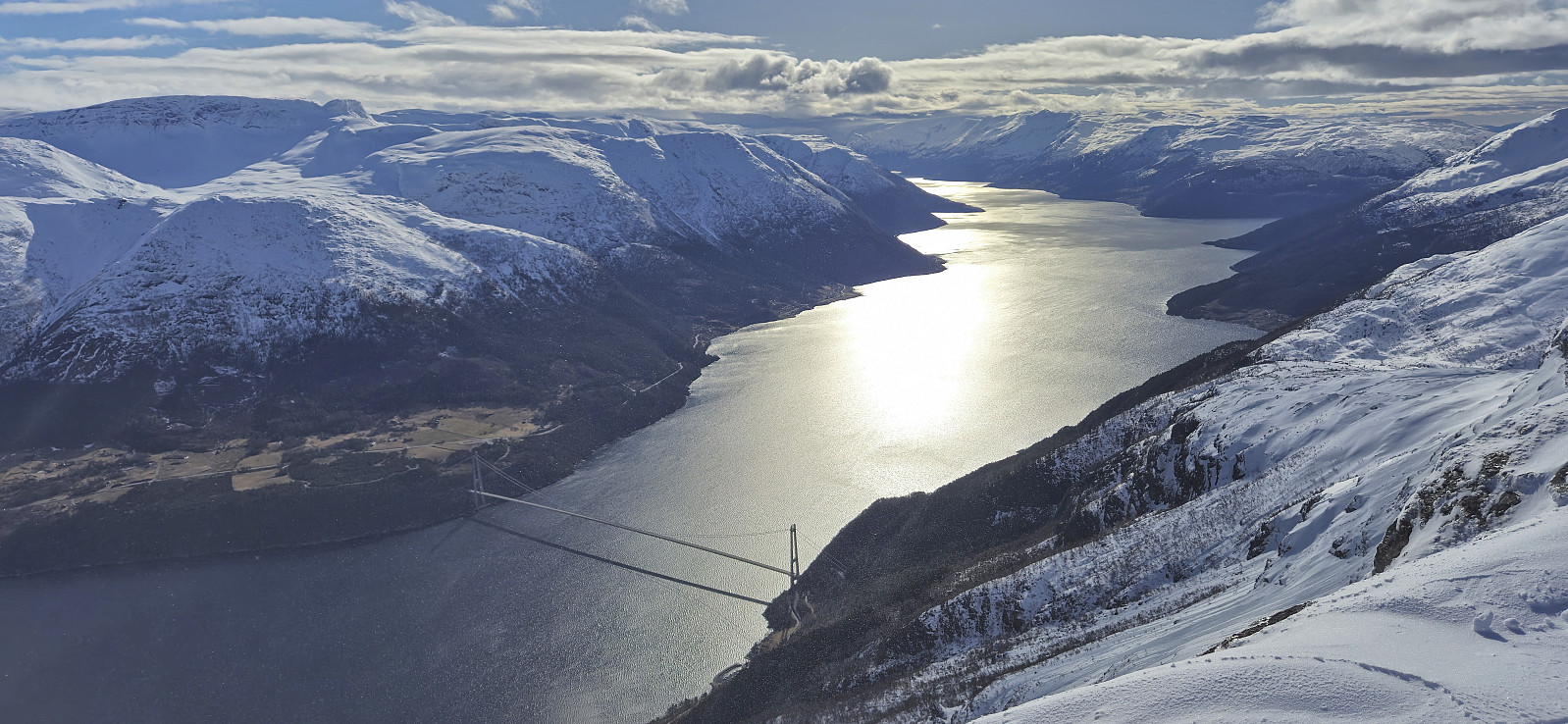
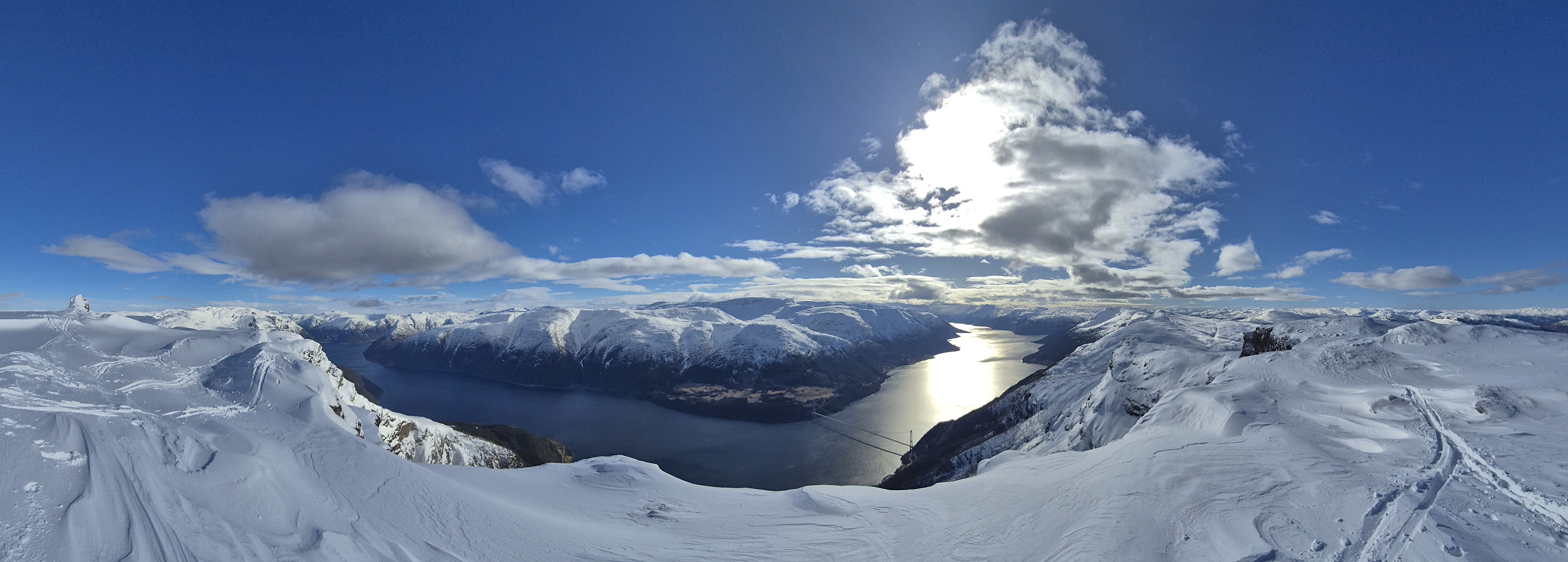
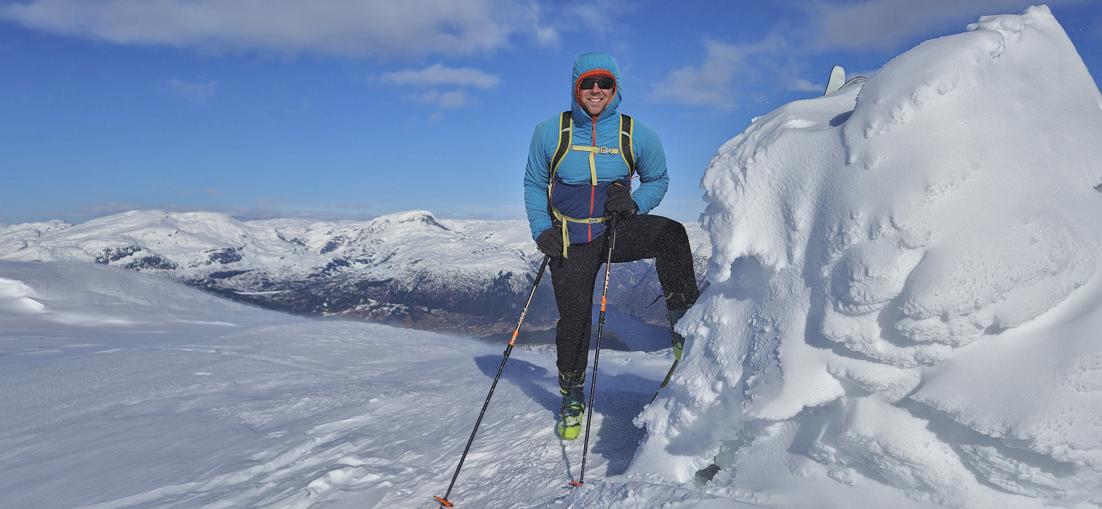
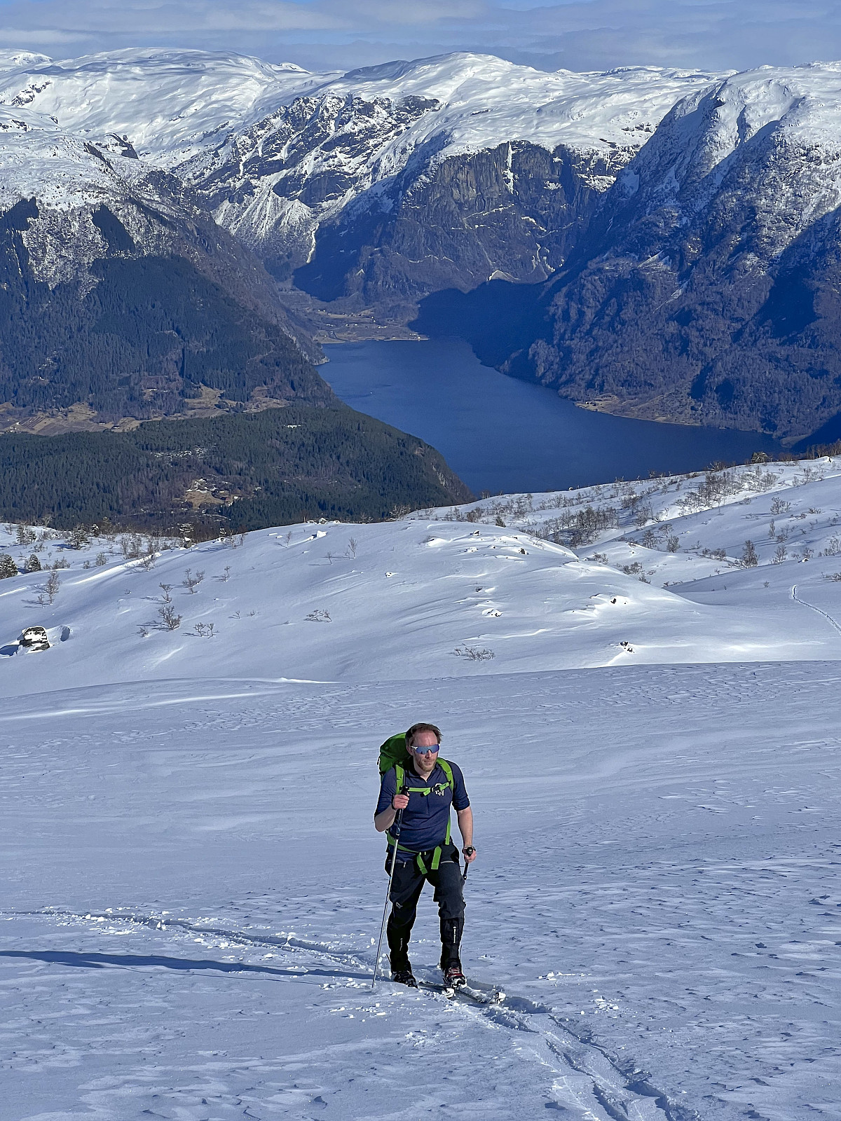
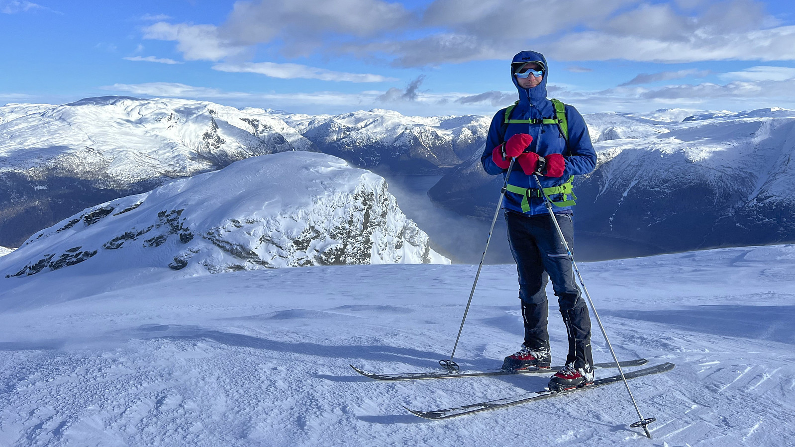
As we got close to the summit, Endre and I chose slightly different ascent routes, with Endre going for the more direct ascent while I ascended via the ridge from the northeast. Both seemed like reasonable options, although perhaps my route is to be recommended if the avalanche risk is higher. We joined up next to the summit cairn and spent several minutes taking in the spectacular views.
Our planned long break at the summit was however cut short due to the cold wind picking up and making the summit area much less inviting. After a quick bite west of the cairn we therefore quickly removed the climbing skins and started our descent, following the same separate routes as for the ascent, with Endre making the most out of his heavier Randonnée setup compared to my lighter and less sturdy mountain skis.
Endre also wanted to visit Grimsnuten and therefore immediately started his ascent while I waited northeast of the summit. His climb to the summit cairn did not take long, but when he did not return I started thinking that he had perhaps gotten some sort of technical issue. However, it turned out that he was simply enjoying the summit too much and did not want to leave. But in the end he of course had to and at that point it did not take long before he reconnected with me and we could together complete the rest of the descent.
The first half of the descent provided excellent skiing conditions but, at least for me, the second half with all its trees and icy snow required more back and forth turns than I would have preferred. In any case, we both made it back to the car without any real challenges, thus completing an excellent nice skiing trip that can be very highly recommended.
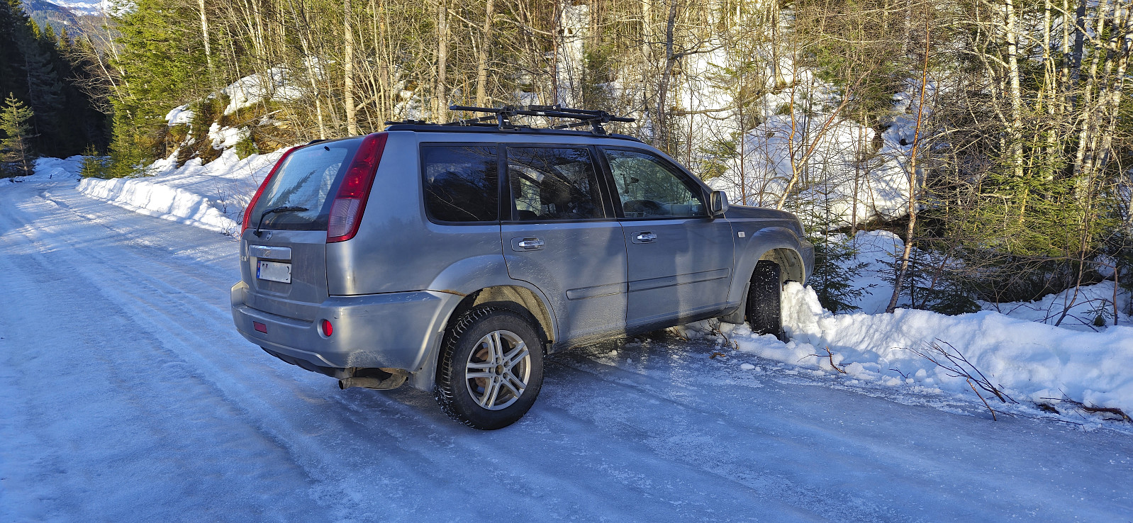
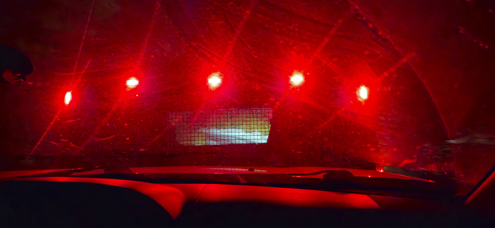
Usually, this would be the end of the report but the excitement of the day was not yet over! It turned out that the icy gravel road that was our only way back to the main road, had at places now turned into almost pure ice. After a couple of occasions where Endre almost lost control of the car, even though driving very slowly, I therefore got out of the car to test the conditions on foot, only to almost fall the second I stepped out of the car.
Based on his experience from the ascent, Endre however believed that the conditions would soon improve. But only seconds later the car started slipping once more and this time he was not able to control it, resulting in the car turning sideways and then getting stuck. Although the car was undamaged, we were now out of options, and did not really want to drive any further on the super slippery surface. We decided to cut our losses and call for assistance. A rescue vehicle was soon on the way but in total it would take almost three hours until we were finally on our way back to Bergen. Lesson learned: do not drive up a slippery road unless you are sure you can get back down!
Takk for en innholdsrik dag, Endre! :)
Additional images from Endre:
| Start date | 16.03.2024 11:43 (UTC+01:00) |
| End date | 16.03.2024 16:43 (UTC+01:00) |
| Total Time | 5h 00min |
| Moving Time | 3h 34min |
| Stopped Time | 1h 25min |
| Overall Average | 2.7km/h |
| Moving Average | 3.7km/h |
| Distance | 13.3km |
| Vertical meters | 912m |


User comments